Date: 23rd August 2008
Distance: 13.4km
Ascent: 1,401m
Time: 6 hours 40 mins
Hills: Stob Coire Sgreamach (Munro, 1,072m), Bidean nam Bian (Munro, 1,150m)
Weather: Early sunshine giving way to cloudy summits. Clearing later in the day.
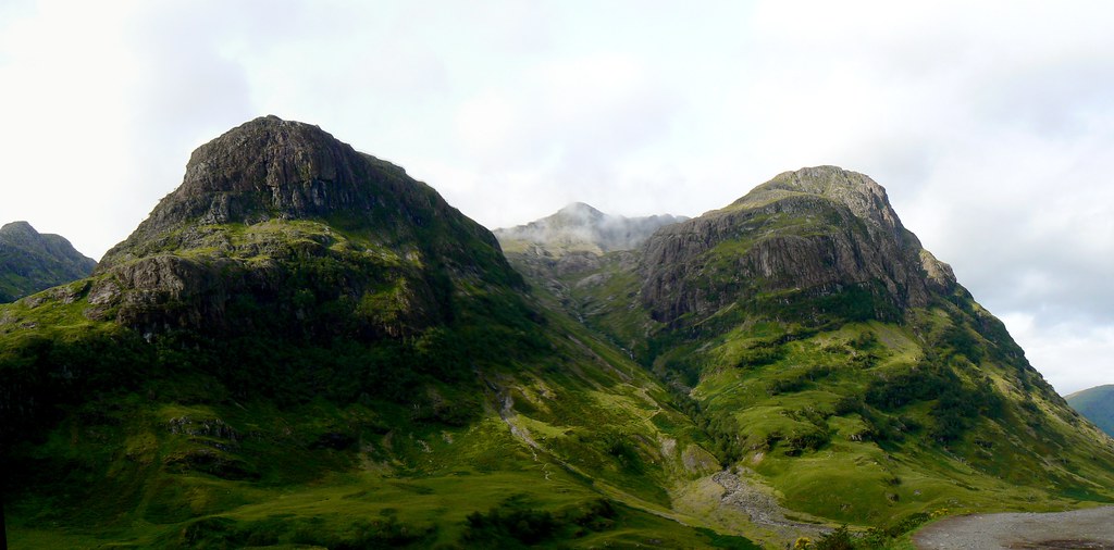
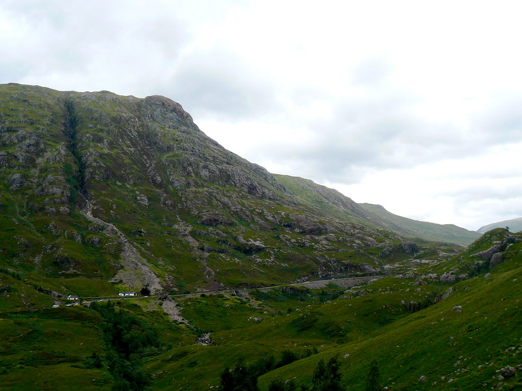
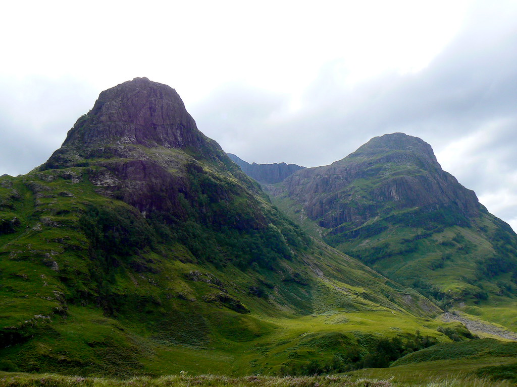
It was a misty morning deep in the Carske but as we climbed out of Callendar and up to the shores of Loch Loraig already it was looking much more promising. The higher peaks maintained a covering of cloud but the valley roads were enjoying early morning sunshine. The journey was spectacular, leading eventually up onto the barren expanse of Rannoch Moor and then, after passing the King’s House and the Glencoe Ski Centre, the enigmatic sight of the big Buchaile marking the entrance to Glen Coe.
The road, a narrow black ribbon, threaded its way down through the awe-inspiring mountains on both the north and south side, occasionally bursting through an outcrop of rock. The car park by the helipad already had a dozen or so cars as we pulled up. By 8:50am we were heading back up the road, kitted up for a day on the hills.
A half mile or so of road walking brought us back to a clear track marked as a public right of way heading through to Glen Etive. This brought us across a rocky plateau and then down to cross the Allt Lairig Eilde where we reached the lower slopes of Beinn Fhada. It was a steep ascent through terraces of rock and grass slopes that eventually brought us out onto the ridge.
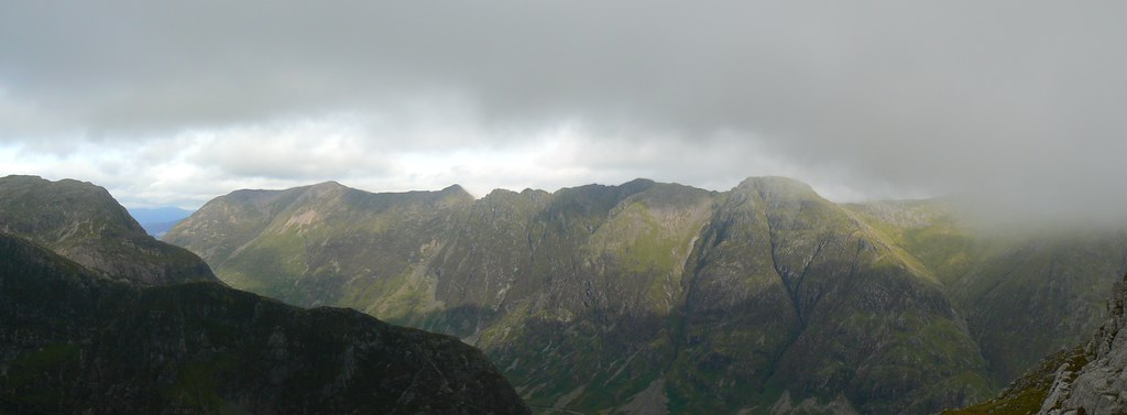
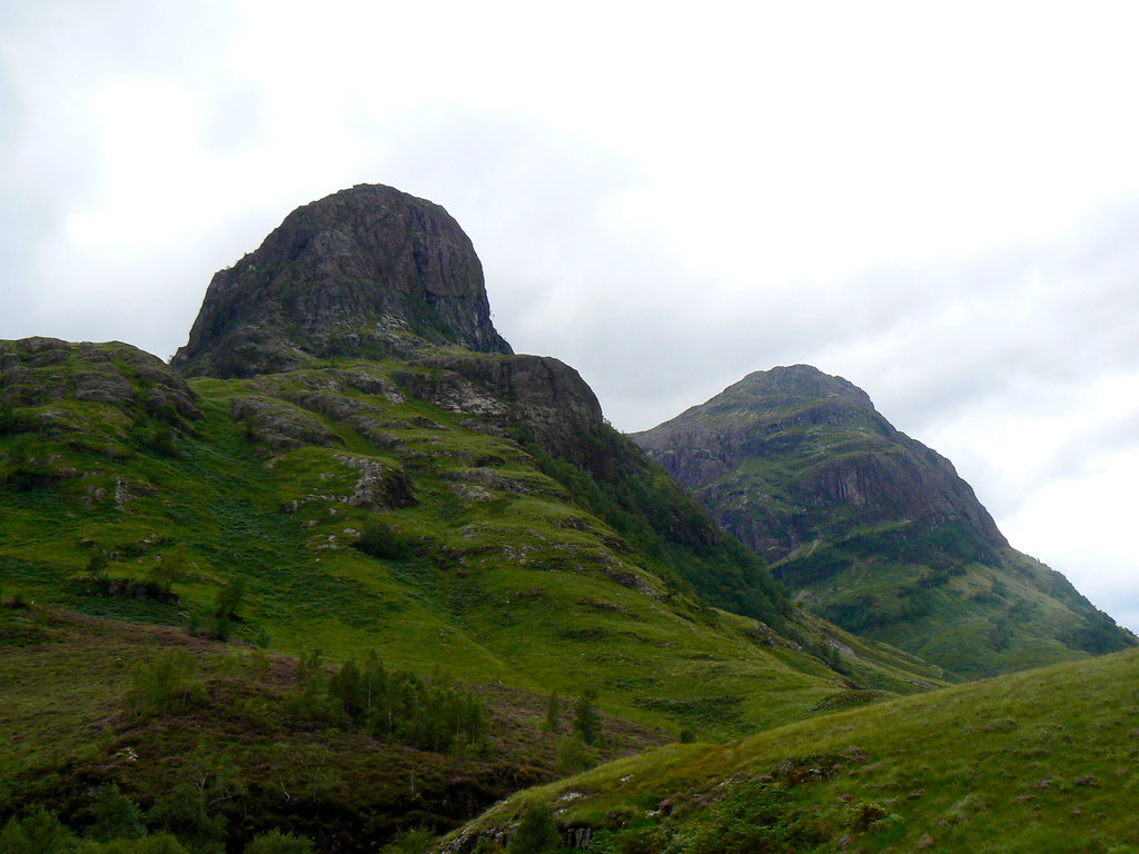
From here we got stunning views of the Aonach Eagach ridge which was continuing to catch the sun. On our side the cloud was rolling in as we paused to catch our breath and have a bite to eat.
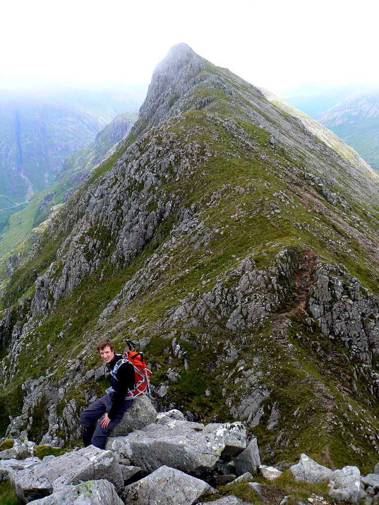
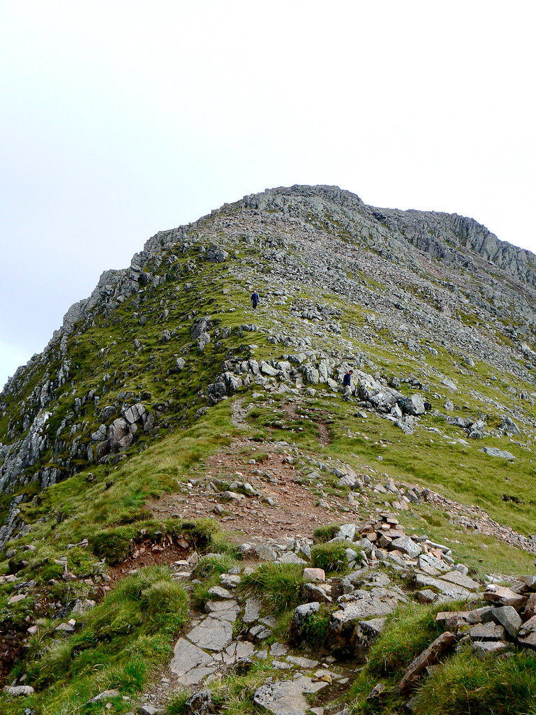
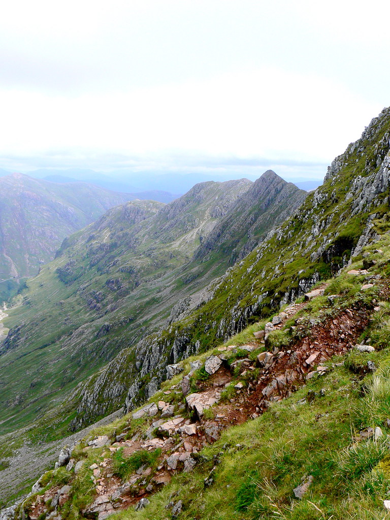
Now we made our way along the ridge of Beinn Fhada, a series of rocky tops that were marked by the occasional track glimpsed forward through the mist. On our right hand side the ridge dropped dramatically down into the Lost Valley.
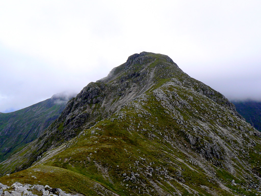
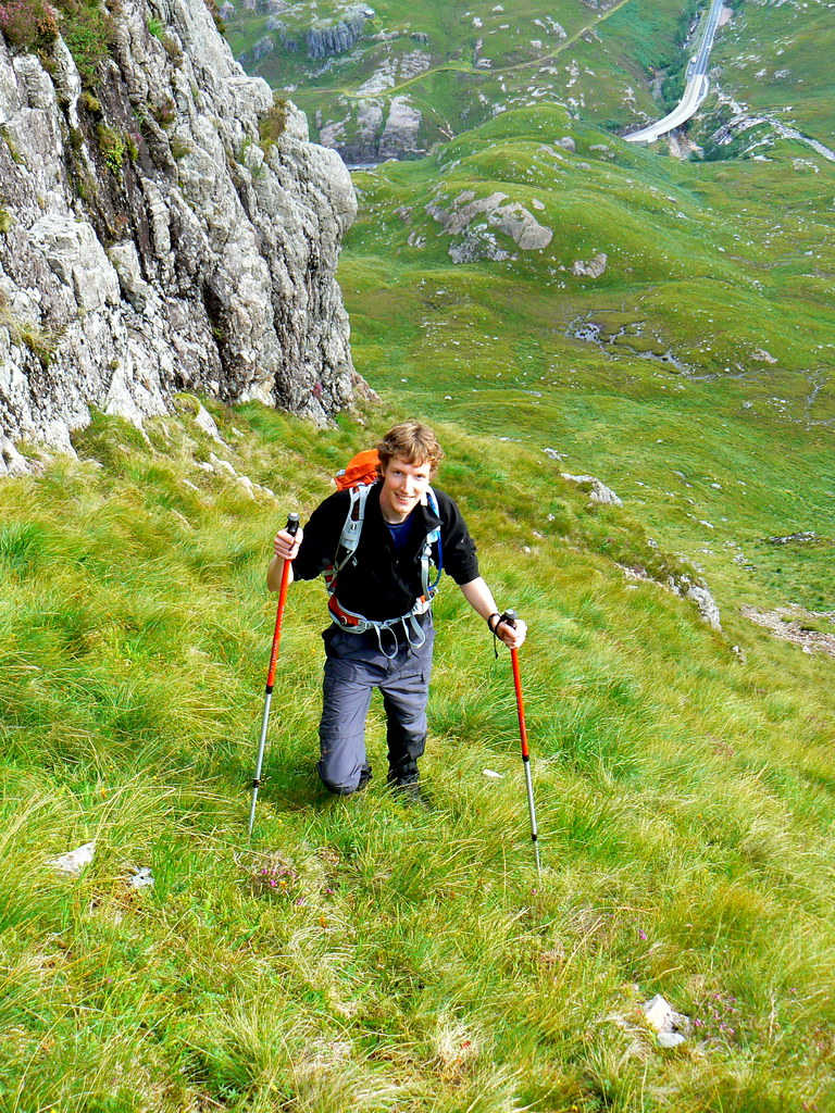
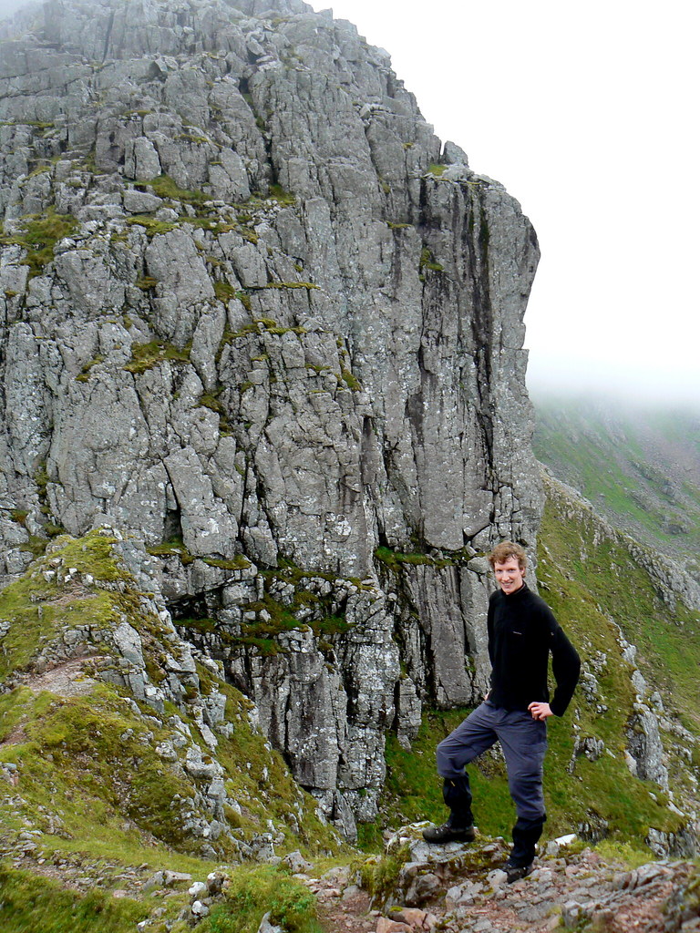
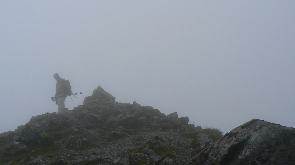
After crossing the 931m top at the south end of Beinn Fhada we came down sharply to a notch on the ridge. A steep climb down seemed to take us to the foot of an insurmountable wall of rock, climbing up 50ft or so. Luckily I was in the company of an excellent guide (my Uncle who has completed his Munros and done extensive mountaineering in the Alps, Pyrenees and more recently the Himalaya) and we went around to the south of the wall before picking up a scrambly route back up behind the main face. Just a few minutes after leaving the bottom I was sitting at the very top of the wall, looking back along Beinn Fhada.
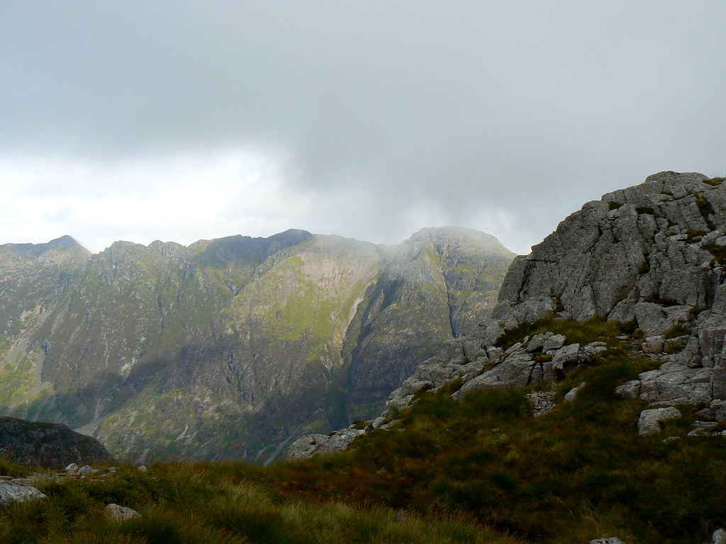
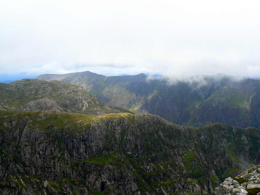
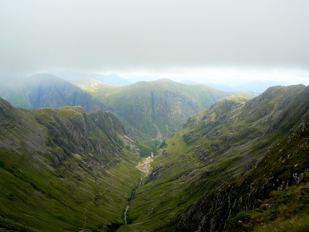
It was a less dramatic walk up onto the summit of Stob Coire Sgreamhach, a Munro which was promoted in the last major revision of the tables. The mist was much closer at this height so after a brief chat with a couple of guys up from Glasgow and another bite to eat we headed off the rock slope and down the ridge to the bealach with the main Bidean summit. From here there were some amazing views down the length of the Lost Valley as well as southward towards Glen Etive.
In the mist we now wound our way up the fairly straight-forward route to the second Munro summit of the massif, Bidean nam Bian itself. This was the high point of the day although unfortunately the cloud was at its thickest so we didn’t get any views.
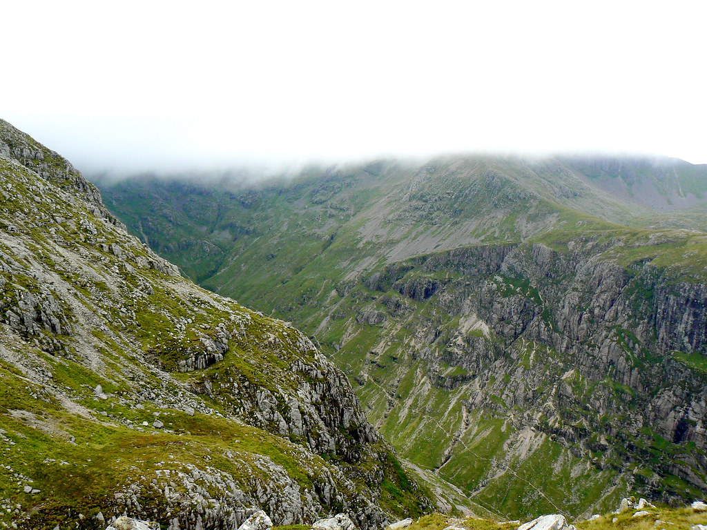
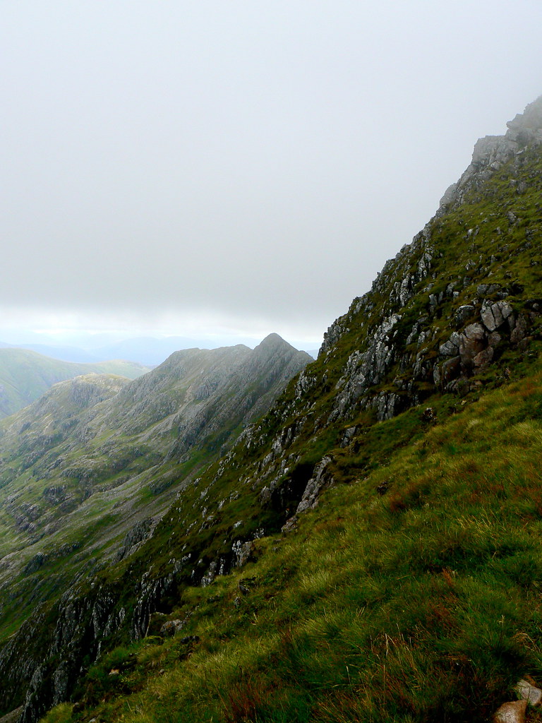
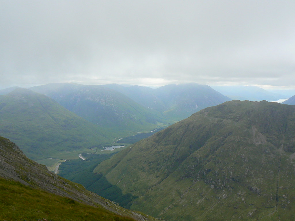
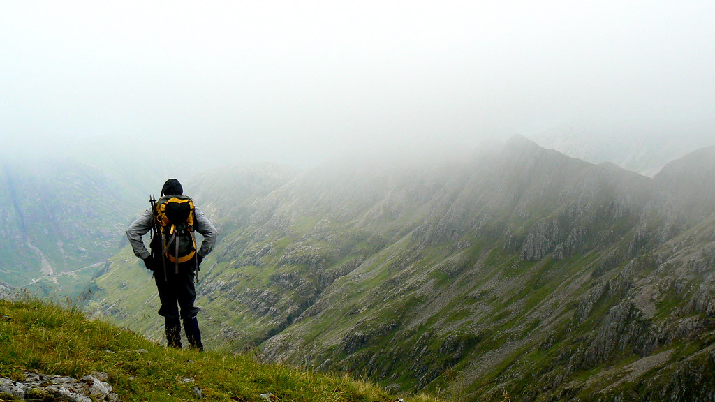
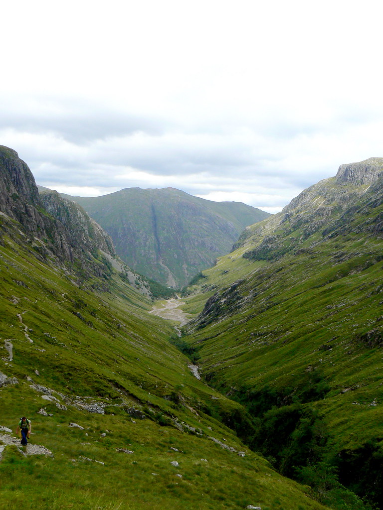
We had planned to carry on round and complete the horseshoe around the Lost Valley. However, given the thick mist and the potential for getting lost in the crags below Stob Coire nan Lochan we decided to retrace our steps to the bealach and descend to the head of the Lost Valley. As we dropped back below the cloud we got some atmospheric views across the range.
On the way we met a few other groups out for the day, including three students from Slovenia who were enjoying their time in the Scottish Highlands. By this time the cloud had started lifting and we now got much better views of the earlier mist-shrouded summits.
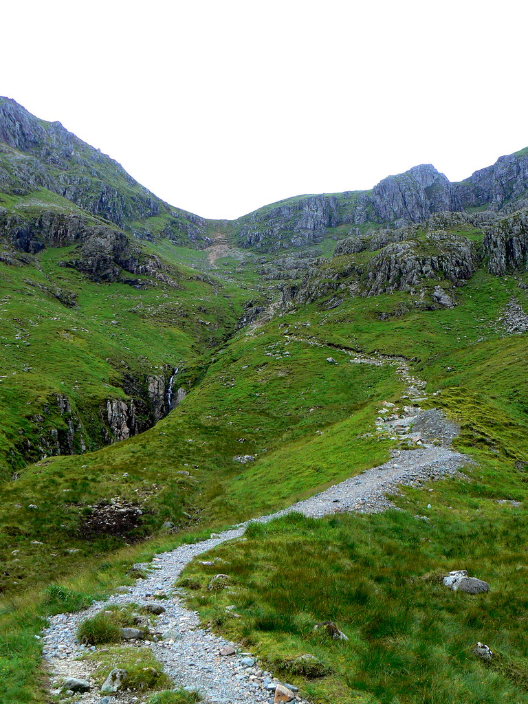
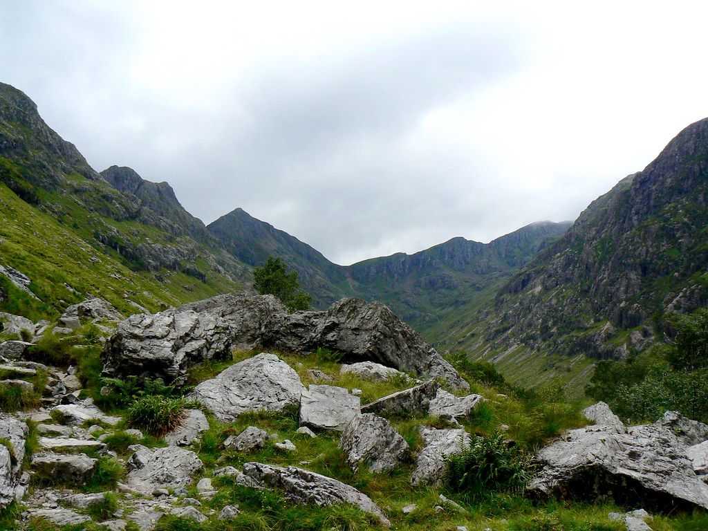
We descended steeply down a highly eroded and very greasy track until a more constructed path was picked up in and amongst the screes high up in the head of valley. It was then a case of winding our way down to the flat floor of Coire Gabhail.
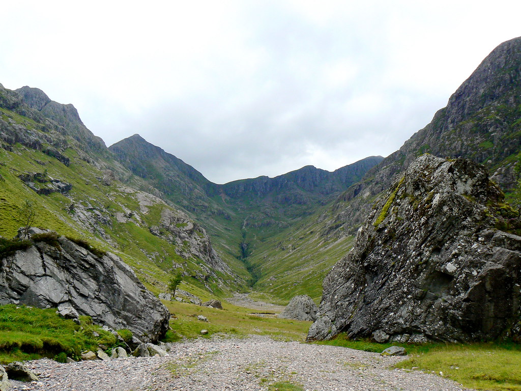
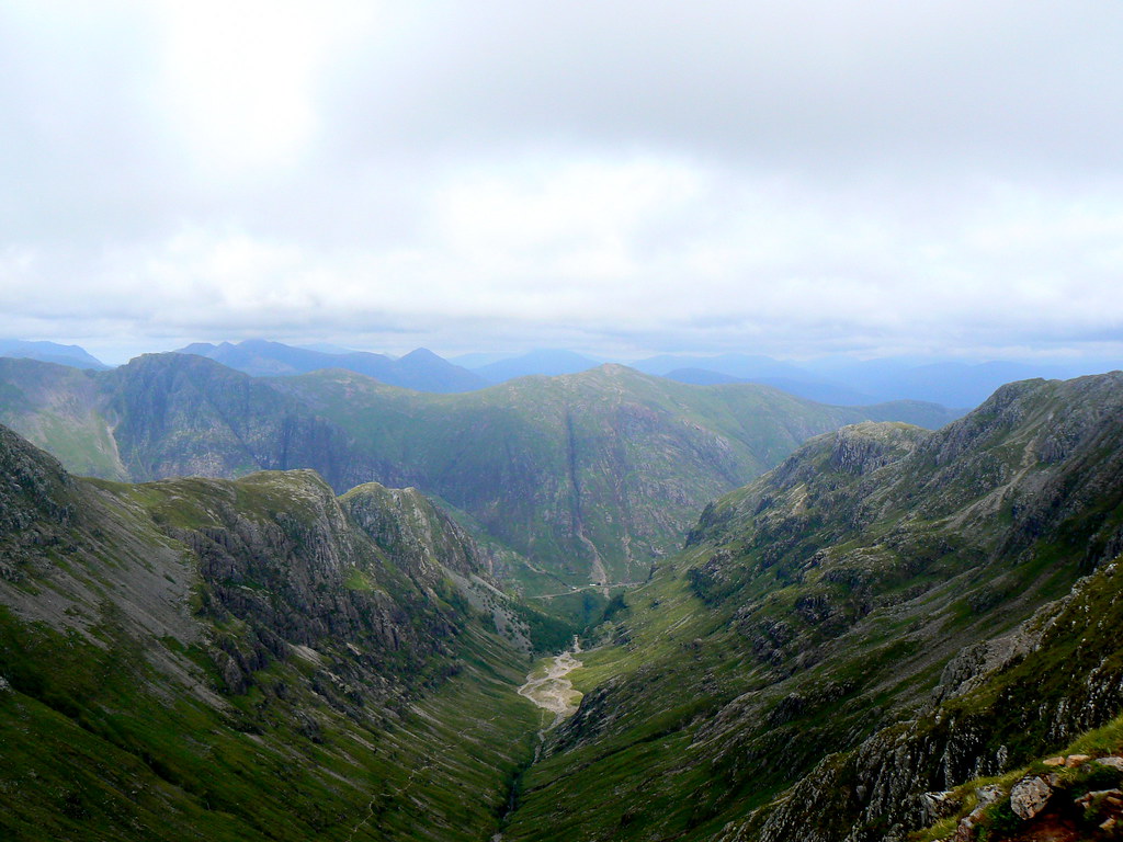
It is a remarkable landscape, particularly as the clouds chose this time to lift from the summits. Behind us the great peaks of Bidean now emerged. As we reached the huge boulders which mark the end of the glacial basin we transitioned from hillwalking country into tourist territory. With the place so accessible from the road many people were trooping up the steps besides a series of wonderful waterfalls to catch a view of the Hidden Valley surrounded by its mountain guards.
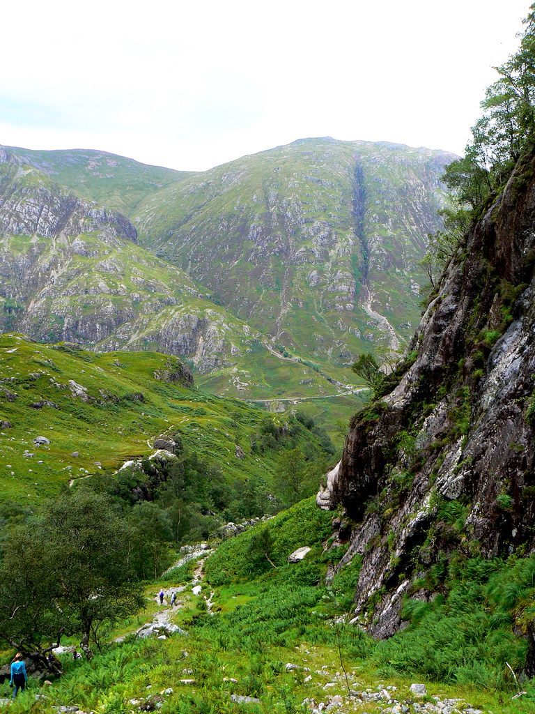
Even so, it wasn’t the easiest of paths down and a couple of interesting water crossings kept the mind firmly on the feet until we reached the floor of the Glen. A short pull brought us back up to the car.
We celebrated a dry day in spectacular mountains with drinks and cake down the road in Ballachulish before battling the Highland Heritage coaches all the way back to Stirling.