Somewhere out in the mist a lonely stag roared. Besides the faint trickling of a nearby stream it was the only sound that could be heard through the muffling effects of the thick cloud. We were somewhere east of Glenshee and despite the lack of views all was good.
Date: 15th October 2011
Distance: 14.77
Ascent: 875m
Time: 5hrs 35mins
Hills: Carn an Tuirc (Munro, 1,018m), Cairn of Claise (Munro, 1,064m), Glas Maol (Munro, 1,068m)
Weather: Low cloud, strong winds on the plateau, mild.
Route: View on OS Maps
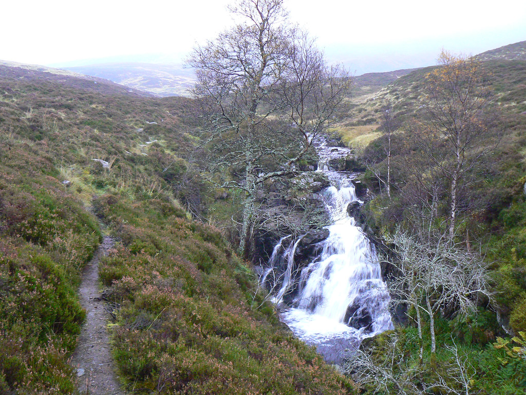
Sixteen Stockets bravely set out from the car park at the start of the path which eventually crosses to Glen Isla by way of the Monega Pass. Though there was rain in the air, it wasn't particularly heavy, and the real problem was the ground underfoot which was merely muddy in places, but a true quagmire in others. A short distance down the path we turned left to climb gently up besides the north bank of the Allt a' Gharbh-choire. The path here was a little better, with some solid gravel underfoot, and so we made swift progress up besides a couple of impressive waterfalls and so further up into the mist. The line of the road faded into nothingness as our world was reduced to the few meters around us; people just a few paces behind were fuzzy shadows.
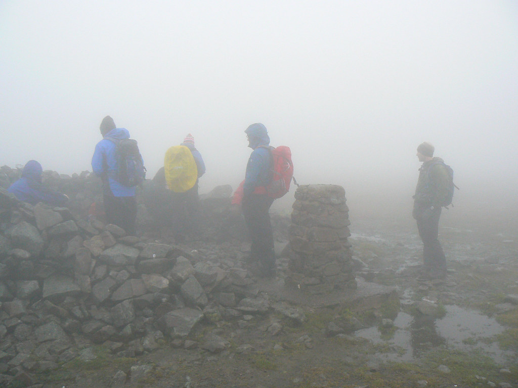
Navigation was made tricky by a proliferation of tracks heading up and down (and sometimes around) but we eventually came round below the steep northwestern slopes of Carn an Tuirc. Here we made the most of the shelter and stopped for a cup of tea and a sit down. Even at 750m the mist was already thick, swirling cloud and it only worsened as we climbed up greasy, grassy slopes to eventually merge on the rocky summit plateau of Carn an Tuirc. In cloud blown through on a gusty wind that soon had us sodden, we lingered only a few minutes at the cairn before turning to make our way towards Cairn of Claise.
With challenging navigation conditions it took a bit of time to pick up the track. Once we were on it though it was easy enough to follow it through the bleak and featureless landscape. The only breaks were afforded by the glimpses of occasional pools of water or the call of a distant grouse. We struck the boundary wall and followed it along to the rocky summit of Carn of Claise. This is one of the less distinct Munros, even less so when you only see about 10m in front of you!
Luckily the wall provided a handy shelter for lunch. I took the time to have a brew courtesy of my stove and everyone was grateful of the chance to get out of the rain.
From Cairn of Claise we continued on, following the rugged track that skirts the edge of the Garbh Coire (you can see this feature in this photo from my round of Glen Callater back in February - read the report). Though the track came and went navigation with GPS and compass got us safely to the point where we once again joined the Monega Pass path. This took us towards the summit of Glas Maol which we soon reached to find there was still nothing to be seen!
The original plan had been to descend north and rejoin our outward route, but the weather had caused us to instead drop down more directly to the ski centre. A quick phone call from Cairn of Claise has rearranged our transport arrangements. After a snack on Glas Maol we dropped down by the standard route, steeply at first to Meall Odhar, and then more gently on the ski centre access tracks.
When we finally reached it, the car park appeared like a vast still lake, so reflective was the shiny surface. We crossed it and then followed the A93 north a short distance until we reached the bus parked outside the ski centre.
The short day meant we had ample time to sample the Inver which served a decent pint, a mysterious soup, but sadly lacked a roaring fire which would have both warmed up and dried off a very damp group of hillwalkers.