A overnight trip bagging the three Munros to the east of Loch Treig with a wild camp on Garbh-beinn with views to Glencoe and the Mamores
Trip Statistics
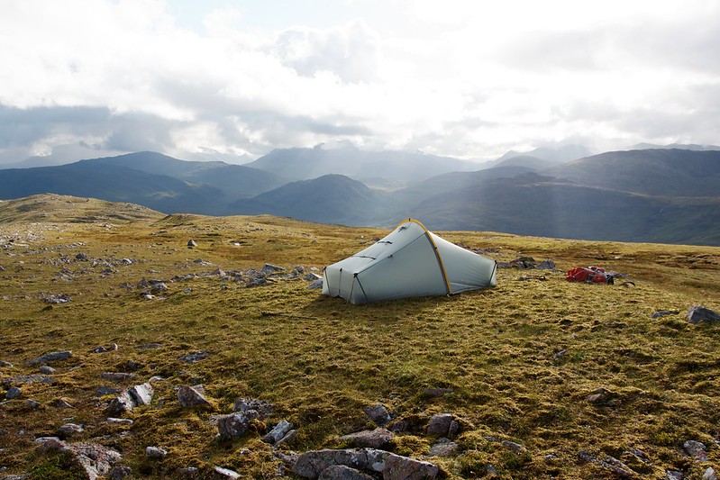
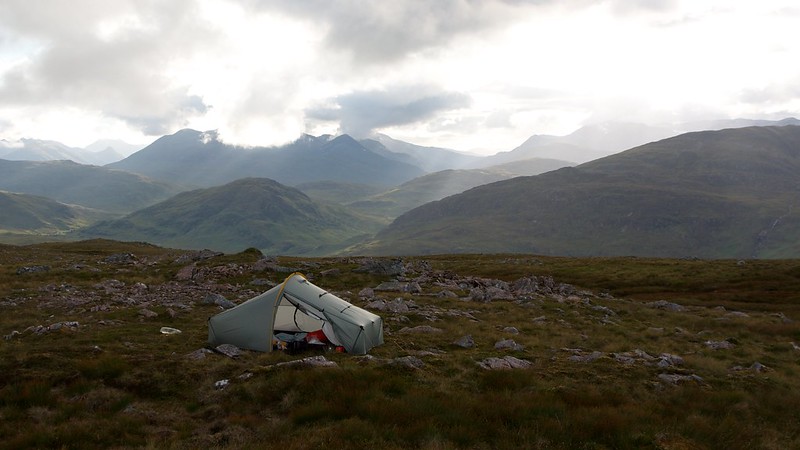
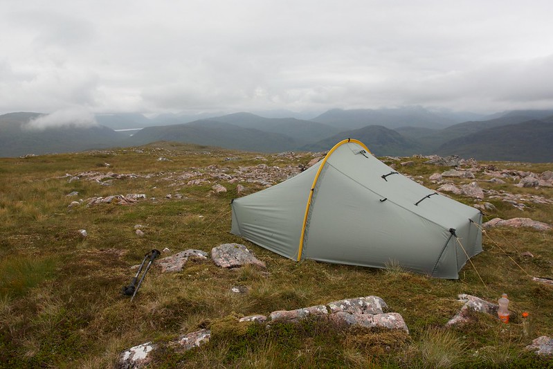
Wild Camp just off the summit of Garbh-beinn (NN 355 709)
Distance: 32.10km
Elevation: 1,538m
Hills: Beinn na Lap (Munro, 935m), Chno Dearg (Munro, 1,046m), Stob Coire Sgriodain (Munro, 979m)
Route: View on OS Maps
Saturday 15th August 2015
During the week I had planned two different possible routes for the coming weekend, hoping to take advantage of some good weather in the North West Highlands. In the end the weather forecast that appeared on Friday afternoon switched the good weather to the Central Highlands and so I threw out the planned routes, grabbed a map from the shelf and decided to do something completely different. This new plan would see me finishing off the cluster of hills that lie between Loch Ericht and Loch Treig.
After a wet drive across the country I pulled into the large parking area at Fersit, off the A82, a little after midday. The heavy rain through Speyside had fizzled out leaving a cool, overcast day. Although the temperature felt quite autumnal, summer’s lingering presence was made clear as a swarm of midges started to gather around me as I changed my shoes and sorted out my pack.

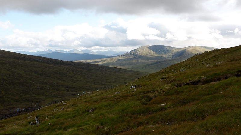
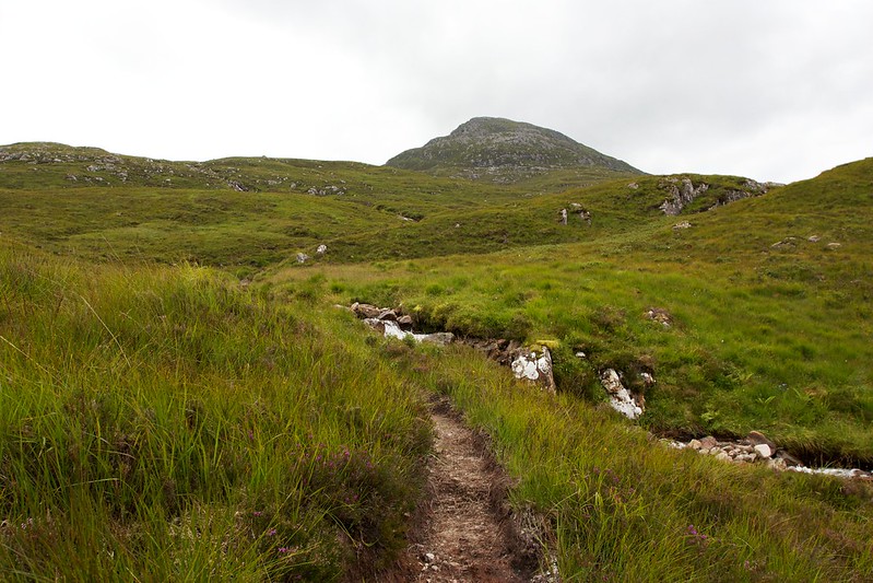
After very little ado I was off, threading my way between the small collection of buildings at Fersit and finally making my way towards the open hillside and the right of way that runs around to Corrour Station. The last obstacle was the slightly worrying presence of a bull (identified by the nose ring) standing just off the track. I gave him plenty of room and was glad to reach the path that winds its way across the boggy ground below the Munros of Stob Coire Sgriodan and Chno Dearg.
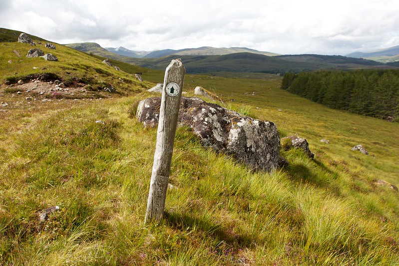
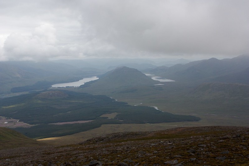
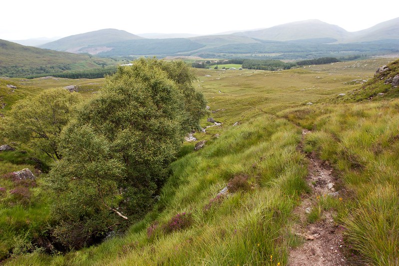
There was still cloud lingering over the Creag Meagaidh group but generally, despite the occasional spell of drizzle, the day seemed to be improving. The path climbed up and then plunged into a wood for a very boggy stretch. After passing the ruins of a house I started daydreaming enough to completely miss the path as it headed upwards and out of the trees. The vehicle track I was now on continued on its boggy way through the woods and a quick glance at the map reassured me that I was likely to meet the main road through to Ossian at some point. This duly happened and I turned south making my way eventually out of the trees and on to the moorland above Loch Guilbhin.
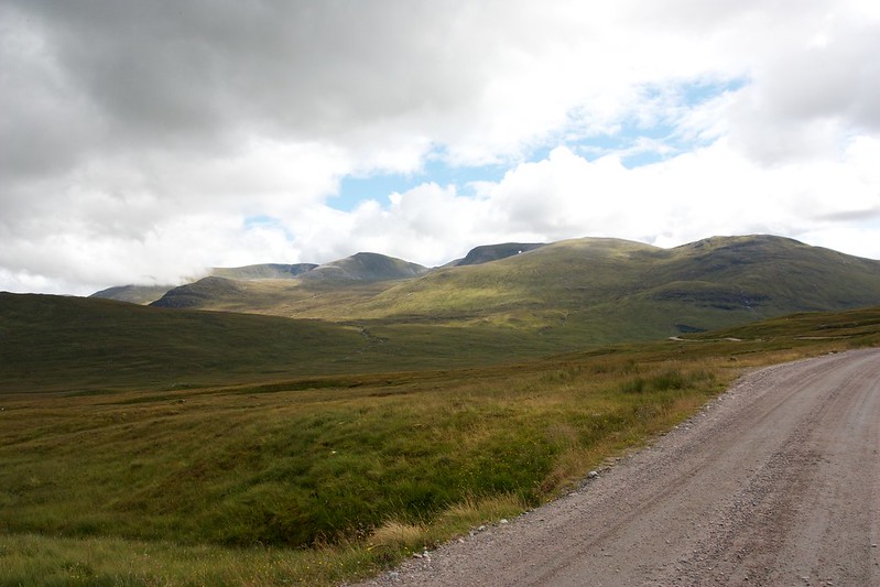
The road is a bit depressing to walk along, wide and stony and looks out of place in this wild landscape, but it got me where I needed and the views across to the Beinn Eibhinn range are fantastic. I could easily trace my route of descent from a fantastic high wild camp I had there back in June 2012, and then my long loop around to get back to Fersit.
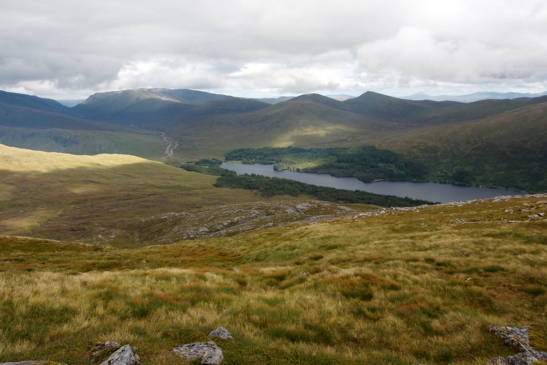
Eventually I wound down to a corner above the loch where I stopped for a late lunch. I had been walking for a couple of hours and Beinn na Lap was now just coming into view in the distance beyond the white house at Strathossian.
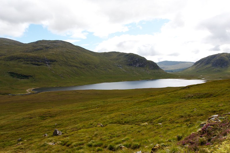
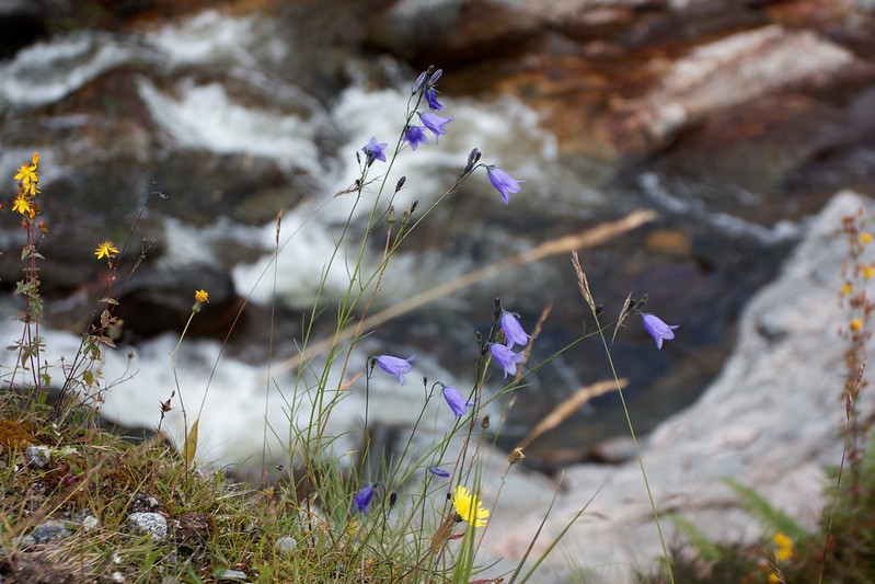
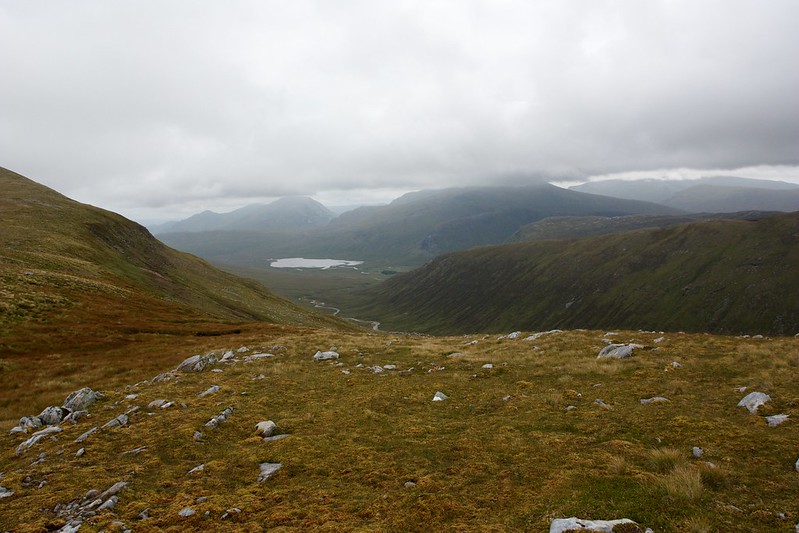
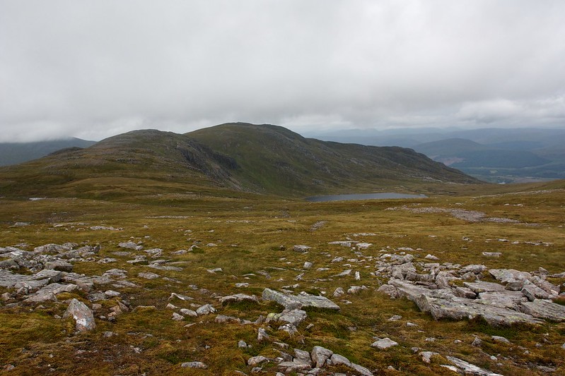
The road now led me along the strath, passing above the house and then reaching a bridge across the Allt Feith Tuill where harebells lined the stony banks. Here I was glad to leave the road and take a grassy track following the south bank of the allt up towards the narrow glen separating Beinn na Lap from Chno Dearg now visible ahead with a lingering snow patch crowning the wall of its eastern coire.
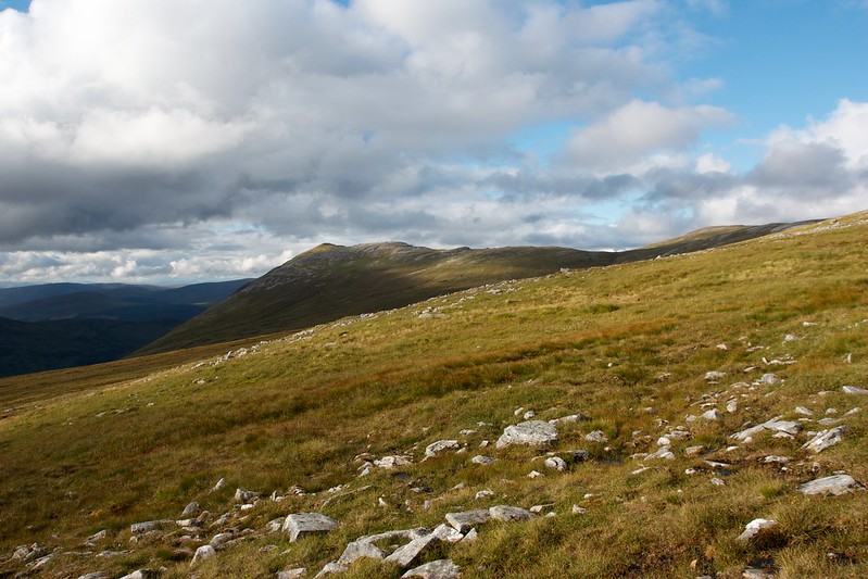
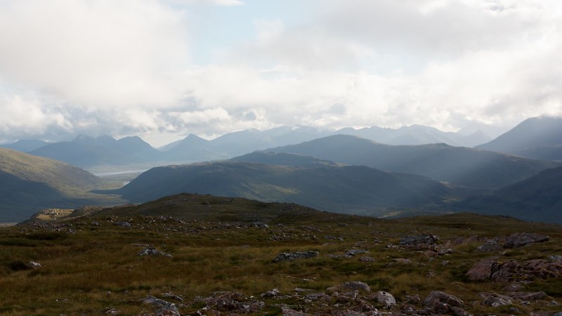
After a short distance I left the path and started to climb boggy ground to reach the nose at the northern end of Beinn na Lap’s long arm. There were a few crags to wind around and between but soon I was up the steepest part of the sron and onto the broad ridge. Behind me there were excellent views to Loch Guilbhinn and the distant hills around Loch Laggan. A patchwork of sunlight was cast across the land as the overcast skies gradually broke.
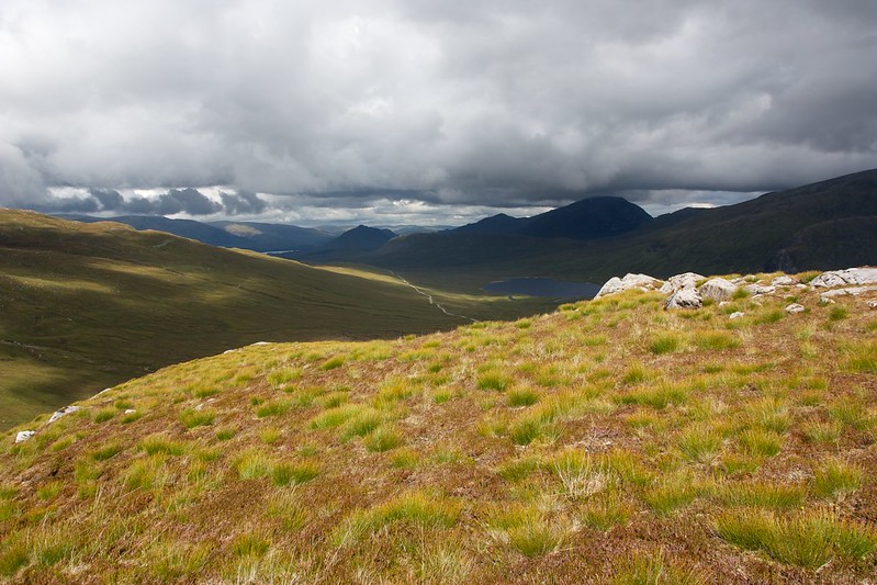
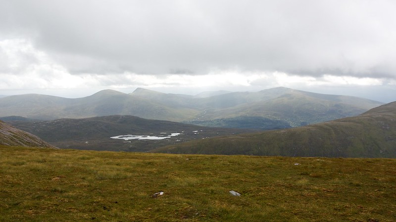
The broad ridge rises gradually over a few kilometres and there was ample time and opportunity to watch the light changing over the surrounding hills. Ben Alder came into view some way off in the distance beyond the grey waters of Loch na Lap.
As the summit of Beinn na Lap neared it got a little rockier and slightly more slender as you swing around the side of the northeastern coire but then the top levels off and it is easy over a little boulder field to reach the large summit cairn. Just as I was approaching from the north a couple reached the summit from the south and sat down in the shelter.
The wind was quite ferocious at this point, whipping across the exposed summit and so I circled the cairn and found myself a spot to sit just off the summit to the east with a view down to the wooded banks of Loch Ossian. The broken clouds coalesced and threatened rain but nothing came of it. I enjoyed a second lunch and then once the couple moved off, I headed up to the summit to have a look around.
The wind was still gusting strongly but the sunshine reappeared, casting a new light on the summit area which looked quite inviting for a high summit camp. Tempting as it was though I was keen to cover a little more distance and get the other big ascent of this route over and done with before stopping for the night.
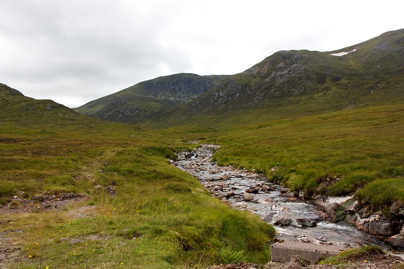
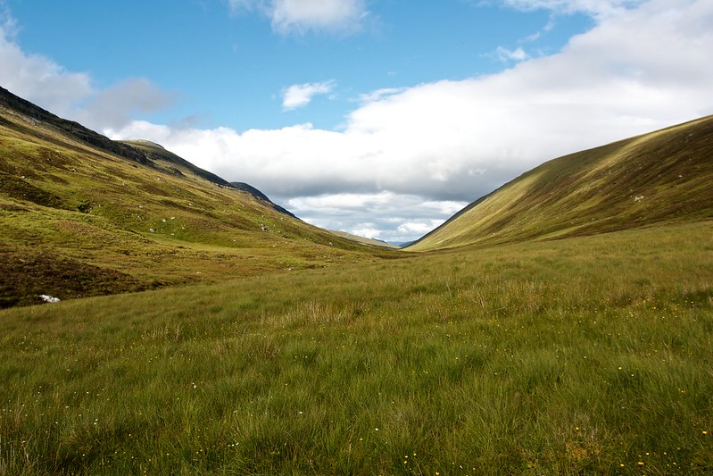
Reluctantly I left the summit of Beinn na Lap and headed off towards the southwest. The slope soon revealed itself as steep but grassy and I picked my way carefully down to the floor of the glen where I kept north to avoid a significant area of peat hags and bog around a small muddy lochan.
After refilling my water bottle in the stream it was then straight back up the eastern slope of Garbh-bheinn, regaining all the elevation that I had just lost. Again the slope was steep but easy enough on grass and short heather. I followed a trickling burn with the thought I might want to fill my reservoir up before reaching the summit but in the end there was water all the way up.
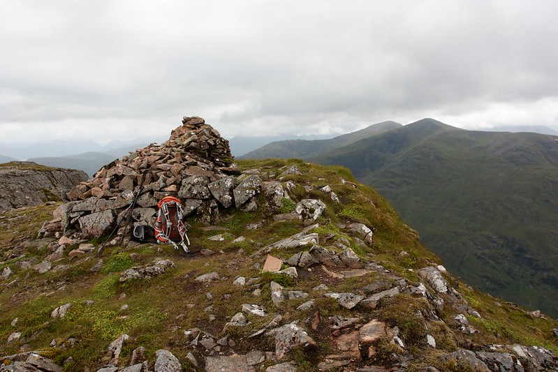
Soon enough I was on the top of the ridge, a gently angled slope leading up from the railway line. I was at a point just a short distance away from where it levelled off to the 857m high summit but the wind was gusty so I stayed where I was as it seemed a little more sheltered.
After a quick scout around I found what I thought was a decent patch of soft ground that, with the tent angled just so, would give me a level pitch. Once the tent was up I went slightly downhill to fetch some water, only then realising from a distance how not-at-all-level the tent was. Near the water I found a nice level patch of ground and so quickly relocated the tent downhill on to it.
Everything was sorted nicely just in time as the skies clouded over and a light rain started. Inside I cooked up some pasta and put on a podcast.
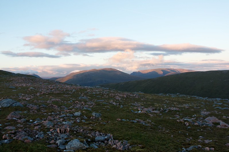
An hour or so later the rain had cleared and the evening was looking much more promising. Outside the tent I found myself a nice seat and settled in to cook some dinner and watch the sun dipping towards the Easains.
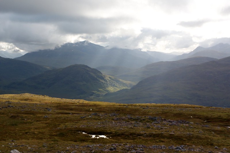
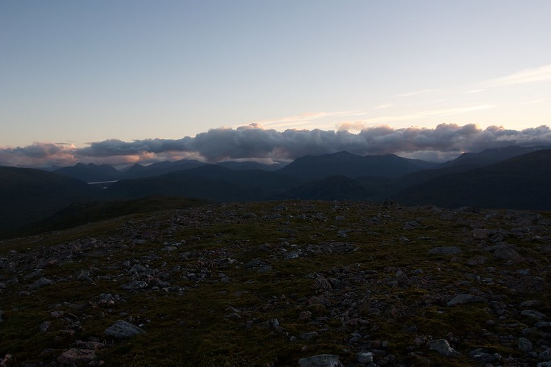
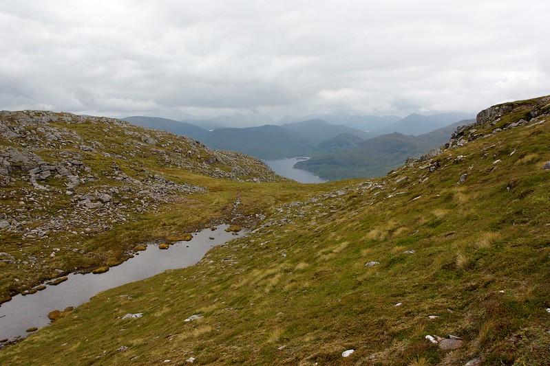
There was still cloud and mist around blocking the best views but the Mamores were visible as well as a wide swathe of the central-southern Highlands from Lawers to Bridge of Orchy. Through a gap in the hills I could see the silvered surface of the Blackwater Reservoir and beyond it the hills of Glencoe.
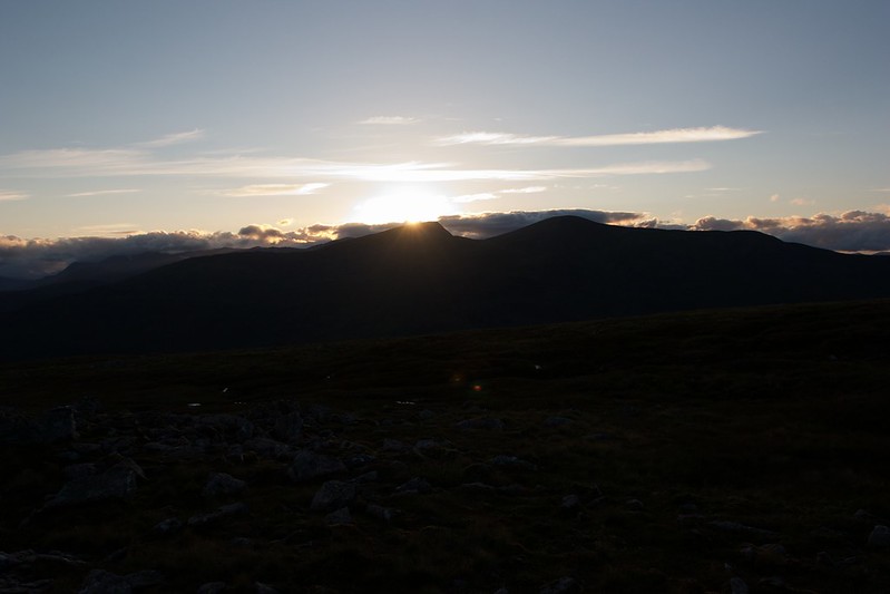
It was a wonderful evening, warm in the sunshine and I sat outside for a couple more hours until the sun finally sank behind clouds to the west. There was very little colour in the sky and it got cold quickly so I retired to the tent to wrap up in my sleeping bag and read some of Carrot Quinn’s Pacific Crest Trail memoir.
Around midnight I had a look outside and found a star-studded sky, the Milky Way a pale arc across the top of the sky directly above the tent. I sat back for a while, spotting three faint, fast moving and very brief meteors (likely Perseids which had peaked earlier in the week).
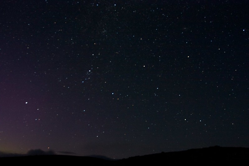
However, if I had realised I should have been looking to the north as a display of the aurora was visible from Scotland (for much better photos see this post from Ewan over at Wild About Scotland) but I only realised this when I looked at the photographs I had taken and spotted a red glow in the corner of one. Sadly I was sleepy and cold and didn’t spend the time I should have to get a good focus so my few star shots are blurry.
Sunday 16th August 2015
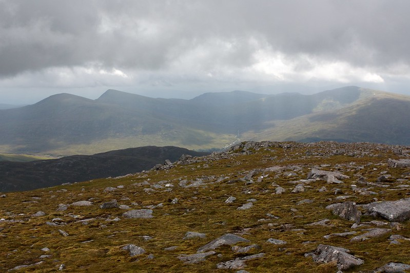
Cloud had rolled in overnight and I woke to a cool, damp morning. I’d set my alarm for sunrise but at 5am the conditions were definitely not looking good so I’d rolled over and slept another couple of hours. Looking out at around 7 the clouds were brushing the summits of the neighbouring Munros. The forecast had been for an improving day so I decided to relax for a couple of hours and see what happened. With my Kindle providing entertainment I lazed around drinking a couple of hot drinks and slowly making my way through a series of small breakfasts.
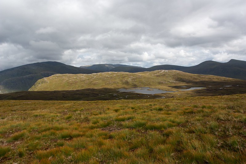
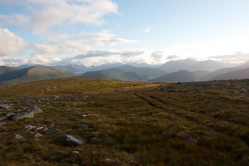
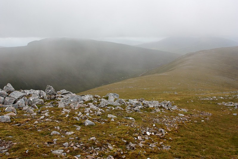
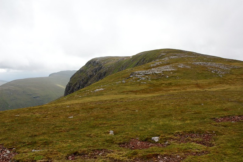
Eventually the weather improved to the point where most of the nearby summits were appearing below the clag. I got everything packed up and set off north, following the easy ground across Garbh-beinn towards the top of Meall Garbh.
A large herd of deer were gathered on the slopes of the Munro top but moved off as I approached. Off to the northeast there were views across Strathossian towards the Ben Alder hills, still mostly swathed in cloud.
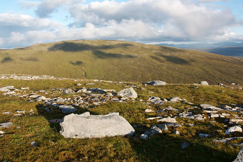
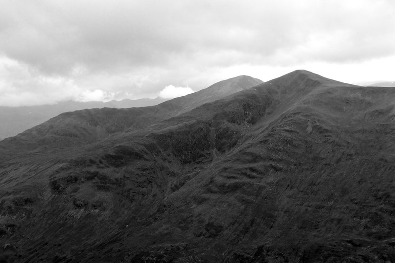
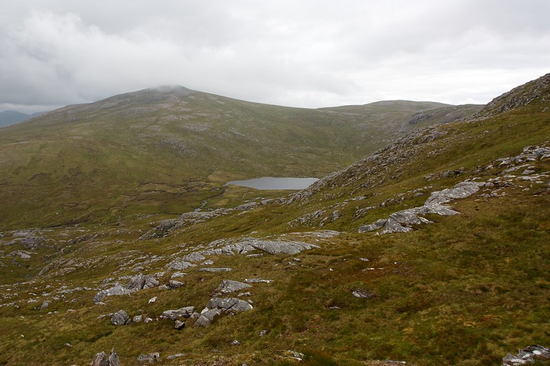
I climbed up the slopes of Meall Garbh, entering the cloud as I gained the final few metres to the summit. There were patches of sunlight appearing on distant hills though and as I crossed between the twin summits the cloud started to thin and lift until I could see the final climb to the summit of Chno Dearg ahead of me.
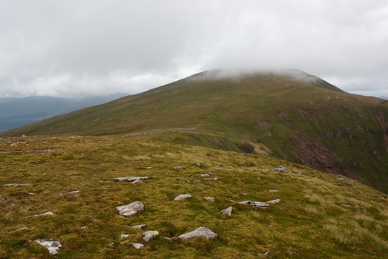
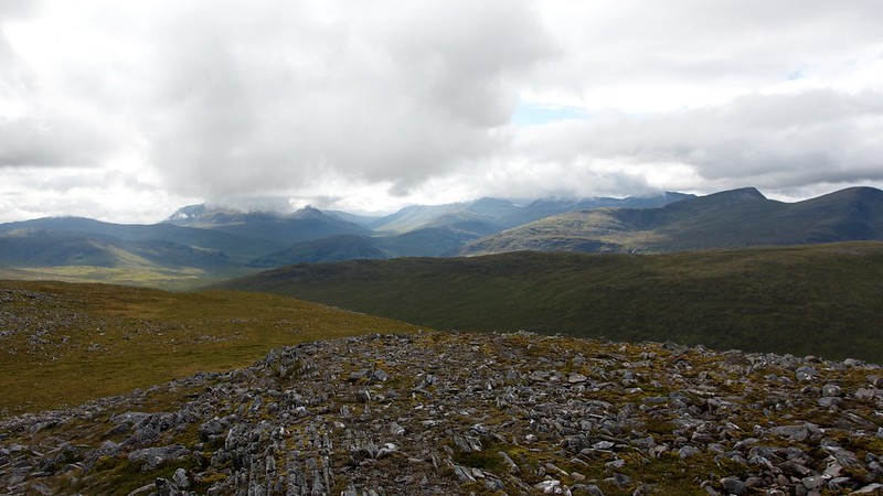
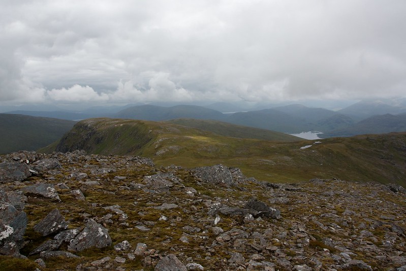
Off to the left there was a view around the head of the coire to Stob Coire Sgriodain, the trip's final Munro which was now completely clear of cloud.
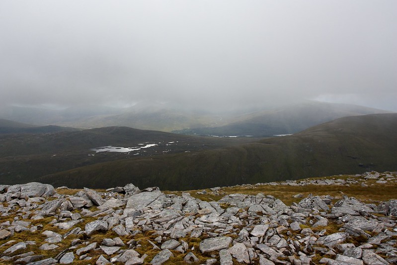
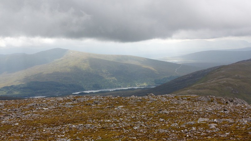
I made my way towards Chno Dearg, following a rough track through the short grass and clipped heather. Behind me sunlight was appearing over Loch Ossian and I could see the rough and craggy eastern side of Meall Garbh with Beinn na Lap beyond it.
The way up to Chno Dearg was straightforward and the clag continued to move off as I arrived at the rocky summit area. There were improving views all around, to the Alder hills, to Laggan and away towards the Easains.
Sunlight was streaming down through gaps in the clouds over the Ossian hills and towards Rannoch Moor as I sat down and enjoyed a late morning snack.
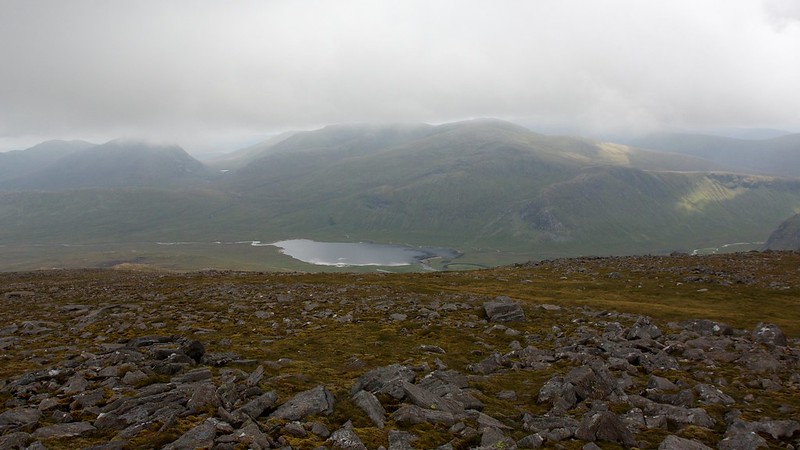
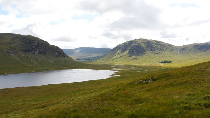
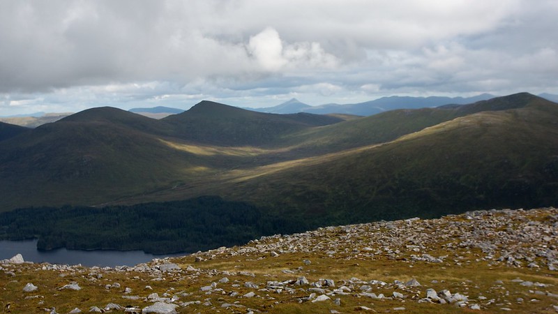
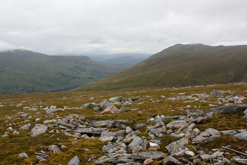
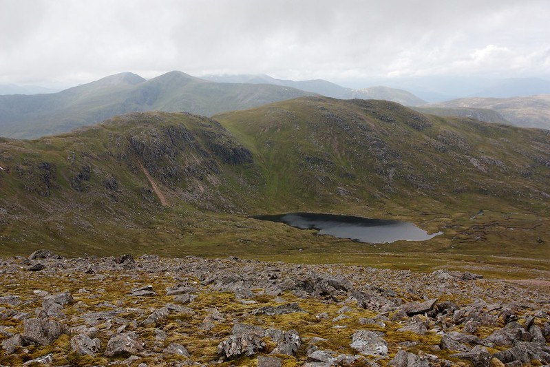
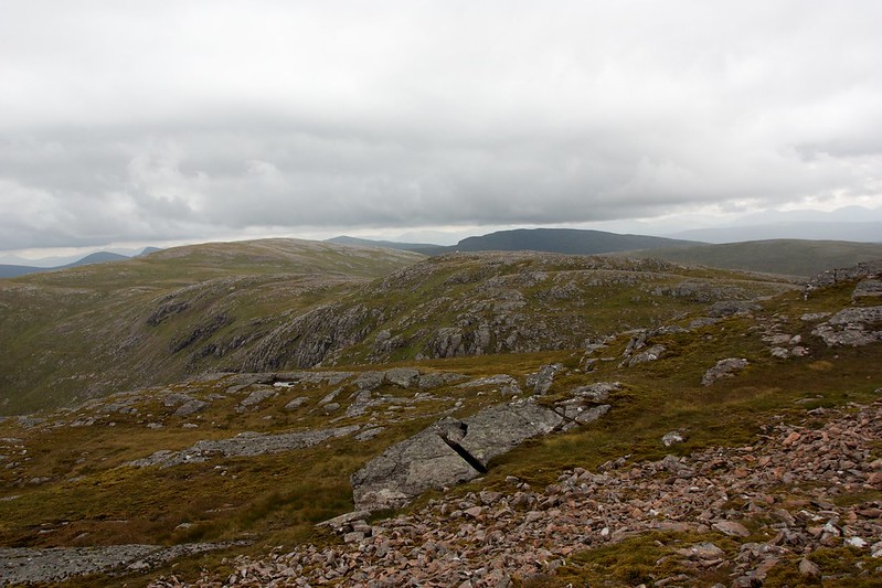
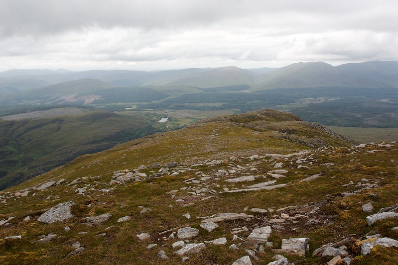
I crossed over to the west side of the plateau where there views back south to where I had camped and across the coire with its lochan to the summit of Stob Coire Sgriodain. By this time the Easains had cleared too. In the distance to the north I could just about see my car parked up near Fersit.
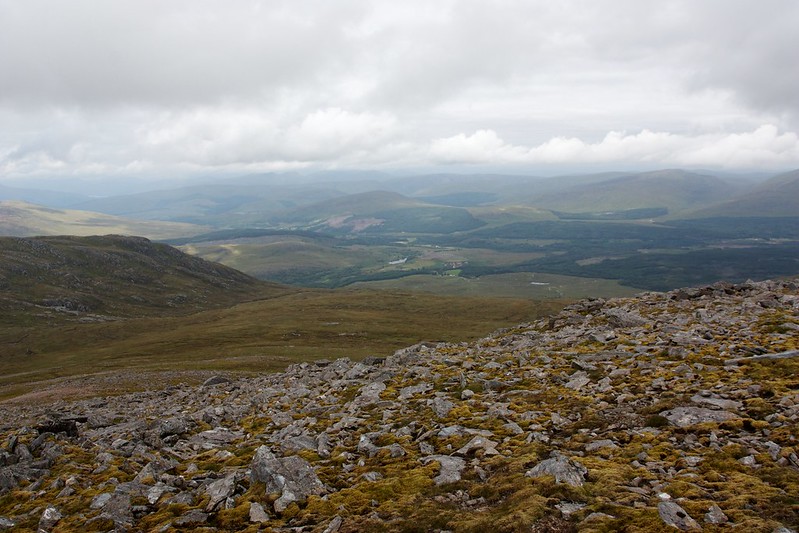
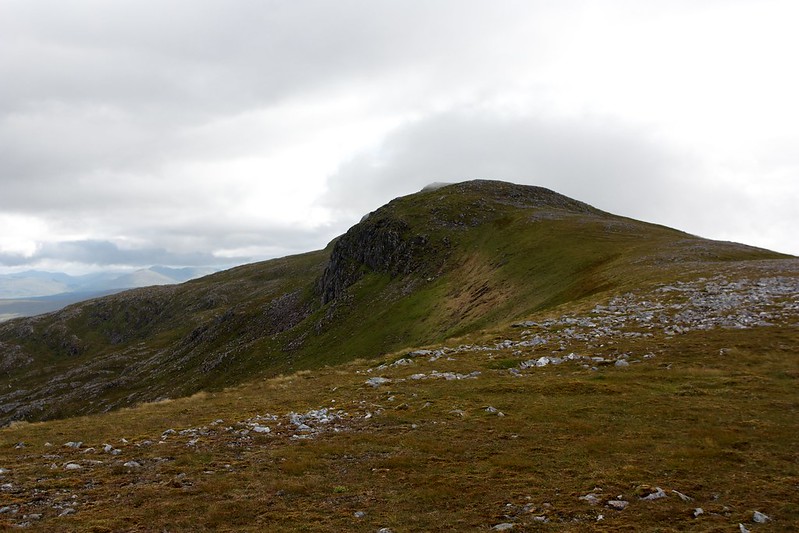
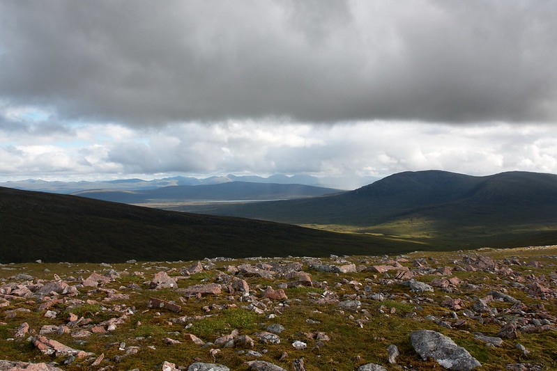
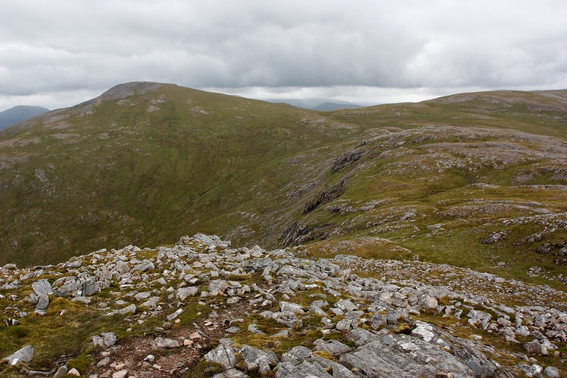
The descent from Chno Dearg was easy and then I picked my way around the rough ground at the head of the coire to start on the series of rough tops that would lead me round to my final summit of the trip.
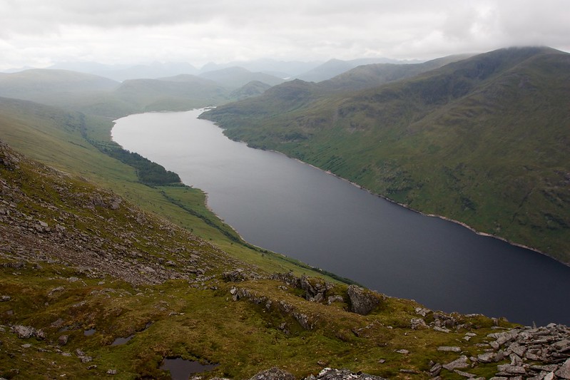
From along here I finally got some views of Loch Treig as well as back across the coire to Chno Dearg. There was a path most of the way but at times it was fun to deviate on to some more scrambly, rocky ground that offered an alternative way.
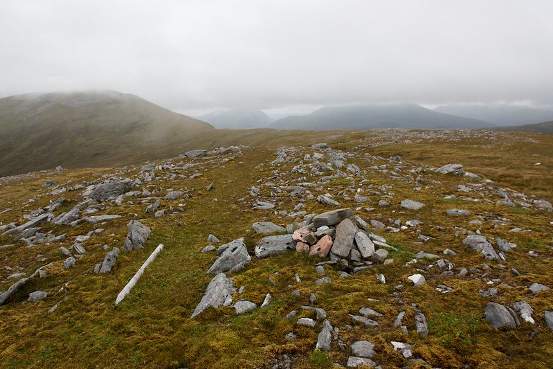
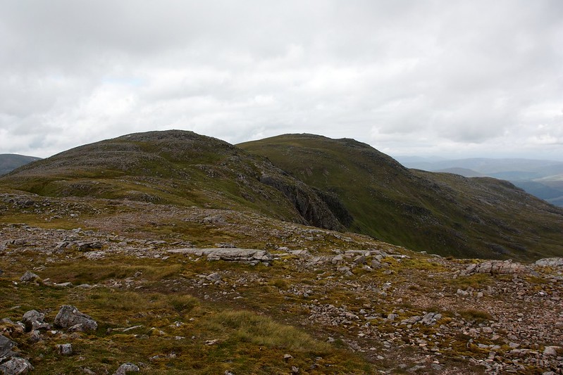
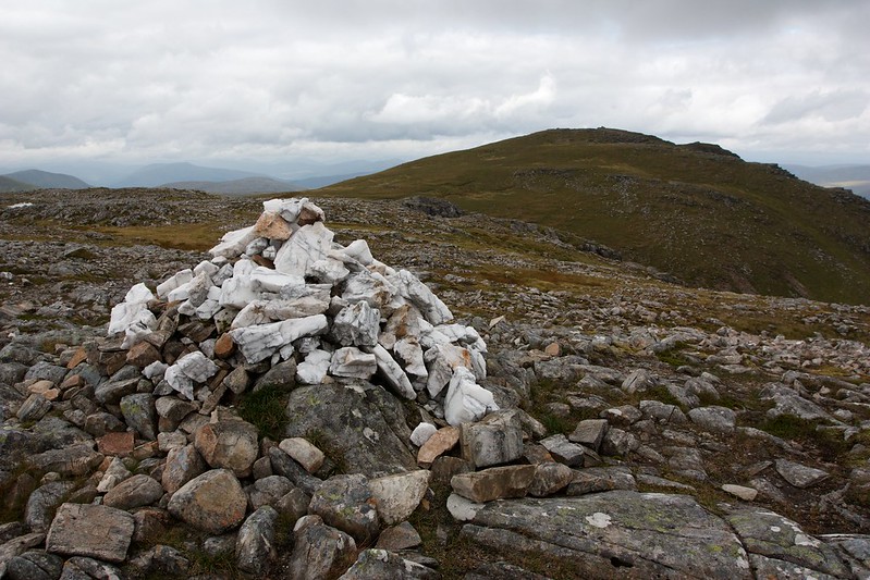
The final top had a quartzite cairn and then there was a reasonably big drop down before the final climb up to the summit area of Stob Coire Sgriodain. I'd watched a couple of guys arrive at the summit and met them just as they were leaving.
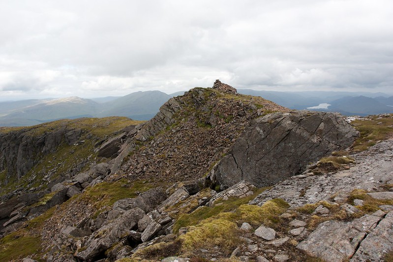
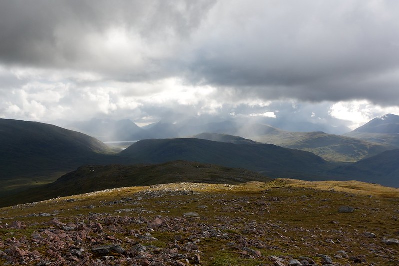
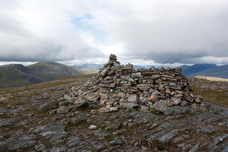
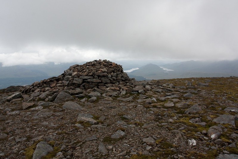
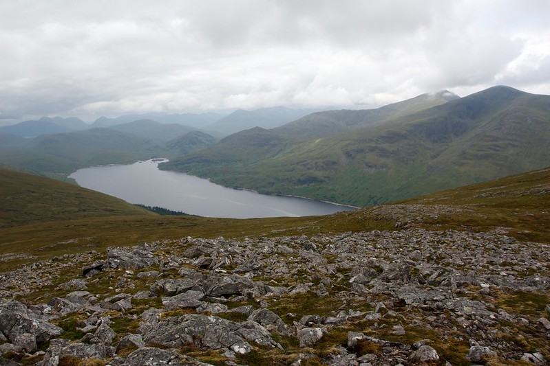
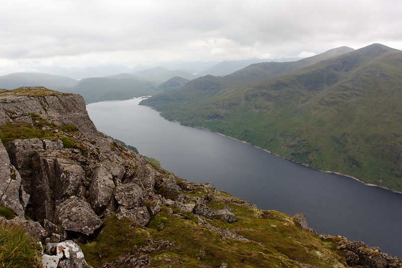
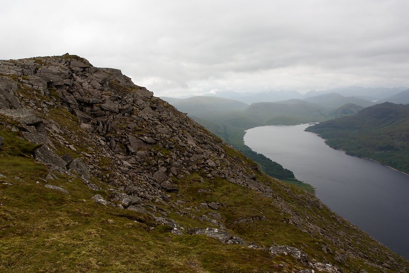
The summit of Stob Coire Sgriodain is a great place, with wonderful views almost straight down to Loch Treig far below. Across the loch the twin peaks of the Easains rose.
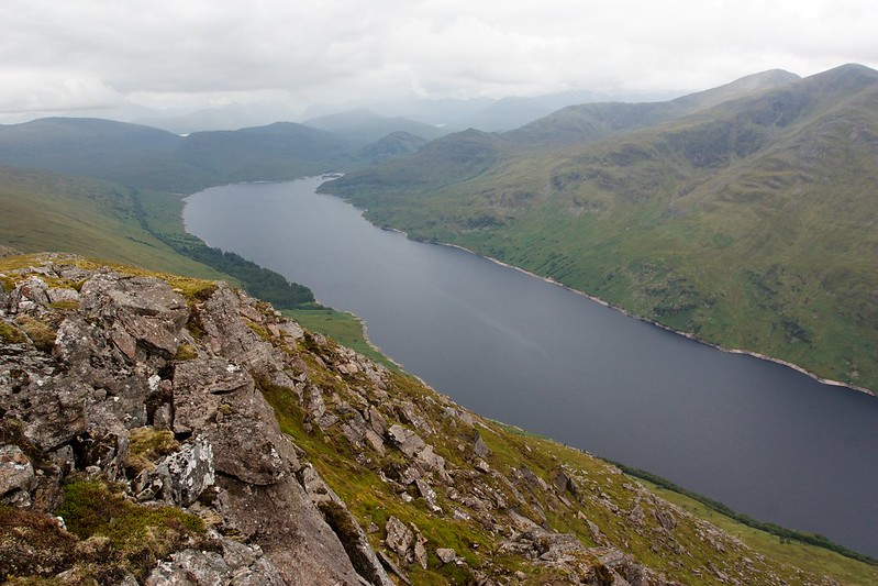
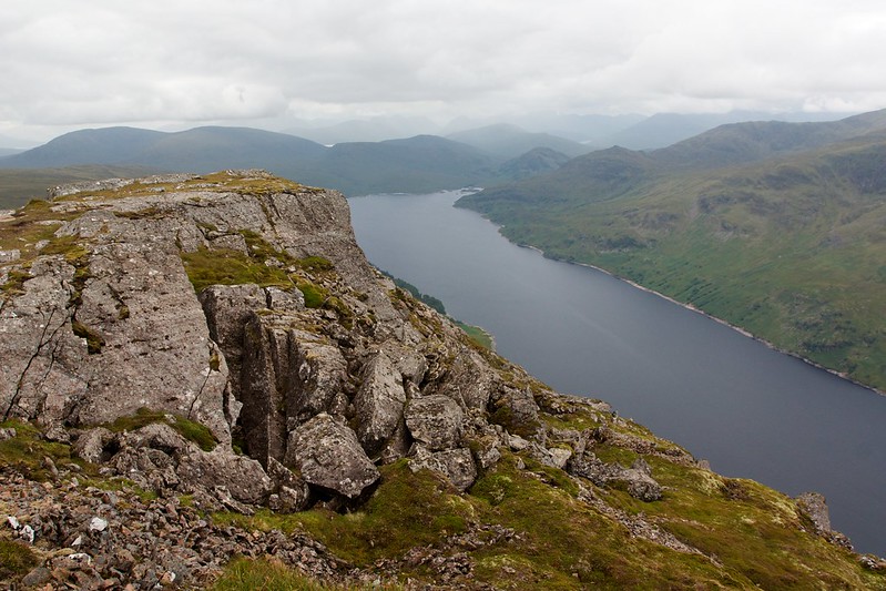
From the first overlook I made my way up to the summit cairn itself where there were good views to Loch Laggan and down Loch Treig towards the hills of Glencoe, still mostly lost in the cloud.
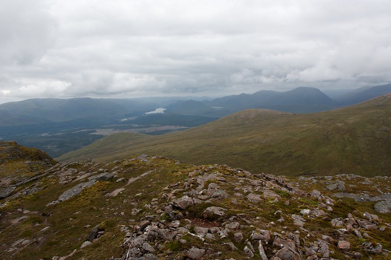
In the distance I could see Beinn na Lap and the area on Garbh-beinn where I had camped. I sat down by the cairn and had some lunch, surprised at how quet the hills were given the views and calm conditions.
Finally it was time to be heading down. I followed the north ridge as it curved its way around the western coire of the hill. Just as I stopped to get a final view of Loch Treig a couple came up and we had a good chat about the views and other hillswe had bagged in the area.
Then it was a simple matter of getting off the hill and back down to Fersit. Initally I followed the broad ridge but as this headed to the steeper nose I dropped into a gully that offered a slightly easier, albeit wetter descent.
This took me down to the boggy, uneven and heathery area below the nose of Stob Coire Sgriodain. Eventually I managed to pick my way across to a path that offered a fairly straightforward route down, mostly following an allt as it tumbled down to Fersit.
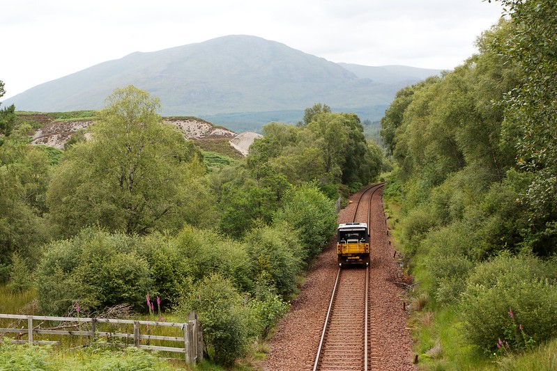
There was a last bog to negotiate and then it was back through Fersit, avoiding dogs and watching as a maintenance truck clattered its way along the railway line heading for Tulloch.