An overnight backpacking trip taking in the two Munros to the north of the Lairig Noe, a wander through Glen Kinglass and by Loch Etive, then returning (after a high camp) by way of the Ben Cruachan ridge including its two Munros.
Date: 8th-9th June 2013
Distance: 45.03km
Ascent: 3,015m
Hills: Beinn Eunaich [Munro], Beinn a' Chochuill [Munro], Ben Cruachan [Munro], Stob Daimh [Munro]
Weather: Glorious. Warm and sunny. Very little breeze except in the evening.
Route: View on OS Maps
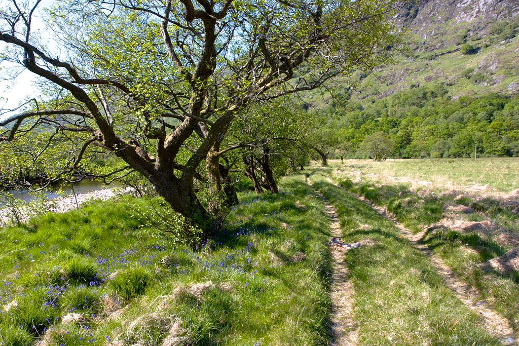
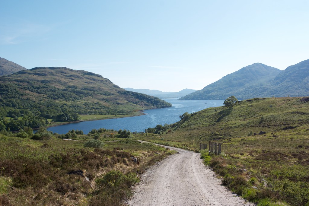
An inauspicious start: drizzly grey in Aberdeen; passing the aftermath of a bad accident on the A90; wiping out a pheasant on the A85 coming into Comrie. Thankfully by the time I wound down towards Loch Awe from Tyndrum the sun was shining and after a quick map check I found the layby near the farm of Castles which is the starting point for those heading towards the Lairig Noe and the two Munros to the north of this pass.
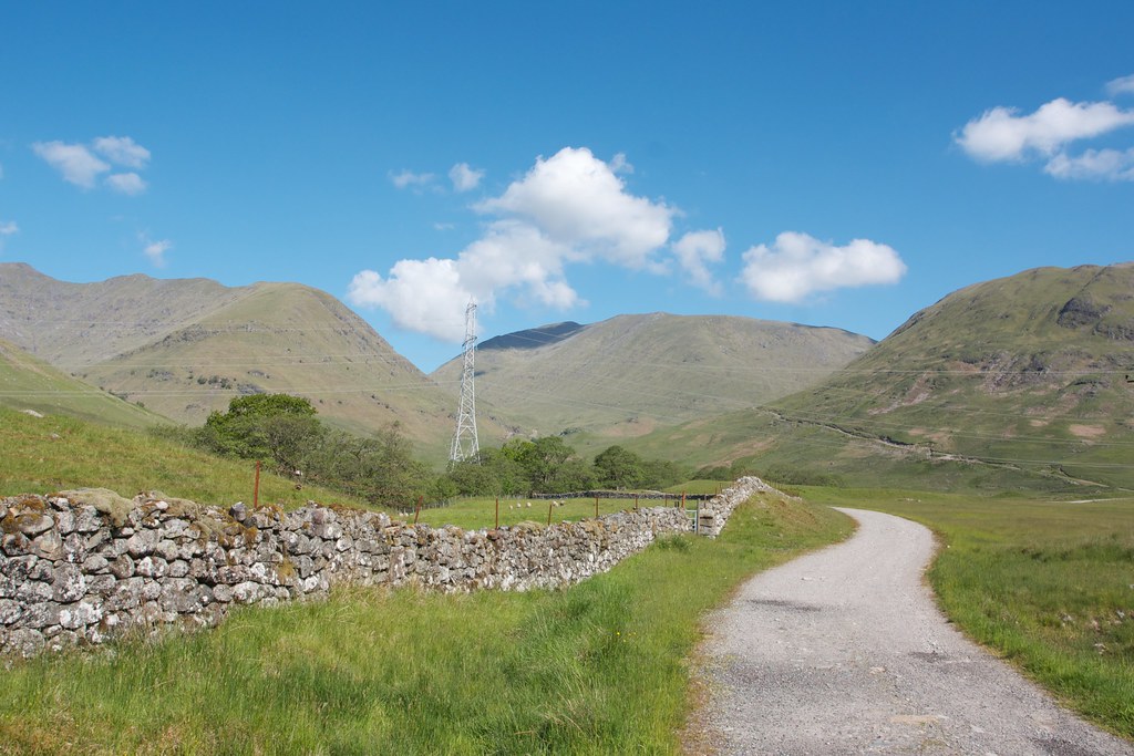
I was off into the bright warm sunshine a little after 9:30am. The skies were a deep, beautiful blue with only a few fluffy white clouds around. Under them the hills were green, a few patches of snow lingering here and there in dark recesses of their upper slopes. An easy track took me around the side of Castles farm and then led through a couple of gates to the Lairig Noe track. I caught and passed a family of three enjoying the sunshine.
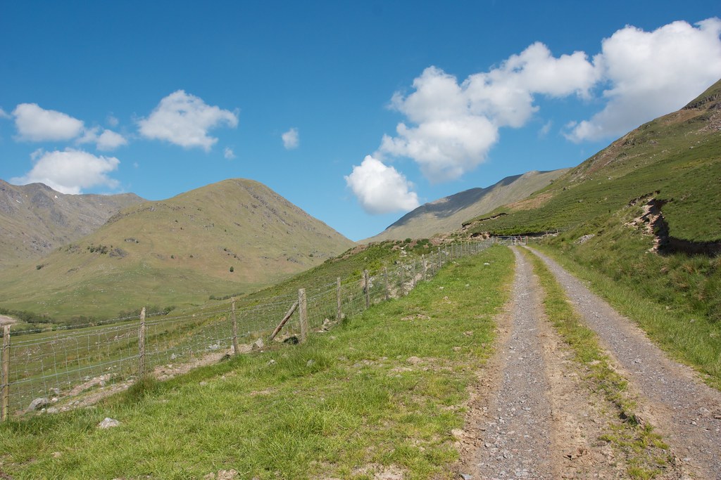
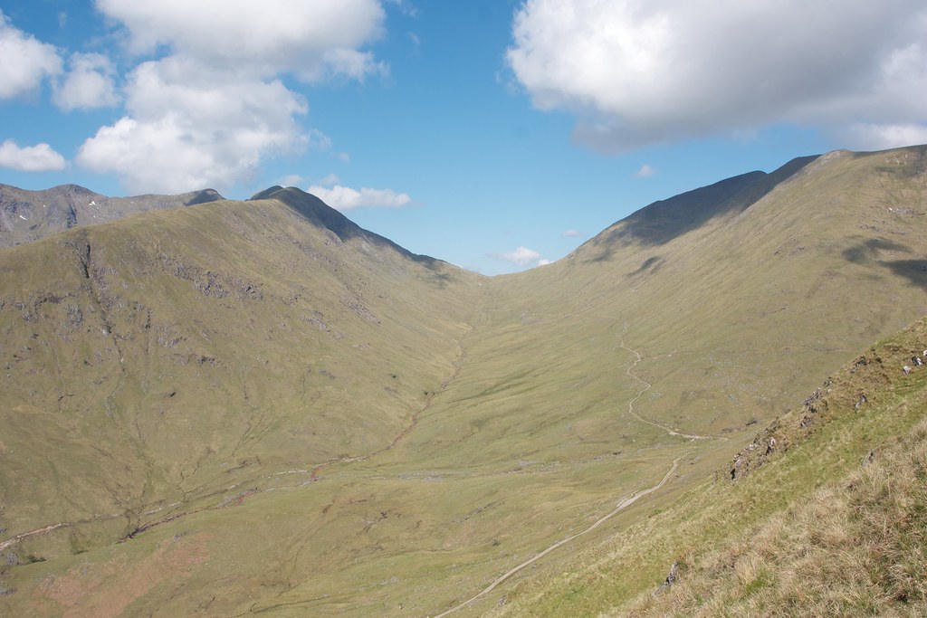
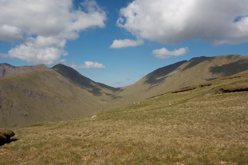
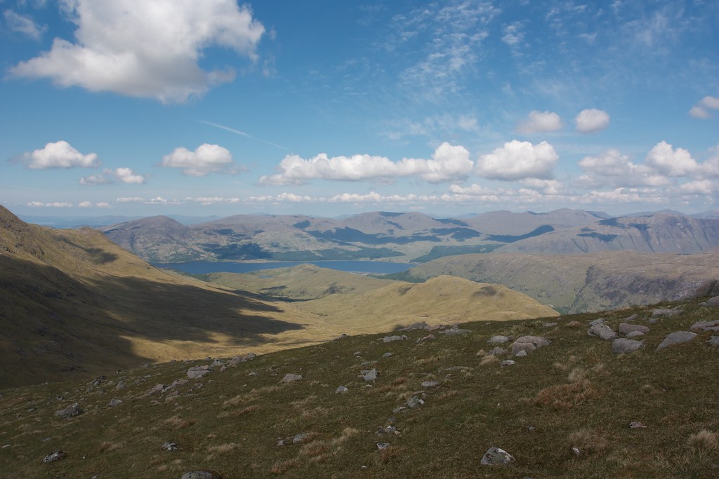
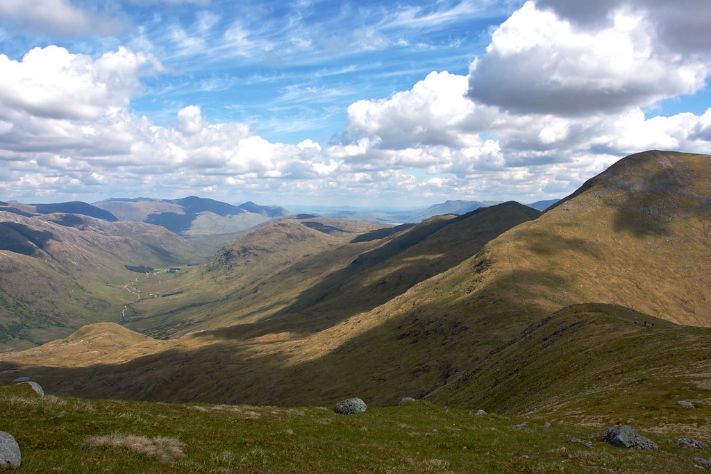
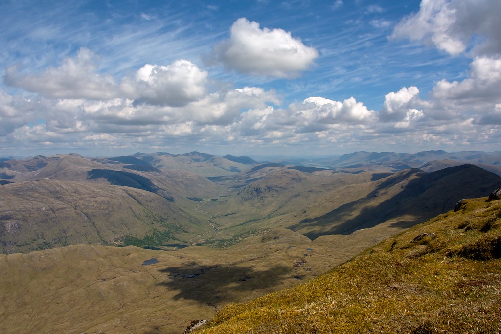
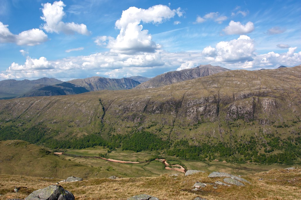
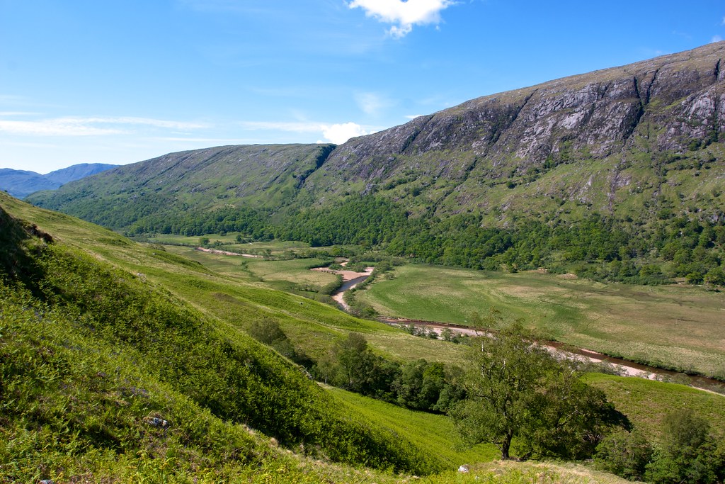
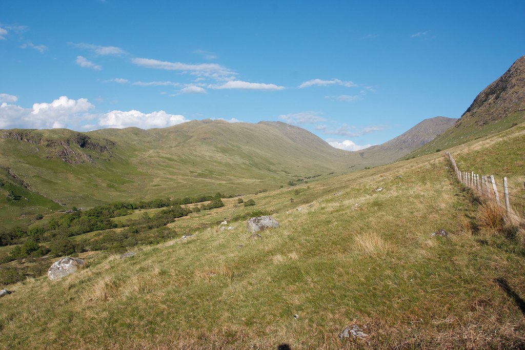
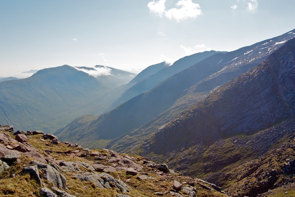
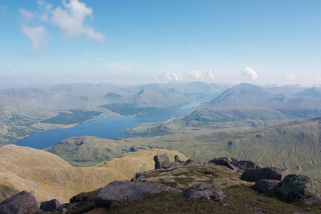
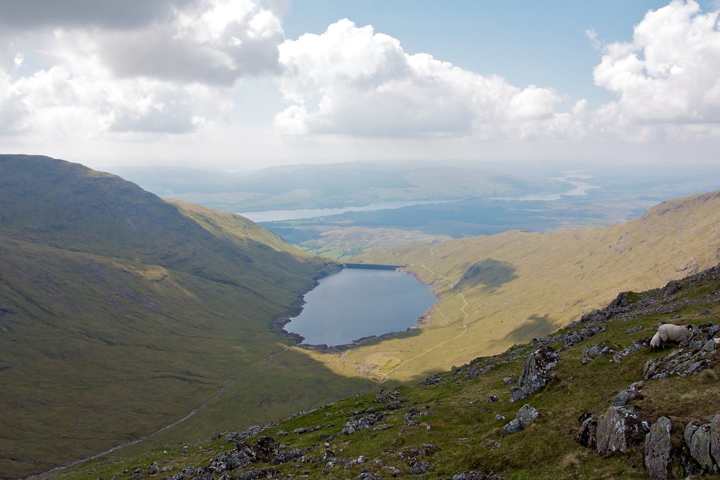
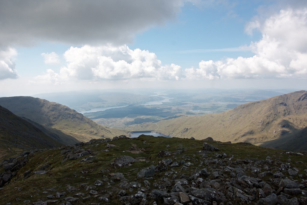
The Lairig track climbed steadily with views starting to open out ahead to the hills and behind to Loch Awe. I came up to the cairned junction marking the start of a narrow track which would get me up to the Beinn Eunaich ridge.
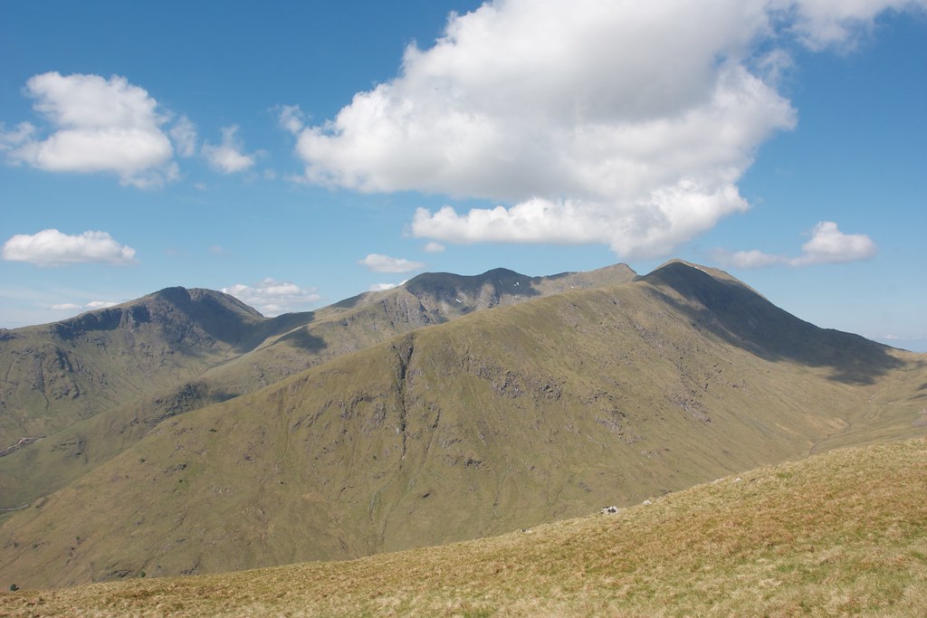
The path up the hillside was steep and in places eroded but did make for rapid progress up the 400m or so of elevation it took to gain the ridge. Behind me the views opened out as the woods and water of Loch Awe were revealed. Kilchurn castle was a dark shape amongst the green of the trees. Across the Lairig Noe the Cruachan massif opened up.
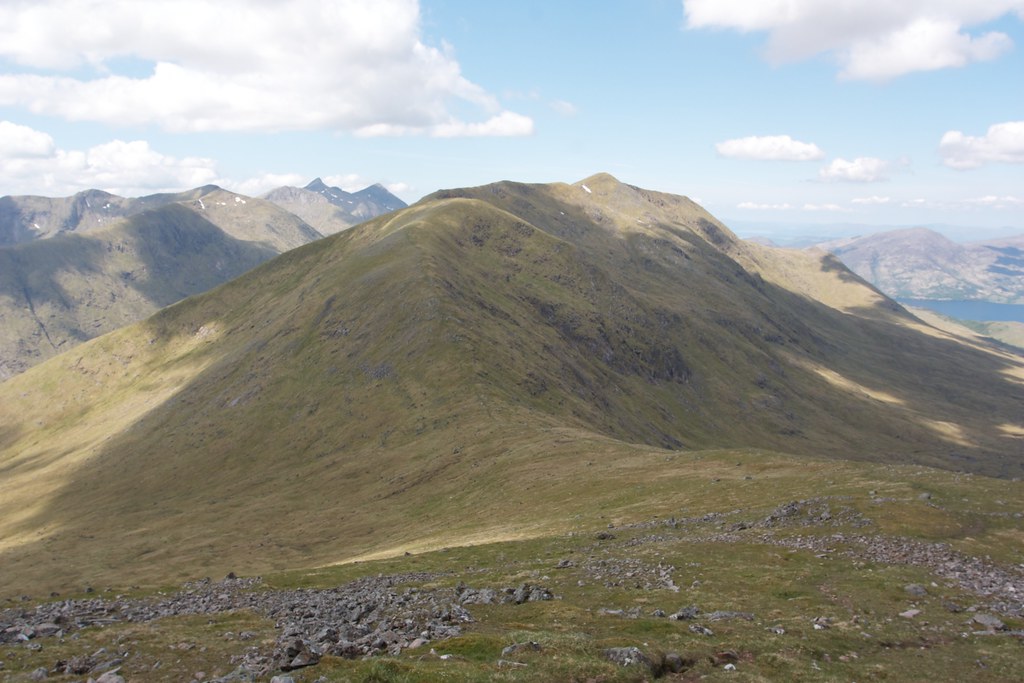
The ridge of Beinn Eunaich was wide and curved upwards towards the summit, an easy slope on short grass. The only downside of this easy stroll up, especially considering the hot weather and unwavering sunlight, was the lack of water. Every tiny stream was dry, the ground occasionally damp, but nothing more substantial.
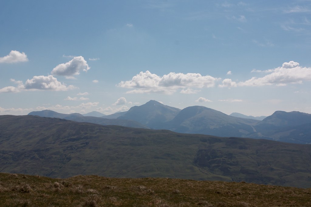
The summit cairn was reached with little fuss and I put down the pack to admire the views. I rationed out some water and munched on some trail mix looking back east to the Ben Lui group and north towards the Bridge of Orchy hills and the Black Mount.
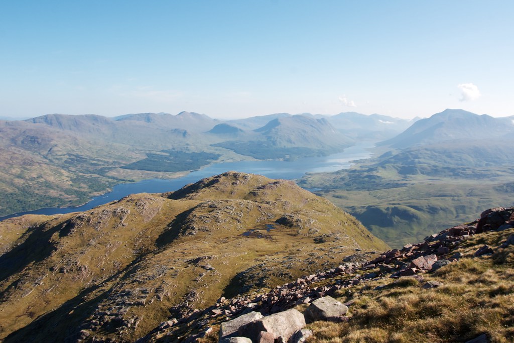
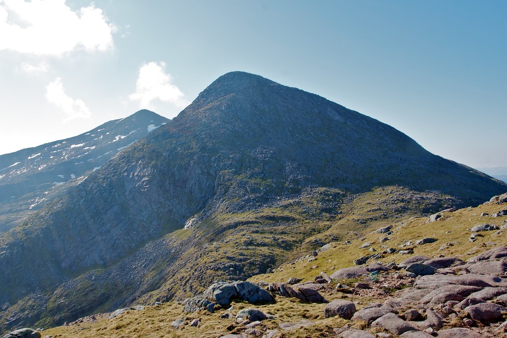
Immediately to my west was the grassy ridge extending down and around to the more interesting summit of Beinn a Chochuill, the next Munro of the trip.
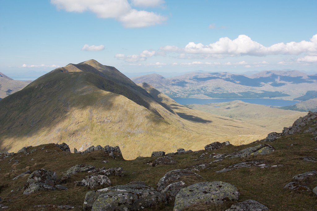

There was an easy path to follow down the steep western slopes of Beinn Eunaich and then it was a gentle climb back up towards the next hill. Sadly even at the bealach there was no sign of running water so I continued to ration out my bottle.
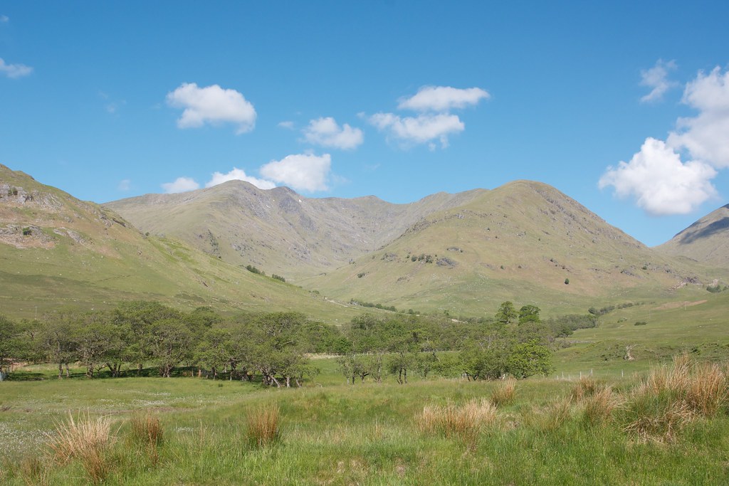
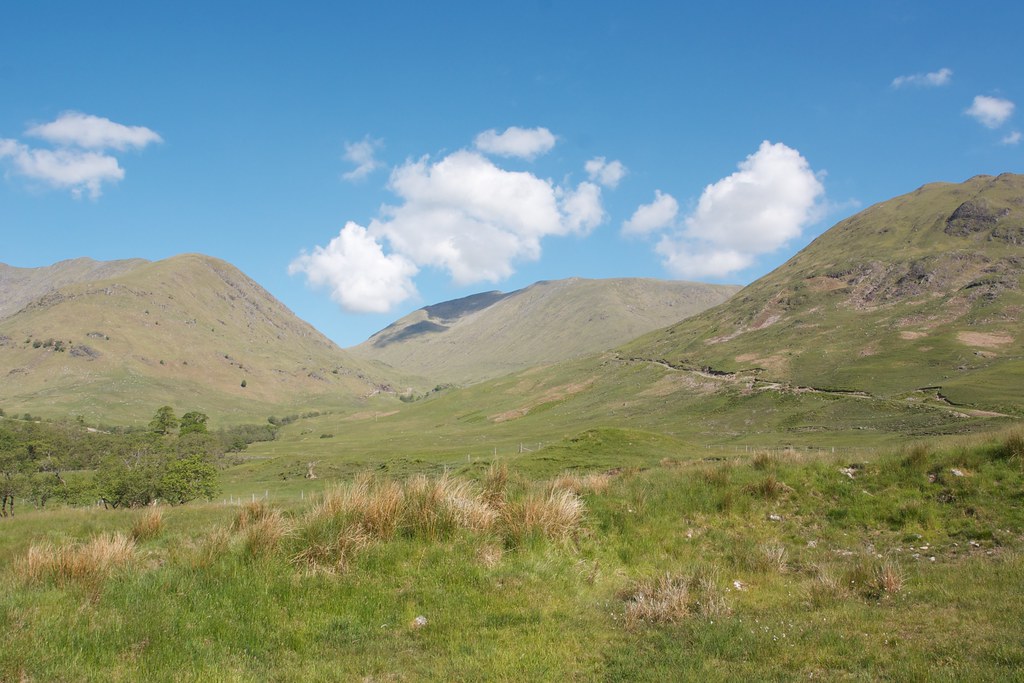
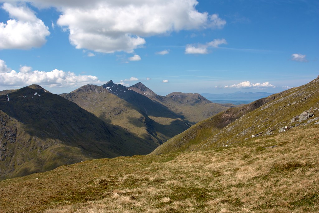
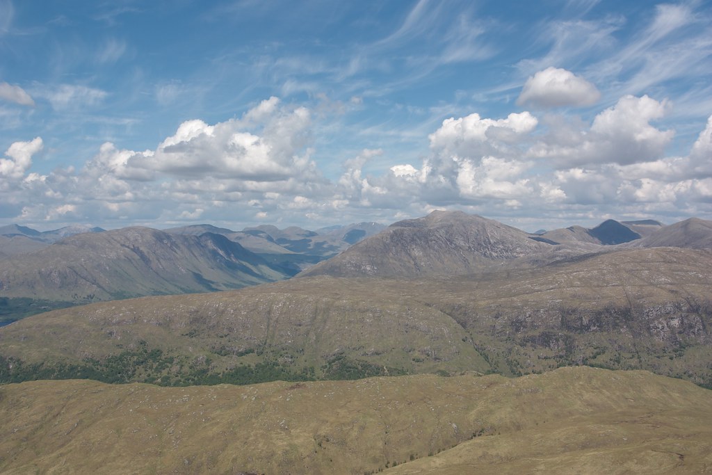
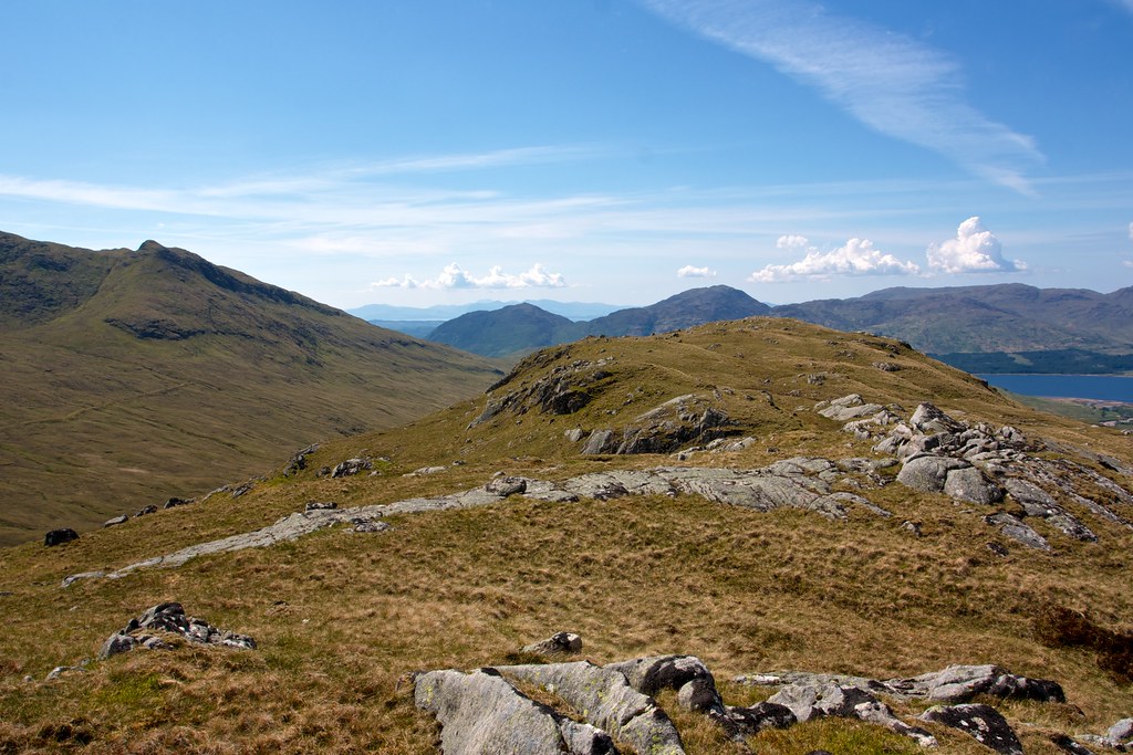
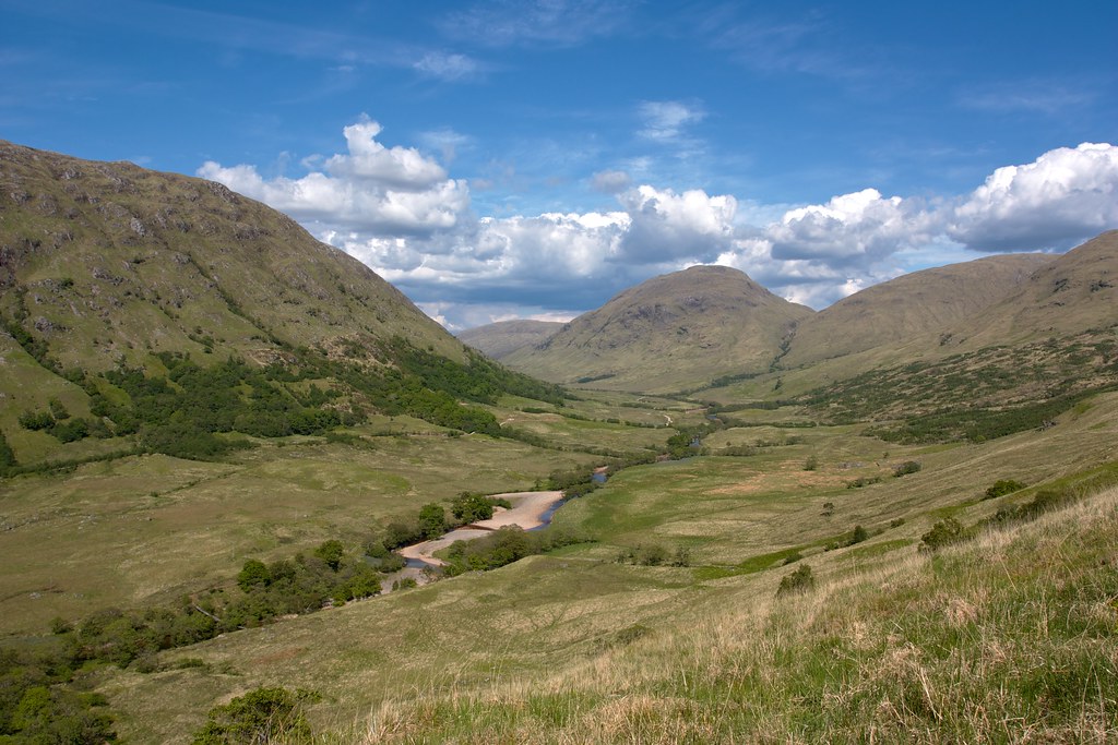
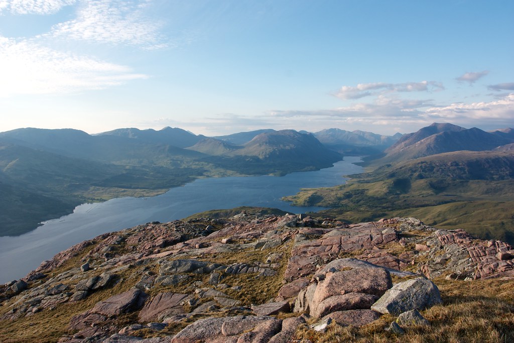
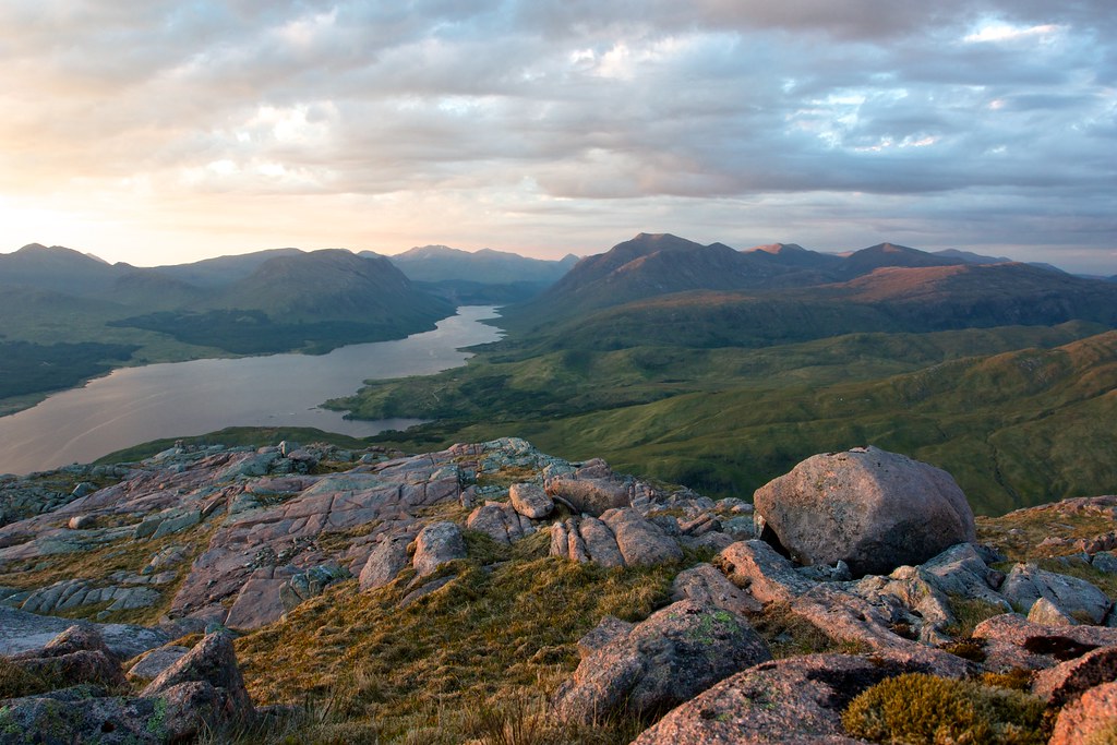
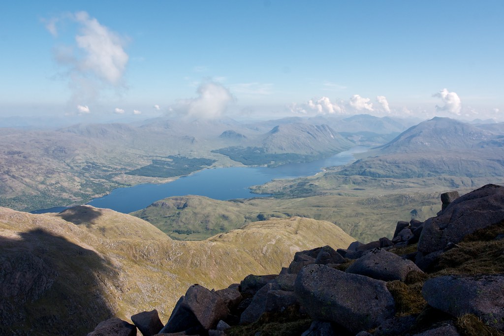
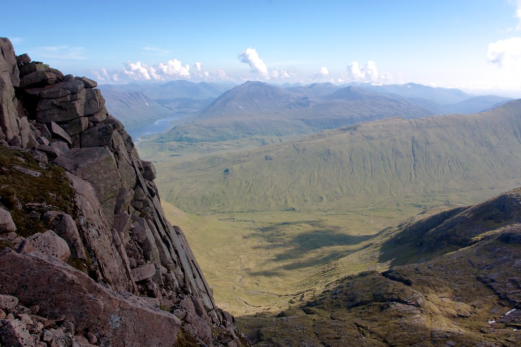
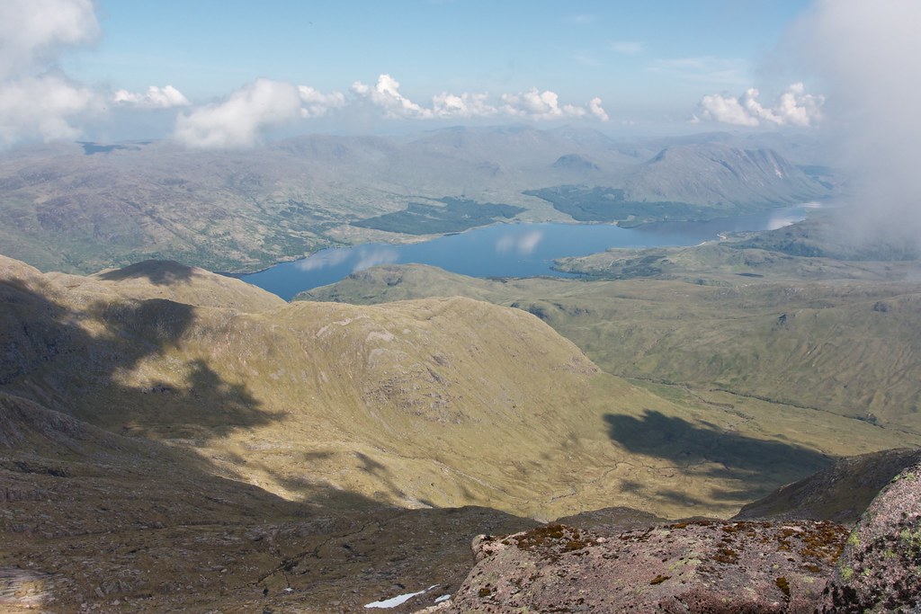
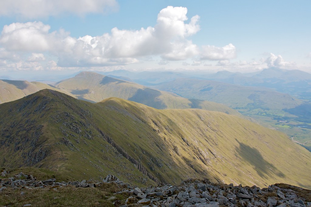
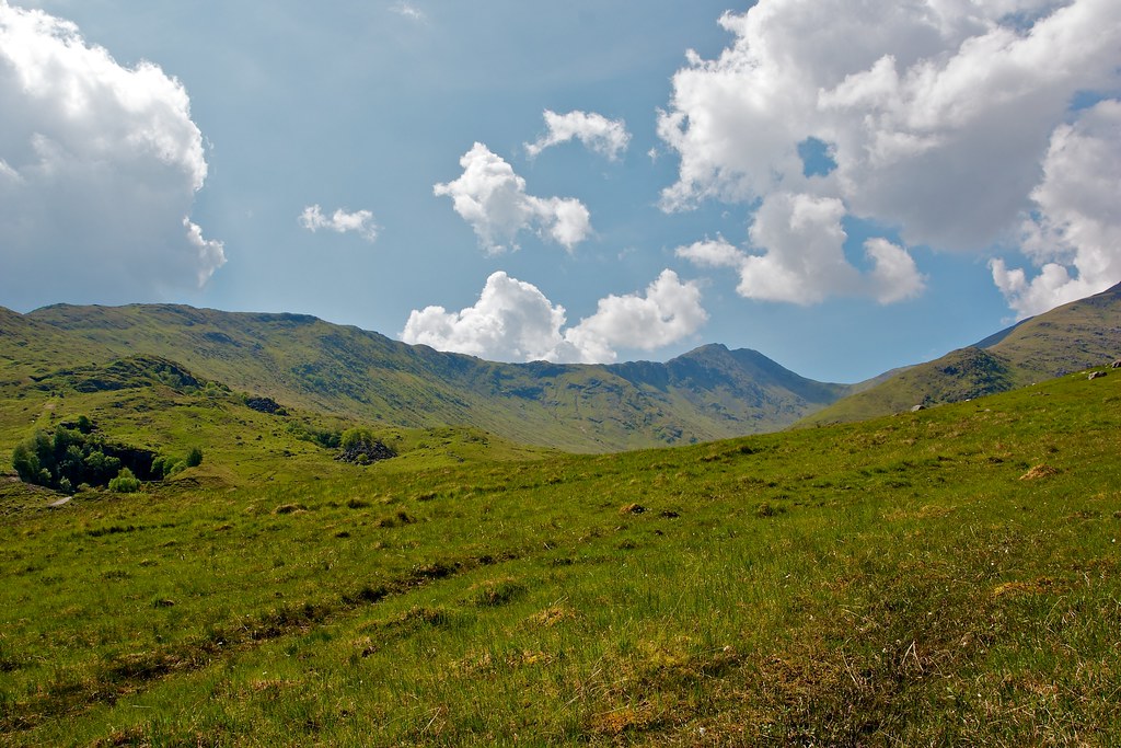
There was a short steep pull up from the bealach but then the ridge widened and provided easy grassy walking with absolutely wonderful views on all sides. Glen Kinglass led the eye towards the Bridge of Orchy whilst the Cruachan range, its dark northern coires on display, marched to my left.
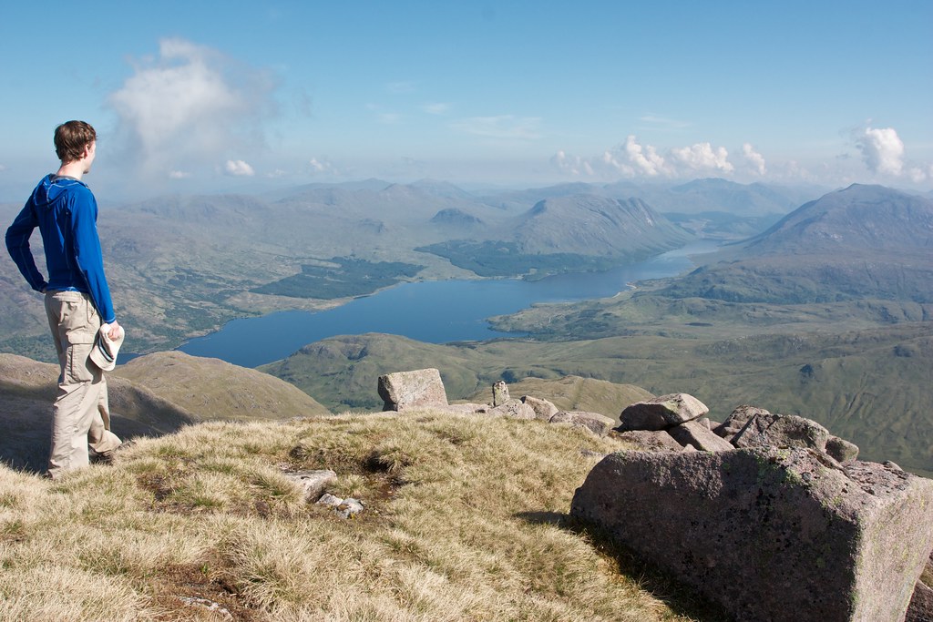
I caught back up with the family of three as I neared the summit. They had missed out Eunaich and ascended Chochuill by a rib above the Lairig Noe. Again the summit cairn commanded a lofty view and a short distance west brought with it the sight of the western coast with Lismore and Mull out in the clear blue sea.
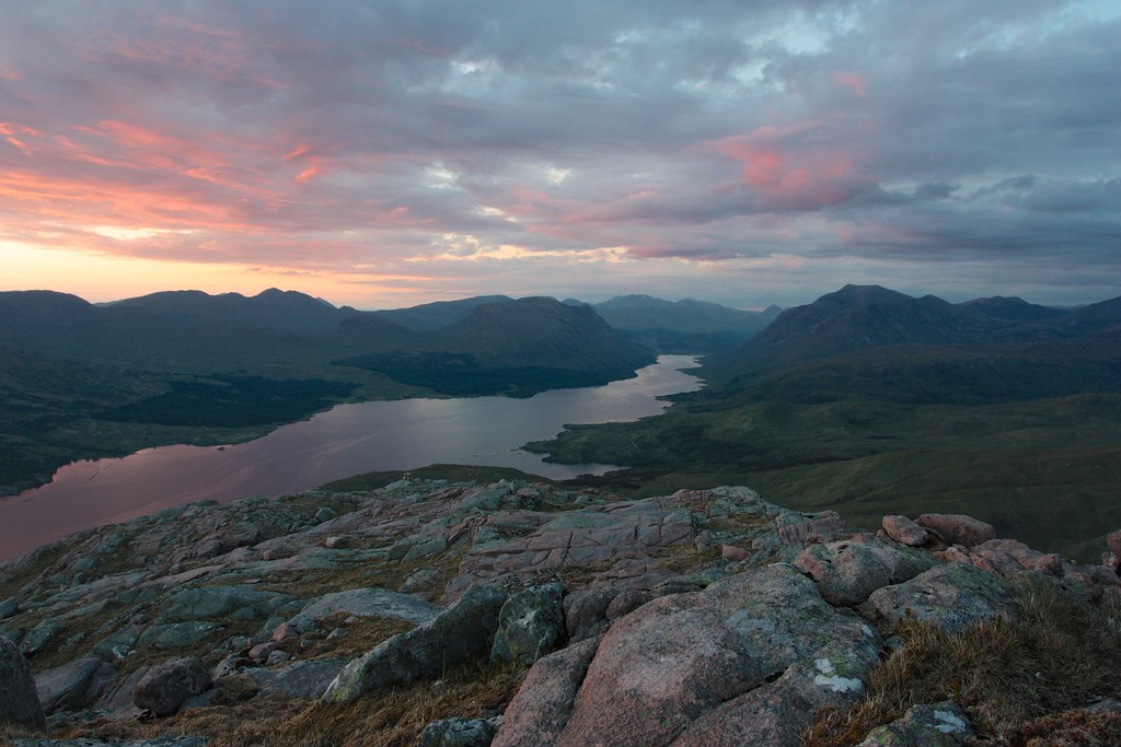
There was hardly a breath of wind and it was wonderfully warm. I found myself a spot to sit down, perched on the edge of the northern crags looking out across to Glen Kinglass and Ben Starav. Wispy high cloud had developed and there were other clouds rolling through that made for beautiful, ever changing patterns of shape and light in the sky.
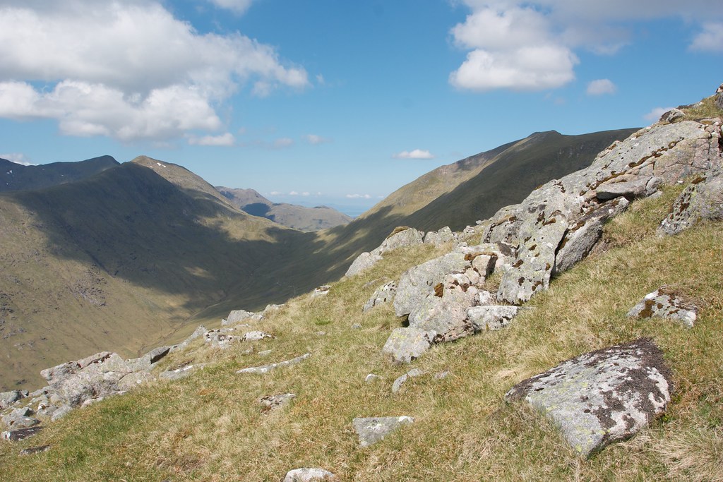
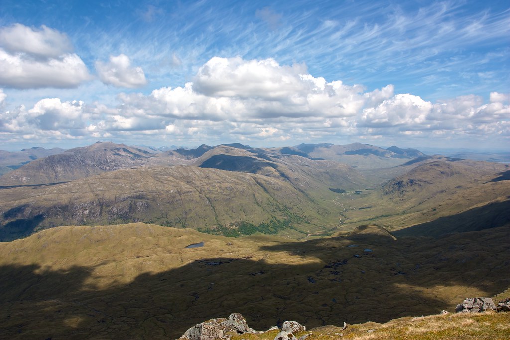
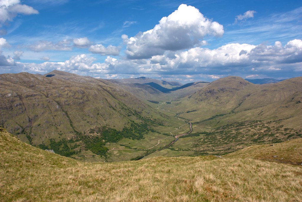
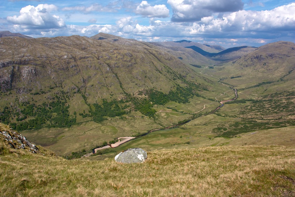
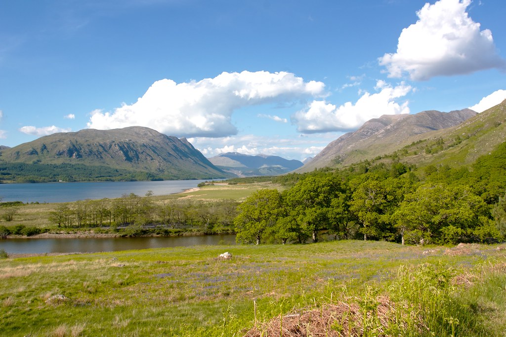
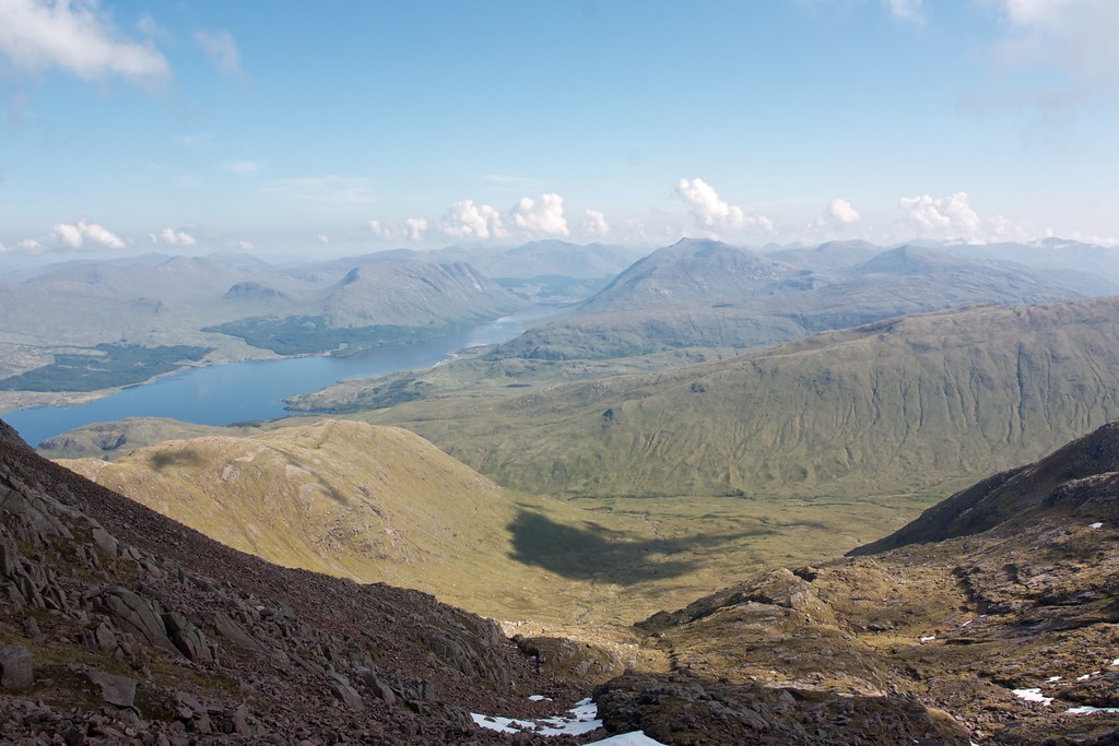
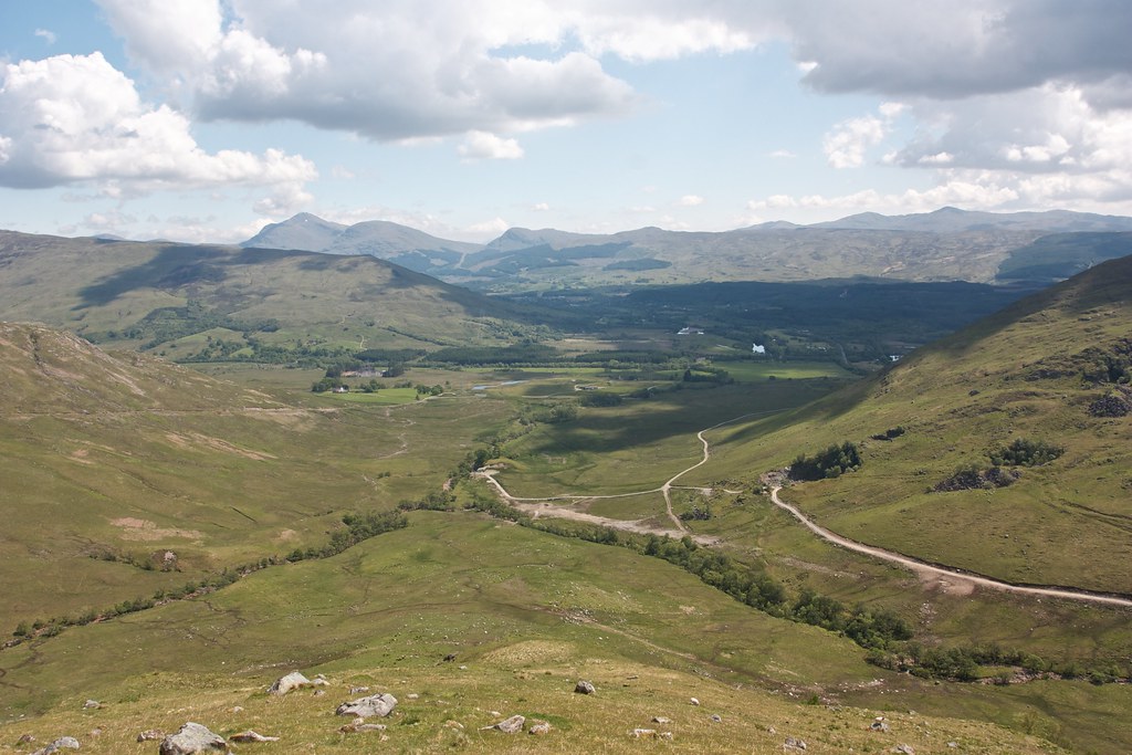
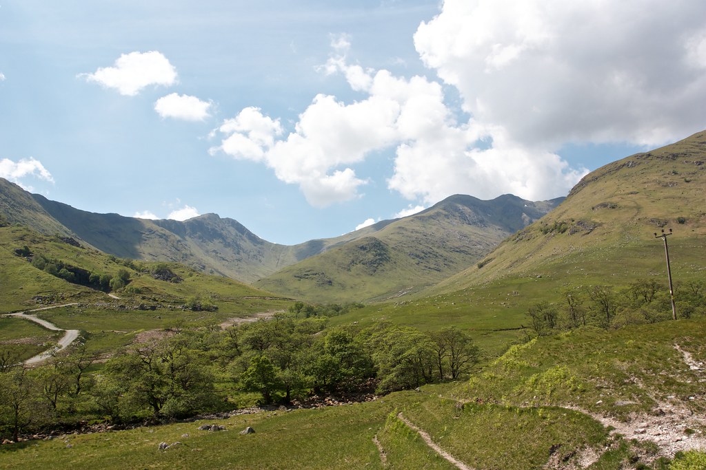
Several people arrived during my lunchtime siesta, all commenting on the views and the weather. It indeed was sublime and I could happily have stayed there all afternoon. As it was I could also see my planned route layed out before me, winding across to Glen Kinglass, which in turn would lead me to Loch Etive. From there the plan was to follow the lochside track south to Glen Noe and then use that glen to access the Cruachan hills.
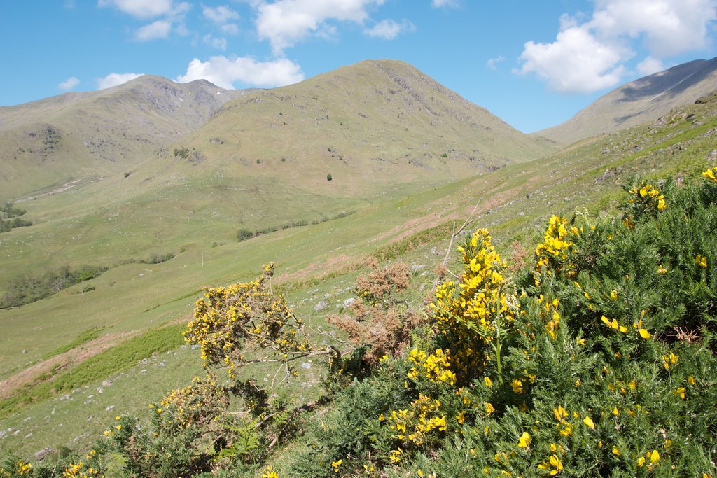
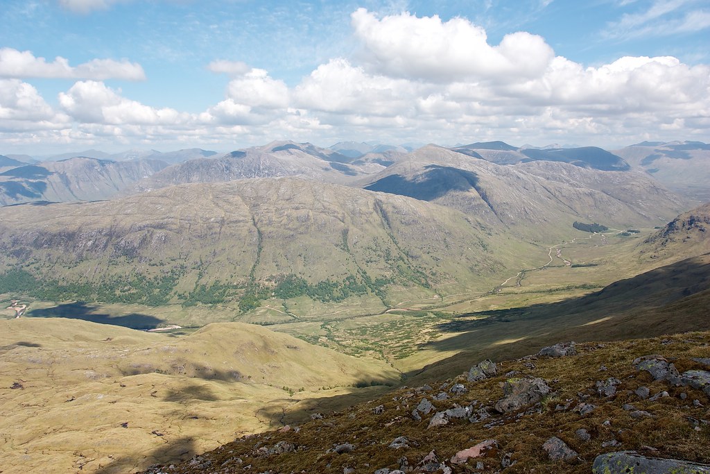
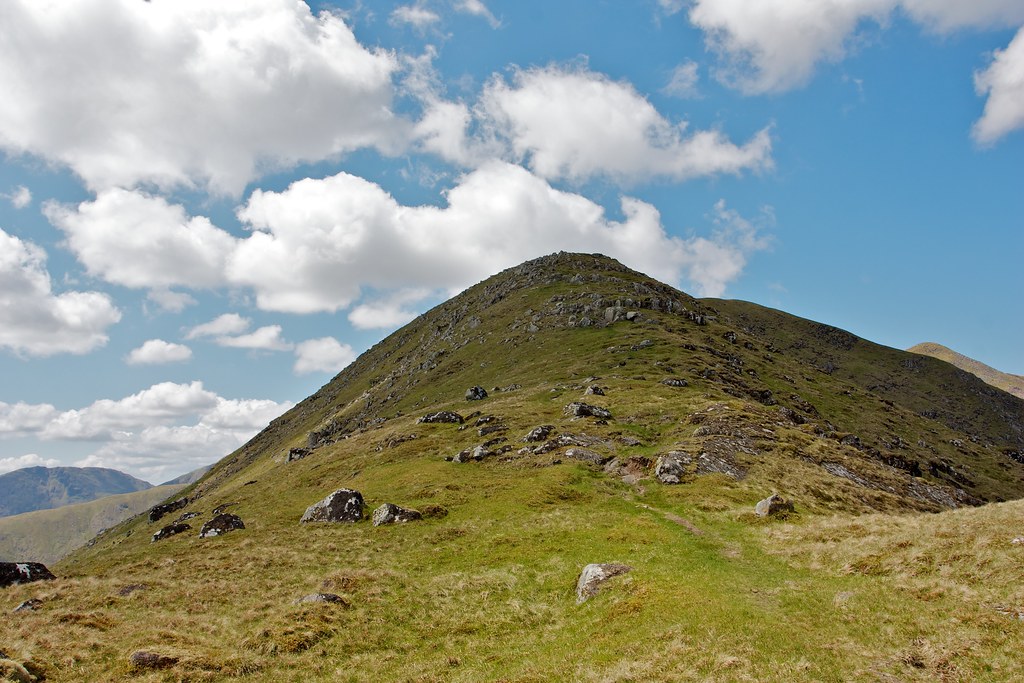
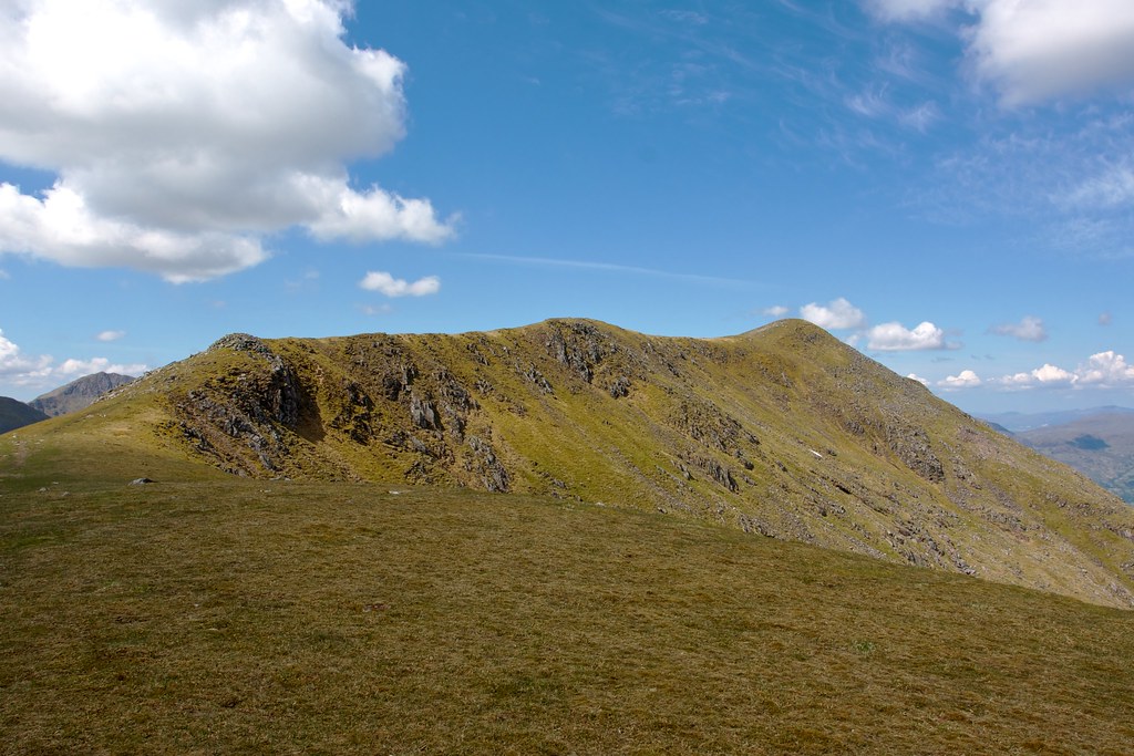
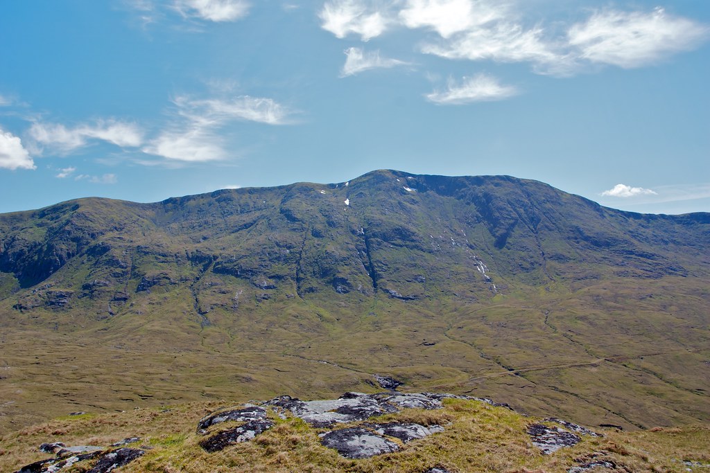
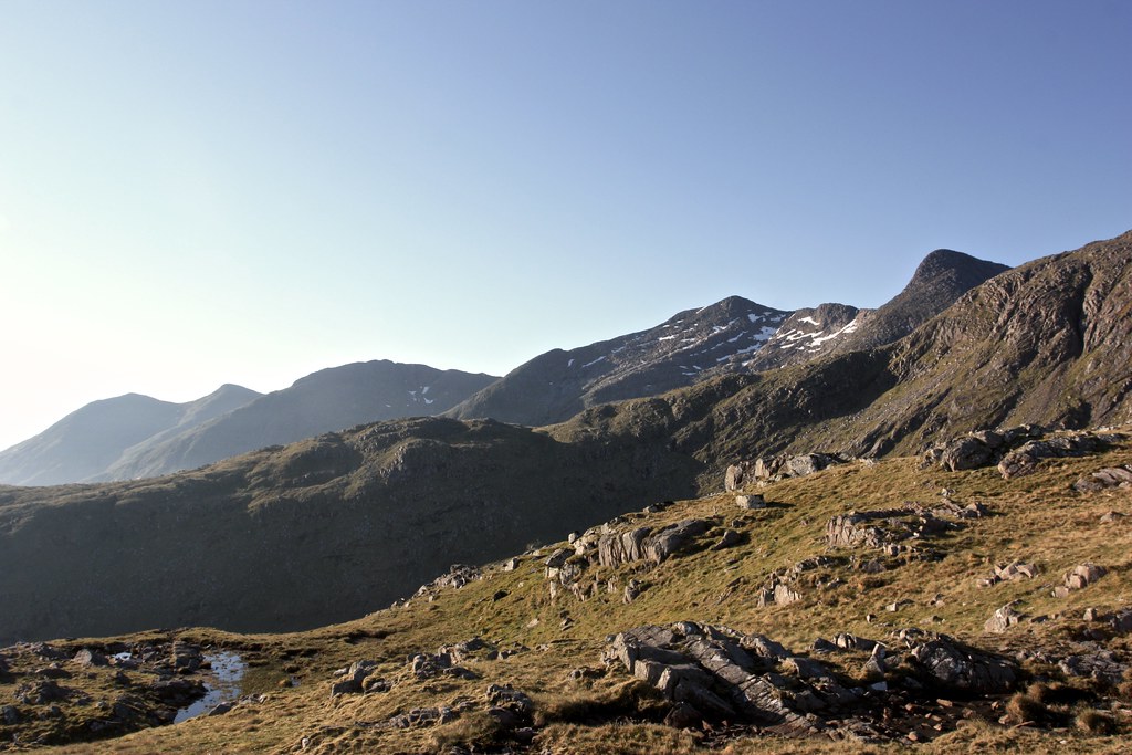
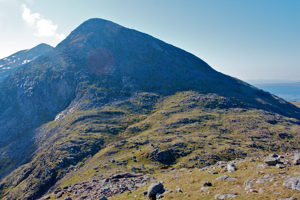
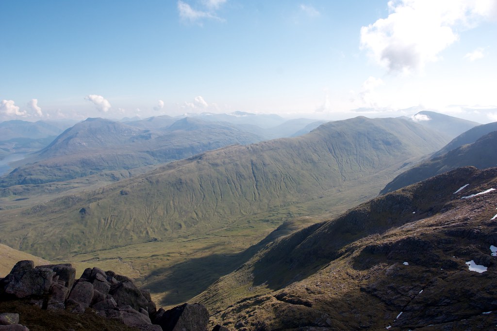
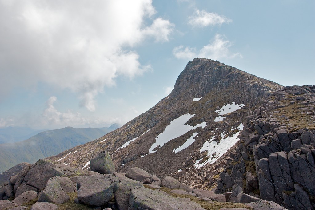
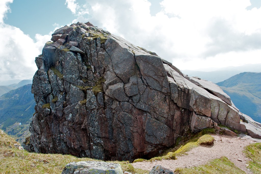
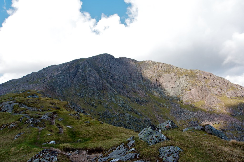
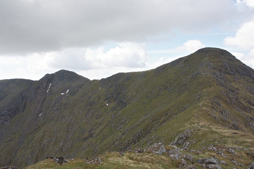
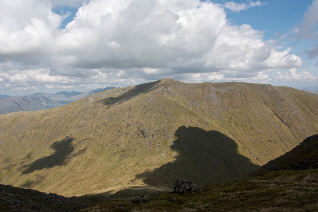
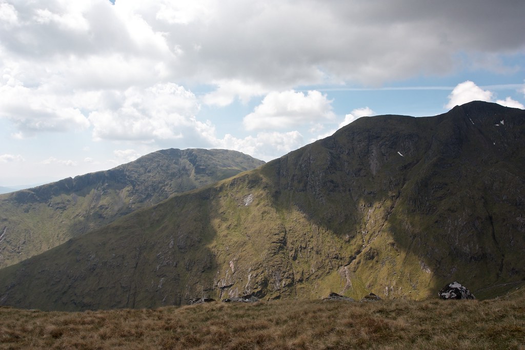
The long western ridge of Beinn a’ Chochuill was a delight in the warm afternoon sunshine. The views out towards Mull drew me forward and in no time I was at the funny little notched summit above Coire a' Chochuill. The views across Glen Noe to the dramatic northern slopes of the Cruachan massif were very impressive, and not a little intimidating.
There was very nearly a little stream here but what should have been flowing water was a series of barely connected stagnant pools. Deer tracks ran off into the coire but I climbed steeply up to reach the craggy summit which would lead me onto a rib running down towards the upper catchment of Glen Liver.
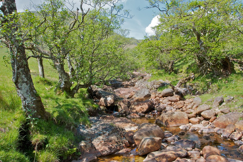
The ridge was steep but easy to descend and as I reached the craggy lower slopes I dropped into the coire, quickly cutting across to the stream where there was fresh water tinkling down between rocks. The Cruachan area is famous for its hydro schemes and this side of the hills is no different with almost every sizeable stream diverted into the hydro catchment. I wasn’t entirely sure of the water quality with all this human intrusion around but a cursory study gave the appearance I was still above the inflows. I was very thirsty and glugged down a litre of water fresh from the stream. Then I refilled the bottle and popped in a hydration tablet. This should get me along to the next water crossing.
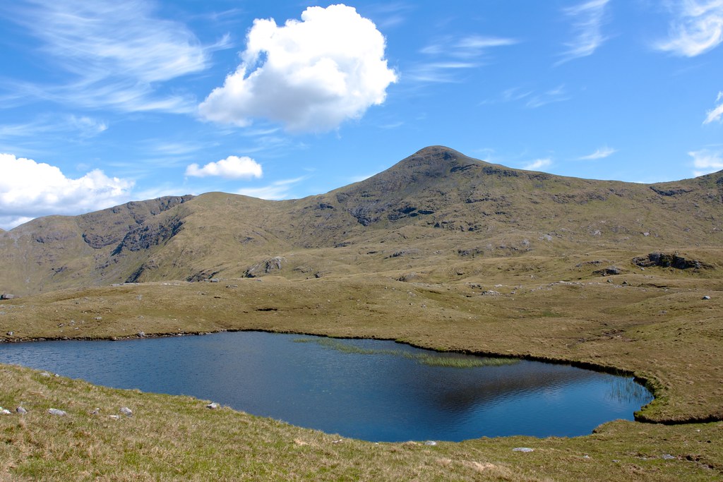
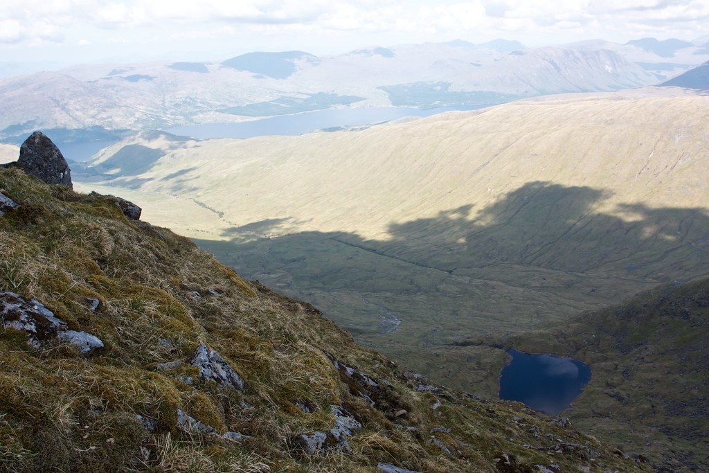
I now had a choice: to cut straight across the upper Liver and make for the descent down into Glen Kinglass, or to follow one of the hydro access tracks around the rim of the coire and then head up Meall Voirlich on the far side. In the end I opted for the latter, following the grassy track along several inflows and pipes and then crossing firm ground to reach an unnamed lochan with good views back up to Beinn Eunaich, the day’s first Munro.
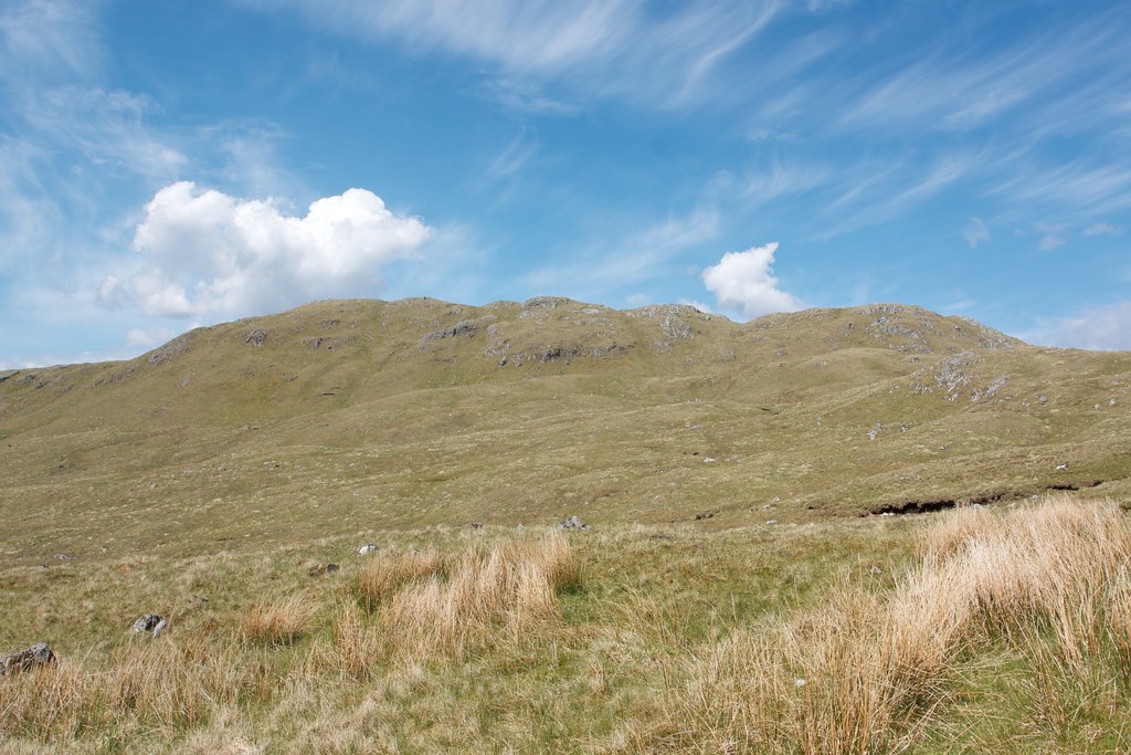
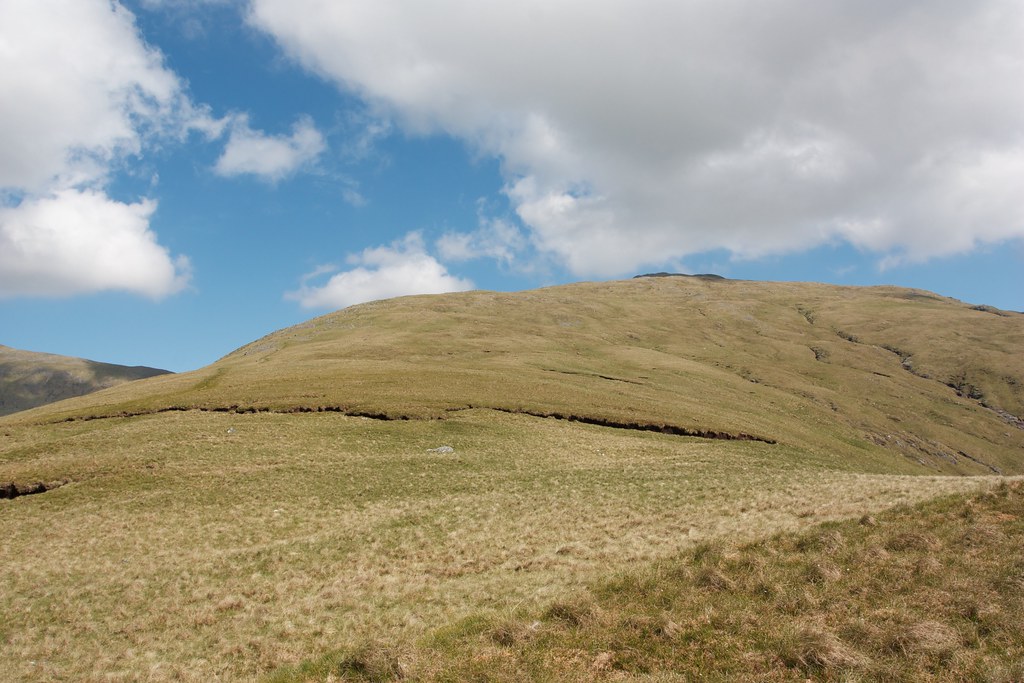
From here it was an easy ascent up Meall Voirlich which doesn’t appear prominent or high enough to appear on any hill lists. Despite this anonymity it provided excellent views down into Glen Kinglass.
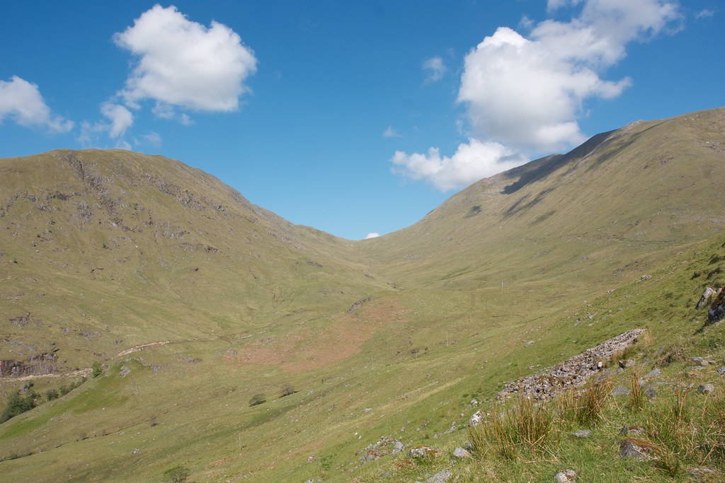
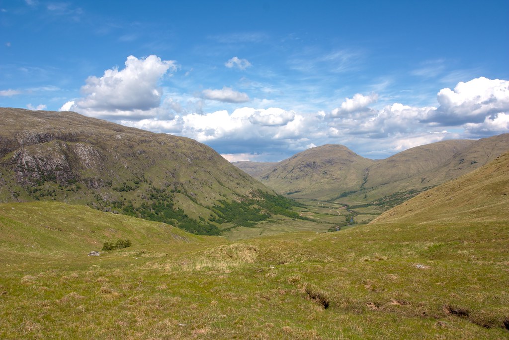
I traversed the lumpy tops of this obscure hill, looking back up to the long ridge of Beinn a’ Chochuill which hid me from the main Cruachan massif. Then it was down a steep descent into the unpathed coire leading down to Glen Kinglass.
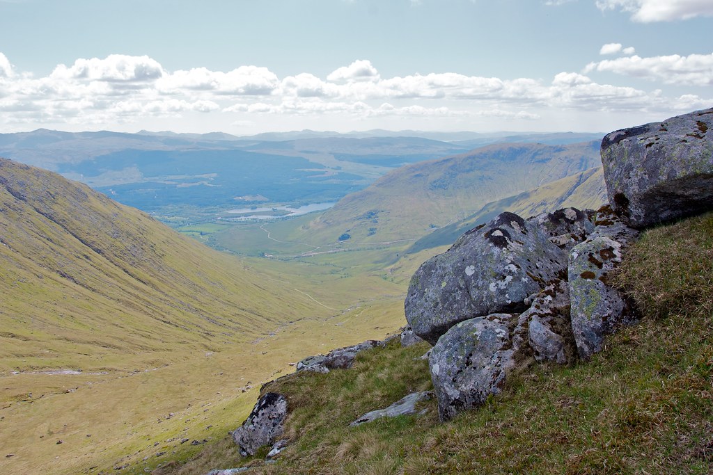
From over 3,000ft I was now almost back down to sea level and the vegetation in the coire reflected this. As I descended the stream dropped into a narrow slotted ravine whilst I followed deer tracks that kept higher up. On the other side it looked like a reasonably clear deer track made easier progress down. I came down into ferns and long grasses and the ground became increasingly boggy.
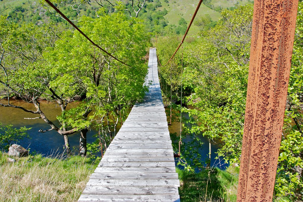
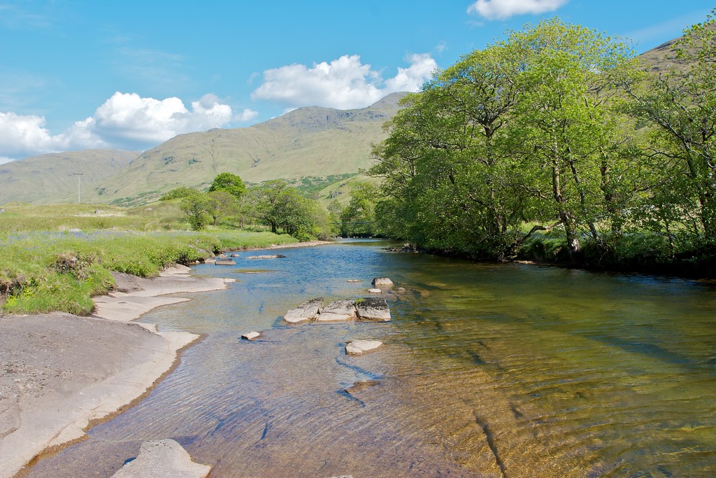
Thankfully I could see the bridge over the Kinglass I was aiming for and after contouring the hillside for a while, descended down a tributary stream until I crashed through the ferns and reached the river. It was a hot and sticky descent and I was glad when it was over. The wobbly bridge spanning the Kinglass provided some entertainment and then it was onto a clearer vehicle track to follow the north bank of the river down towards Loch Etive.
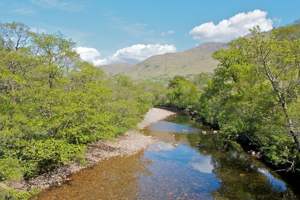
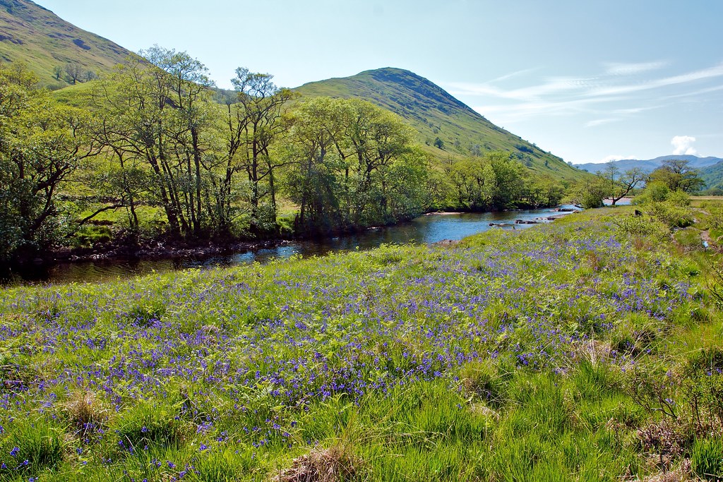
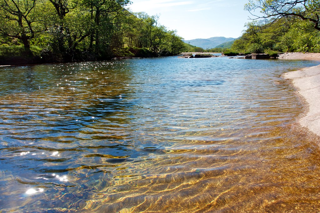
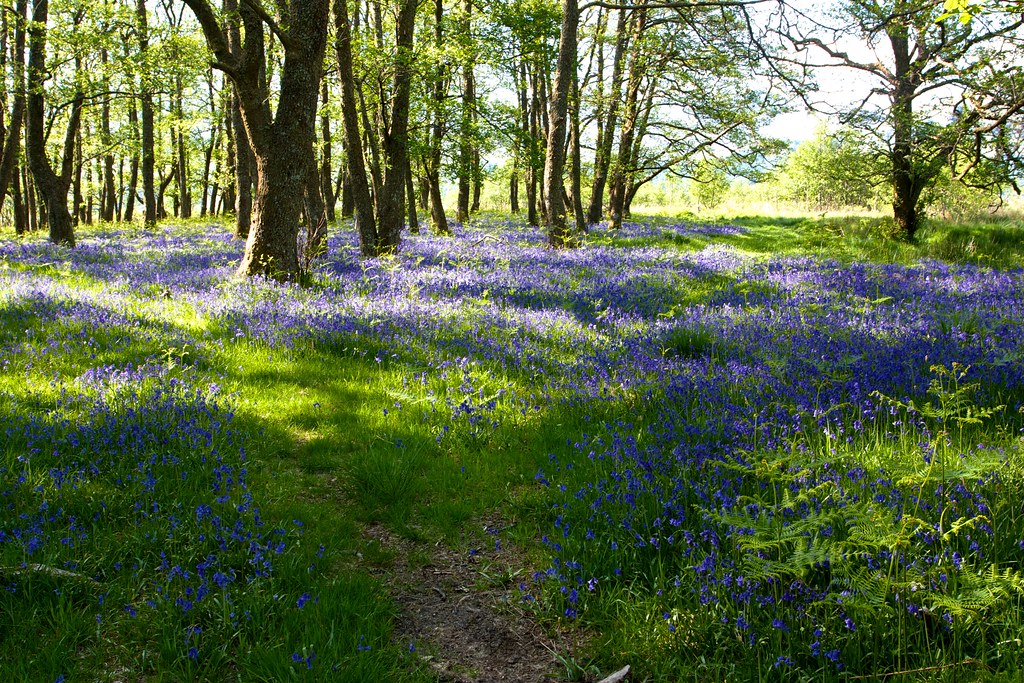
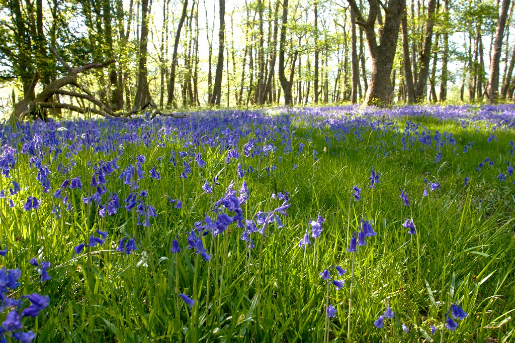
I hadn’t gone far downstream when I came across an idyllic meadow of bluebells leading down to a flat shelf of rock by the river. The sun shone and it was hot and still. I couldn’t resist the temptation and was quickly into the wonderfully clear waters of the Kinglass.
The river was slow and lazy just here and I enjoyed bobbing around in the water my limbs enjoying the rest and relaxation. Back on the bank I lay back to air dry in the sunshine before continuing on my way.
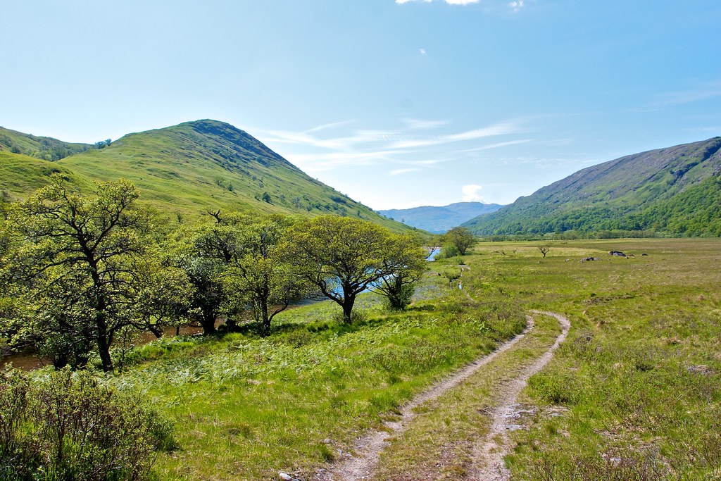
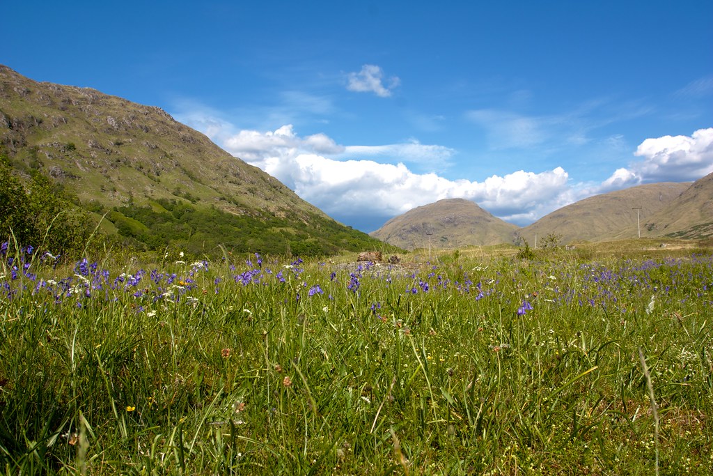
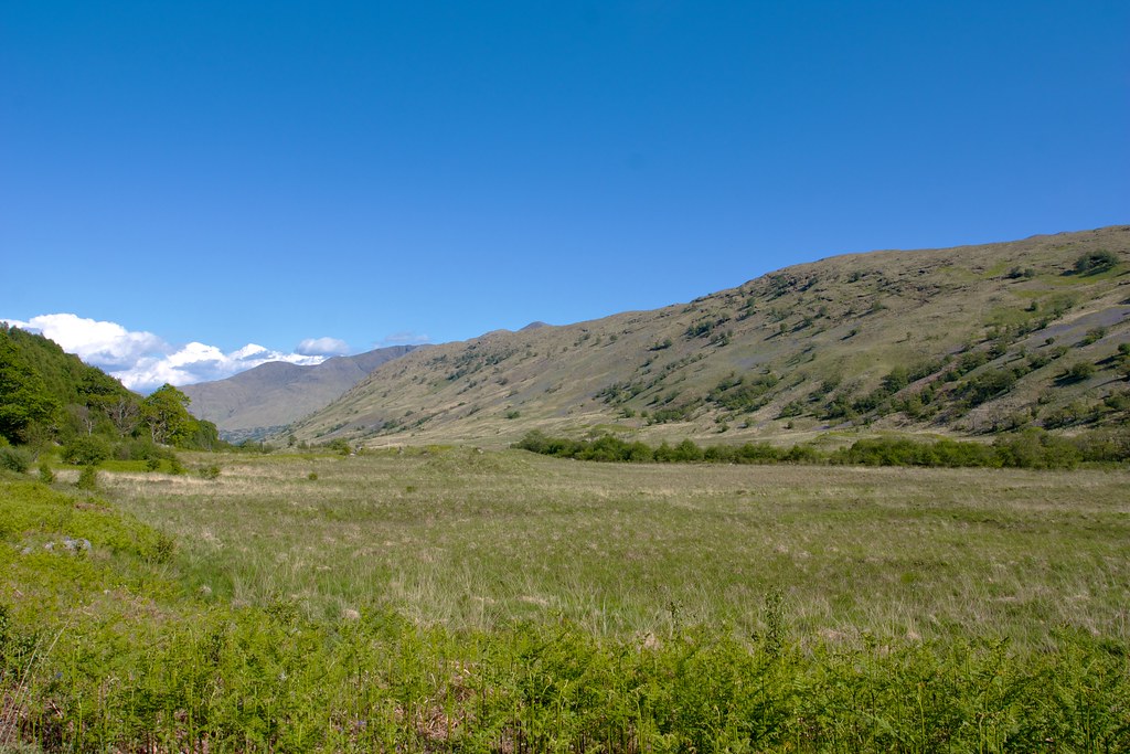
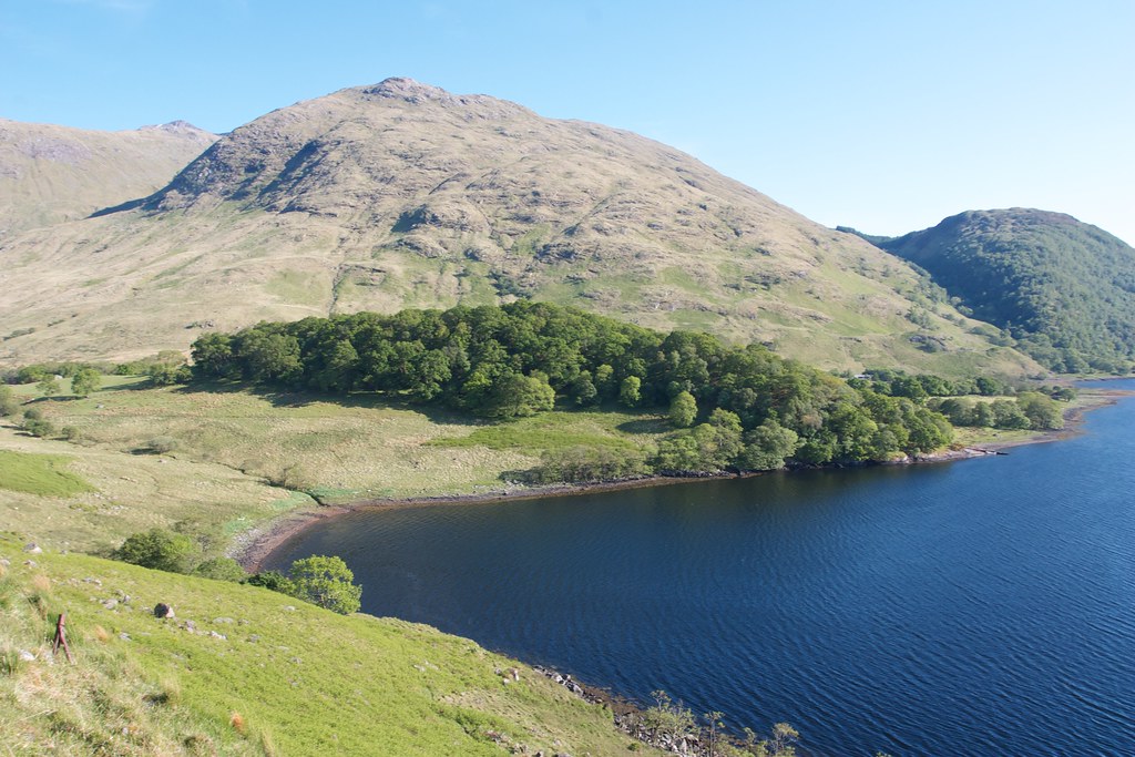
Glen Kinglass on a sunny afternoon is sublime. A couple of 4x4s passed me by but otherwise it was idyllic. In the lower glen there was a great abundance of natural forest and below these there were wildflowers everywhere.
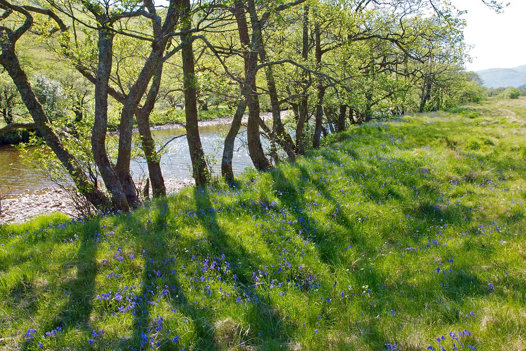
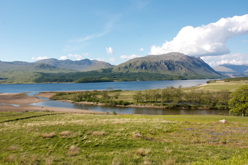
I came down to the junction with the Loch Etive track near Ardmaddy and there across the way was the most beautiful tract of bluebell wood, the light filtering down through the canopy of leaves. I spent a few moments treading through the grove.
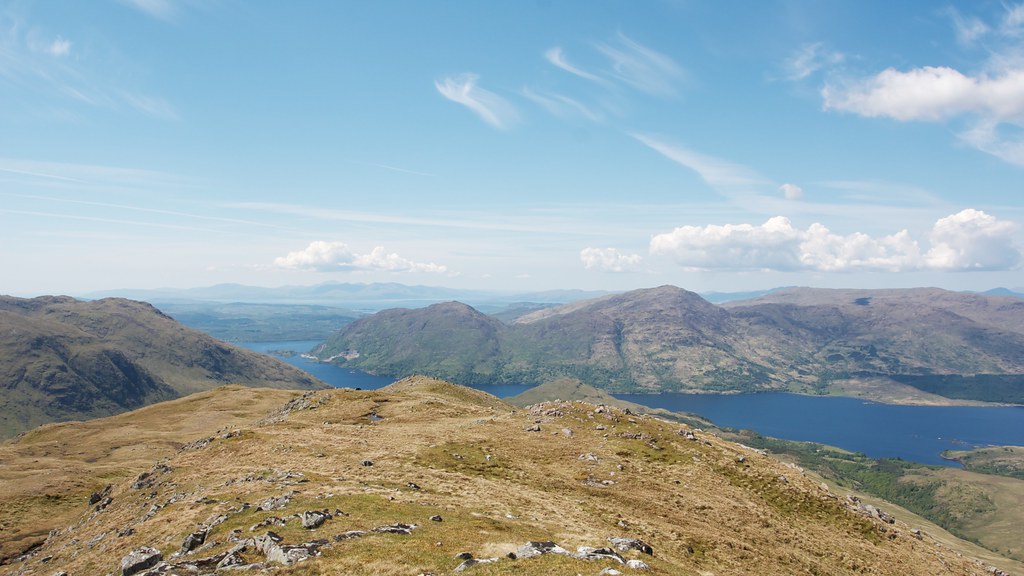
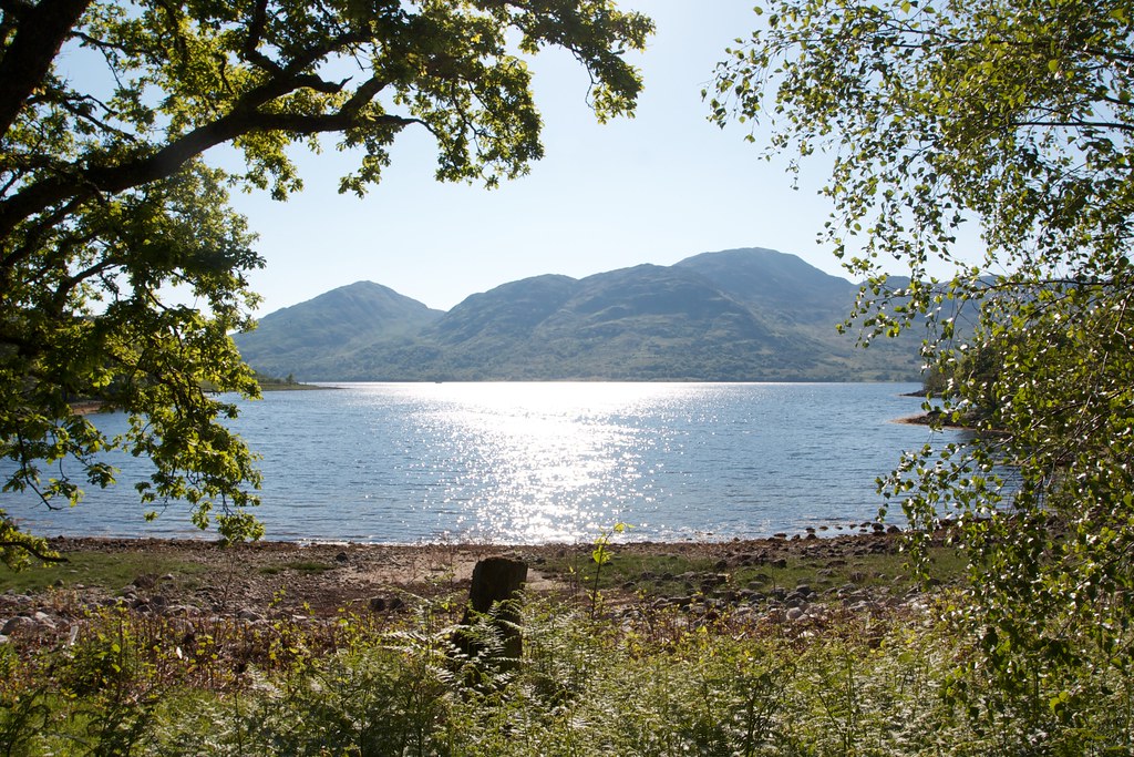
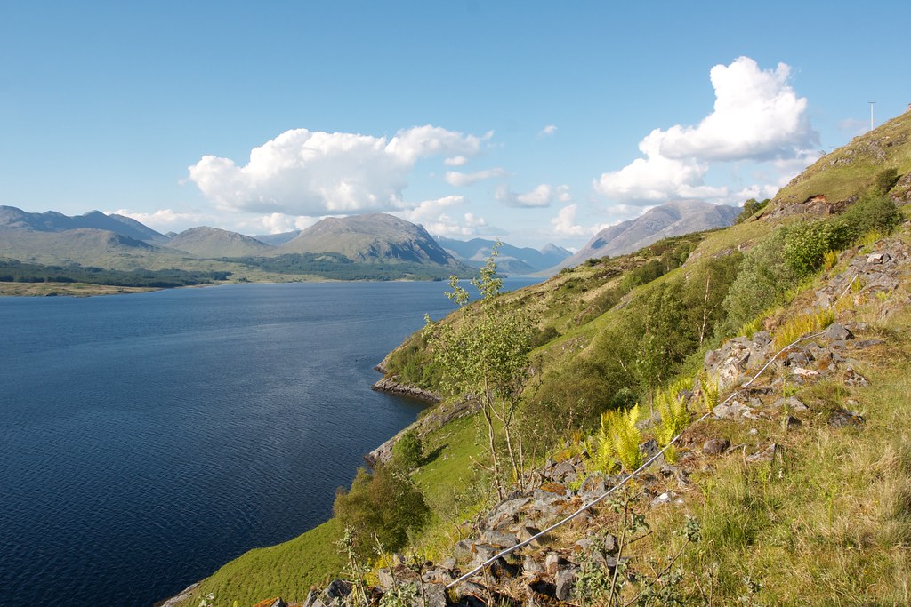
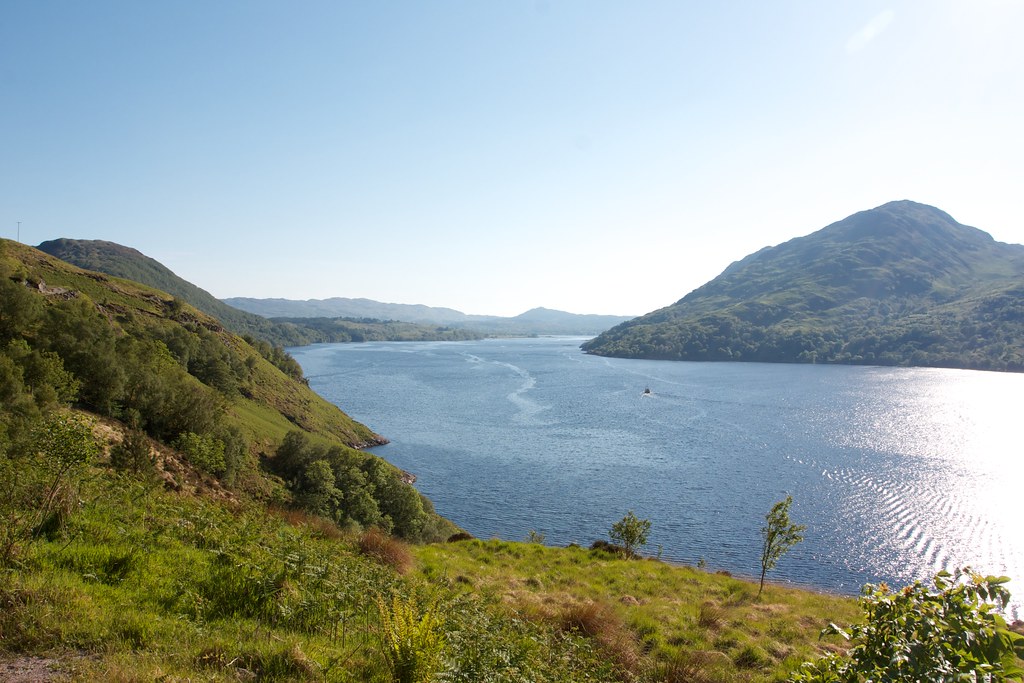
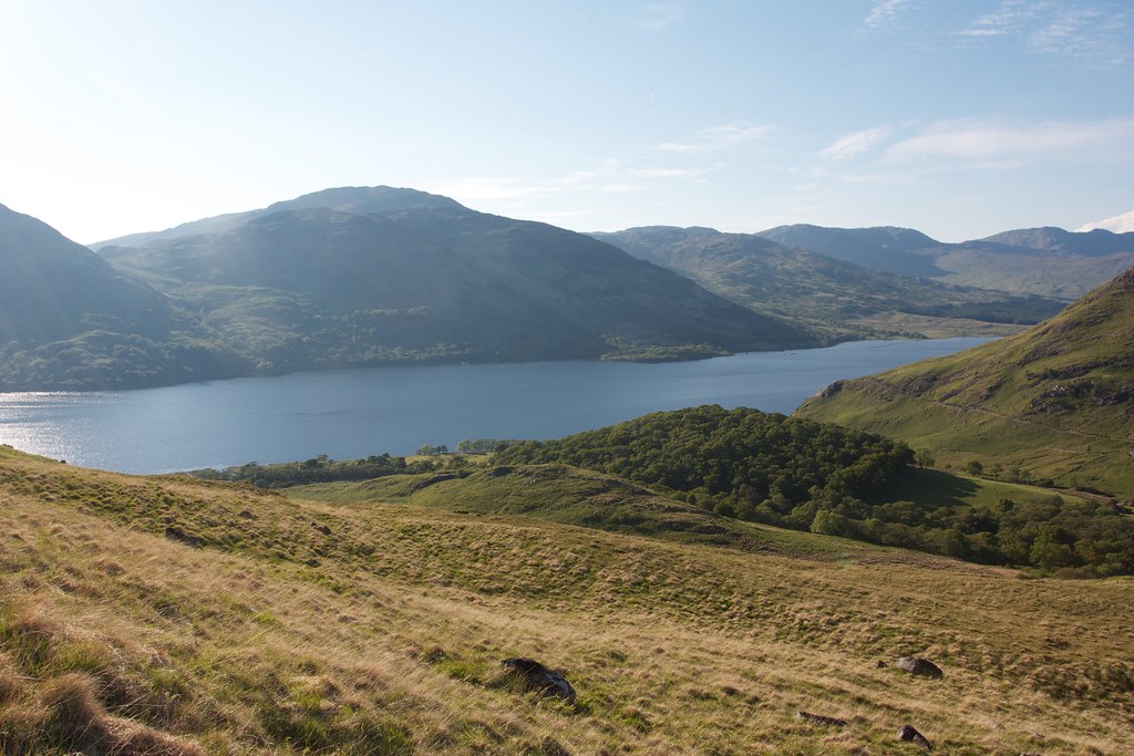
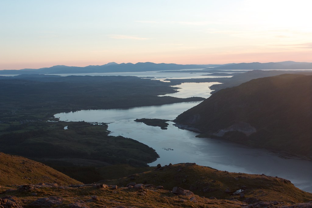
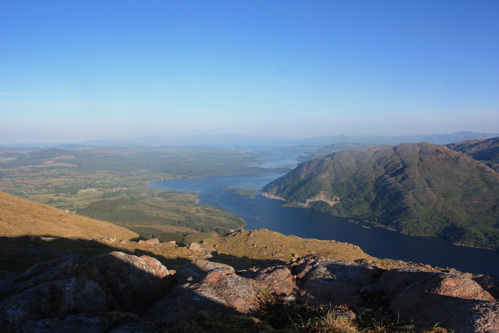
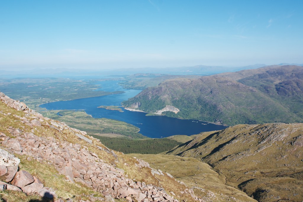
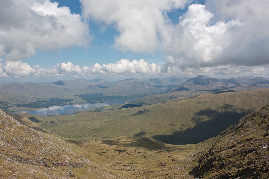
Back on track it was about 5pm and with the evening stretching out warm and inviting in front of me I ambled along the track that winds along the shores of Loch Etive. Across the Kinglass and then up to the first headland brought with it wonderful views back up the loch.
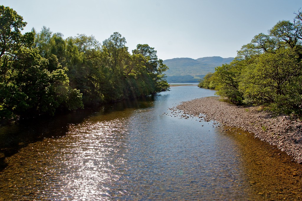
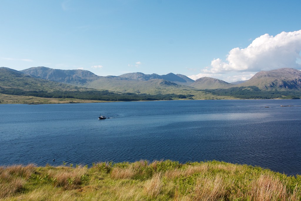
Ben Starav’s stark grey flanks towered on the near shore whilst further back were the hills of Glencoe. The waters of the loch were deep blue, broken by buoys and fish nets. In the distance a fishing boat puttered along.
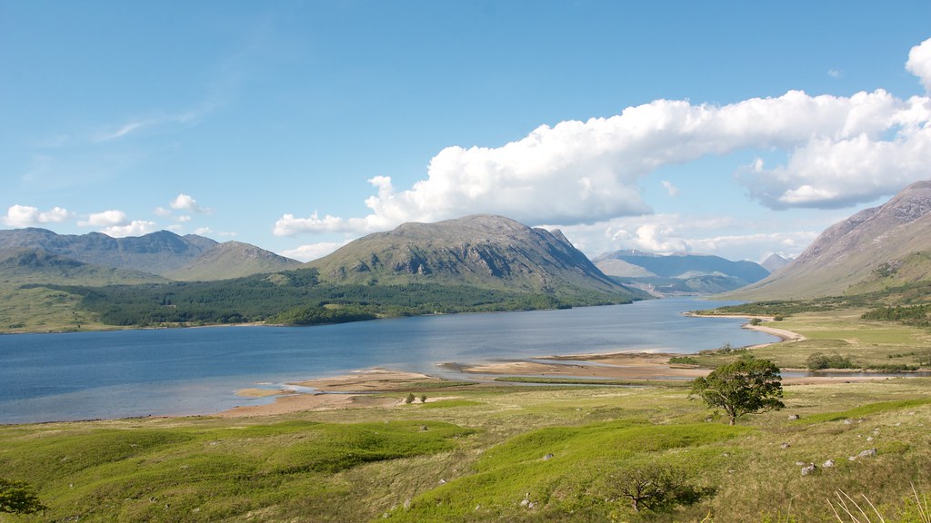
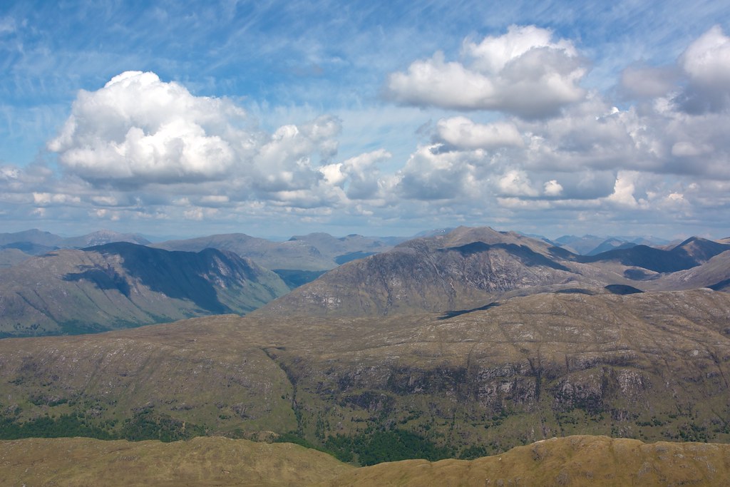
Once around the corner I got my first views of the Cruachan ridge standing tall above Glen Liver and a more distant Glen Noe.
I dropped down to the bay at Inverliver where I got a friendly wave from a chap in a 4x4. Just up from the bay I found a tinkling stream. It was hard to tell its exact course but the water seemed crisp and clear enough so I refilled my bottle. I passed the neat houses at Inverliver and then continued around the next headland again enjoying sensational views down Loch Etive.
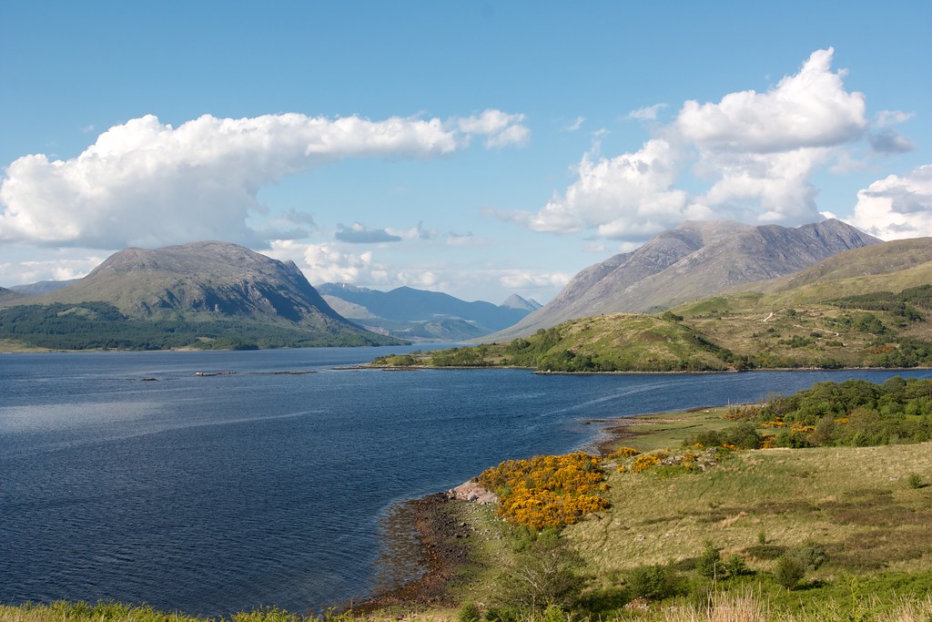
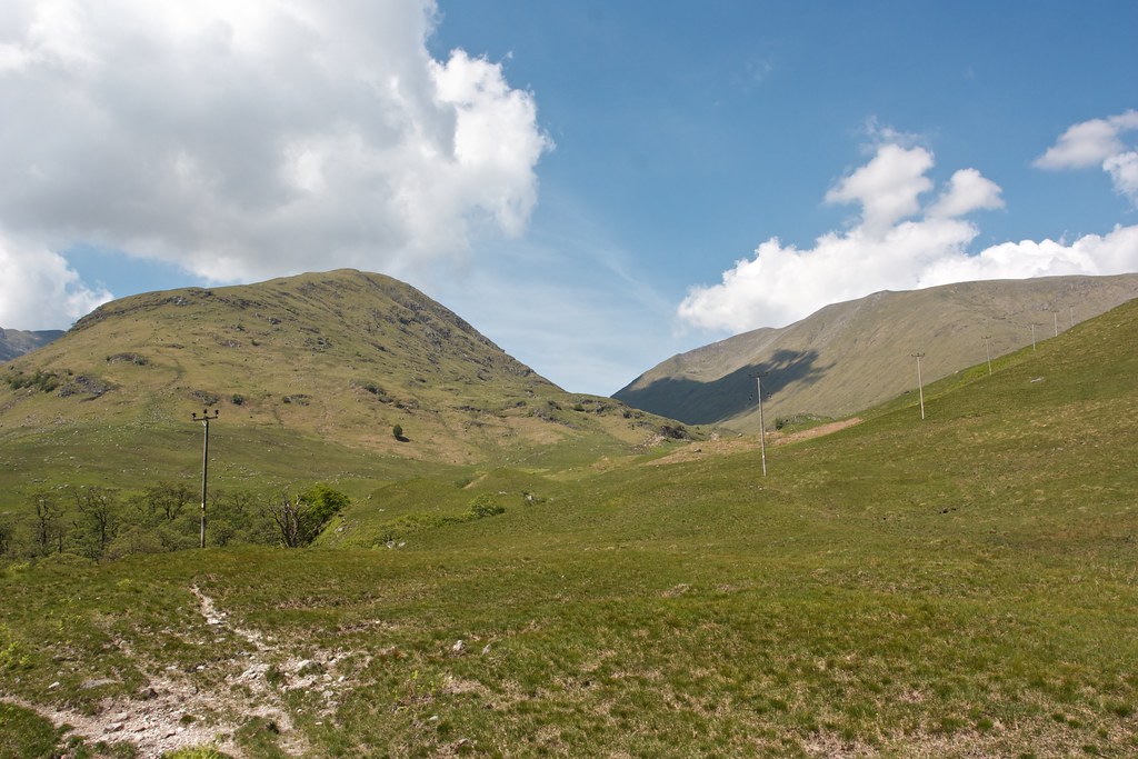
At the farmhouse at Glennoe I had my final chance to follow my initial route up to the summit of the Lairig Noe. All day I had been studying the west end of the Cruachan ridge from as many angles as possible and concluded that it would be possible to access the ridge. More importantly the 600m peak lying immediately opposite me across Glen Noe promised lochans on its summit, a sign of potential flat land.
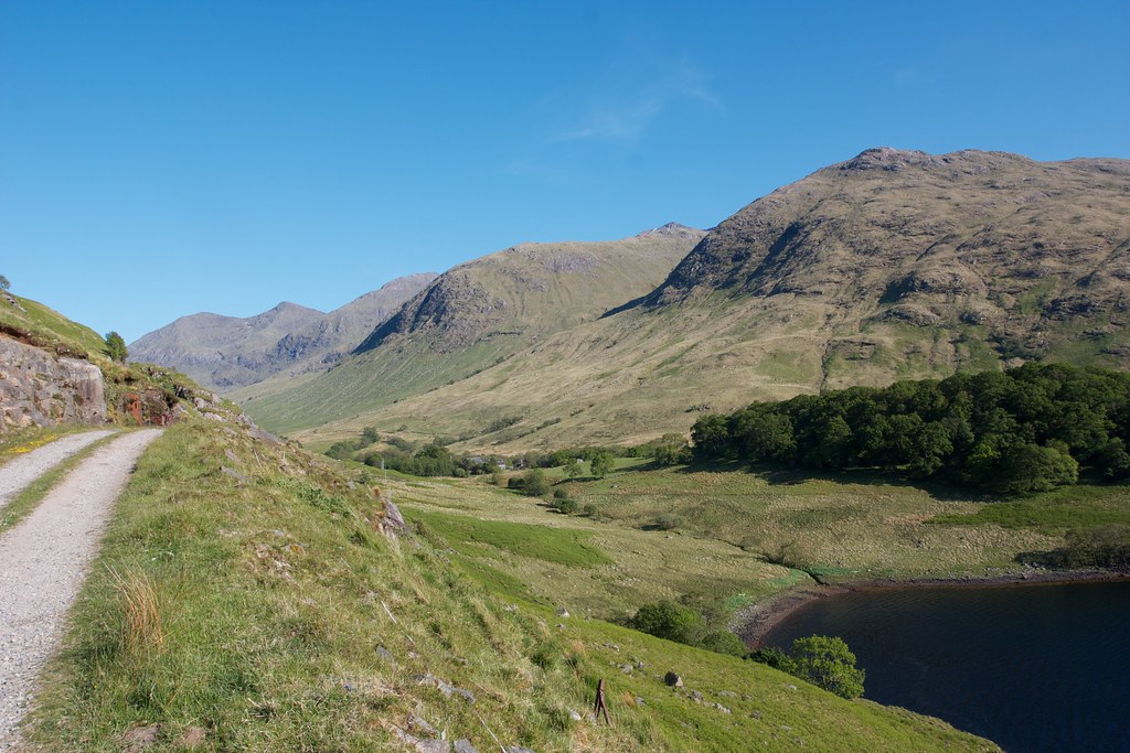
The conditions were so good that I wanted that summit view and so I passed Glennoe, crossed the river and then picked my way through ferns, heather and sheep pasture to finally access the lower slopes of Meall Corpach. After finding a useful gap in a barbed wire fence I was heading up. It was a steep, steep climb, especially at the end of a long hot day, but my efforts were rewarded as the views opened up. Evening sunshine bathed Glen Noe and behind me lit up the waters of Loch Etive.
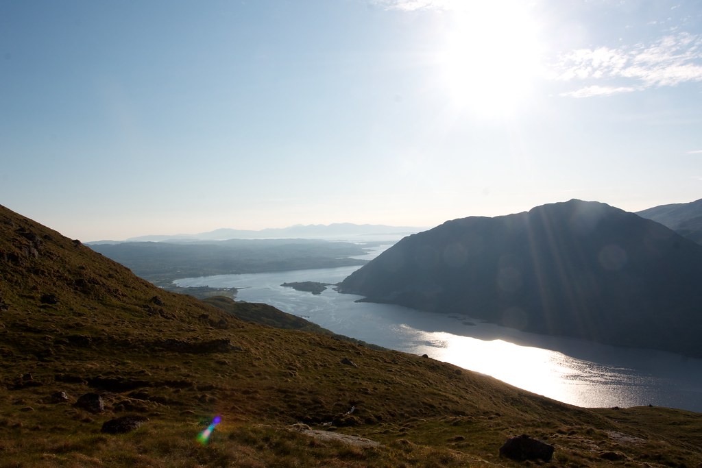
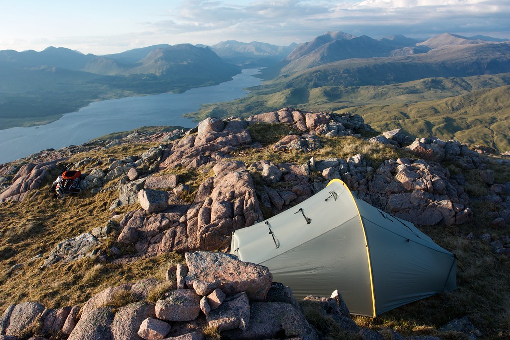
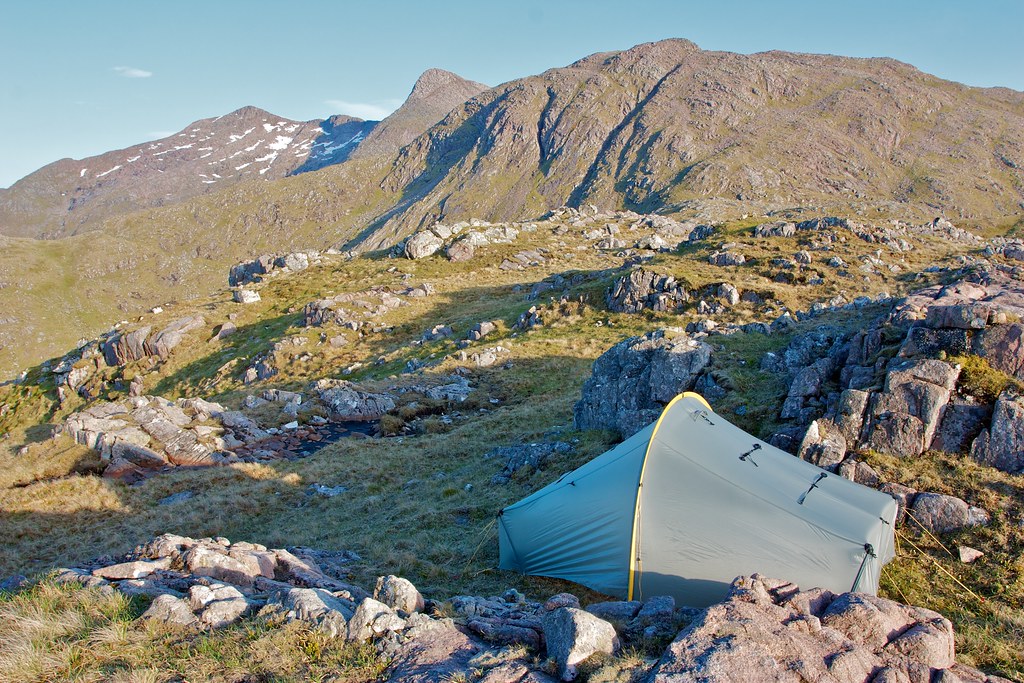
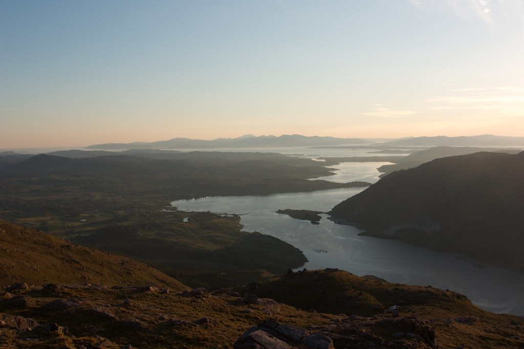
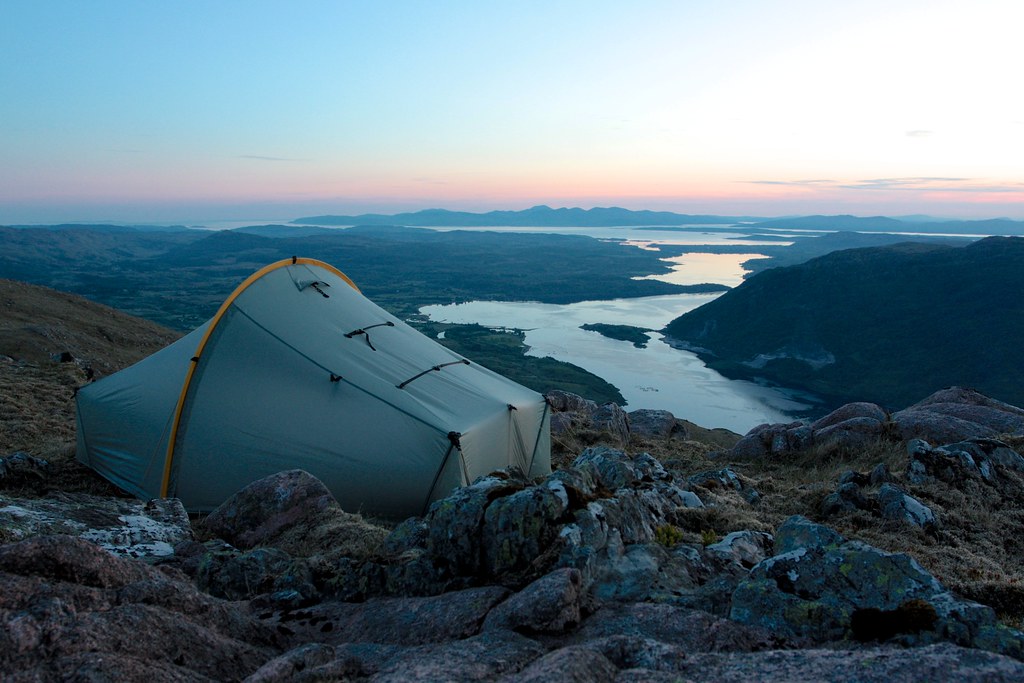
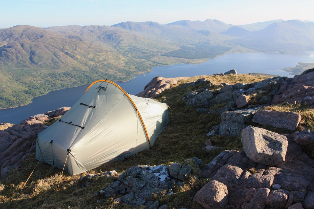
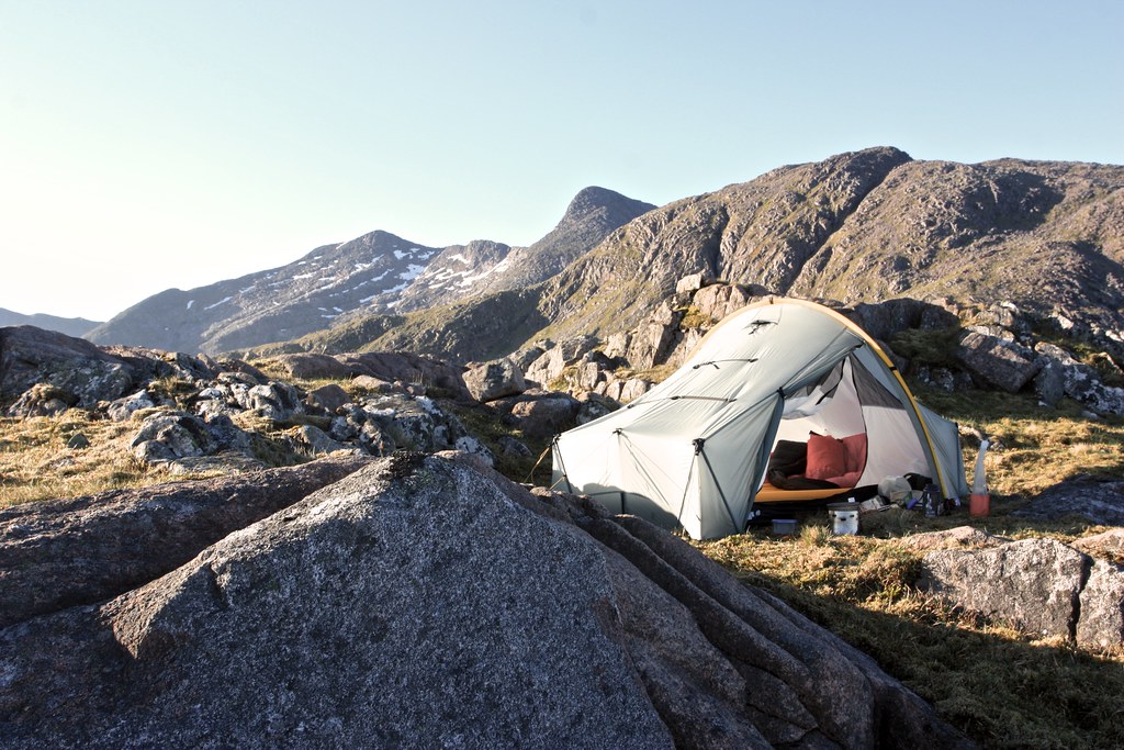
As I climbed I followed the course of every possible stream I came across but found no running water besides a few dripping, slimy patches. I scrambled up a few small crags and finally the gradient eased. I was on the summit slopes of this little 600m gem and knew it was the place to stop for the night. The views out to Mull, up Loch Etive and up to the Cruachan ridge were just sublime. I scouted around but soon settled on a little balcony of moss and rock.
As I’d ascended a stiff breeze had got up and it made erecting the tent a challenge. The first site turned out to be just a little short so I moved the tent slightly and found a much better pitch between two jumbled rocks. With the tent up I went to gather water, eventually having to settle for the larger of the three lochans I found. Not even the outflows were running. I would be boiling water then!
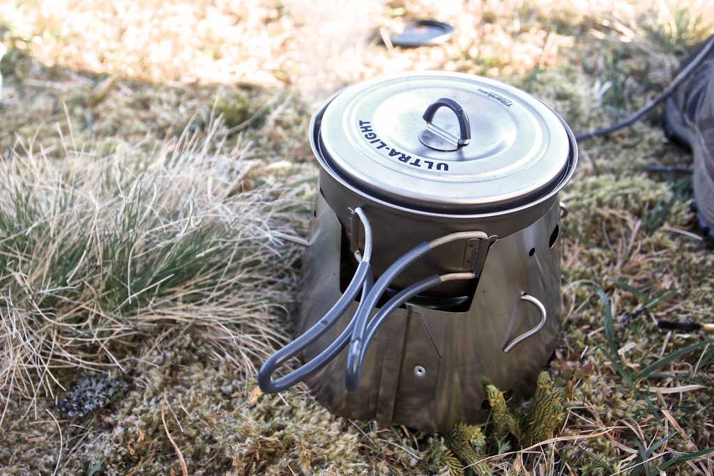
Back at the tent I was famished and soon had my dinner going. I was delighted to be back using meths and the Caldera Cone performed brillaintly even with a strong breeze.
After mulling around the hillside enjoying the changing light and the cool evening air I made a hot chocolate and stood with it gazing out across the sunset sea.
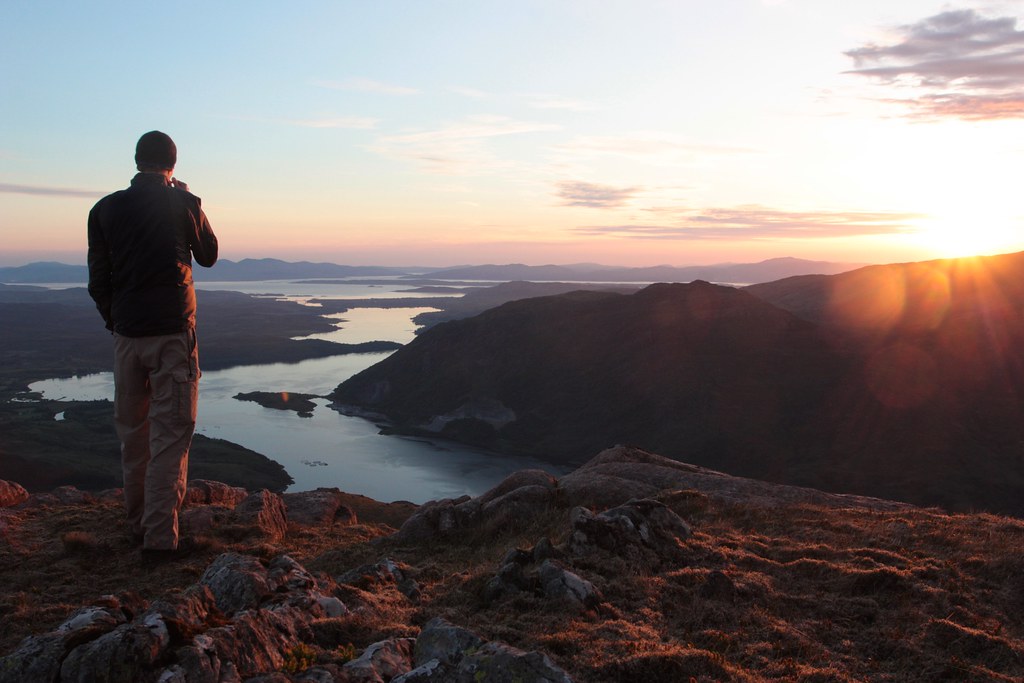
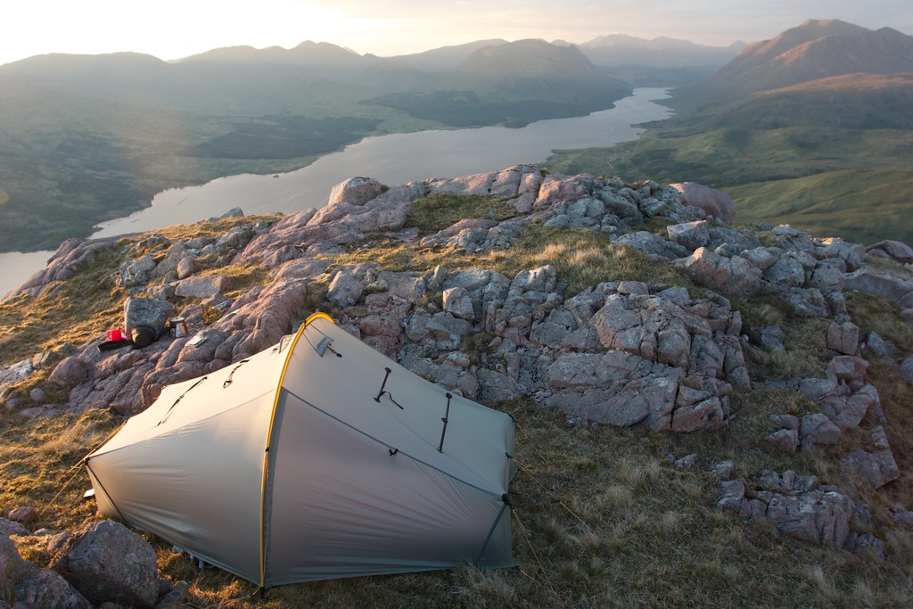
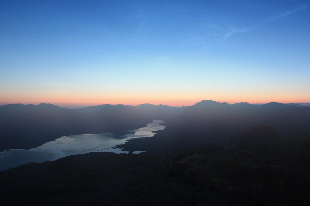
The sun finally dipped below the western hills. With its light gone the wind dropped to stillness and so I moved the tent back around the corner to get the best of the views out to Mull.
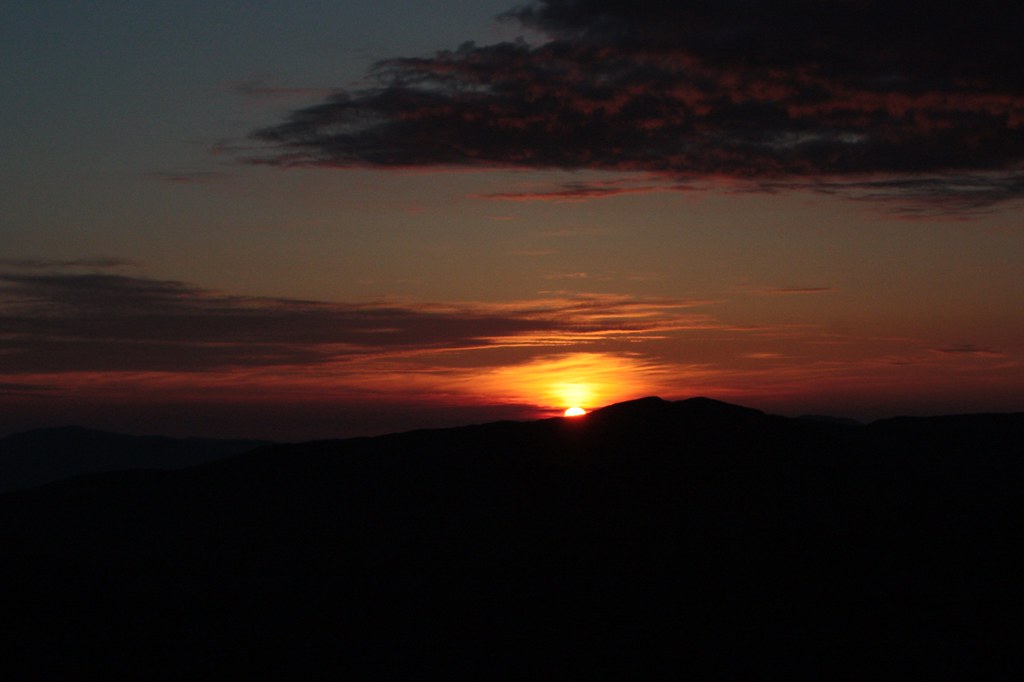
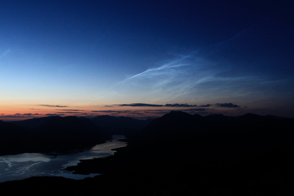
As twilight faded the darkenening skies brought with them the first gleam of a bright display of noctilucent clouds. I stayed up long into the middle hours of the night watching the sky. It was an incredible experience; quite possibly the best night I've ever spent in the Scottish hills.

Day 2
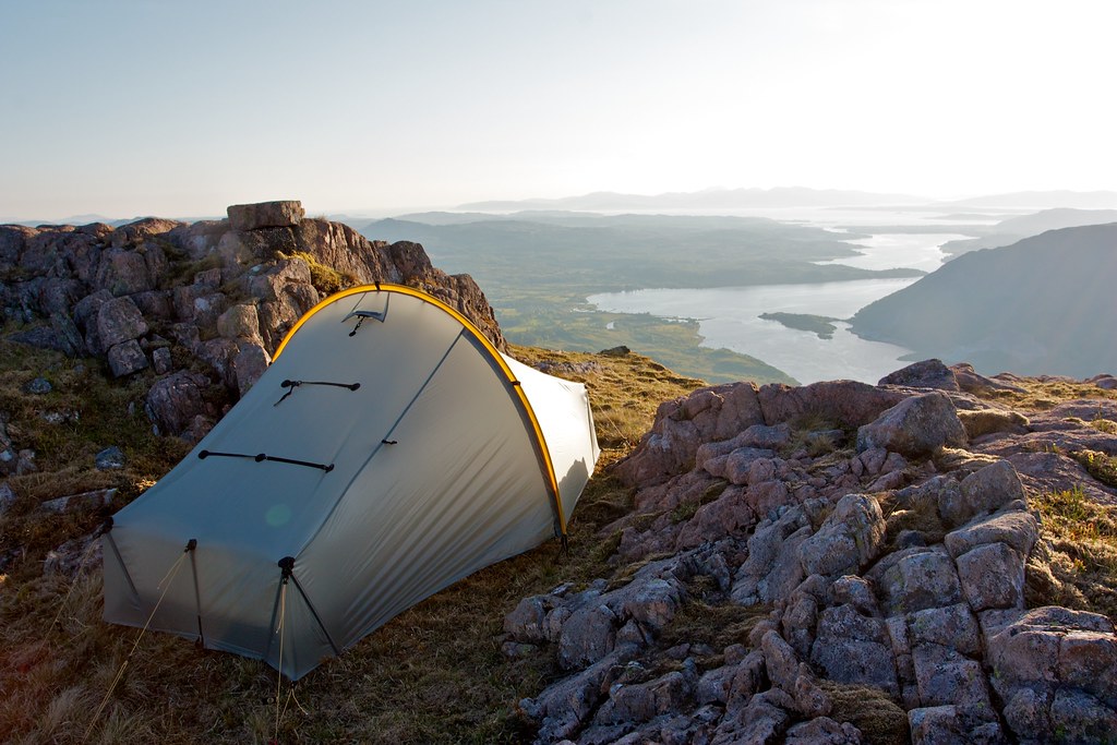
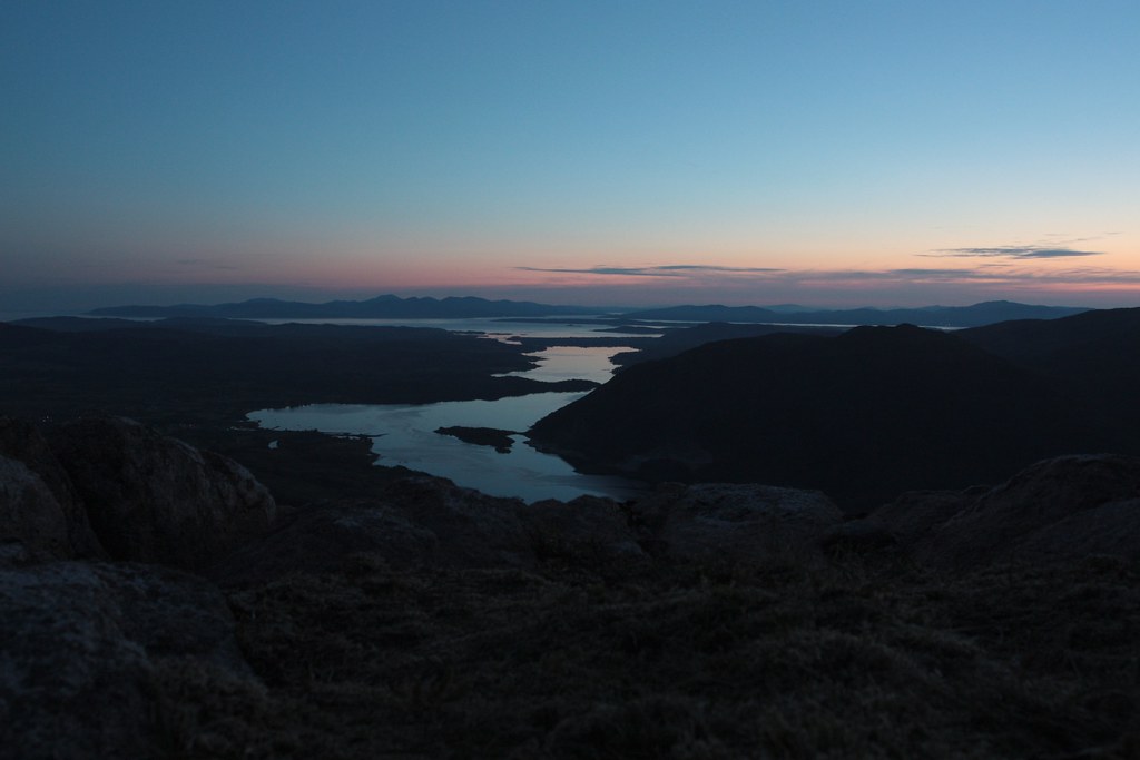
After a long day in the sun I was exhausted and in the warm, still conditions quickly drifted off into a happy sleep. I woke briefly at around 3 to see the dawn not far off. Everything was still and a little hazy but the noctilucent clouds still shimmered in the north. I thought about setting my alarm for sunset but was asleep again before I knew it and didn’t wake up until the warm sunlight hit the tent at about 6am. I dozed for a bit before finally rousing myself up to examine this new day.
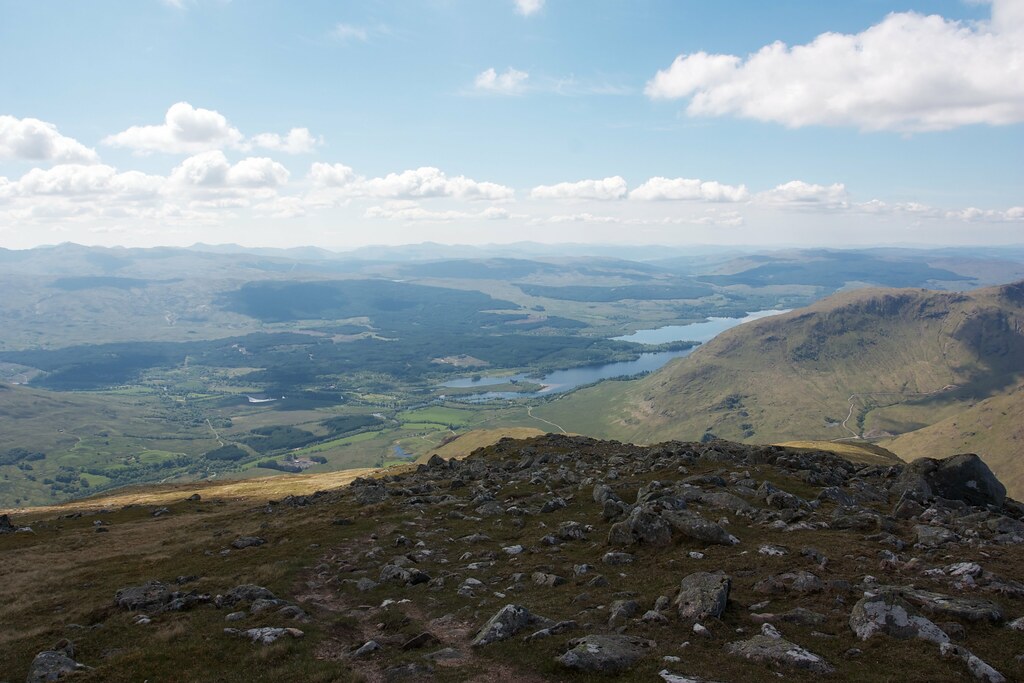
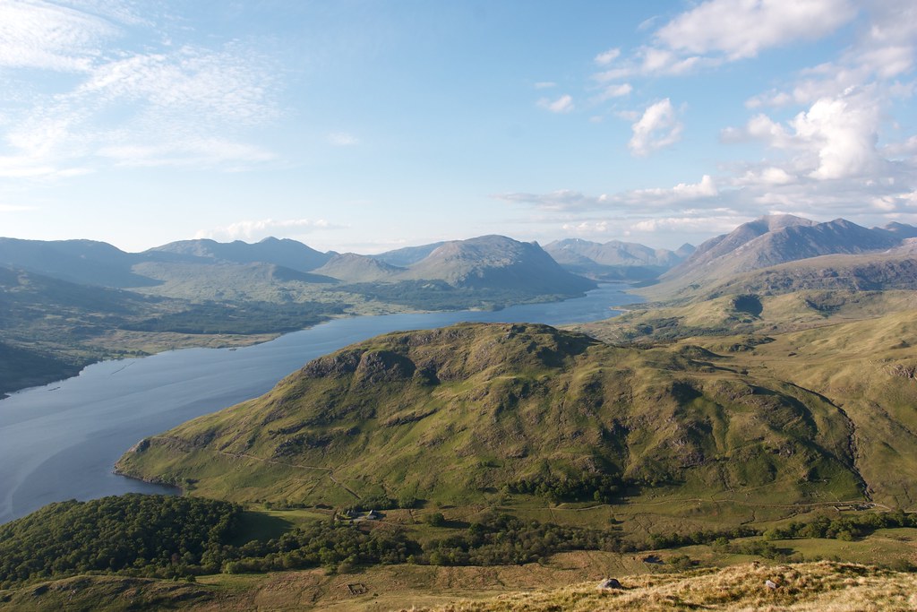
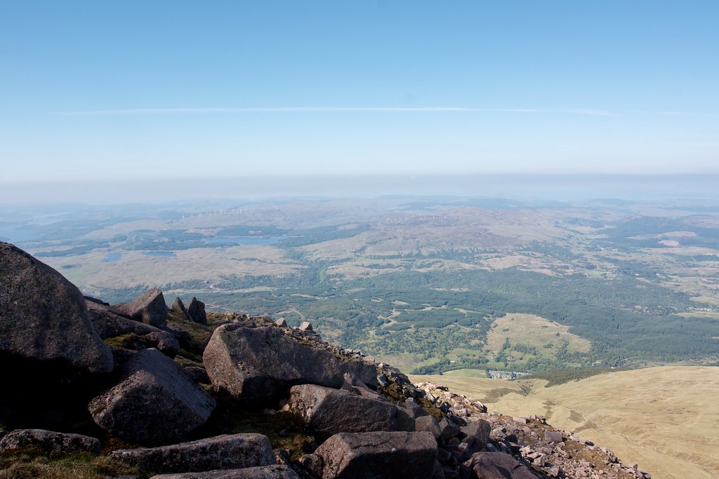
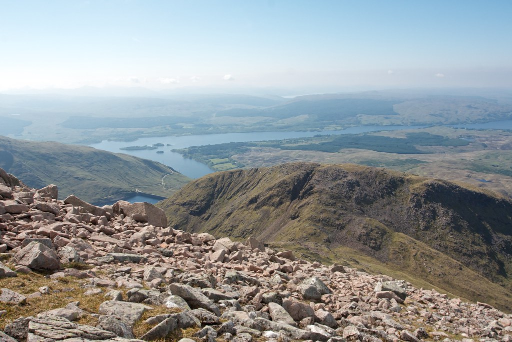
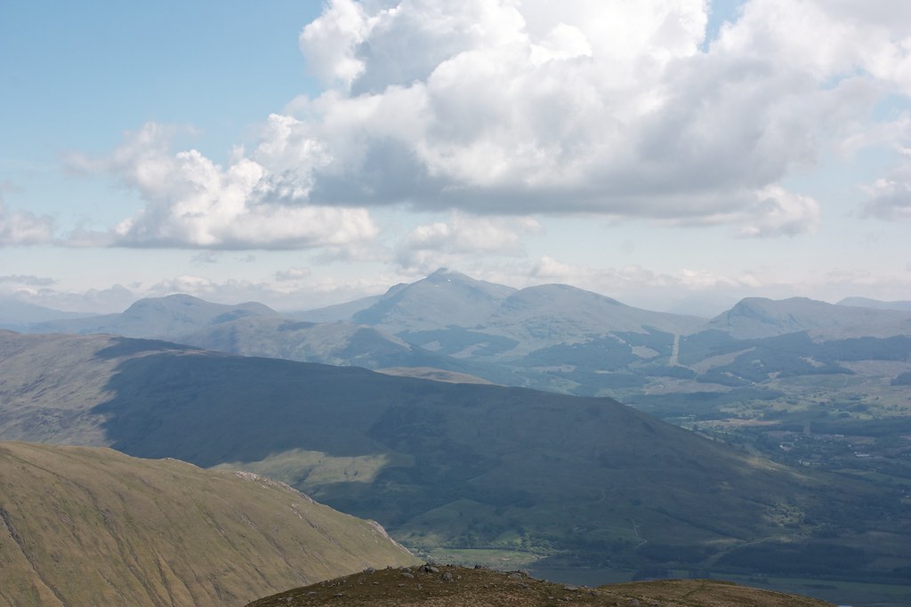
It was more than acceptable. A haze had appeared out to sea and Mull was less clear than the previous night. Over the Etive mountains a little mist was lingering. Behind me the Cruachan range looked magnificent.
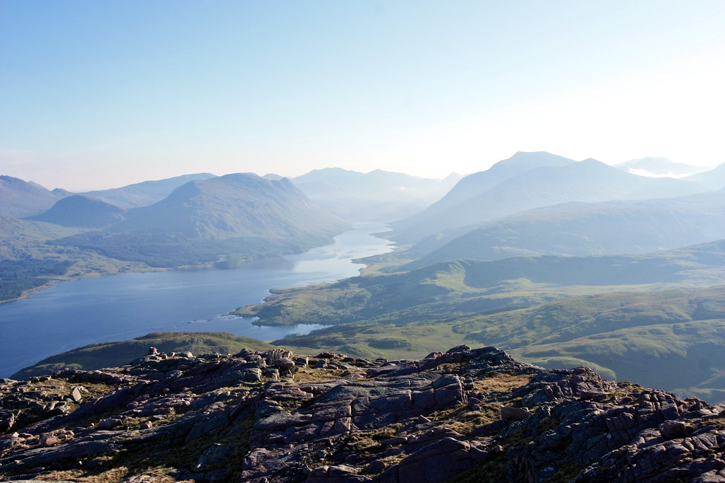

I enjoyed a cup of coffee and breakfast, slowly getting myself ready for the day ahead. It was almost too nice to move and I knew I had another 600m of vertical ascent pretty much straight from camp to get onto the top of the Cruachan ridge.
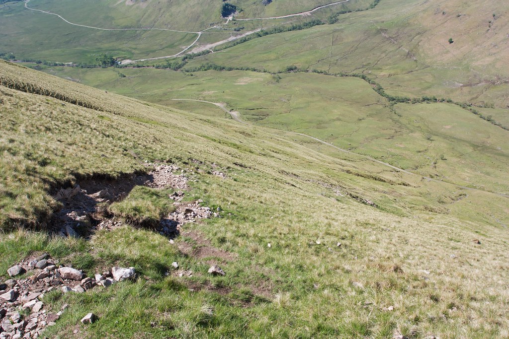
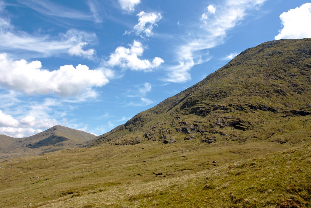
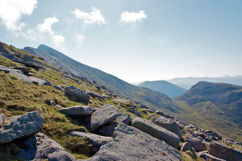
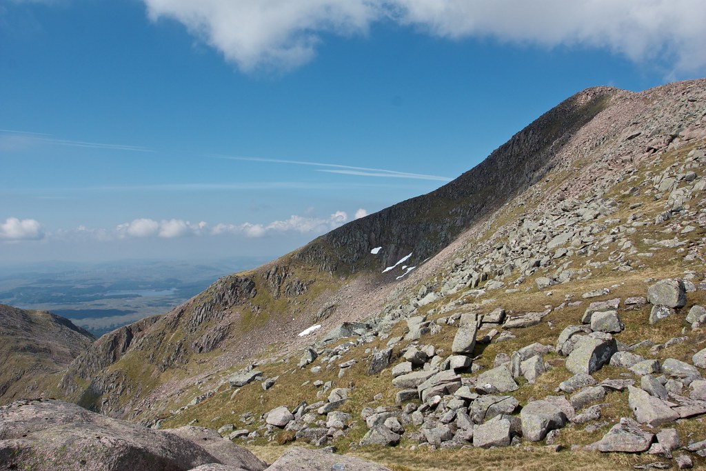
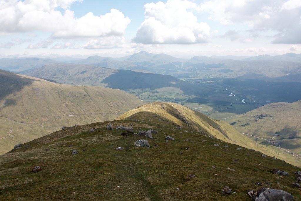
The first part was a stiff climb up to the 900 odd metre high summit of Meall nan Each. It was pretty steep and even in the shade I was sweating furiously as I wound my way up between crags.
The jumbled summit area of Meall nan Each provided a little relief, and, most joyfully, running water. I filled up on cool, crisp water before heading up the final little climb to this 900m hill just west of the main ridge.
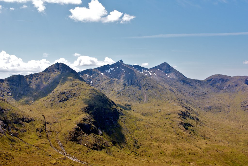
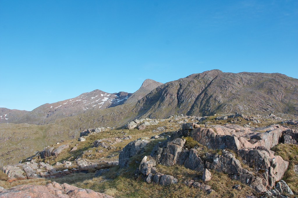
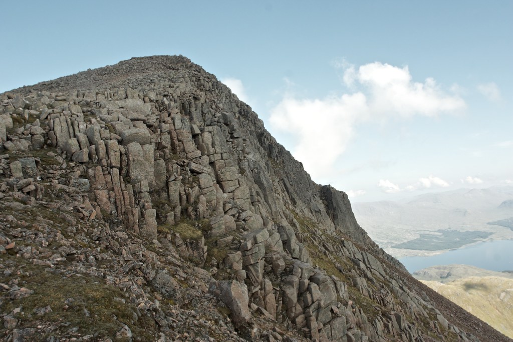
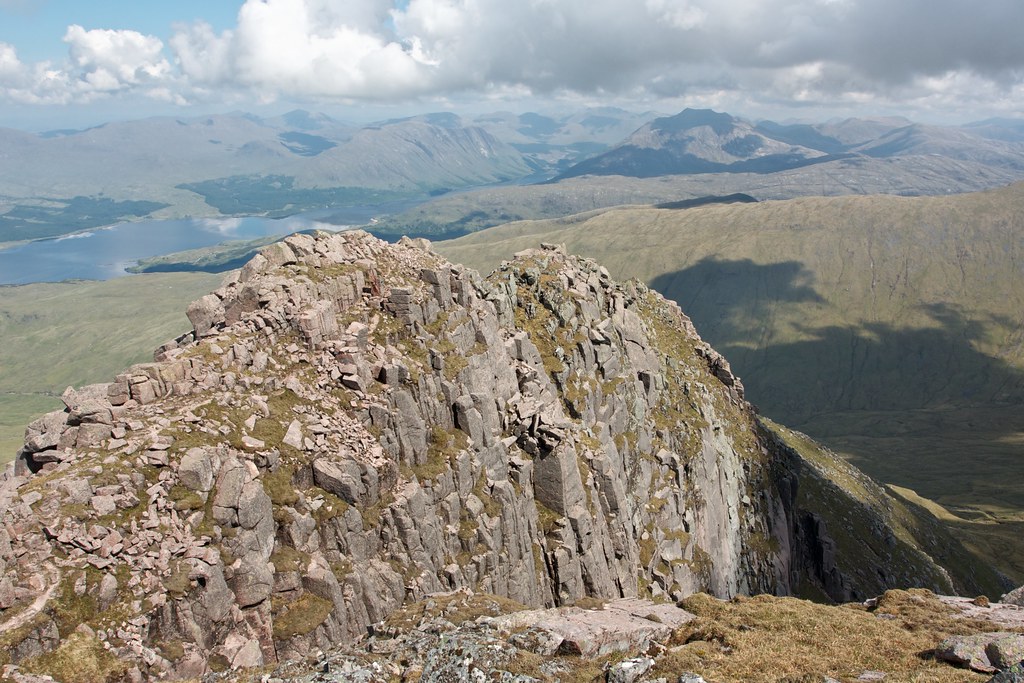
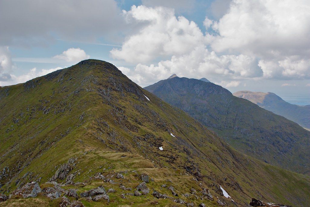
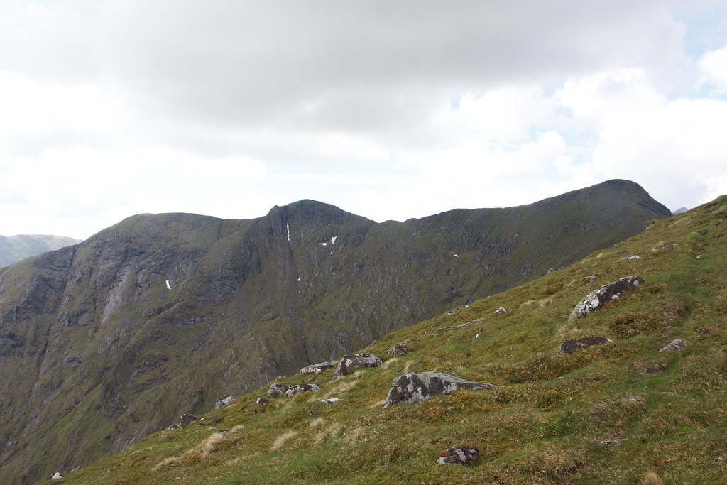
This brought with it an impressive perspective on the craggy western face of Taynuilt peak, the final high point on the Cruachan ridge. A couple of hundred metres of riven crags and blocky slabs turned to shattered rocks as the face met the bealach below me.
This was clearly a no-go zone but, as I suspected from views the day before, the southern ridge was sensibly angled and looked to meet up with the slopes rising from the belach beyond the worst of the obstructive boulders and rocks. Access to the ridge looked possible.
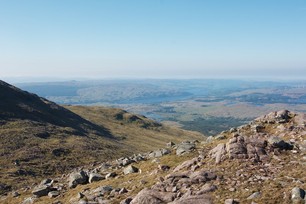
The drop to the bealach was steep but once again there was running water and after another drink I followed a rising contour, aiming for a distinctive block at the end of the southern ridge’s crags. This brought me around on grass with the occasional boulder field until I was on the south ridge. Below me the views opened up to Taynuilt itself and Loch Awe snaking its way beyond low, forested hills.
The ridge was easy enough and hints of a path emerged at times as I wound up, occasionally encountering some very easy but enjoyable scrambling. I emerged on the summit at 10am delighted to have accessed the Cruachan ridge without any real trouble.
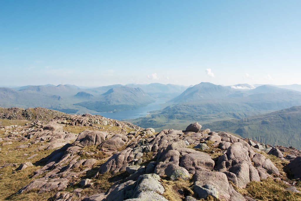
The early mist had now started bubbling up into clouds here and there, the occasional plume spilling over the ridge to the east. Otherwise the views, though hazy, were glorious in all directions. I sat on the northern precipice eating a snack and gazing out across the hills. It was utterly still and I couldn’t spy a single person in view.
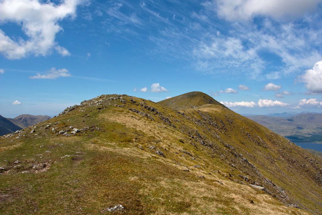
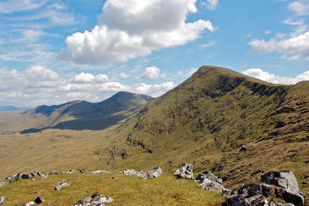
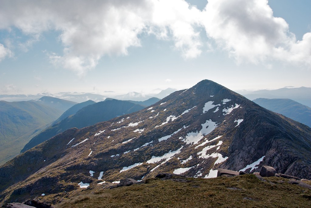
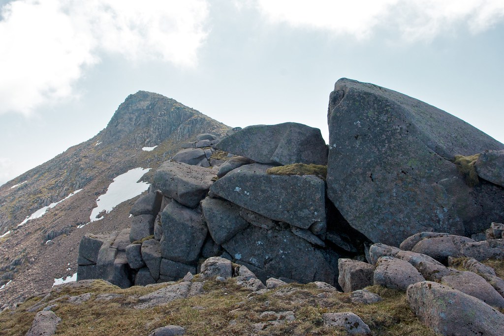
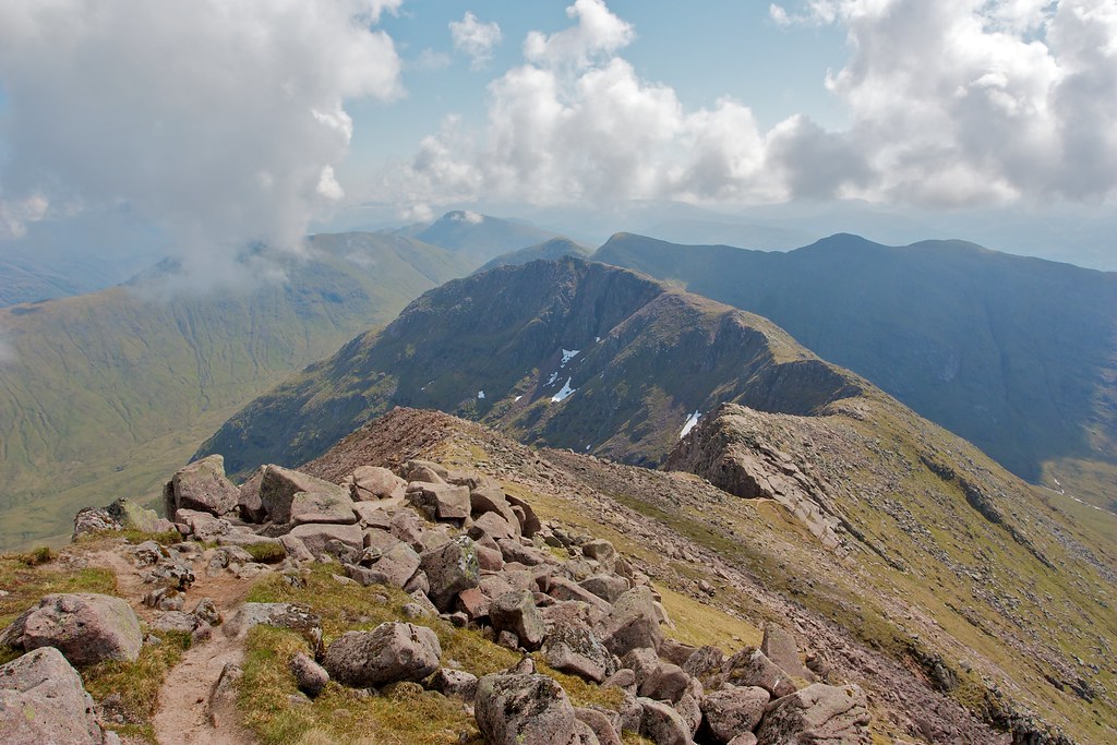
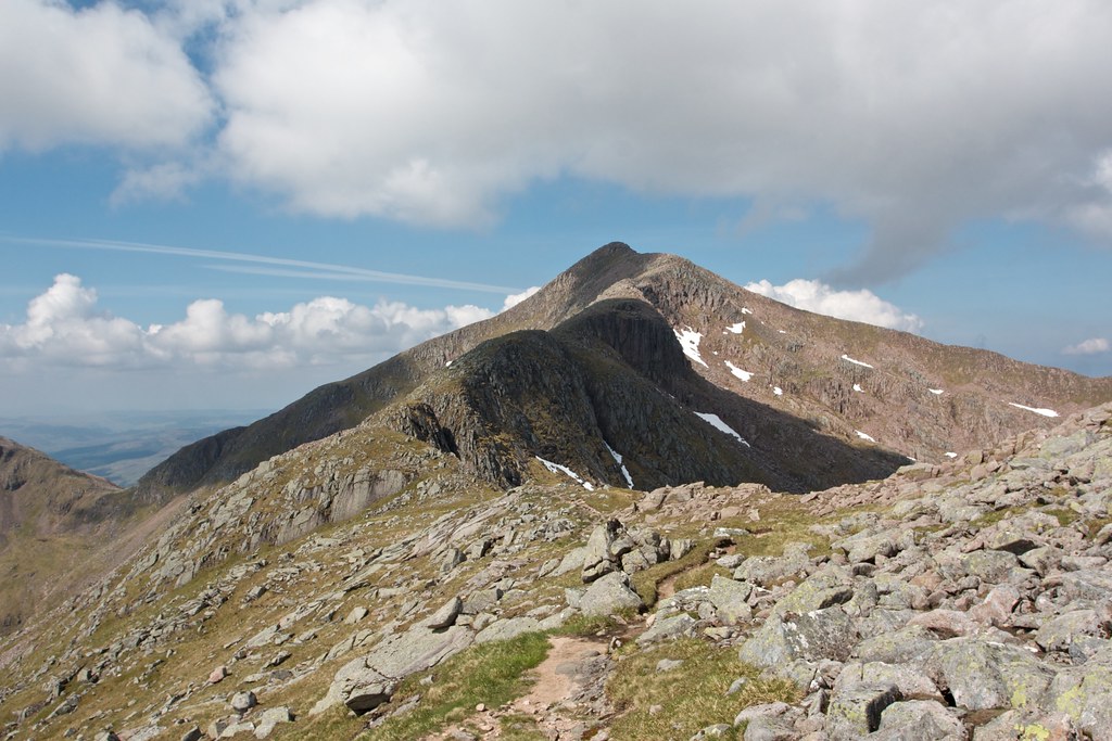
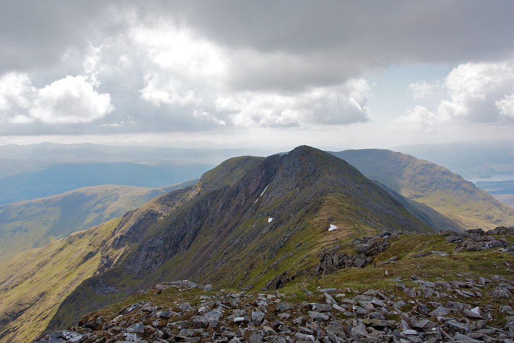
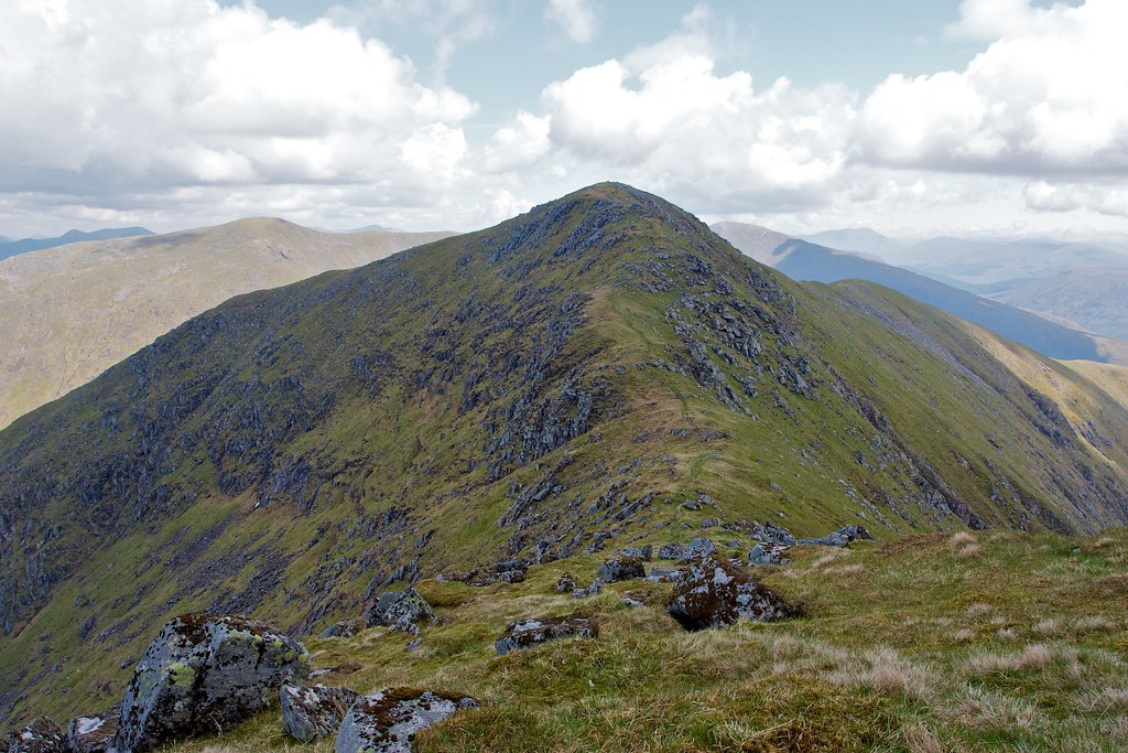
From here the Cruachan ridge stretched out eastward. Ben Cruachan was the next point along the ridge and I enjoyed the traverse across. The descent was steep on a stony path and then the reascent involved a couple of really nice scrambles on very grippy rock with great hand and foot holds.
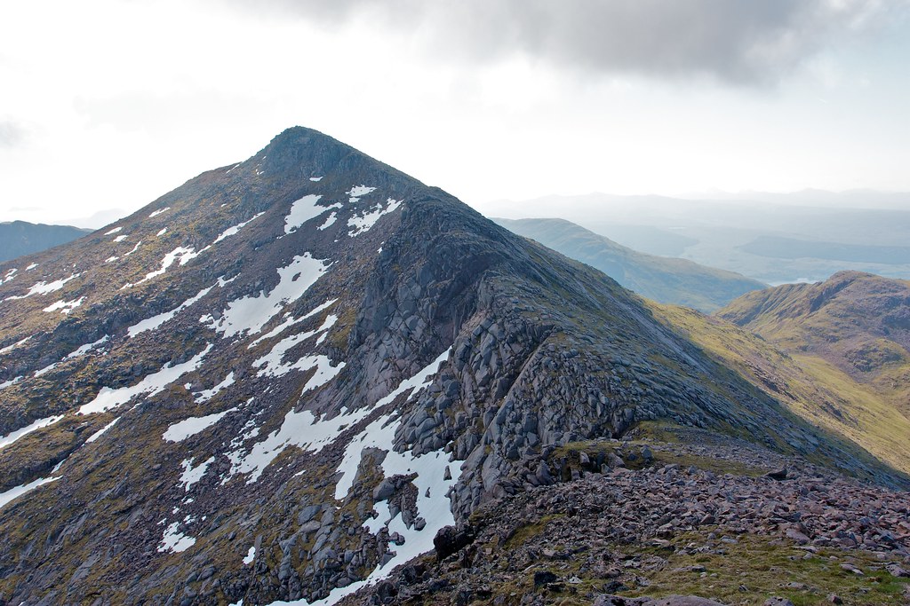

In no time at all I was on the 1,126m summit of Ben Cruachan.
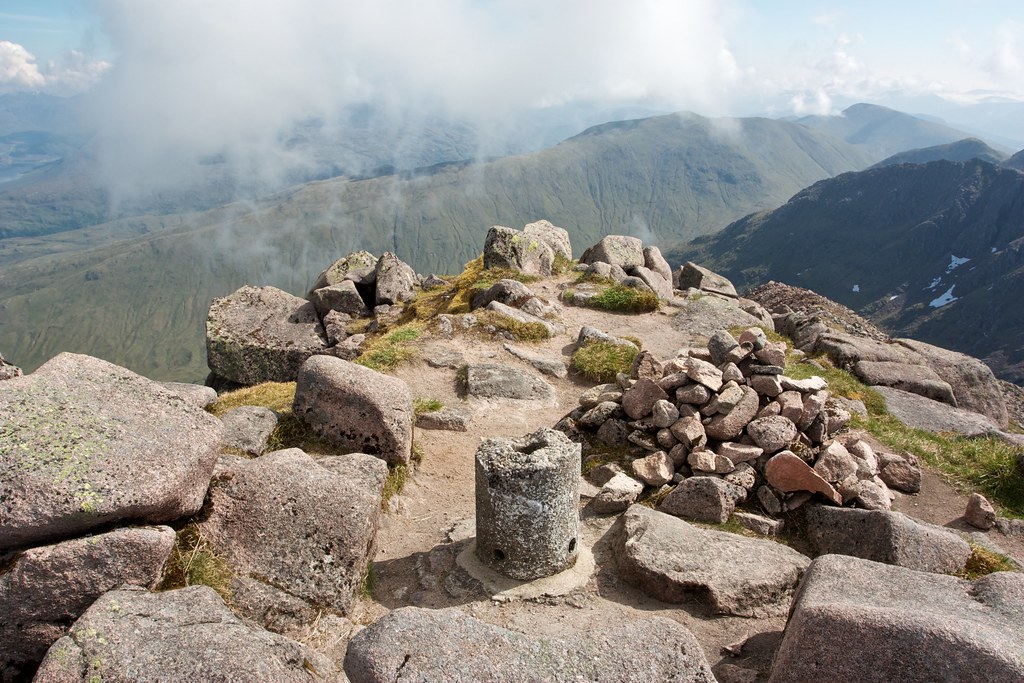
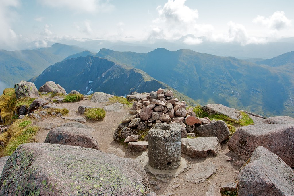
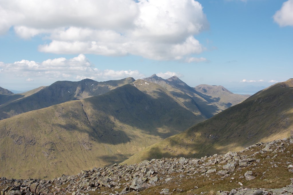
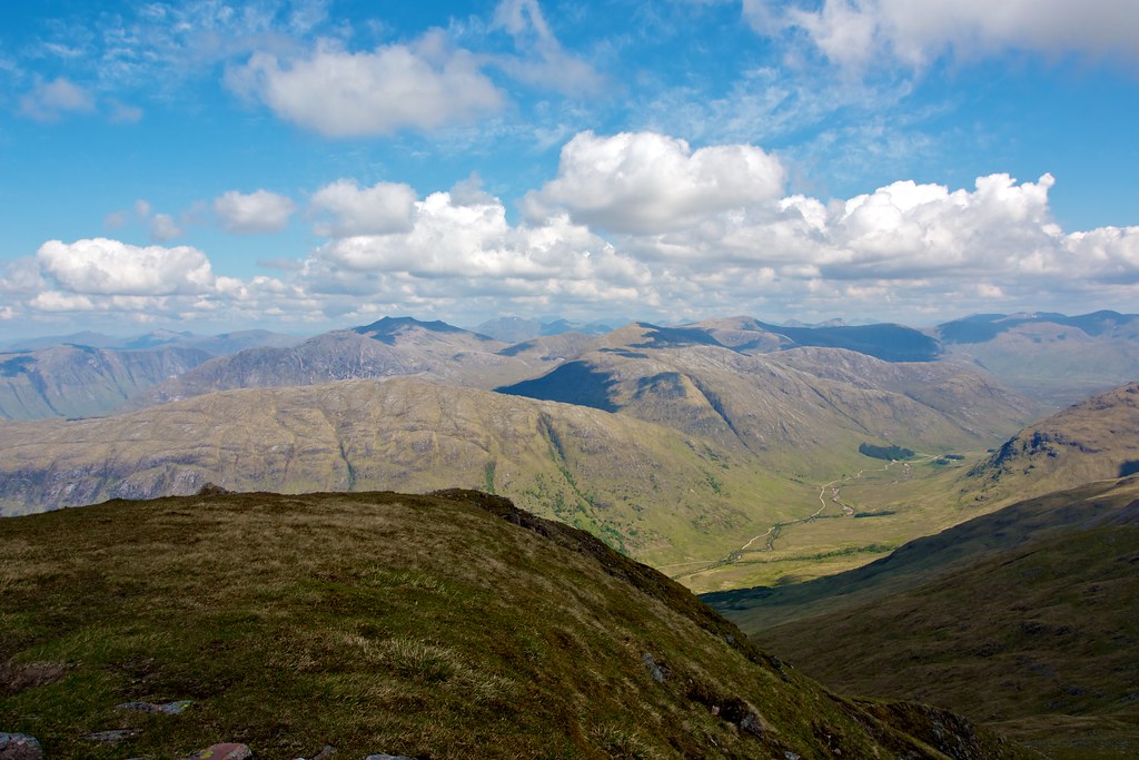
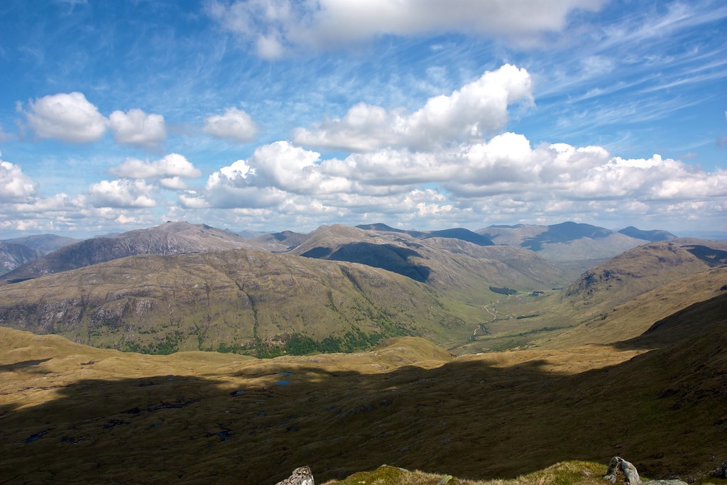
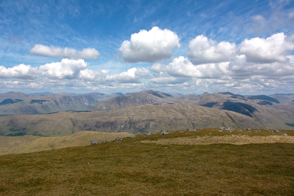
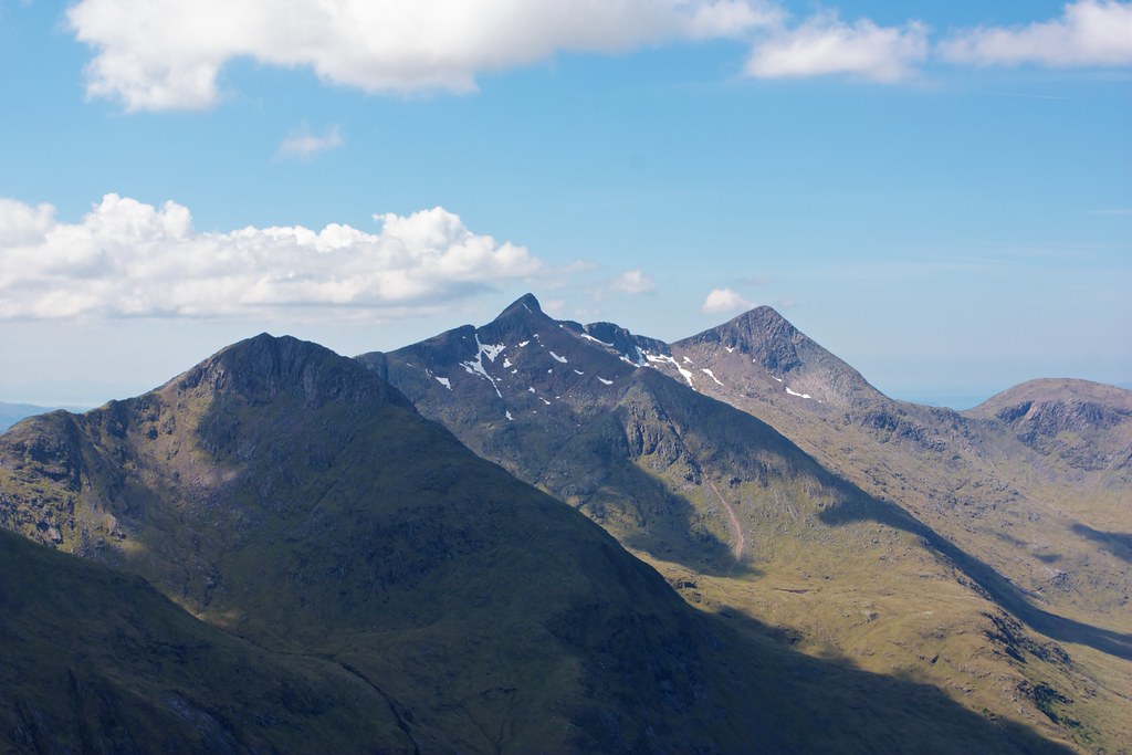
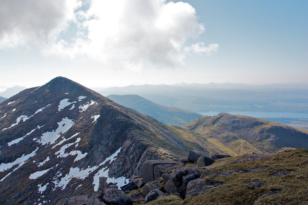
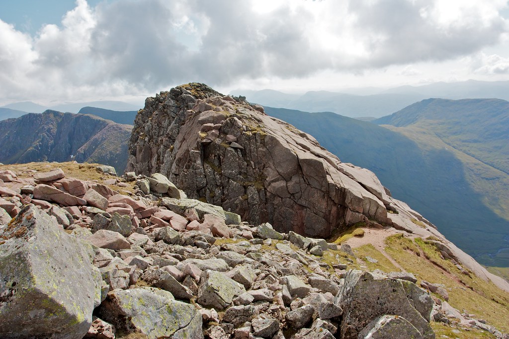
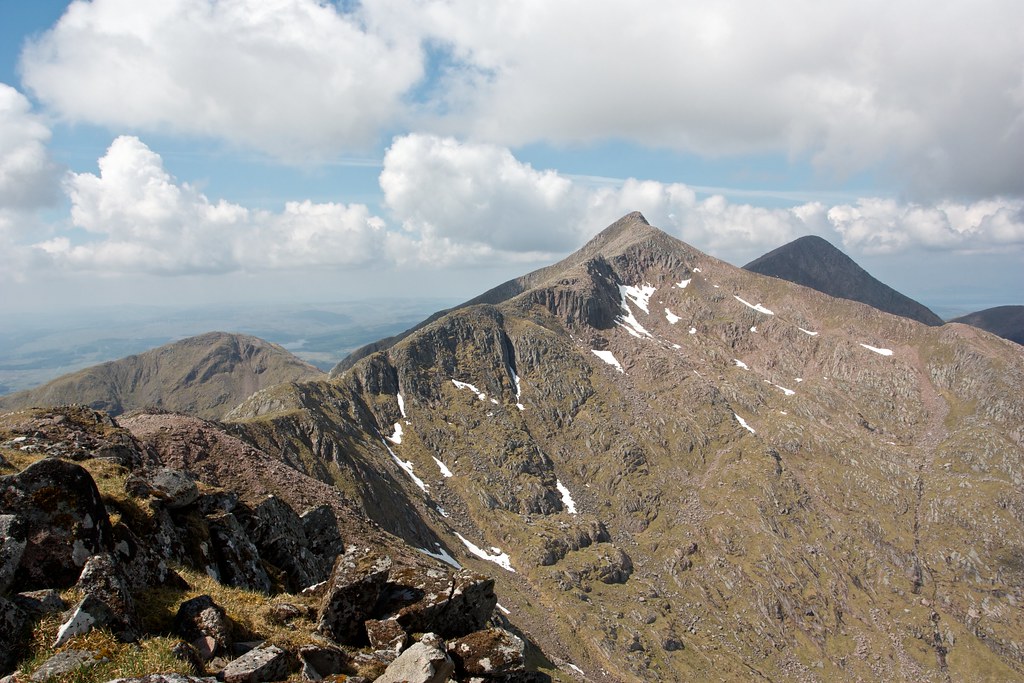
This is a lofty perch with steep drops on both the north and south sides. To the east and west the ridge stretches out, westward giving views to Taynuitl Peak and out towards the sea, eastward looking along the winding ridge to Drochaid Glas and beyond to Stob Daimh.

I left the summit, following the easy angled ridge as it dropped down towards the slabs and Cruachan's "bad step".
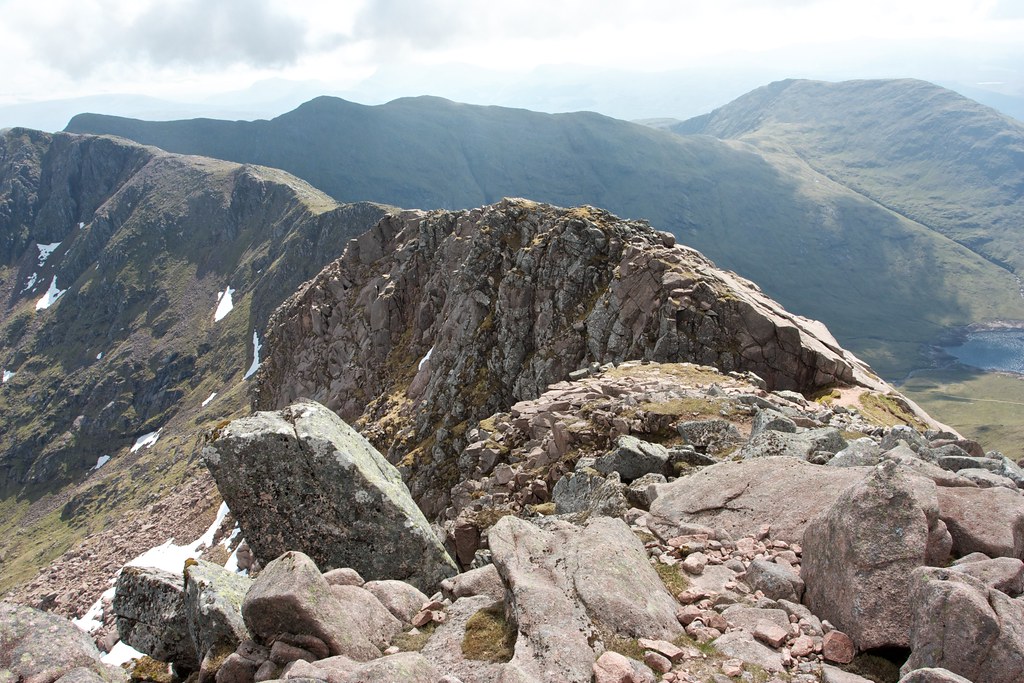
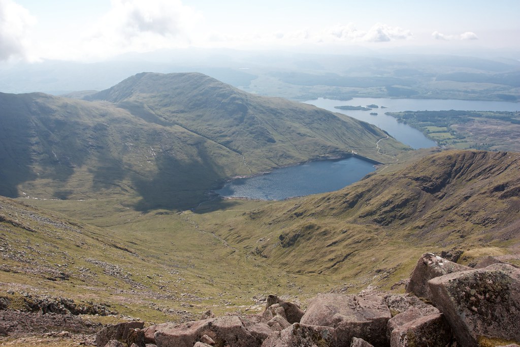
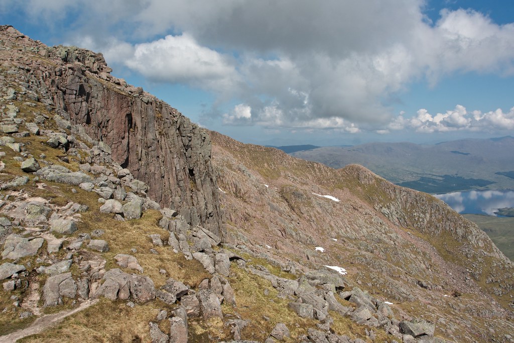
I dropped down to the step itself which sits poised above the Cruachan reservoir, vertiginous slopes dropping steeply down. Though I had ascertained that bypass was possible it wasn't necassay as the rock was incredibly grippy and after a slightly awkward first move I was soon up the slab and looking down the ridge beyond. The views back up to Cruachan were wonderful.
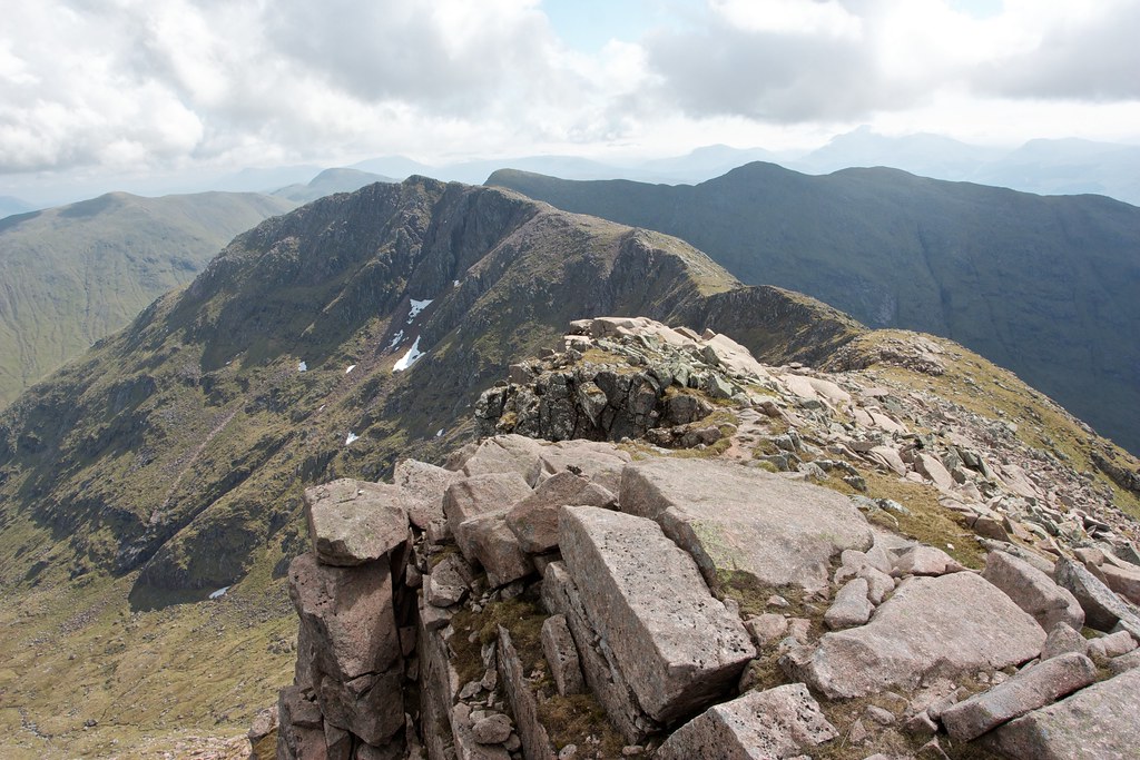
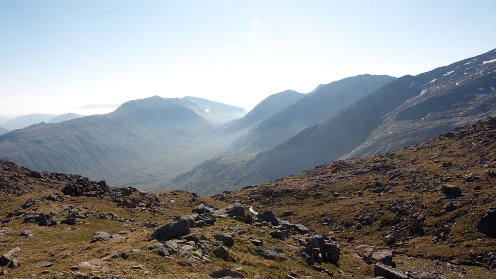
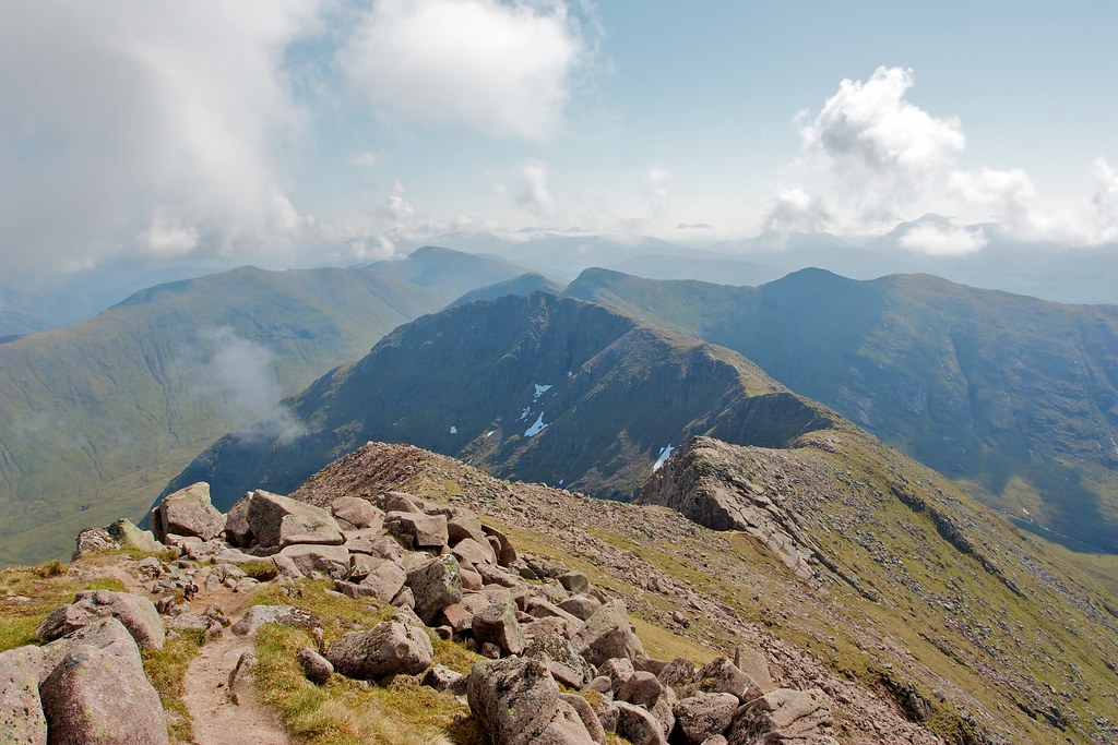
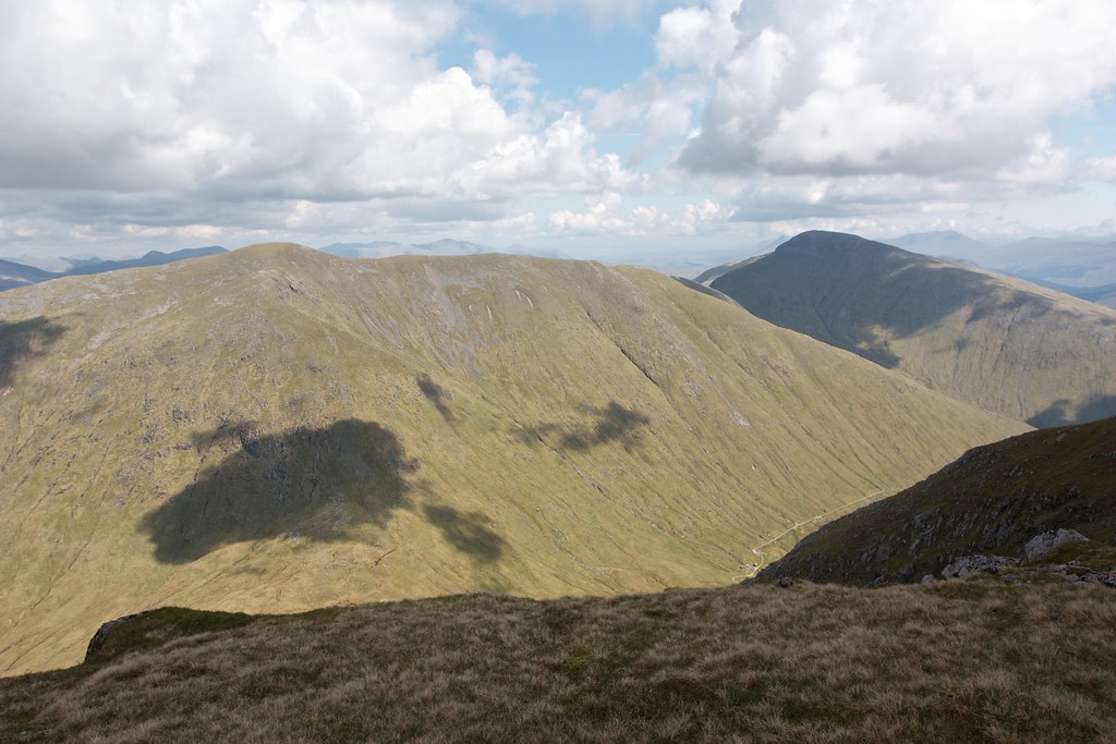
From the top of the step the ridge now eased and became a little grassier, interspersed with short rocky sections. Drochaid Glas gradually drew closer as I traversed the ridge high above the reservoir.
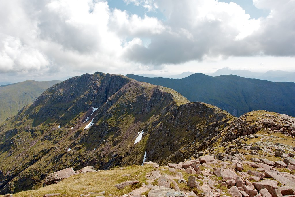
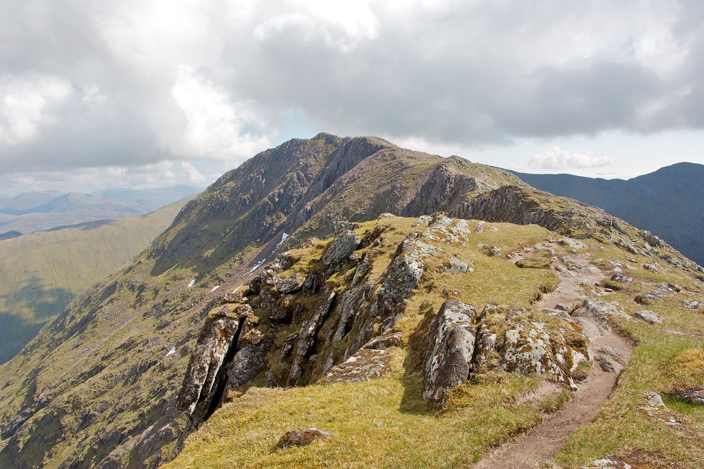
The ridge led me around to a cairned junction from which it was a short diversion north along a blocky ridge to reach the summit of Drochaid Glas, a Munro top. The views back to Ben Cruachan showed the distinctive curve of the east ridge with Taynuilt Peak a dark shape beyond.

By now the cloud had thickend and was rolling in from the east plunging the grassy ridge to Stob Daimh, the next Munro, into shadow.
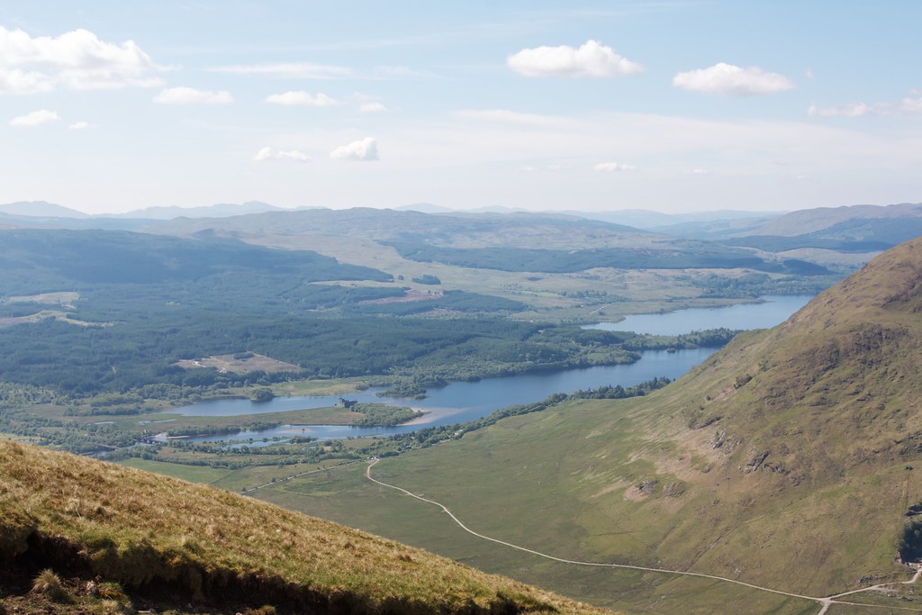
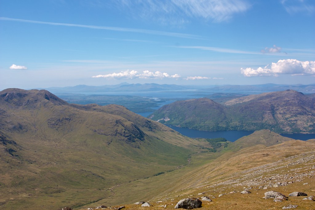
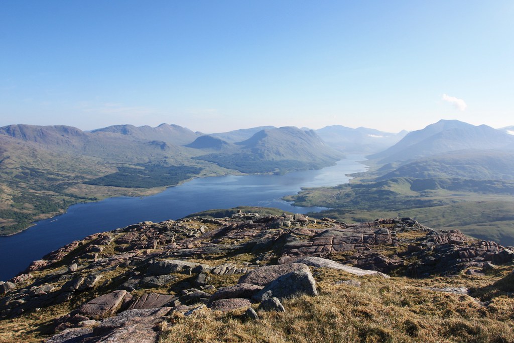
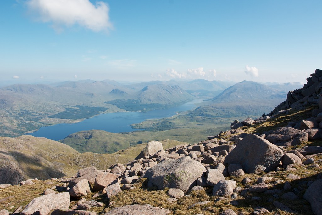
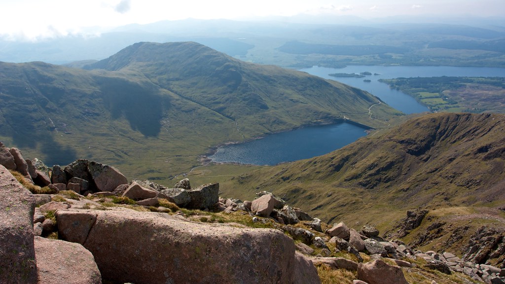
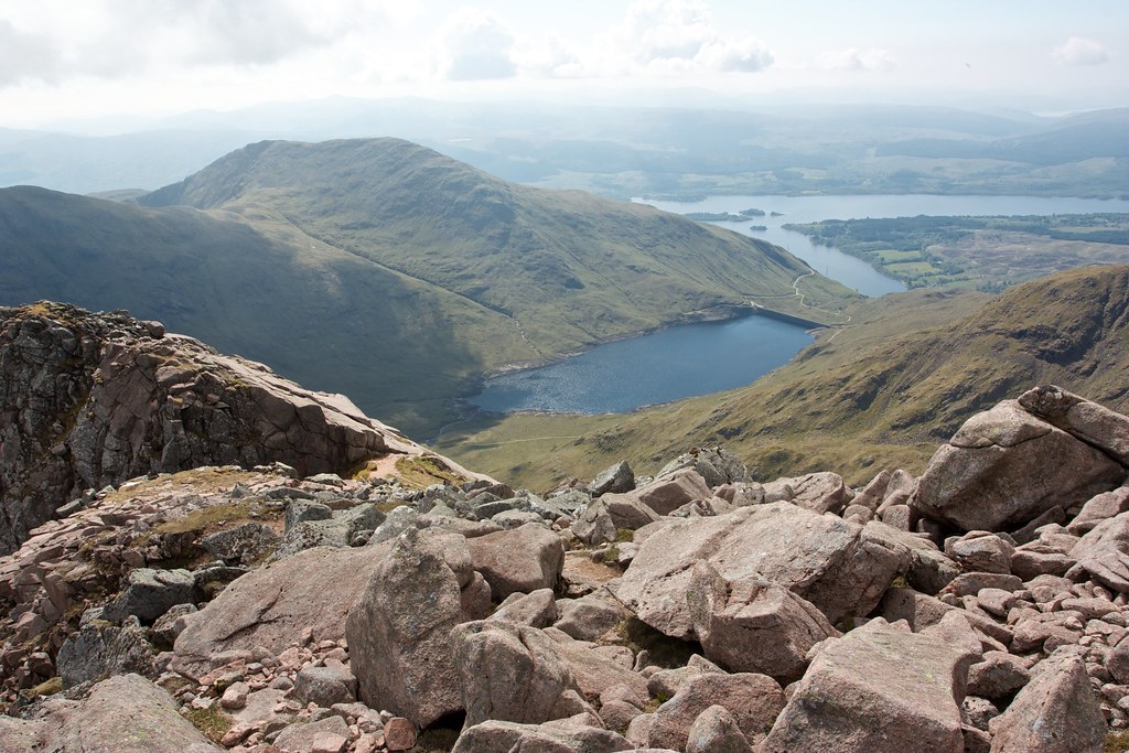
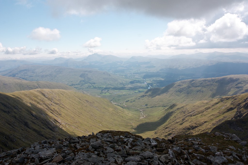
I returned to the junction and then took the left hand fork dropping down a very steep and eroded path to join the easy angled ridge to Stob Daimh. I was now looking directly down the Cruachan Reservoir to the dam and Loch Awe beyond.
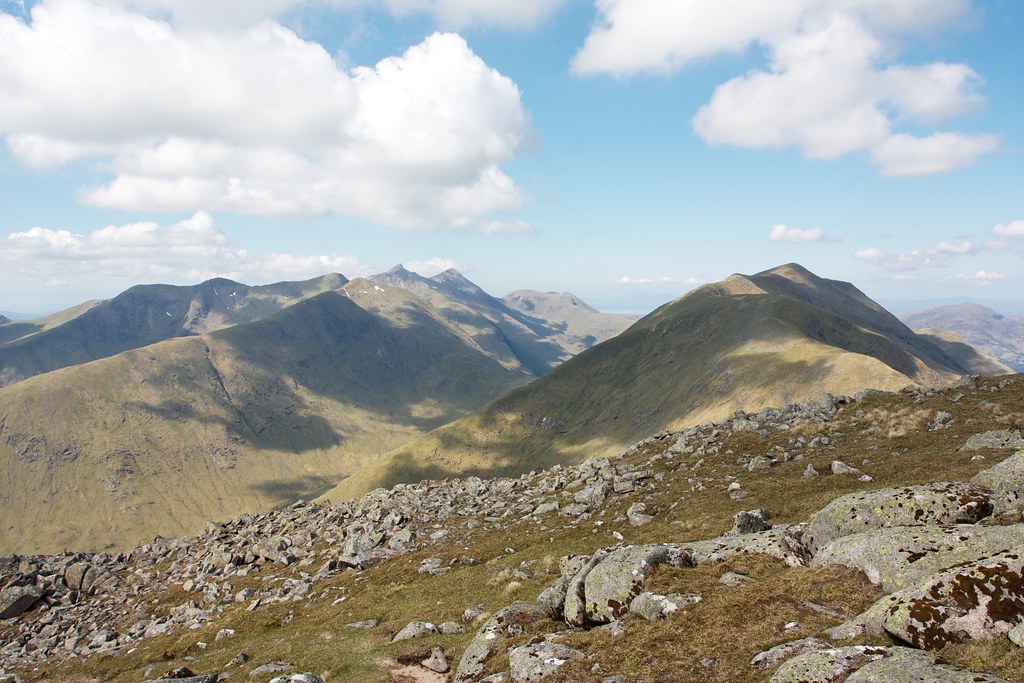
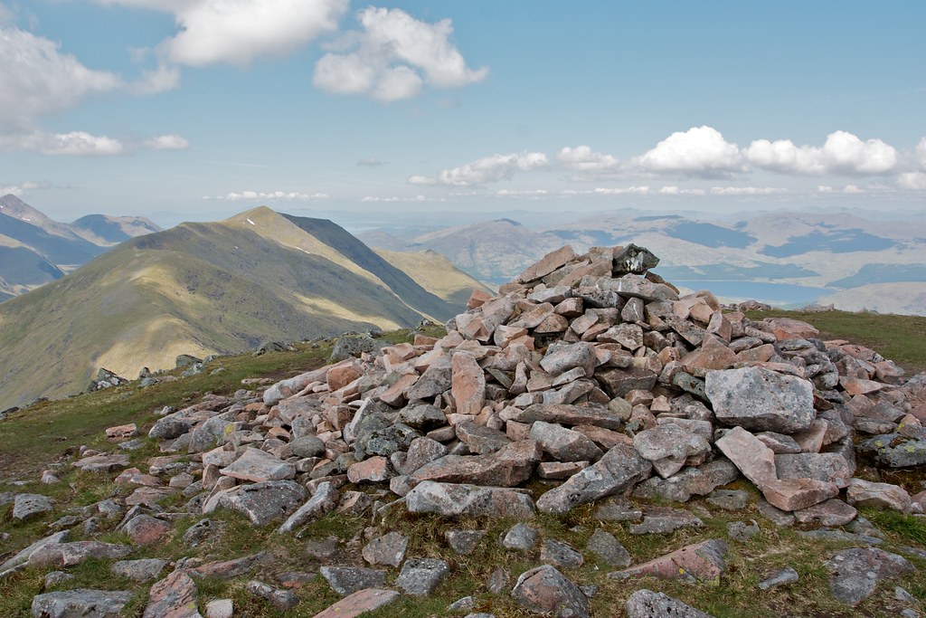
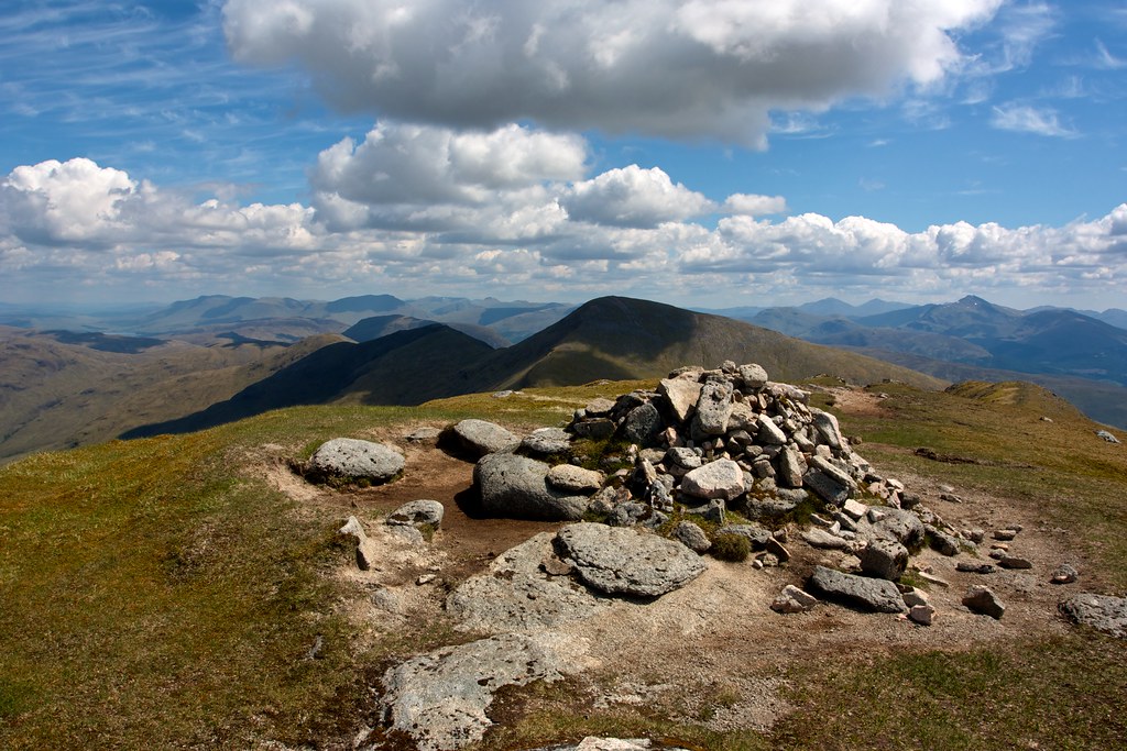
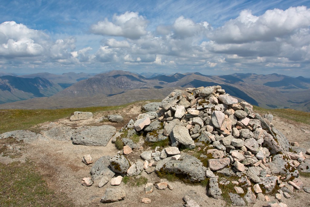
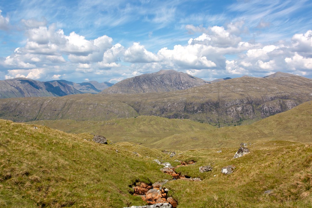
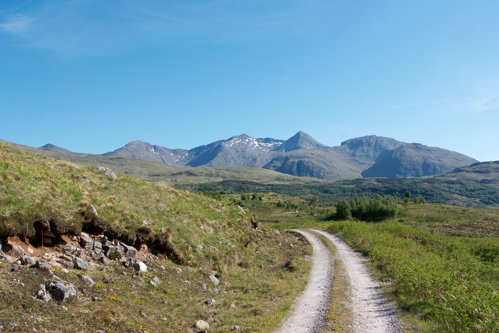
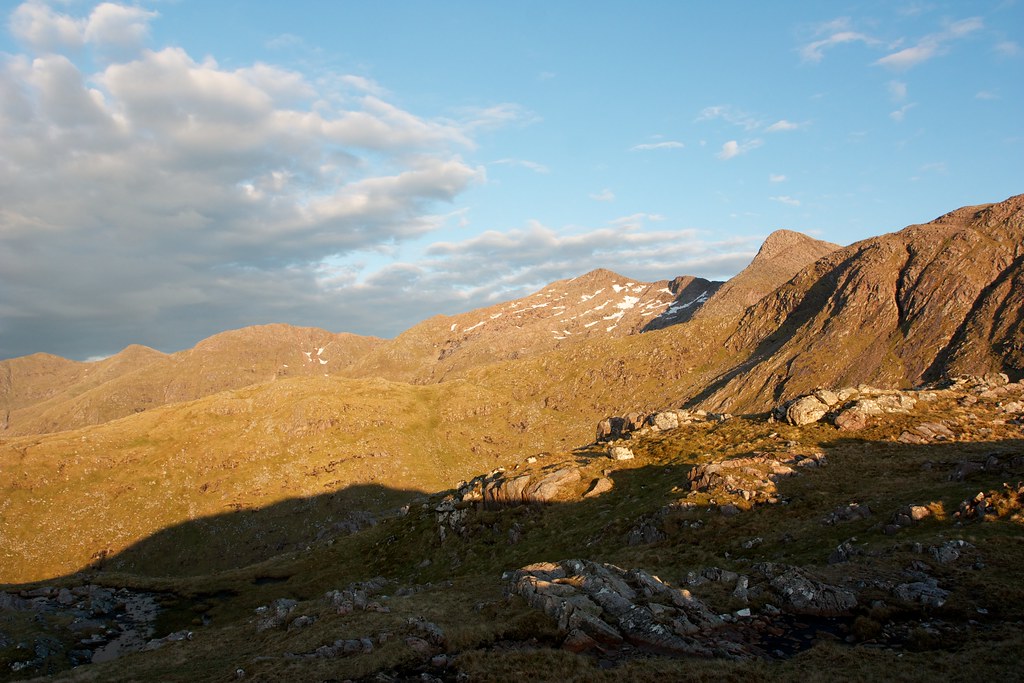
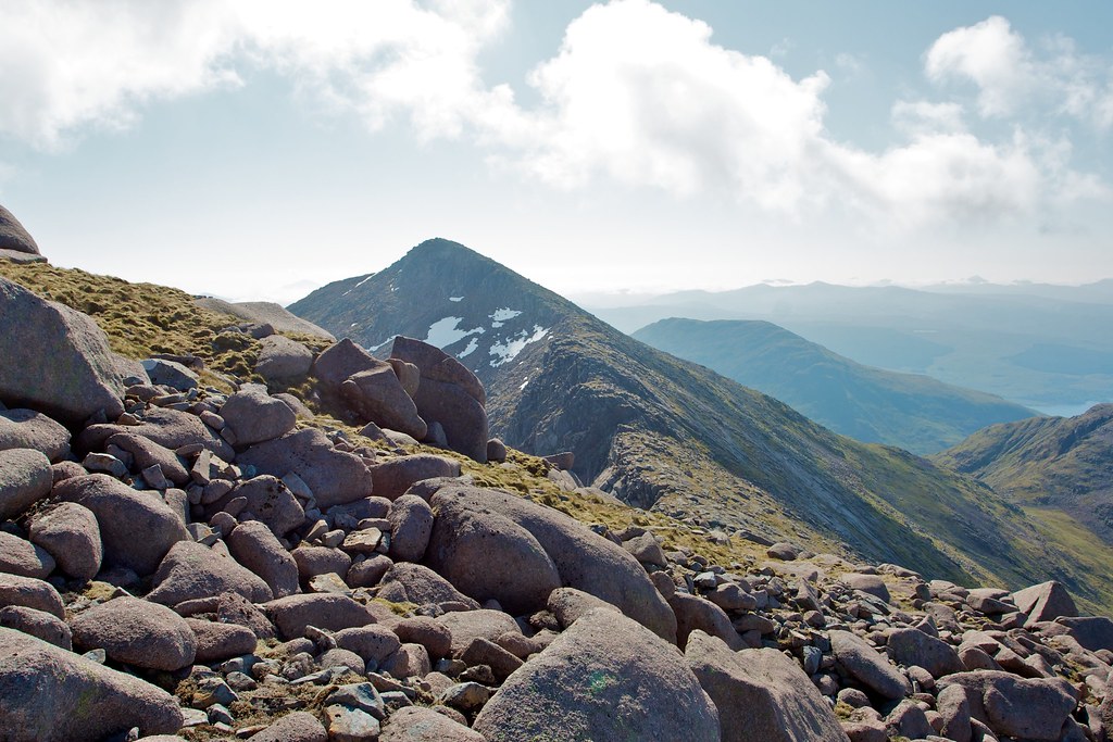
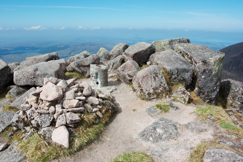
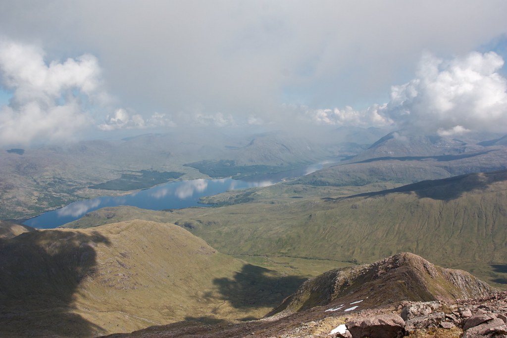
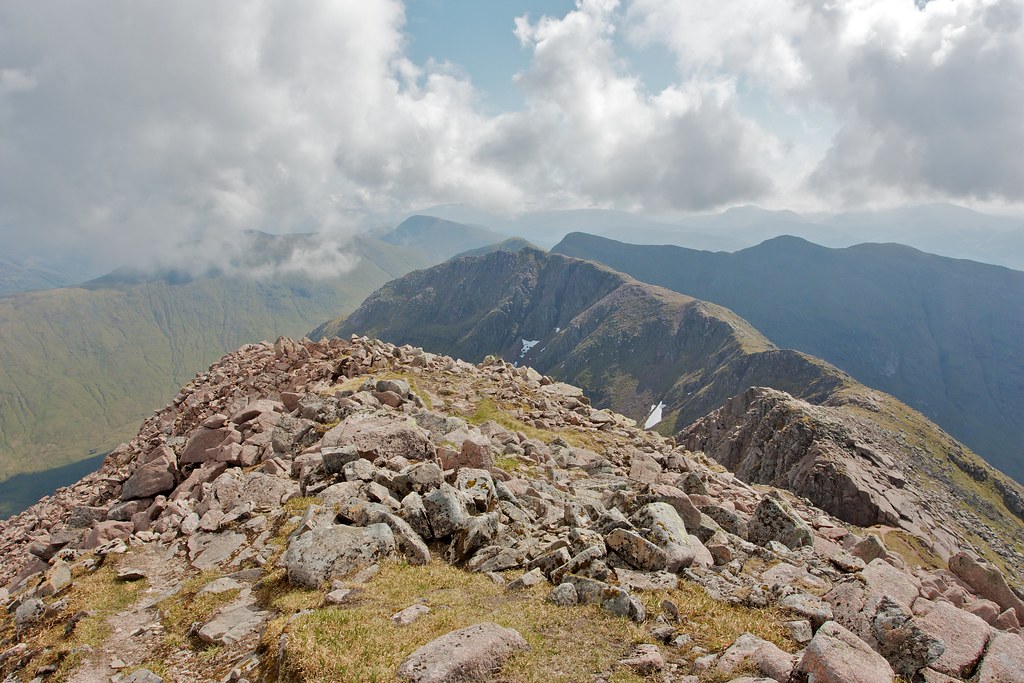
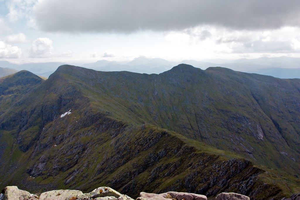
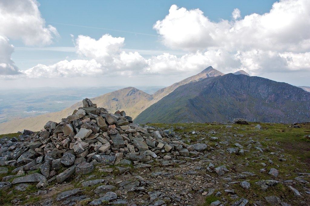
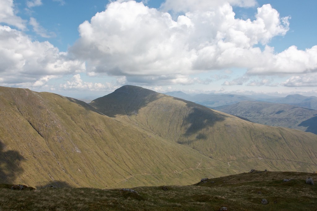
The final climb up to Stob Daimh was easy on a good path and soon enough I was at the flat summit complete with small cairn. The views back down the ridge to Cruachan were magnificent despite the cloudier conditions. To the north I now had a good view across the Lairig Noe to the two Munros I had climbed the previous day.
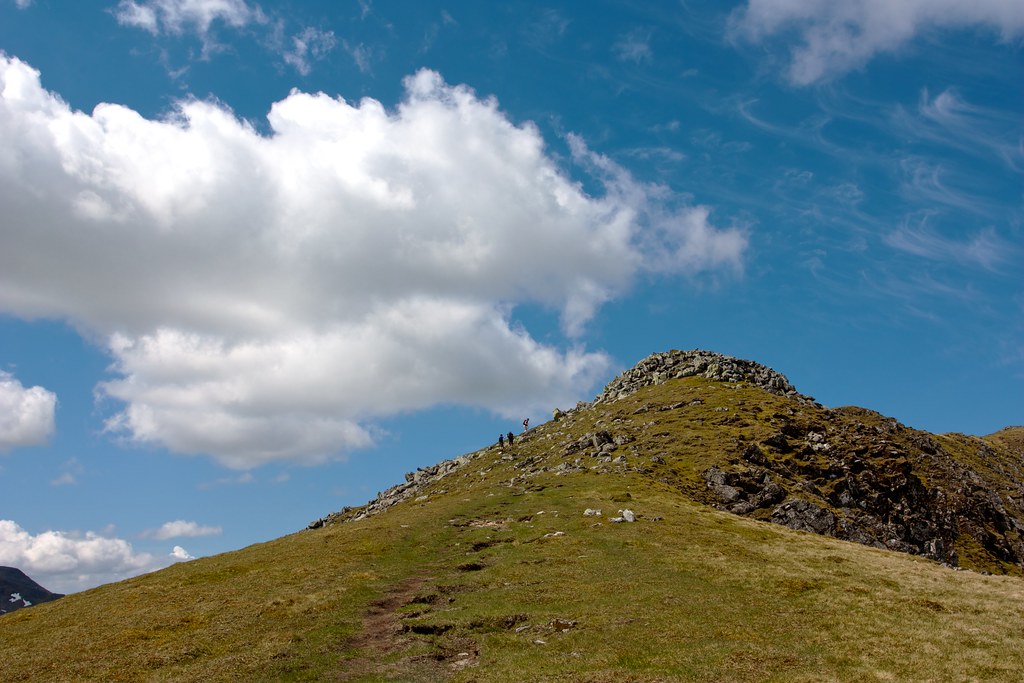
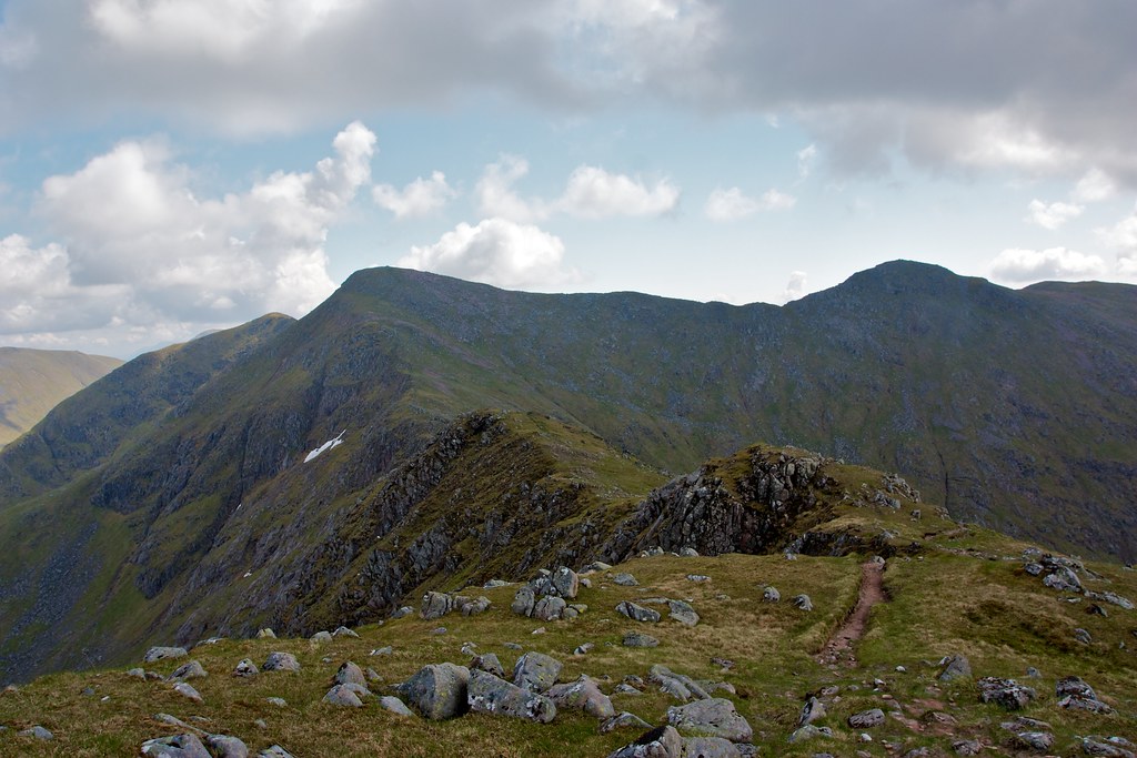
Though there are a choice of descent ridges I thought it would be neat to close the loop around the Lairig Noe and descend via Sron an Isean's long grassy eastern ridge.
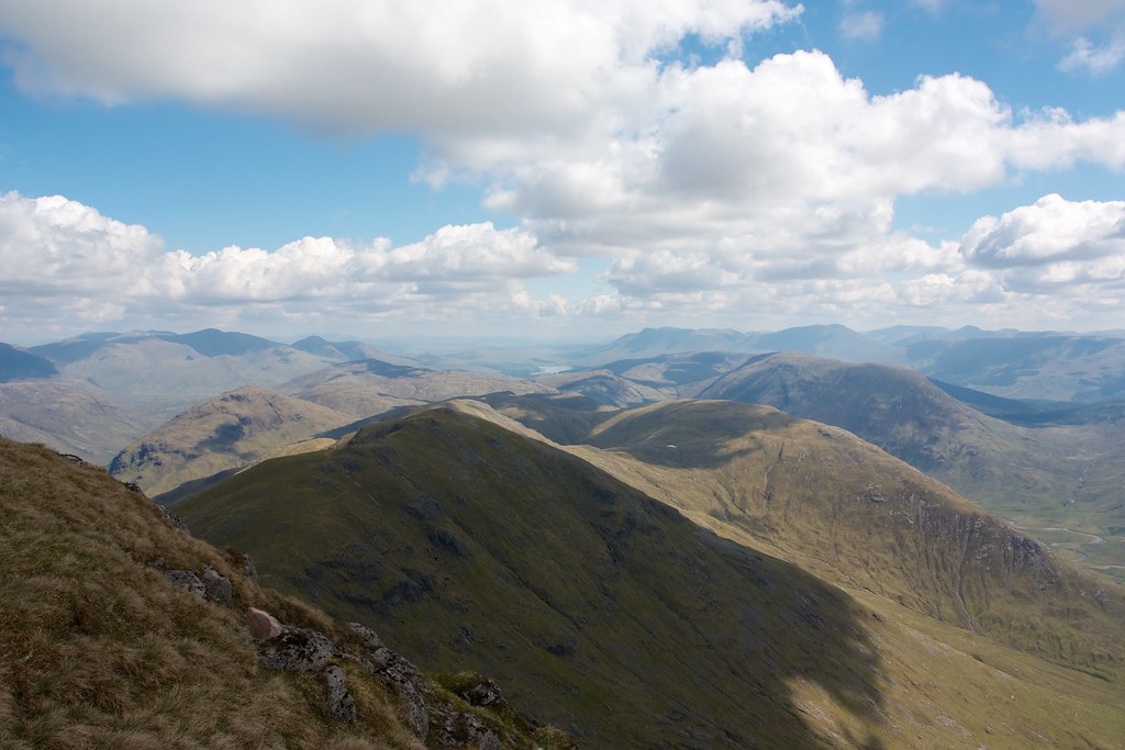
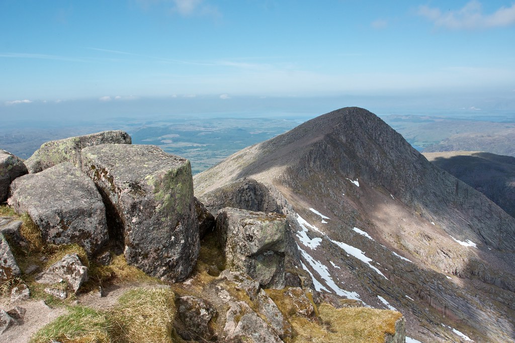
I dropped down from Stob Daimh, following the northeastern ridge and peering down beyond the lochan and into Glen Noe with Loch Etive beyond.
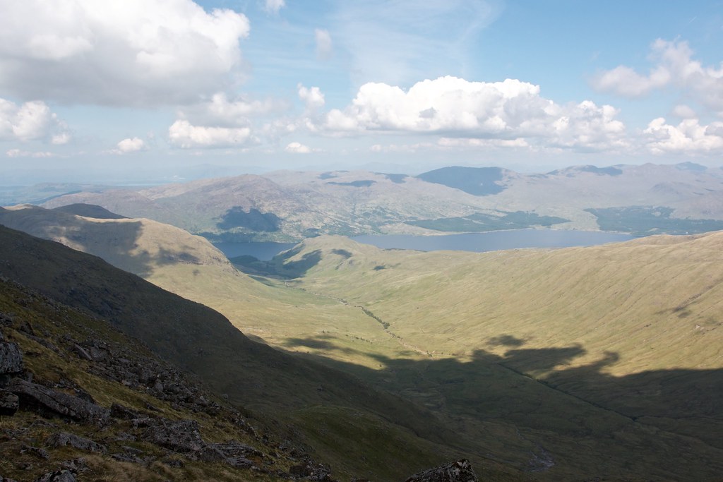
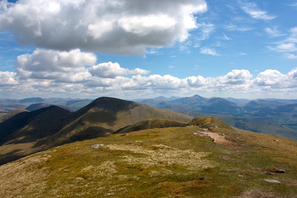
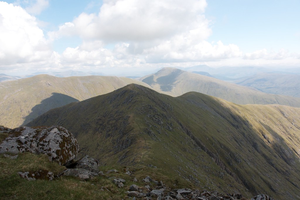
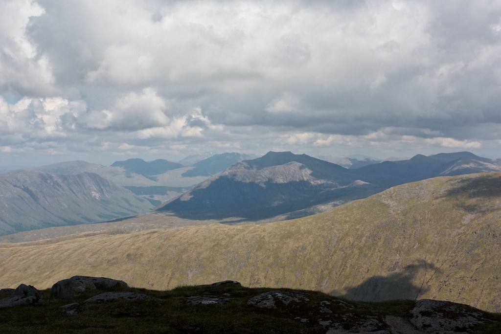
Soon I was on the summit of Sron an Isean, looking back to Stob Daimh, the peaks of Cruachan gradually being hidden from sight. I had views across the Lairig to Beinn a' Chochuill and Beinn Eunaich and across Glen Orchy Ben Lui stood in bright sunshine.
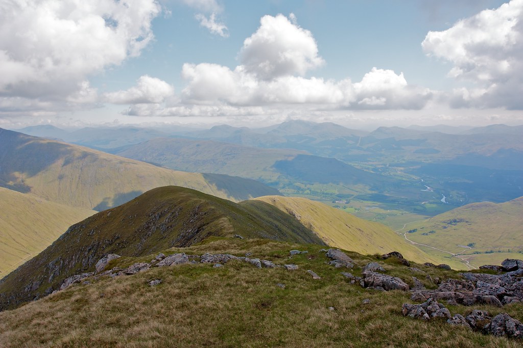
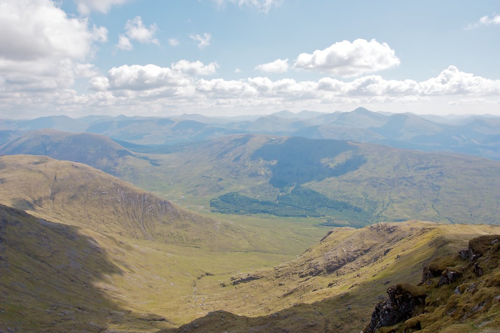
I now aimed for Ben Lui, angling eastward to follow the easy, broad grassy ridge down from the summit of Sron na Isean.
There was a distinct path to follow and I made rapid progress, watching as the views across the coire back to Stob Garbh developed.

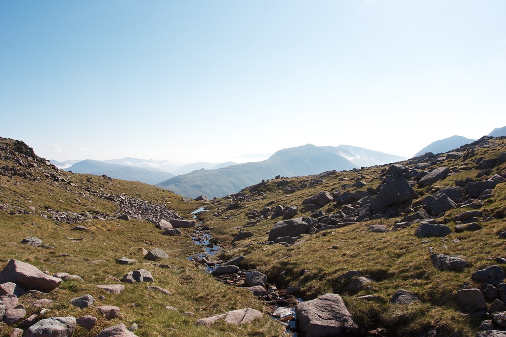
As I neared the end of the ridge the ground steepened and a number of crags sent me back and forth across the nose, eventually reaching the lower slopes, a sheep pasture and then the crossing of the Allt Mhoille. There were fabulous views back up Coire Glas.

At the stream crossing I stopped to replenish my water a final time. It was warm but pleasant in the shade of the trees but before long the midgies found me and so I moved on.
I had a last lingering look up the Lairig Noe before crossing the pastureland on a rough track to rejoin the track I had headed up the previous morning.
It was an easy amble back to the car. The heat was intense, reflecting back off the tarmac and I was glad to get everything packed away, winding down the window to drive off with a cooling breeze.
I headed back to Tyndrum for a late lunch at the Real Food Cafe thoroughly enjoying fish and chips with an ice cold coke. Then it was just a small matter of driving back to Aberdeen. By the time I was home it was grey and damp again. Back to normality. Thanks to the west coast for providing more than enough vitamin D!