Distance: 22miles Time; 7hrs OS Map: 44 Route: View on OS Maps
Today I went on a superb walk through some real, rugged Scottish countryside. I caught the 7:45am bus from Aberdeen out to the small village of Dinnet, beyond Aboyne on the A93. Arriving at 9:15 I immediately set out south, crossing the Dee and then talking a narrow farm track across the small hill close to Tillycairn. This soon dropped down to the Water of Tanar which flows through Glen Tanar at a place called Millfield. The path now turned right, heading south-west along the Tanar and past Glen Tanar House and its small loch.
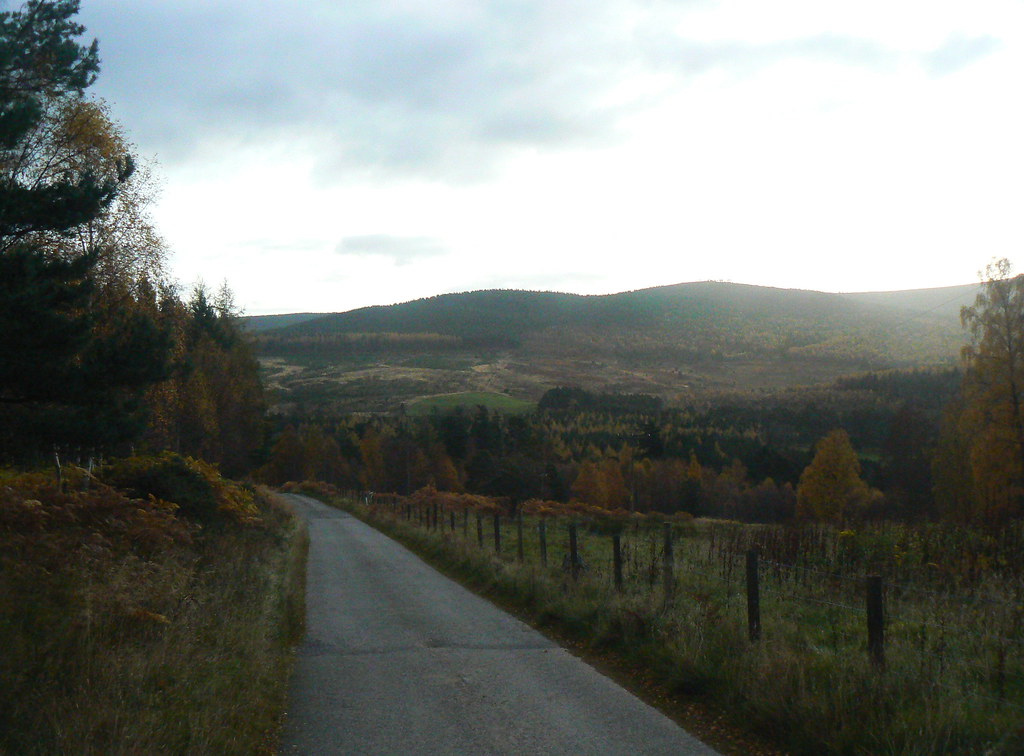
For the next hour and half the track passed through the Forest of Glen Tanar, a pleasant stretch of native Caledon forest dominated by pines. I didn't meet another person on the road and it was a pleasant, peaceful walk with the sound of the river beside me and the colours of autumn all around.
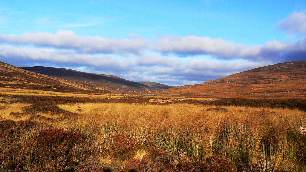
At around 11am I stopped at Half Way Hut for a brief cup of tea. From here it was only another 15 minutes before I left the woods and came into the open scenery of the top end of the Glen. Here the hills quickly climbed up, reaching heights of 500-600m around me. With the heather turning it was a stunning sight. As I rounded the corner near Etnach farm I caught my first sight of the mountain - Mount Keen, the most easterly Munro at 939m and my target for the day. It was an imposing sight, much taller than the hills around me, and barren looking from this distance.
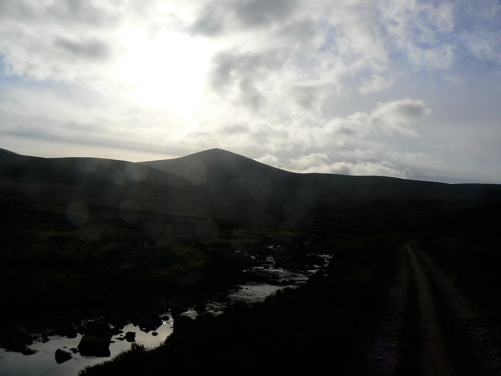
The track continued to follow the Tanar, crossing it on two occasions across old arched-stone bridges before it joined the Mounth Road, an ancient drovers track coming across the hills from Ballater. Joining this I crossed the Tanar one last time on a new footbridge (constructed after the previous crossing was washed away in a flood in 2000) before immediately climbing up onto the western shoulder of Mt Keen.
Already behind me stunning views opened up, looking across the hills, and back down Glen Tanar. In front of me and to my left the mountain continued to climb dramatically. It was a steep but steady slope with a well marked track. Soon I was on the western shoulder from here the track left the Mounth Road and continued up to the summit. I now had fine views over to the Caingorms, and in particular Lochnagar, the closest Munro.
After putting on my waterproof coat (to keep out the wind), hat and gloves I made my way up the final steep slope to the summit. Again the track was good and I only had to scramble on a couple of occassions.
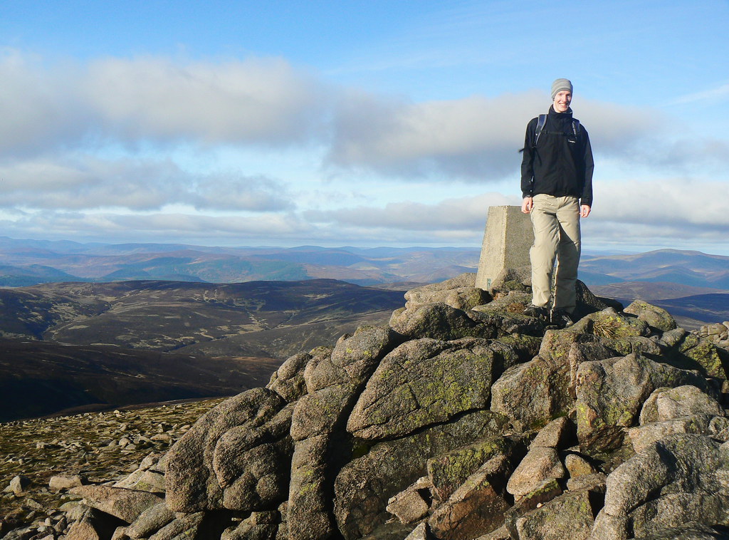
After 3 hrs 30 mins of walking I reached the summit, clambering up to the trig point and taking in the stunning views whilst holding on against a strong westerly wind. All around the skies had cleared to reveal a stunning landscape of hills, moors and valleys. The Caingorms lie to the west of here and they could be seen rearing up beyond Lochnagar.
There were other people at the summit who had approached from the south, and after eating lunch I asked one of them to take my summit shot.
Just after 1pm I turned back and followed the route I had come to get back to Dinnet. The shadows were lengthening but the late afternoon sunlight in the Glen was stunning and it was a great walk back. I didn't have time for many stops, and made it across the tops to Dinnet with the sun sinking. I arrived back at the bus stop at 4:15pm, 7 hours after setting out that morning and only had a short wait for the bus back to Aberdeen.
It had been a great day and climbing my first Munro gave me a great feeling of achievement and satisfaction.
See more pictures in the Flickr photoset.