
A short overnight trip to the Munro of Gulvain located near Fort William in the Northwest Highlands
Date: 25th-26th May 2023
Distance: 29km
Ascent: 1,348m
Time: 28hrs
Hills: Gulvain South Top (Munro Top), Gulvain [Gaor Bheinn] (Munro)
Weather: Warm and sunny with a cool, gusting wind at height. Becoming cloudier.
Route: View on OS Maps
Medical Prologue: in mid-December 2022 I fell over on ice and managed to fracture my kneecap. Whilst in a brace and fairly inactive I developed a DVT and was put on a course of blood thinners. Since coming off them in April and working with a physiotheraptist for my knee recovery I had been slowly ramping back up exercise, with regular walking, cycling and some gentle running. This trip came after a few active days where I had not suffered from any pain or discomfort either during or after completing both a long bike ride and a half day out in the Trossachs. I was therefore feeling good about trying for a new Munro and breaking up the driving by doing a wild camp...
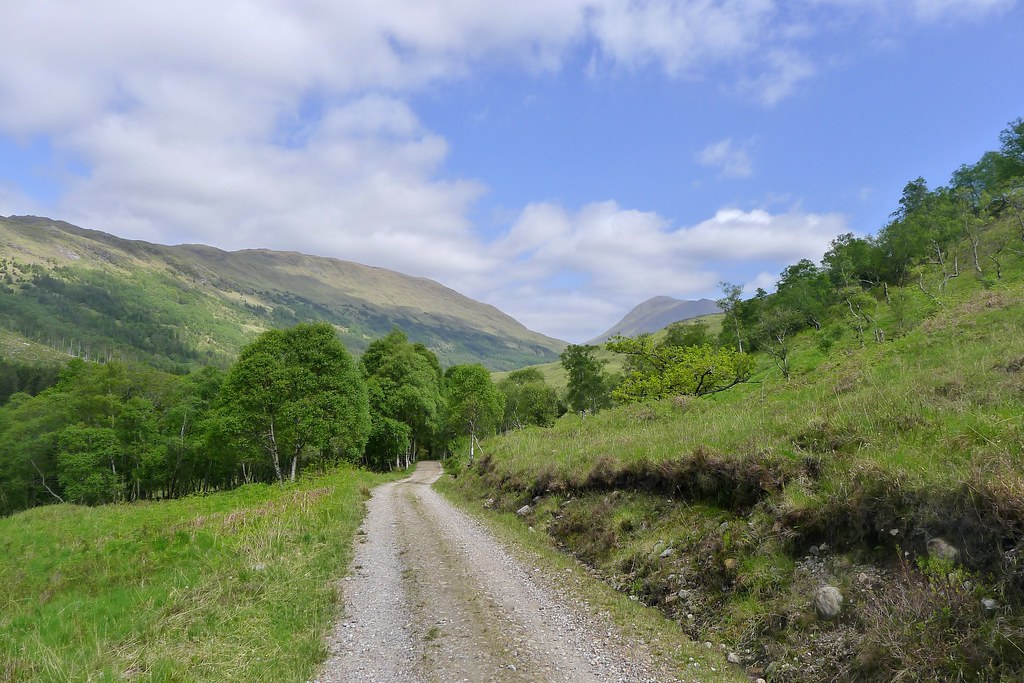
It was 11 in the morning, bright sunshine and a bit of a breeze blowing, and yet as I sorted out my pack and changed into walking shoes I was getting eaten alive by midges! They hastened my departure and I was soon crossing the busy Road to the Isles and winding my way past the few buildings on the far side before picking up the hilltrack signed by Scotways to Strathan, 10 miles away across the hills.

The stroll up through the lower stretches of Gleann Fionnlighe was beautiful. The birch trees were a bright spring green and in a blue sky lazy white clouds drifted by. There was birdsong amongst the trees and bluebells still lingering in the shade by the river.
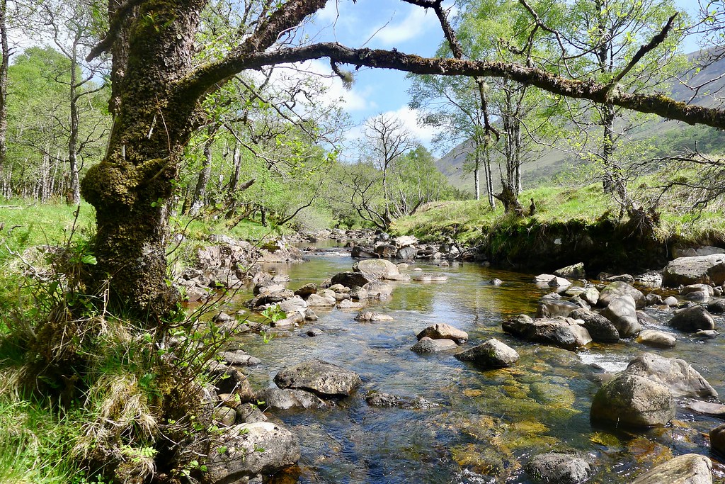
The track dropped down to cross the river near Uachan and here I got my first glimpse of Gulvain up towards the head of the glen. The track now wound along close by the river and after nearly an hour of walking I stopped for a brief snack break and to replenish my water bottle.
Beyond the ruined building at Dail nan Uamhachan the track was a bit rougher and waterlogged in places but I continued to progress up the glen, the occassional view of Gulvain showing its broad southern slopes growing ever closer. The trees finally gave way to open glen and near a stone sheepfold I stopped on a derilict dry stone wall to enjoy lunch in the hot sunshine.
From here it was just a short distance to a bridge crossing the Allt a' Choire Rheidh and then across boggy ground to finally reach the slopes of Gulvain. To the left I had views up Coire Rheidh to the Corbett of Braigh nan Uamhachan which I had considered including in this outing. The thought of a couple of miles of rough ground followed by a steep and pathless ascent to Gulvain was somewhat offputting on a hot day though.

The track up the south side of Gulvain can be clearly seen from the walk in and proved to be a mostly pleasant, albeit steep and unrelenting, affair. After a steep lower section it turned into a series of wide switchbacks that I took at an easy pace, pausing often to admire the expanding views back down Gleann Fionnlighe and over to the hills of Ardgour.

As I passed the 400m mark I saw the first fellow hillwalkers of the day. First a guy who had made his second visit to Gulvain, this time continuing on to the Munro summit. The second was someone who I'd last spoken to on the Clachlet Traverse back in 2020. We stopped and had a good chat, remarking on the excellent weather and the quietness of a midweek Munro.

I continued up, reaching the rockier upper section where I passed another couple making their way down. They would be the last people I would see until the following lunchtime. The tough height gain was rewarded by increasingly expansive views. The pointy line of summits marking Streap just to the west caught my eye as the gradient finally started to relent.

Off to the east I could now see Ben Nevis, still decorated with snow patches, across Loch Eil. The views to the south were increasingly hazy and there seemed to be smoke rising in the direction of Loch Shiel.

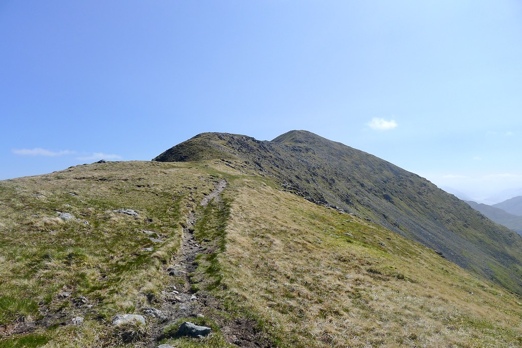
The path brought me up the final, more gradual slopes to the top at 855m which marked the southern end of Gulvain's ridge. I could see the south top now very close by, and peeking out beyond it, the more distant true summit.

I paused here for a quick snack break. On exposed ground the wind was really gusting and so I sought some shelter on the northern side of the hill which gave views down upper Glen Mallie as it wound its way towards Loch Arkaig.

After a brief pause to enjoy the views I followed the path across some undulating terrain before it headed up the slopes to the south top. Once again there was a clear path which climbed uphill, only disappearing briefly as the route traversed a short boulderfield.

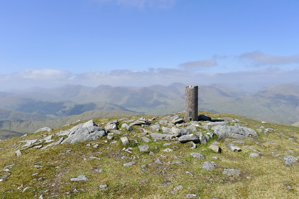
After a little more effort I reached the trig point marking the 961m high South Top: just 20m shorter than the main summit now seen another km or so away. From here there were stunning views in all directions.
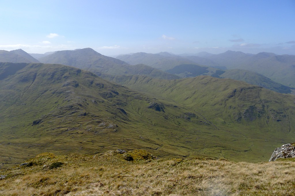
The main draw were the hills and mountains of the Rough Bounds of Knoydart, now seen beyond the gap marking where Loch Arkaig lay. I could see along the ridges all the way to the distinctive summit of Sgurr na Ciche.

After another short break on the South Top I made my way north, heading for the Munro summit. The descent was fairly gentle, taking me past a grassy balcony with pools of water which would have made for a good camping spot.
The ridge curved between the steep western slopes and the more gentle slopes of Coire a' Chaorainn (a location where Chris Townsend camped during his 2019 TGO Challenge) to the east. It was easy going terrain and there were no difficulties.

The views were excellent with views over the empty coires towards the hills around the head of Glenfinnan.
After descending to the low point it was then a similar, gentle incline back up towards the summit itself. There were some craggy buttresses on the western side of the summit slopes but the path rose above them and it once again proved easy going, even with the gusting wind.

The path wound its way up the final grassy slopes and I soon found myself approaching the substantial cairn, marking the 987m high summit of Gulvain.
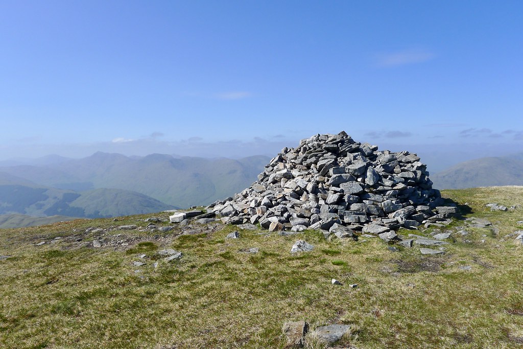

Again there was a cool and gusting wind blowing so I sat with my back to the cairn on the eastern side and enjoyed a final, extended break. It was around 4 in the afternoon and there was a peace over the hills. I drifted into a peaceful reverie which was only briefly disturbed when a small helicopter came down from the north and passed through the glen to the west of Gulvain.

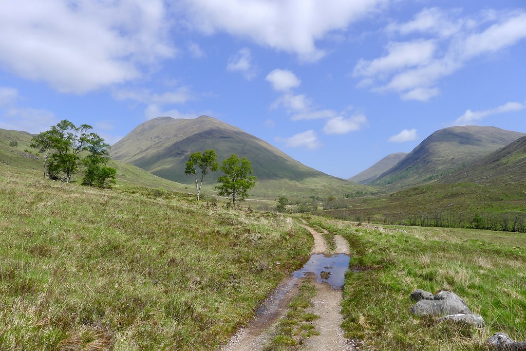
With the afternoon drawing to a close, my thoughts turned to the evening and finding a suitable camp spot. Although I could have stopped up on the summit I wanted to make a little more inroad into my planned route and drop down the northeast ridge of Gulvain and then up and onto the lumpy hill of Mullach Coire nan Geur-oirean which could be seem some way off to the northeast, sitting above Loch Arkaig. This would then allow me to cross Glen Mallie in the morning and return to the car by way of the Corbett Meall a' Phubuill, located to the east of Gulvain.

The initial descent was trackless and dropped down through some fairly steep boulder and scree fields. I carefully made my way down, losing 150 meters or so of height before the slope eased and became more pleasant and grassy.

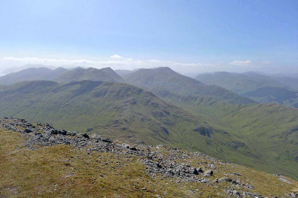
The long ridge forms one side of the huge, wild Coire Sgreamach which drops down towards distant Loch Arkaig. The going was much easier on the grassy ridge and there was even a clear path for much of the way, though perhaps one used more often by deer than human. In the distance down at the bealach I could see quite a few deer gathering as the evening sunlight developed.


Unfortunately it was around this time, about 6 or so hours since setting off, that my left leg started to develop quite a bit of pain and I ended up limping down to the wall marking, presumably, an estate boundary.

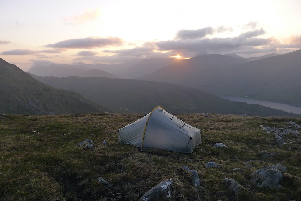
Progress was now slow but I was still keen to get to a decent camping spot so after crossing the wall I headed slowly back uphill and then contoured around to where there was a fine view down Loch Arkaig to the hills of the Rough Bounds. After examing a couple of different spots I settled on a pleasant looking area which offered a grassy spot for the tent and some nearby water. The incredibly dry run of weather meant that I hadn't seen any running water since starting the ascent of Gulvain.

The tent was soon up and I gathered water from the slow seep of bog nearby. Now I could rest my leg and enjoy the long evening, gazing out of the tent window towards Sgurr na Ciche and the other hills above Glen Dessary.

It was a pleasant evening, broken only by the helicopter making a return journey, this time passing almost directly over the tent before heading off to the northeast.
I passed the time by enjoying the views and reading several chapters of The Buried Giant by Kazuo Ishiguro.

Some cloud had built during the evening and the sun disappeared behind it, the light show fizzling out before it ever really got going. After the sun finally disappeared to leave a grey dusk I zipped up the tent and quickly drifted off into a pleasantly deep sleep.
I slept soundly and didn't poke my head out of the tent until around 5:30 the next morning.

I slept for another few hours, finally rousing at 8:30. The weather had changed with cloud descending to give a nearly uniform grey sky. The Munro summits were shrouded.
A short walk around the area showed that my leg pain had not really subsided and so I decided the best course of action was to take the most direct route back to the car, dropping into the glen below and to the east of Gulvain, and heading back out without trying for another summit. I was disappointed but the main thing was to get out of this quite remote area safely and to that end I wanted to give myself as much of the day as possible.

I had a fairly relaxed breakfast, taking my time over coffee, before getting everything packed up and heading off. I first of all ascended the short distance to the top of the rounded hill on which I had camped. Here there were more deer and I came across a fine half antler which got strapped to the bag.

From here I was able to survey my route across the somewhat featureless area that marked the watershed between Gleann Fionnlighe and Glen Mallie. My aim was to follow the lower slopes of Gulvain before making for the forested narrowing of upper Gleann Fionnlighe. I was doubtful I would find much in the way of paths or tracks until I was back on the southern side of Gulvain.
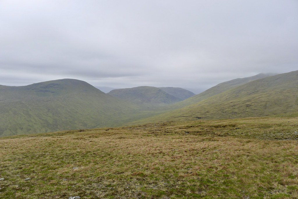
With my leg still painful it was slow but steady progress back down to the wall and then across the pathless, occasionally peat-hag filled terrain at the foot of Gulvain's northeast ridge. I crossed several small streams and was glad to be able to refill my water bottle with fresh, moving burn water.
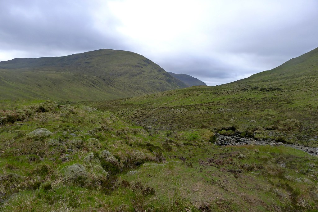
As I drew closer to the small, boggy lochan marking the watershed I could see what looked to be a path or track down in the flatter part of the glen and decided to see what it was like. It turned out to be a track made by trial bikes. Although there was a lot of churn and I had to avoid some of the muddier sections, it still made progress a bit quicker and I followed it as it dropped towards the trees. As I headed south it became increasingly more like a real path which had been torn up by the passing of the bikes.

As I reached the trees the path dropped steeply down to finally reach the river and as the time was around midday I stopped here on the stony banks for lunch, enjoying a final brew of coffee from the stove.
As I was eating I heard voices behind me, and three folk appeared laden down under big backpacks. They had come over the hill from a bothy to the east and were as surprised as I was to see someone in this remote stretch. They continued down the far bank of the river and I was soon following them.

I crossed the river where a small orange flag marked the trail bike crossing and followed the path on the other side, the backpackers now some way in the distance. The path was mostly easy to follow but occassionally seemed to disappear as these things are want to do.
Eventually the land on the east bank steepened and so I crossed back over and then, not finding an obvious path, climbed up the slopes to find the path was now running some way above the river. Once located this once again sped up progress and I found myself looking back up the southern slopes of Gulvain.

My slow but steady progress had brought me back to the track through Gleann Fionnlighe and despite my continuing limp I felt confident of making it back to the car from this point.
The walk out was fairly uneventful. The low cloud briefly started to break but never really turned into full sunshine again. I passed a couple of other people out for a walk but on the whole it was a slow, quiet wander back to the car.
I broke up the journey home with a stop for fish and chips in Tyndrum which was welcome after a very slow crawl through the Friday afternoon traffic in Fort William.
Medical Epilogue: I went to the GP the following Monday and was referred for an ultrasound scan a couple of days later where a second blood clot was found. This explained the onset of pain I experienced late in the afternoon as I headed off Gulvain. As this was the second DVT in a short space of time I was put back onto blood thinners and given advice about compression socks... If anyone else has experience of staying active after a DVT diagnosis I would be very interested to hear from you...