Distance: 18.55km
Ascent: 1219m
Time: 6hrs 56mins (including several long stops)
Hills: The Law (638m), Ben Cleuch (Graham, New Donald, 721m), Ben Buck (679m), Blairdenon Hill (631m), Dumyat (Sub-2000 Marilyn, 418m)
Weather: Early dull overcast skies clearing to bright sunshine, strong icy wind, later cloud again
Route: View on OS Maps
It's a long drive to Tillicoultry from Aberdeen. This fact prompted the first 7am start of the 2011 calendar for the Stocket Hillwalking Club, but luckily it didn't seem to dissuade members or guests from turning out in healthy numbers. The long day would be rewarded with sunshine, piercingly cold winds, and snow, lots of snow.
The drive was broken by a brief stop for enormous bacon butties at The Horn, just beyond Dundee, where legs were stretched underneath crisp blue skies. Unfortunately as we travelled further south and west towards the Central Belt, the skies gradually filled with a low lying blanket of grey cloud. By the time we were driving through Tillicoultry the summits of the southern Ochils were all shrouded in a thick layer of mist that didn't look to have much intention of shifting.
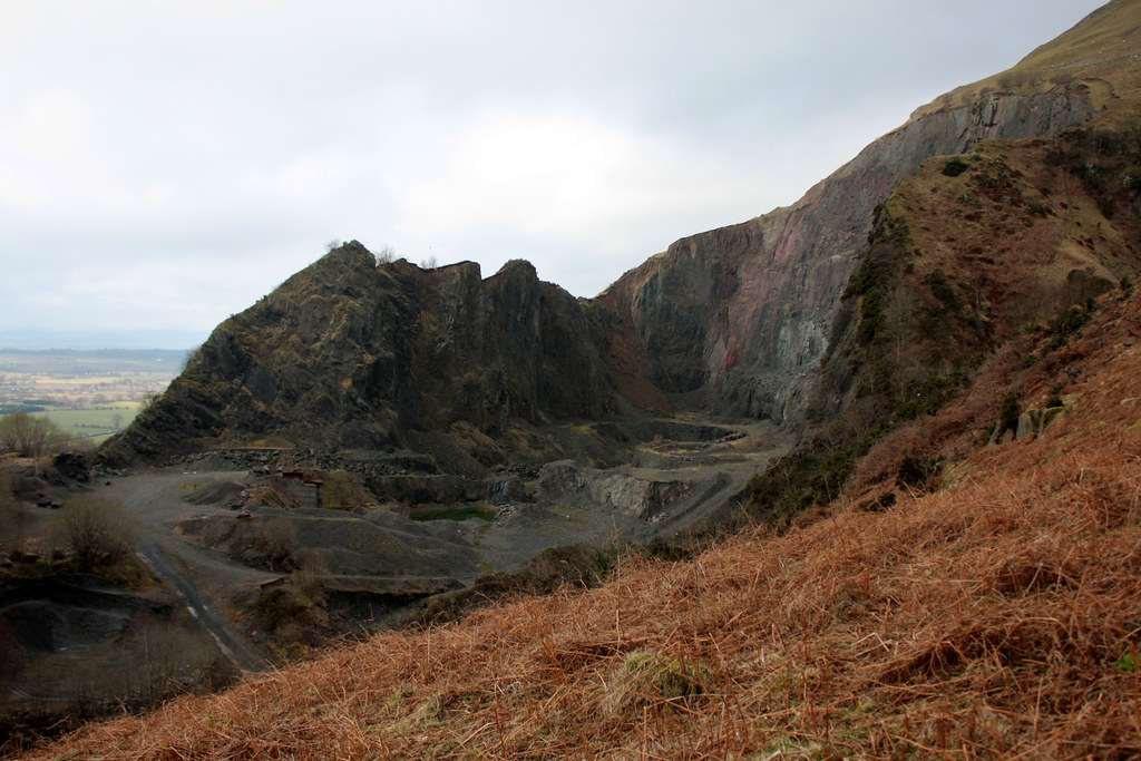
After the long bus ride everyone was raring to go and we were soon threading our way through the back streets of Tillicoultry until we headed up towards Mill Glen. Initially we came to a halt when it turned out that the lower path through the steep-sided glen is currently closed due to dangers of erosion and rockfall. We retraced our steps, finding the higher path which soon had us climbing steeply above the dramatic gorge-like glen down which the Mill Burn tumbles. To our left we had views of the large quarry that has been cut into the lower slopes of Wood Hill.
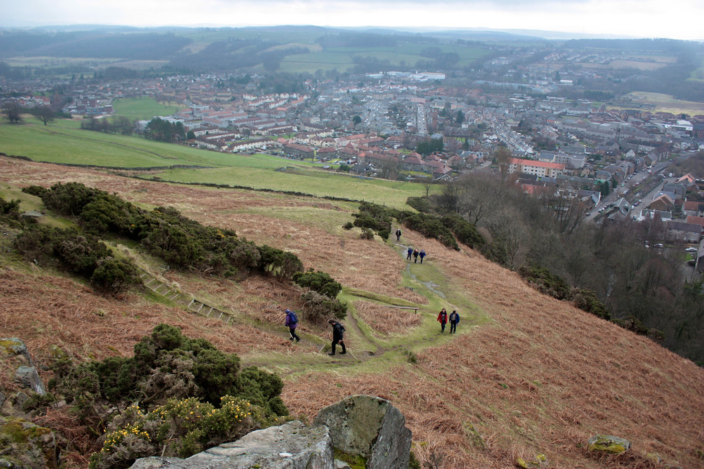
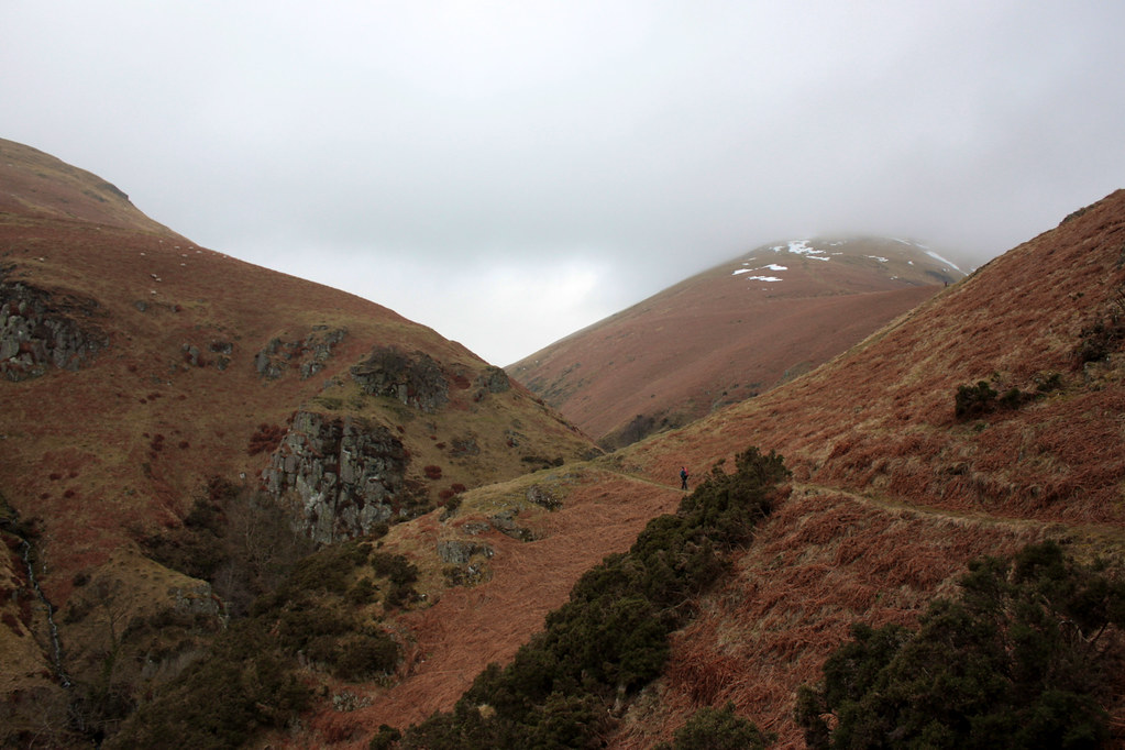
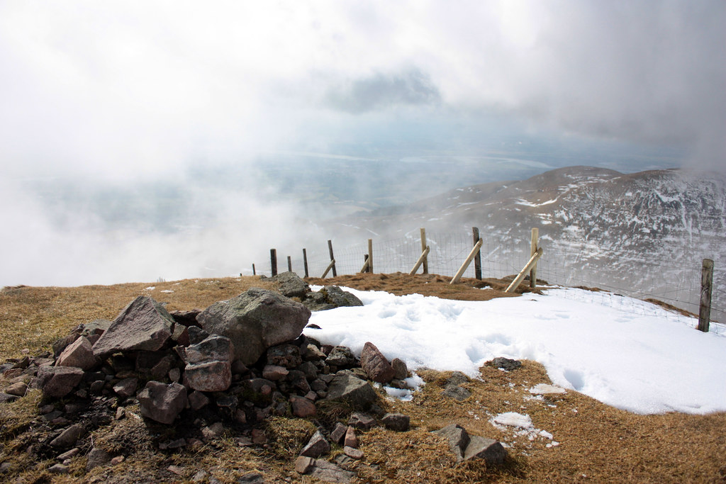
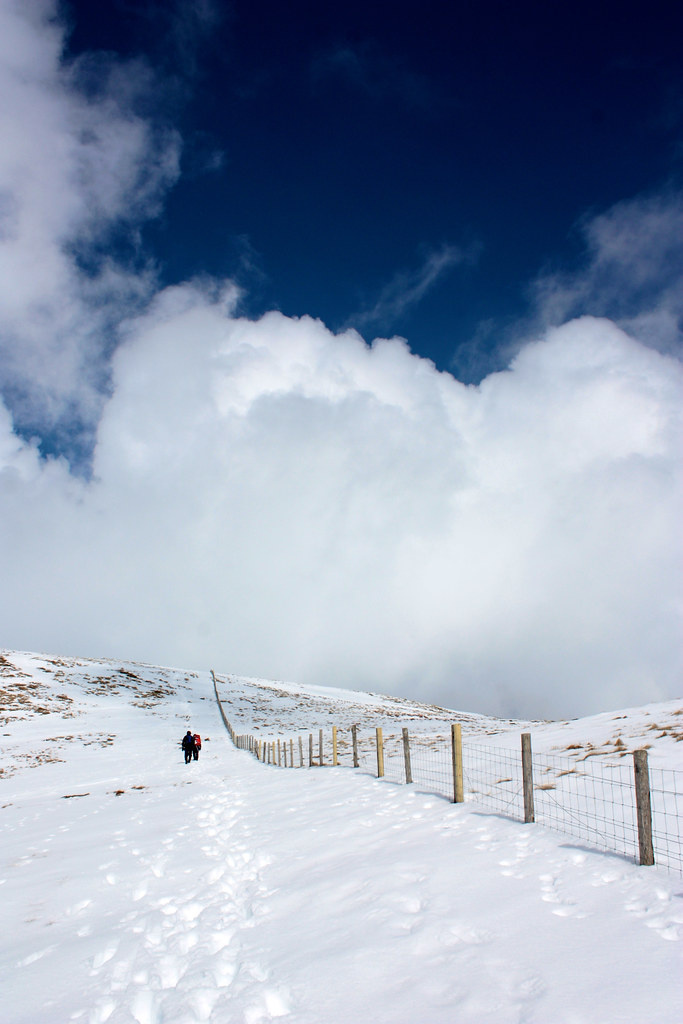
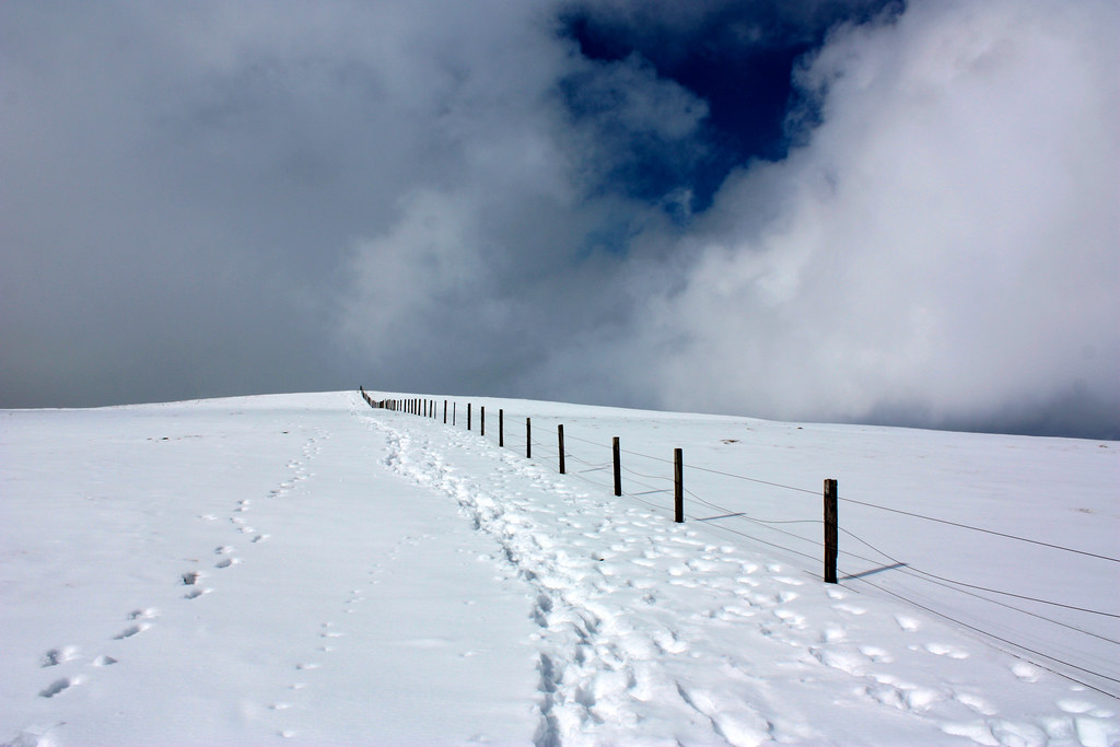
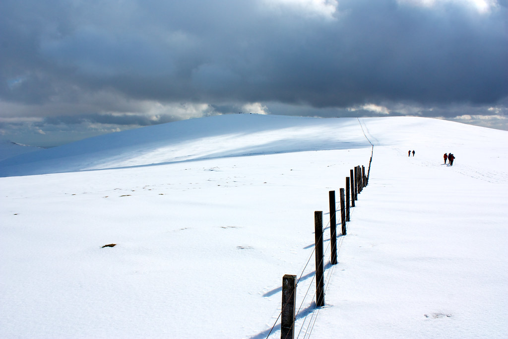
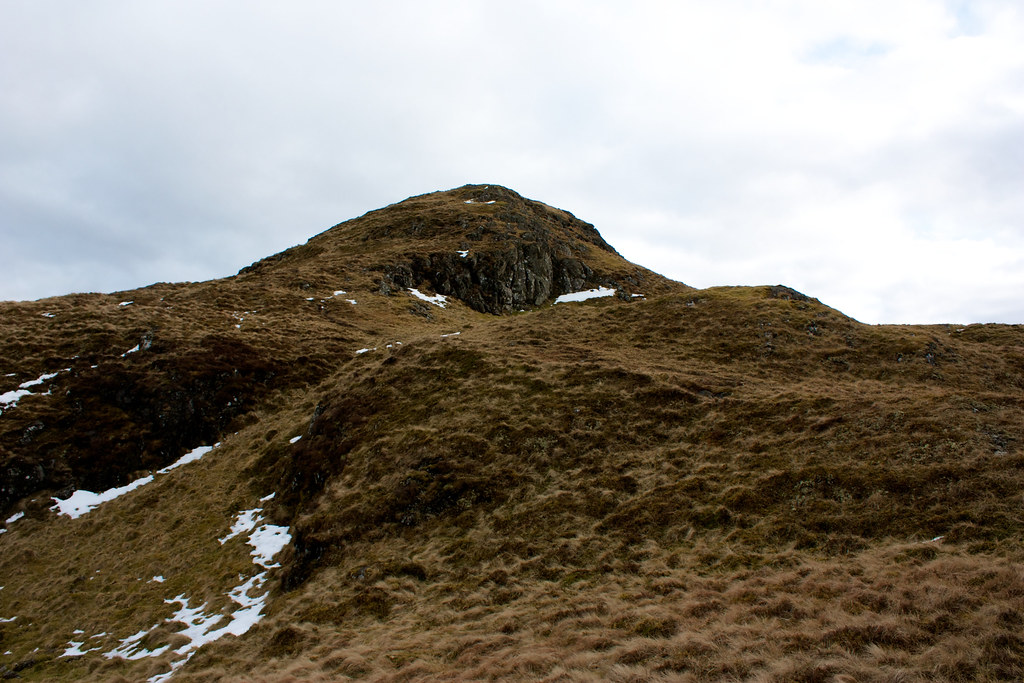
The contouring around to the foot of The Law was fun, the path edging precariously around above a steep drop, and was followed by a scrambly descent to a bridge across the Gannel burn. From here a steep re-ascent took us onto the southern shoulder of The Law where we encountered the first patches of old snow. It was fascinating to be but a few minutes walk from the centre of a reasonably large town and yet feel so out in the wilds, but such is the strange and beguiling nature of the Ochils, particularly on this southern side.
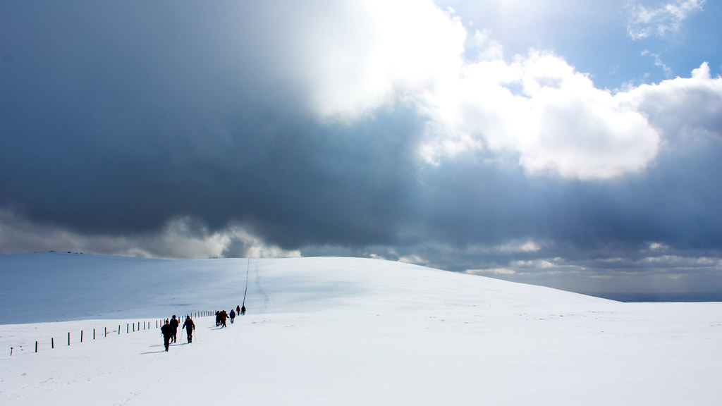
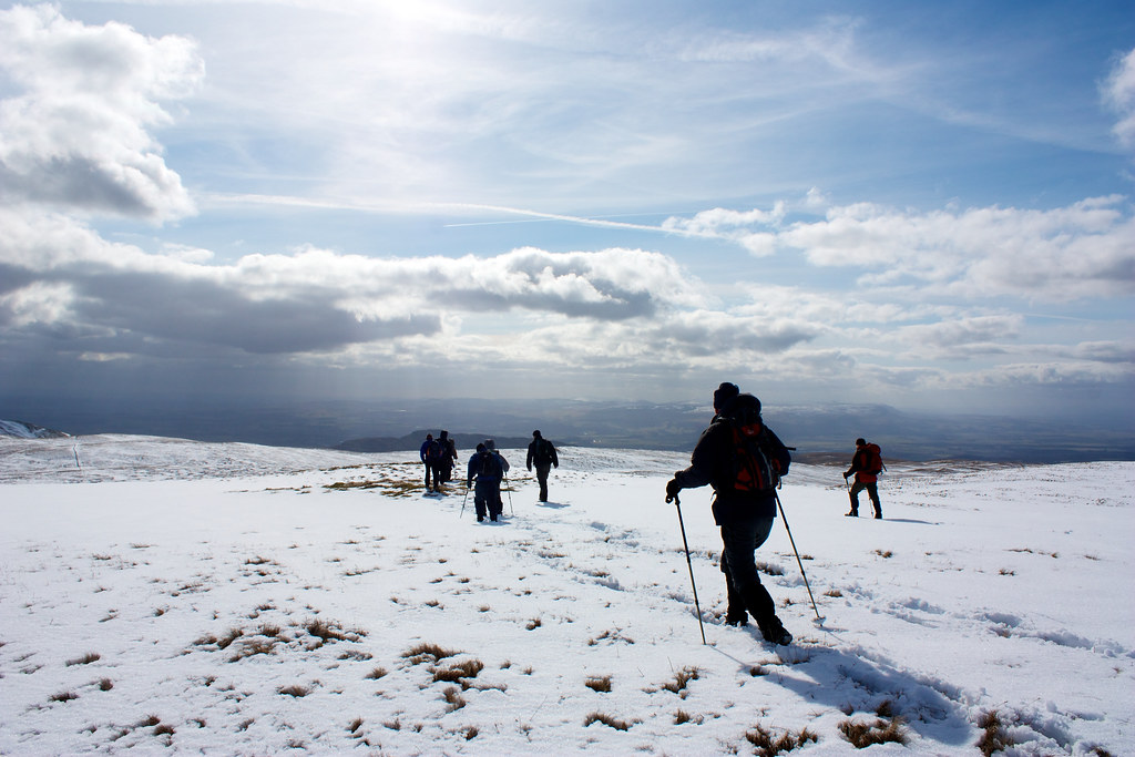
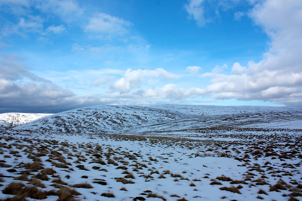
The climb quickly took us into the mist, obscuring views back to the shimmering line of the Forth behind us. The tiny trig point came as welcome relief from the viewless climb but I didn't hang around there long as the wind was very strong and deeply cold, carrying the feel of snow and ice on it. The final slopes up to the summit had been through deep snow. On the east side, sheltered from the wind, the snow was a bit softer and there was a pause here for tea and food whilst everyone regrouped.
As the first to arrive I had the longest wait, but it was worth it as by the time we were ready to depart, the clouds were blowing through and bright patches of sunlight began to illuminate the surrounding hills. By the time we started to make our way along the connecting ridge between The Law and the col below Ben Cleuch there was bright sunshine and stunning views north and east into the heart of the Ochils.
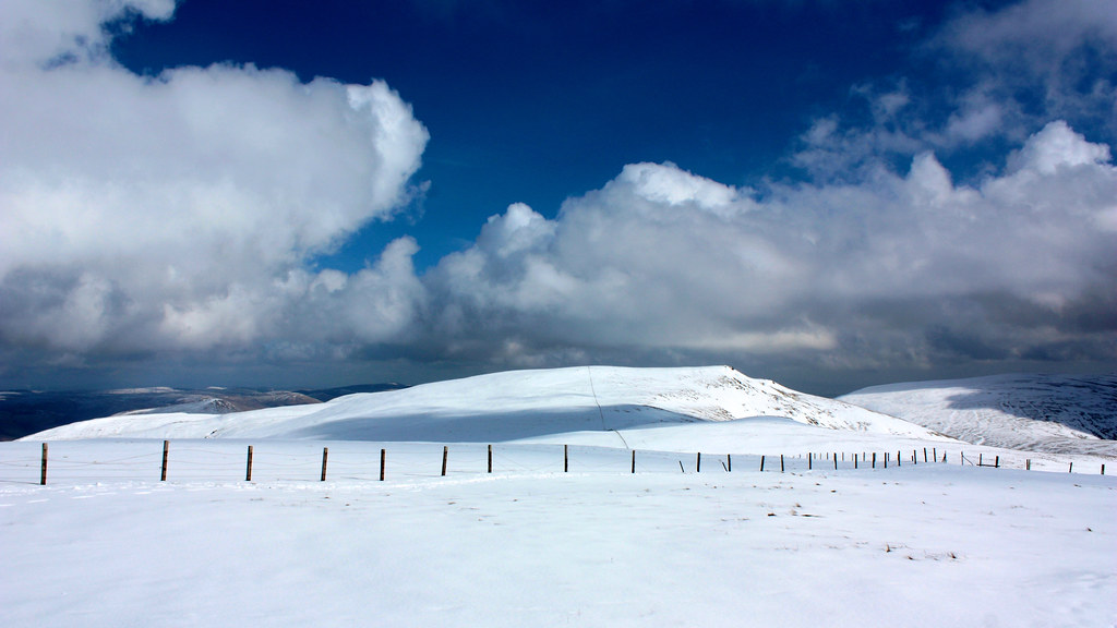
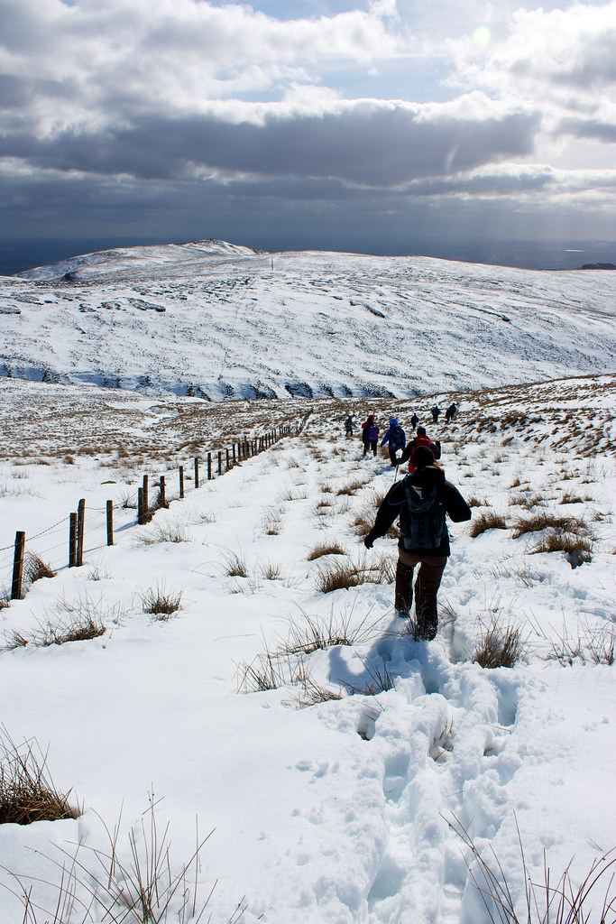
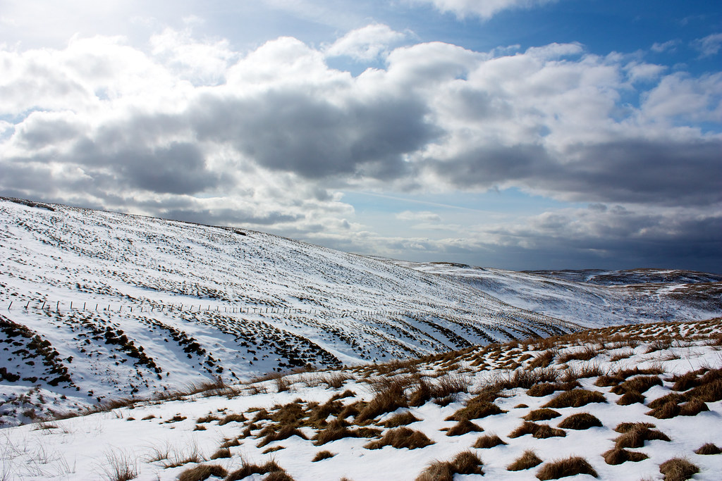
The deep snow made the going tough and we stuck to single file, driving a good furrow along what was already a well trodden ridgeline. The route follows the line of a new looking fence; these seem to be something of a feature up on these hills for we would be following or crossing them for a great part of the day.
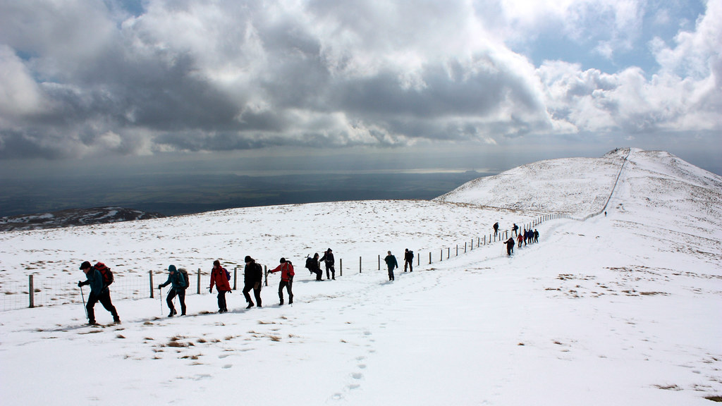
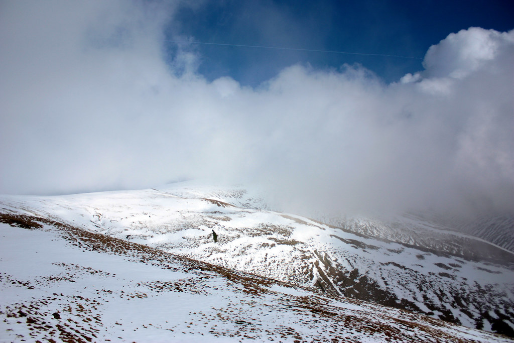
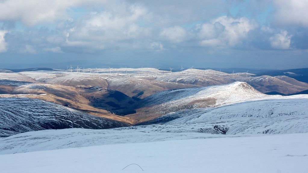
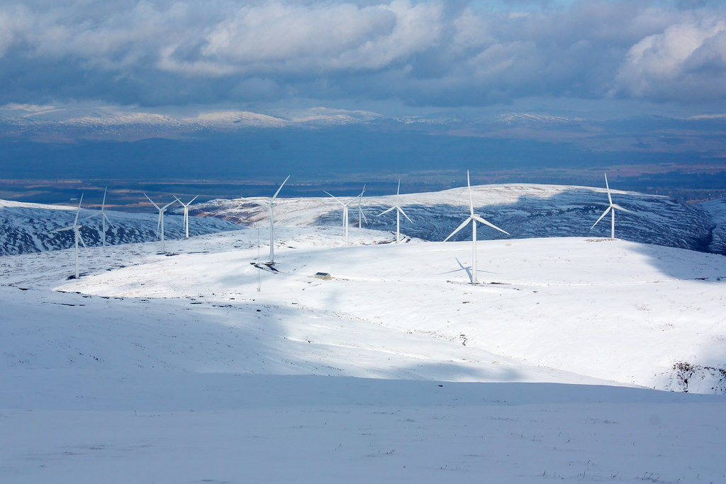
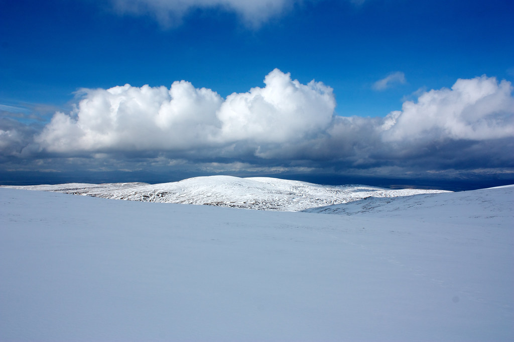
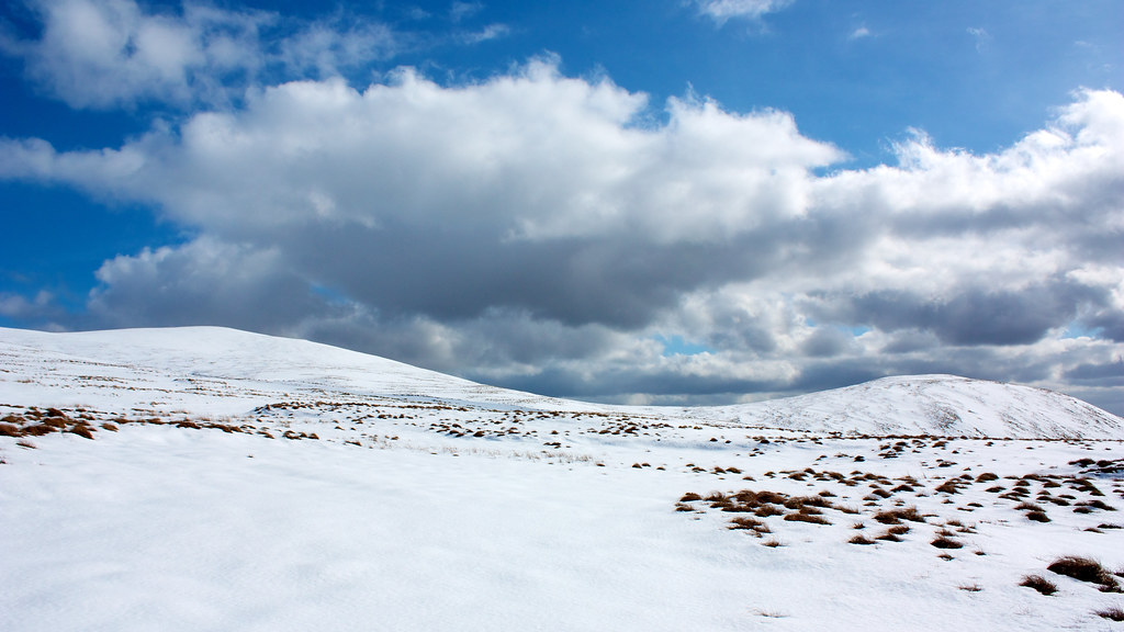
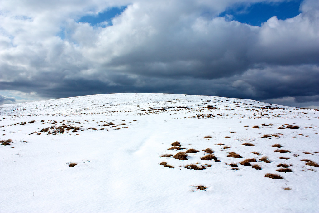
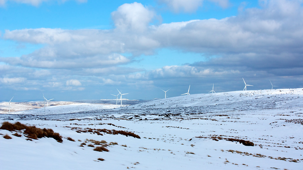
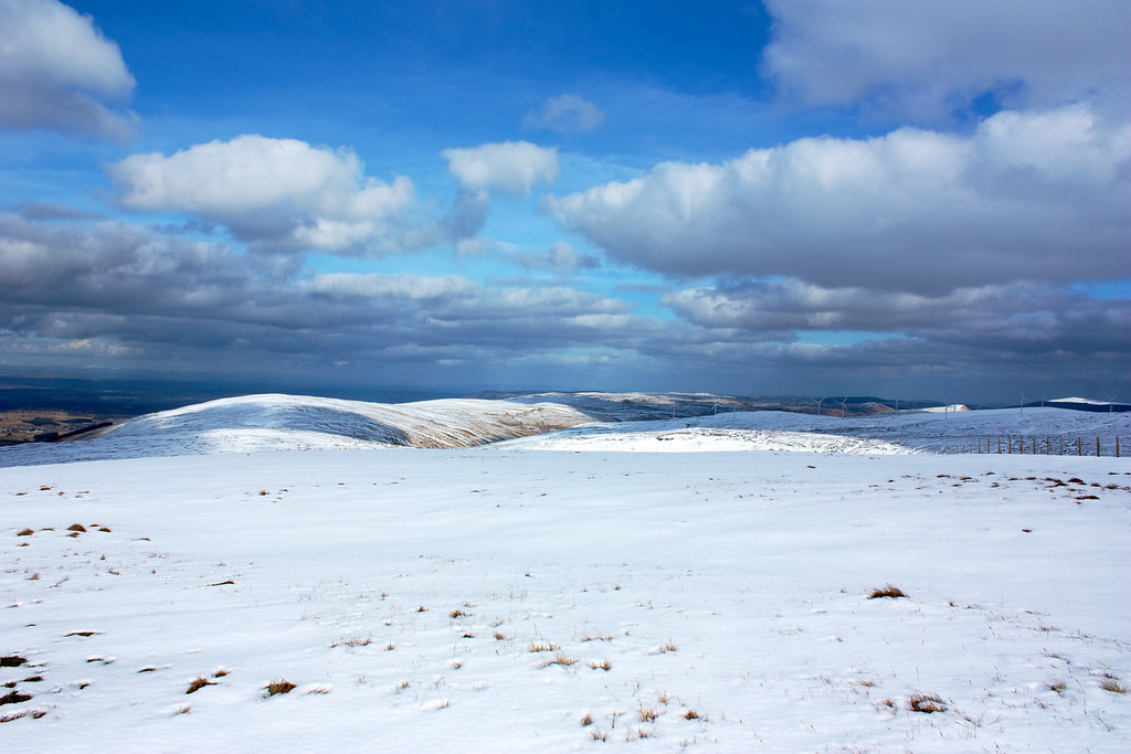
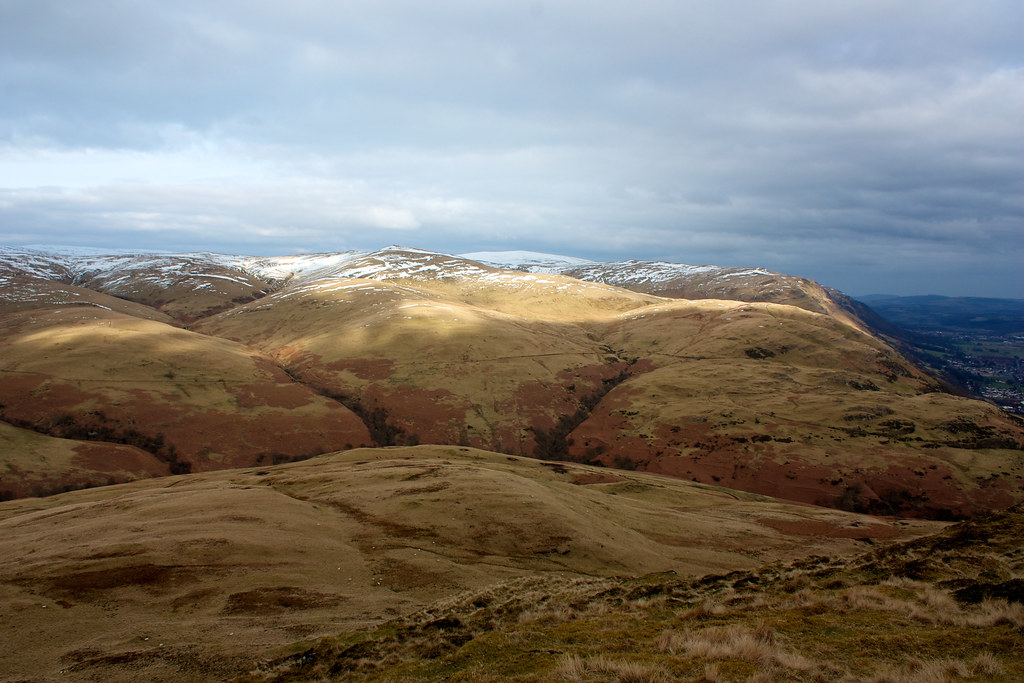
The gentle ascent of Ben Cleuch offered more snowy delights, with the added pleasure of views across the wide snowy range of hills running north into Perthshire. Two of the windfarms which sit deep in the heart of the Ochils were now visible, their white arms spinning gracefully in the strong wind. The skies were now a bold and brilliant blue, setting off the pristine white snow perfectly.
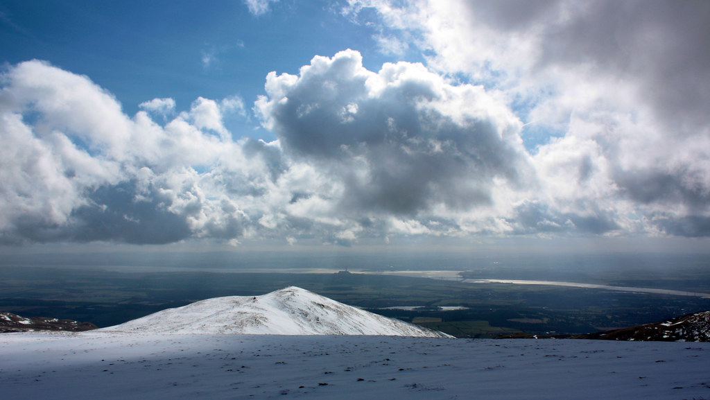
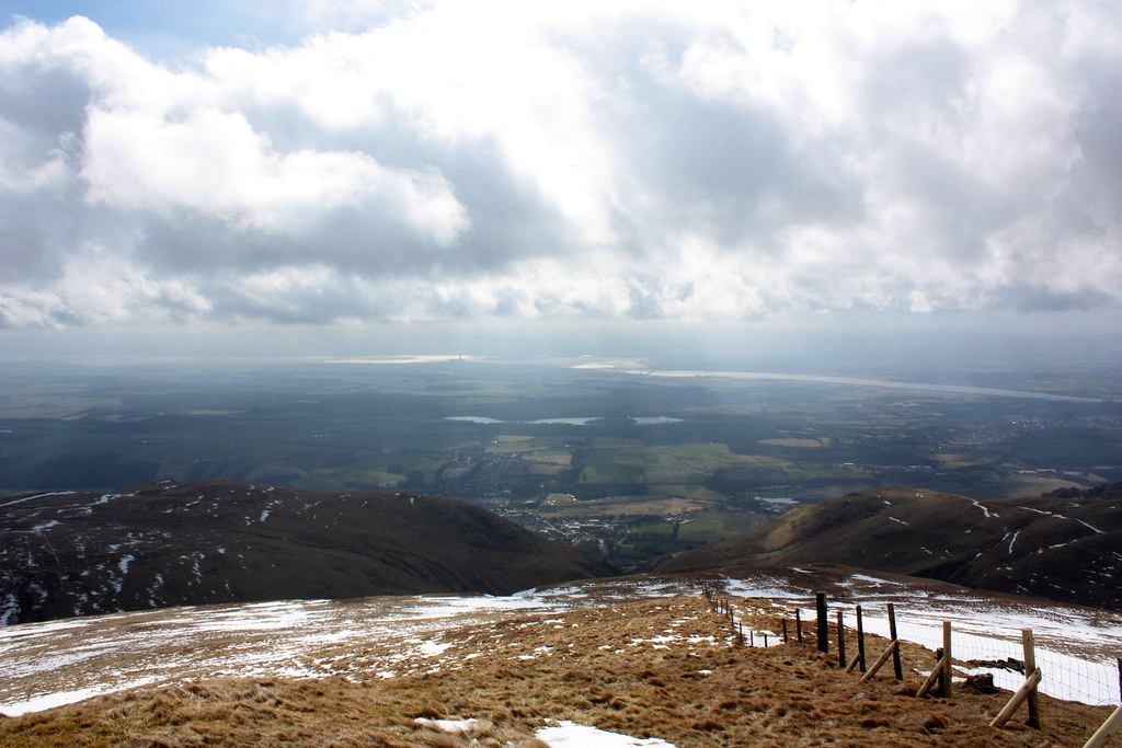
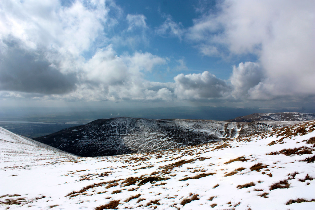
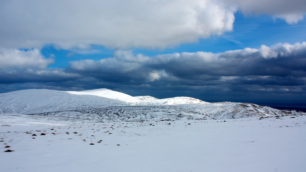
At the summit of Ben Cleuch (a Graham at 721m) we enjoyed panoramic views down the long twisting length of the Forth, and further north to higher hills. Nowhere looked to be quite as clear and sunny as our hill though.
Up until now we had been following a well trodden path, but whilst a deep furrow led up to Ben Cleuch from the east, only one set of footprints could be seen heading off the summit to the west. As we were completing a traverse it was westward that we headed about to find out just how deep the undisturbed snow was.
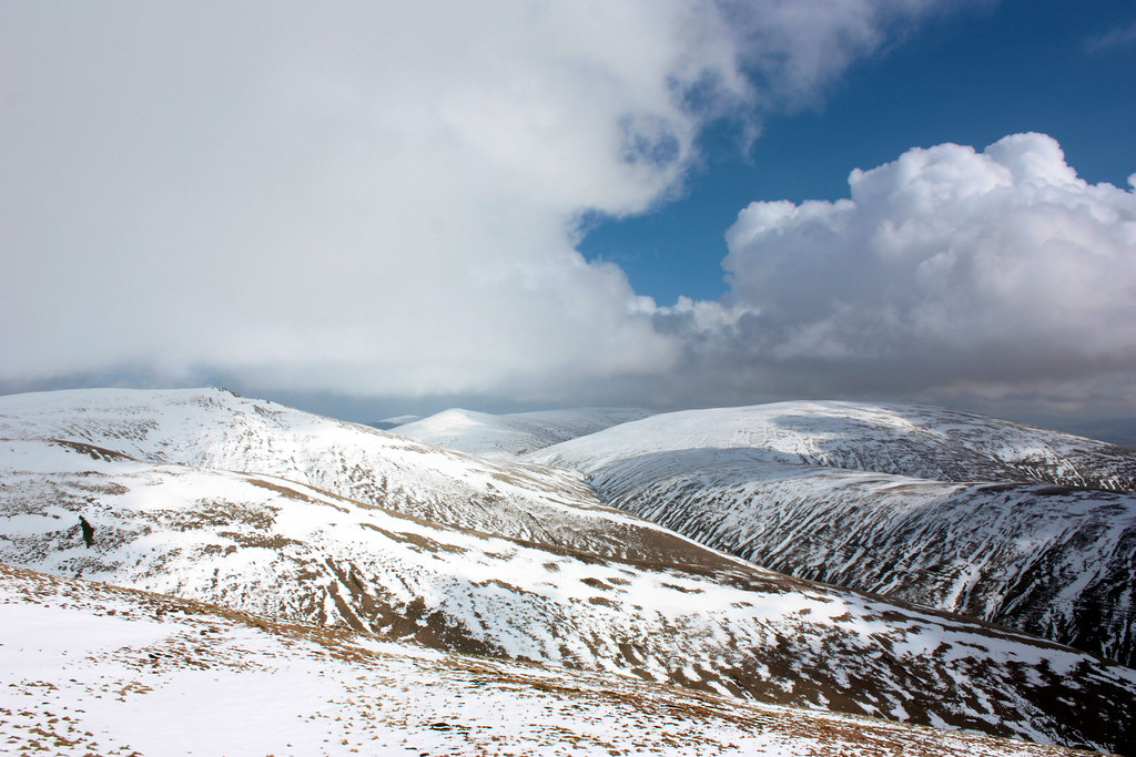
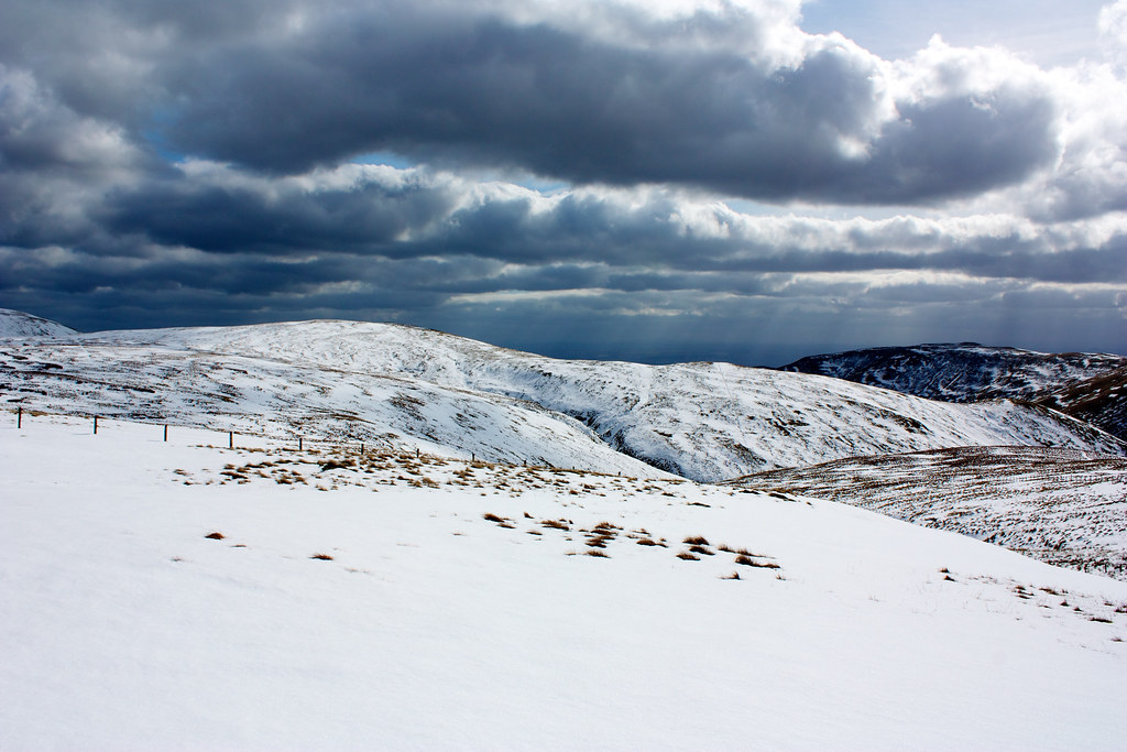
It was quite a deceptively long crossing on a broad ridge to reach the next hill of the day, Ben Buck. With the unceasing wind we didn't wait around on its summit too long, but now dropped down off Ben Buck into the wide area of boggy land separating us from the next hill, Blairdenon Hill. This was easily the most arduous part of the day with the deep snow hiding even deeper bogs, burns and holes. I think it's fair to say that most people went up to their knees or waist at least once, the snow pouring over boots whether or not gaiters were in use.
We slowly turned towards the eastern end of Blairdenon Hill where a slight depression gave us sufficient shelter for a brief lunch stop. This was a good opportunity to dislodge a lot of the ice which had built up inside the rim of my boots! Luckily the chorizo and olive houmous rolls had sufficient spice to warm me back up!
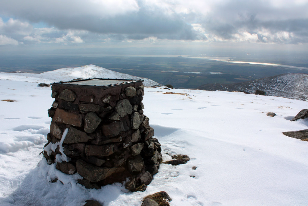
From the lunch spot it wasn't far up to the eastern end of Blairdenon Hill where we paused at the small cairn to admire the view. Here a few folk decided to leave the high ground and take the vehicle track into Alva to wait for the bus there. We continued on though, finally reaching the true summit of Blairdenon Hill.
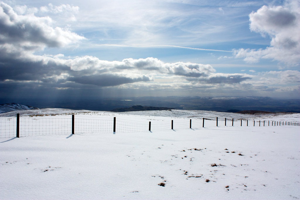
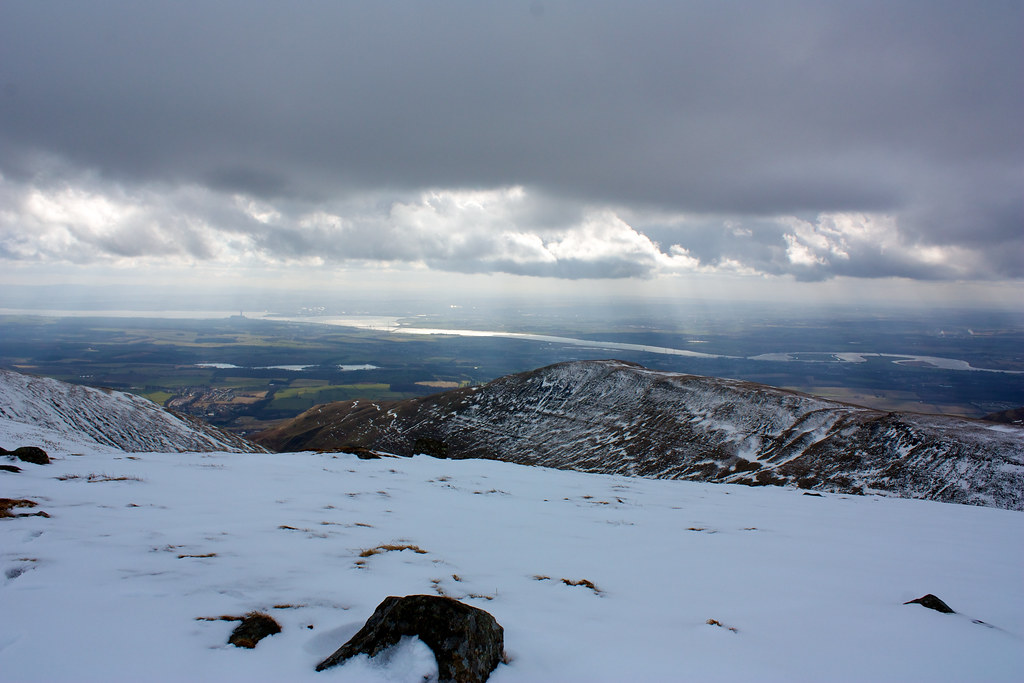
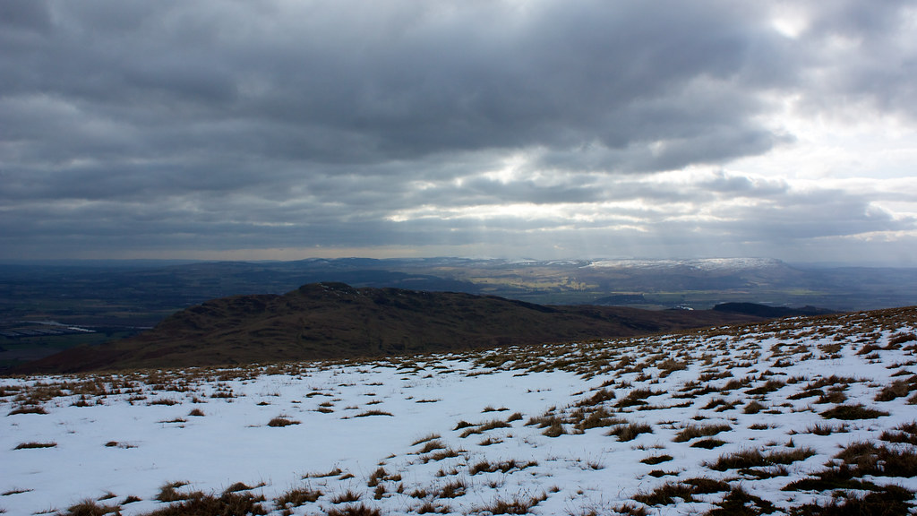
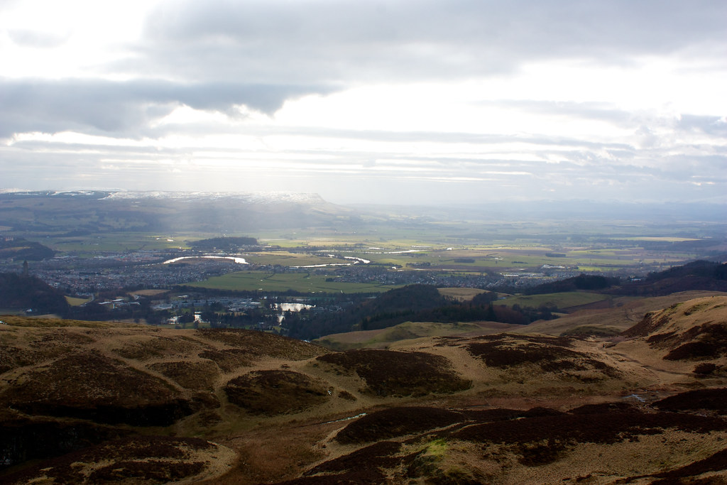
Another fence line was now followed as we dropped steeply south off the hill. By this time the clouds had started reforming leading to some dramatic light over the lowlands.
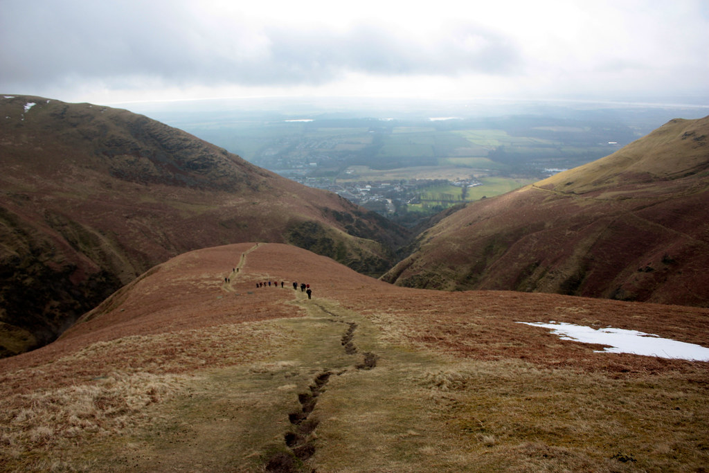
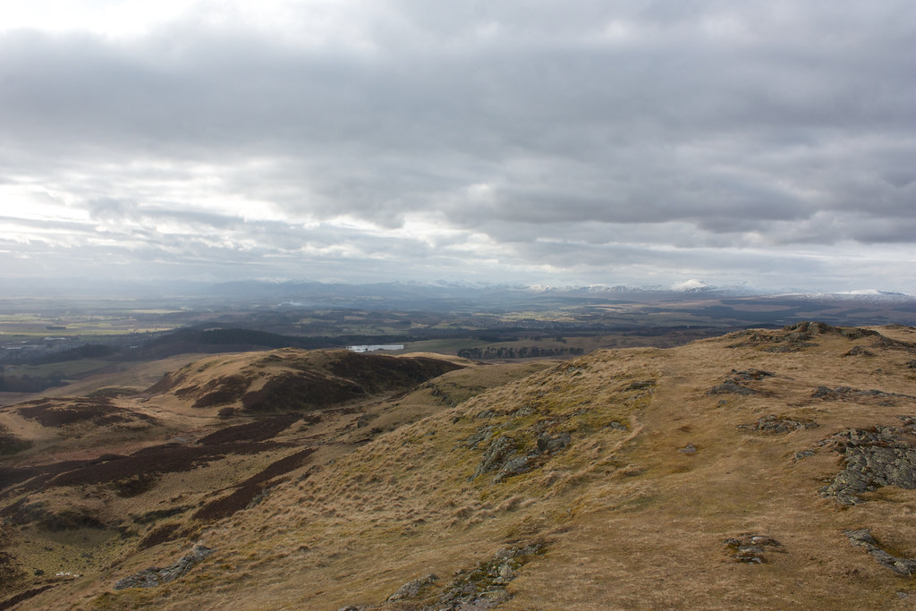
After crossing the Old Wharry Burn we contoured around the boggy land between Big Hunt Hill and Bengengie Hill, slowly losing height and with it much of the snow cover. By the time we came out below Loss Hill we were mainly walking on damp grass under gloomy skies. Ahead of us we now had our final target of the day Dumyat.
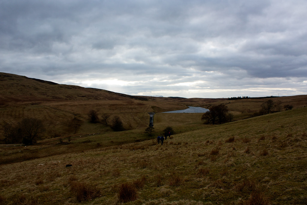
We dropped down towards the Lossburn Reservoir which involved a slightly convoluted route down a muddy bank, across a barbed wire fence near an old ruined farmhouse and then a slight pull back up to drier ground before we made it to the outflow.
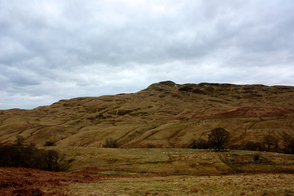
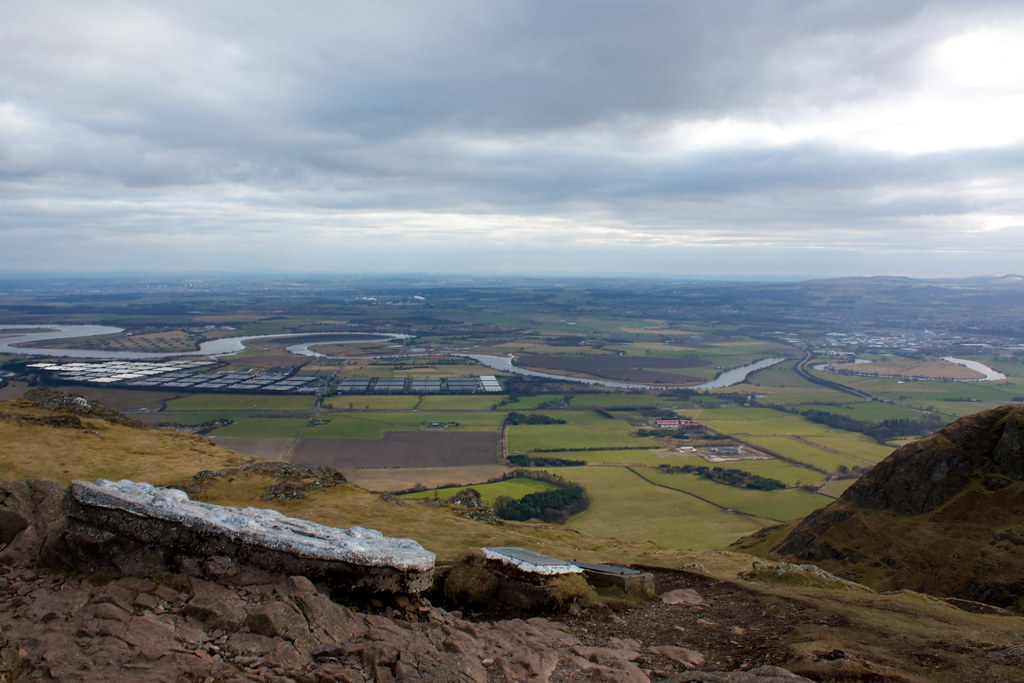
From here a well constructed vehicle track led us up on to the northern slopes of Dumyat, a steep wee hill, clearly showing its volcanic origins, which sits just above Stirling. A well trodden path took us all the way up to the west end of the summit area where it was just a short walk along to the beacon tower and the trig point.
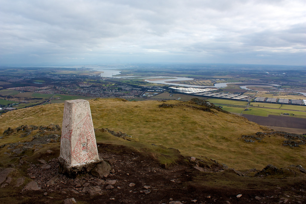
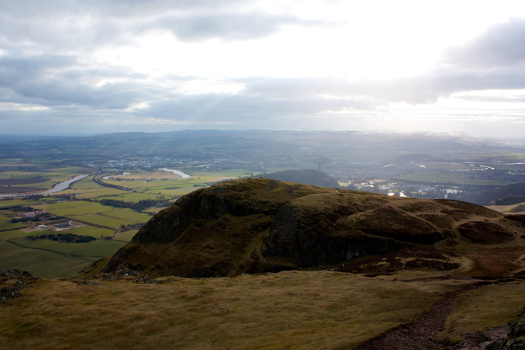
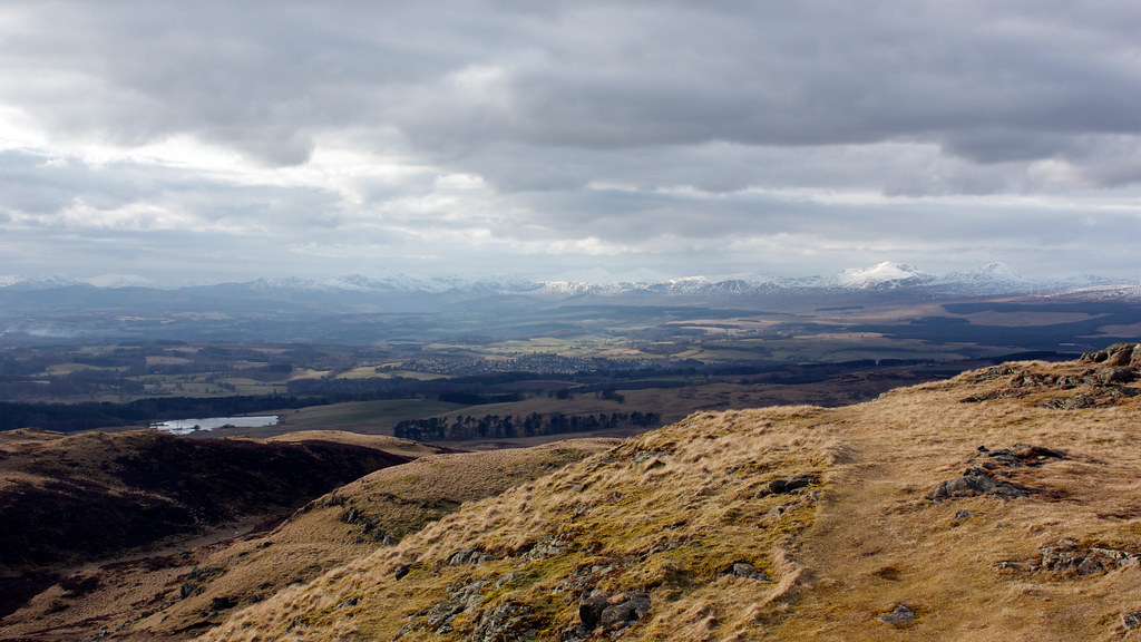
This was my second time up Dumyat and the views were definitely better this time, with shafts of sunlight scattered across the Forth floodplain, the Carse of Stirling and away over the Campsie Fells towards Glasgow. To the west and north a long march of mountains could be seen, the giants of the Southern Highlands, from Ben Lomond around to Ben Vorlich above Loch Earn. It showed the strange nature of the little Ochils, which stand prominently well south of the Highland Boundary Fault. It also offered a good viewpoint down the length of the Hillfoots, back to Tillicoultry where we had started.
After a final refreshment break, enjoying the views, it was off down the steep eastern side of the hill until the land flattened out and we dropped down into the village of Menstrie where the coach and the pub was waiting for us. For an 11 mile walk it had felt a lot longer and a lot tougher thanks to the deep snow, but the great views has more than made up for any slight numbness in the toes. I must remember the gaiters next time!