 Joe Dorward is passionate about that corner of the Cairngorm Mountains, largely west and north of the village of Braemar in Aberdeenshire, which is known as the upland of Mar. Beginning with camping holidays to the area as a young boy, he has spent many enjoyable days exploring the rivers and glens of this rambling area of rough moorland and heathery hills, and is gradually constructing his guide to them, a fabulous website called the the upland of Mar.
For anyone who has walked in this area (and the popularity of Eas Dé (known as the Linn) and the Central Cairngorms means that this will be many) the website is a trove of wonderful knowledge, photos and history and well worth spending some time exploring. It has sketch maps (with corrected place names), photographs, videos, articles on geological features, as well as critical reviews of books that concern themselves with the area, such as the writings of the Scottish naturalist Seton Gordon, and much more.
Though now largely owned by the National Trust for Scotland, the upland of Mar was a former vast estate owned by the Earls Fife and has an interesting history both where human habitation is concerned, and in terms of the geology, with the landscape still bearing the scars of ice age glaciation. The website is concerned with all corners of this part of the country; from the River Dé through to the ruins of places like Geldie Lodge.
The book which has been titled Lowdown on the upland of Mar is a distilled version, a field guide, that brings together the detailed information contained within the website. As such, if you are familiar with the content of the website, then you will find much of the same material repeated in the book. Joe principally structures the book by following major geographic features, the rivers and glens of the region, pursuing each one as it cuts its course into the high Cairngorm mountains. He covers prominent features - including farms, shielings and lodges; the rivers, streams and lochs; and bridges and dams - tracing their course and development through historical writings taken from a diverse range of sources, as well as more recent scholarly studies. Historical maps, including the first Ordnance Survey maps of the area are also referred to. Using these he builds up a rich and detailed picture of this fascinating part of Scotland that many hillwalkers, mountain bikers and climbers will be familiar with.
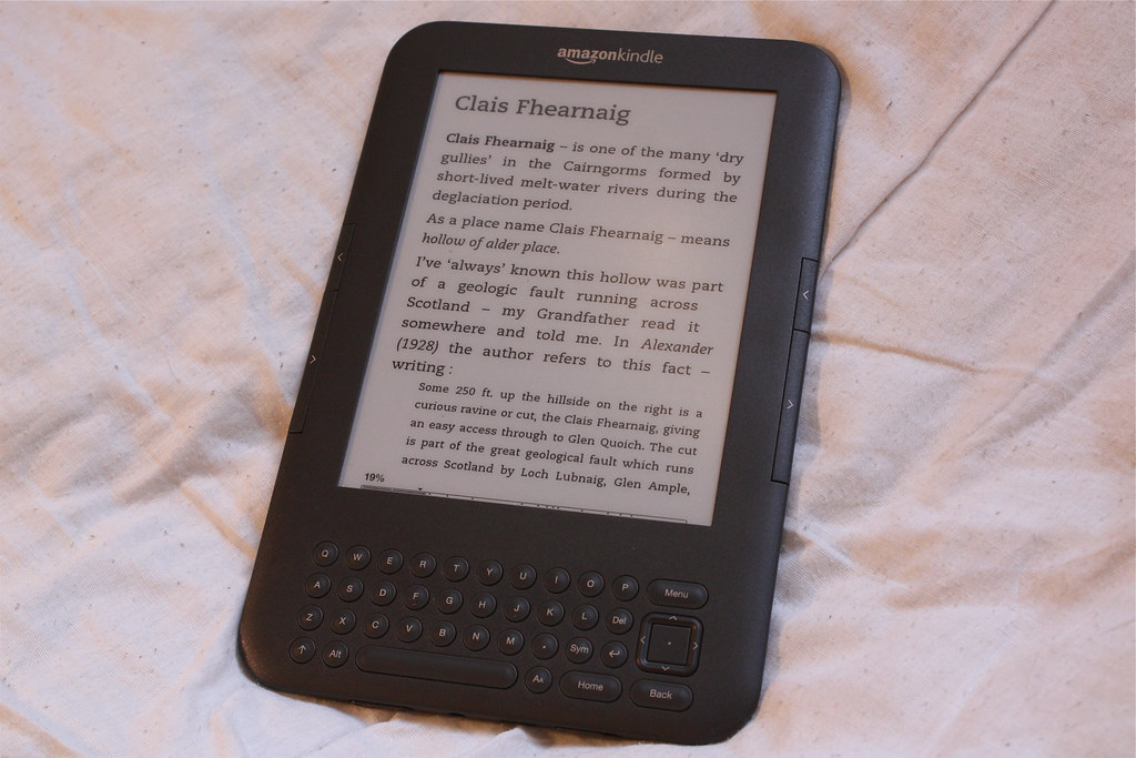
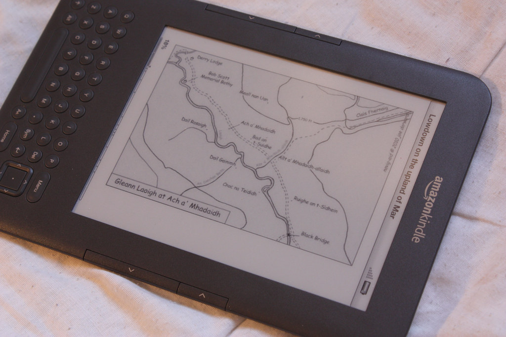
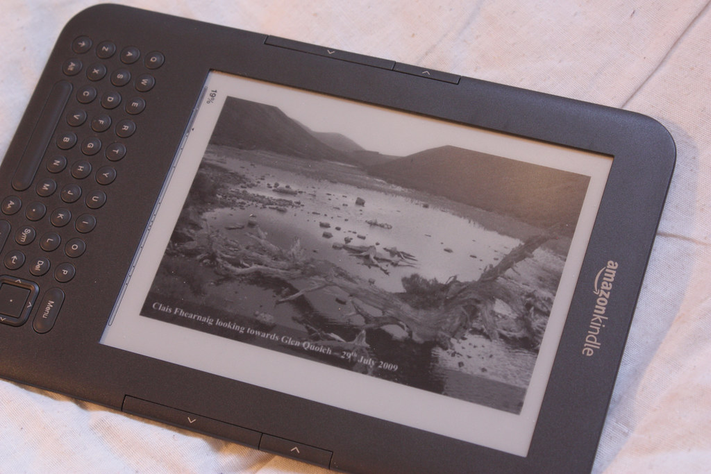
Joe has chosen to publish the book via Amazon's Kindle platform, though you don't actually need a Kindle to read it (Amazon provide apps for several of the major operating systems and mobile platforms). The ebook is just over 100 pages long and includes a selection of photographs and illustrations from the website, the reproduction of which is good on my 3rd generation Kindle (see the photos accompanying this review). Whilst the sketch maps are in black and white, the clarity is excellent and the black and white photographs are clear enough to provide illustration for the book. Full colour, higher resolution versions of the maps and photographs are available on the website should you need better reproduction, as well as in the Kindle desktop and mobiles versions.
Though it is primarily intended to be used as a guide whilst out walking and exploring in the area, the book itself makes a good stand-alone read. It includes an interesting introduction as well as notes on some of the Scots and Gaelic language used throughout. As an avid Cairngorm wanderer, I am familiar with many of the places covered by Joe's book, and I enjoyed discovering more of the history of the area including some entertaining "tall tales" associated with people and places. I feel that even those who aren't familiar with the area, but who enjoy the history of people and places, would gain something from reading this book, particularly if they have the OS map spread out in front of them to follow the contours of the land. It is a book as much about local history as it is about local landscape. It does however concern itself with the minutiae of the area, and details individual crofts and side streams as they are encountered.
The book is well written with Joe easily combining different sources, as well as his own voice, to create a coherent narrative and the only area of criticism is that often the lists of place names and translations get to be a little repetitive (though this is symptomatic of Gaelic place names in general, rather than anything Joe has done). As with any Kindle book it is somewhat time-consuming to flick back and foreword to refer to the maps. I have found it easier to read the book either in conjunction with the website, or with the relevant OS map to hand. Though arguably the same content is largely available on the website, it is nice to have it presented in a book-format where the information flows naturally from one area to the next without the constant clicking that website navigation involves.
I did come across a couple of strange formatting issues (titles spread across a couple of pages) which I have let Joe know about and which should should be addressed in the next revision of the book (that is, if they are a widespread issue and not just confined to my own copy). These do not detract from reading the book and I have come across no issues with the text itself.
If you are interested in purchasing your own copy of Lowdown on the upland of Mar, or trying out a sample chapter, then please go to Joe's website which has links to the book's page on both Amazon.co.uk and Amazon.com. Currently the ebook retails for £7.99 on Amazon.co.uk and Joe notes on the website that proceeds from the sale of the book supports the continuing research into history and geography of the upland of Mar.
As a footnote I must admit that I am as guilty as anyone else of simply repeating the Anglicised and corrupted spellings used by the Ordnance Survey on their maps. My blog reports cover the Lairig Ghru (Làirig Dhrù), Glen Lui (Glen Laoigh), Glen Ey (Glen Eidh), the River Dee (Dé) and many, many more. Reading this book has made me want to try and improve this aspect going forward, as well as revisiting old reports to get the names right!