Date: 23rd June 2012
Distance: 31.42km
Ascent: 1,410m
Time: 10hrs 15min (including several breakfast stops!)
Hills: Beinn a' Chlaideimh (Ex-Munro, 914m)
Weather: Early bright skies, mild, later on low cloud and humid with brief rain showers
Route: View on OS Maps
Aberdeen on Friday evening was warm and muggy with a constant threat of precipitation in the air. Carting my backpack, change of clothes and barbeque provisions up the long hill of King’s Gate to the Atholl Hotel was certainly a good warm up for the weekend and it was a relief to get hold of a cold pint of beer whilst we waited for everyone to assemble. Recent tales of backpacking and camping were swapped and possible side-excursions for the day were discussed. We had a chat through the various weather forecasts and chose the most optimistic one for the next day’s walking.
We pulled out of Aberdeen at 11pm, the streets shimmering with rain that was now falling quite heavily. The dark rainclouds blotted out the lingering light in the north and the thrum of the coach engine soon sent me to sleep. The harsh white lights of the twenty-four hour superstore at Inverness were a brief interruption but the next thing I knew we were turning off the Ullapool road onto the narrow road that threads its way across the moor towards Dundonnell. Cars parked besides the road signalled our arrival at Corrie Hallie where stiff legs were stretched out and yawns stifled.
The rain had cleared up after Inverness and already a pale blue glow was cast across the landscape by the approaching dawn. People briefly considered head torches but as eyes grew accustomed to the gloaming it was clear they wouldn’t be needed. The arrival of a few midgies hurried final preparations and then we were off, heading back up the road slightly to pick up the turning for the start of the walk.
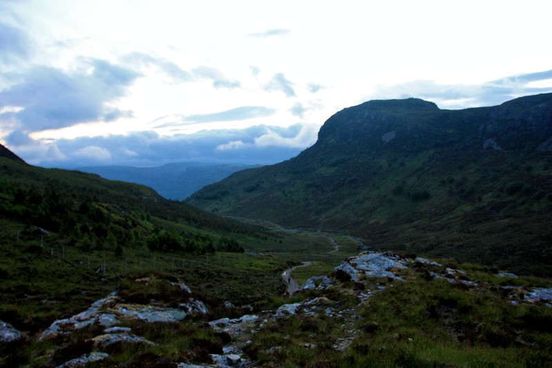
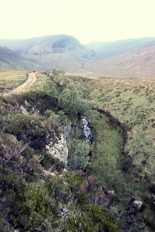
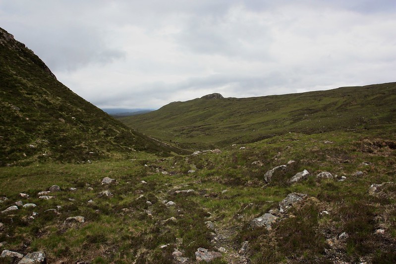
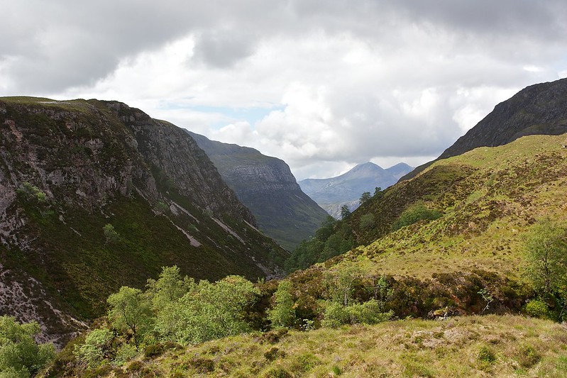
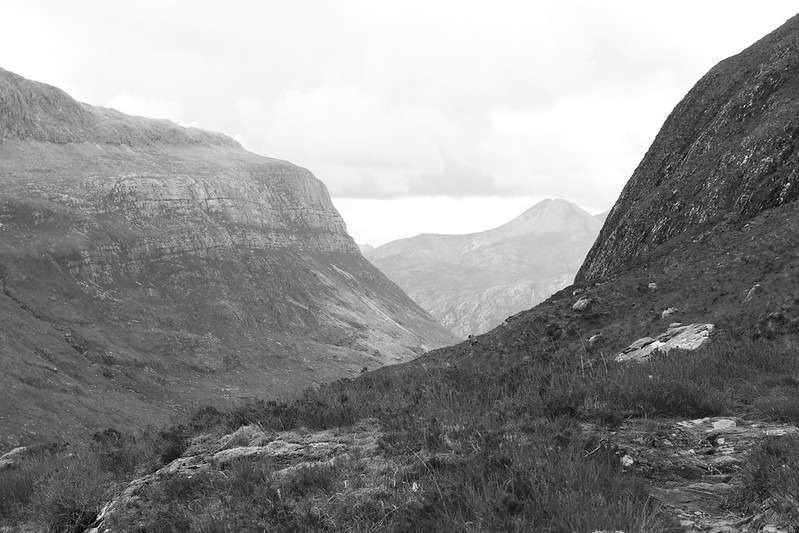
Anyone who has completed a round of the Munros will likely know this track for it heads into the famous bothy of Shenaval below An Teallach. Here many people stay a night before tackling a round of the Fisherfield mountains or An Teallach itself. It’s a good landrover track that climbs quite steeply up besides a wooded gorge. The sound of the stream tumbling between rocks was the only sound besides the crunch of boots. It was that quiet hour before dawn.
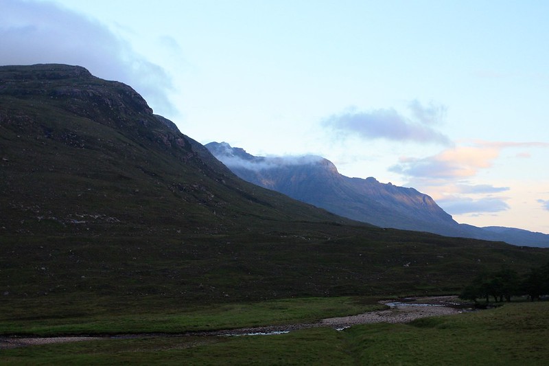
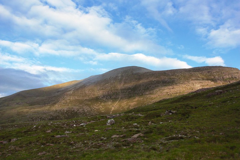
We crested the climb below Carn na Canaich just as the sun rose. Sadly a layer of cloud in the north east hid the disc from view but for a few moments the sky was lit by a watery red-orange light. Ahead of us the Fisherfield hills were shrouded in cloud, only the occasional dark prow of a mountain could be glimpsed through the swirling mists.
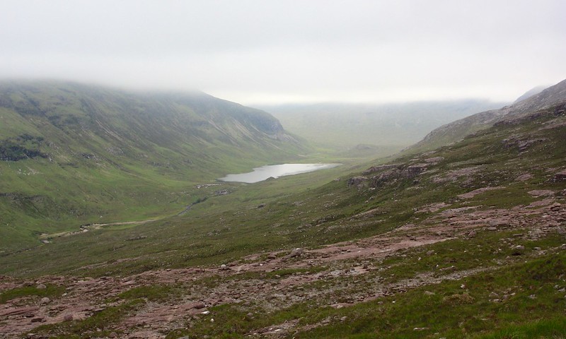
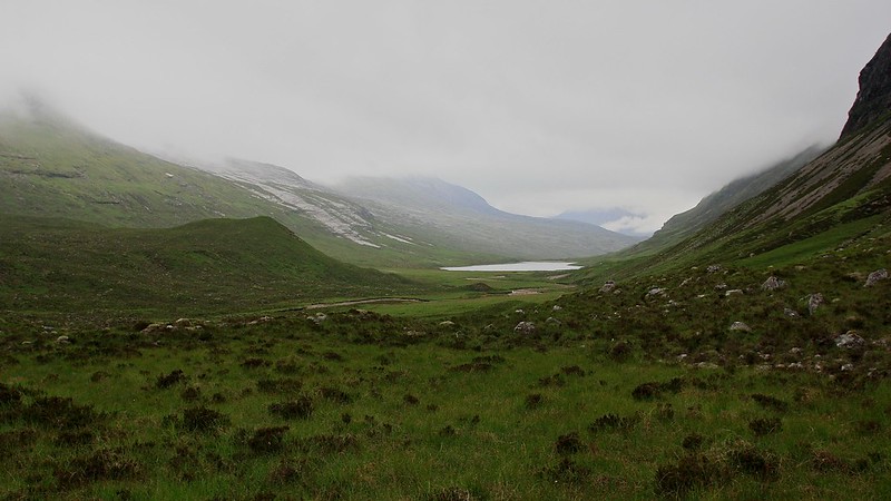
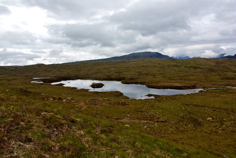
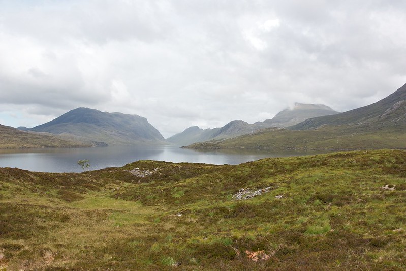
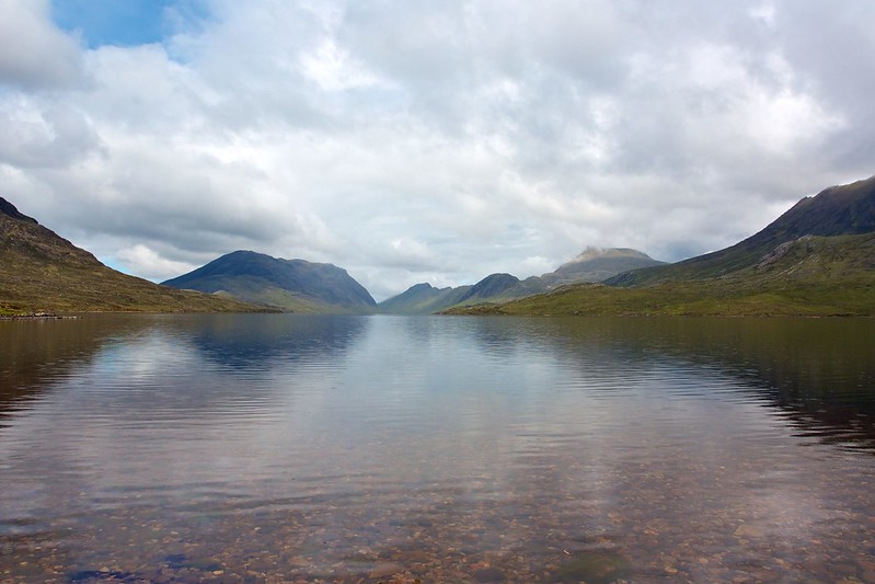
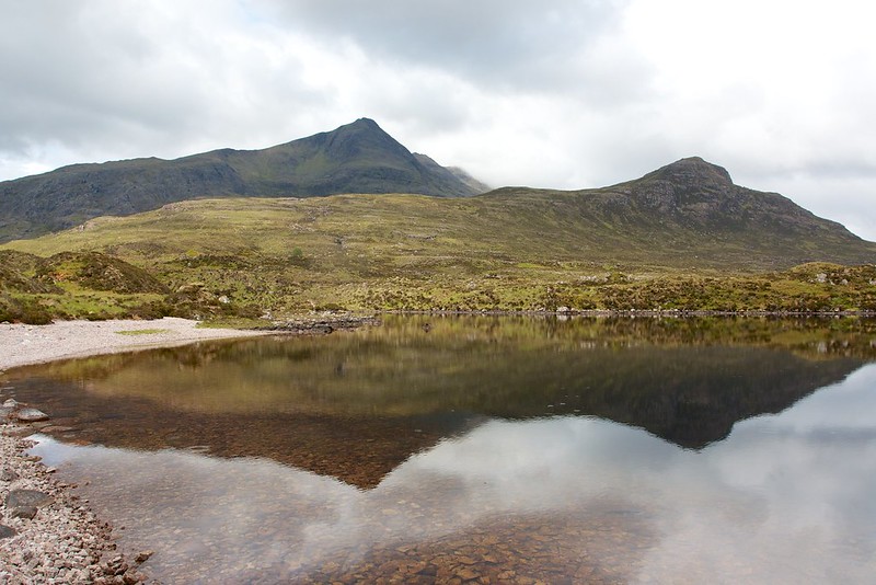
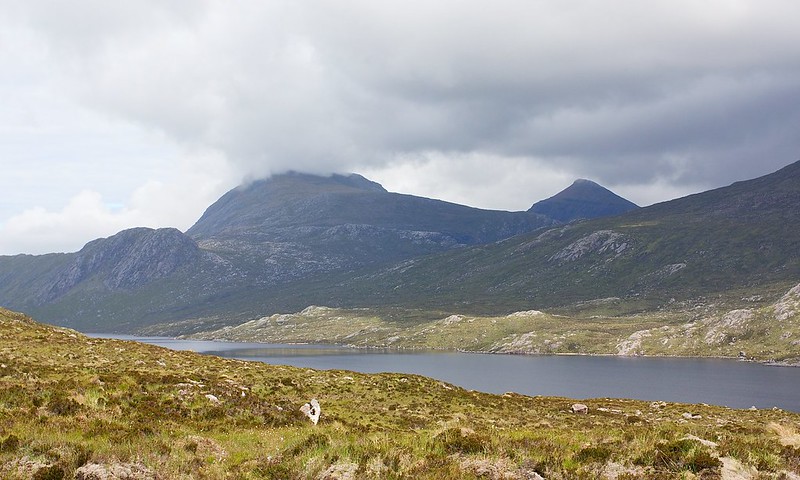
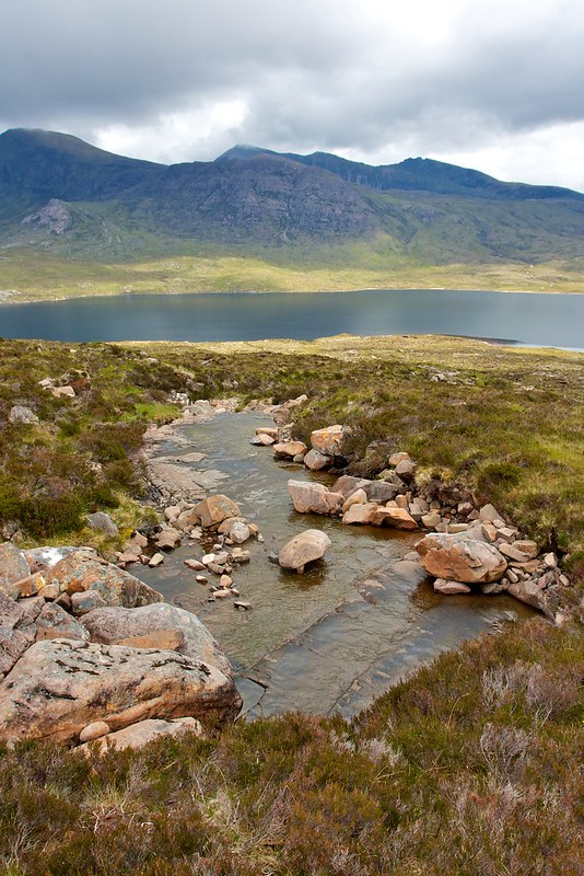
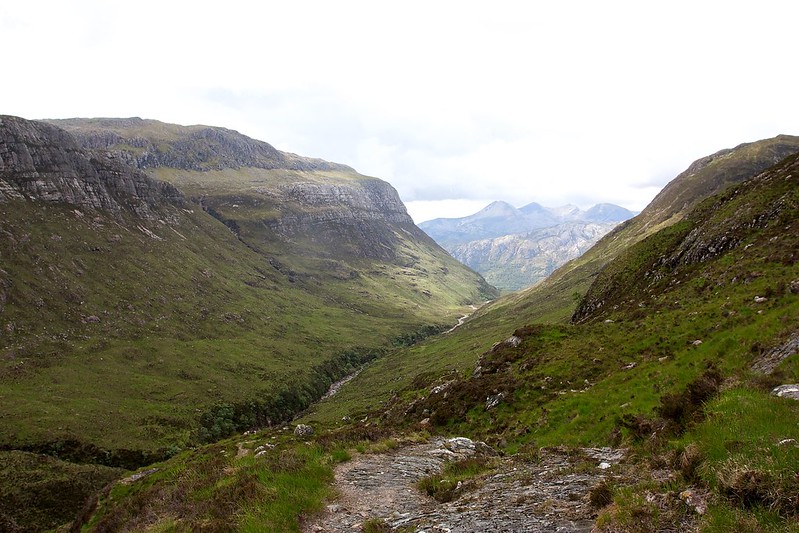
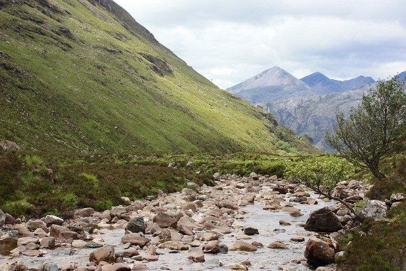
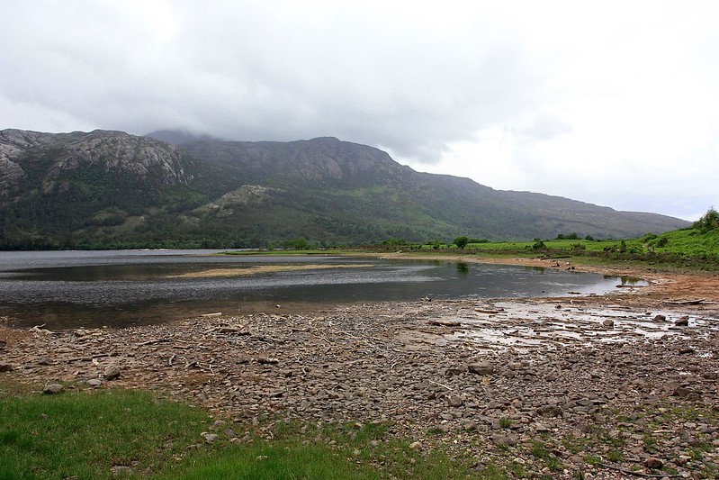
We passed the turn-off to Shenaval and continued on, threading our way through a watery landscape of lochan and bog. Dropping into Strath na Sealga took us besides another water course where this time a brief pause gave us the sight and sound of a pair of Ringed Ouzels, a less common relative of the Blackbird. The views down to Loch na Sealga were spectacular, the river winding its way down the grassy strath which is dotted with clumps of trees and the barest hints of human civilisation: the landrover track, a locked building and some stone foundations of earlier settlements.
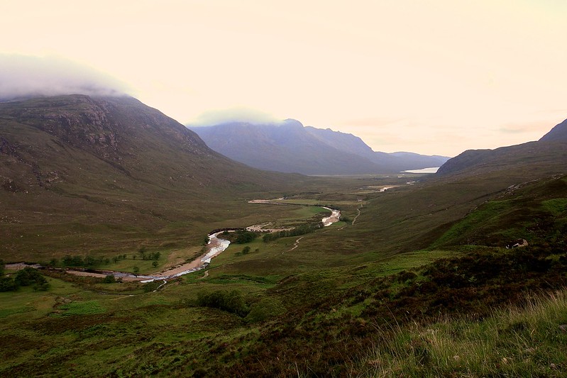
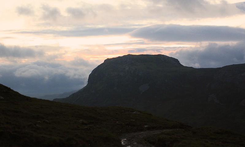
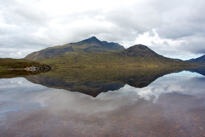
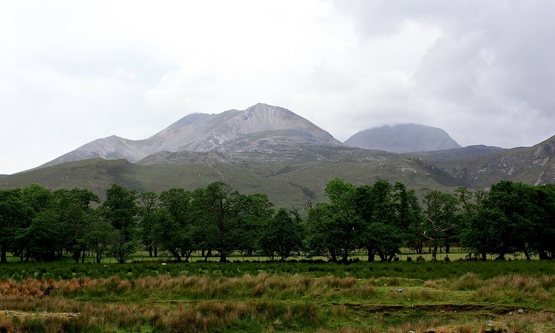
Above the loch, An Teallach, the iconic mountain which sits above Dundonnell, had a cap of cloud but was slowly being revealed. Down near the river we found a ruined shieling to sit amongst and enjoy a quick break. The views up the Strath were spectacular and it was only the appearance of the dreaded midgies that got us moving again.
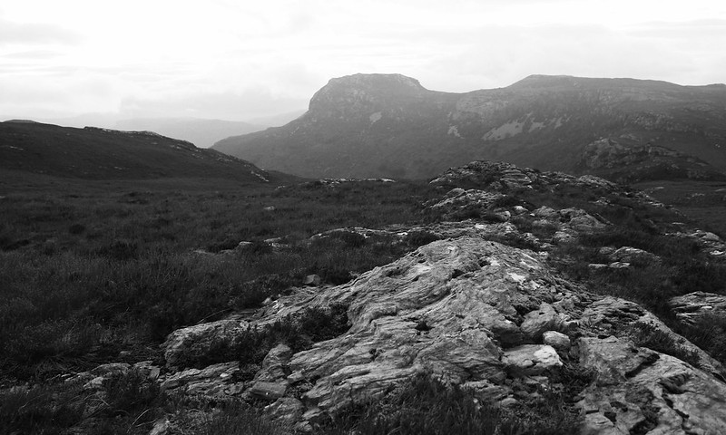
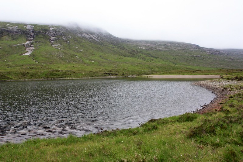
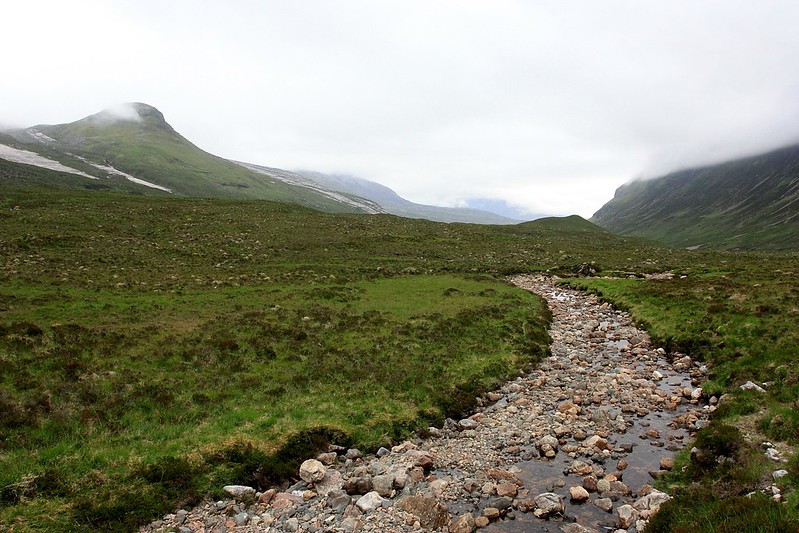
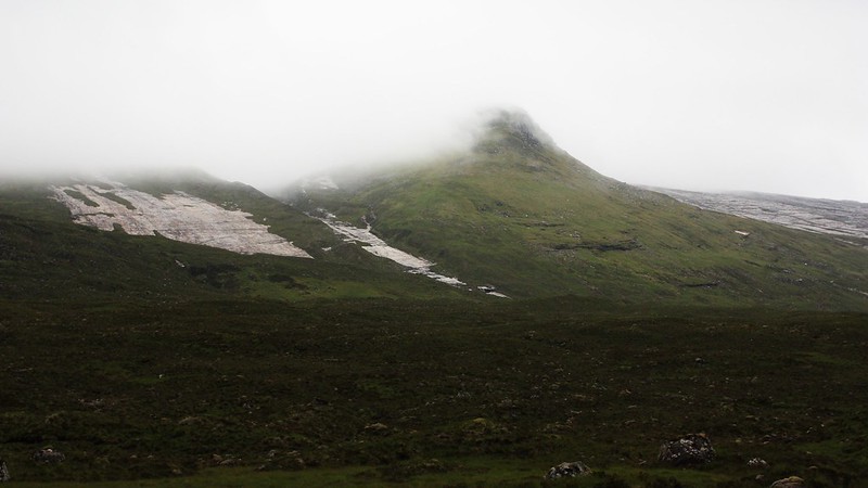
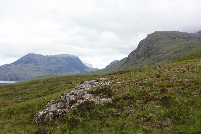
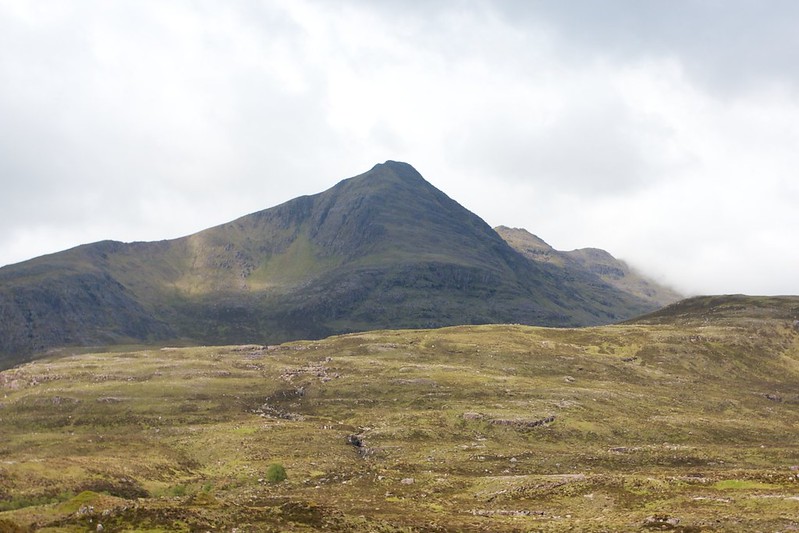
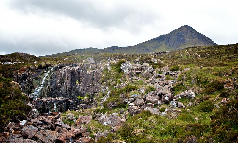
With the summits now cloud free I decided to detour away from the group who were heading along the good track to Loch an Nid. I fancied making an excursion up onto the Fisherfield ridge with the idea of taking in a few of the summits if the weather held. As it happens the northerly summit was the one recently demoted from Munro status by the evil workings of the Munro Society. It remains an integral part of the ridge though so whatever its actual height I was going to head up and over it before continuing my way south. After easily fording the abhainn the initial slopes were grassy, occasionally broken by ribbons of rock. Higher up I reached a lumpy plateau which gave good views to the clear summit of Beinn a’ Chlaideimh.
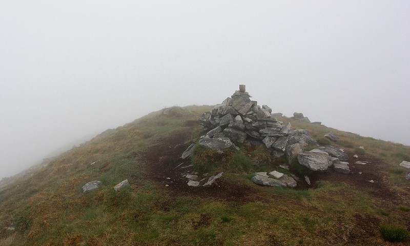
The northern end of this hill is steep and craggy but I could pick out a grassy route up a steep ramp that should bring me up just north of the summit ridge. This proved to be the case and as I ascended up the ramp a path appeared which I followed up very steep slopes. As I crested the ridge the cloud, which I had seen drift in from the northwest and rapidly envelop An Teallach, reached me and the perfect visibility was reduced to a peasouper in a matter of seconds. I carried on up the bouldery slopes to reach the narrow, grassy summit ridge and this I followed over three tops to reach the cairn at the far end.

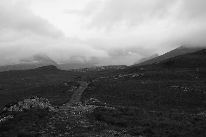
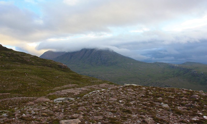
The conditions were fairly miserable and if there are mountains in this land that I want to get a view from, then they are these ones. Looking at the map I decided to follow the ridge down and then look for a route back down to Loch an Nid from the low point before the steep pull back up to Sgurr Ban. In the end the mist was disorientating and the ridge more complicated than the map implied. I ended up following a path that rapidly disappeared amongst rocky slopes and when I checked my compass I found I had come off the ridge to the east. Rather than climb back up to the ridge I took a bearing due east and followed that downhill until I emerged from below the clouds and saw Loch an Nid not far away. My diversion was at an end and the great Fisherfield Munros would have to wait for another day.
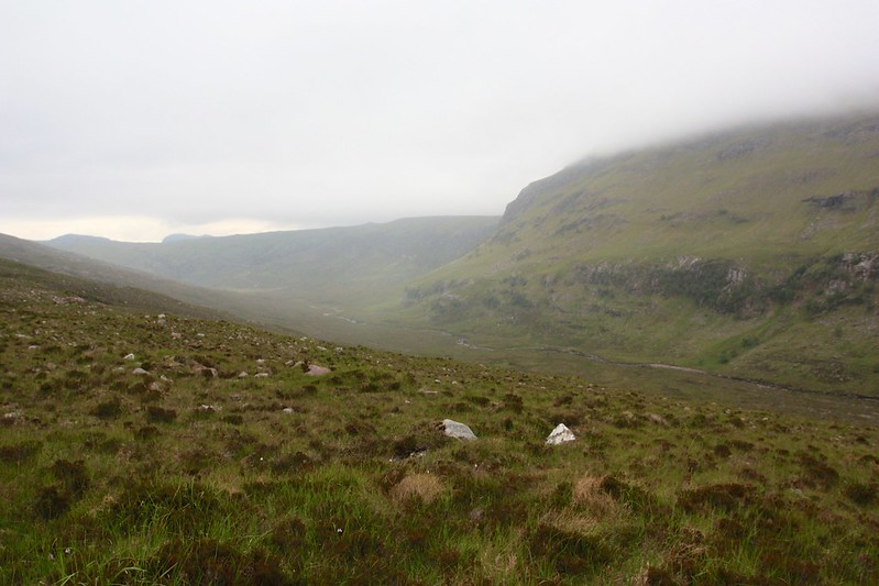
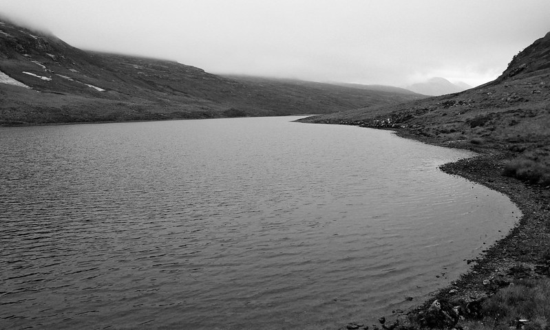
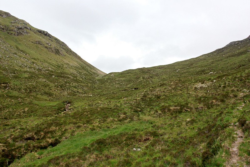
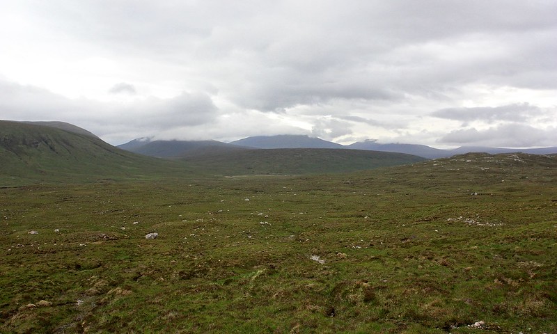
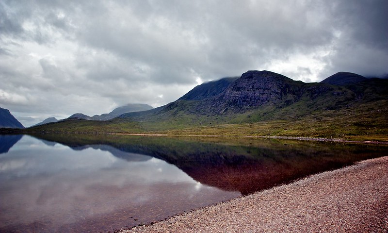
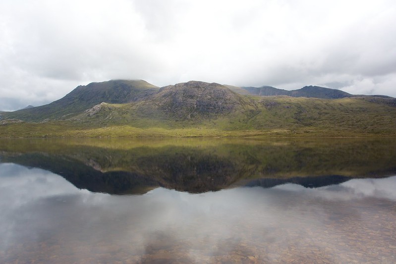
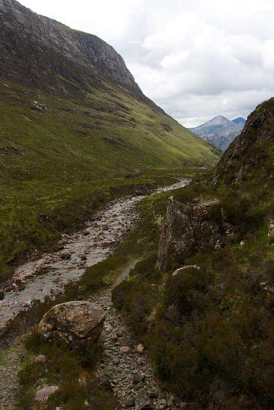
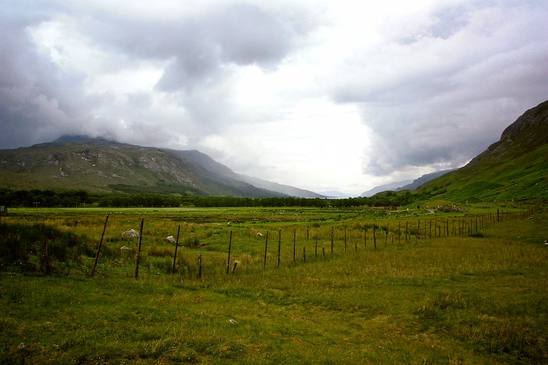
I traversed across the lumpy contours to reach the end of the loch where I once again forded the river and joined the path heading south. The cloud had continued to lower and sadly the hills all around were shrouded in mist. I continued on past the sombre loch and then as the ground started to rise headed southwest to climb up to the Bealach na Croise. Eventually I found a good path on the east bank of the stream and as I got higher I saw the group ahead. Crossing the river the path continued up to the bealach which happily remained below the cloud.
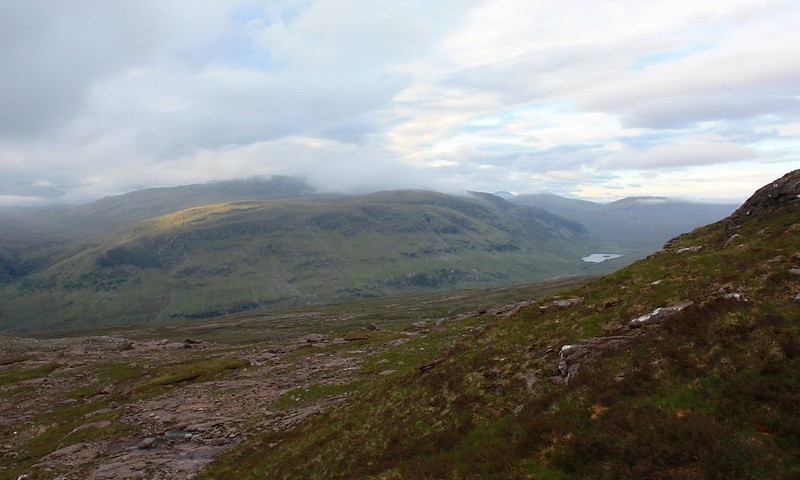
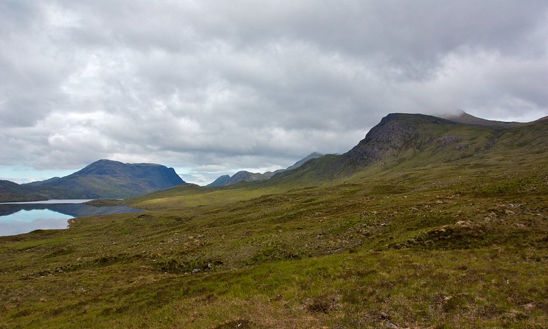
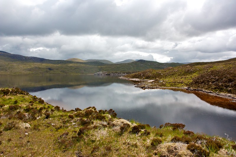
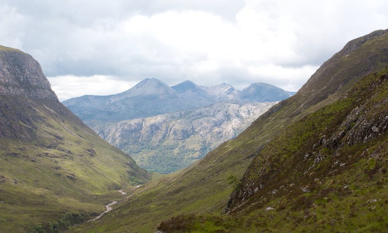
Regrouped we now traversed on pathless terrain across and below the rocky summit of Creag Ghlas Beag and paused for a break a short distance below Loch Meallan an Fhudair. Across the wild, empty land could be seen Fionn Beinn and further south were tantalising glimpses of the many peaks of Beinn Eighe in Torridon.
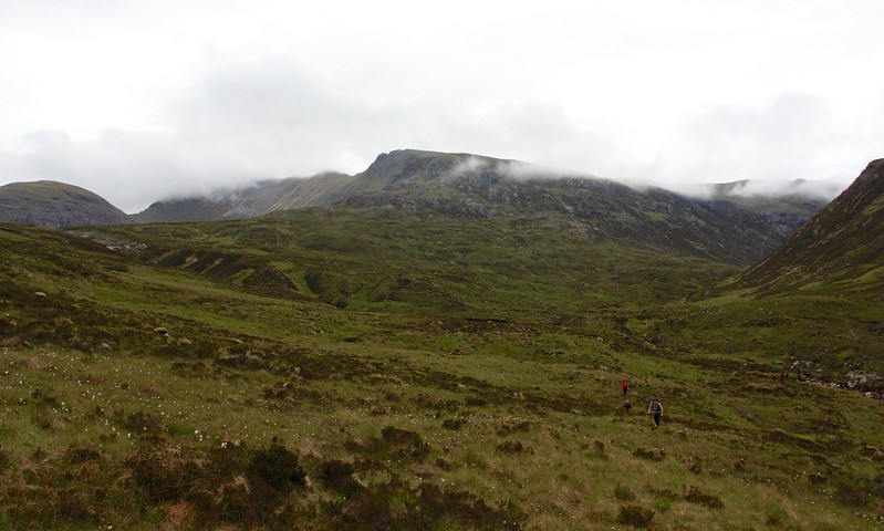
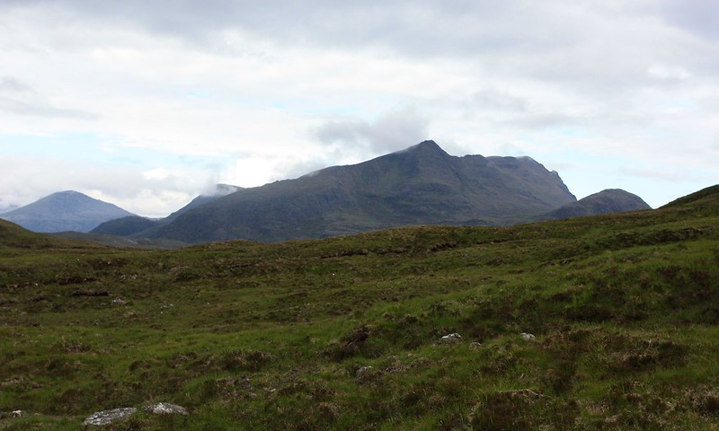
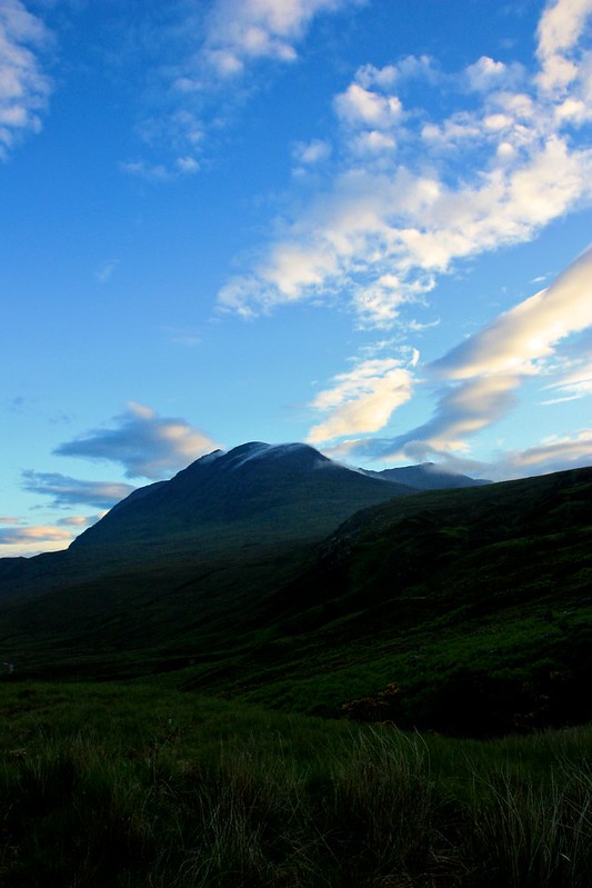
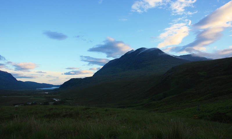
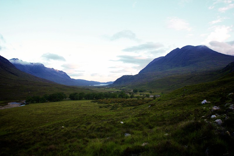
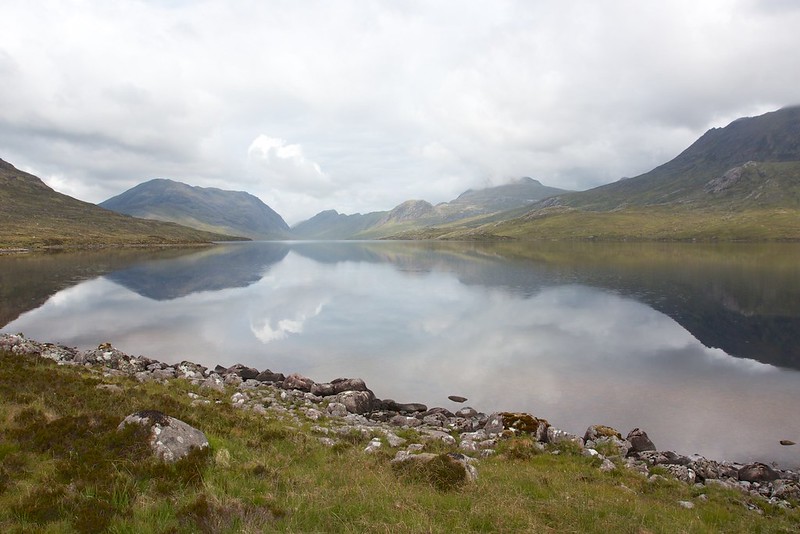
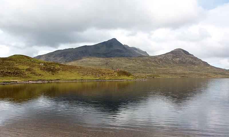
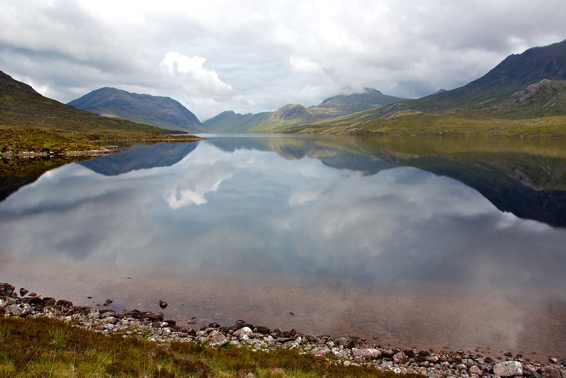
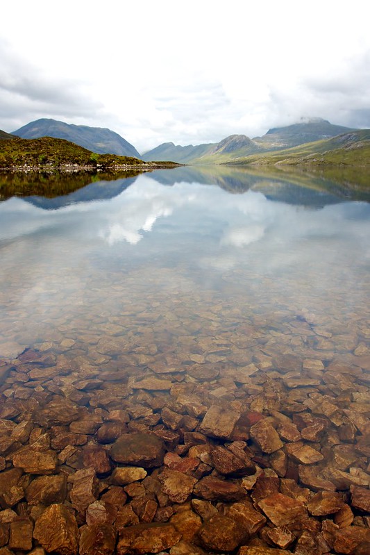
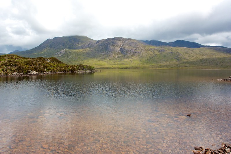
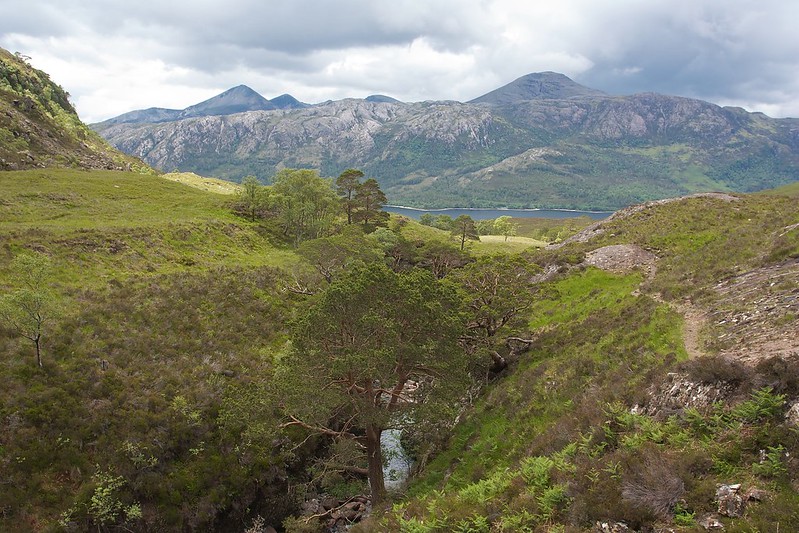
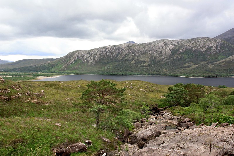
As we crested the next rise the best view of all came into view, Slioch sitting above Lochan Fada. This dramatic mountain, its pointed eastern top dark against a lightening sky, dominated the middle part of the walk. We dropped down easy slopes to the head of Lochan Fada.

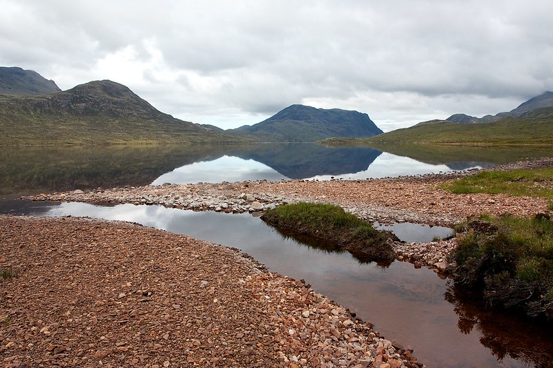
What a glorious place this is! The lochan is a long, sinuous stretch of clear water with Slioch and the long ramparts of Ben Lair on one side, and the Fisherfield hills of A’ Mhaighdean and Beinn Tarsuinn above its northern shore. Its calm waters reflected all this dramatic mountain landscape and it was with a sense of perfect wonder that we sat down on the pebbled beach at the head of the lochan to take it all in. Frankly I could have stayed in that place forever.
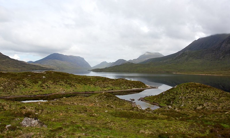
However, there was a barbeque to be thinking of and so we wound our way on a good track around the end of Lochan Fada, stopping often to look out at the views. A raincloud drifted over Slioch but it resulted in only a light shower, the moisture burning off almost as soon as it reached the ground.
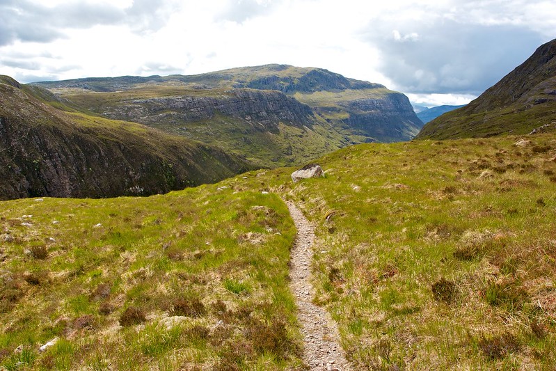
We were now heading for Gleann Bianasdail which links Lochan Fada with Loch Maree. Although Loch Maree is a couple of hundred metres lower than Fada we had to first climb up and over a shoulder of land before we could drop into the glean. This climb gave us views along the entire length of Bianasdail which truly wouldn’t look out of place in the foothills of the Pyrenees. We climbed steadily up beside a tumbling allt and when it crossed the path, paused to refill our bottles and quench our thirsts with cool, crisp mountain water. We then wound our way up to the crest of the pass, glad that the final ascent of the day was over.
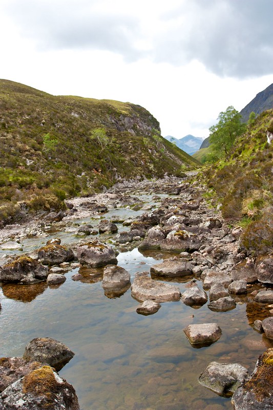
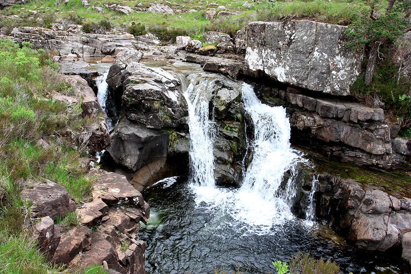
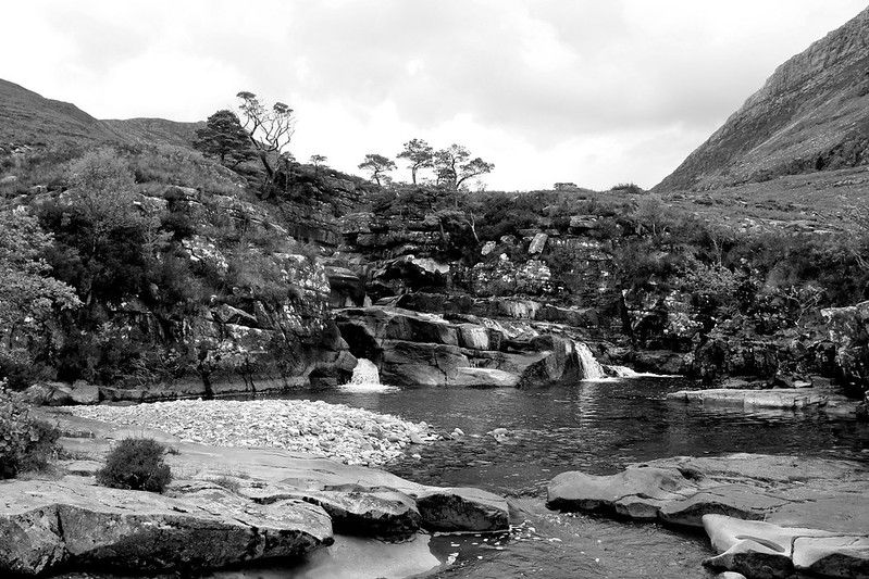
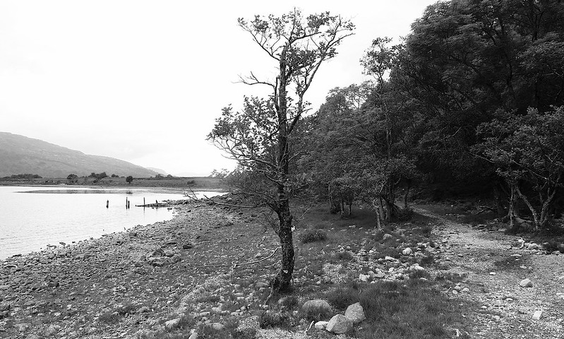
The track through Gleann Bianasdail is excellent and we were soon descending to the river which was chattering away beneath the dark rocks on either side of the narrow pass. We then dropped through the thin woods and out past myriad waterfalls below the southern arm of Slioch to reach the green shores of Loch Maree. Here we stopped for another break, pausing to eat the last sandwich and looking back up at the hills we had passed between.
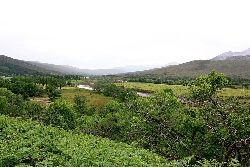
The last six kilometres seemed to take an age but our pace was encouraged by the threat of rain which could be seen both in front and behind us. Beinn Eighe offered enticing views across Loch Maree and then we were picking our way through Kinlochewe to reach the public car park, the coach and our barbeque venue.
Beer and wine were opened, people visited the pub to get themselves a gin and tonic, and soon there were spicy burgers and sausages to go around. A passing shower briefly dampened proceedings but soon enough the sun was back out and people were out sitting around and generally enjoying this most agreeable Midsummer. We topped off the meal with strawberries and cream and a huge carrot cake.
The journey back was long and although I tried my best, after the road through Strath Bran I felt into a deep and peaceful sleep. It wasn't until Inverness that I noticed the rain return and by Aberdeen it was back to as gloomy as it had been the night before. We counted ourselves lucky that Fisherfield had been so kind and I'll be back with my tent to have a proper explore of this most beautiful of areas.