Date: 4th June 2012
Distance: 30.39km (cumulative trip total: 50.25km)
Ascent: 1,997m (cumulative trip total: 3,096m)
Time: 11hrs 6min (cumulative trip total: 17hrs 33min)
Hills: Ben Alder (Munro), Beinn Bheòil (Munro), Carn Dearg (Munro), Gael-Chàrn (Munro), Aonach Beag (Munro), Beinn Eibhinn (Munro)
Weather: Sunny skies with cloud returning later. Chilly north to westerly breeze all day.
Route: Click to view on an OS Map
If you missed Part 1 of this outing then you can read it here.
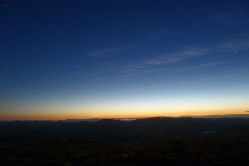
The bright skies of the night before had been a good portent and I awoke after a long, comfortable and slumbering sleep to find the tent lit up by the rising sun. I’d slept through sunrise but poked my head out in time to see the sun crest the notch of the Bealach Dubh. Warm and cosy, I was reluctant to get up but knew that I had a big day ahead. Outside the world was frosty, the grass sparkling with a million frozen crystal drops and the tent covered in a layer of thin ice. I got my stove going and soon had hot coffee and porridge which was a great way to start the day.
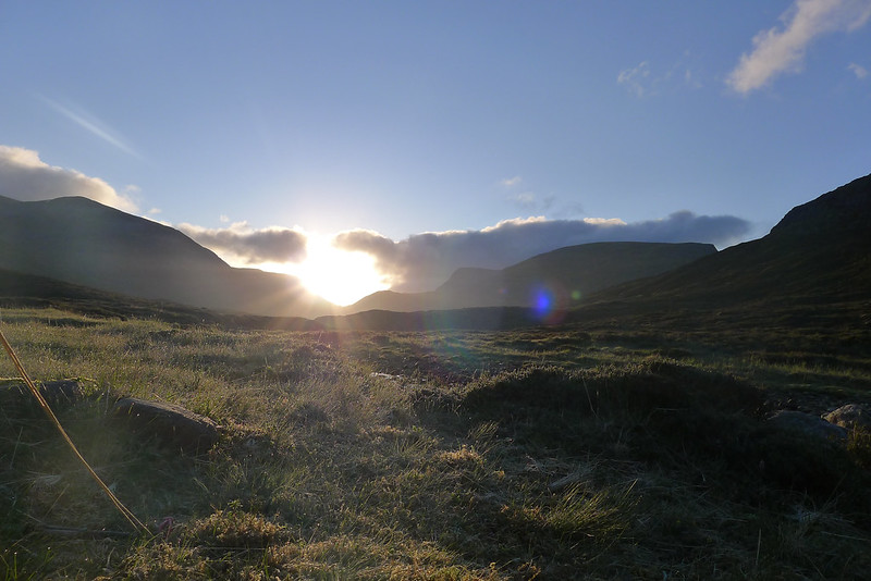

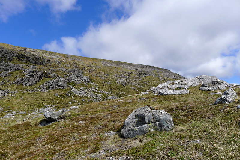
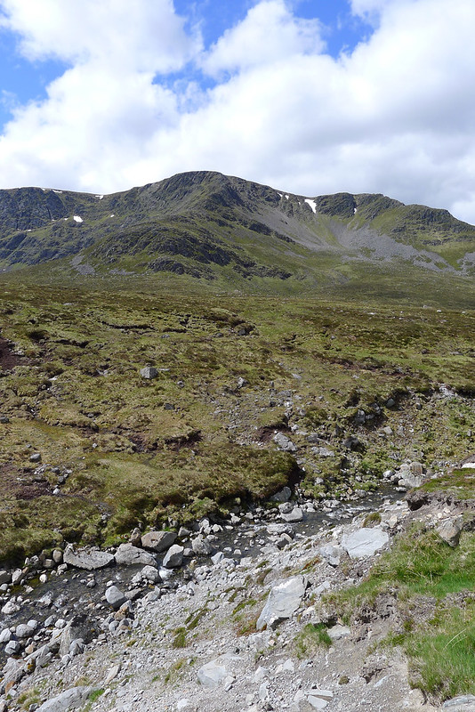
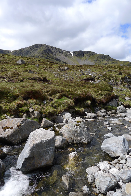
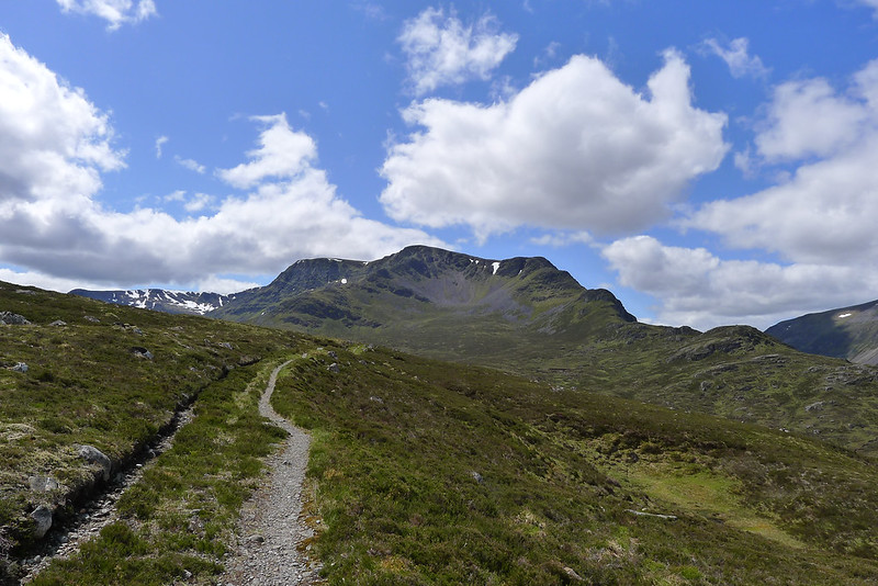
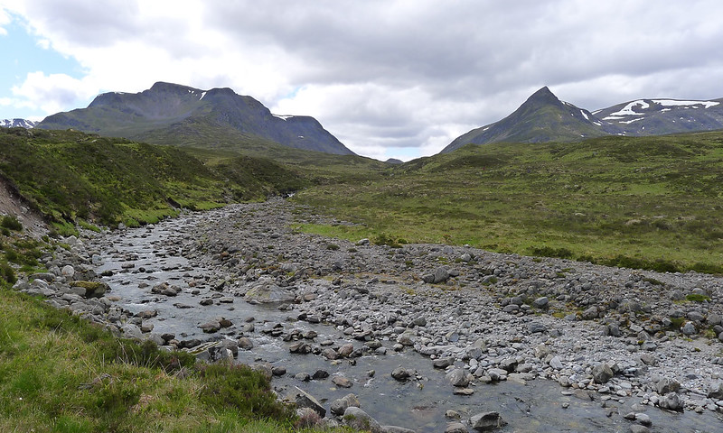
As everything started to warm up nicely I washed up and slowly got everything packed away. I was eventually off just after 8am. I was pretty close to the head of the Uisge Labhair and after following the path a short distance crossed the stream and climbed up the boggy hillside. I was aiming for the end of Ben Alder's south-western ridge which should provide a steep, direct way up towards the plateau. I soon crossed the path that comes down from the bealach and bends east towards Loch Ericht and was then climbing up to join the ridgeline. The morning sunshine was warm and I was soon stopping to drink some water and take in the magnificent views.
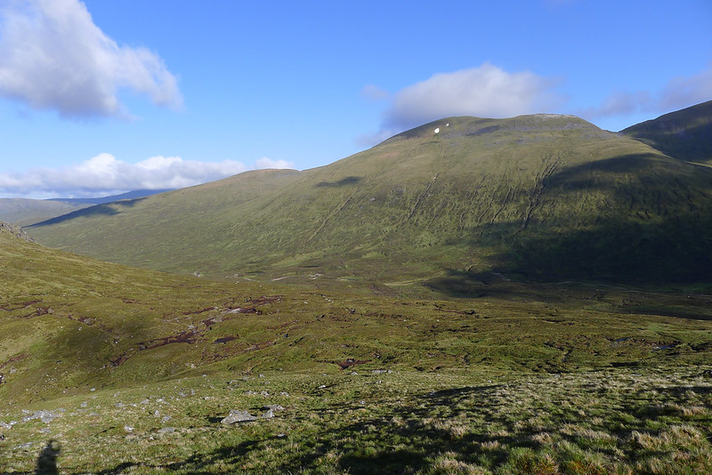
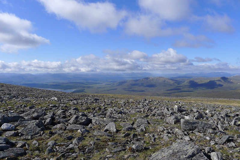
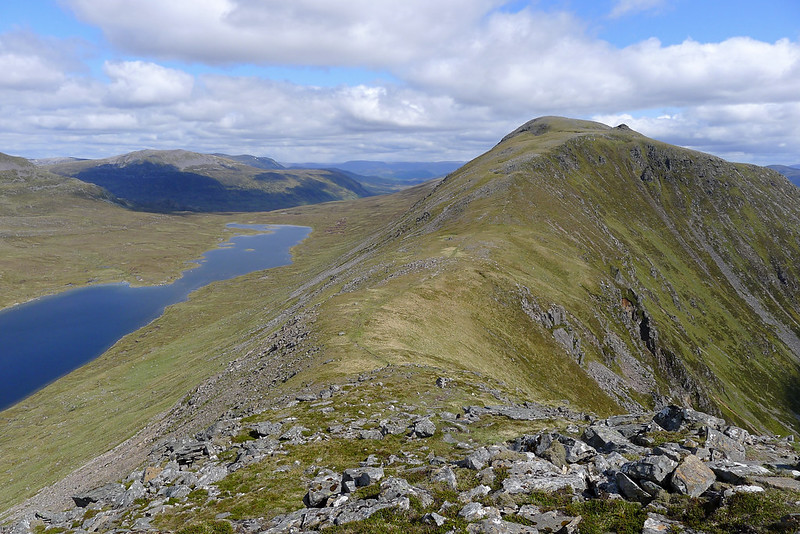
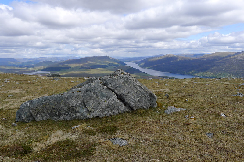
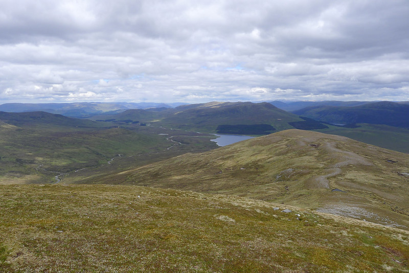
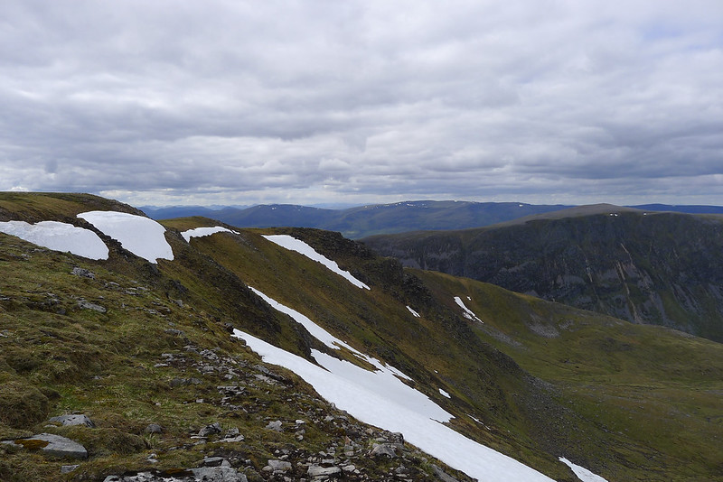
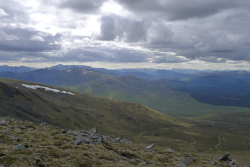
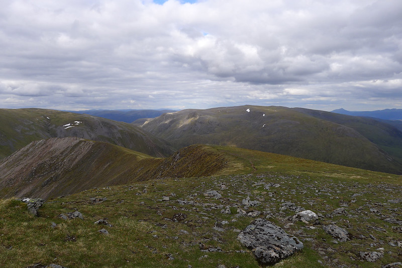
With the end of Loch Ericht visible I now wound my way up through shattered rocks that make up the south-east ridge. In short order I was high above the bealach and the gradient eased as I emerged onto the plateau. Under clear blue skies I surveyed this huge area of high land, the largest area of land above 3,000 feet outside of Nevis and the Cairngorms.
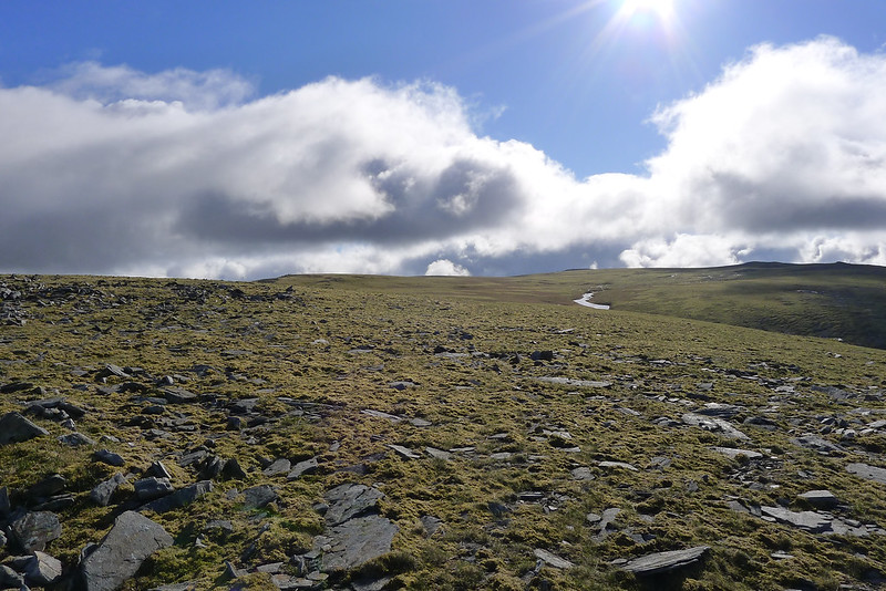
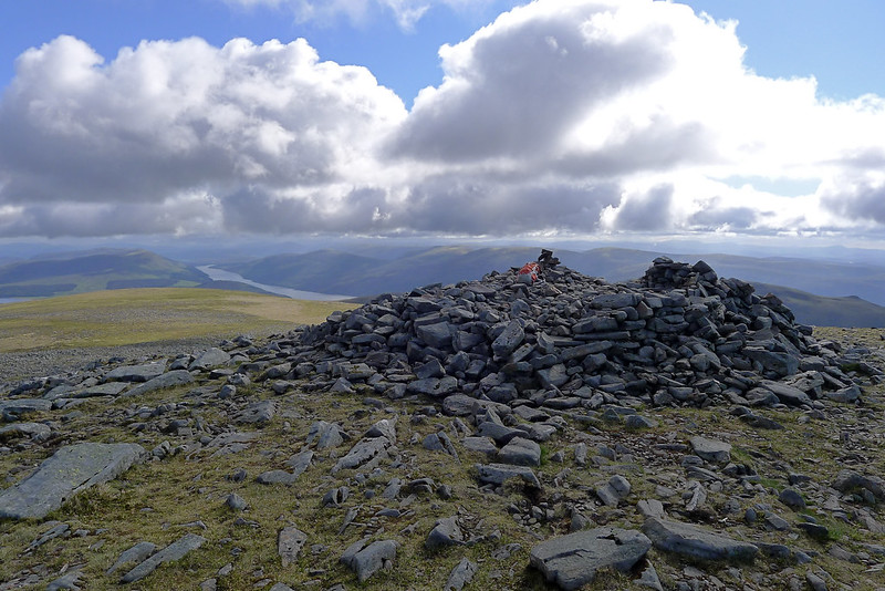
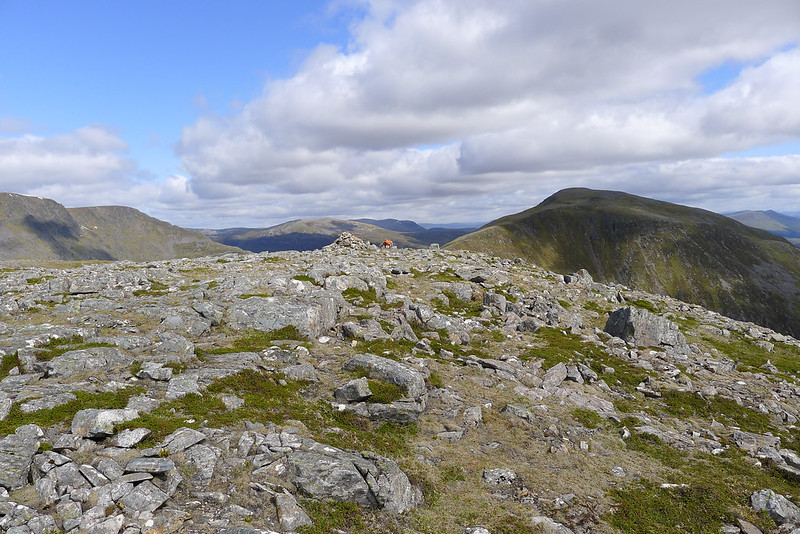
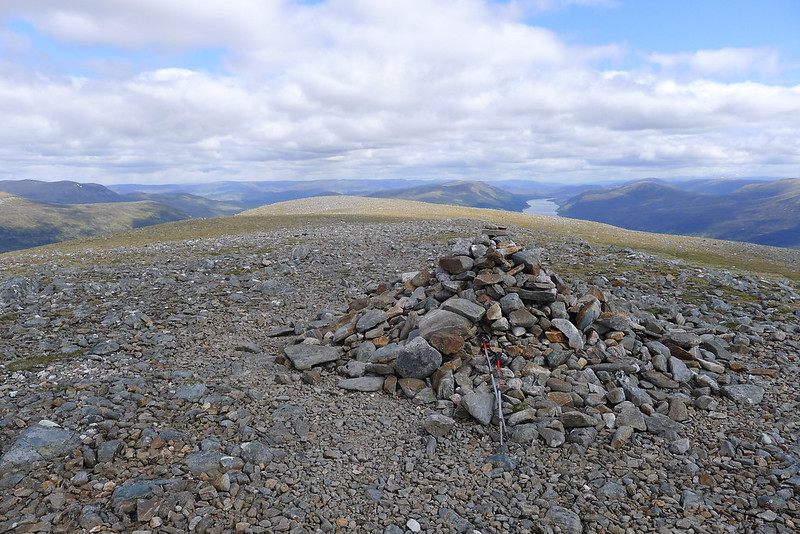
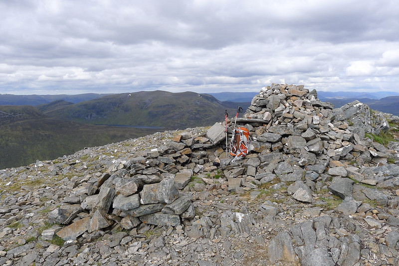
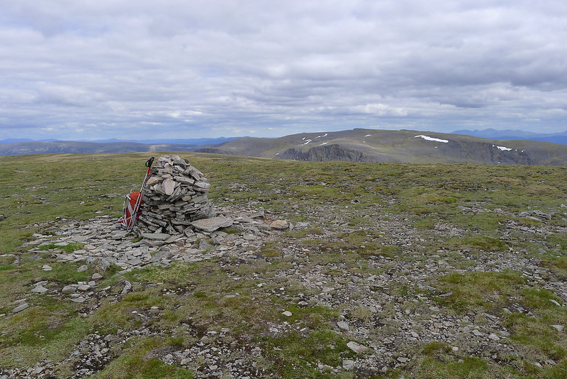
I ambled my way across delightful short turf and springy heather to a summit on the eastern side to get excellent views across to the Aonach Beag hills. Now ahead of me and with only very minor ascent was the summit of Ben Alder, the 25th highest Munro at 1,148m which I arrived at just on 9am under glorious sunshine and a light northerly wind. There is a substantial cairn, a trig point and a number of summit shelters but I was content with slinging my pack down and standing on the cairn gazing off at countless hills stretching away on every horizon.
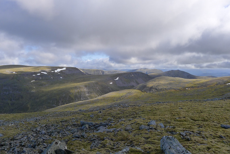
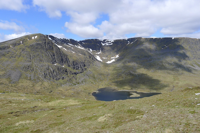
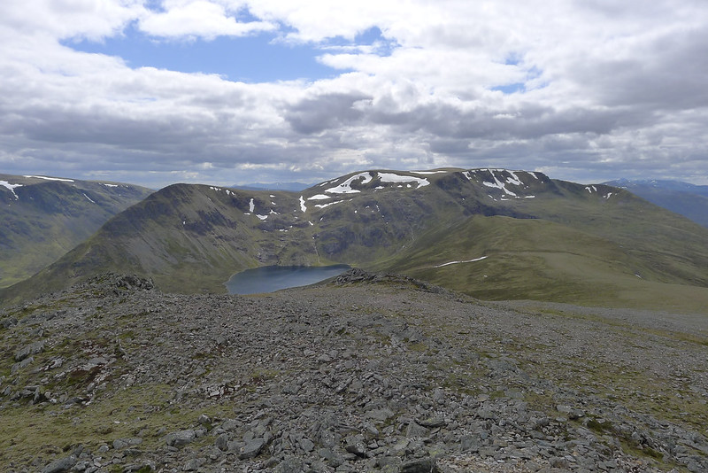
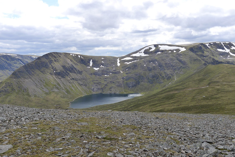
At this early hour of a Monday morning there was no-one to be seen anywhere and I enjoyed a very lazy time on the summit utterly absorbed by the stunning views. Eventually I dragged myself away, passing the snow-crusted Lochan a' Garbh Coire and circling the grand cliffs of the giant Garbh Coire itself.
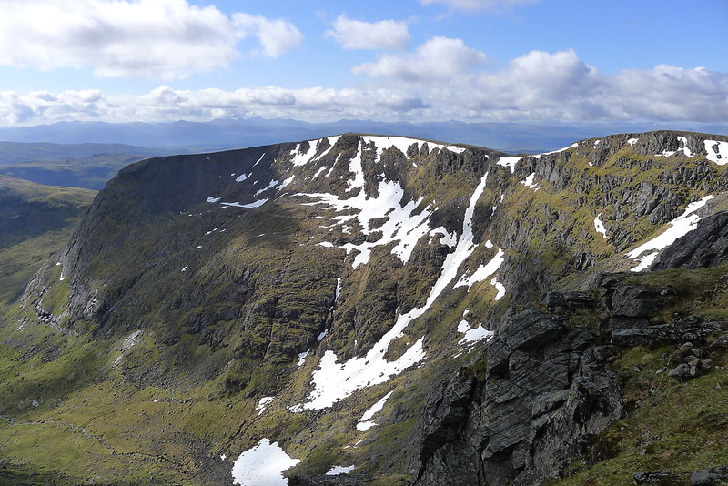
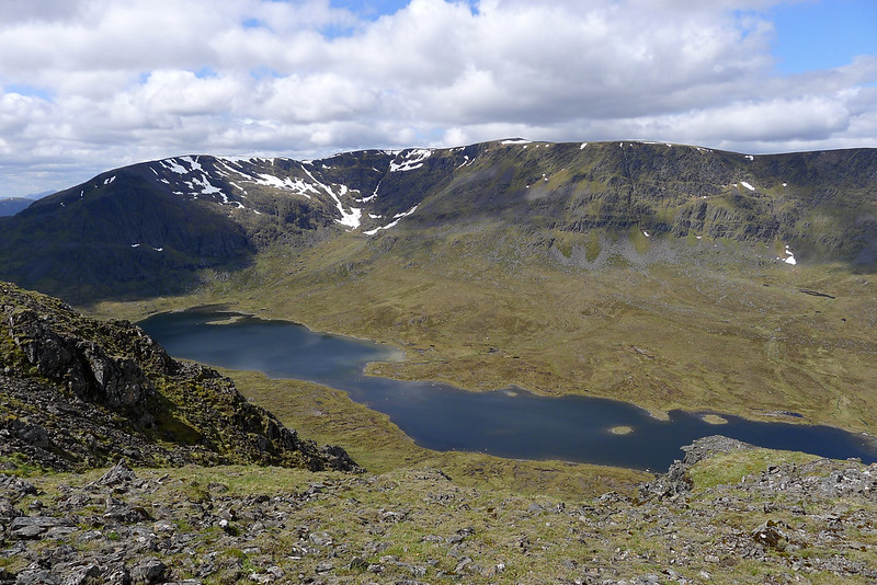
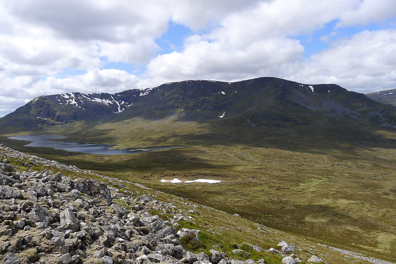
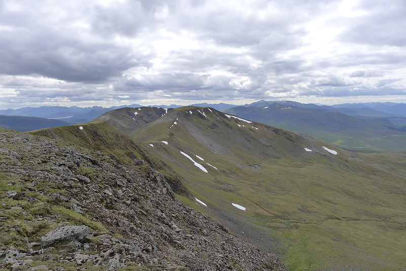
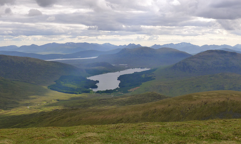
The views down to Lochan a' Bhealach Beithe were stunning with the Munro of Beinn Bheòil looking very small from this vantage point.
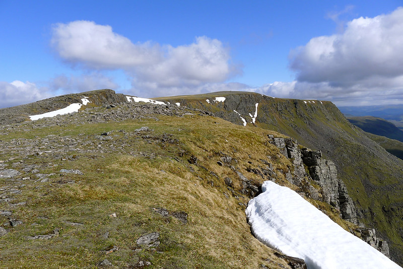
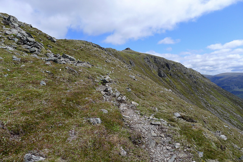
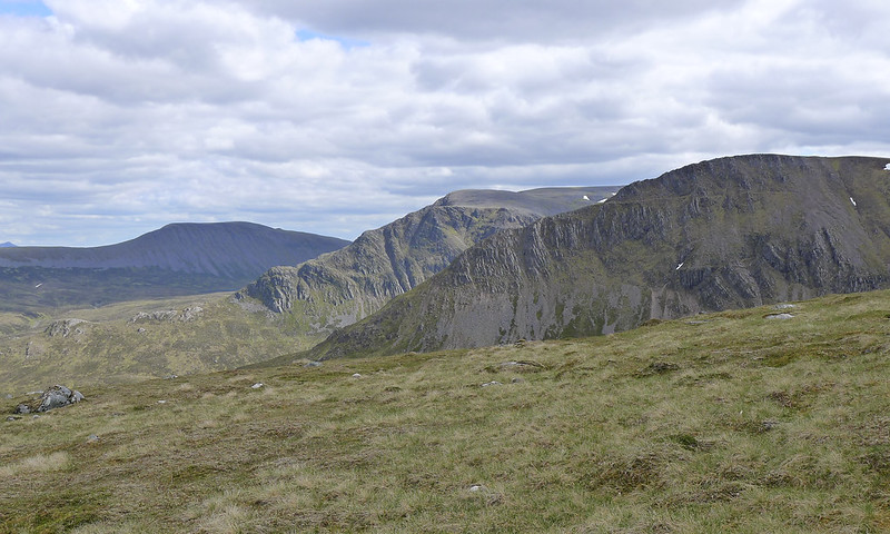
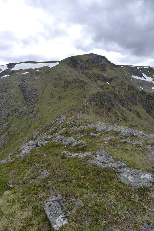
I followed the cliffs around to the top of the final arm of Ben Alder and then looked for a way to descend to the Bealach Breabag. The slopes here are dramatically steep with shattered crags barring access. I traversed back south until the gradient eased slightly and from here was able to pick my way carefully down a number of steep terraces to eventually reach the bealach. I suspect an easier access route is further south where the slopes of Ben Alder are less precipitous.
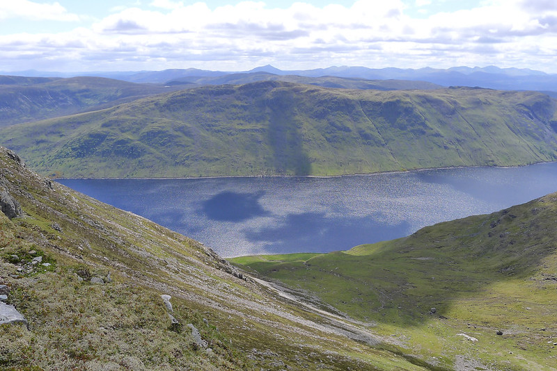
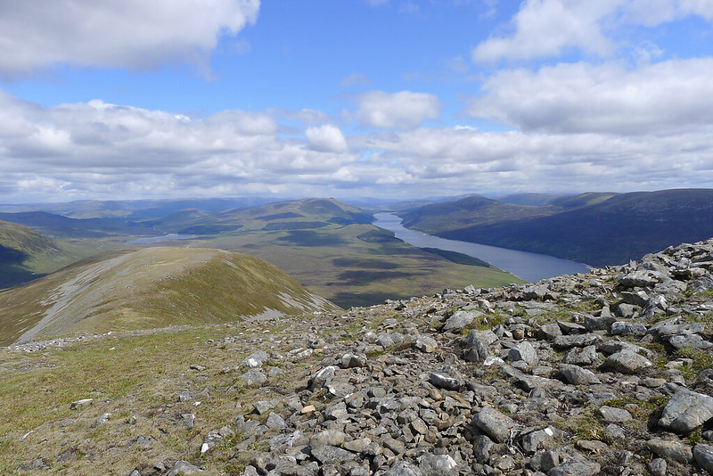
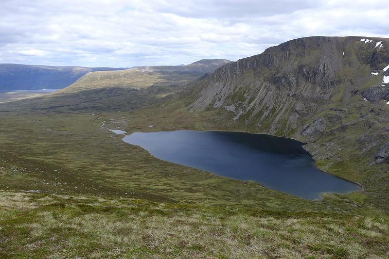
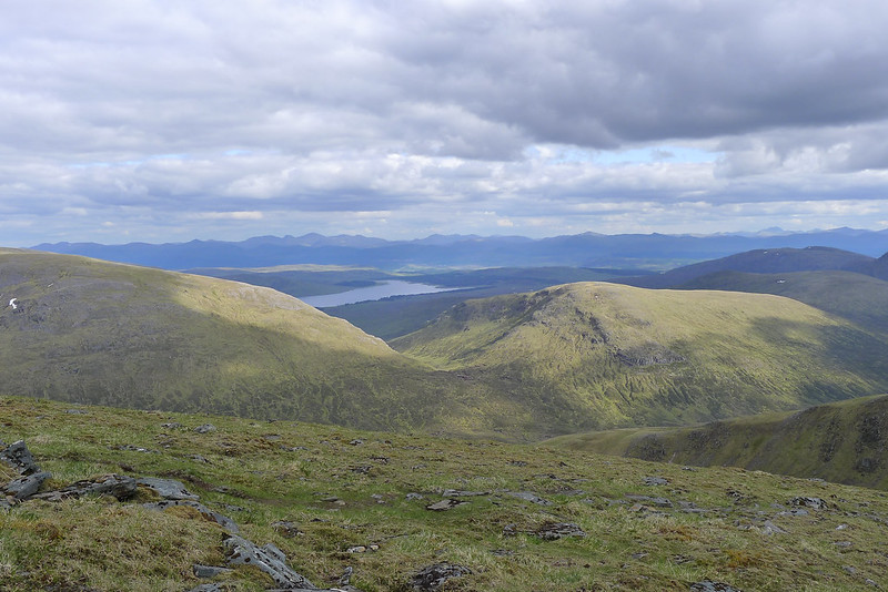
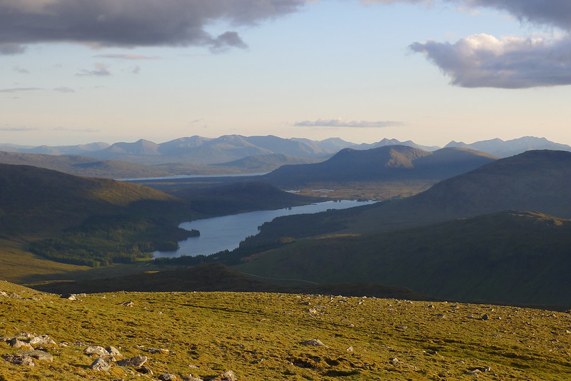
From the bealach I enjoyed the views up Loch Ericht before making my way up the easier slopes of Sròn Coire na h-Iolaire, the southern top of Beinn Bheòil. This is a fantastic viewpoint and well worth the ever so slight detour off the route up to the Munro. Here is a video from the cairn.
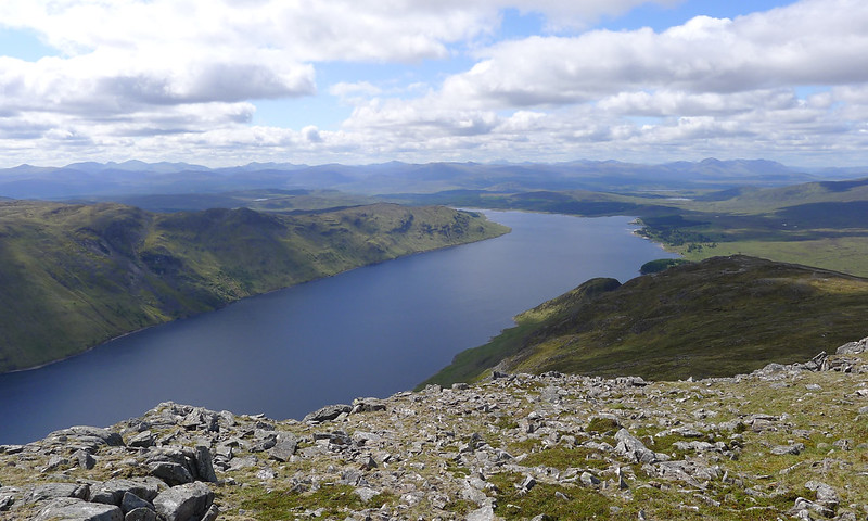
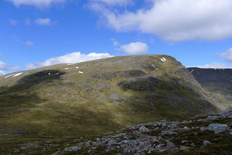
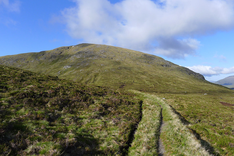
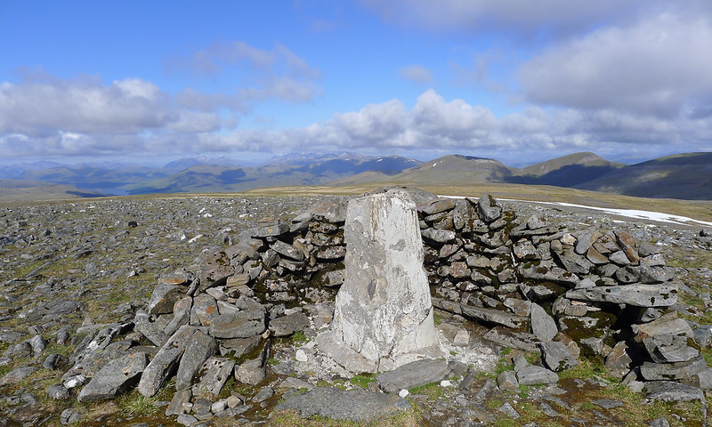
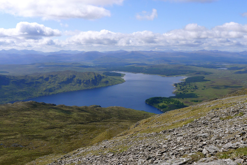
After absorbing the views and adding another layer of sunscreen to combat what was rapidly becoming a very sunny day (though the temperatures were thankfully tempered by the breeze which had once again arisen since sunrise) I set off down to the col and then up the slopes of Beinn Bheòil. There appear to be a number of routes but the one I followed took me on a fun rising traverse above the blue waters of Loch Ericht until I emerged on gentler ground near the tor. I scrambled up here and then made my way the short distance up to the summit cairn which lies on a flat, bouldery plateau.
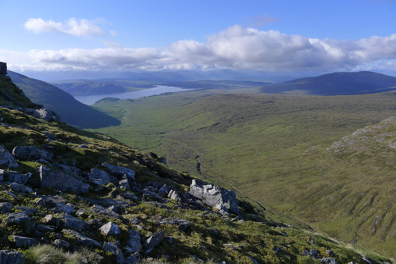
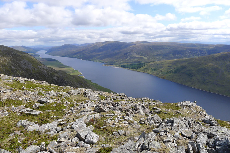
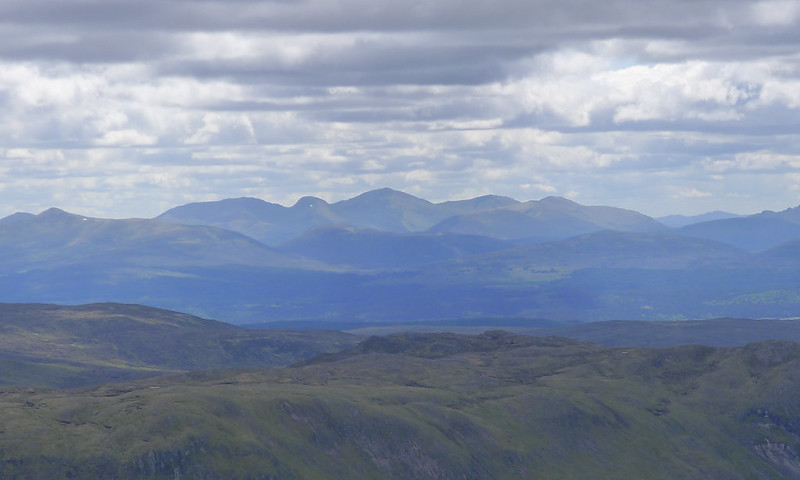
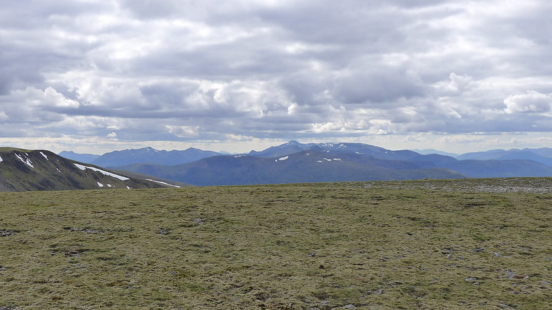
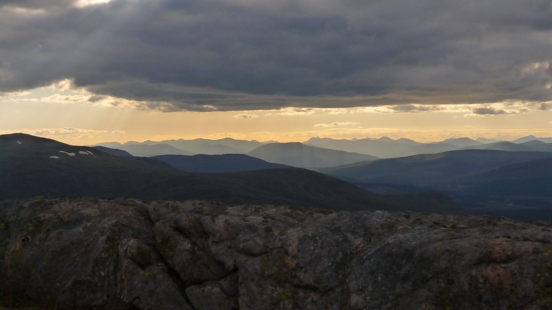
Here it was time for a slightly early lunch, again slightly sheltered from the wind but with fantastic views along Ericht towards Dalwhinnie and east to Beinn a’ Ghlo and Schiehallion. Interestingly further north the main Cairngorms were wreathed in heavy, rainy clouds. I felt pretty good about my choice of hills.
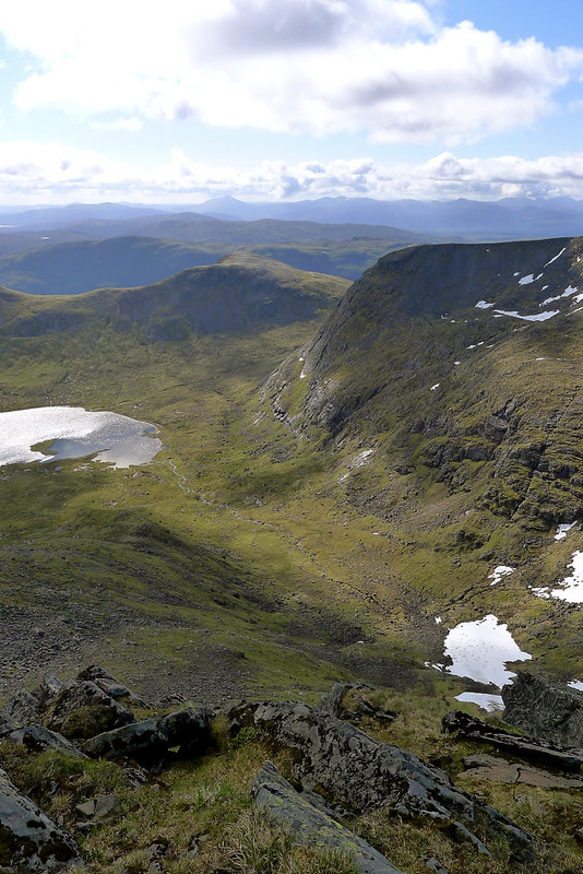
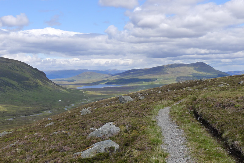
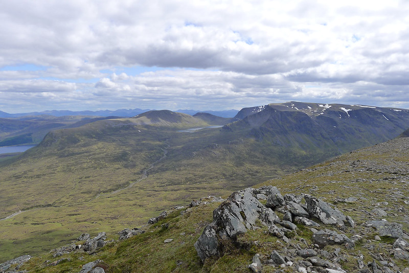
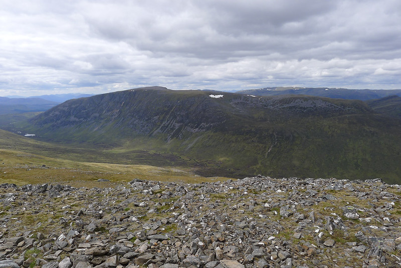
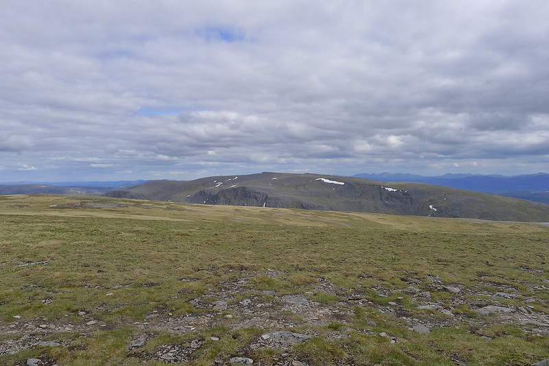
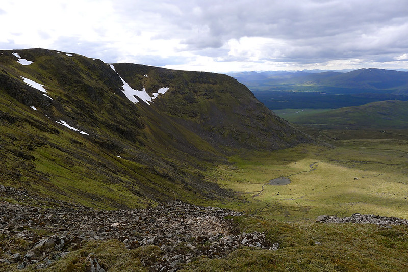
After lunch I continued north off the summit of Beinn Bheoil. The slopes immediately above Lochan a’ Bealach Beithe are steep and scree covered so I headed north, losing height, until I was able to drop down much easier slopes to the access path coming up from Culra. The views to the short and Long Leachas of Ben Alder as well as over to the Lancet Edge were stunning. My plan didn’t include any of them this time but I’m keen to get back to try some of these scrambly ascent routes in the future.
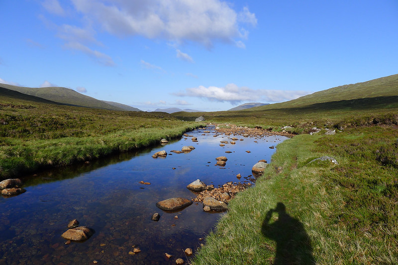
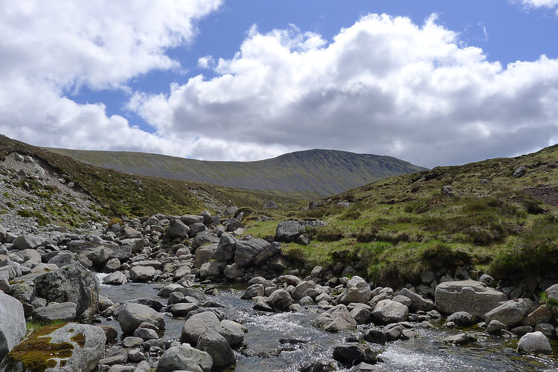
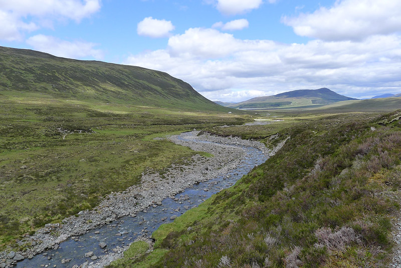
Once at the path I was out of water (having last refilled on Ben Alder) and so I put my bag down and dropped down to fill up from the Allt a' Bhealach Beithe which comes down from Loch. This stream has scoured a rocky channel through the land and must be an impressive sight when running high.
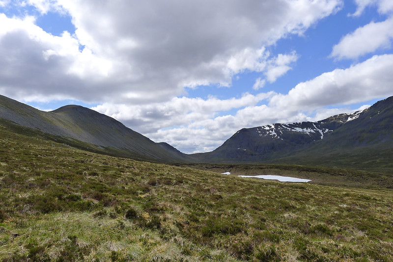
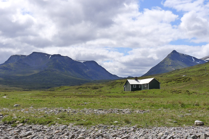
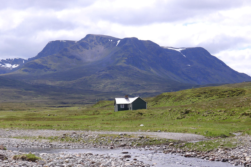
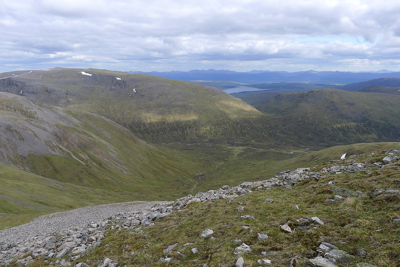
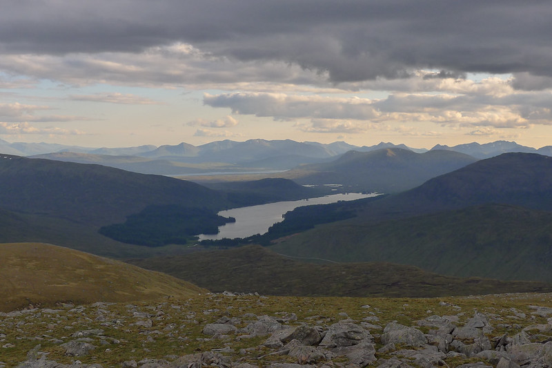
Refreshed by cool mountain water I was ready to head down to the bothy at Culra enjoying both the good path and the incredible views. This area is truly a landscape of giants and as I approached the river I was starting to get that classic mountain view of Ben Alder and the Lancet Edge separated by the deep trench of the Bealach Dubh.
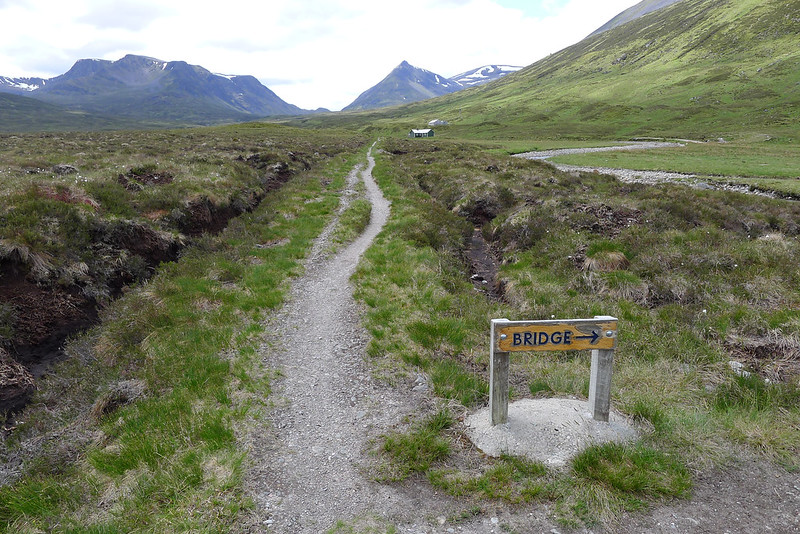
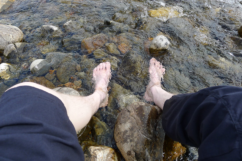
I wound my way down along the river, past the tents and the bothy and then crossed over by way of the vehicle bridge just north of Culra. It was then just a short distance back to the bothy where I dropped down to the river for a break. It was utter bliss to take off shoes and socks and soak my feet in the chilly waters of the Allt a' Chaoil-reidhe.
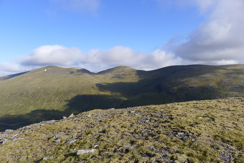
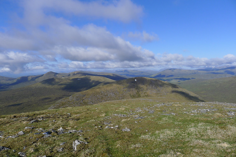
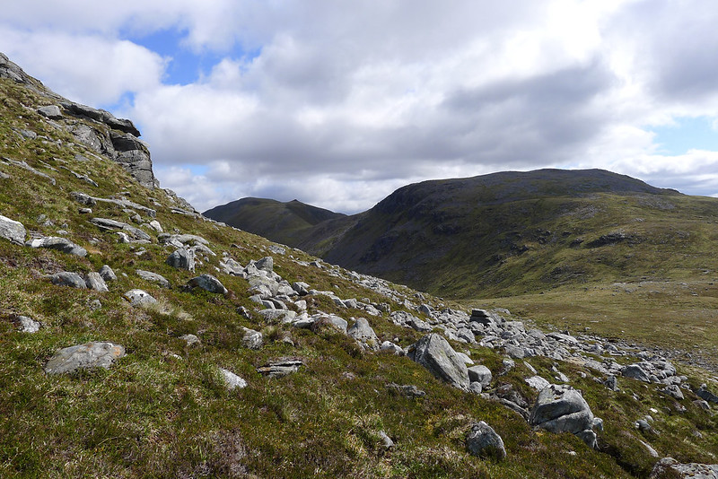
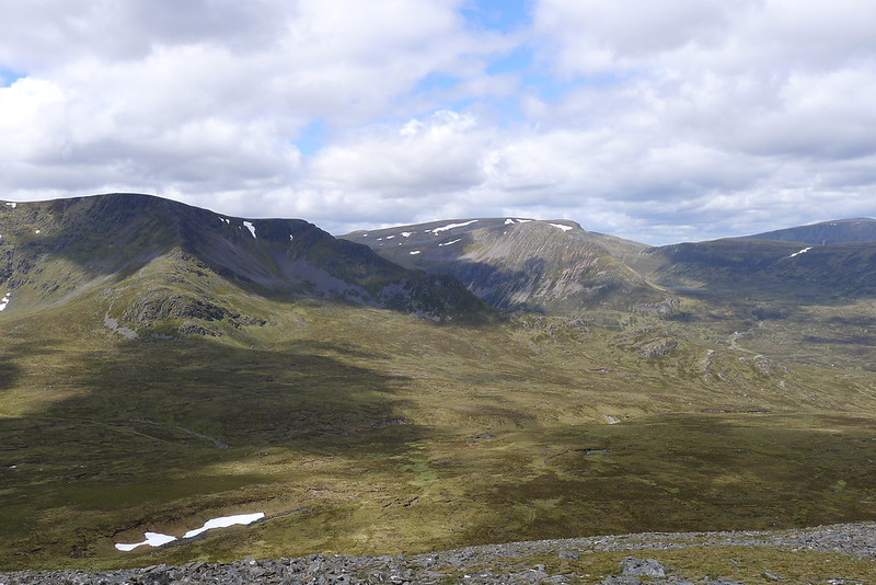
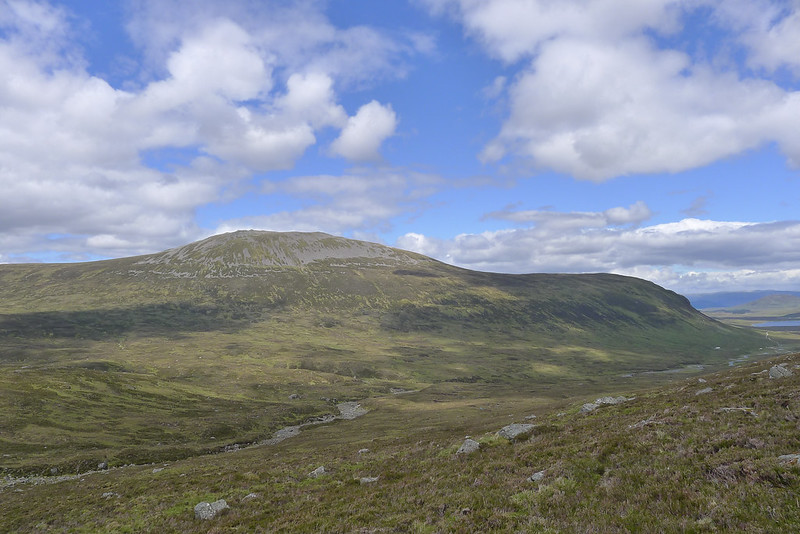
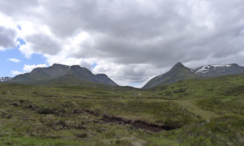
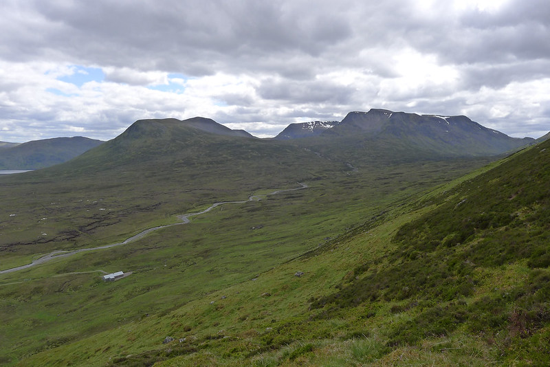
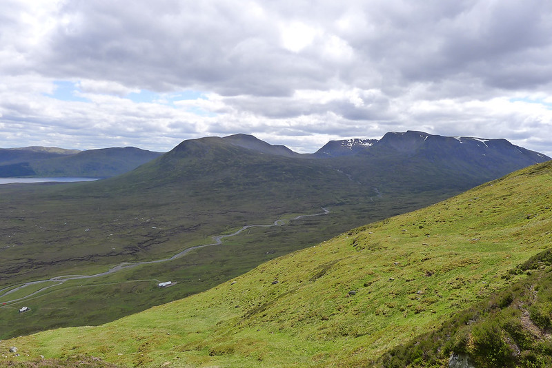
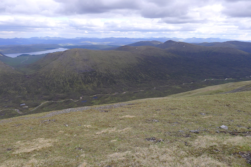
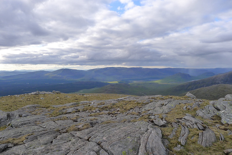
After this pleasant respite it was back to the grindstone. Next up was a tough pull up from Culra, following nothing but the occasional deer track I ascended the steep slopes of Carn Dearg gaining a few hundred metres of height in very little horizontal distance. It was a joy to top out on the heathery plateau and make my way up to the prominent summit. The views behind me extended over Loch Pattack to the line of Spean and further north the Monadhliath were superb.
As I reached the cairn another chap could be spied coming over the boulders from the south but on arrival he wasn’t one for talking. I took in the views, had a bite to eat and then meandered my way downhill heading for the last interesting ascent feature of the day. The ridges of this area all line up neatly and as I crossed high above Loch an Sgòir I got a great view of the side of the Lancet Edge and the Long Leachas of Ben Alder.
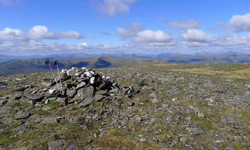
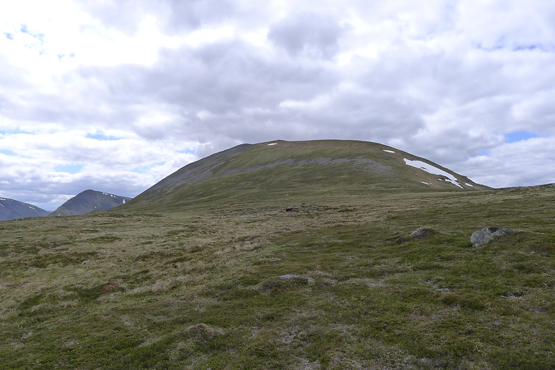
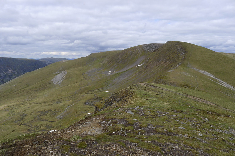
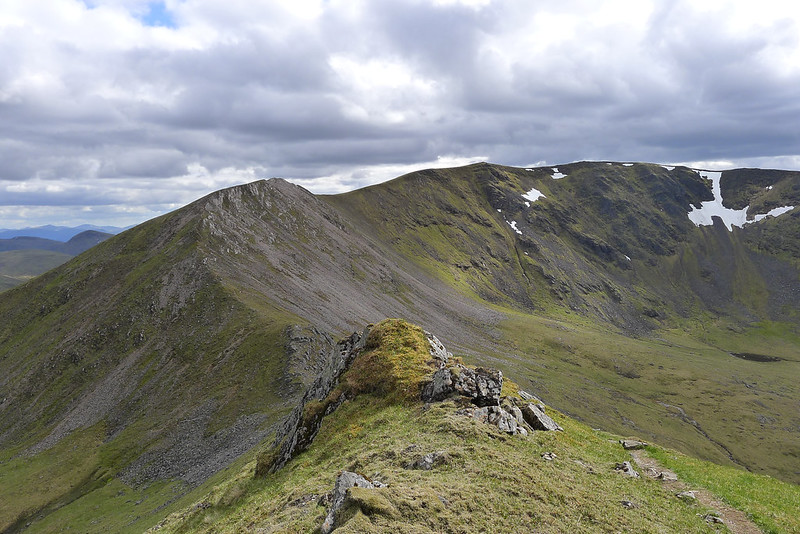
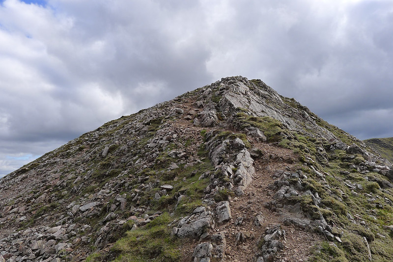
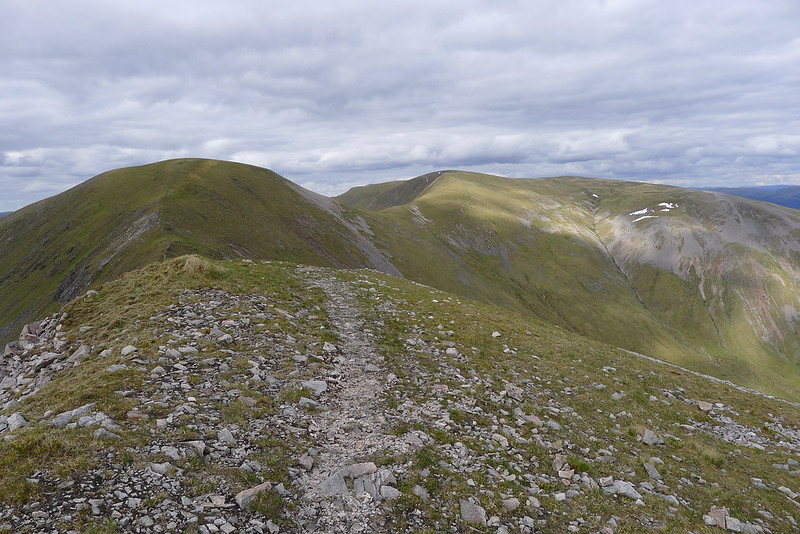
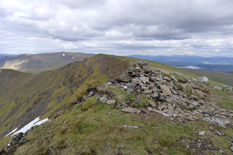
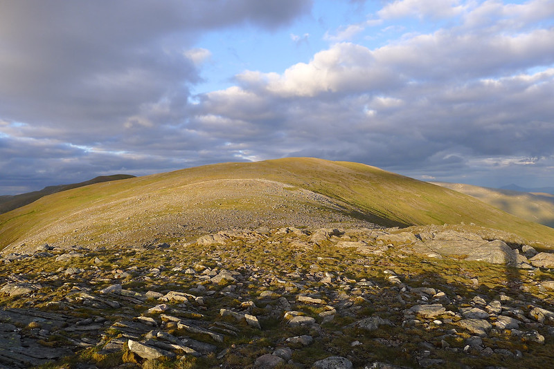
I was on my own personal ridge, the short stubby nose that connects Carn Dearg to the massive plateau of Gael-Charn. This looks an impressive feature from afar but turned out to be a good ascent with just a modicum of hand-on-rock action to steady myself with the extra weight of the camping pack.
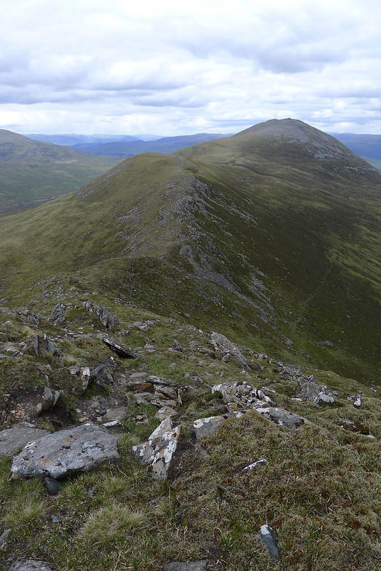
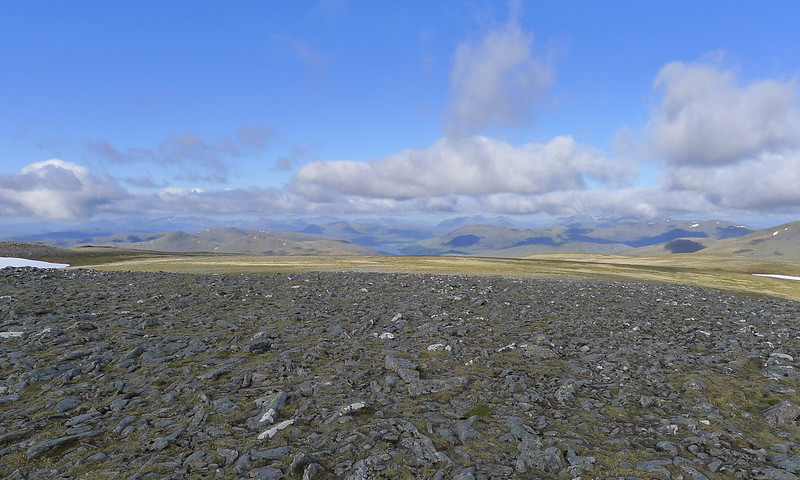
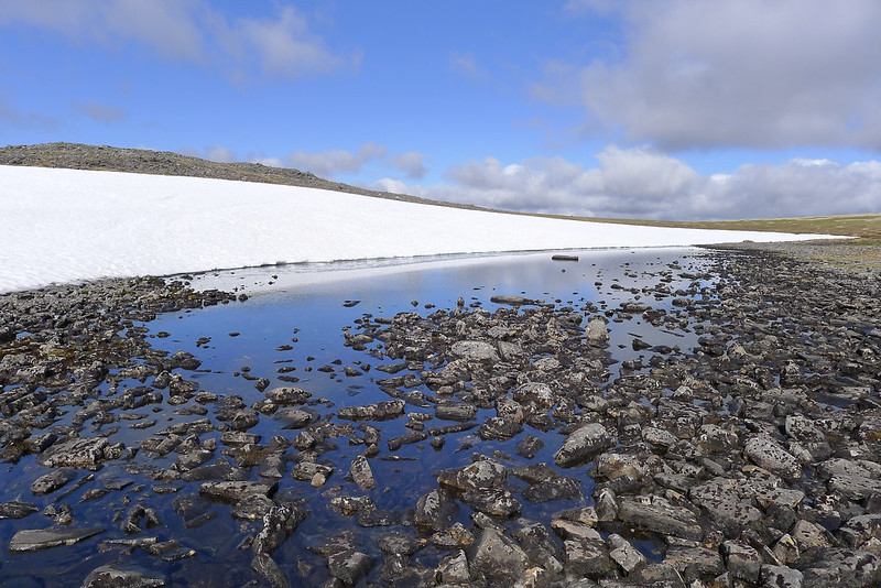
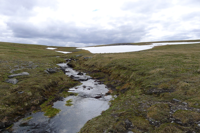
It was a strange experience emerging from the narrow, rocky ridge onto the wide plateau. Like stepping from the North West Highlands to the Cairngorms in a single stride. Gael-charn is a big area of high ground and easy to navigate in clear weather. I first of all dropped down very slightly to refill my bottle from a snowmelt fed stream, chattering its way across to plunge over the edge and into Loch an Sgòir. Then I headed up to spot height 1117 practicing some compass navigation before heading across to the summit cairn a little further south.
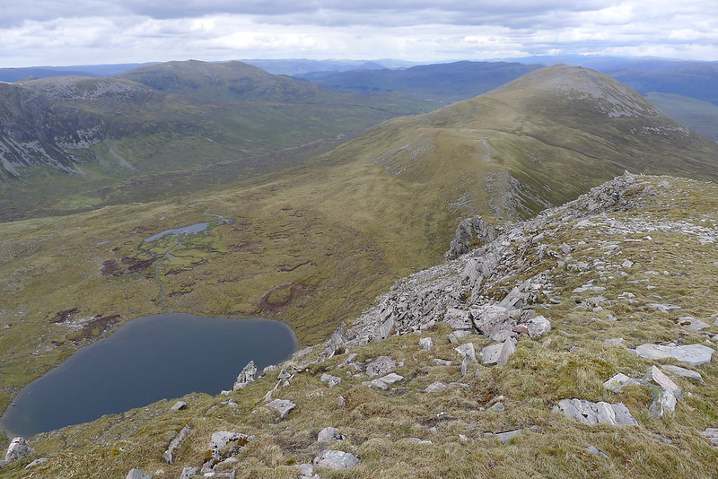
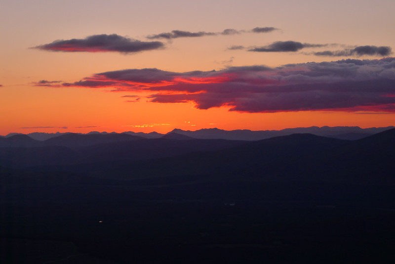
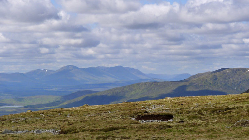
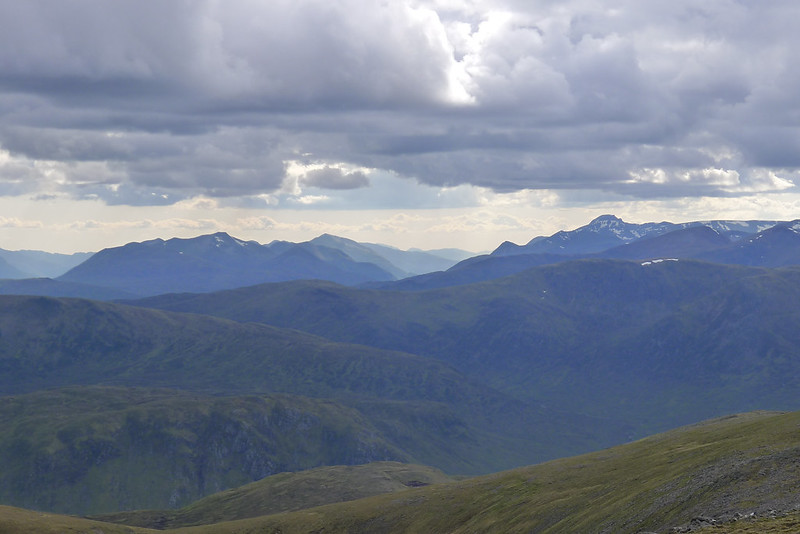
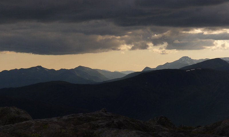
The wide plateau deprived me of far closer views but the far hills were starting to light up as the sun drifted slowly into its early evening position.
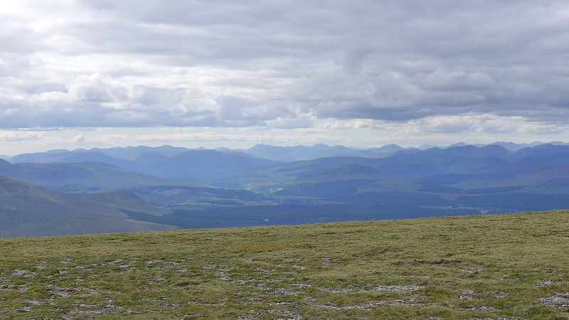
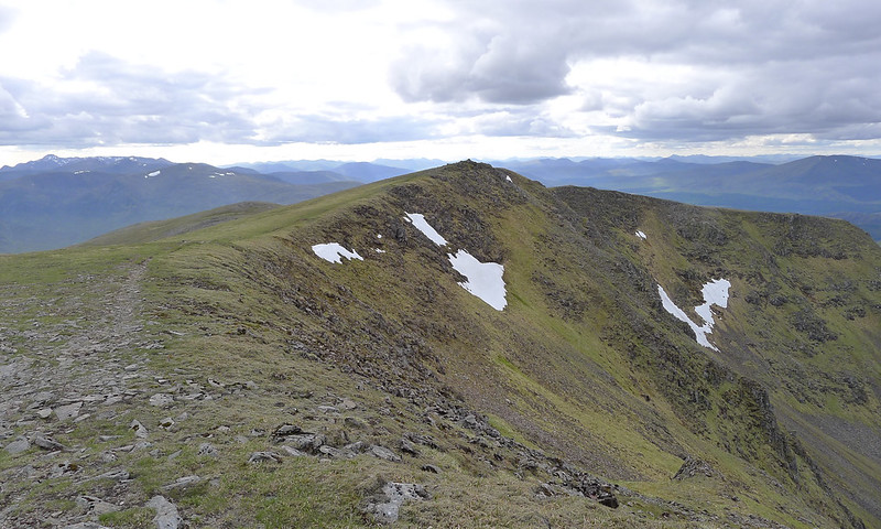
It was an easy grassy walk along the northern lip of the connecting ridge to take me to Aonach Beag,another Munro. I left my gear at the summit and dropped off slightly north to take in the views out over the Spean and towards Laggan. The peace and quiet of this area really is something and still I had only passed four people all day.
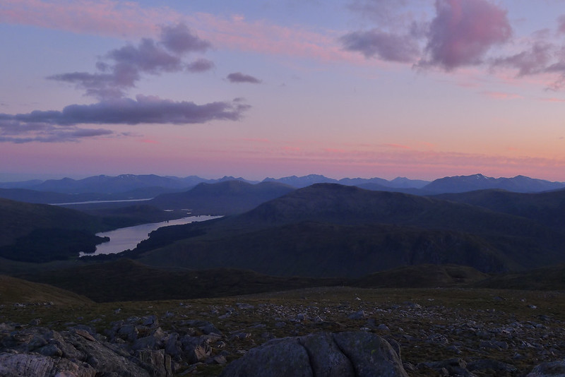
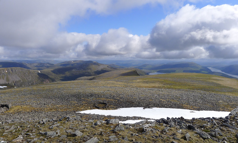
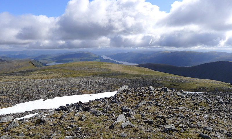
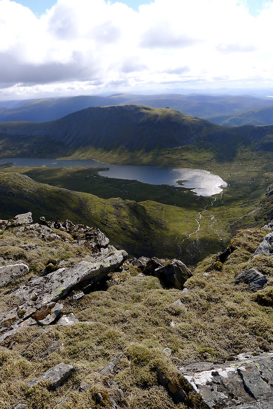
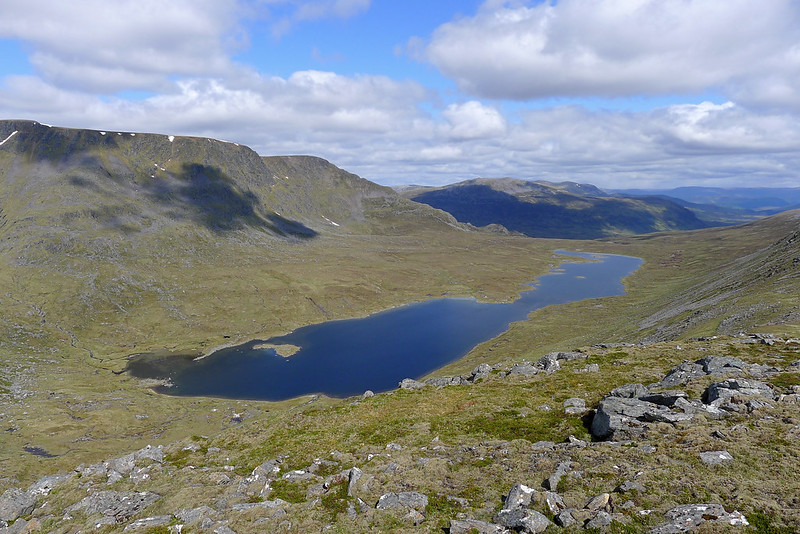
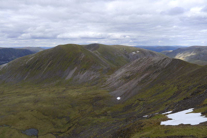
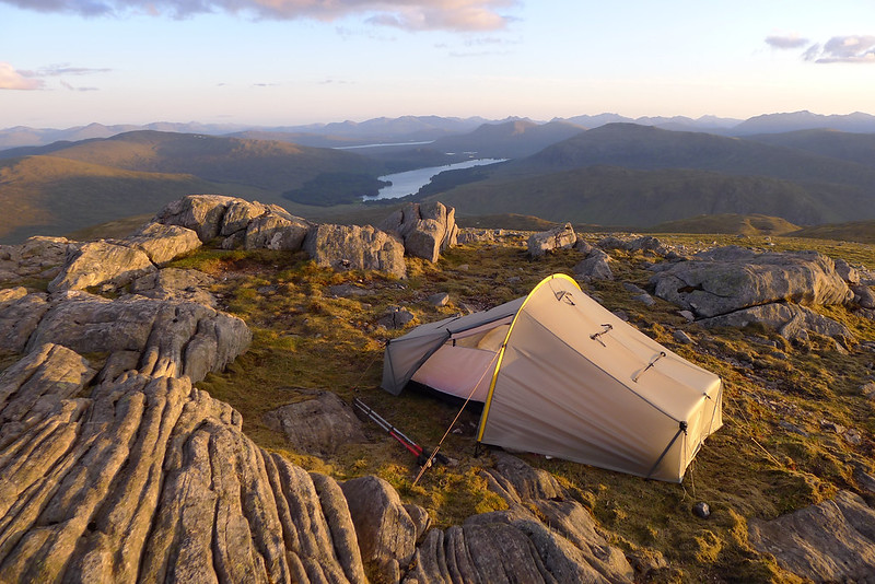
From Aonach Beag there was one final slightly disheartening loss of height down a scrabbly path to a col perched high above the glen containing the Uisge Labhair. I enjoyed the views over to Ben Alder and Loch Ericht and then continued up the pleasingly narrow ridge towards the summit of Beinn Eibhinn. After crossing a few minor tops I was on the summit ridge where the spectacular view down to Loch Ossian immediately caught my eye.
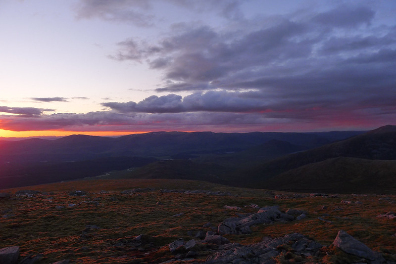
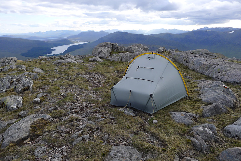
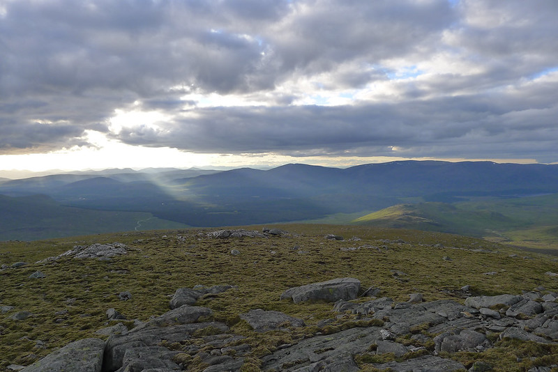
I had been on the move for about eleven hours now and was definitely ready to put my feet up. The summit ridge has a grassy western aspect and it felt quite sheltered; I was almost tempted to pitch the tent here but I knew I still had to sort out water for the night. Instead I carried on to the summit cairn to make it six Munros during the day, and the eighth one of the trip. The views were spectacular with the lowering sun starting to illuminate the landscape below the cloud which had gradually gathered during the afternoon.
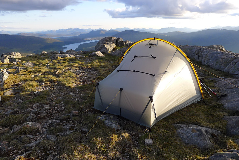
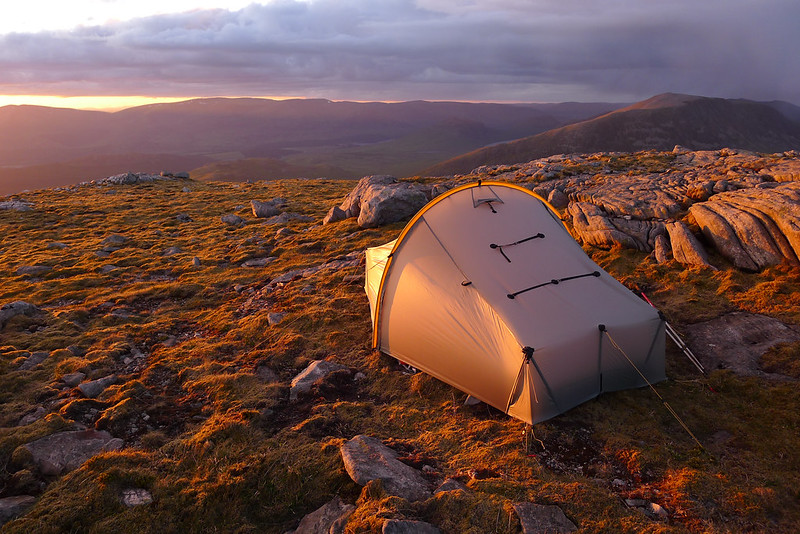
My plan had been to drop off to the west top of Beinn Eibhinn where there are two lochans marked on the Landranger map. However, from the summit I could see a nearer pair of lochans just on the west shoulder. This would mean only about 50m of height loss from the summit and I could see some snow patches that would provide me with water. I dropped down to find a rocky knoll marking the southern edge of the hill. It wasn't immediately obvious where I could pitch but after some pondering I found a narrow patch of turf to get my tent up on. The wind was quite strong and blustery at this time but the tent felt secure and I was happy to set about my evening. I quite enjoyed the fact that after 20 miles and 2,000m of vertical ascent during the course of an 11 hour day, I was now only about 2km north and 500m higher up compared to where I had camped the previous night!
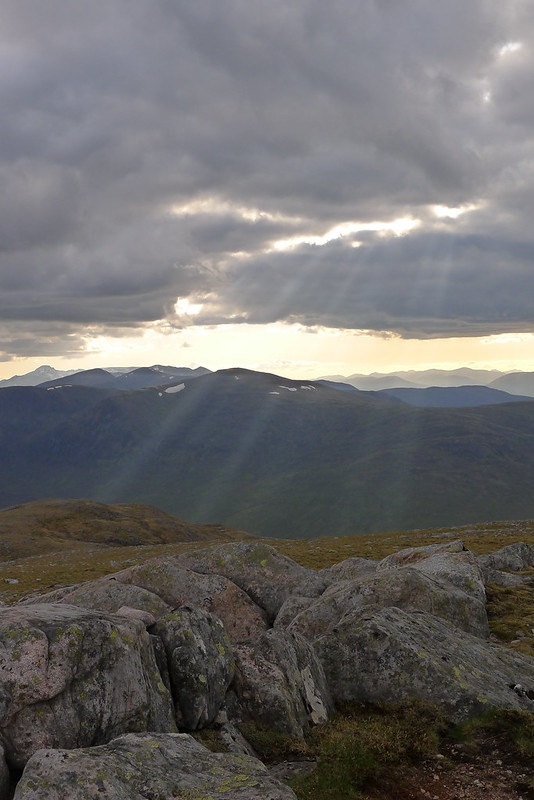
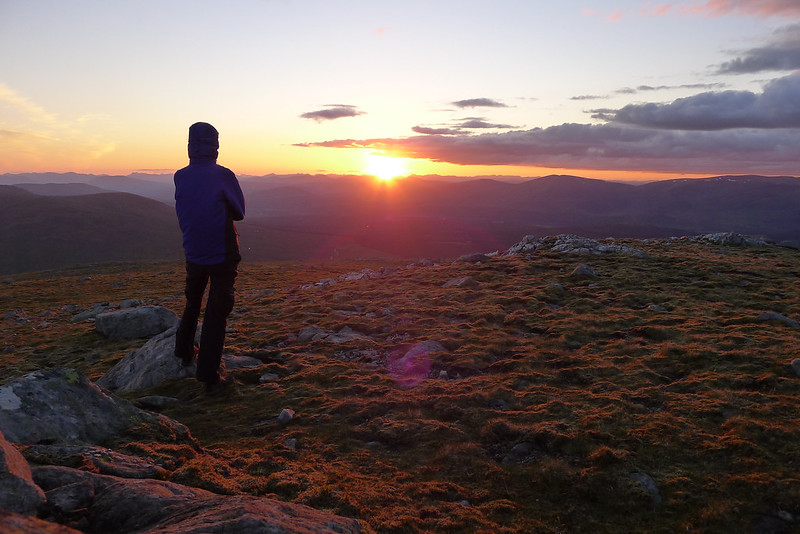
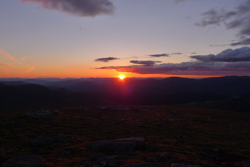
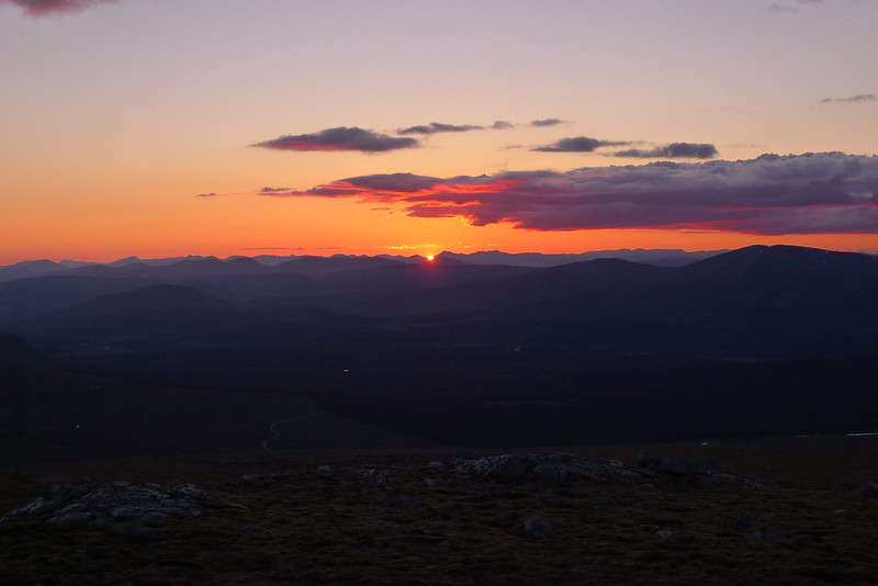
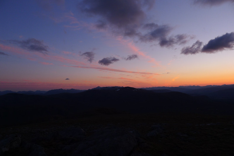
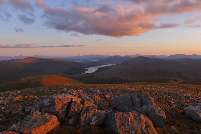
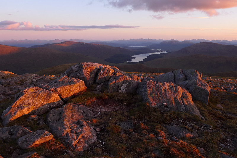
The views were already stunning and these just got better and better as the evening progressed. I had dinner and then sat down on the rocky escarpment to enjoy the wonderful views. In this way I whiled away several hours, taking photos and generally just enjoying the moment. The wind started to ease off slightly but there were still some gusty times and I was soon wrapped up in all my layers. Over the Monadhliath and Glen Spean the occasional rain shower passed by but again nothing troubled me.
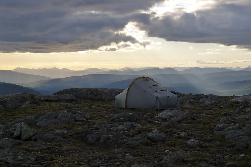
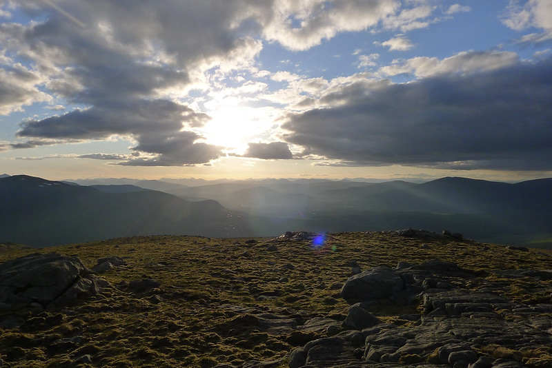
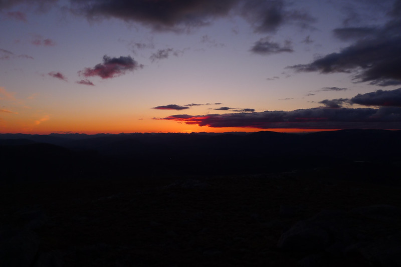
As sunset approached I came across a much nicer patch of ground and so decided to move the tent across. This only took a few minutes but the effort was worth it as the pitch was slightly better oriented for the wind and almost perfectly level. It was now just a matter of enjoying the light show as the sun gradually dropped below the clouds and then set beyond the western mountains.
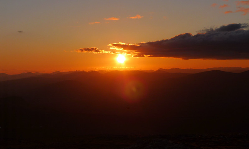
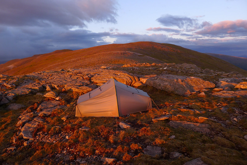
After sunset the light quality was amazing, the sky lit up by pinks and reds. Eventually though it faded to leave just a glow from the North West and so I turned in for the night. It had been a long but brilliant day.