A report of a four day backpacking trip through the Northwest Highlands of Scotland
Date: 24th August to 27th August 2012
Distance: 82.26km
Ascent: 3,671m
Time: Four Days
Hills: Sgurr nan Coireachan (Munro), Sgurr Thuilm (Munro), Luinne Bheinn (Munro)
Weather: Plenty of it
Route: Click to view on Social Hiking
Day 1
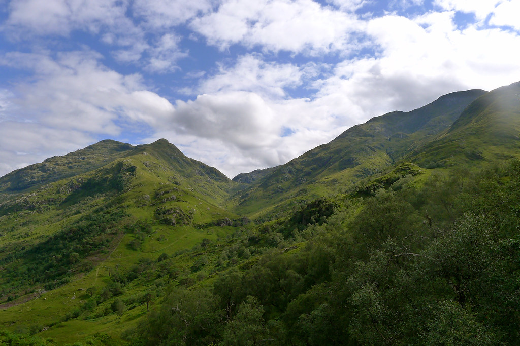
I've never really felt nervous before a trip before, but this one seemed different. My rucksack was loaded with food enough to see me through five days of backpacking. It was heavy, bulging, even a little unwieldy. As I sat on the Citylink coach that took me from the Cluanie Inn (where I had parked my car) to Fort William I gazed out at a familiar landscape. Hills and lochs that I have driven past several times now were all gloomy and grey as a steady rain fell from leaden skies. At Fort William I had a couple of hours to wait before my train but with little appetite spent it in the bustle of the station cafe reading a few chapters of my book. The Maillaig-bound train duly arrived on time and took me west, along the beautiful shores of Loch Linnhe. As the rain finally eased there was now a brightness to the sky, a promise of a better afternoon and the thought of claiming my first couple of Munros of the trip.
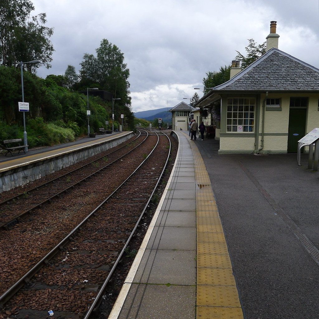
At Glenfinnan I left the train with a small number of touristy-types who soon disappeared off to various corners of the village. I was left alone on the platform with my rucksack and my thoughts, and very little choice but to start heading north if I was to get back to my car. In fact, stepping off the train, that first part of the journey complete, seemed to take a lot of the lingering tightness out of my stomach and under brightening skies I started to feel more pleasantly excited about shouldering my pack and heading off down the road to pick up my way north.
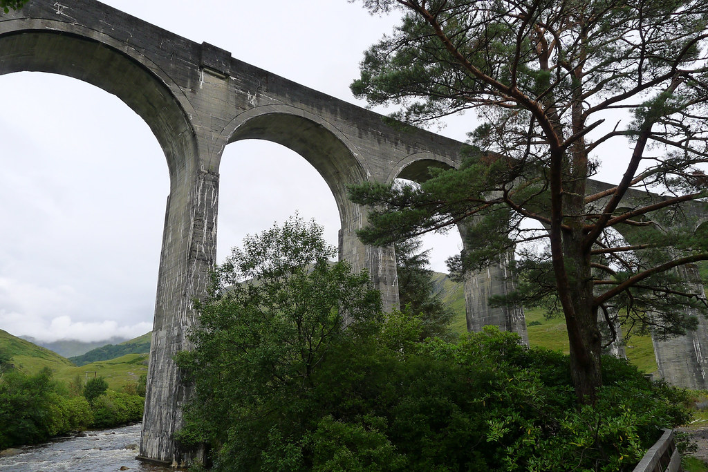
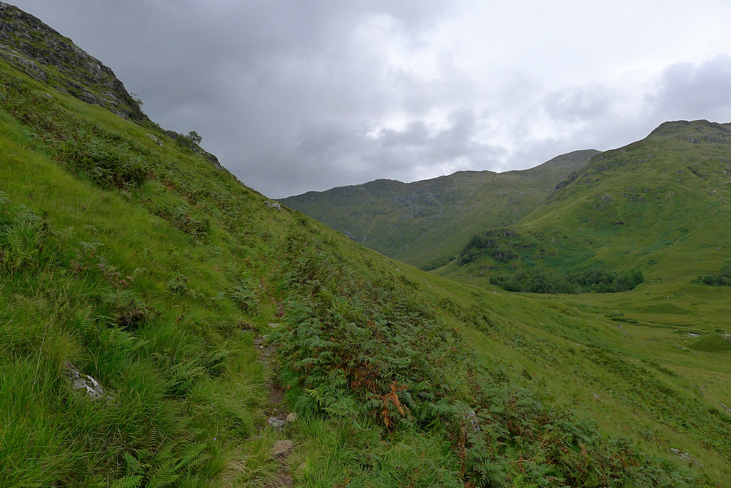
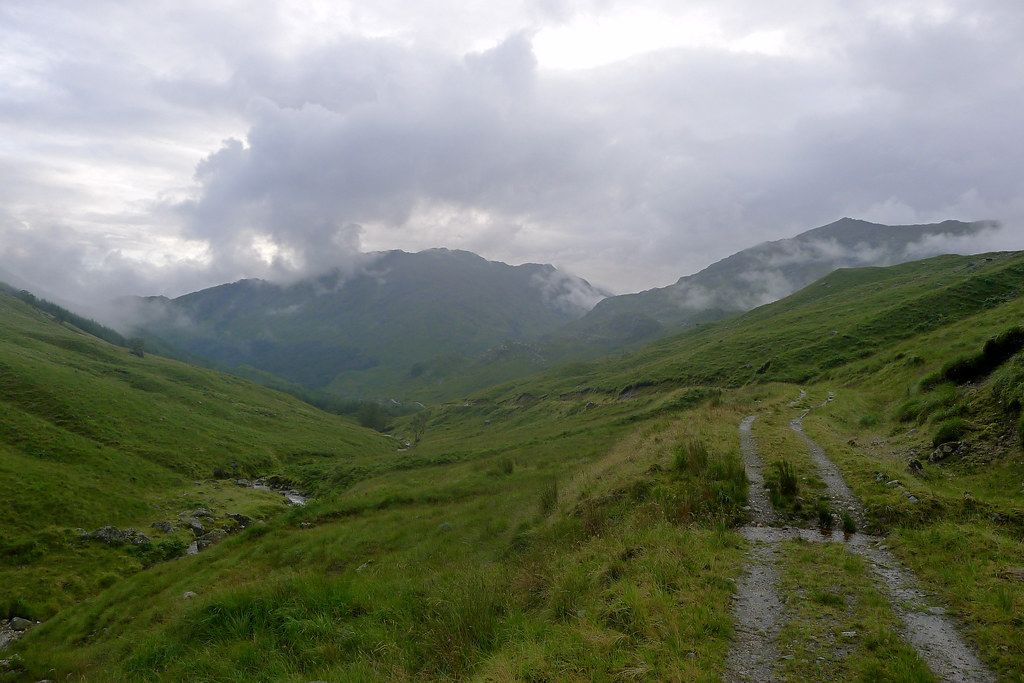
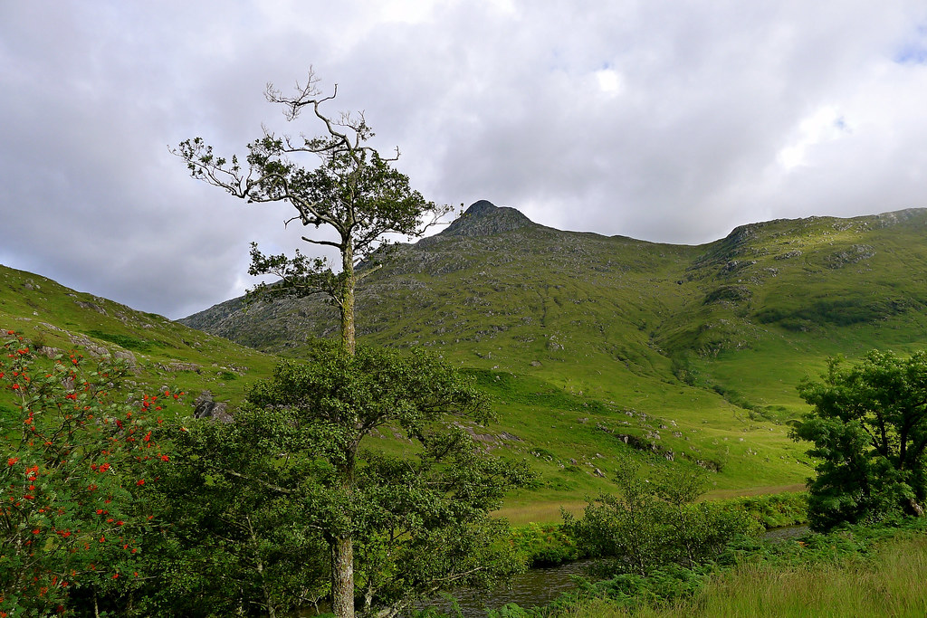
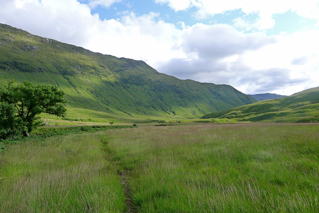
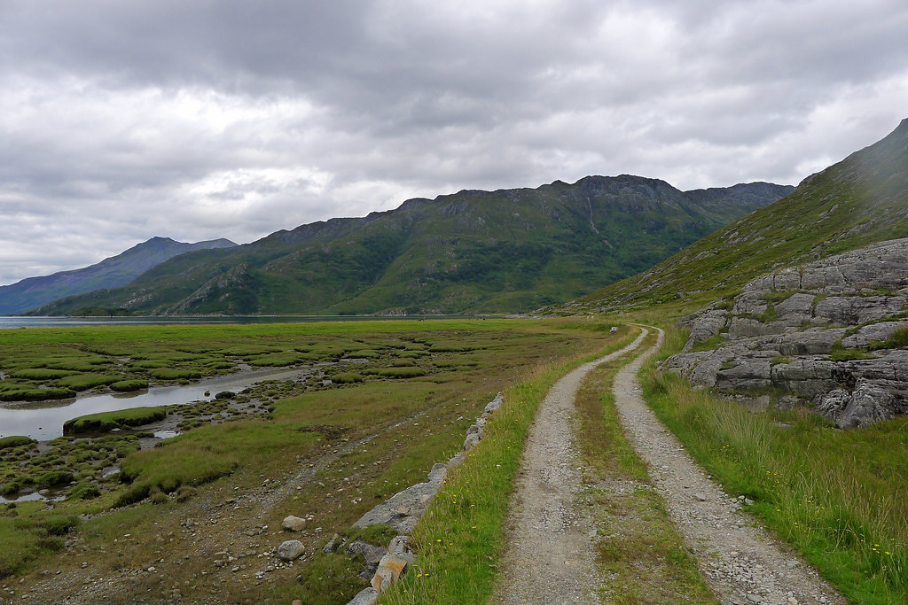
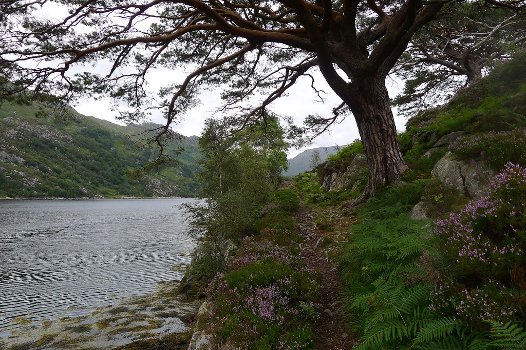
After a short stretch along the main road I turned left just before the bridge over the River Finnan and followed the tarmaced estate road through the glen. After stopping briefly under the brutal concrete viaduct that has gained fame through a certain wizarding movie franchise I continued on.
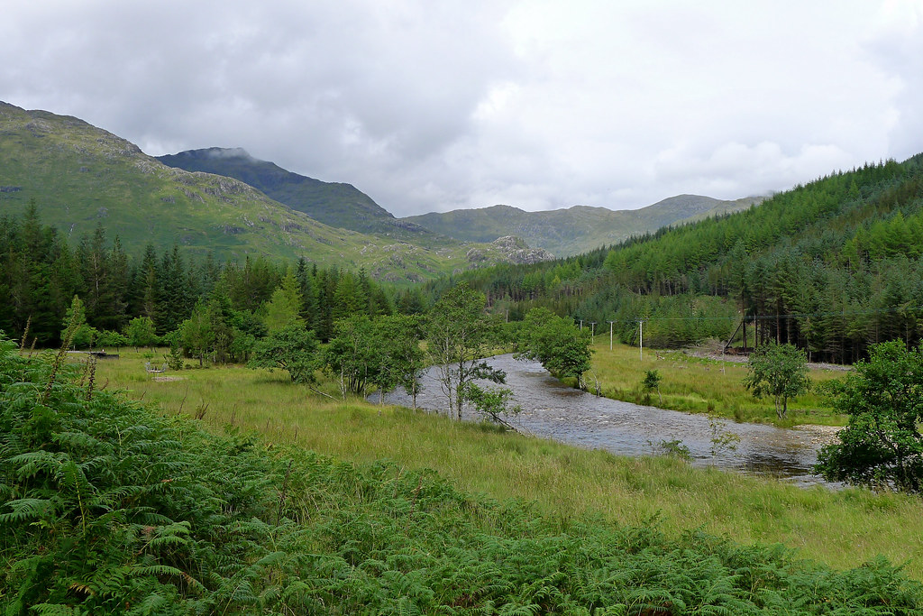
Glenfinnan estate is currently installing a series of run-of-the-river hydro generation schemes along the Finnan and its tributaries and as such the glen is somewhat of a mess with new and widened construction tracks, new buildings and more. Thankfully the lush greenery down by the river and the dramatic profiles of the hills remain unspoilt and I enjoyed my steady meander down to reach the turn-off to Sgurr nan Coireachan.
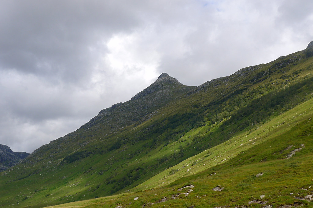
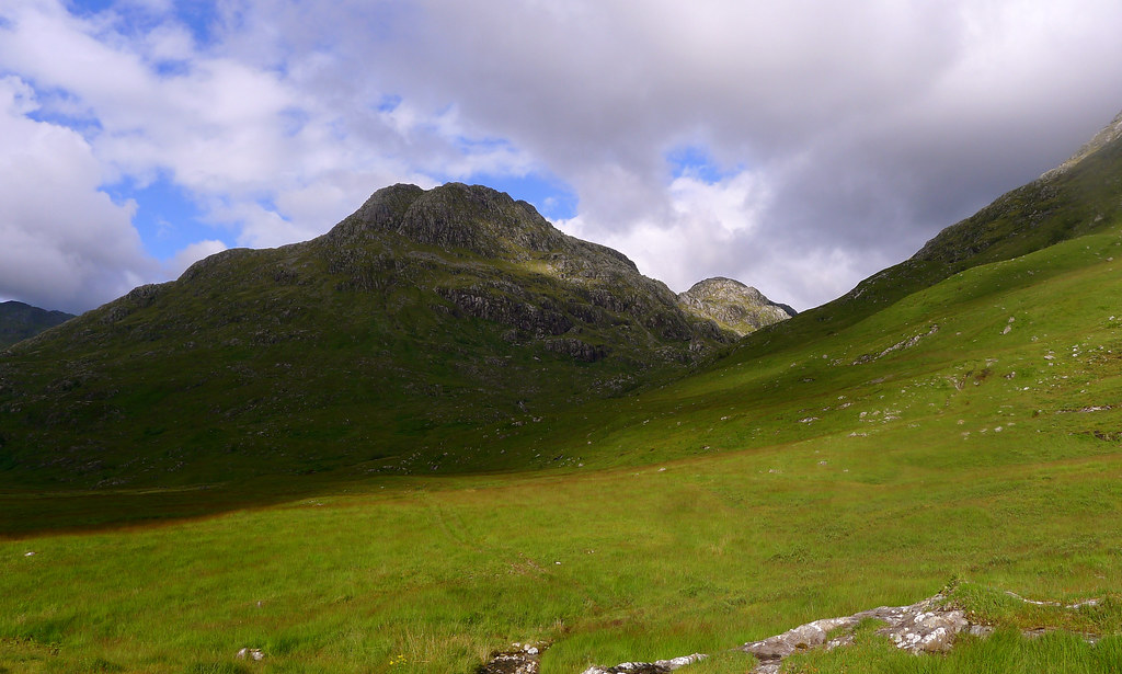
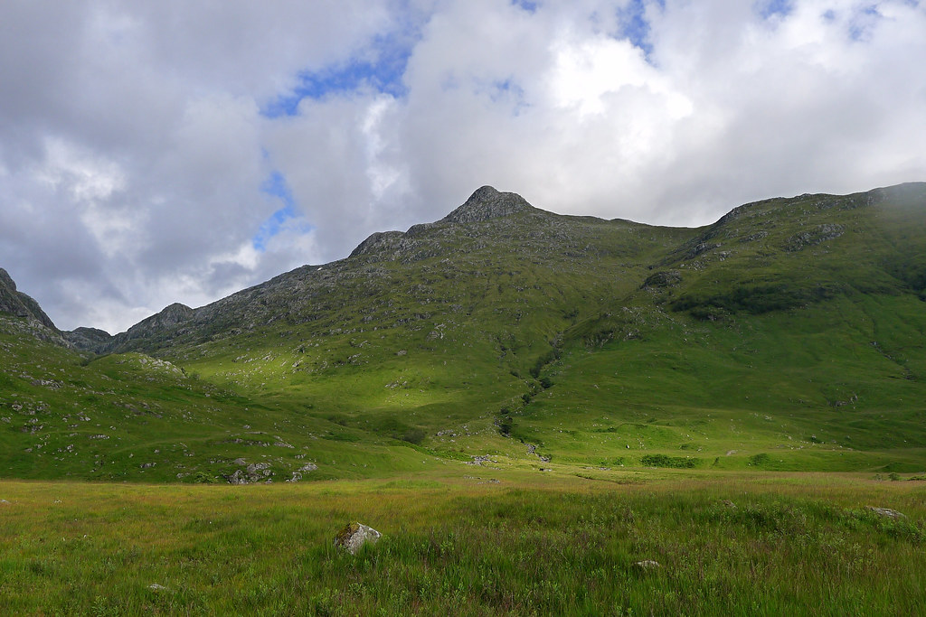
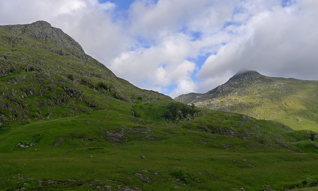
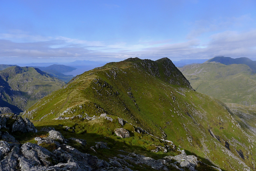
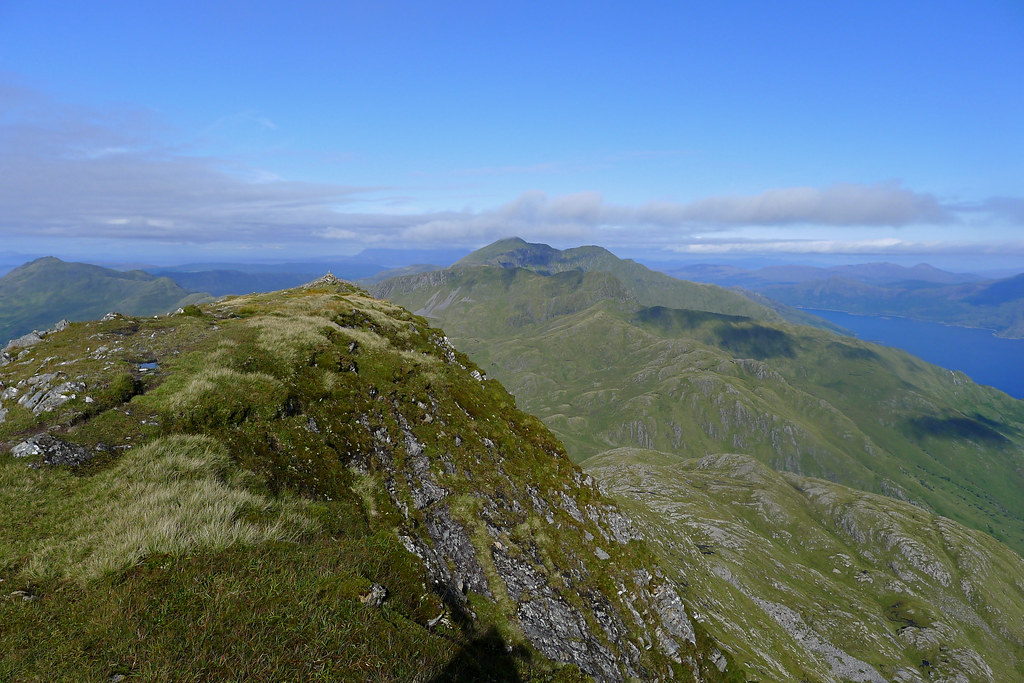
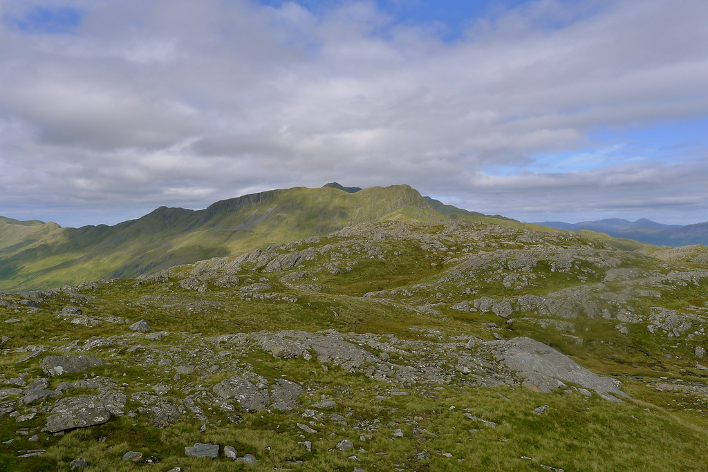
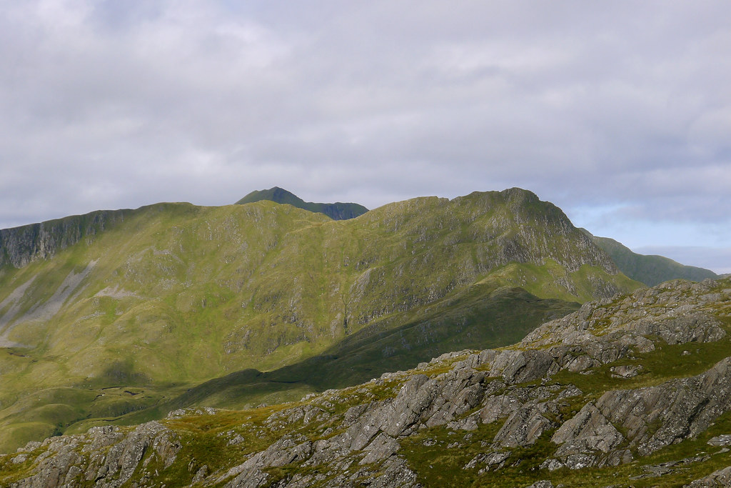
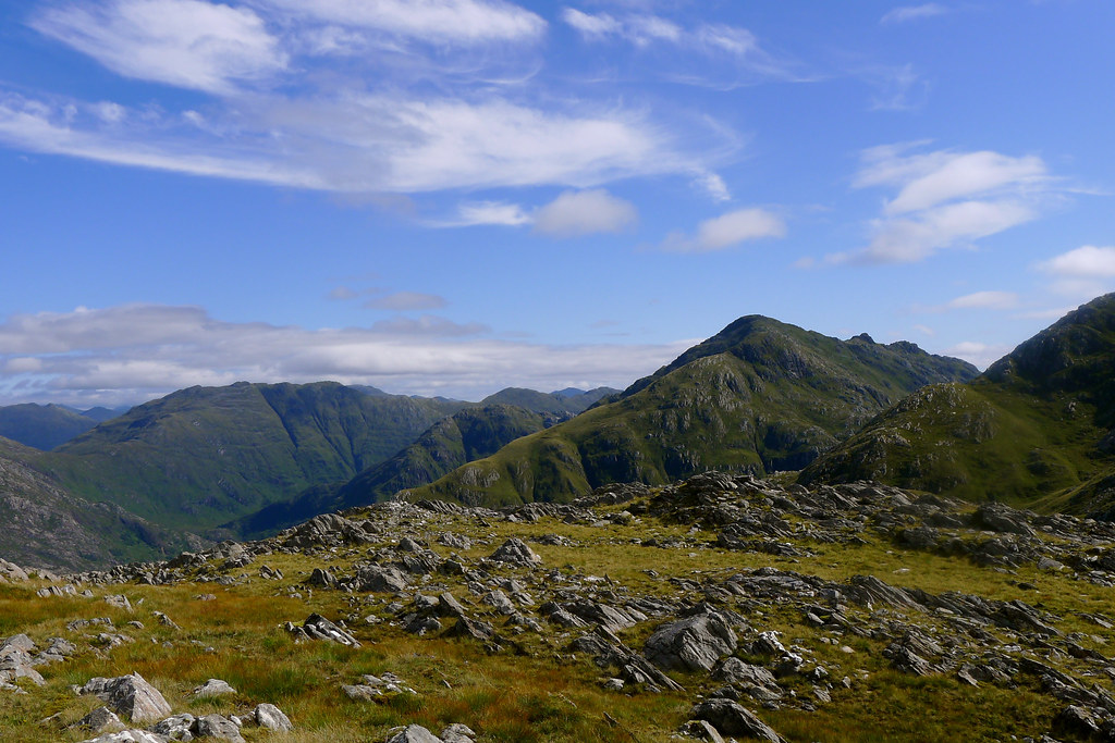
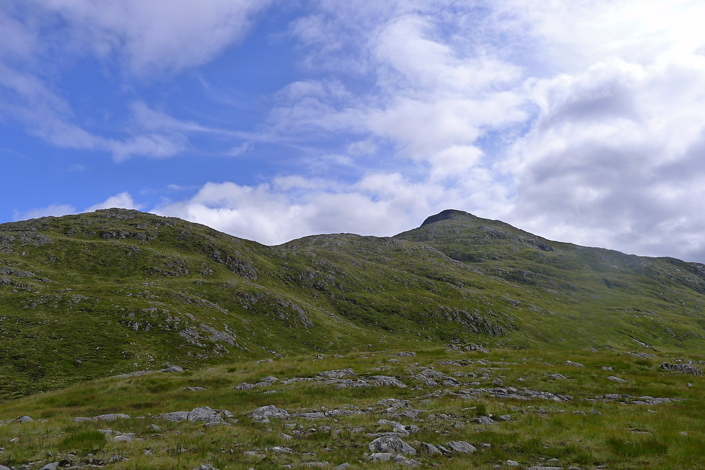
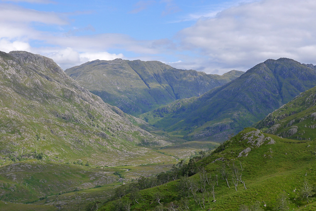
The ascent of this hill is on an excellent stalkers track which rises steadily above the glen, climbing around and over a number of craggy lumps towards the subsidiary top of Sgurr a'Choire Riabhaich. Though mostly easily to follow I did end up losing the path at one point but a short scramble up slick grass got me back on course.
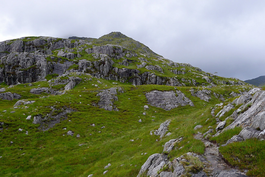
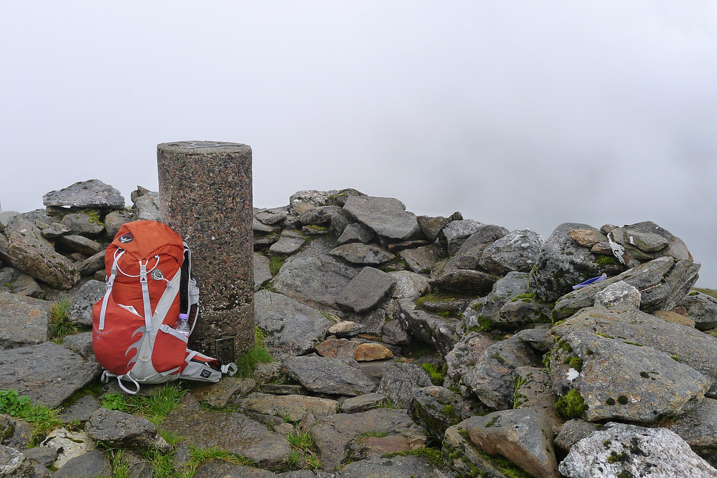
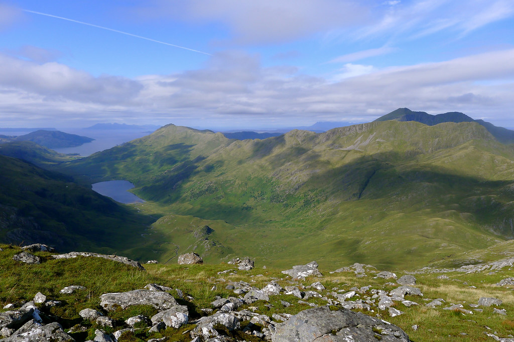
The front nose of Sgurr a'Choire Riabhaich is an impressive bulk of rock but the path turns it steeply on its right flank, rising as a series of gravelly zig-zags to emerge on the top. The rest of the walk up to the Munro was easy going between more rock bands and a couple of easy scrambles. The views back down Glen Finnan towards the hills around Loch Shiel and the views across to neighbouring Streap were grand but as I rose I moved into mist and cloud that was pouring back in from the west. I reached the trig point at the summit in dense cloud.
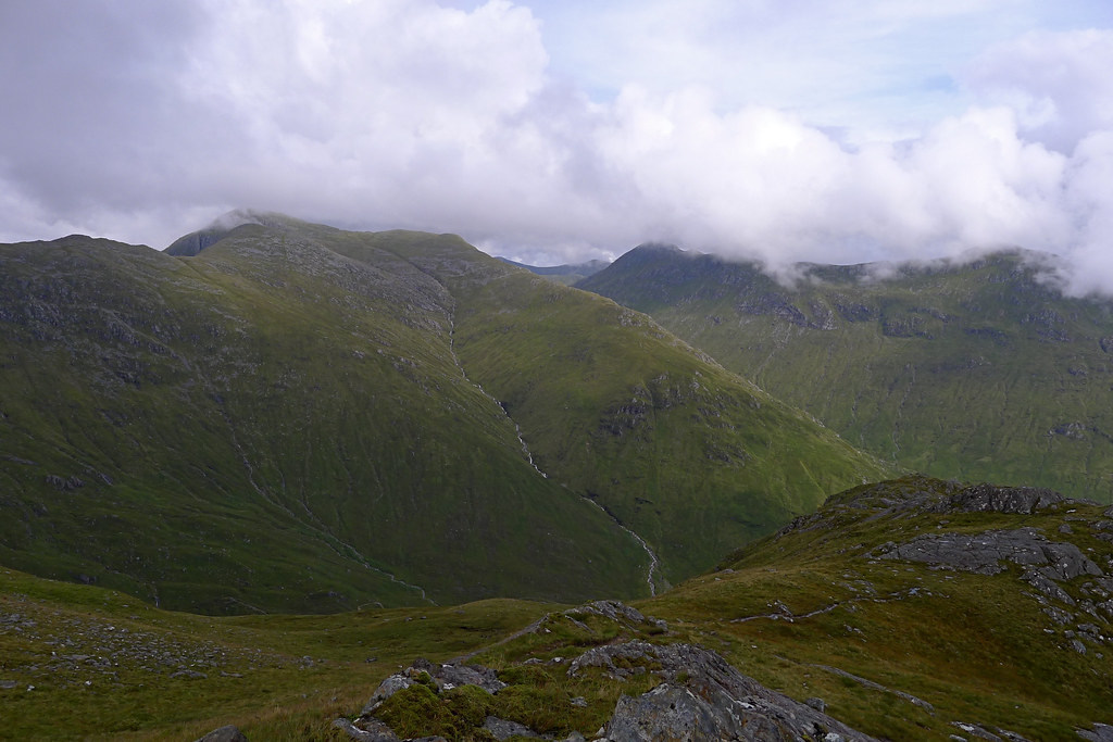
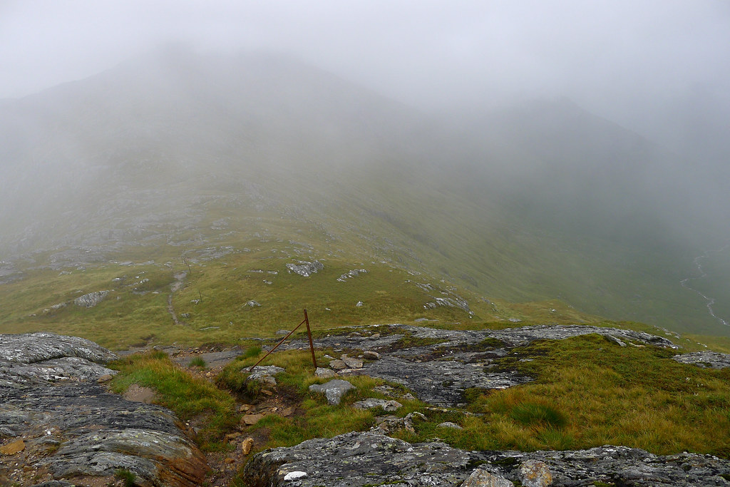
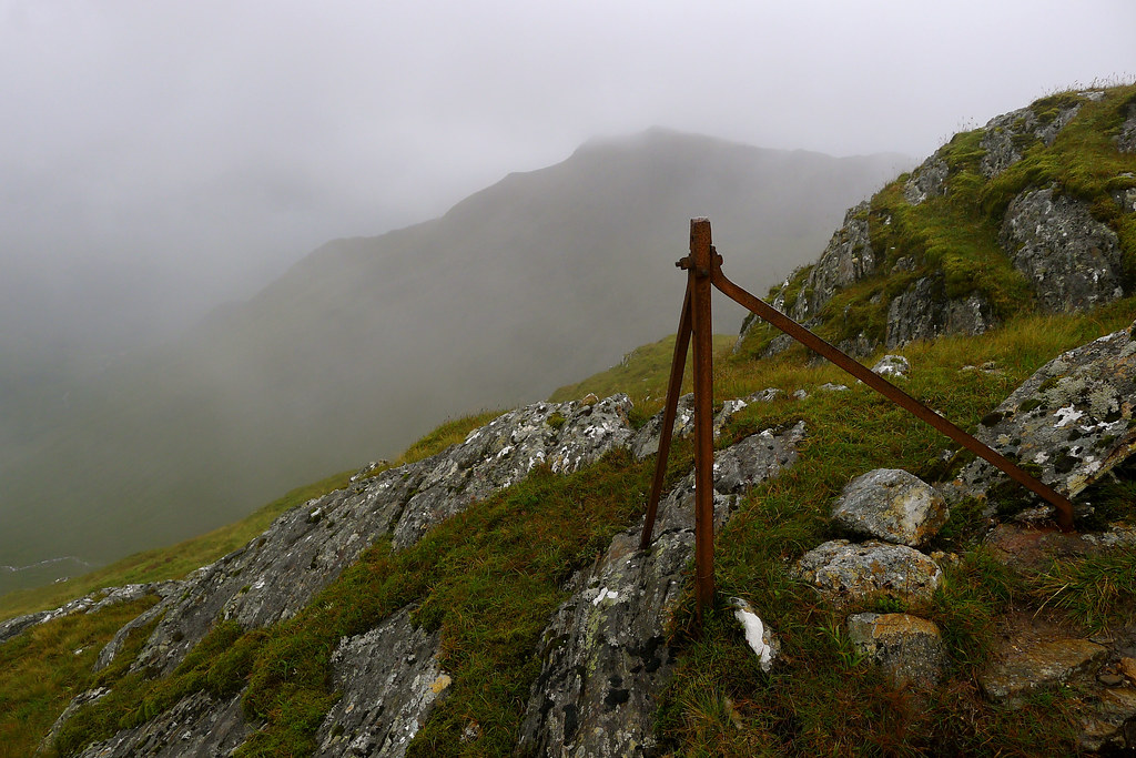
From here the natural route is to follow the high ridge line across a series of lower tops to reach the second Munro of Sgurr Thuilm at the far end of the horseshoe. This is easily accomplished, even in the mist, as a clear track follows a line of rusting fence posts all the way around. I followed this easily, no views to distract me, although from time to time the cloud thinned and I got a view of a pale, distant Loch Arkaig as well as the dark shapes of the surrounding mountains. However, as I progressed the cloud once again thickened and it started to rain. The final climb up to Sgurr Thuilm was a little slippery and delivered me to another fog-bound cairn. I paused here for a snack and a drink but again the views were nil.
In the planning stages of this walk I had intended to come down the north ridge and then camp overnight somewhere in Glen Pean but on contacting the estate had been informed that the north ridge and corries were used by the stalkers and they would rather I kept to the main Munro route. This meant my descent of Sgurr Thuilm took me back towards Glenfinnan on a steep but good quality path.
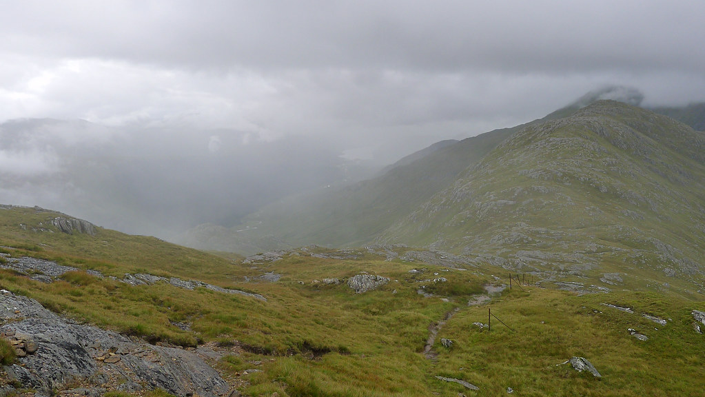
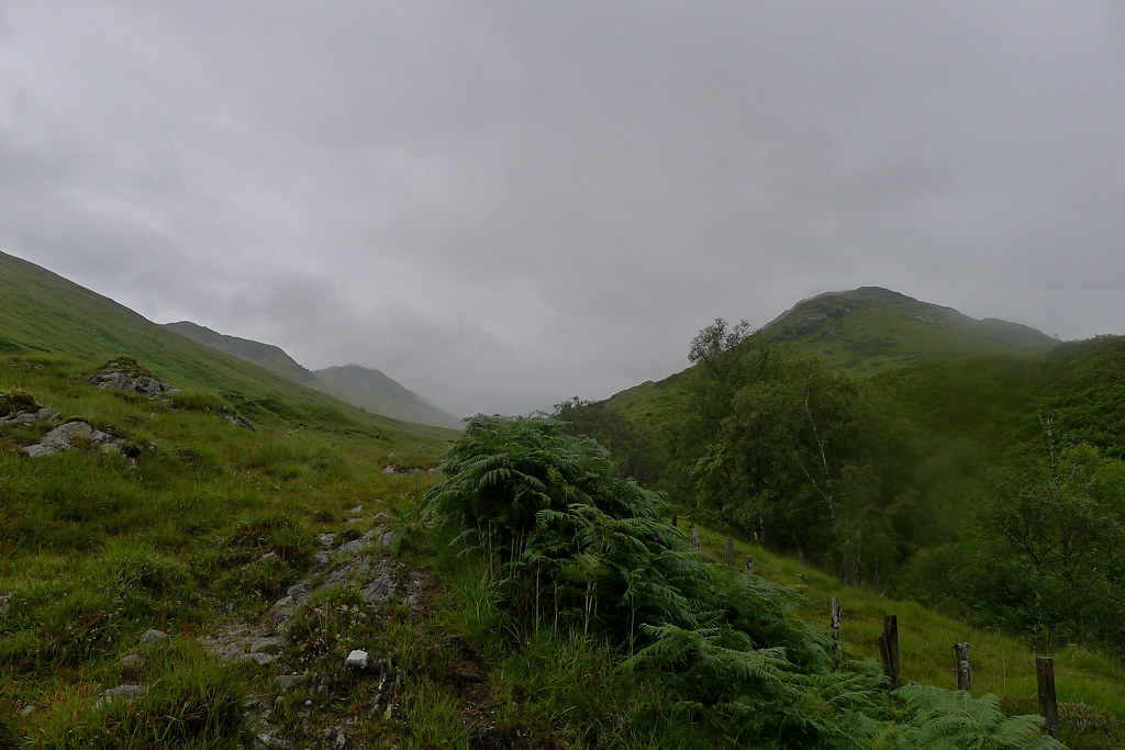
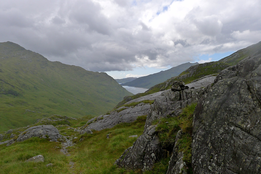
Towards the bottom I was able to turn east and make my way down wet ground to rejoin the track I had left earlier as it climbed up to the bealach between Sgurr Thuilm and Streap. After refilling my water bottle I followed the track up to the bealach where, based on the hour of day, I was planning to camp.
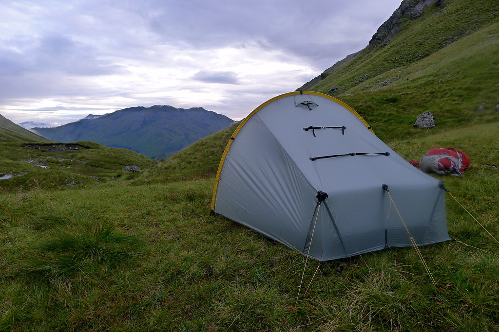
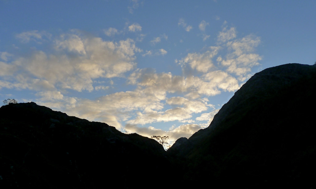
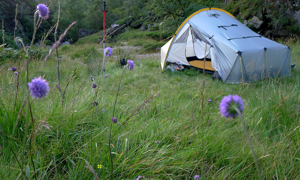
As I reached the summit of the pass the mist had started to descend off the high tops once more after a brief spell of clearer weather. Through it I could see the shadowy shapes of a group setting up their own tents a little further on. I found my own raised, flat knoll out of hearing distance of the others and got my own tent up and camp sorted. There was plenty of flowing water and I soon had a brew on and a hot dinner. With the light fading and more clouds gathering I retired to the tent for a relaxing evening spent reading and drinking hot chocolate and reflecting back on a what had turned into a good first day, despite the weather.
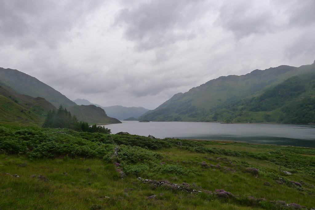
Day 2
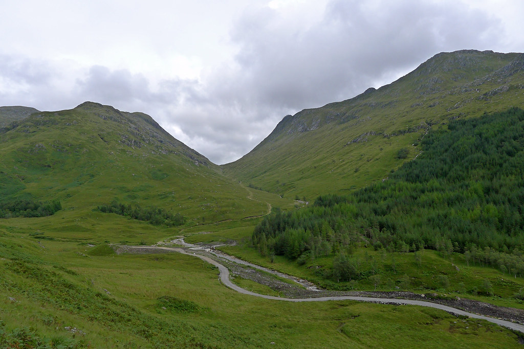
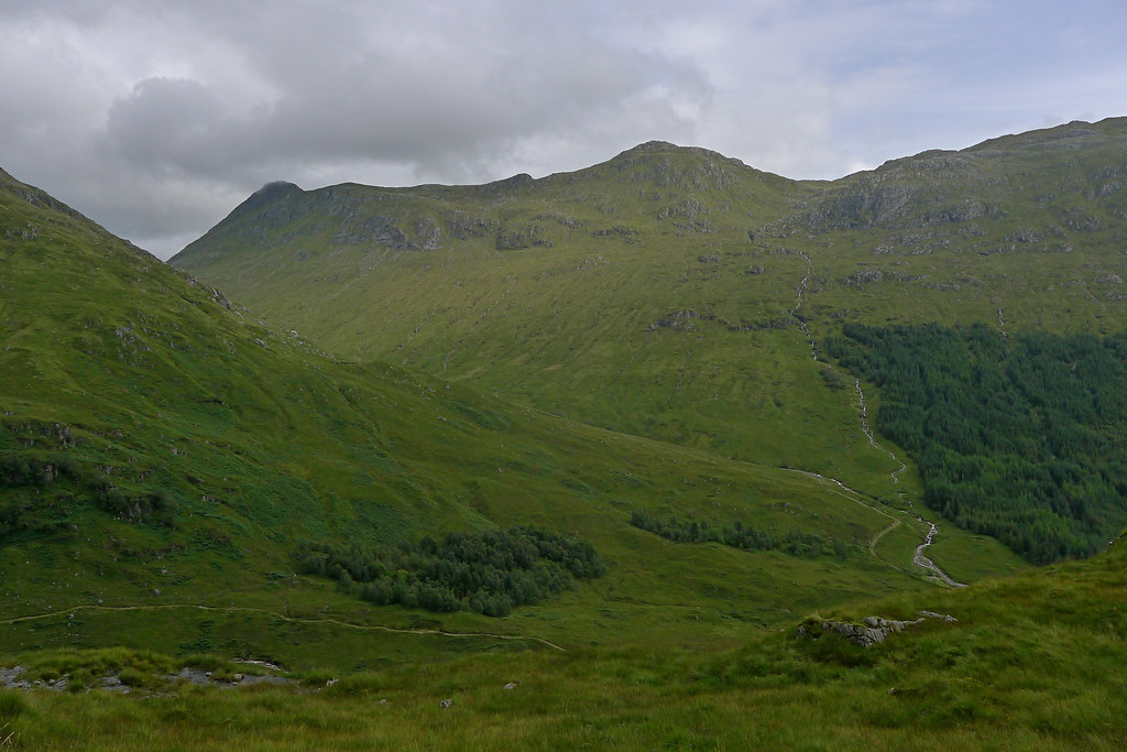
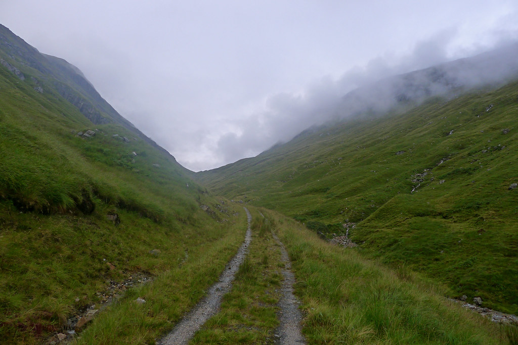
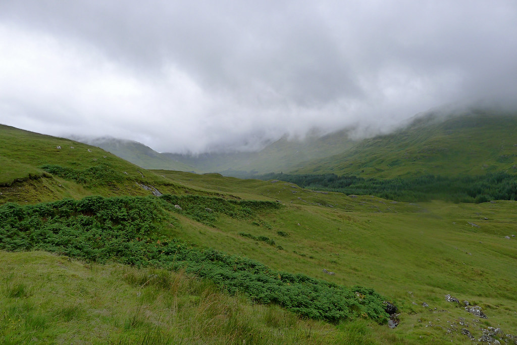
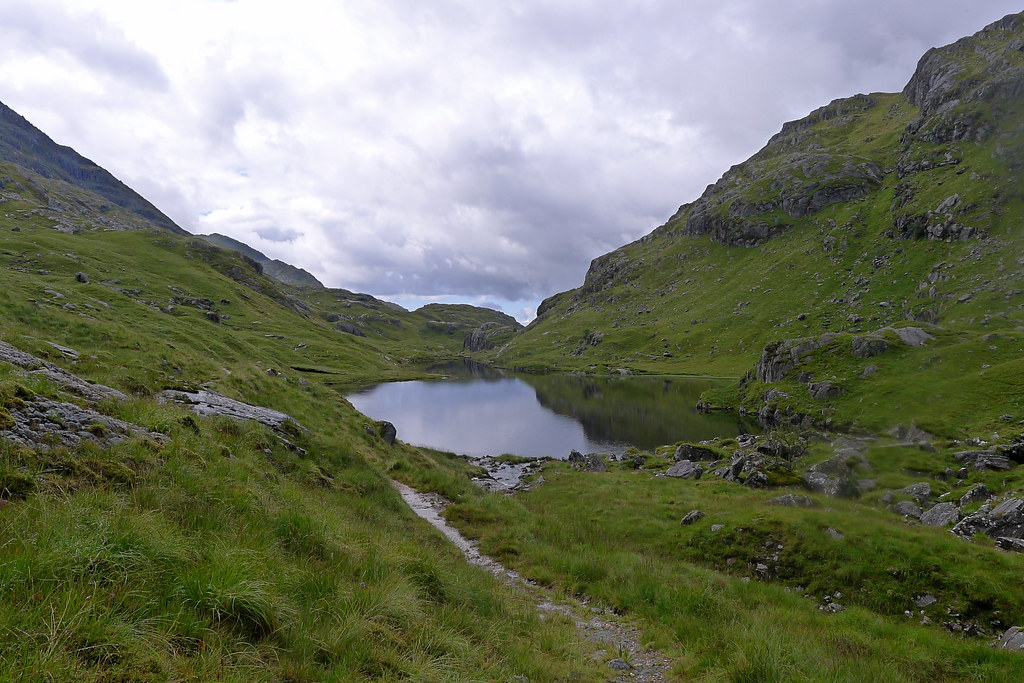
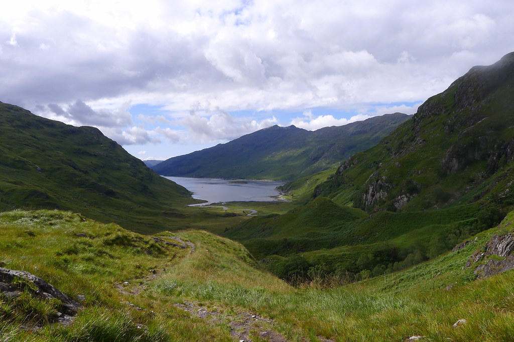
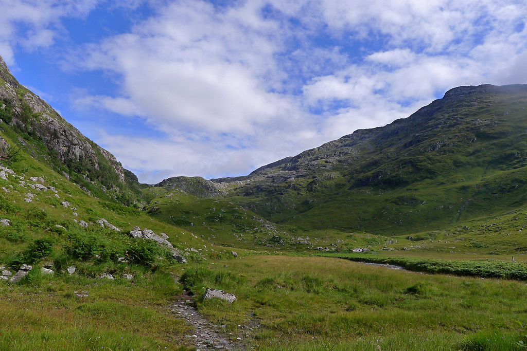
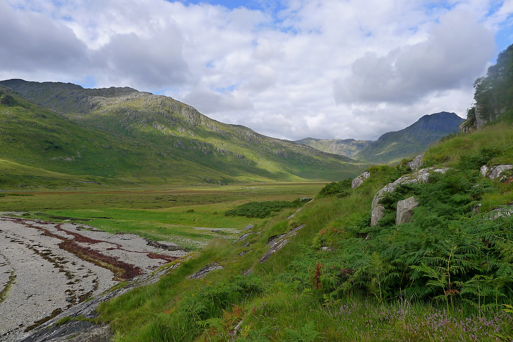
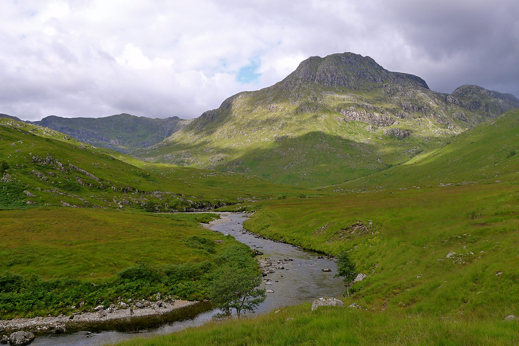
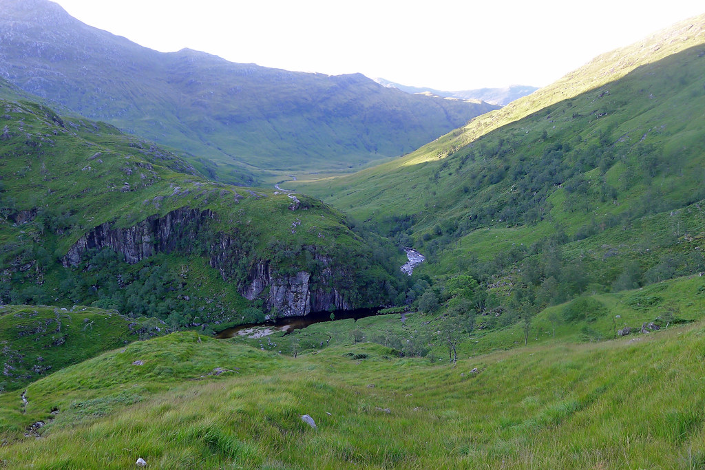
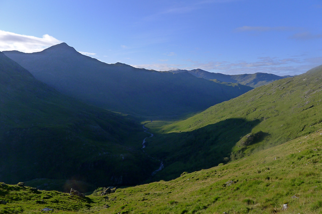
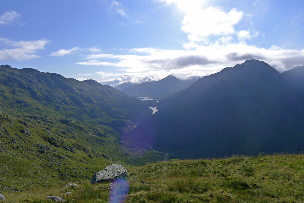
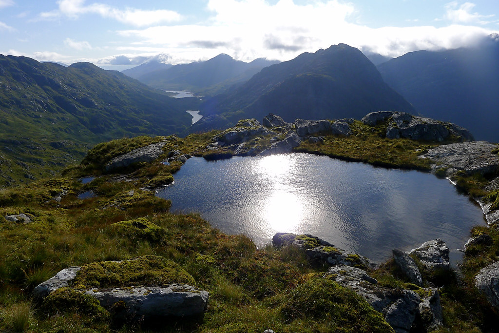
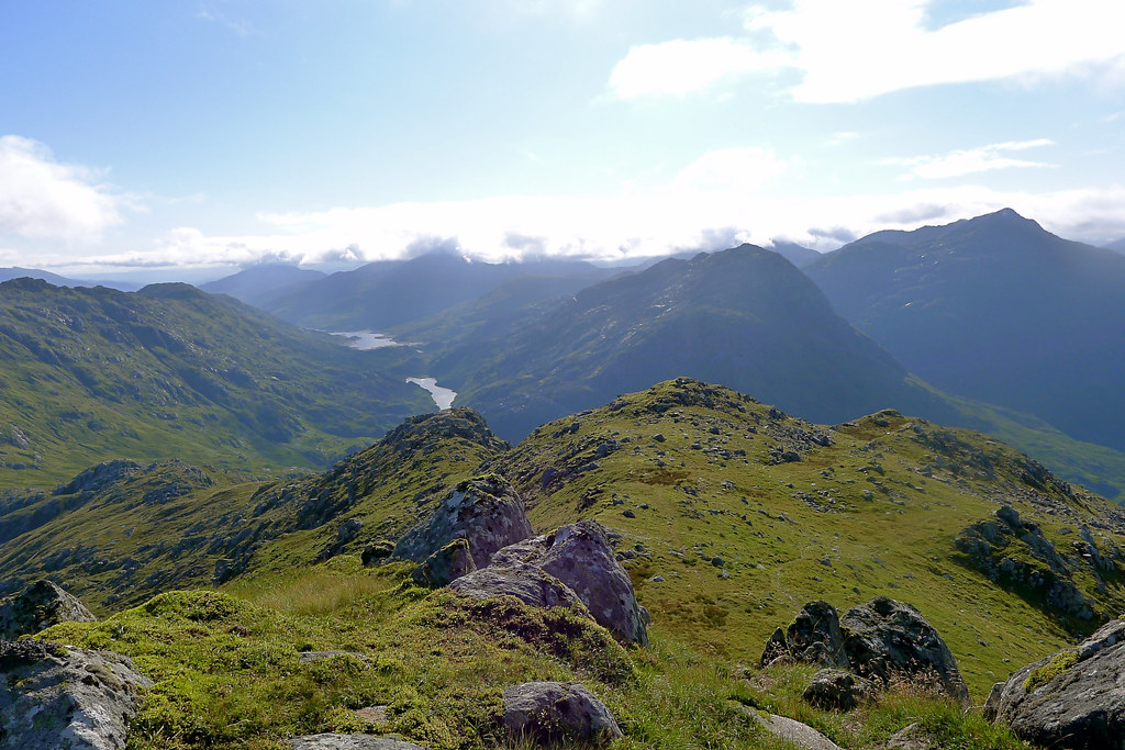
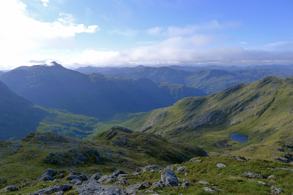
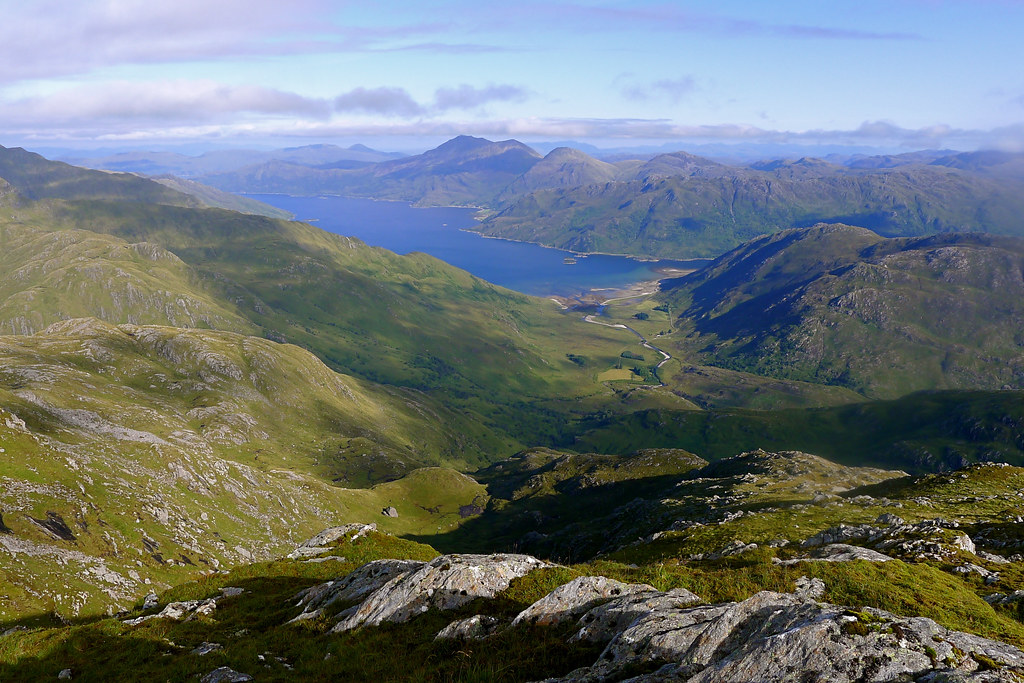
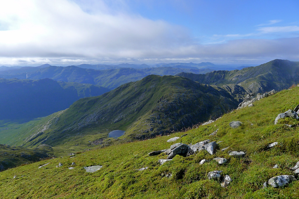
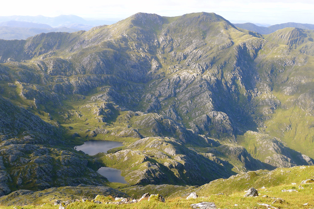
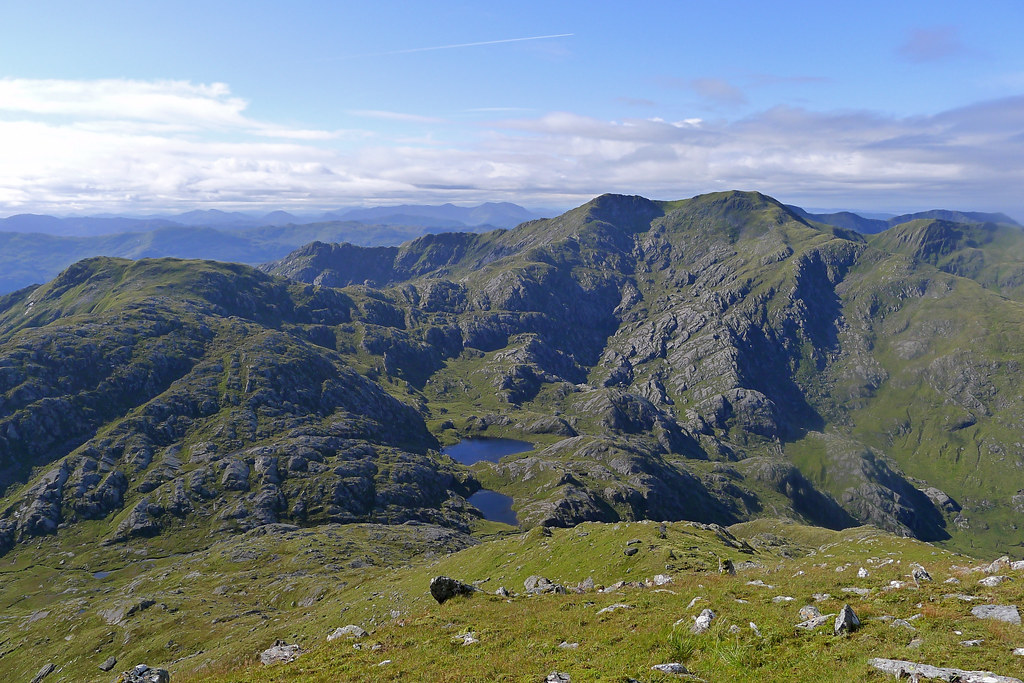
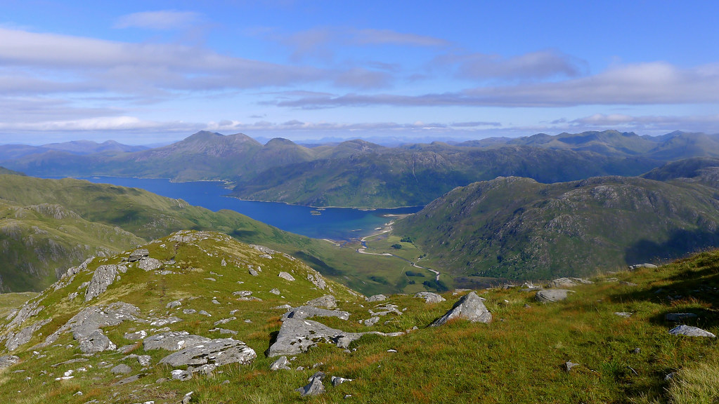
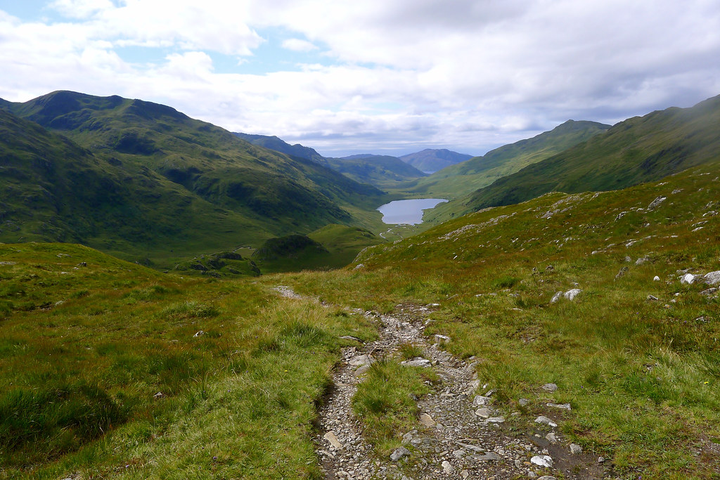
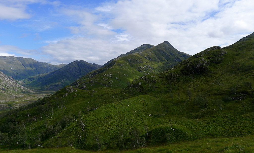
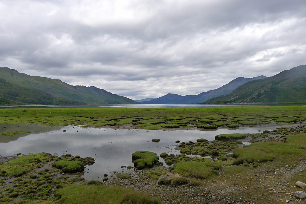
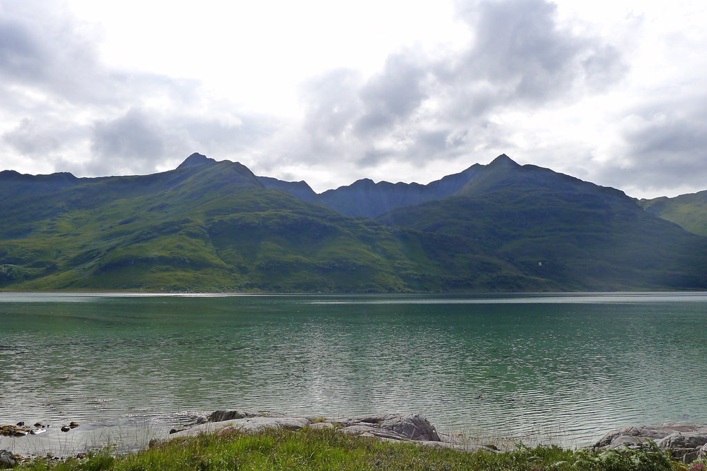
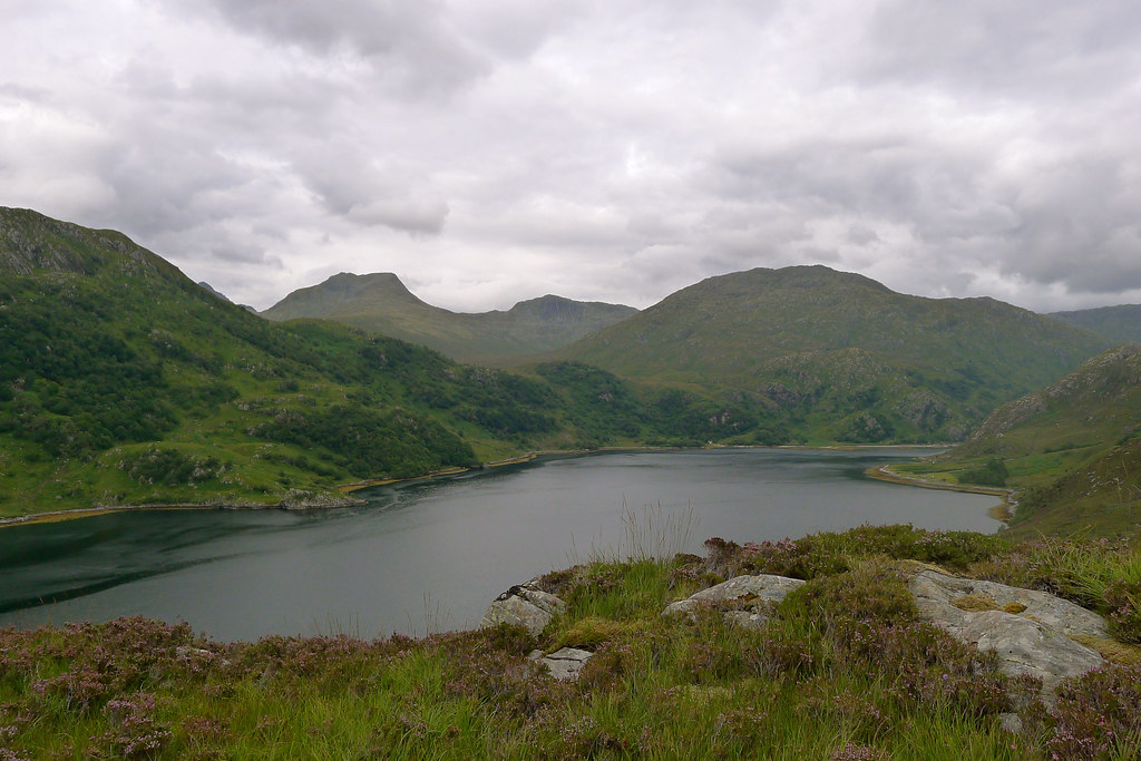
The bealach above Glen Finnan to the River Carnach below Ben Aden
Although the weather had cleared a little as the evening advanced I woke to a misty dawn. I turned over and slept for another couple of hours, finally getting up at around 8 to enjoy a coffee, some breakfast and a fairly lazy start to my first full day.
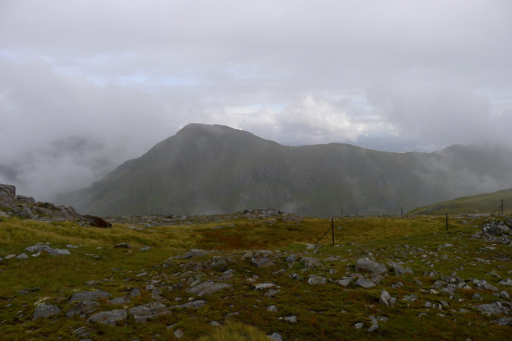
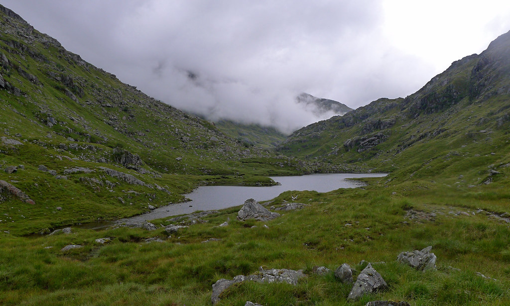
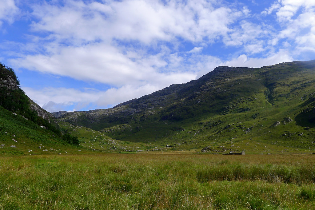
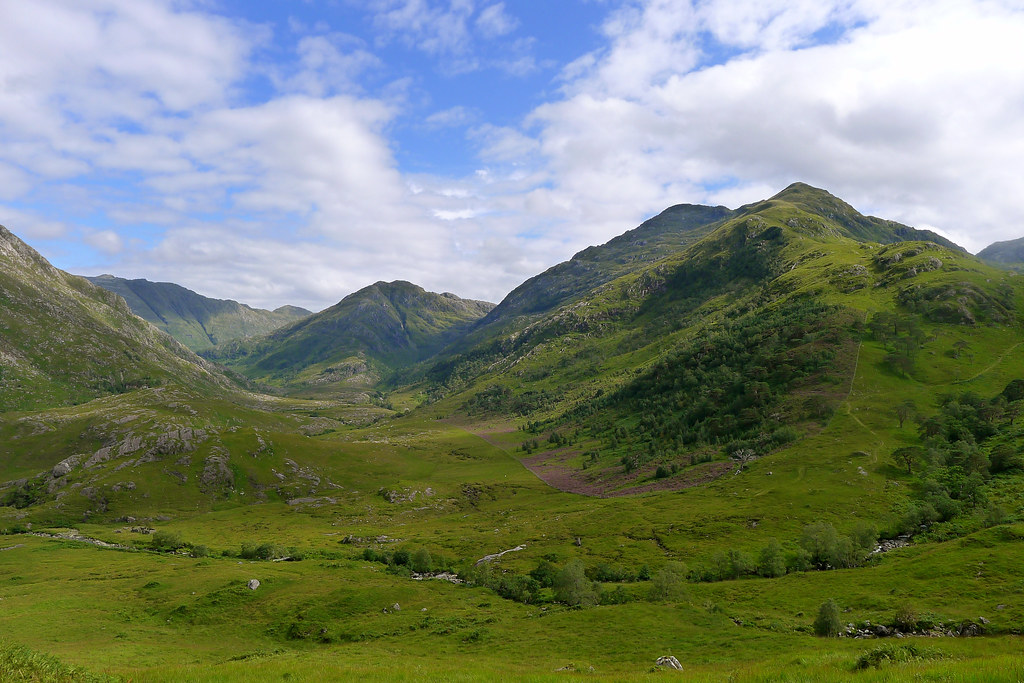
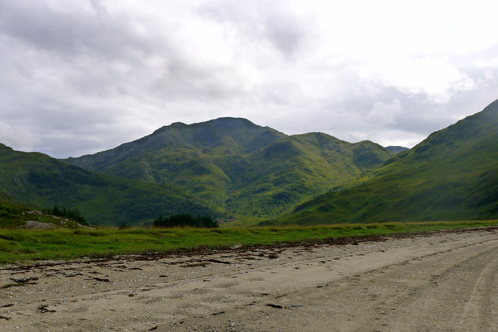
The weather was definitely on the damp side with the cloud low and gloomy though it wasn't actually raining. The fair weather plan for today would have been to tackle the three Glen Dessary Munros, ending on Sgurr na Ciche and then heading north to camp, possibly going as far as Loch nam Breac. The weather was far from fair and I didn't see much point in doing these spectacular hills in dense cloud. My alternative route was a longer, lower route, aiming for the same point but going around via Sourlies and then following the River Carnach to arrive at the loch.
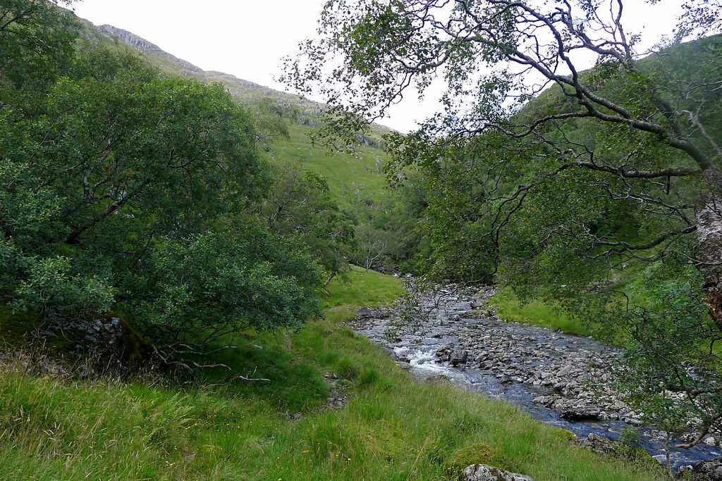
With everything packed away I finally dropped off north from the bealach at just on 9. The other campers were just stirring. I soon found myself in Glen Cuirnen a long, quite narrow glen which led me north towards the intersection between Glen Pean and Glen Dessary. The weather soon deteriorated and I found myself following a waterlogged track with my hood drawn up around my face. There were muddy tracks on both sides of the stream but neither seemed better or worse until I came to the lower reaches where tall bracken drove me across the water to reach an argo track on the other side which guided me down to the bridge over the River Pean. Here the rain had eased off so I paused for some food and a water refill.
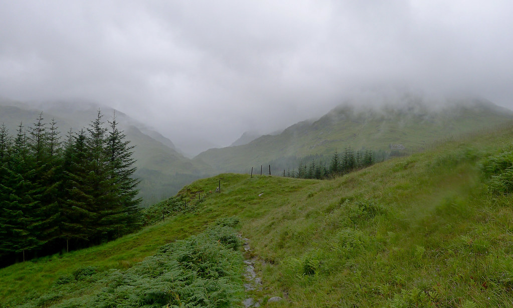
It was an awful mud-choked path that led up away from the river through the fringes of the forest but thankfully it led to a good land rover track which took me around the foot of Monadh Gorm near Strathan and into Glen Dessary. With the tops still lost in the low cloud I didn't feel I was missing out on much by sticking with the forest track all the way to the bothy of A' Chúil.
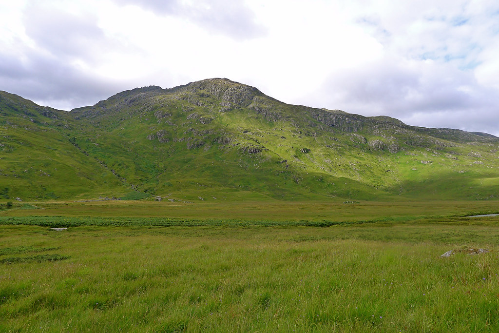
Shortly after this the forest ended and I dropped down to cross the river, climbing up a boggy track to reach the path on the north side of Glen Dessary. This path was much narrower and followed the contours of the glen more closely. I climbed up over low ridges and dropped down to wade through churning side streams. The hills above me continued to be shrouded in mist and cloud, their crags eerie and sinister in the gloom above me.
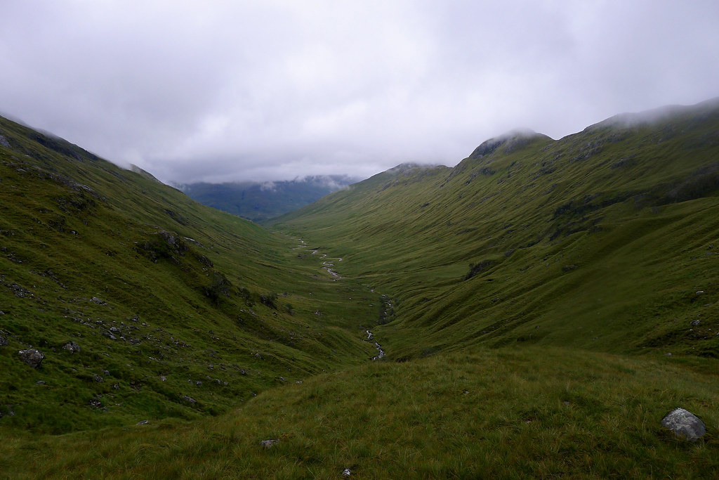
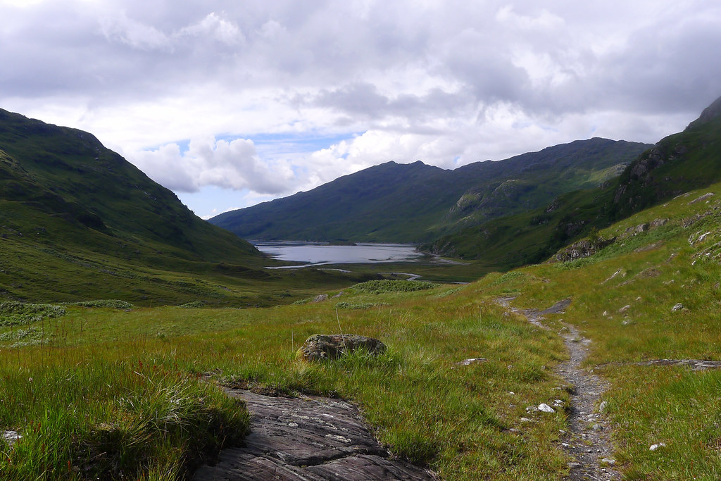
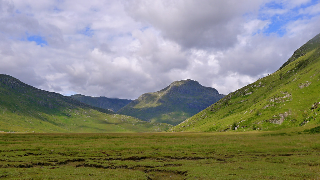
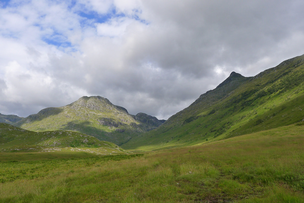
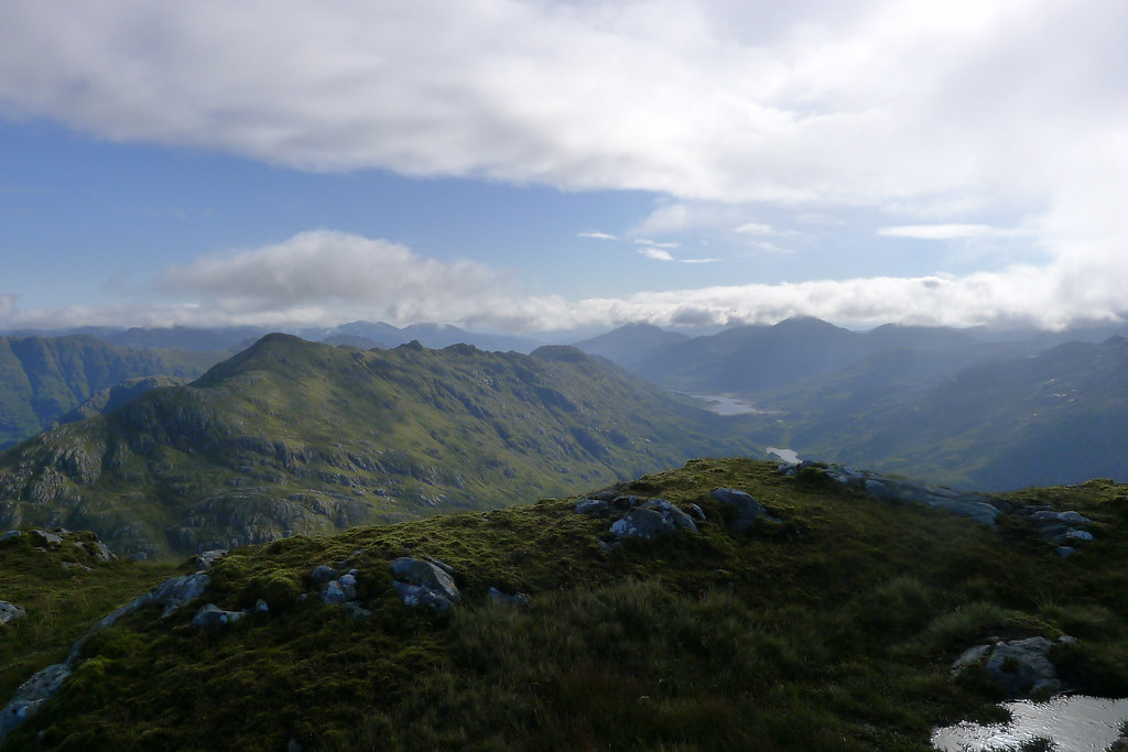
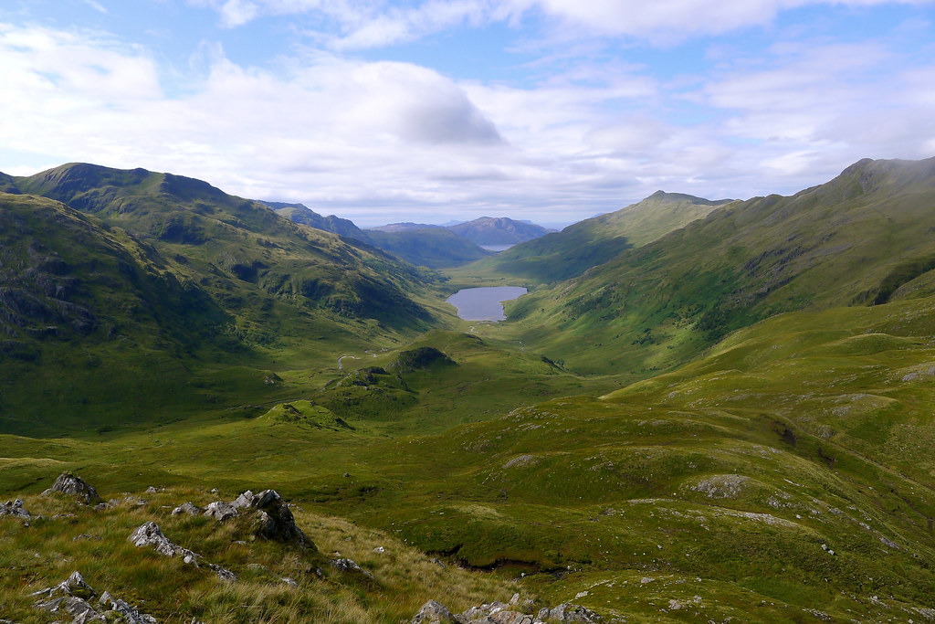
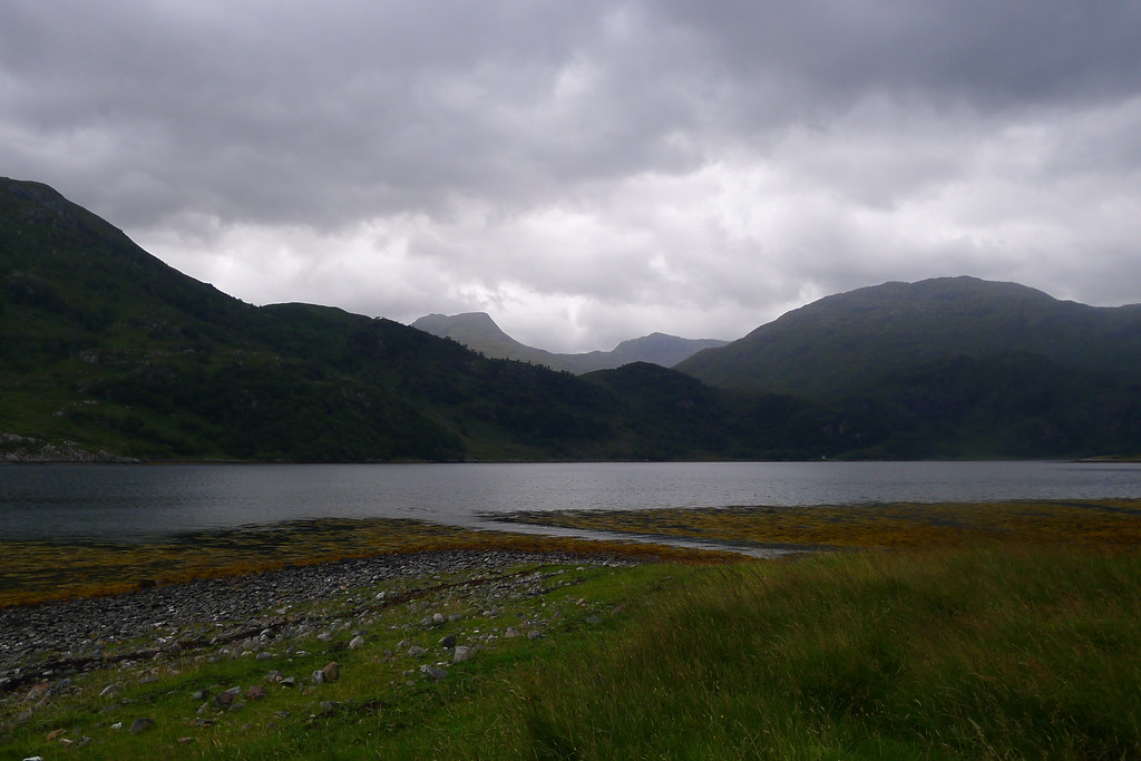
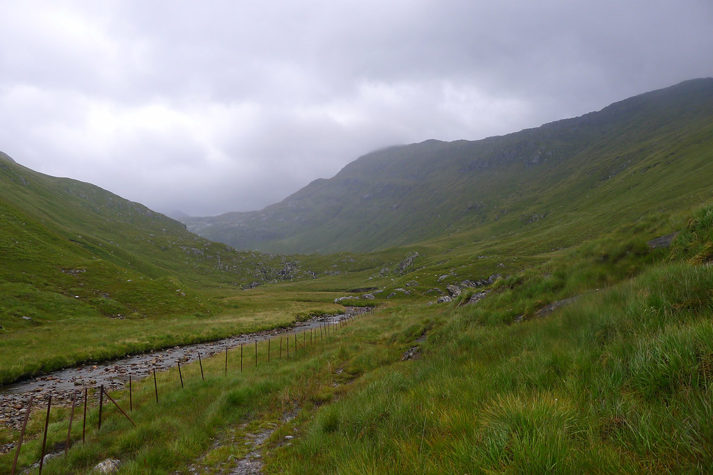
It was good to gradually rise out of the wide part of the glen and enter its narrower upper reaches where the ground became less rugged. There was more bog to negotiate but I was soon on rockier ground and climbing up to the cairn marking the high point of the pass over to Loch Nevis.
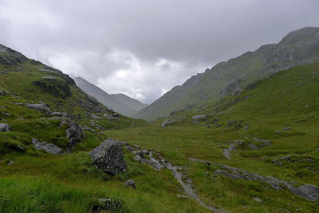
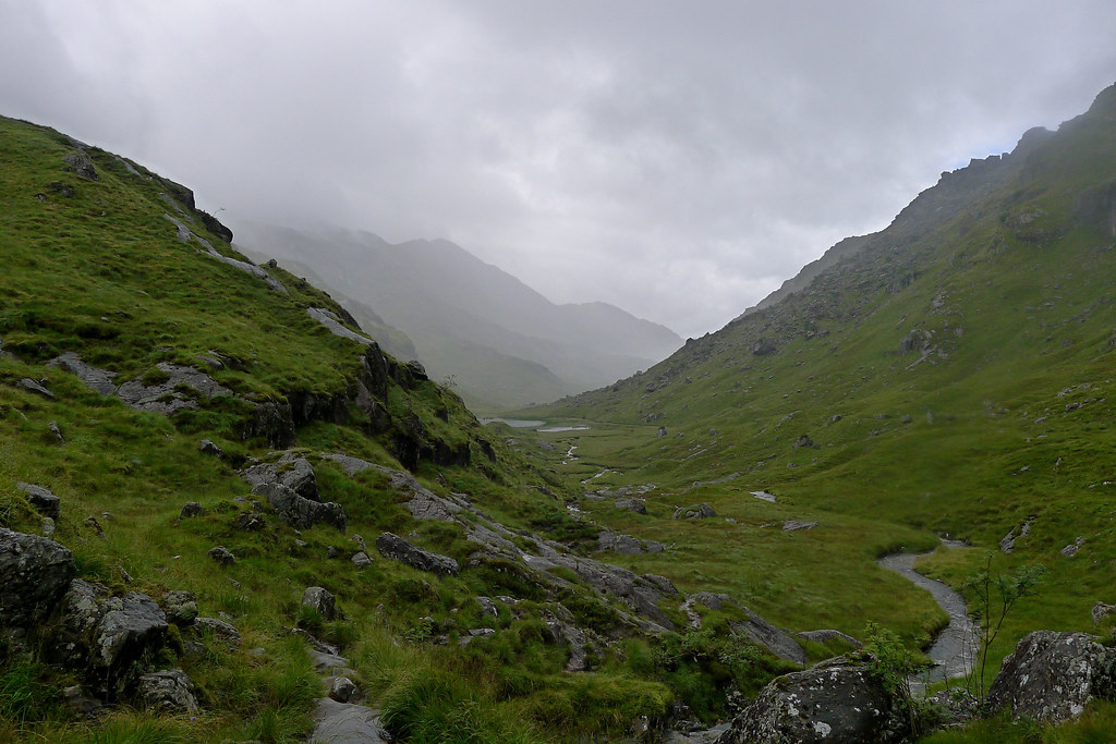
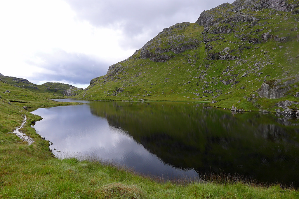
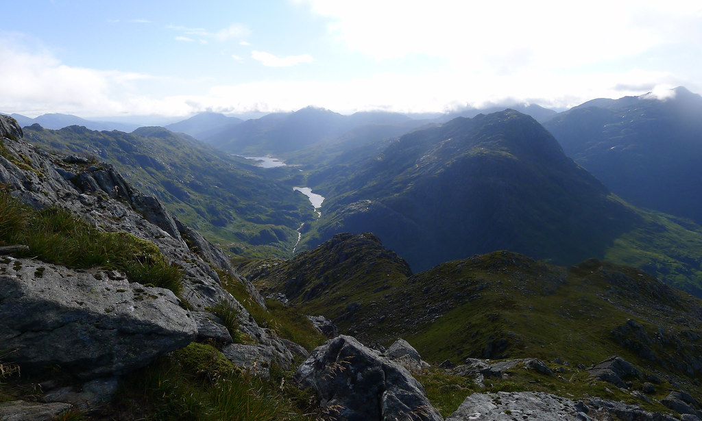
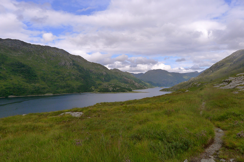
I was now looking down to the Mam na Cloich Airde, the pass which holds two beautiful, wild lochans and from which the River Finiskaig runs down to reach the sea at Loch Nevis.
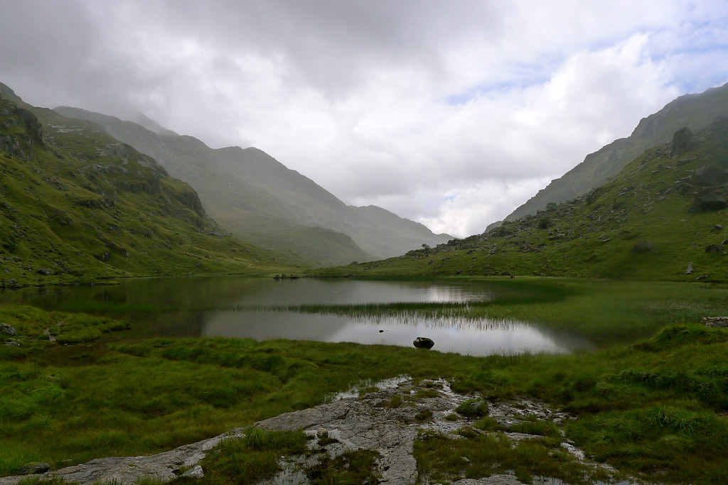
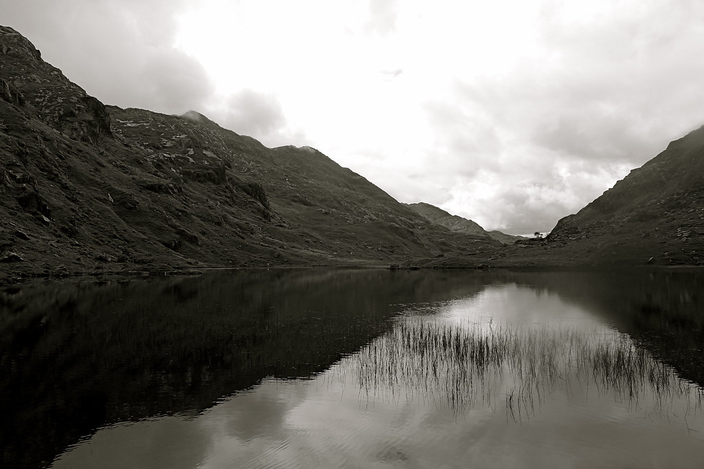
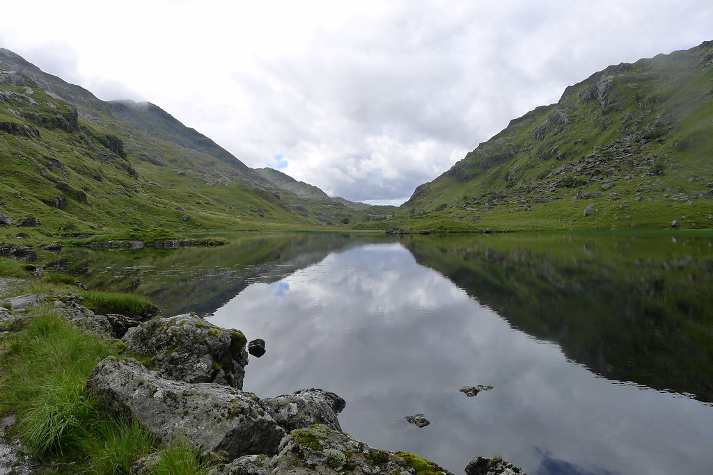
The water of Lochan a’ Mhaim was utterly still, reflecting the rugged outline of the hills. There was a silence up here and a melancholy feel as I sat munching on some fruit and nuts. The rain had finally eased off and it was a delight to take down my hood and enjoy the fresh air. I continued on, following the track along the shore of the lochan and then along the short connecting distance to reach the second lochan. Behind me cloud was spilling down off the tops but ahead of me there were flecks of blue sky appearing.
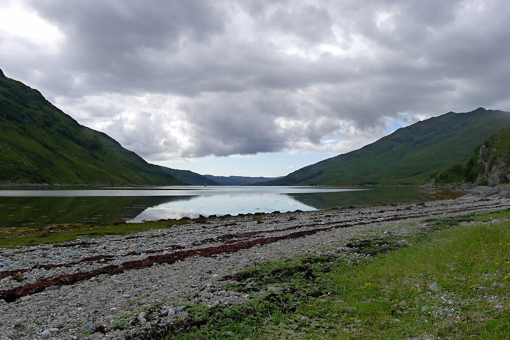
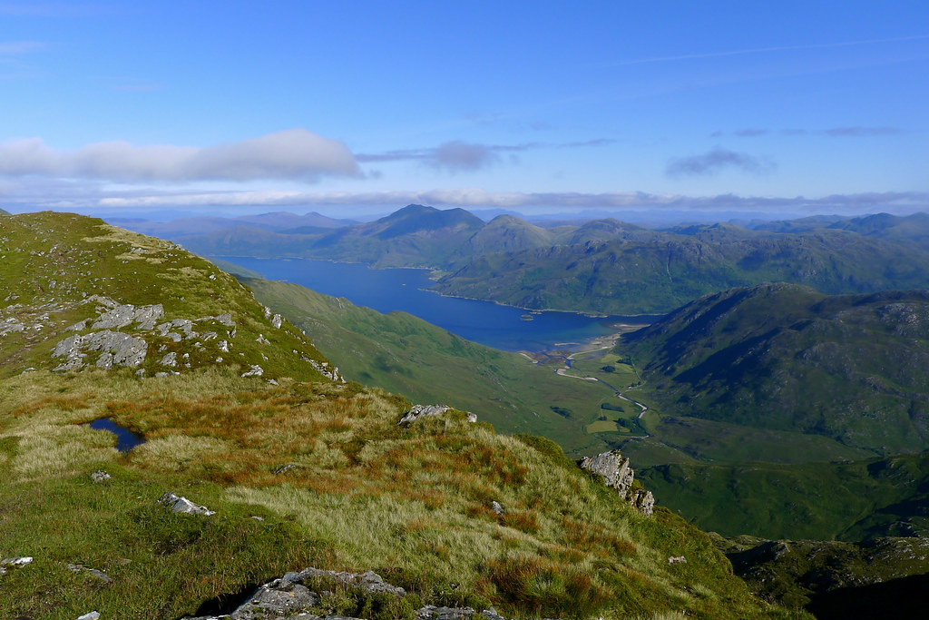
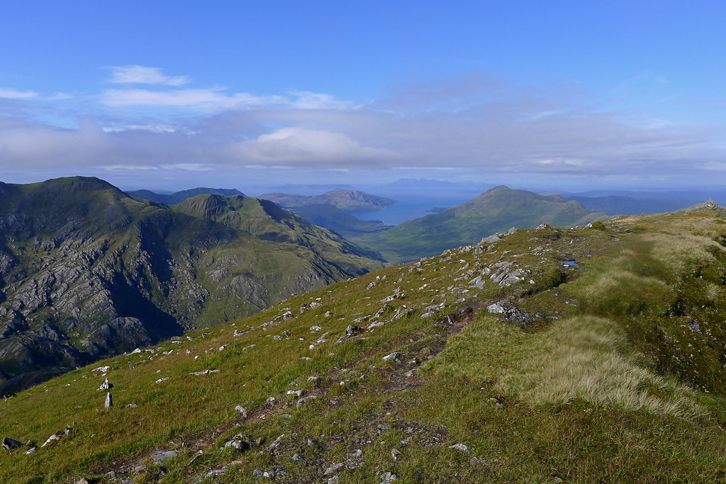
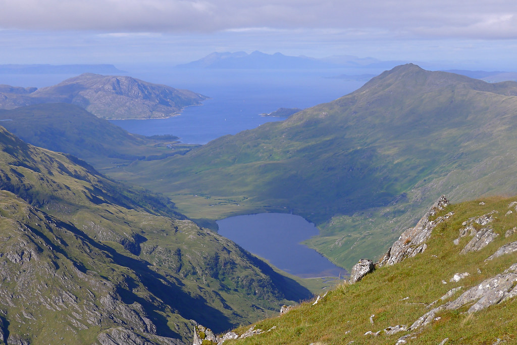
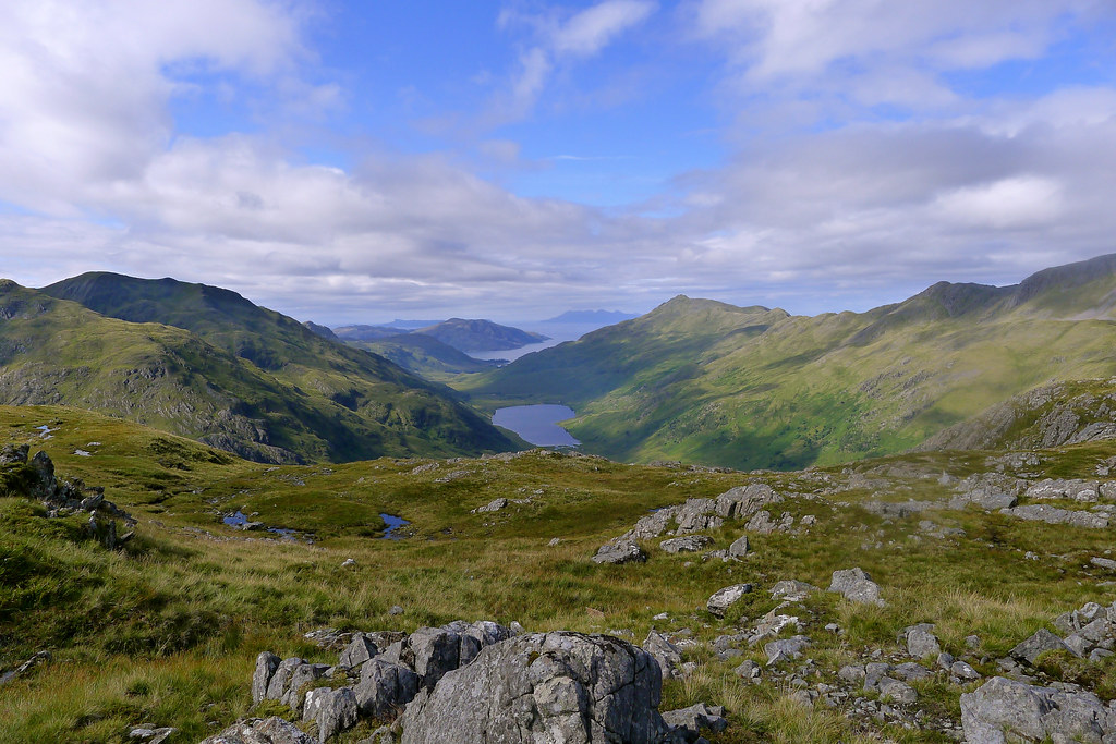
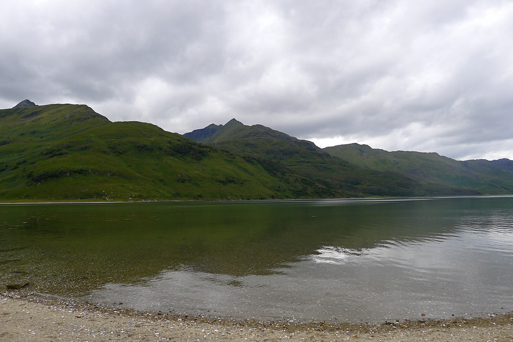
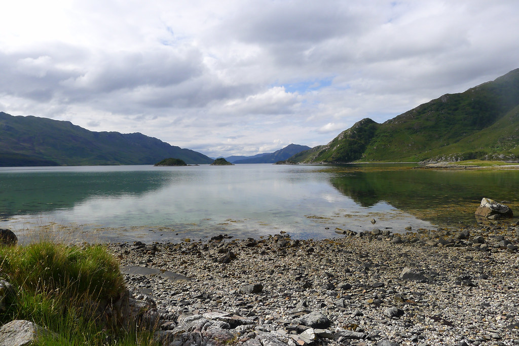
After a few moments of bright, warm sunshine the rain briefly returned as I followed the track down to cross the infant waters of the Finiskaig. Ahead of me in the distance I could see a fellow traveller making their way to the final climb out of the pass. I followed them up, climbing above the winding Finiskaig to get my first wonderful view of Loch Nevis.
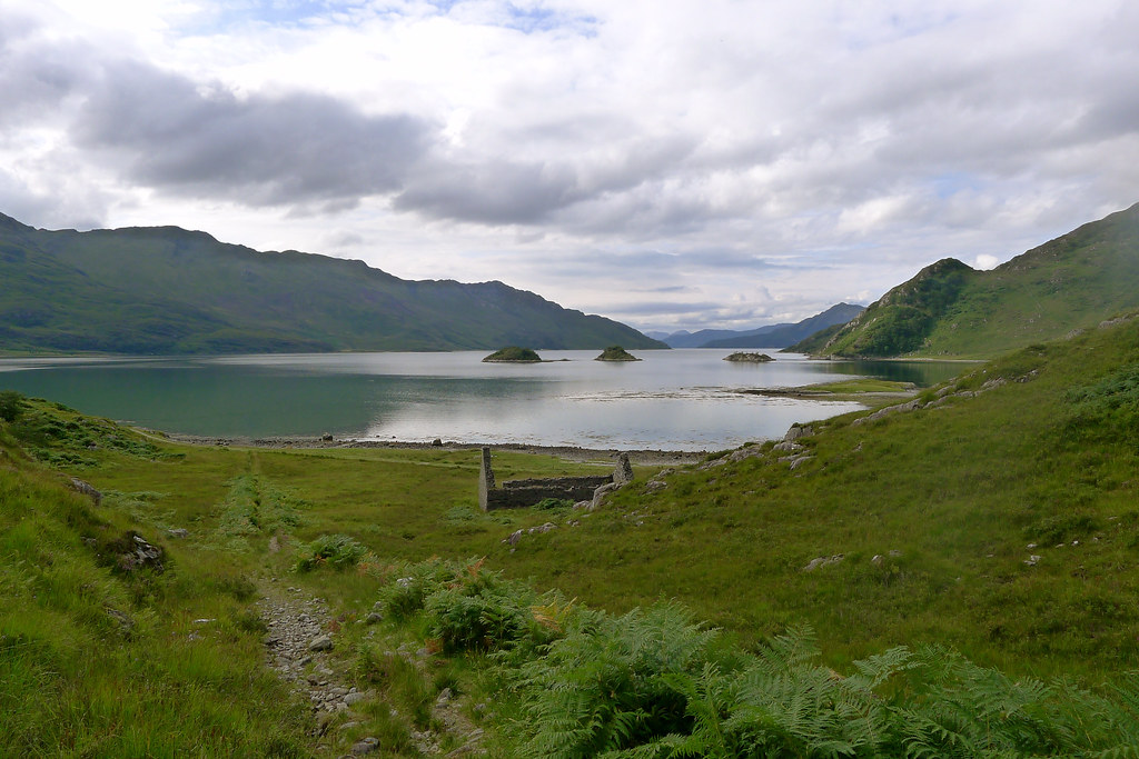
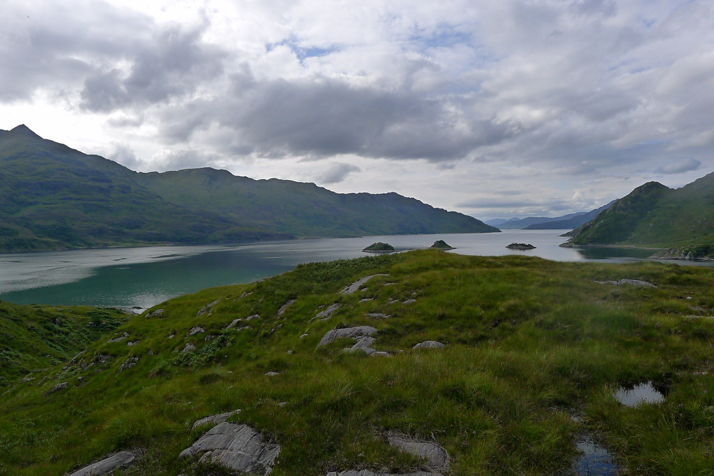
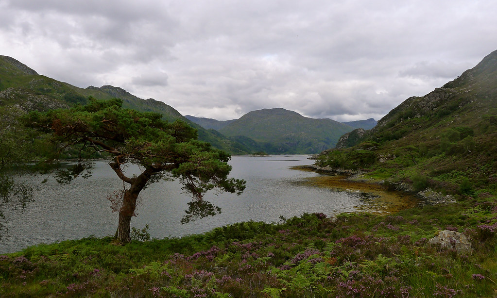
With the hills of Knoydart rising beyond it, and a large sailing ship anchored off the shore it was truly like a scene out of a Robert Louis Stevenson novel. I tripped down the delightful descent path as the ground became increasingly green and lush and the skies once again became blue. The Allt Coire na Ciche tumbled down from the hills to my right, a roar of white water, and merged with the Finaskaig. Then it was down and through the salty marsh flats to reach the shingly beach in front of Sourlies bothy.
There was already a crowd at the bothy, including a couple of folk visiting via boat. I passed the bothy and a short way further on found a pleasant patch to sit down and soak up the atmosphere. It was wonderful, the still, shimmering waters, the drifting clouds and warming sunshine. I settled myself in to enjoy a relaxed lunch break.
As I was packing up the skipper of the boat came over for a brief chat. From him I found out that the weather for Monday was still supposed to turn bad. He bid me a good journey and I was soon away, heading along the shore to find my way around to the Carnach. It was getting late in the afternoon but there was still plenty of daylight and I wanted to get closer to the Knoydart hills before pitching my tent for the night. The tide was high so I picked my way across the jutting headland separating Sourlies from the outflow of the River Carnach.
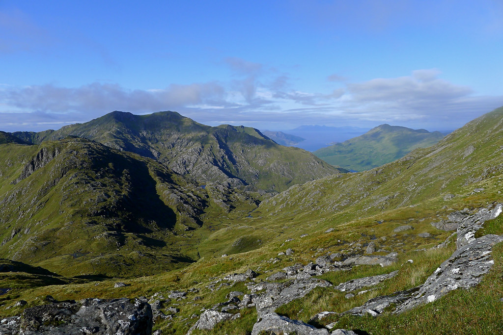
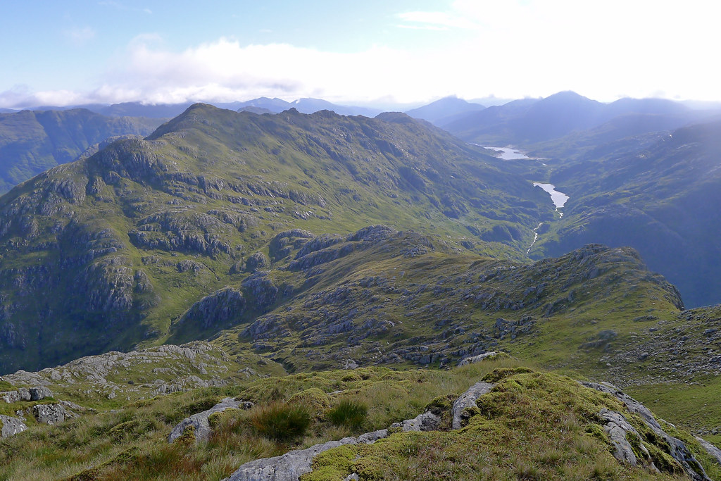
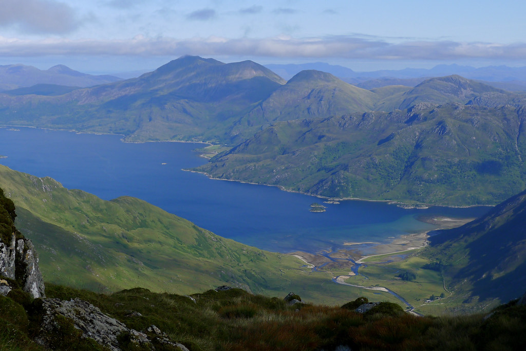
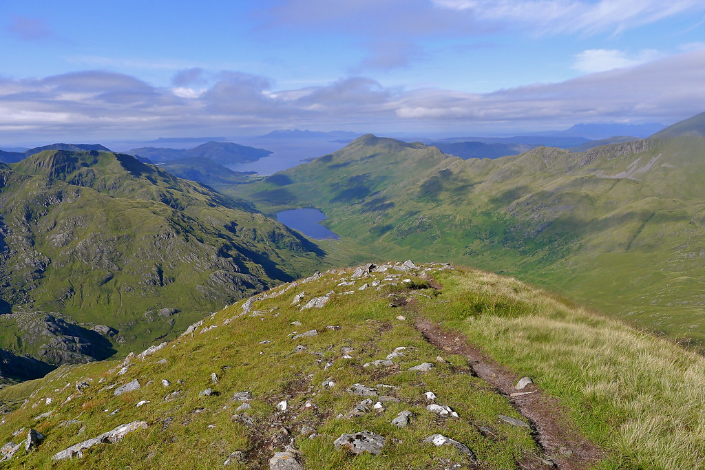
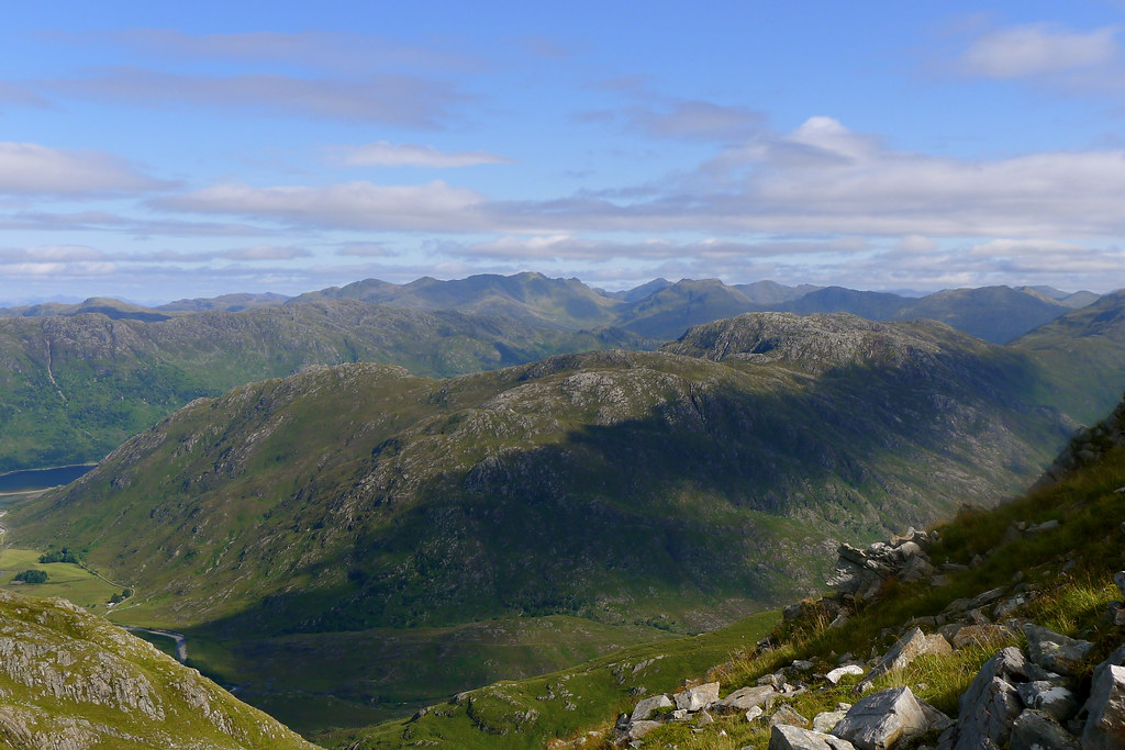
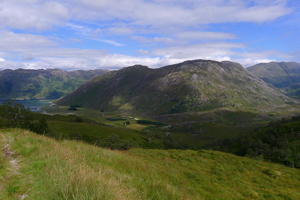
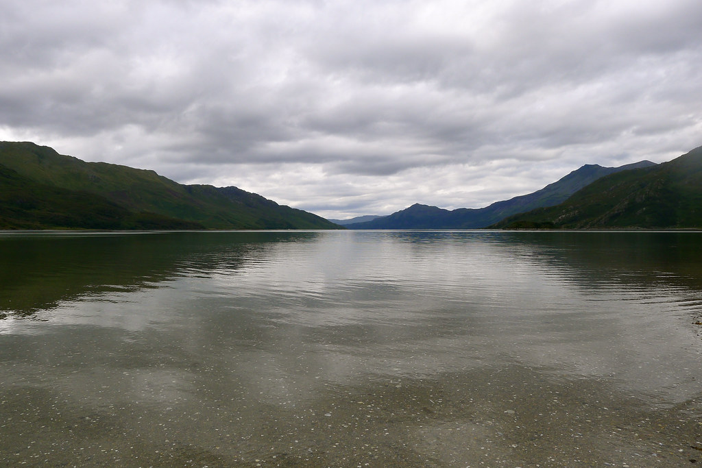
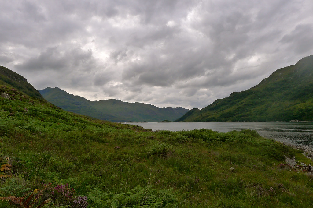
I dropped back down to the shore and enjoyed a last lingering view up Loch Nevis before turning my attention to the flood plain of the Carnach, a wide, meandering river with wide, marshy ground running all the way up to the foothills on my right. It wasn’t easy terrain but I made steady progress, drawn on by the incredible sight of Ben Aden in front of me.
This rocky, imposing and remote Corbett is a one of the most stunning mountains and the view was only improved as the pointed shape of Sgurr na Ciche, now completely cloud free, emerged as I rounded a corner in the glen. Eventually the marshland gave out and I joined a track that was at times clear and well surfaced, and at other times almost lost in marshy tracts. Progress was a lot slower than anticipated on this stretch but the late afternoon sunlight was wonderful, providing plenty of visual drama as I headed further up the course of the Carnach.
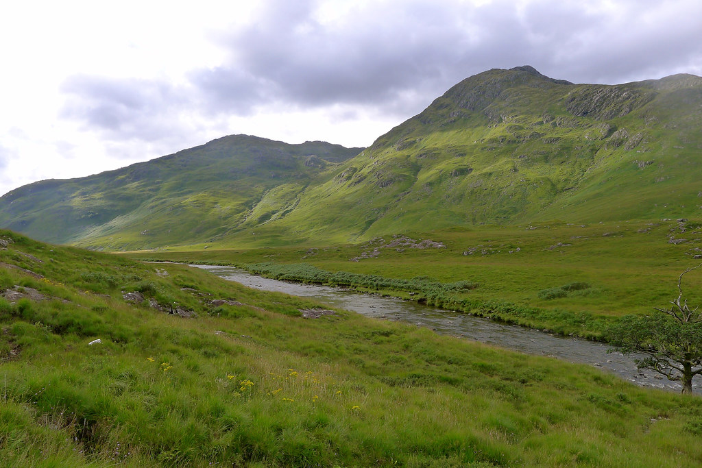
Clouds continued to bubble up and blow through but largely the summits stayed clear and I enjoyed the feeling of drying out after all the earlier rain. I did have to wade across the river but it turned out to be fine: wide but very shallow. As I rounded the corner below Ben Aden I started to get a sense of the terrain ahead of me as the upper reaches of the Carnach ran up into a rough and rocky looking gorge.
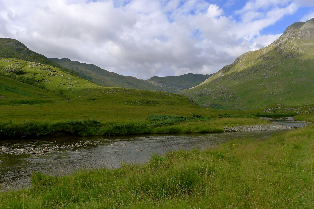
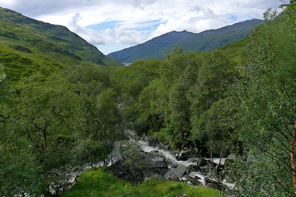
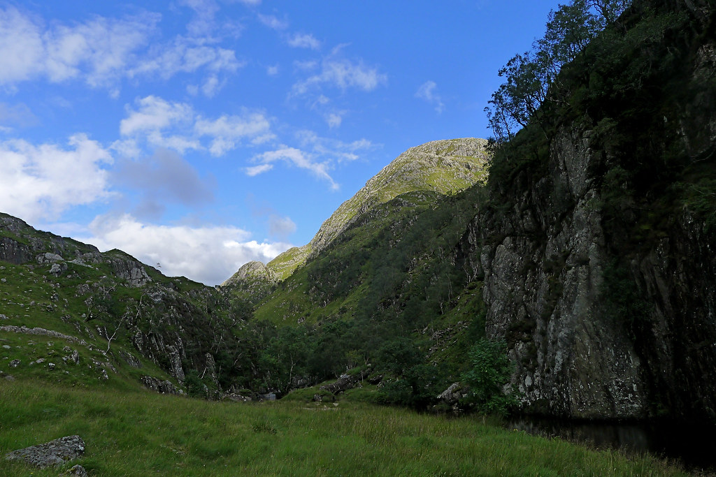
Higher up a few more trees appeared and then I was wading through waist-high bracken to finally reach the entrance to the wooded ravine which joins the upper and lower stretches of the Carnach. I followed the narrow riverside track as it ducked in between trees and the rocky river bank, sometimes climbing high and rather precipitously above the gorge. It was dramatic and there was a little easy scrambling at times.
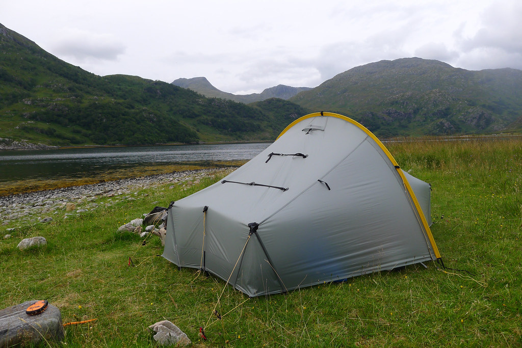
Eventually I reached the end of the gorge, the river turned sharply right and was suddenly calm and tranquil again. A huge rock wall rose on the far side of a deep, dark section of water and on my side, on the other side of a field of thistles, was an idyllic section of close-cropped grass that remarkably seemed tick free on inspection. A steady breeze was blowing down the river and there wasn’t a midge to be found. It was now around 6pm and I decided it was about time to pitch the tent. Going any further would have involved an hour or two more of climbing if I wanted to reach the loch.
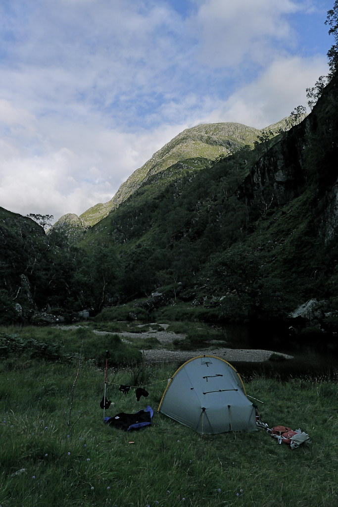
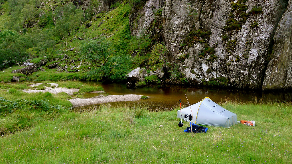
The tent was up and a make-shift washing line soon had hat, gloves and washed socks drying in the gentle breeze. I made a hot chocolate and sat outside the tent enjoying the evening light. A single very large tick was spotted but exterminated. I retired to the tent for dinner which was a good decision as no sooner had I got inside but the skies darkened and a heavy shower started, rain pounding off the tent. No matter though. I was on the edge of Knoydart and Sunday was forecast to be a great day.
Day 3
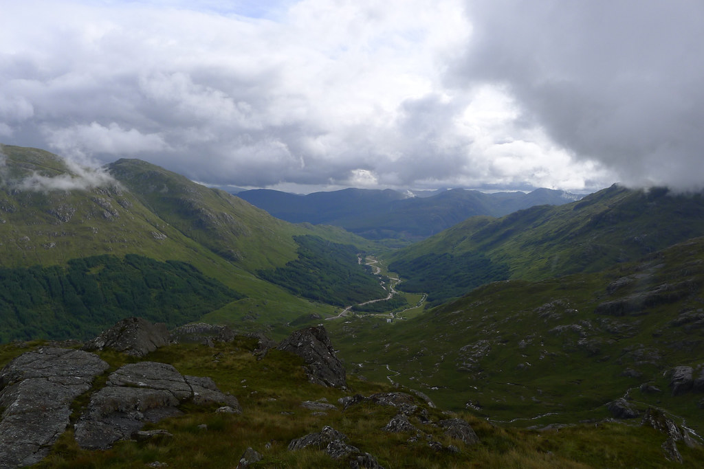
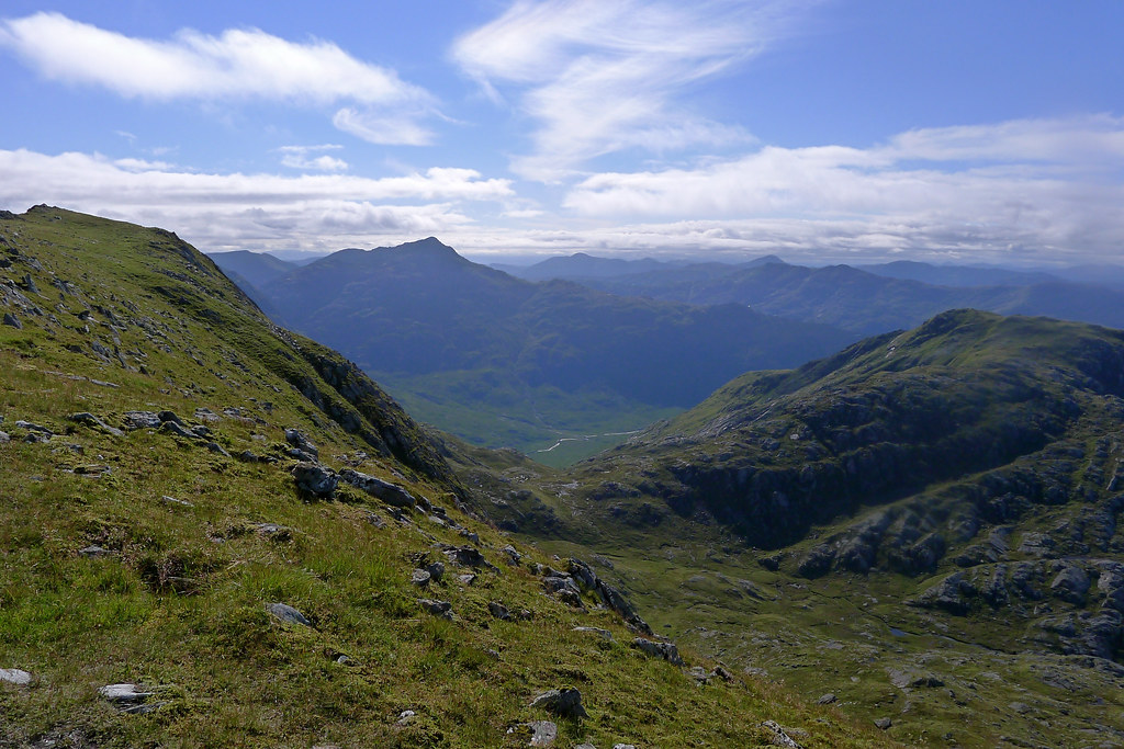
From the Carnach through Knoydart to Loch Hourn
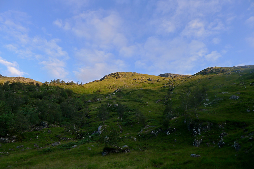
I awoke to a perfect day. Fluffy clouds were picked out in subtle shades of orangey-pink as I made a cup of coffee. As I wandered around my little slice of paradise a large heron flew up the river passing just a few feet away from me!
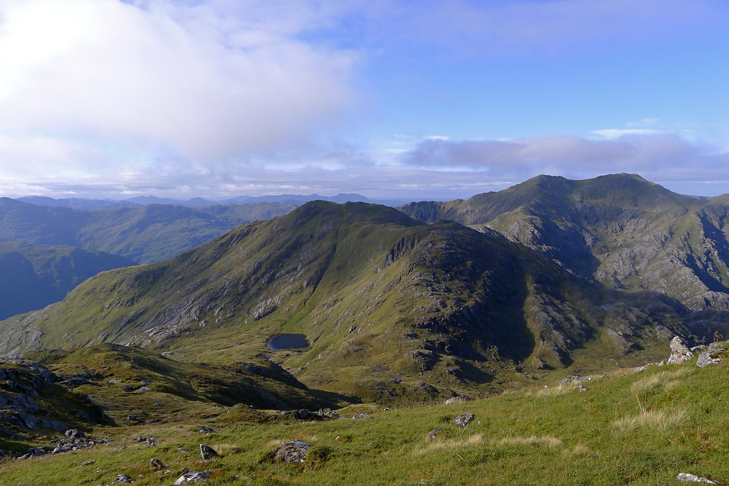
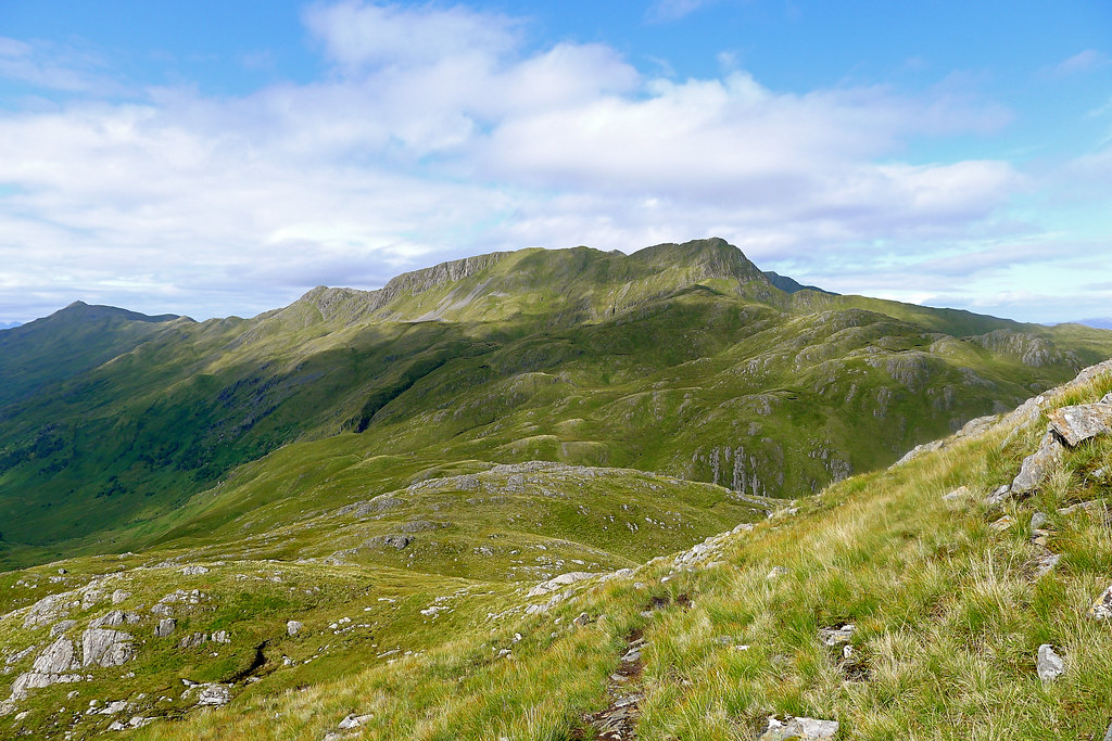
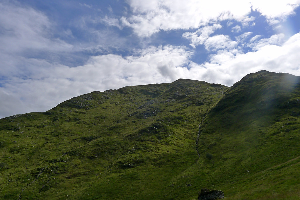
I had no intention of wasting such a good day and was packed and off an hour earlier than the previous day. This time there was no gentle descent to ease me in but rather a lung-busting climb up the steep eastern slopes of Luinne Bheinn. My original plan had been to climb this hill from the pass climbing up above Lochan nam Breac but as I hadn’t quite reached that point the previous evening it seemed sensible to take a more direct route of ascent.
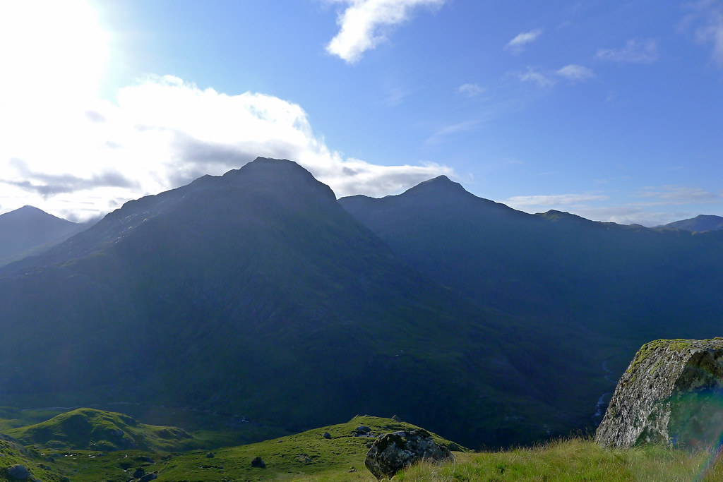
The climb was unrelenting but easy enough on steep grass slopes, weaving around the occasional boulder. The gradient provided plenty of excuses to pause and admire the magnificent views that were opening up all around me. In particular Ben Aden and Sgurr na Ciche silhouetted against the bright morning light were spectacular. As I rose more and more hills became visible.
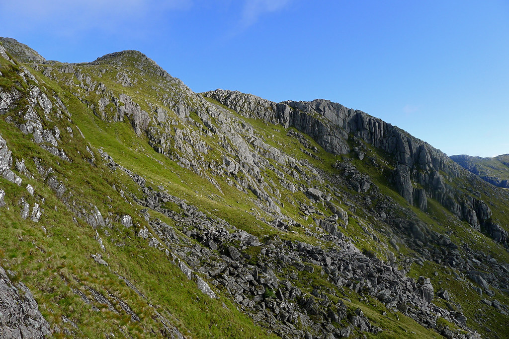
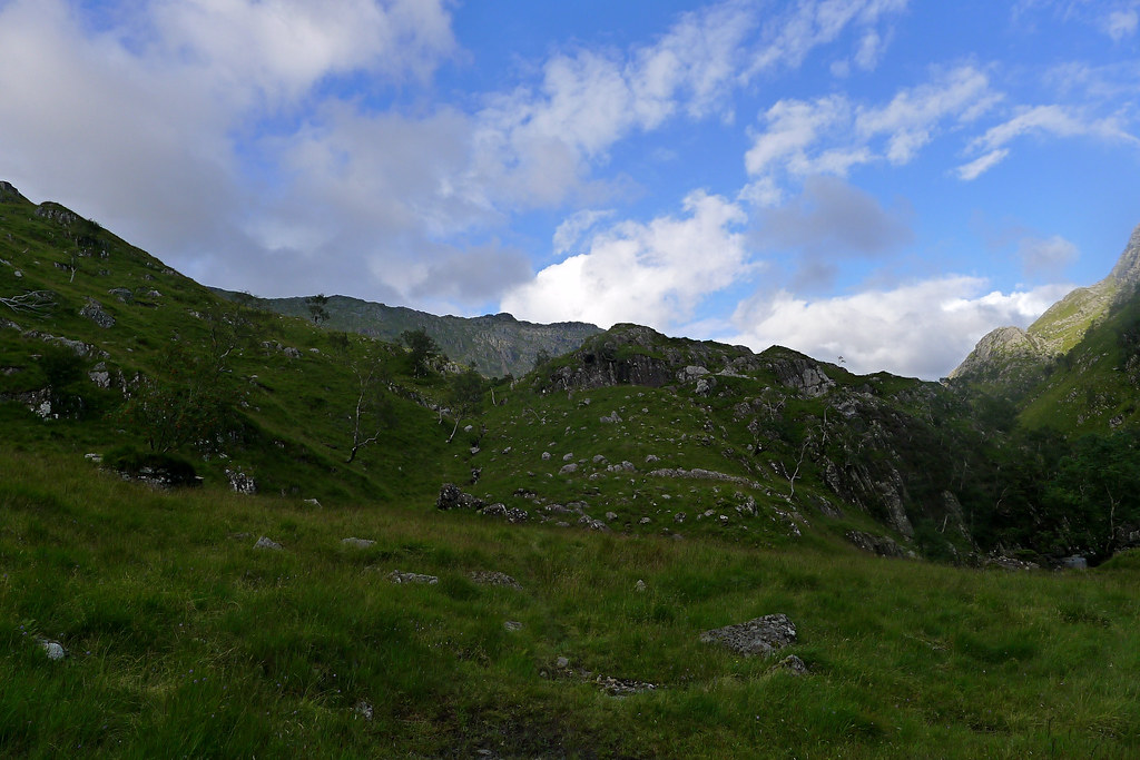
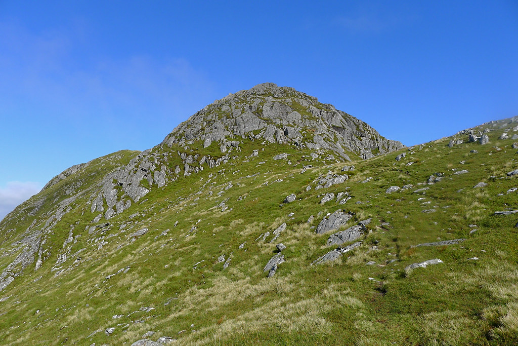
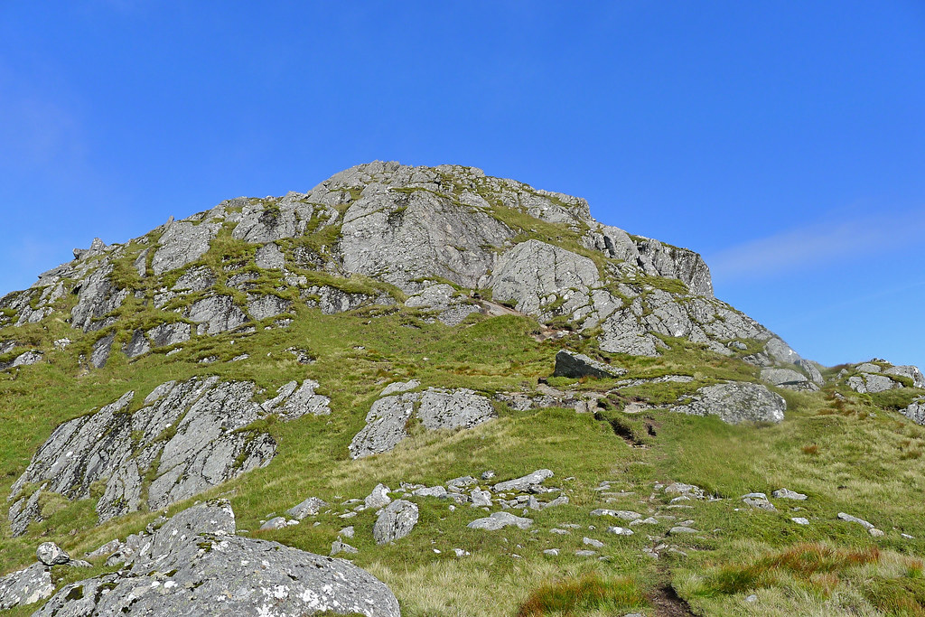
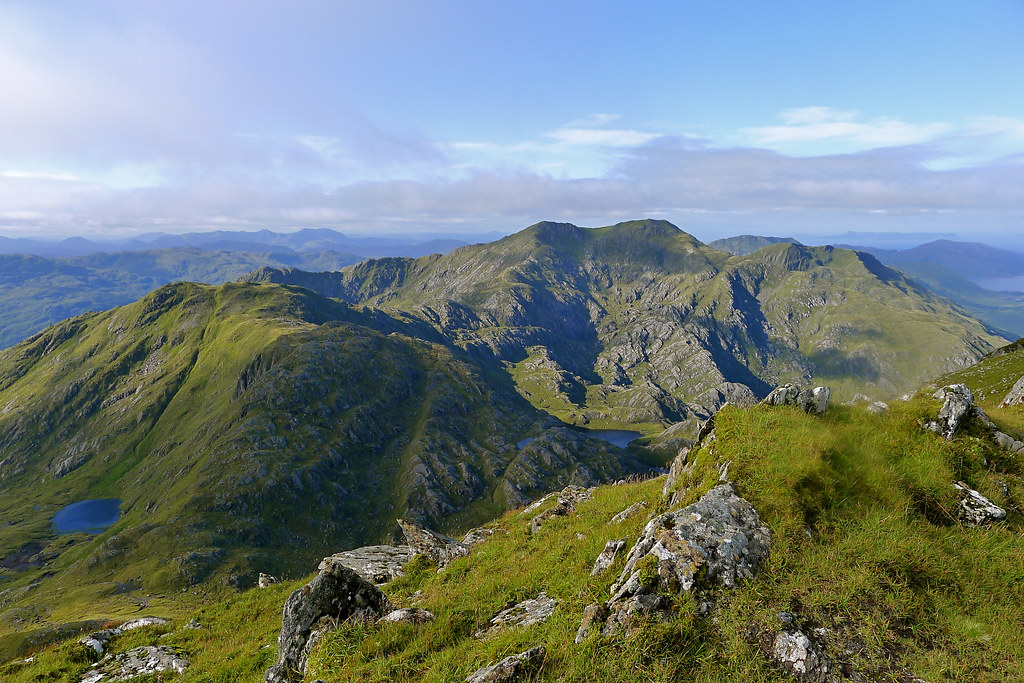
Eventually I came out into the upper reaches of the coire I had been heading towards. There was a towering series of crags on my right but the low point on the ridge was ahead of me and looked accessible. The headwall was steep but after a short grassy scramble I was up the final damp gully to emerge on the ridge to the southeast of Luinne Bheinn.
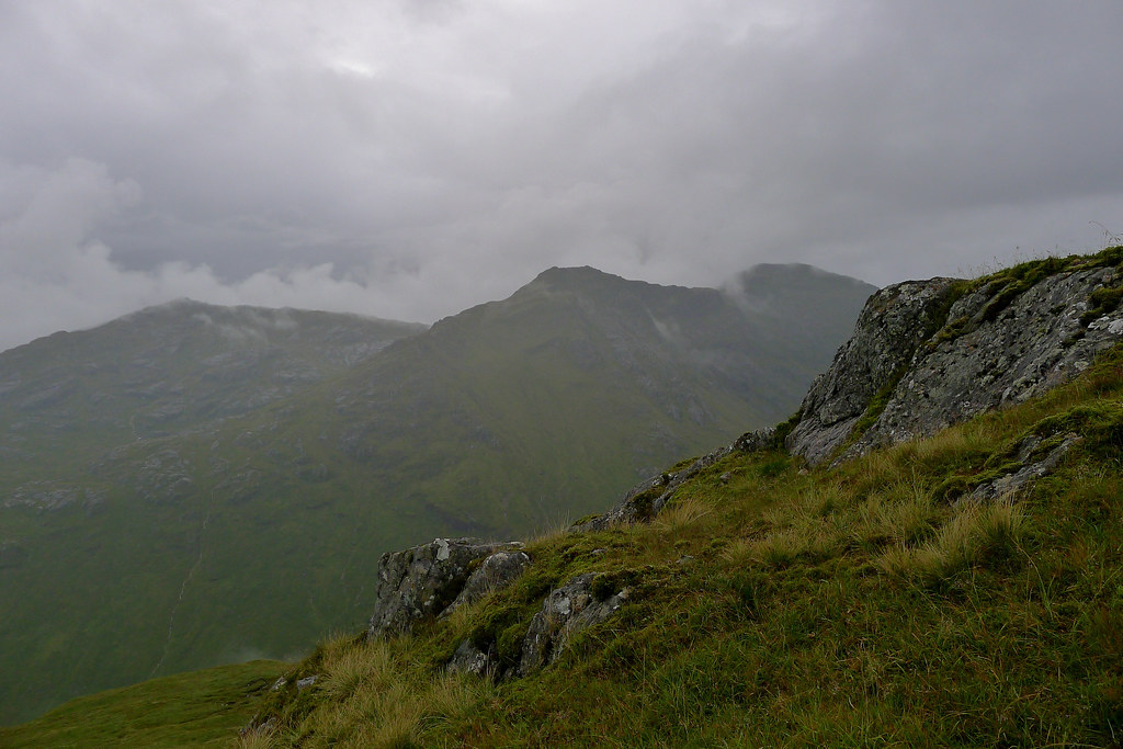
There was by now a little bit of cloud clinging to the highest tops but largely the weather was glorious and I revelled in the views. I now had a clear view up towards the summit of Luinne Bheinn and as I followed the ridge upwards the views behind me to Meall Buidhe also opened up.
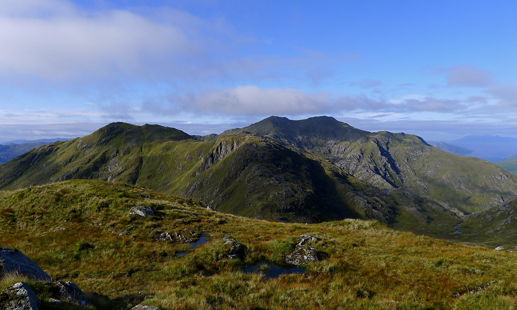
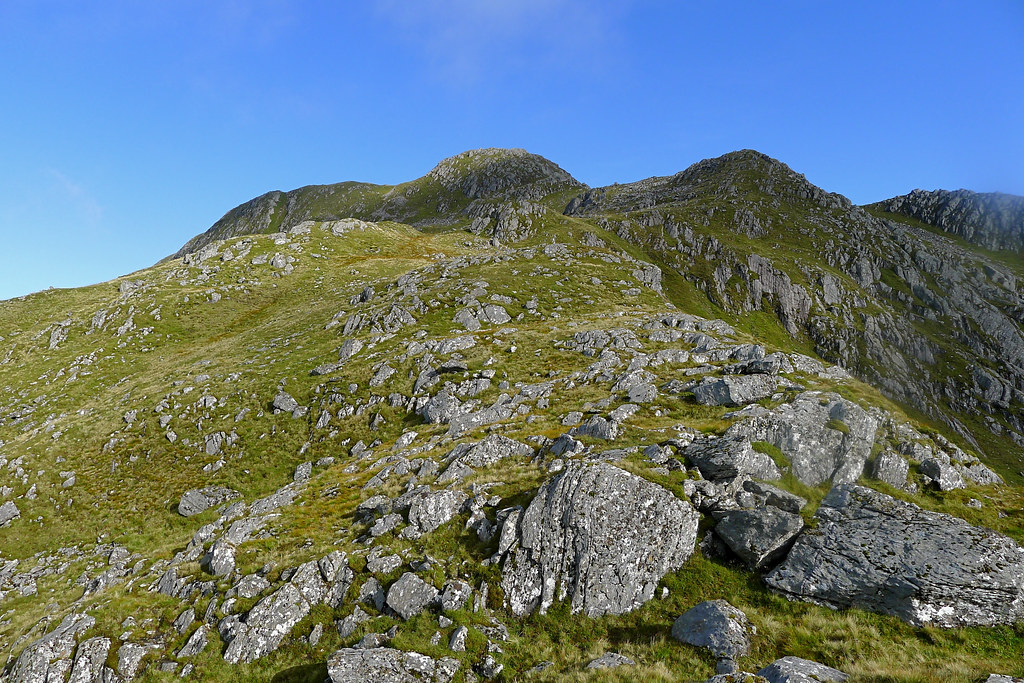
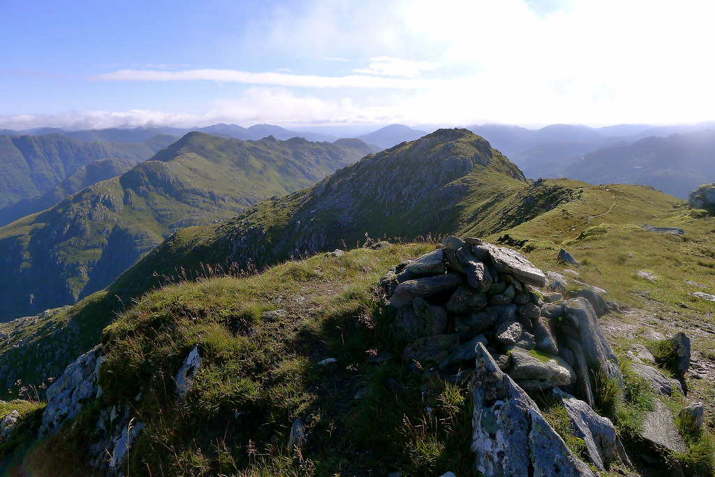
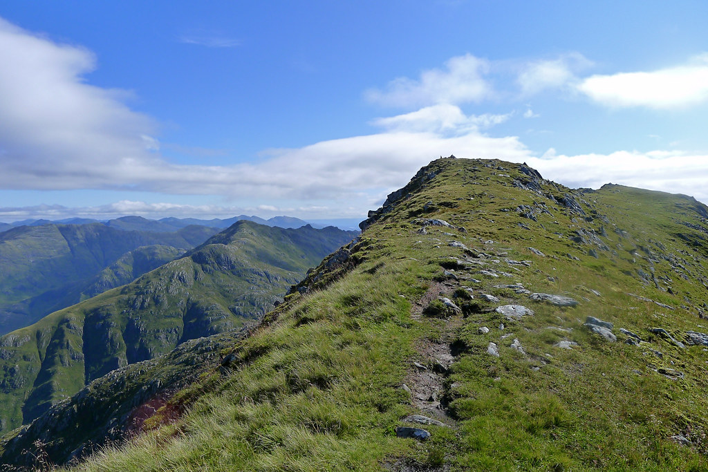
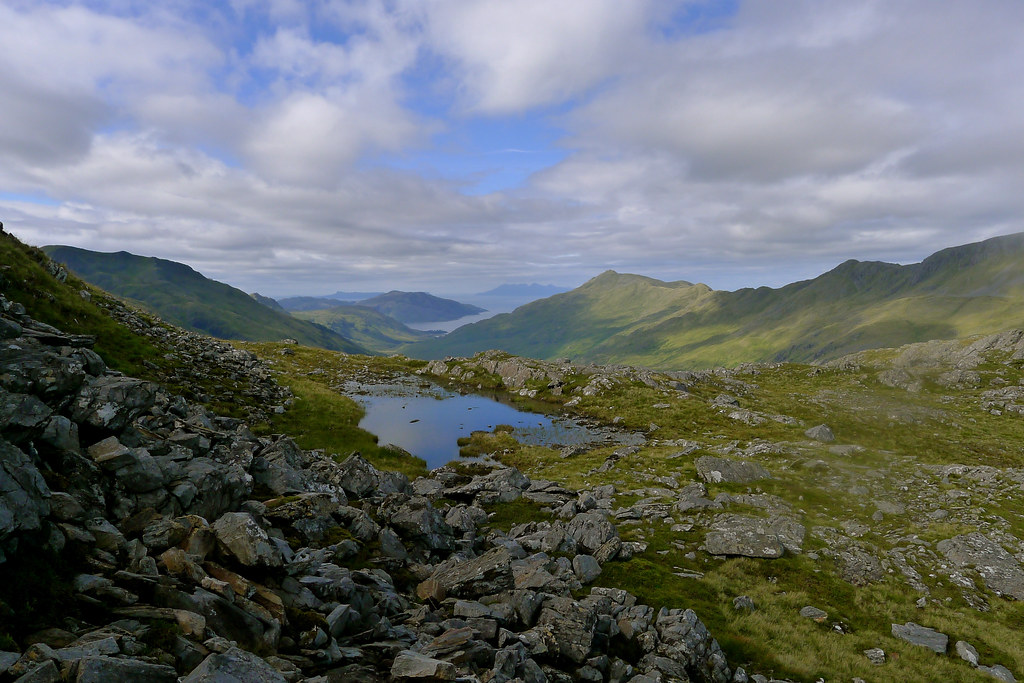
I picked up the trade route coming around from the other Munro and followed it as it wound its way up the ridge through a series of little rocky crags. I could now see clear across Knoydart and out across the shimmering sea to the islands of Eigg and Rum.
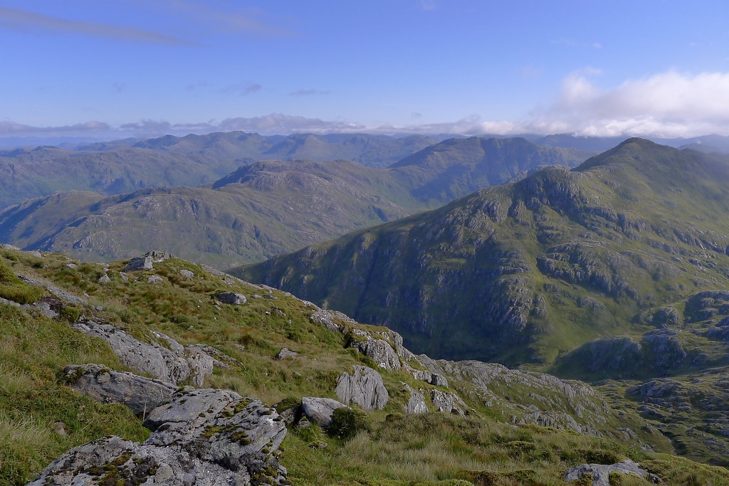
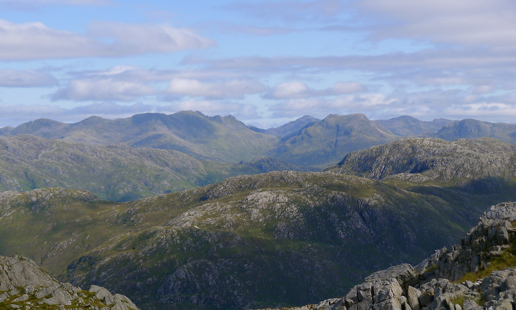
The east top presented a few scrambly sections whilst in between flat terraces of grass provided ample viewing opportunities. I gazed back across the Rough Bounds and then north where the hills of Kintail, Affric and Torridon stood brightly in the morning sunshine.
The ascent kept up the interest but I eventually reached the eastern summit of Luinne Bheinn. This brought with it stunning new vistas, including the view down to Barrisdale Bay and the turquoise waters of Loch Hourn.
I put my pack down and clambered to the top of the highest rock, spinning 360degrees in wonder and awe at this stunning landscape. Everything about it was wonderful and although it was a bit breezy the conditions were perfect with great visibility and blue skies.
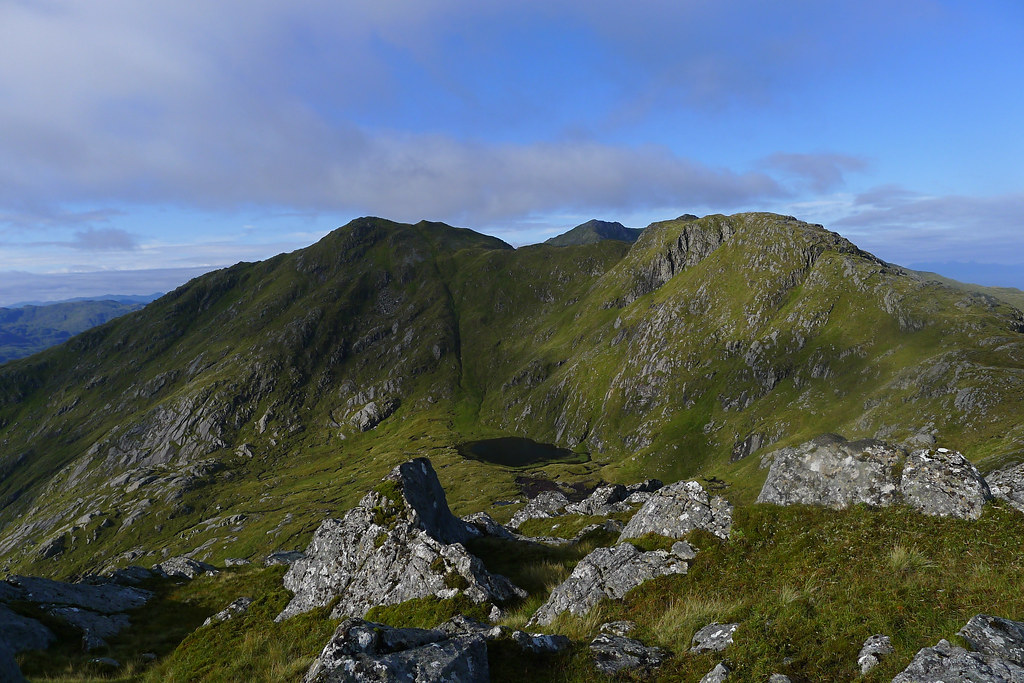
I set off along the summit ridge, descending from the east top and then rising gently up towards the actual Munro summit. The views continued to evolve with Rum and Eigg clear beyond Inverie Bay. Behind me the cloud was building a little over the Rough Bounds.
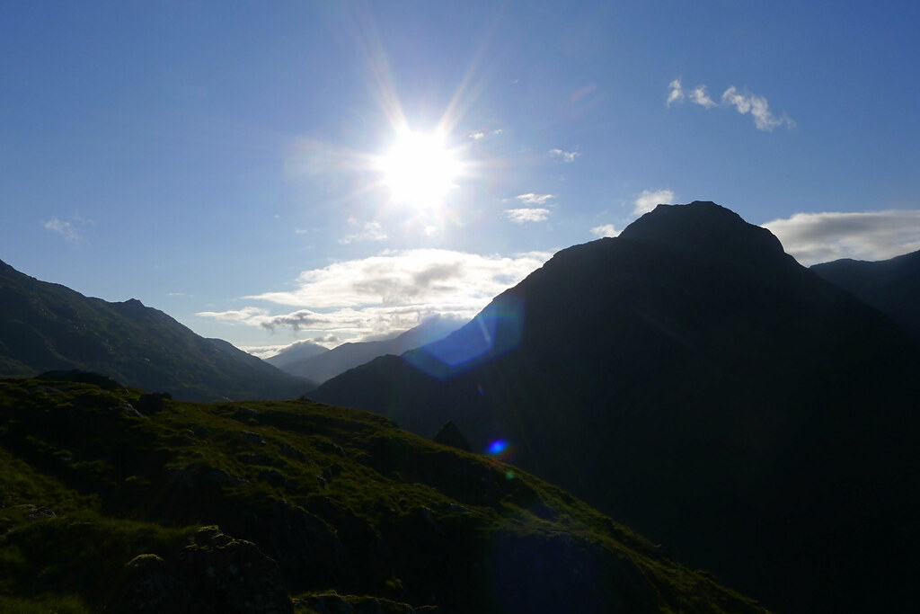
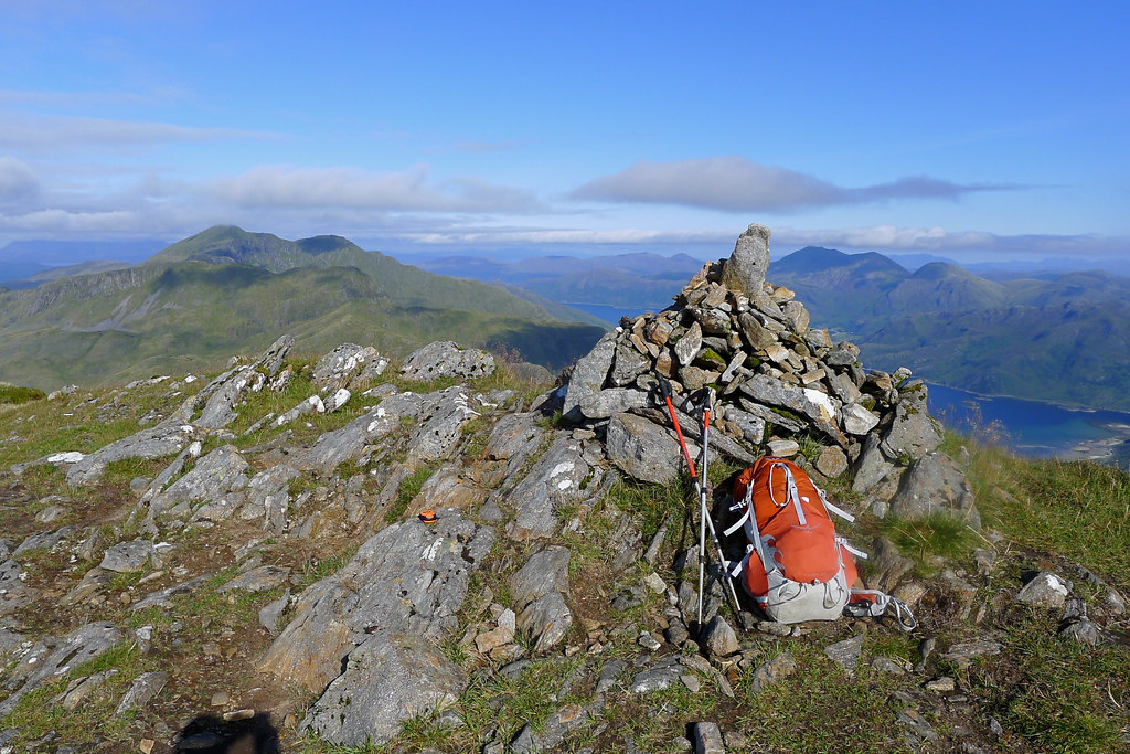
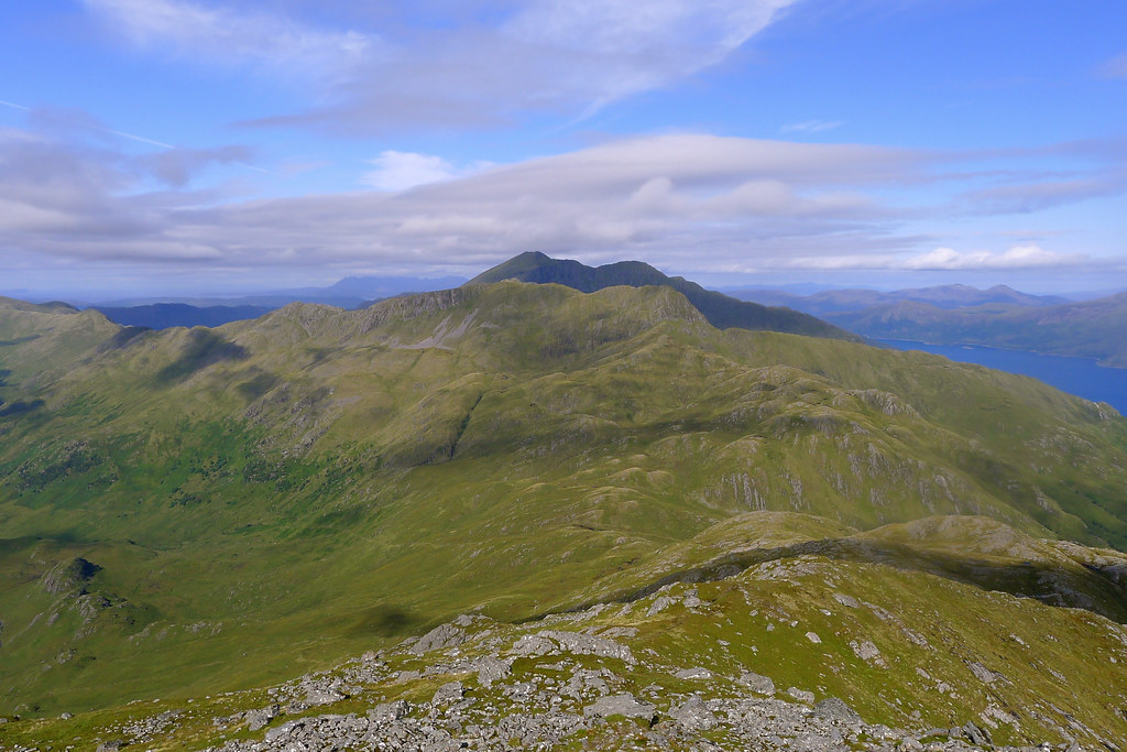
I passed by a smaller cairn which may, or may not, have been the actual summit but actually ended up stopping at the much larger cairn which marked the western end of the ridge. Here I again took in the magnificent views. It felt pretty good to be on the summit of a Knoydart Munro at 10:30am on a sunny Sunday morning. Beyond Ladhar Bheinn the Cuillin of Skye were hanging stubbornly on to cloud. Elsewhere though there was plenty of sunshine and the mountains of the Northwest marched off into the very far distance.
After about an hour on the summit, including calling home and chatting to a guy who came up from Barrisdale I was starting to get chilly and so started to make my way off, now heading west towards Ladhar Bheinn.
The descent was on a good track, following the broad crest of the ridge with occassional scrabbly steeper sections.
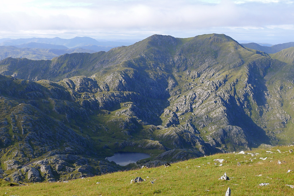
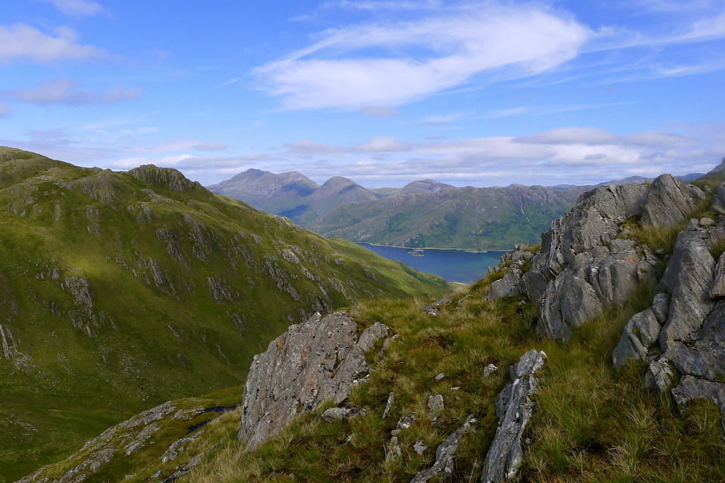
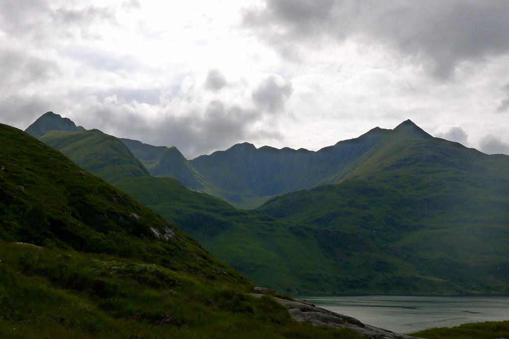
The steeper sections ended on a rocky terrace dotted with lochans and small bubbling streams. It was appreciably warmer here having dropped a couple of hundred metres of height and so I took the opportunity to sit and enjoy the views. Ladhar Bheinn now towered above me and the views north to Kintail and south along the Dubh Lochain to Inverie were stunning. Beinn Sgritheall dominated the views over Loch Hourn.
I crossed the tumbled land until I stood gazing out to the mighty nose of Stobb a’ Chearcaill, the eastern end of the great round of Coire Dorcail. It is a seriously impressive bit of rock.
I now had to pick my way down boggy slopes to reach a line of fence posts which marked the final descent down to the summit of the Mam Barrisdale. Cloud was now starting to fill the sky a little but it was still pleasant and warm and the surroundings were sublime.
At the summit of the pass I stopped for lunch in the warm sunshine. A few other folk came by, most heading for Inverie it appeared. I was sorely tempted by Ladhar Bheinn but also knew about the bad weather forecast for the following day. Ideally I wanted to get a bit closer to the car to be able to get out tomorrow and going over Ladhar Bheinn would have prevented this. I took the difficult decision to leave it this time and instead turned towards Barrisdale bay.
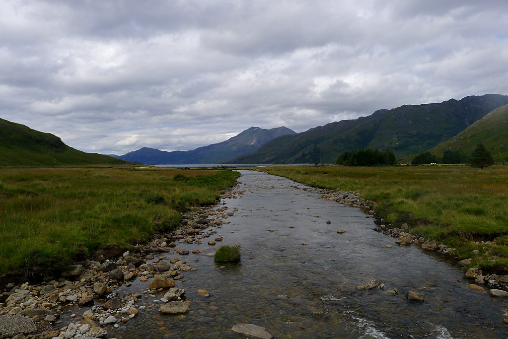
The descent was easy going on a good track and I made steady progress, stopping once to refill my waterbottle and then much more often to gaze up at the rugged hills surrounding Glen Barrisdale. Behind me Luinne Bheinn looked very dramatic, waterfalls tumbling down its northern slopes.
As I neared the floor of the glen I got further views up towards Glen Unndalain and into the fastness of Barrisdale. Below me the small collection of buildings marking Barrisdale itself slowly drew closer.
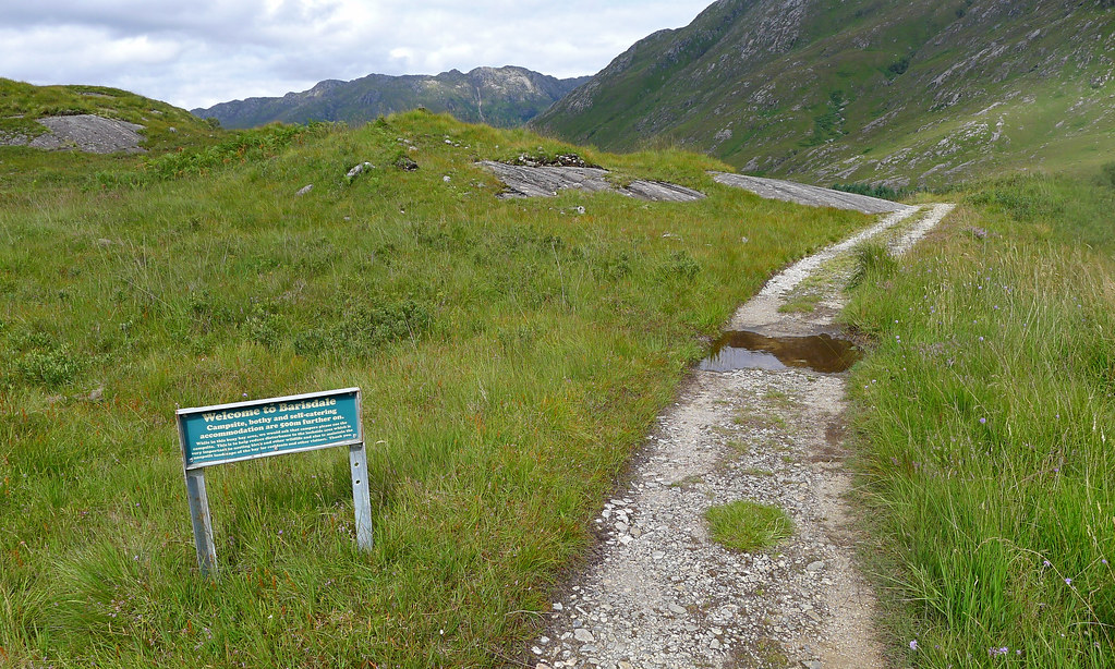
I passed the sign welcoming me to Barrisdale, crossed the river and made my way past the campsite, bothy and farmhouse. It was all very pleasant but I was looking forward to getting down to the shore of Loch Hourn which cannot be done until you are a little bit further round the bay. As the views back to Luinne Bheinn and across to Ladhar Bheinn opened up I dropped down to the shingle shore.
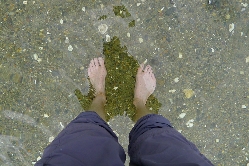
It was calm with just a light breeze to occasionally ruffle the water of the sea loch. It was a pleasure to put the pack down after the long ascent, and then to remove shoes and socks and wade out into the chilly, clear water of the bay.
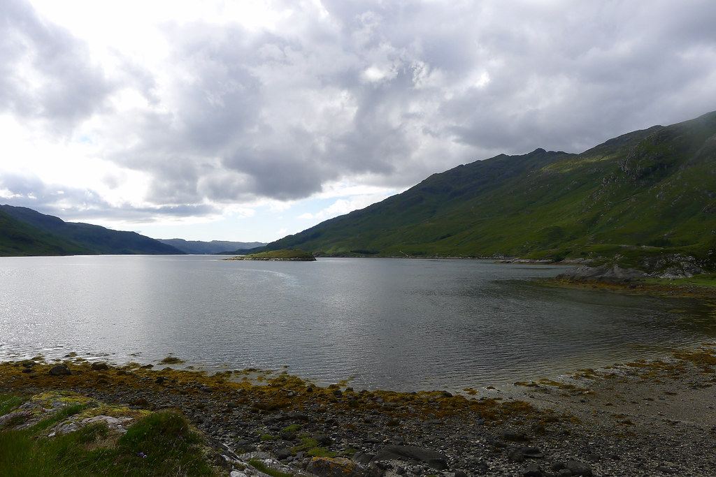
It had clouded over briefly whilst I was down by the shore but after some food I headed off again, now following the shoreline path, and as I made steady progress around the bay the sun once again appeared. The loch waters turned a turquoise green and the hills lit up as the sun hit them.
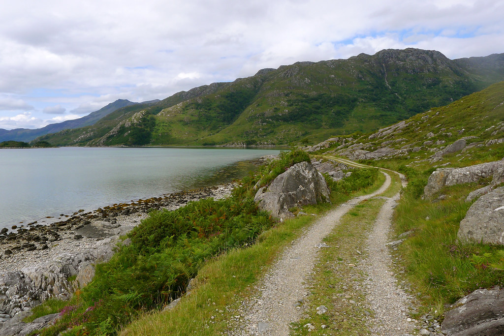
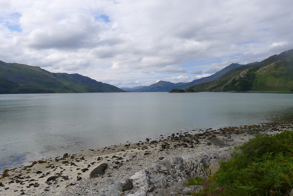
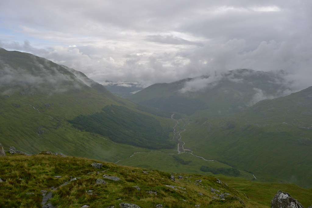
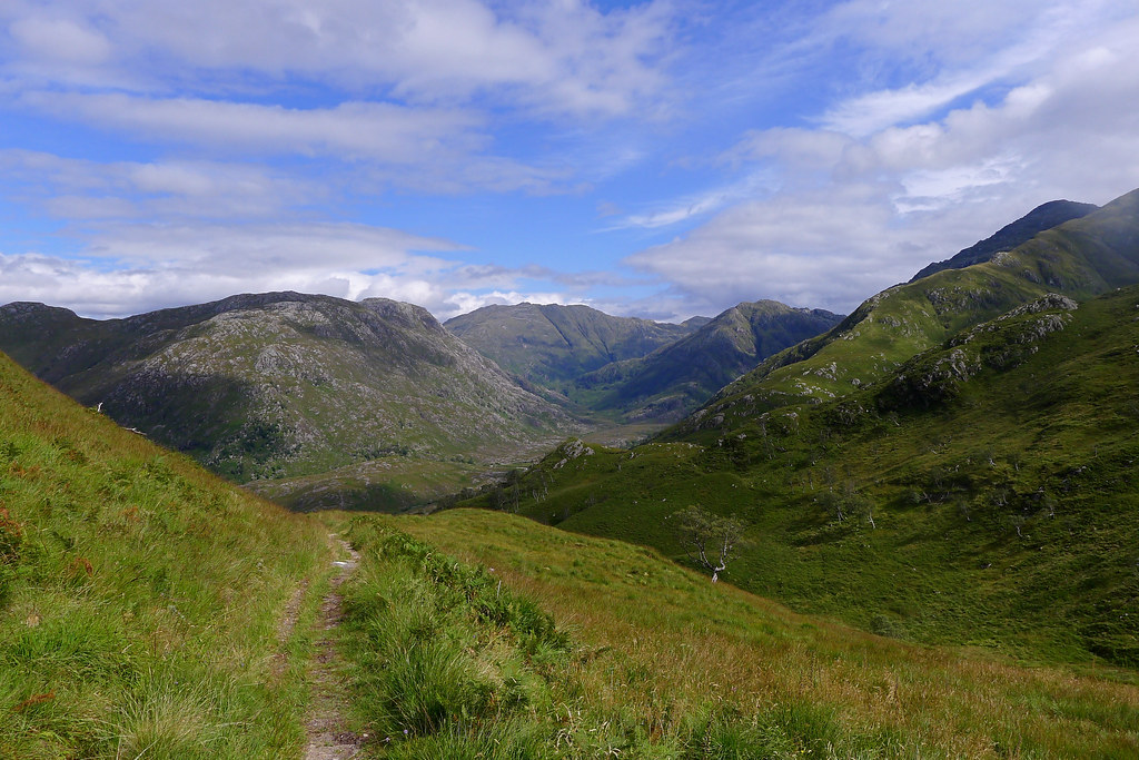
This path, which runs all the way along Loch Hourn to Kinlochourn is famous for its ups and downs and after the pleasant stretch along Barrisdale Bay I was climbing up the first of these. The views out along the loch from the first summit section were stunning, the waters looking tropical.
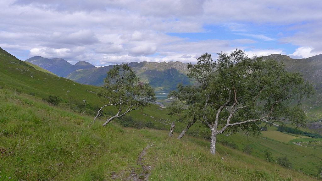
It is a long way with a great deal of ups and downs but I was in no great hurry and happy just to enjoying the passing scenery and the delights of the path as it ran from the high tops down to the very edge of the loch and back again. Slowly Knoydart receded behind me and the hills of Kintail started to loom in front of me.
After passing the empty house at Runival I went over a large outcrop and once again came down close to the shore. Here there looked to be something of an unofficial campsite with a stone fire circle and some well cropped grass. The evening had advanced and I knew it would take another couple of hours to push past Kinlochhourn and find a wild camping spot in the hills below the South Shiel Ridge so I opted to stop here for the night.
It turned out to be not a great decision as with hardly a breeze the west coast midgies were soon out in force. I hastily got the tent up and dived inside but it wasn’t possible to prevent many of the blighters getting in and so I spent an evening cooped up with the midgies and my book. It was sadly a bit of dissatisfying end to a great day in Knoydart.
Day 4
Loch Hourn to the Cluanie Inn
It wasn’t until the early morning that a decent wind got up and suddenly the tent was being knocked about. The midgies quickly disappeared but now I knew there was a new problem; the approaching storm I had been warned about a couple of days ago outside Sourlies.
By 7am the wind was fierce and I was up and about, hastily getting everything packed away before it could be carried off across the loch. Luckily it didn’t start raining until I was almost at Kinlochhourn.
As I approached the end of the loch the wind was strong and gusting, driving heavy raindrops directly into my face. The final stretch of path seemed to go on forever and it wasn’t until I finally hit the tarmac near the jetty that it eased a little and progress improved for a while. I crossed the river and then made my way through the estate, climbing up the wooded hillside above the lodge to reach a path running along the power lines. This I followed as it turned into Coire Sgoireadail. Here the winds were a bit less dramatic and I could stop for some food and a drink of water. I didn’t hang around long though as the rain soon returned.
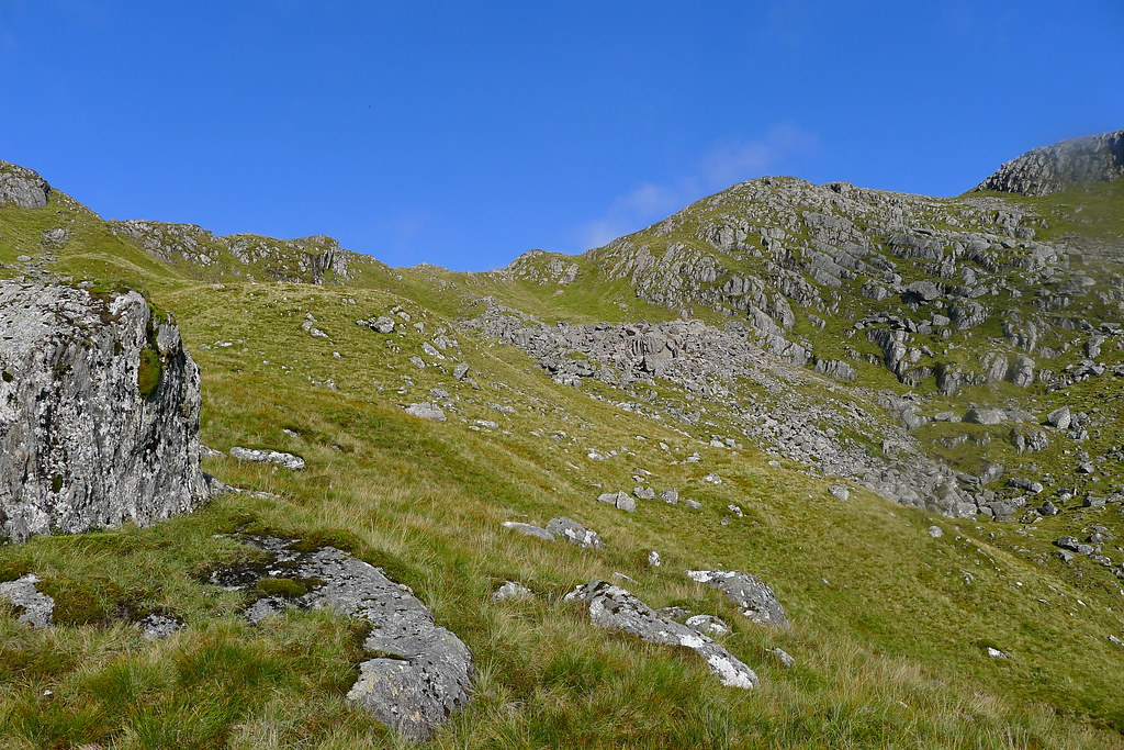
The coire proved a dramatic landscape though there was a reasonable track to follow once I had waded through the allt. In its upper reaches it was rocky with tumbling waterfalls and it took me to quite a decent height before I dropped over the far side and down into the upper reaches of Glen Quoich.
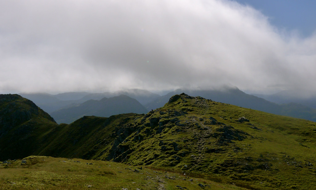
Here after another river wading I picked up a good track which I was now to follow all the way along the south edge of the South Shiel Ridge. On a better day the plan would have been to return by this ridge, however it was not be this time. The weather was poor, the wind remaining strong and the rain sometimes heavy and sometimes light. I really did just draw my hood up and get on with it pausing briefly every few km to have a drink and a snack.
In this way I made good progress, bypassing the large house at Alltbeithe with views down to Loch Quoich, and then heading back up to get around the far end of the South Shield Ridge. I crossed the far end of the hills on a good stalkers path which then dropped me down onto a private tarmac estate road for the final few miles out to the Cluanie Inn.
After around 7 hours of near constant wind and rain it was a relief to get back to the car to change out of damp clothes and then to head around to the Cluanie itself for a reviving cuppa, some soup and a big bowl of chilli.
It rained the whole time I was at the pub, getting increasingly heavy and I was glad to have made the decision to exit from the hills rather than spend another day hoping for a chance at the high tops.
Finally, feeling human again I enjoyed a relaxed drive back to Aberdeen to end a very satisfying trip. I didn’t hit all my goals but I thoroughly enjoyed the experience, learnt a few more lessons about dealing with bad weather days, and generally made good progress despite not hitting as many Munros as I would have liked. Hopefully starting off the next big trip will be somewhat less of a nerve-wracking affair!