Part two of my five day adventure into the heart of the Fisherfield wilderness. If you missed Part One you can read it here first.
Tuesday 20th May
Wild Camp on Ruadh Stac Beag to Wild Camp by Loch an Nid (NH 082 740)
Distance: 13.59km (Cumulative: 64.05km)
Elevation: 1,038m (Cumulative: 4,034m)
Hills: Sgurr Ban (Munro, 989m), Mullach Coire Mhic Fhearchair (Munro, 1019m)
Route:
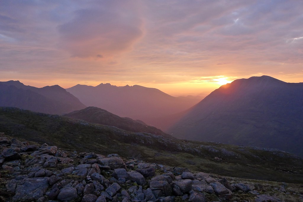
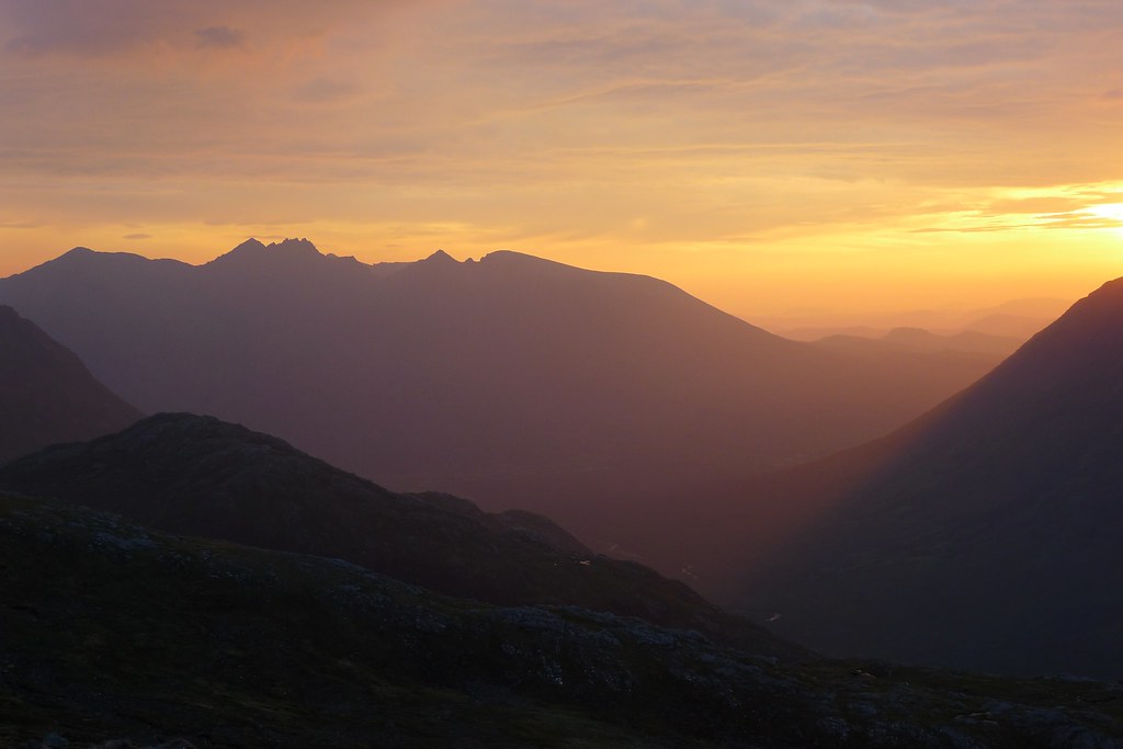
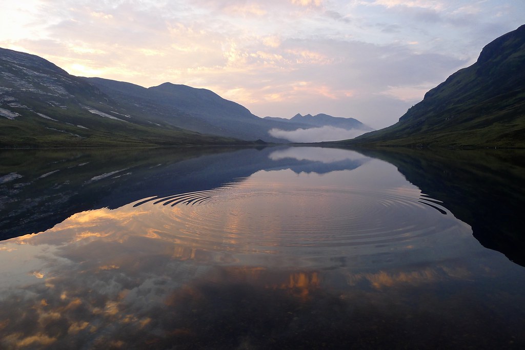
I slept well after sundown but the promise of a good sunrise had me unzipping the tent a few hours later to see a bright moon sitting over the eastern Fisherfield hills. A faint glow on the northeastern horizon told of dawn close at hand.
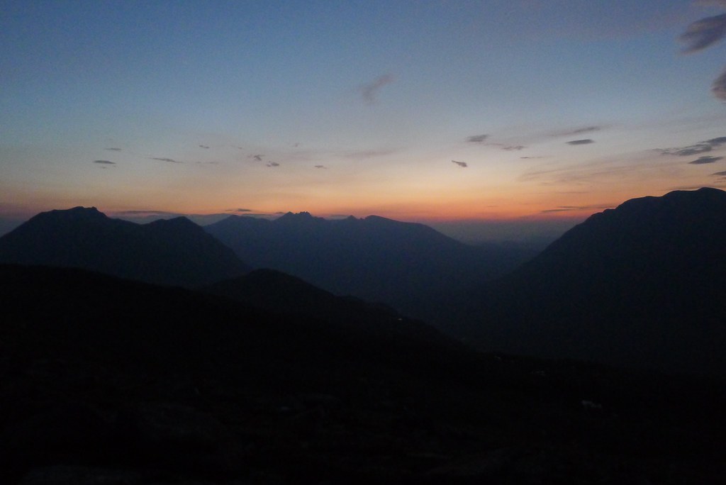
I snoozed for a few more minutes and then roused myself out of my cosy sleeping bag. The sunrise was one of the most magical I’ve experienced whilst out in the Highlands. A flame orange lit up the sky, the Fisherfield mountains dark silhouettes against this fiery sky. It was an incredible sight.

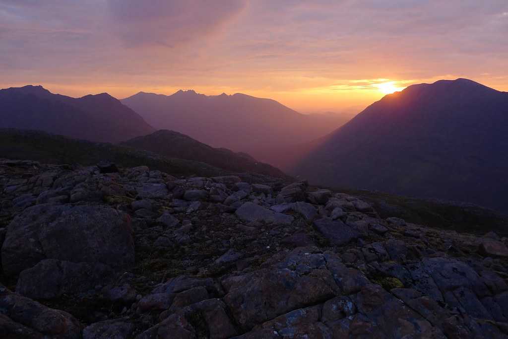
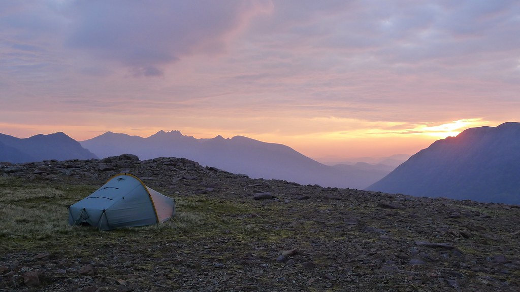
After the light-show it was back to the tent for a couple more hours cosily snoozing as the warm glow suffused me. When I finally got up properly a full day had dawned and the sun was shining down brightly through a hazy sky. There was a strong wind blowing and so I didn’t spend too much time hanging around on the summit, packing everything up, and then heading across to the rocky summit of Ruadh Stac Beag.
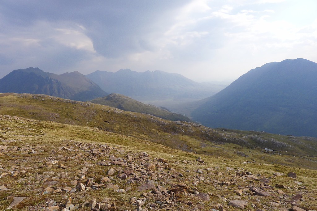

I’d been able to partially survey a descent route down to Gleann na Muice which would save a larger loop north following the more normald escent route below Beinn Dearg Mor. Although I regretted not getting a close up view of this most dramatic of hills I figured I’d be building that into a trip to visit An Teallach and the other northern hills sometime in the future.

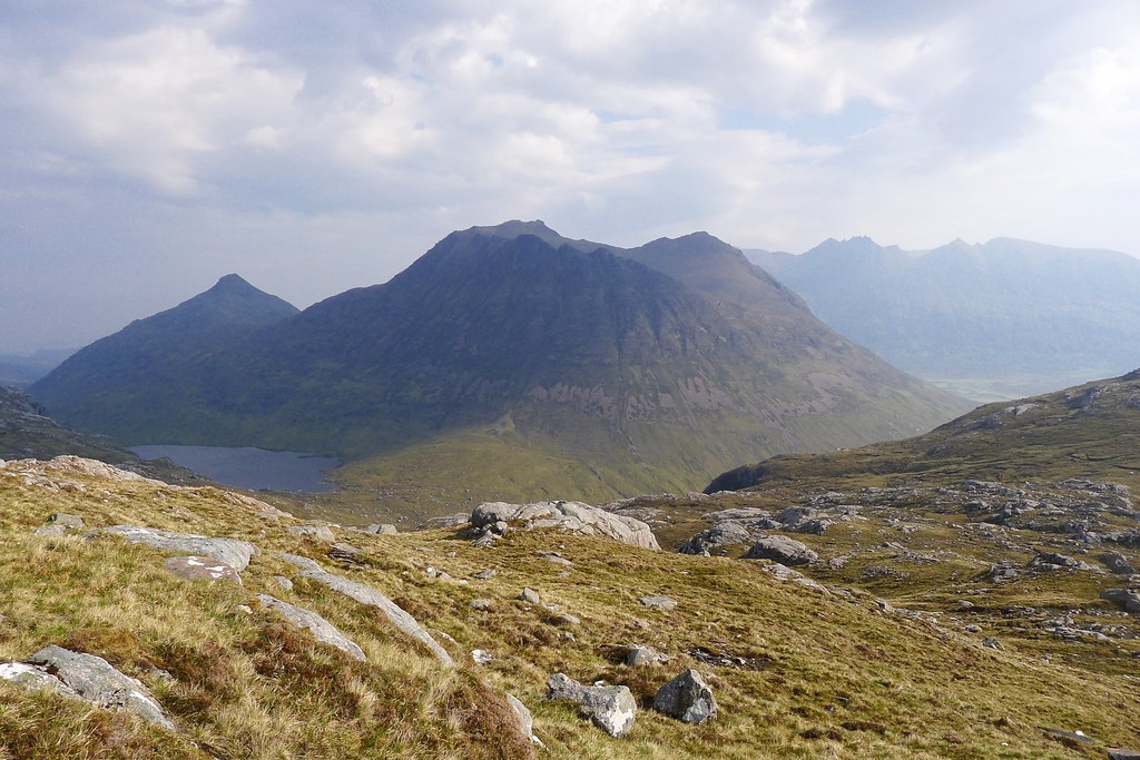
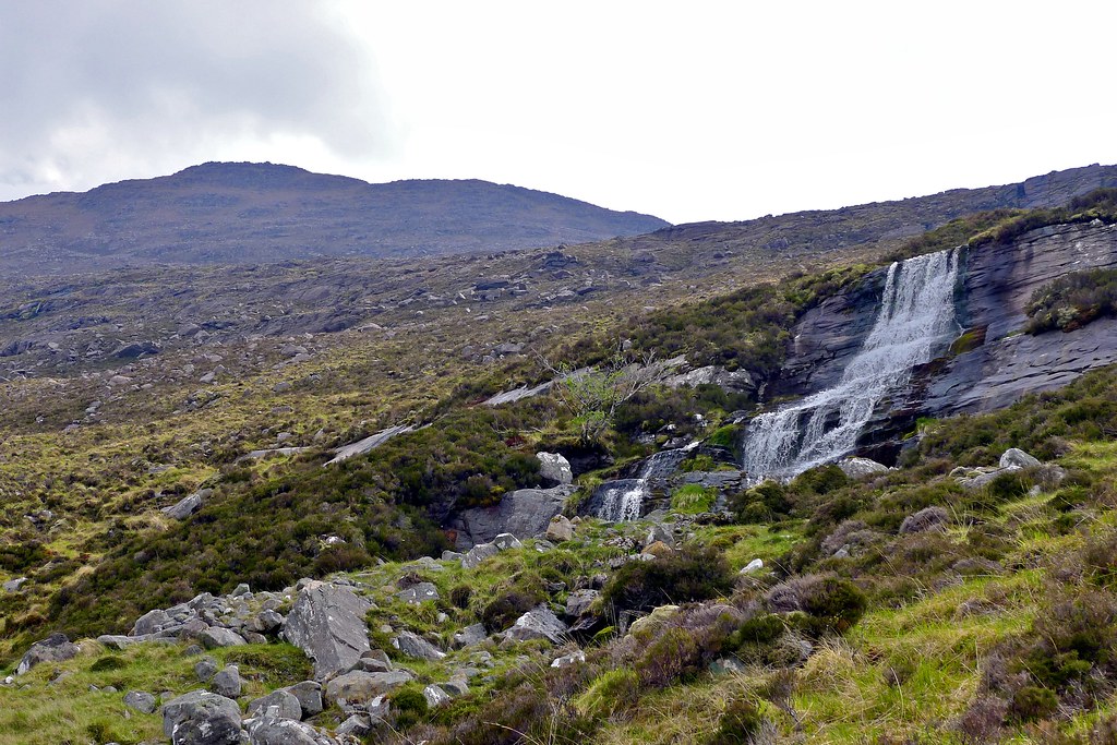
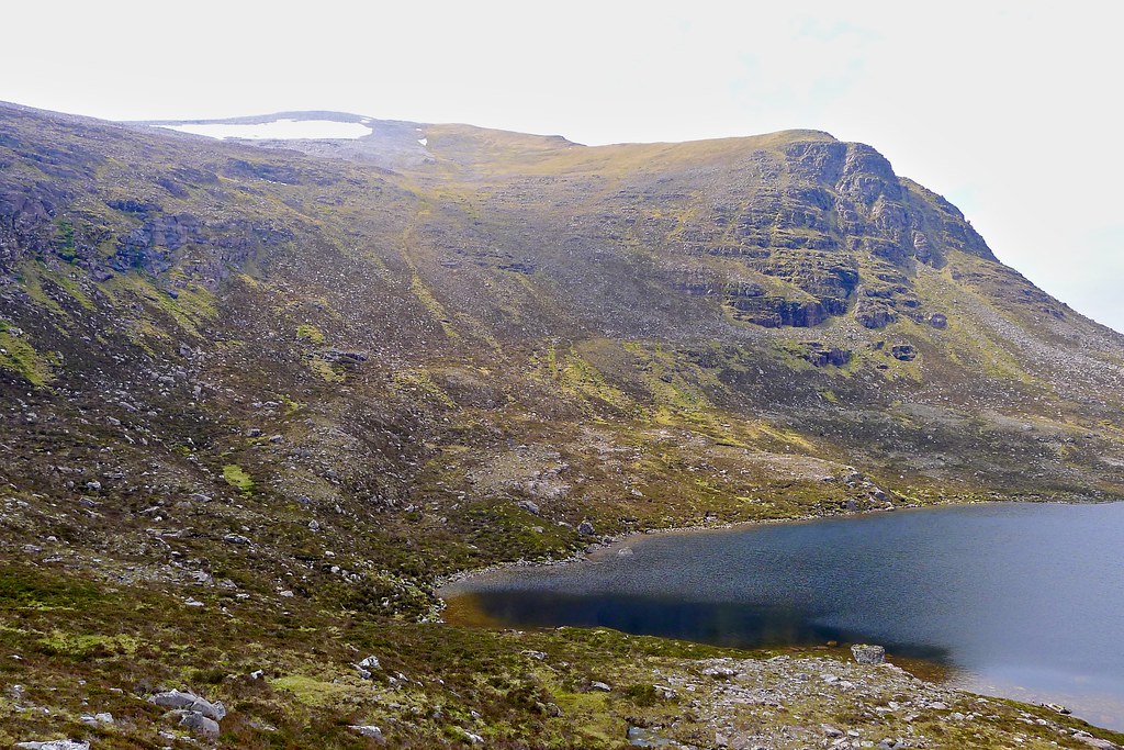
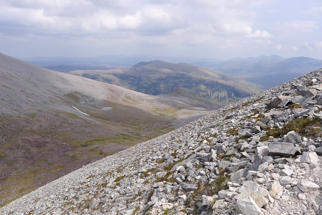
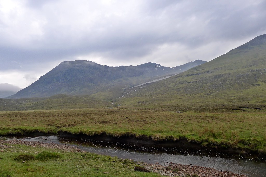
I dropped steeply off Ruadh Stac Beag, down to a jumbled bealach below its northern slopes. On the way a tinkling stream in a narrow scooped ravine gave me a much more sheltered spot to pause and carry out the morning ablutions. From the bealach I was able to easily follow the Allt na Doire Beithe as it dropped down into Gleann na Muice. The coire floor sloped at an easy angle and the ground was easy. As I descended an eagle, catching a rising thermal off the crags to my left started to rise in a long series of loops.


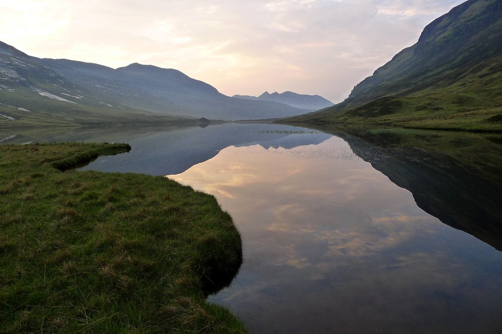
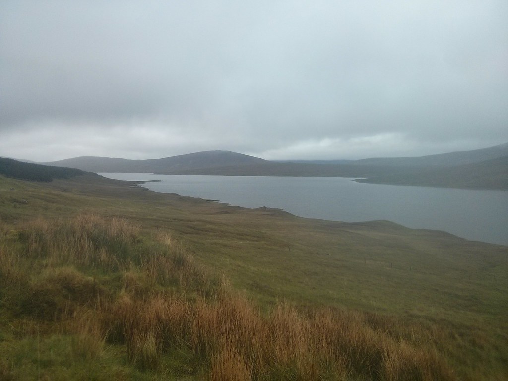
It was warm when I reached the west bank of the Abhainn Gleann na Muice. A beautiful morning had developed with swirls of white clouds drifting around a perfect blue sky. The river was wide but shallow and it was refreshing to slosh across it in my trainers.
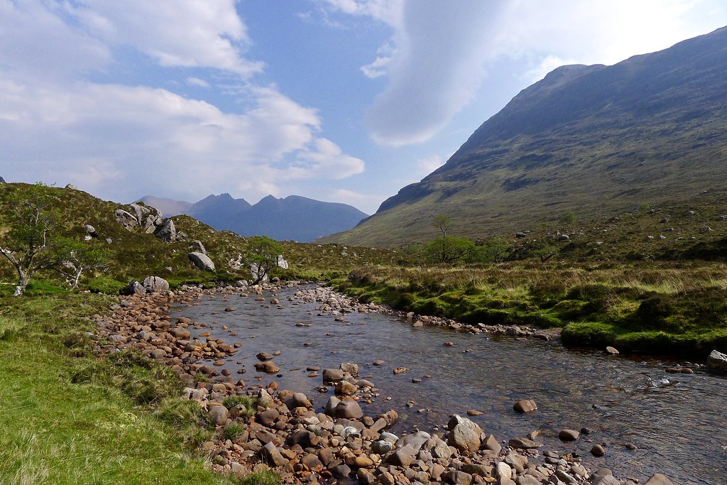
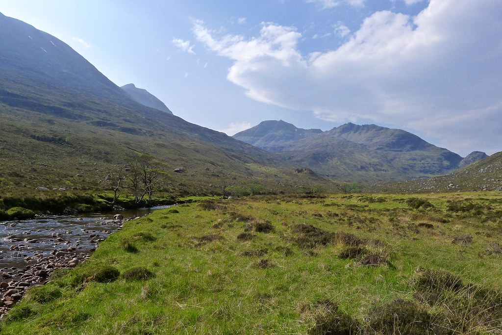
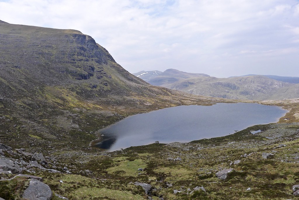
On the east bank I paused for a snack break, enjoying the stillness of this remote and peaceful glen, before starting the long slope up to the bealach between Beinn a’ Ch and Sgurr Ban, directly to the east.
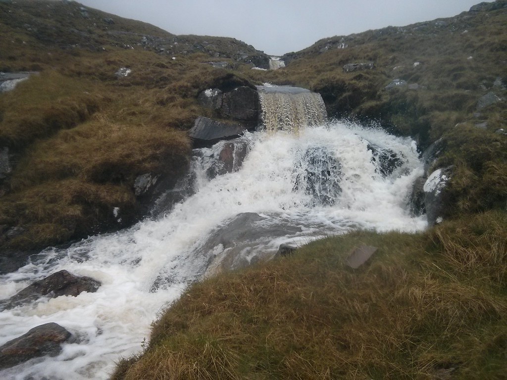
This was a drawn out but relatively easy ascent with only a few small crags to wind around. The rush of the outflow from Loch a’ Bhrisidh was an easy handrail and the ascent brought fresh views back to Beinn Dearg Mor and up towards Ruadh Stac Beag.

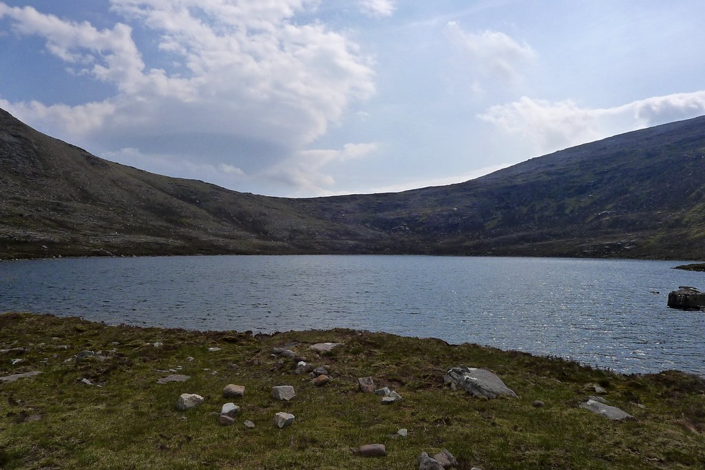
Loch a’ Bhrisidh was another isolated spot that provided ample excuse for another snack break and a long, thirst-quenching drink.
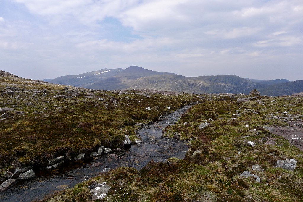
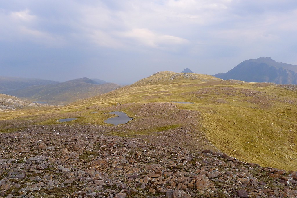
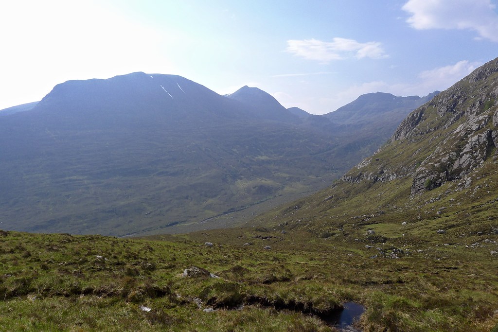
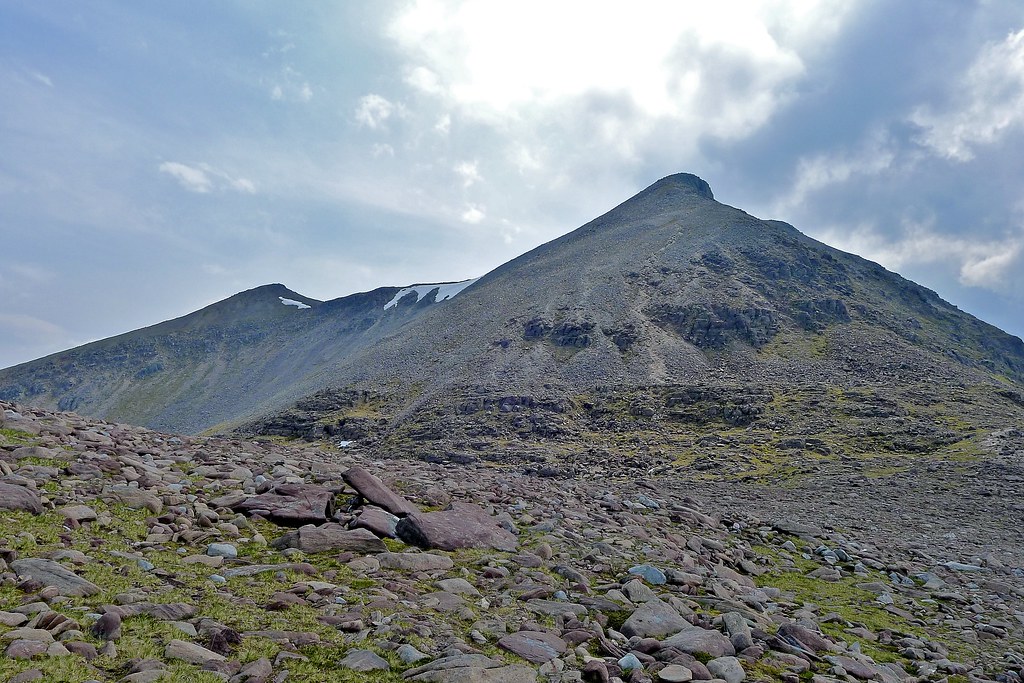
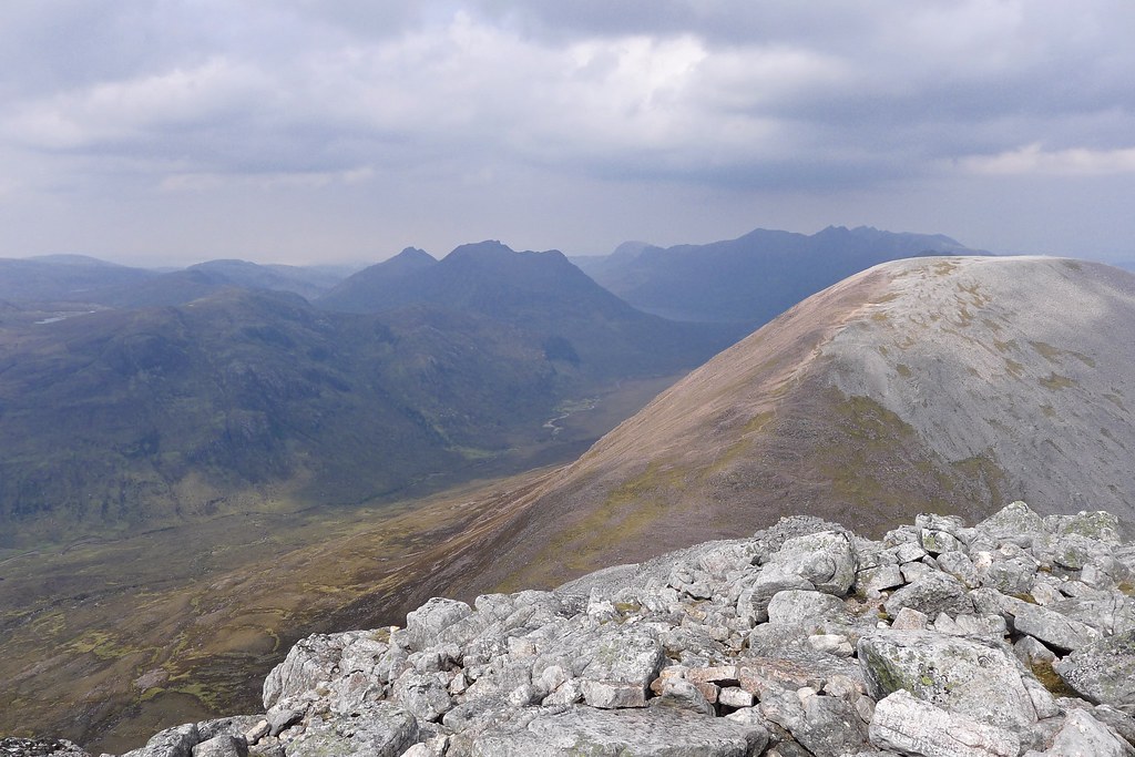
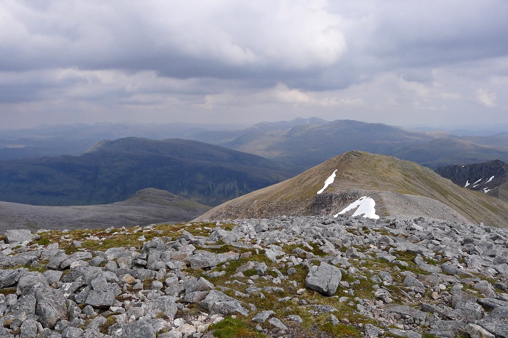
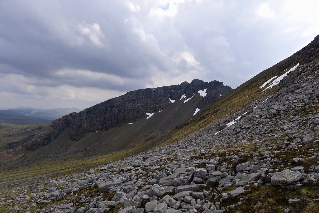
From here it was a short pull up to the bealach to the north of Sgurr Ban with the Munros long, bouldery shoulder extending down to me.
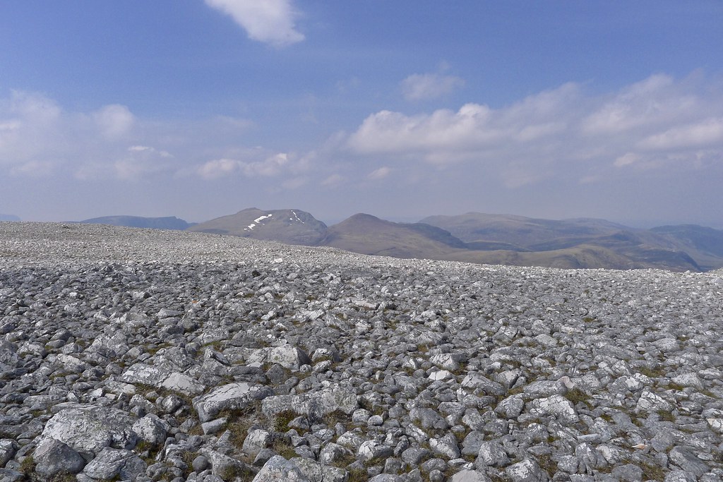
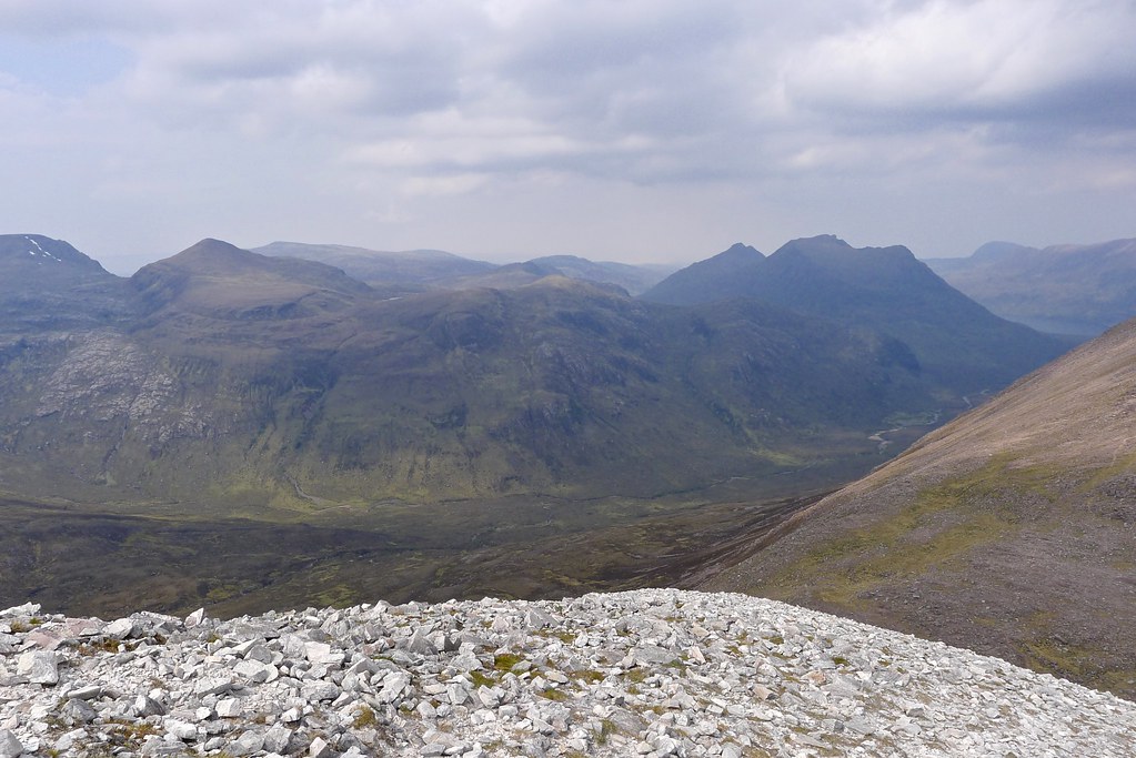
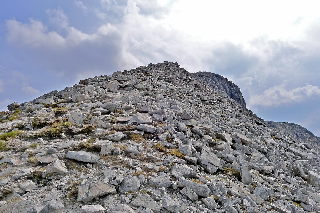
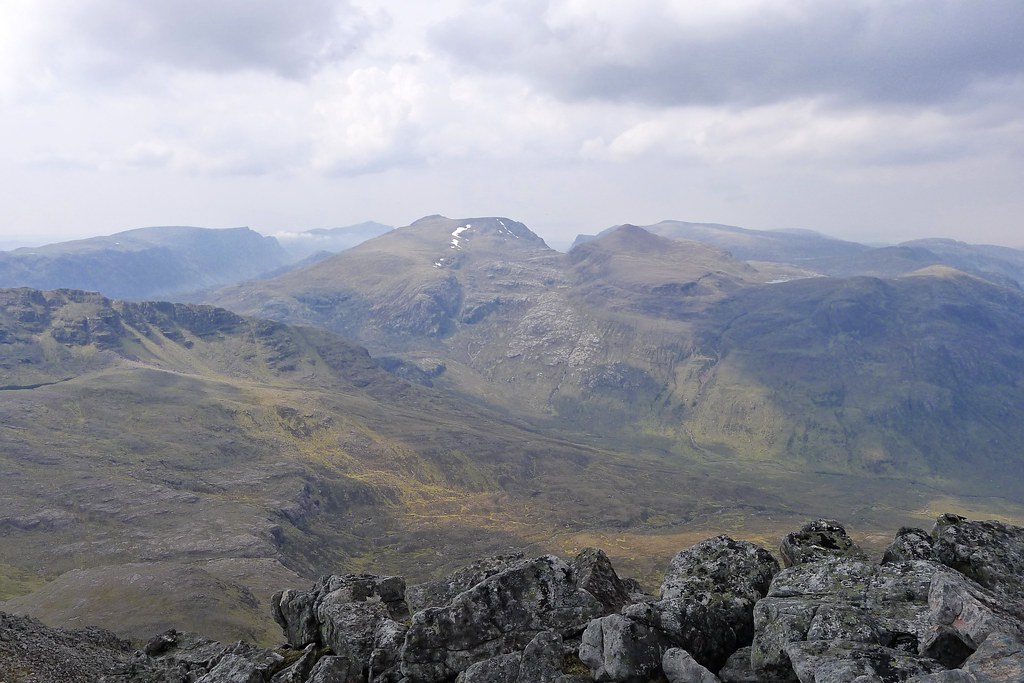
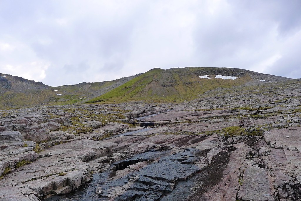
Every footstep needed careful consideration as I slowly clambered my way up the loose and uneven quartzite blocks. Hazy views northward to the Beinn Dearg group and eastward to the Fannaichs were welcomed as I stopped to catch my breath.
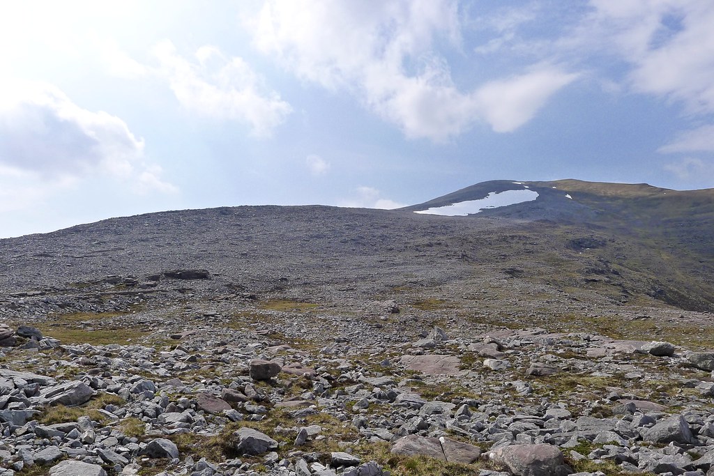
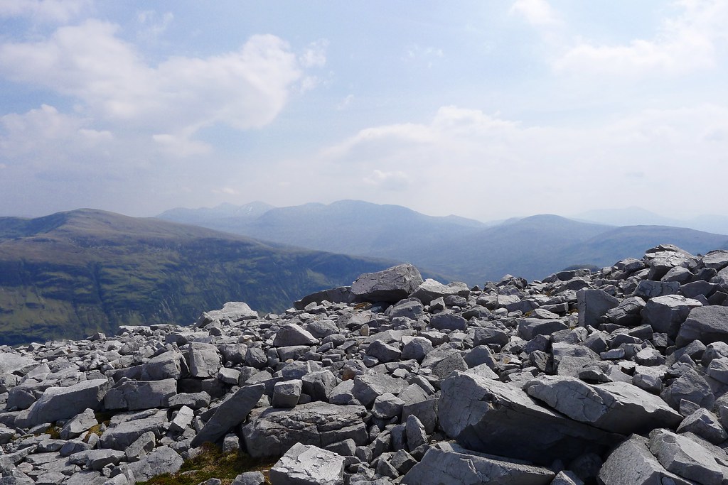
Threads of grass and moss made the upper section a little easier but nontheless I was very glad to reach the flat, stony plateau and make my way across to the substantial cairn.
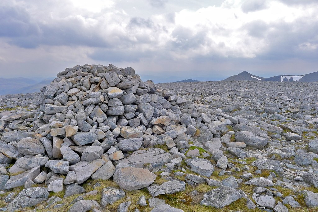
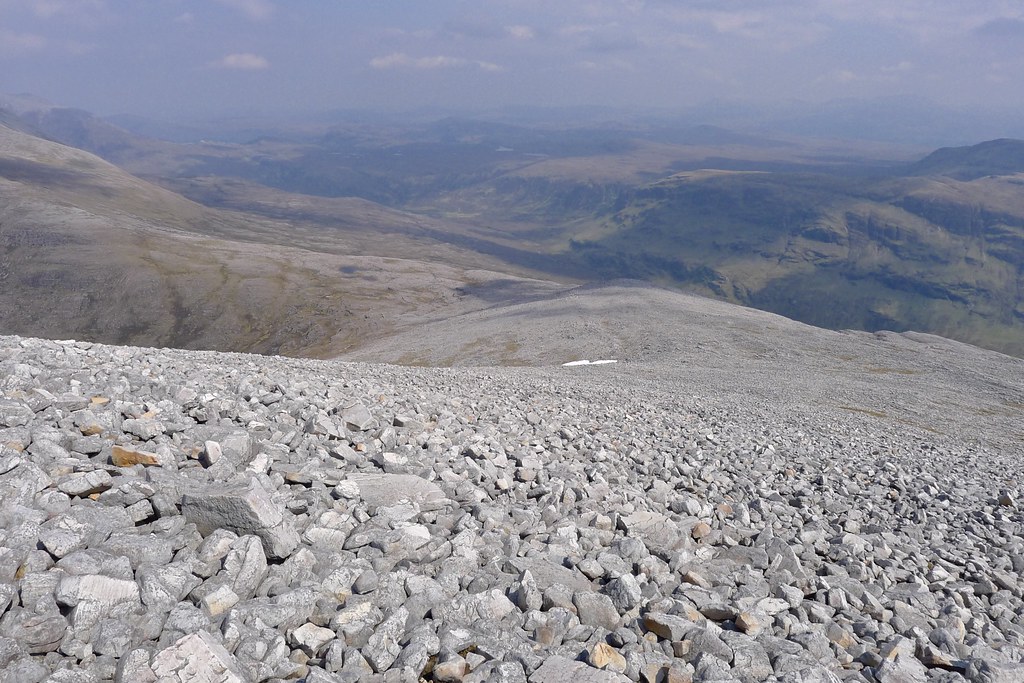
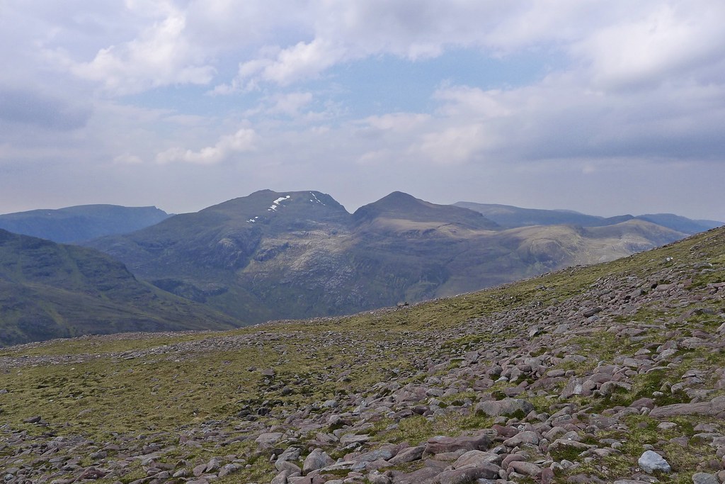
The wide plateau steals away much of the views but it was still grand to look out at a wide arc of distant hazy hilltops as I sat munching on my lunch. The cool, sharp breeze meant I sheltered behind the cairn.
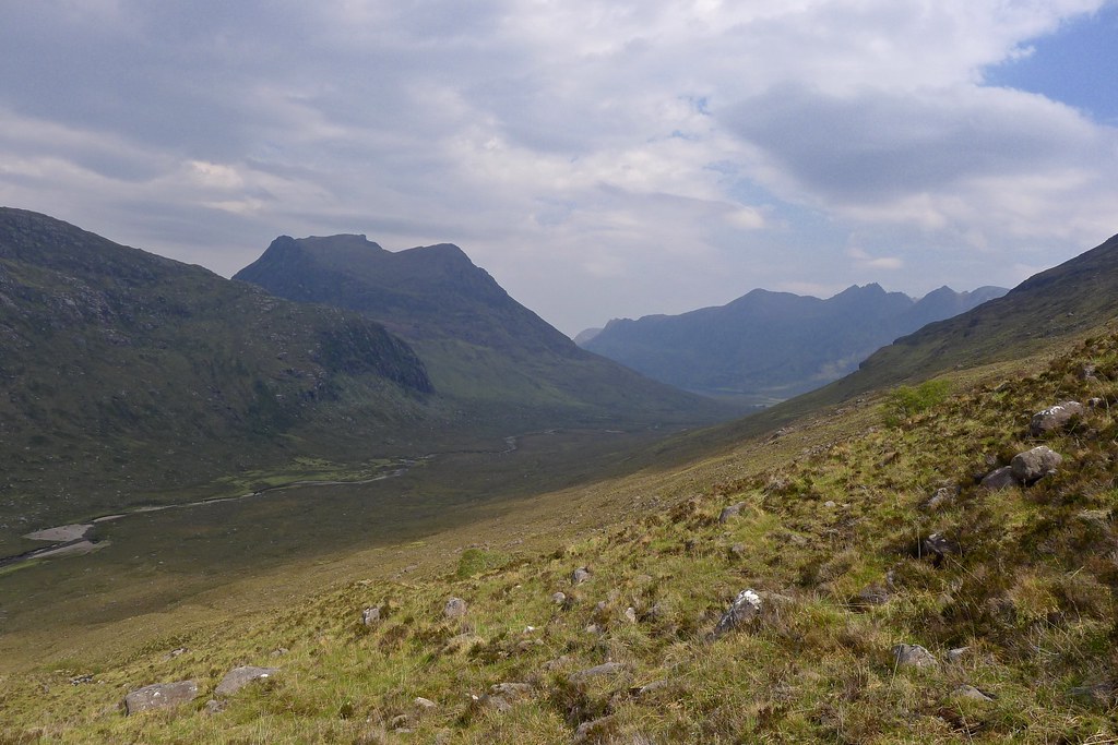
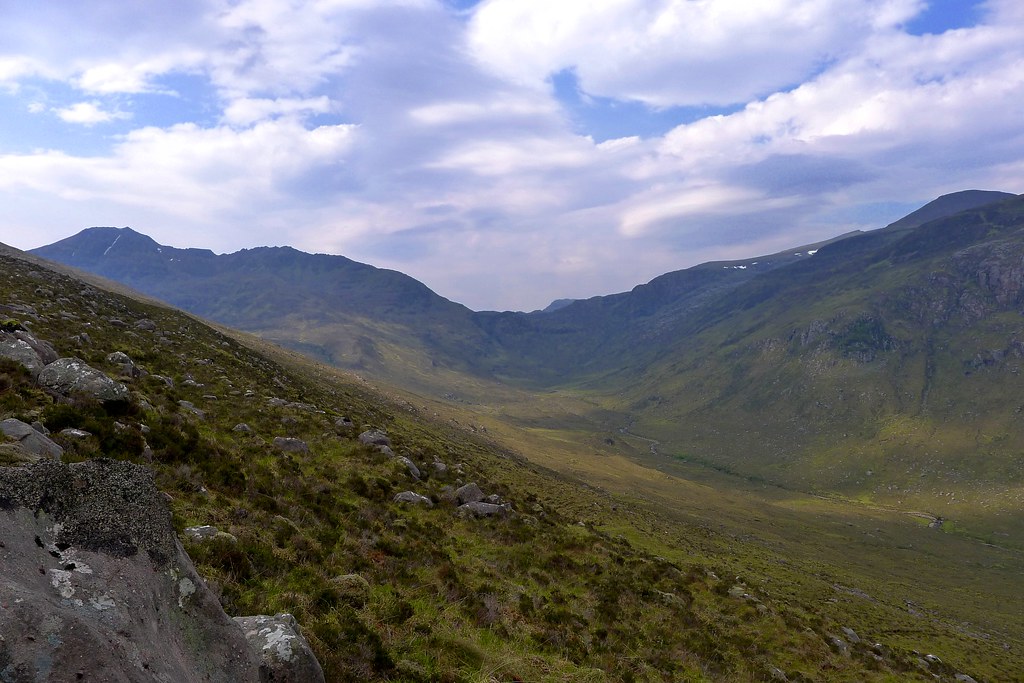
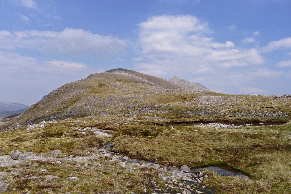
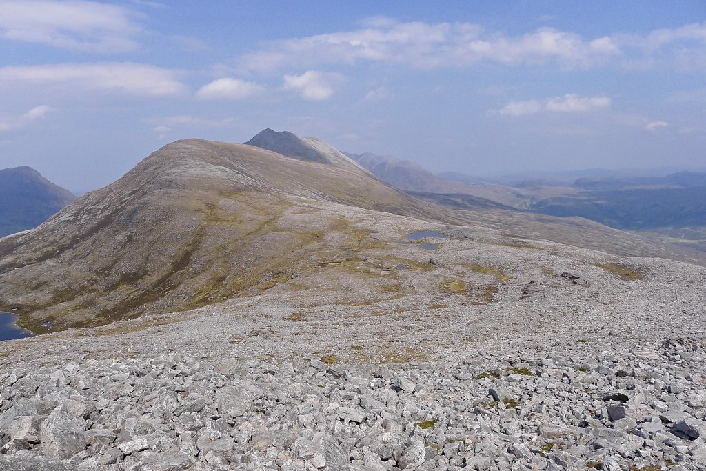
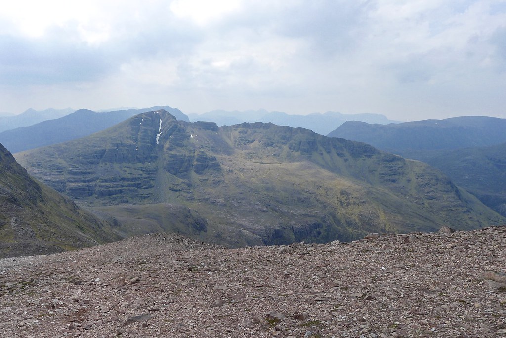
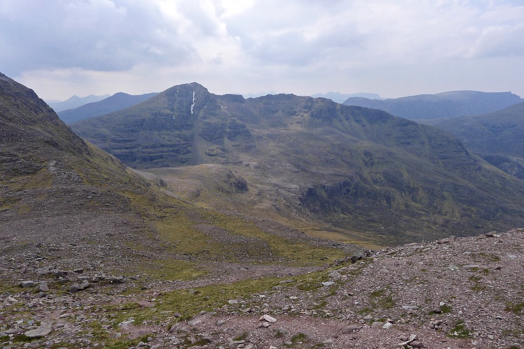
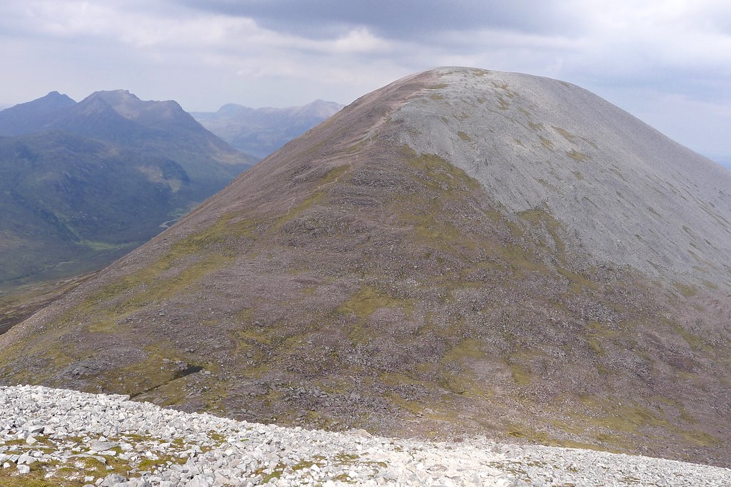
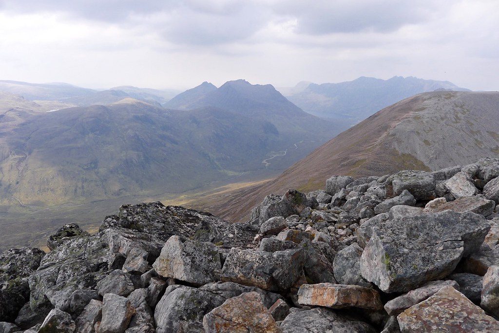
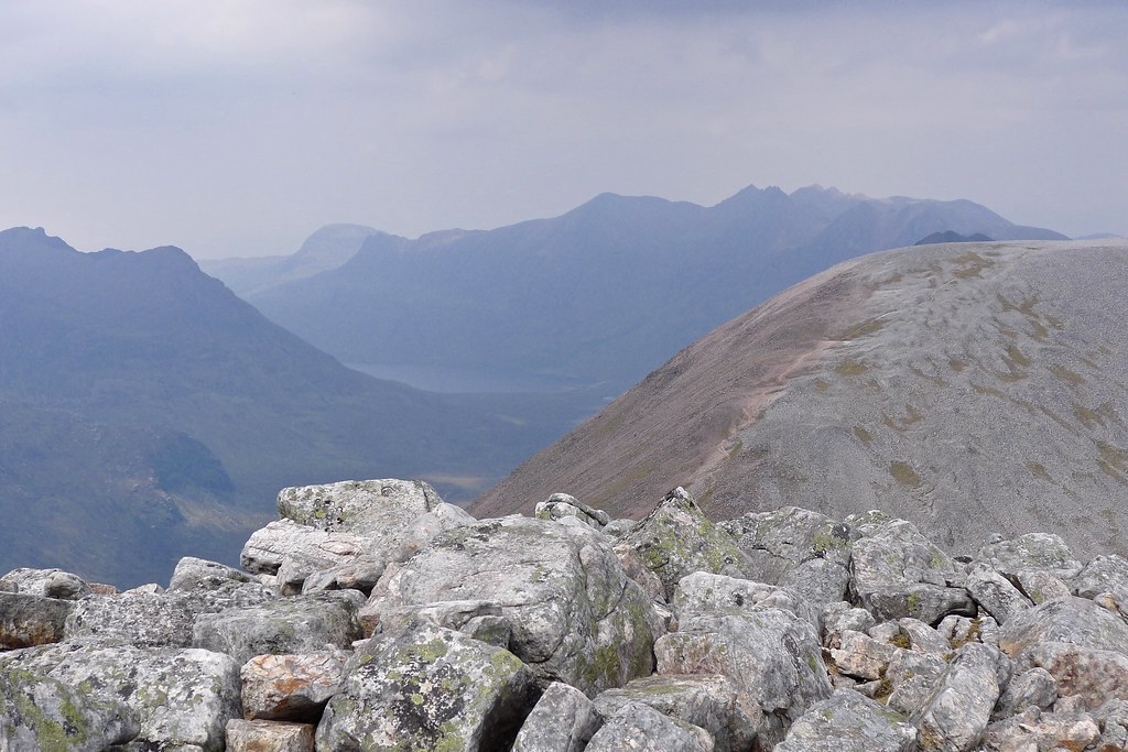
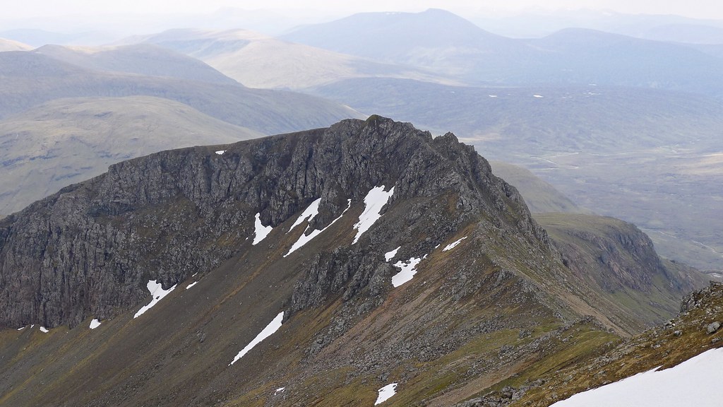
After lunch I headed across the plateau to get a good luck at the next hill, Mullach Choire Mhich Fhearchair. This is the highest point of the Fisherfield 5 and was to be my last hill of the day. I had read plenty about its fearsome east ridge which culminates in the Cuillin-esque summit of Sgurr Dubh. I wasn’t going to go all the way over this ridge but did want to drop down towards Loch an Nid so was scouting out descent routes from the less ferocious section of the ridge. The Mullach is a hugely impressive hill with its quartzite cap and multiple tops. The descent to the bealach was easy on a well worn track that looped gently down through the red sandstone with good views across to Beinn Tarsuinn.


The ascent on the other side was somewhat more interesting. Steep and eroded scree slopes were the order of the day with my shoes crunching into loose gravel as I sought a way up. The main track is horrible but it was possible to find a slightly more solid route up to one side which involved a bit more scrambling but a lot more confidence.
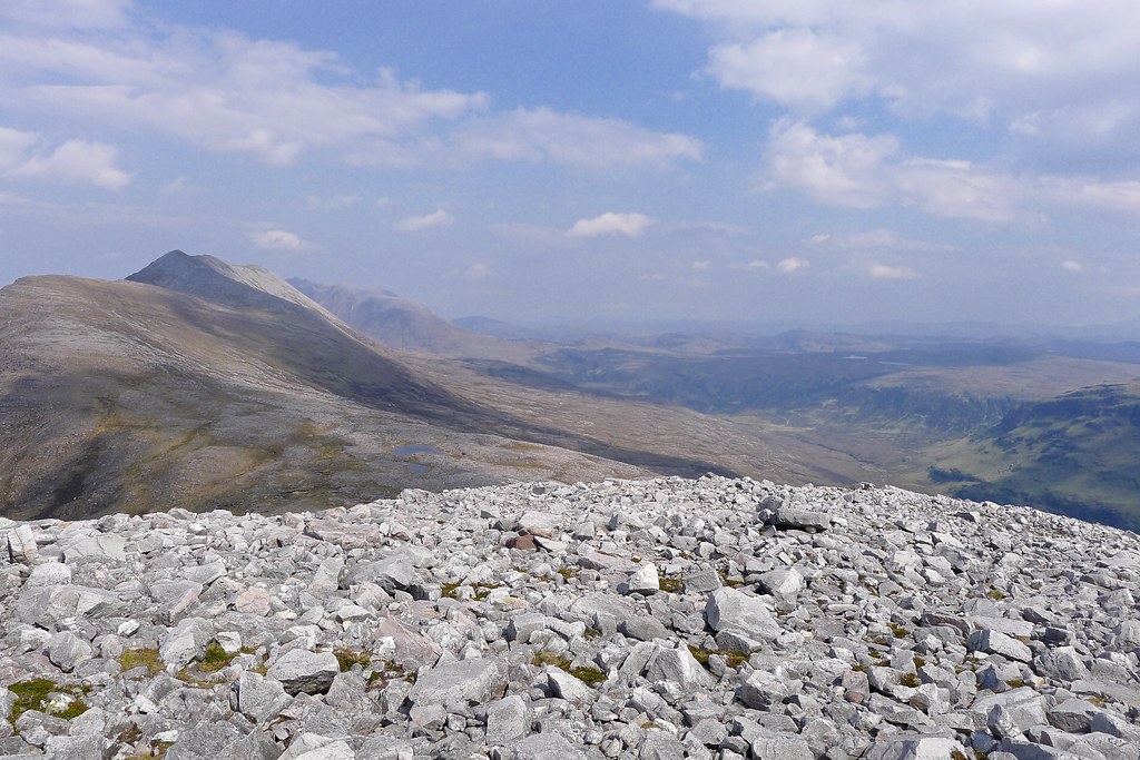
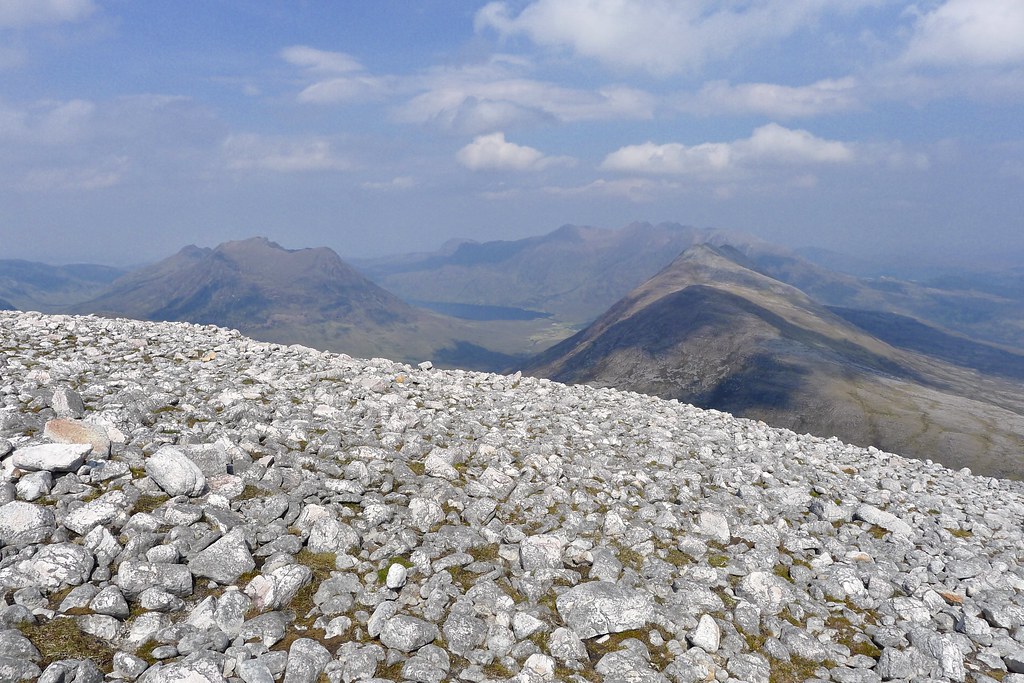
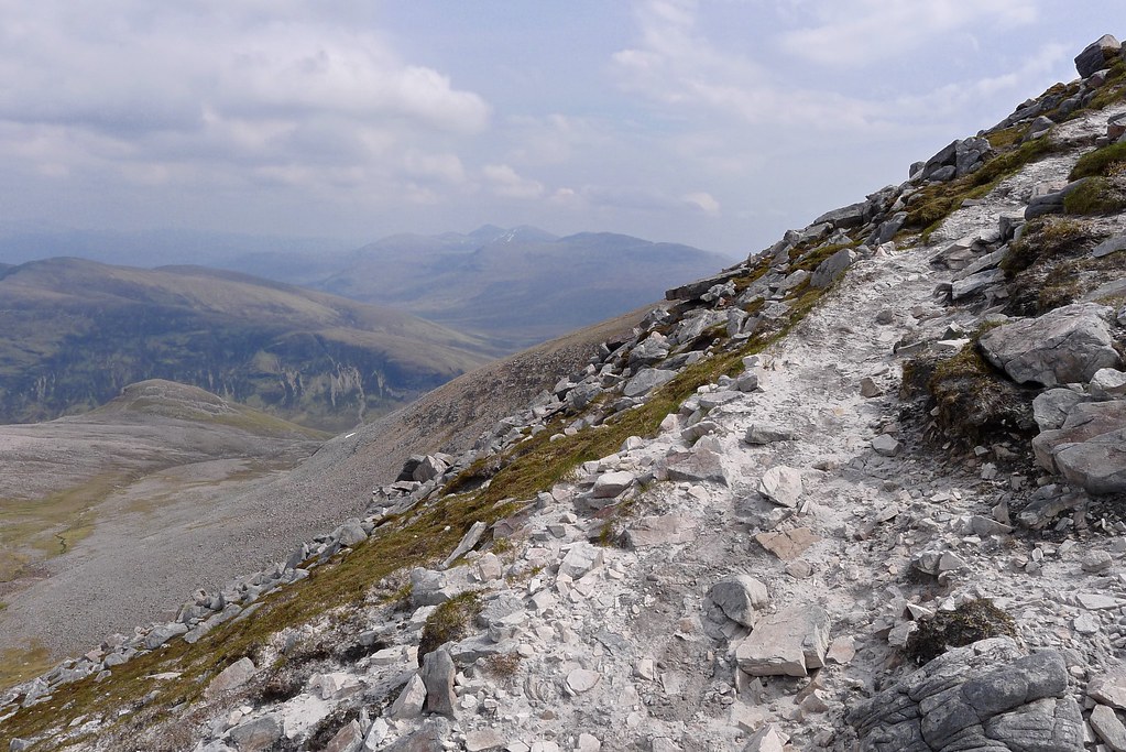
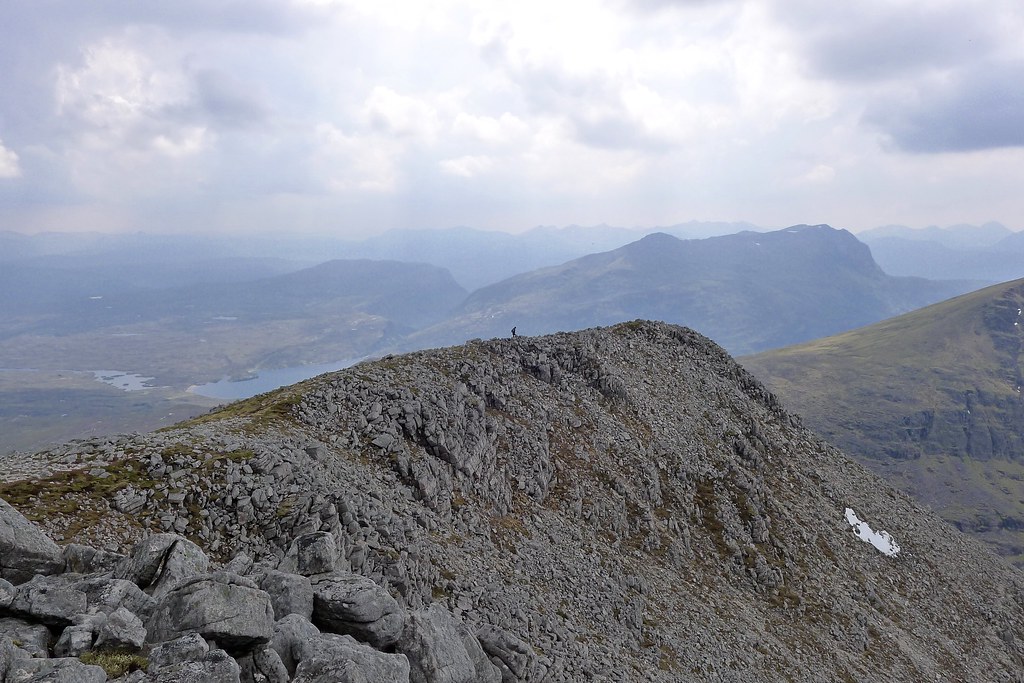
The slope eased and the surface changed to quartzite, so eroded that it was a fine grey-white powder. The section to the top was fabulous, airy with some mild boulders to negotiate and fabulous views all around. It was a joy to finally reach the summit, a small cairn balanced on the edge of the steep western face.
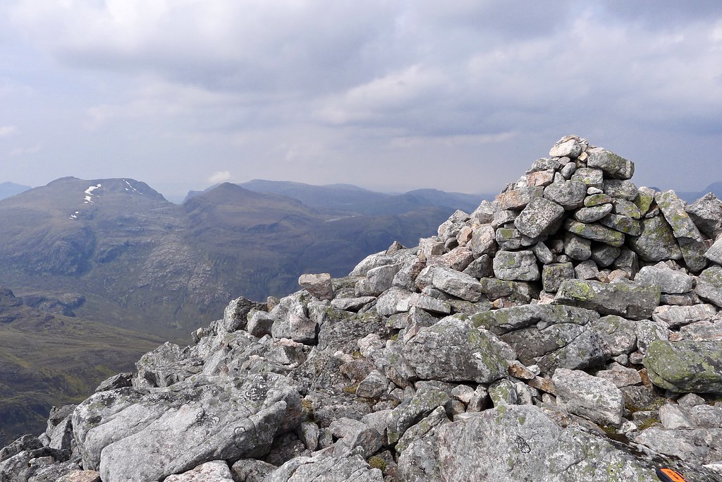
Earlier from Sgurr Ban I’d watched a figure drop down from the summit to the east top, heading for the scramble of Sgurr Dubh. I now watched the same person make their way back up to the Munro summit. In the meantime after a good look around I perched myself on the edge of the steep drop just below the cairn. My feet lazed out into space as I looked out over the hills I had come across during the previous days.
The gentleman arrived and thanked me for looking after his glasses which were sitting, unbeknownst to me, on the summit cairn! It was my first human contact since Sunday afternoon and we had a good chat about the glories of Fisherfield and respective planned routes. He was doing a fast traverse from Loch a’ Bhroain and heading out to Poolewe. I wished him well and watched as he quickly dropped off the south end of the Mullach making for Beinn Tarsuinn.
I sat watching as cloud started bubbling up towards the Fionn Loch.
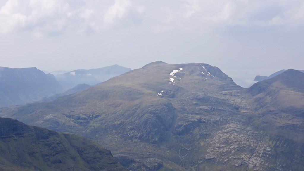
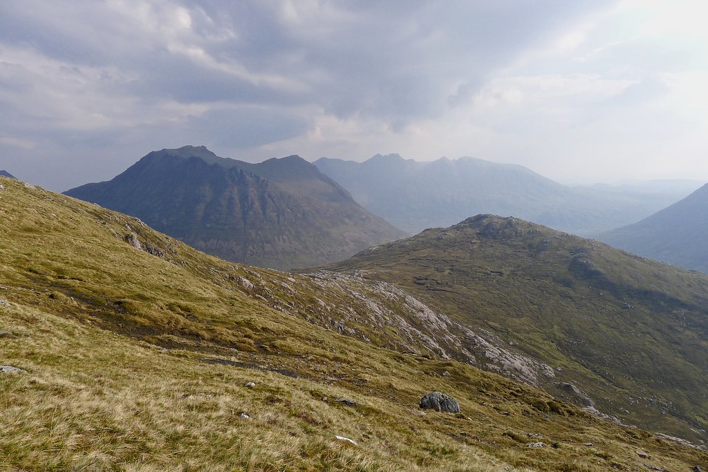
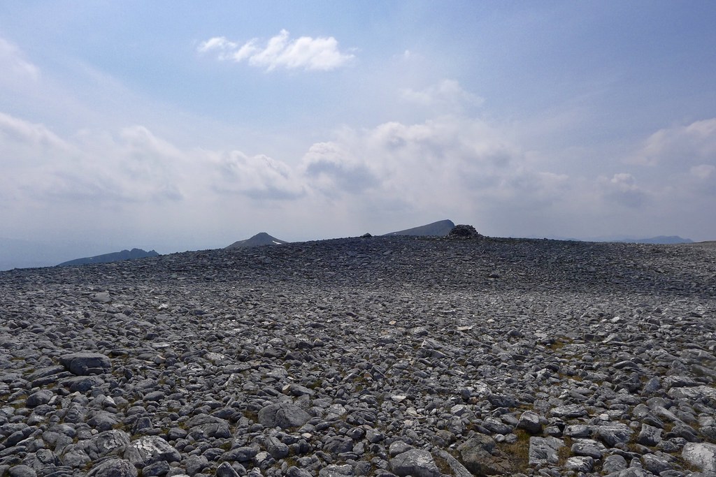
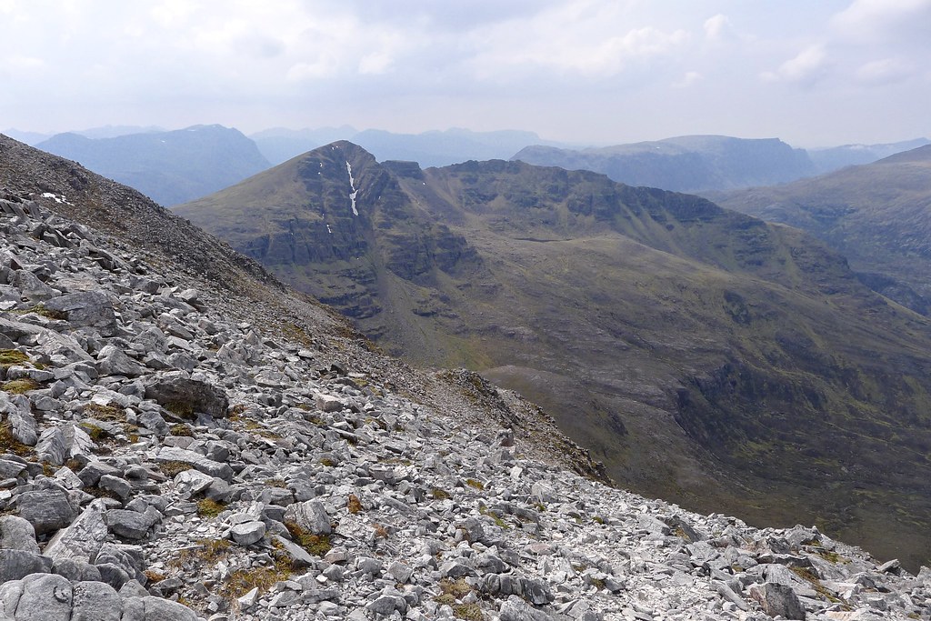
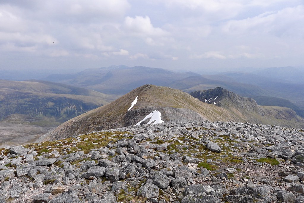
After a few more minutes breathing in the remarkable views and enjoying the solitude I too picked my way off the bouldery summit. I headed down to the east top, pausing for a minute to admire the large snowpatch curving round the upper lip of the north face.


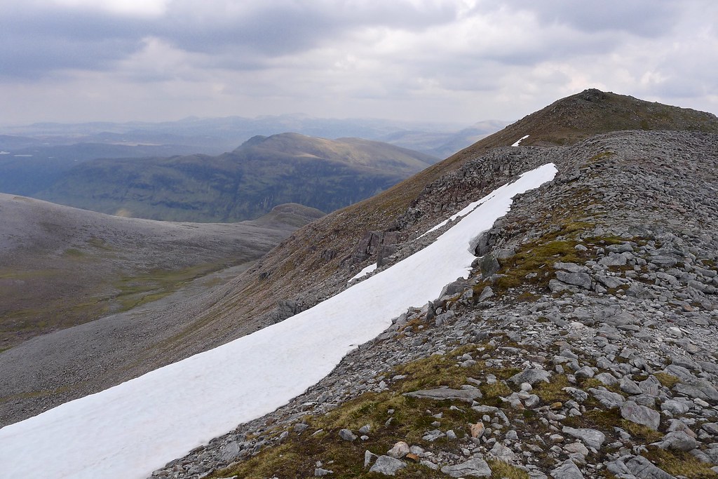
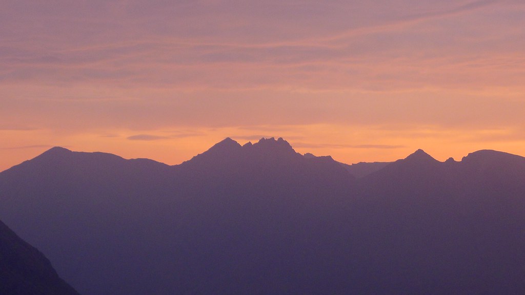
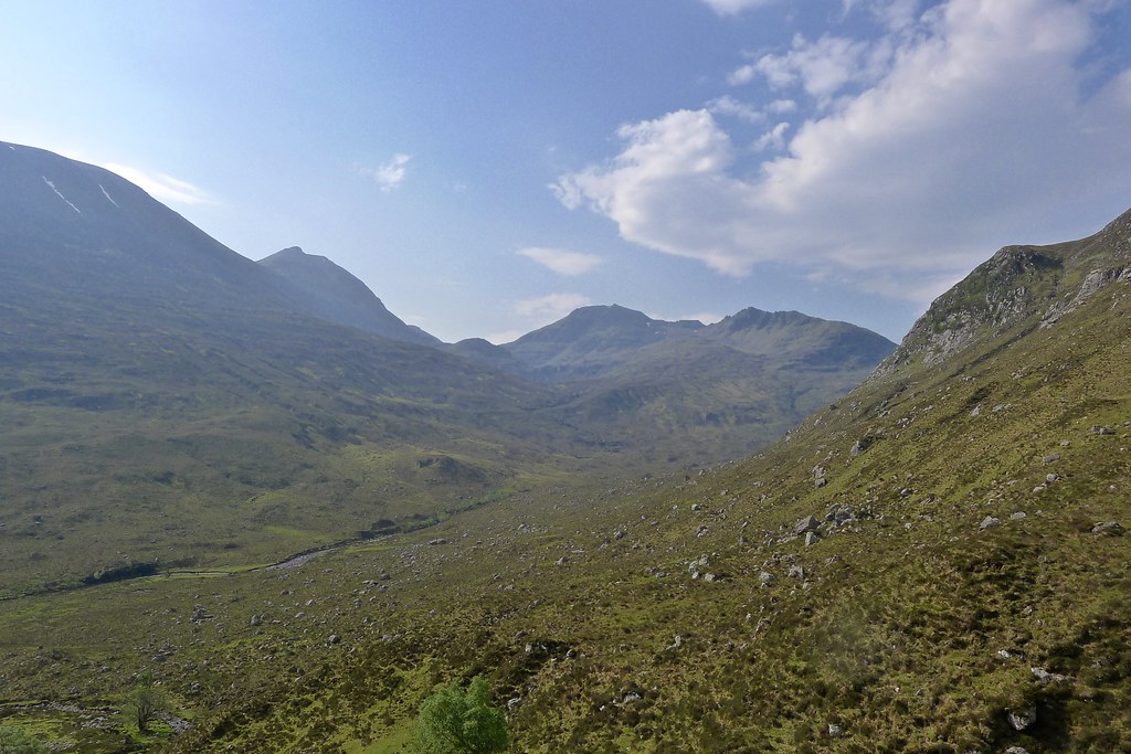
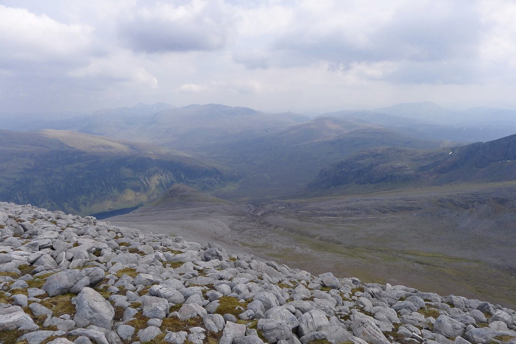
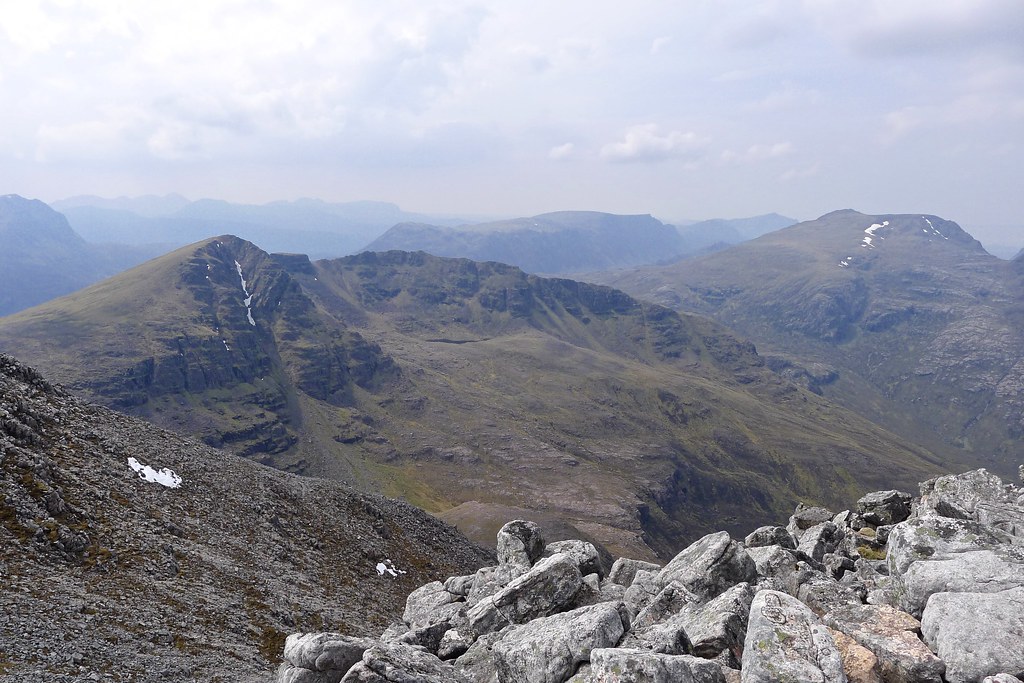
The east top was easily attained and I now had a view down the sinuous ridge to Sgurr Dubh and its dark spires of rock. This view confirmed my decision not to tackle it on this occassion and instead I started to look down the eastern slopes below me. The Fannaichs were gradually being swallowed by cloud but I was in sunshine as I dropped steeply downward.
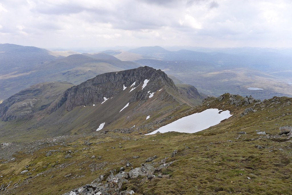
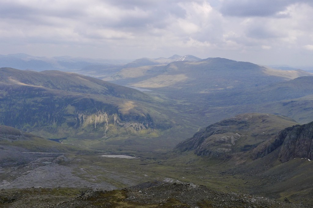
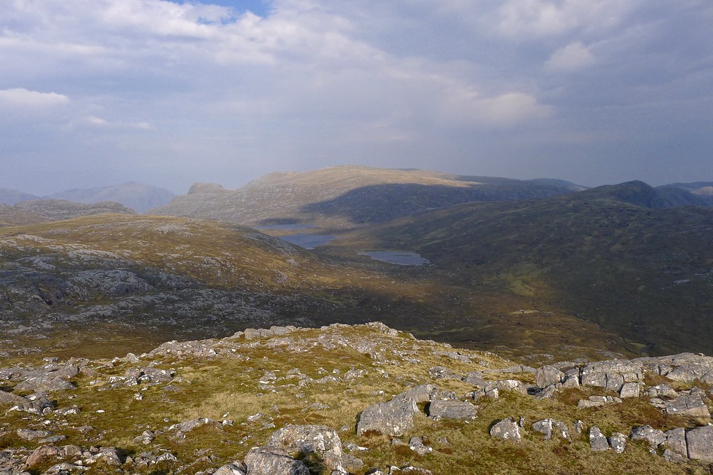
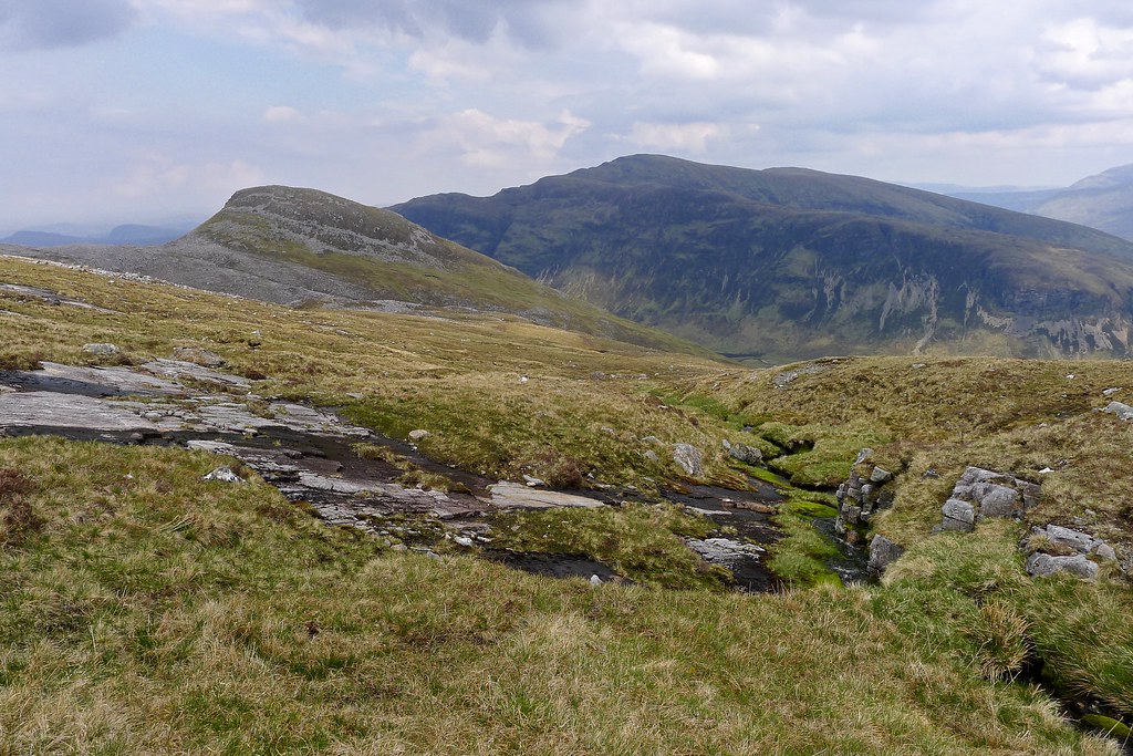
The majority of the descent was fine but there was a stretch of unavoidable boulders that formed an unpleasant traverse on steep ground. I was glad to reach more grassy slopes and then the gradient eased and I was down in the gentle ramp of coire. This offered spectacular views up to Sgurr Dubh and the continuation of the Mullach’s eastern arm as it ended abruptly at Tom an Fhiodha.

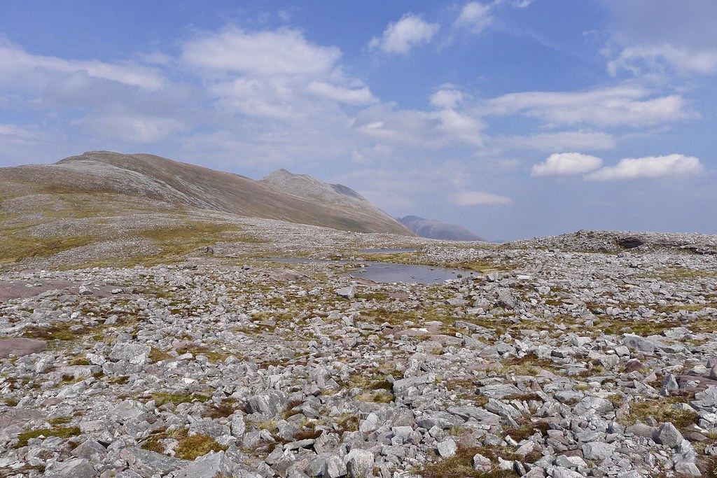
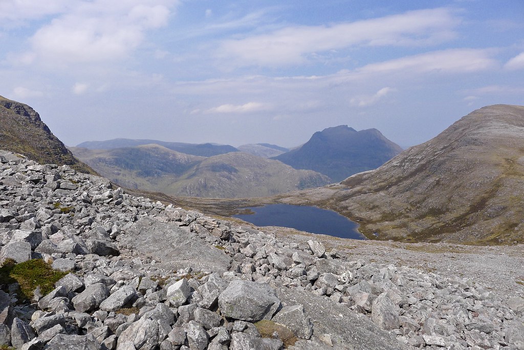
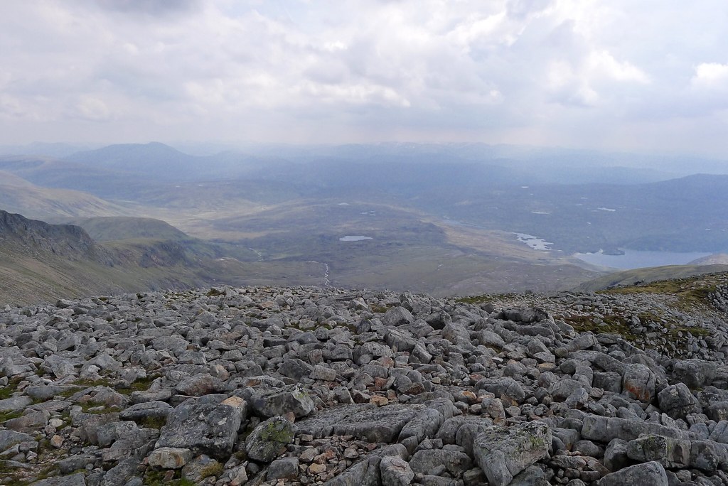
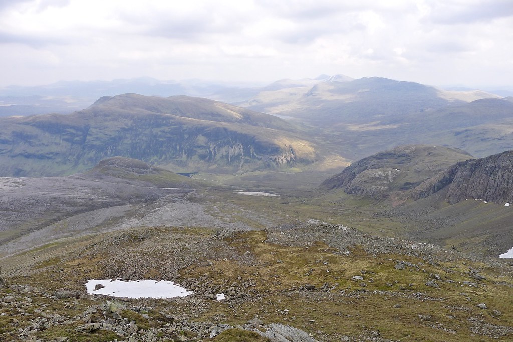
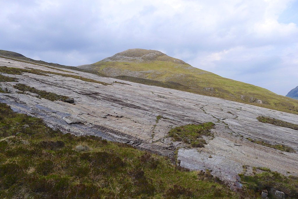
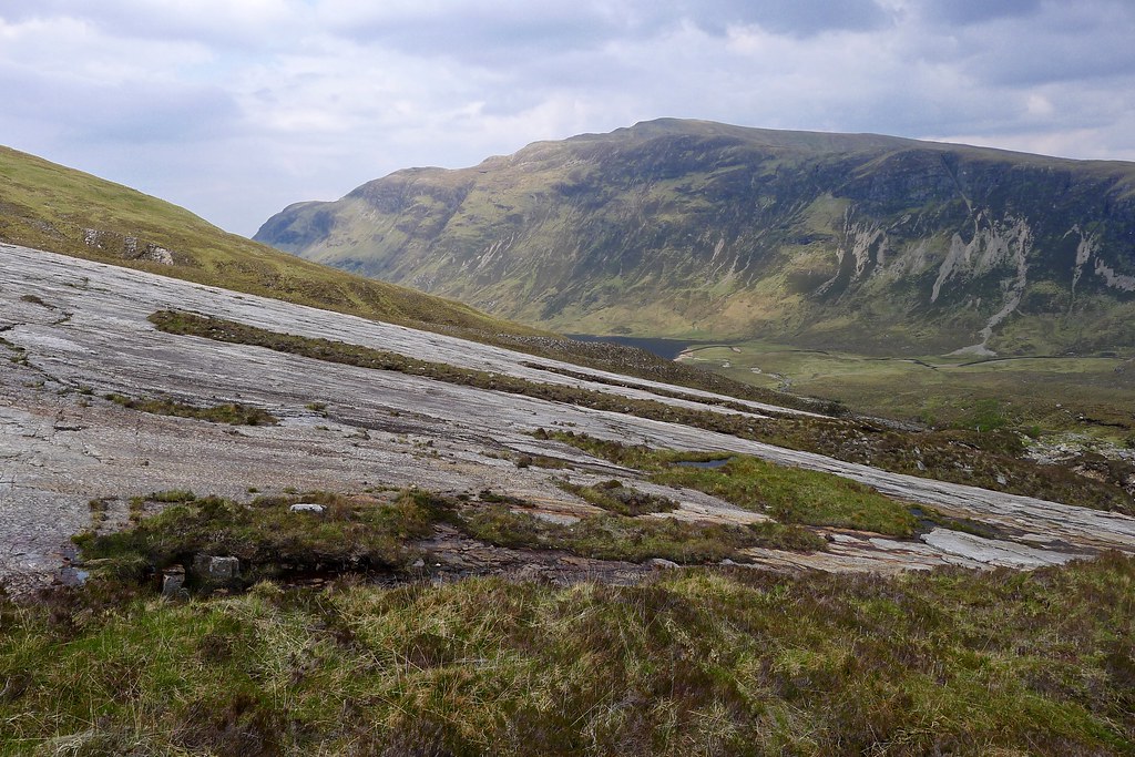
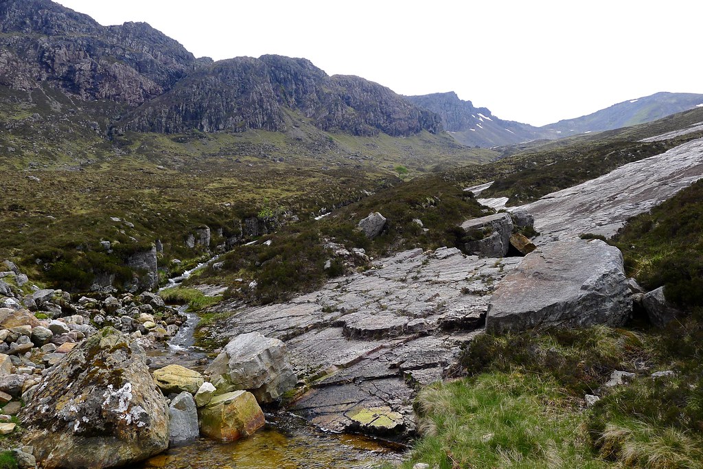
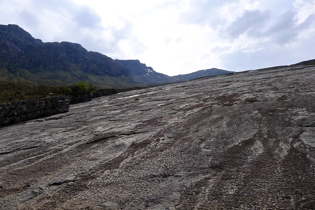
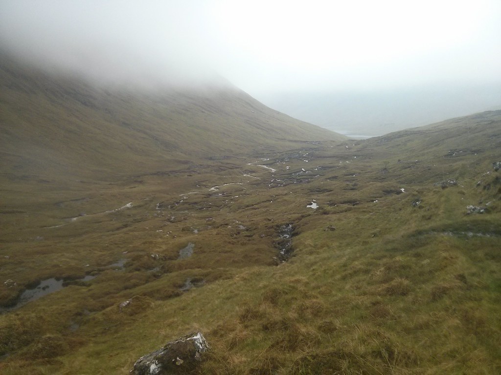
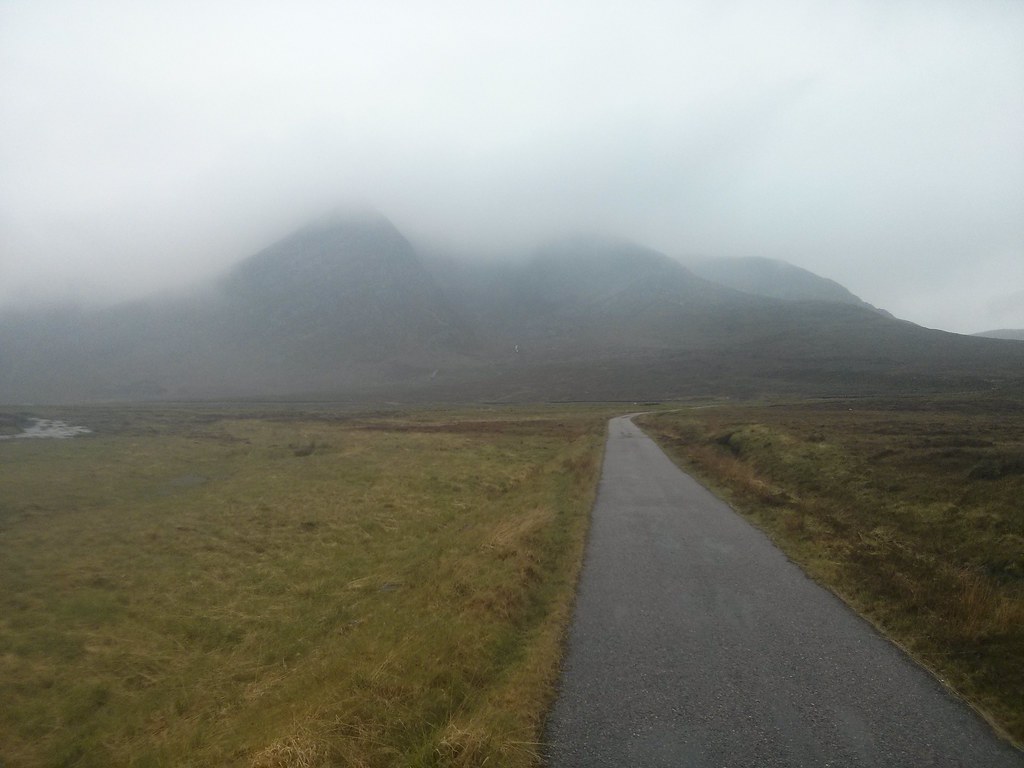
The sloping grassy ramp led me downward until I reached the first of the bare quartzite slabs which are a dominant feature of the slopes above Loch an Nid. These had streams of water running down them but away from the water course they were grippy and I made good progress down, passing between the conical top of Meallan an Laoigh and below the sandstone cliffs of Tom an Fhiodha.
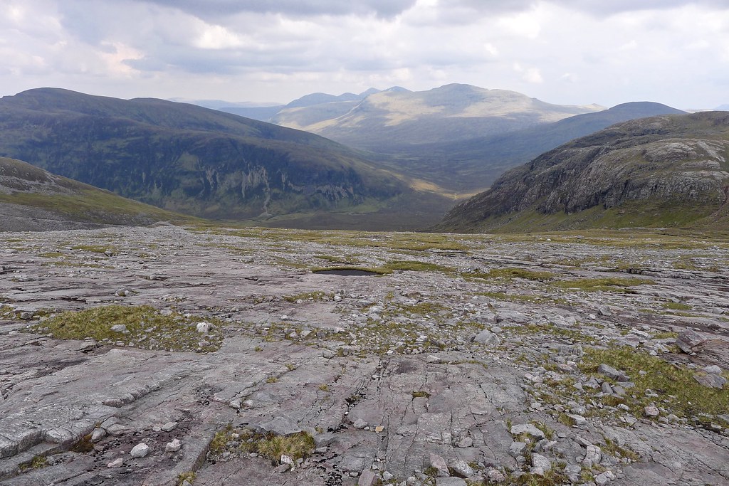
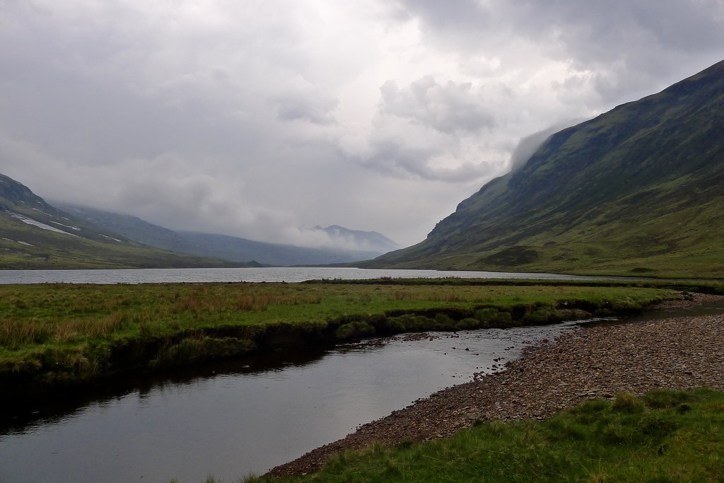
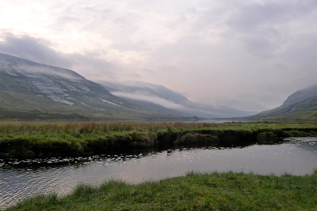
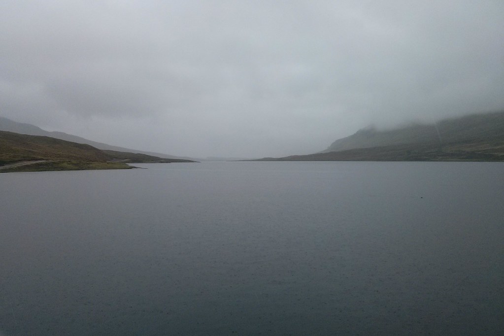
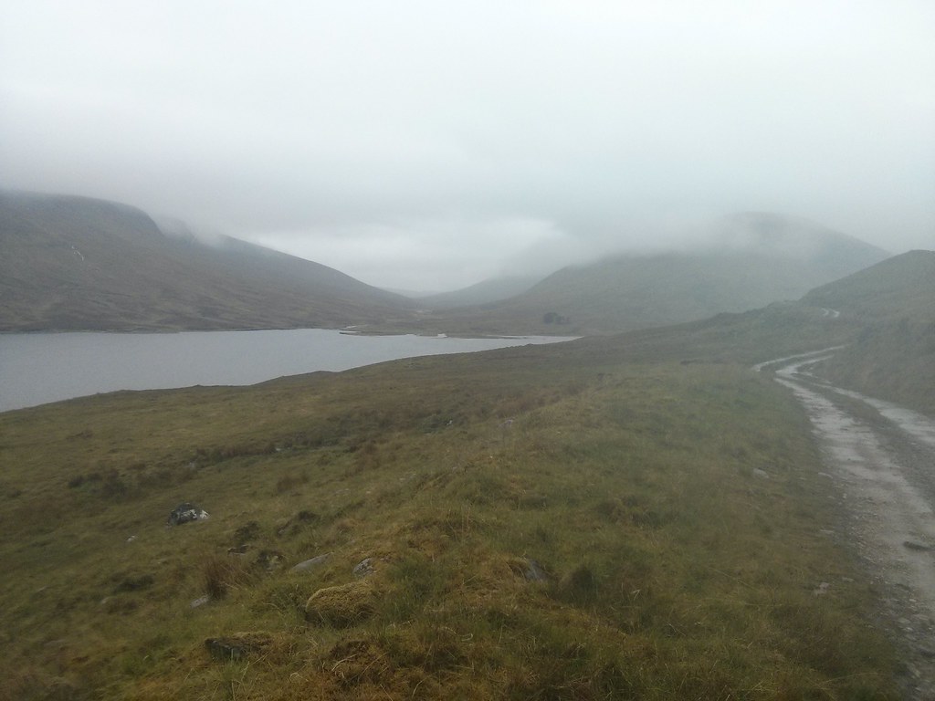
The clouds building over the Mullach behind were looking ever more menacing and so it was good to finally catch my first glimpse of the end of Loch an Nid. Given the advancing hour and the deteriorating weather I was strongly considering camping there, rather than making any progress round towards Loch a’ Bhroain.
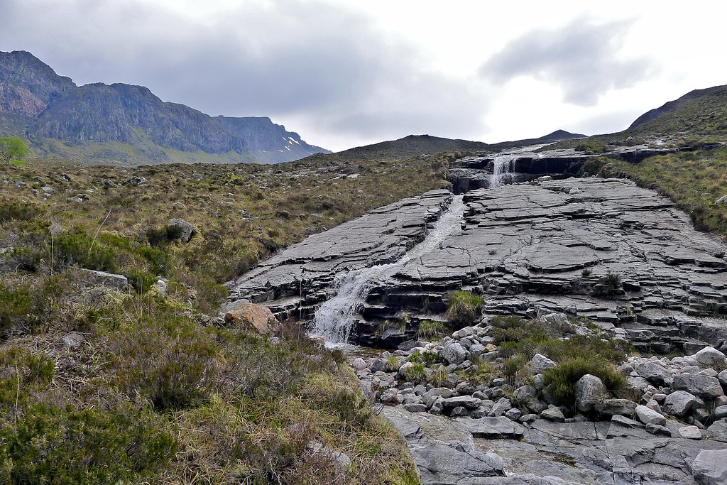
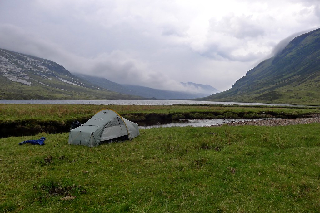
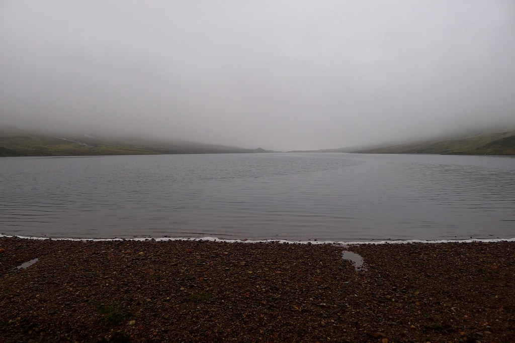
The slab I was on ended in a steep end and I backtracked and crossed a second slab to make forward progress down the north bank of the stream. I was down amongst lumpy heather tussocks when the rain started. At first it seemed just a summer shower, rain sizzling into hot grass and rock, the smell of ozone almost overpowering. I kept going thinking it would let up. It didn’t though, it got heavier and heavier until I was scrabbling around in my front pocket to extract full waterproofs. My mind was made up and I hurried down the final short slopes, skipped across the Allt and made a beeline for the inflow to Loch an Nid. Mindful of being trapped on the first night by rising water I waded across the inflow and quickly found a nice flat spot to pitch the tent.
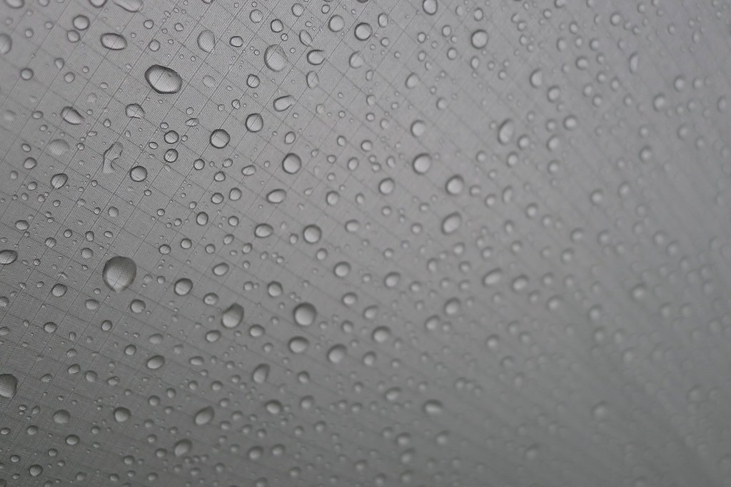
The rain was incessant, drumming on my hood as I got the tent up in record time. I threw my bag and poles in one porch and squeezed into the other, stripping off my damp clothes and clambering into the muggy confines of the tent inner.
The roar of the rain on the fly was quite something and it felt good to be here in this most elemental of environments. I soon got myself organised and as the rain continued enjoyed stretching out with a hot soup and my Kindle.
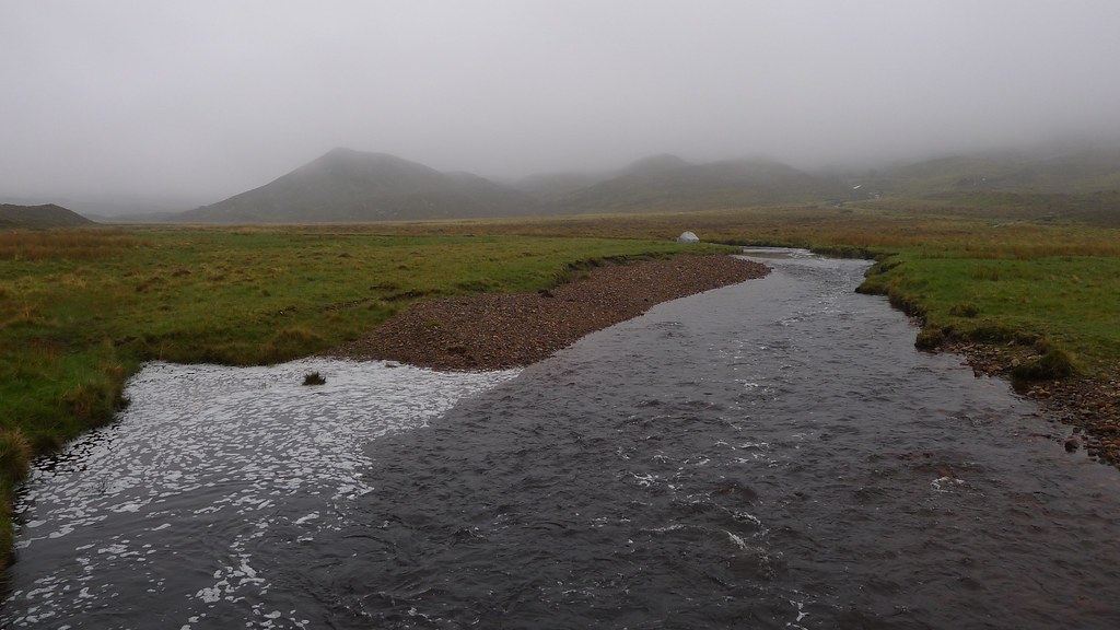
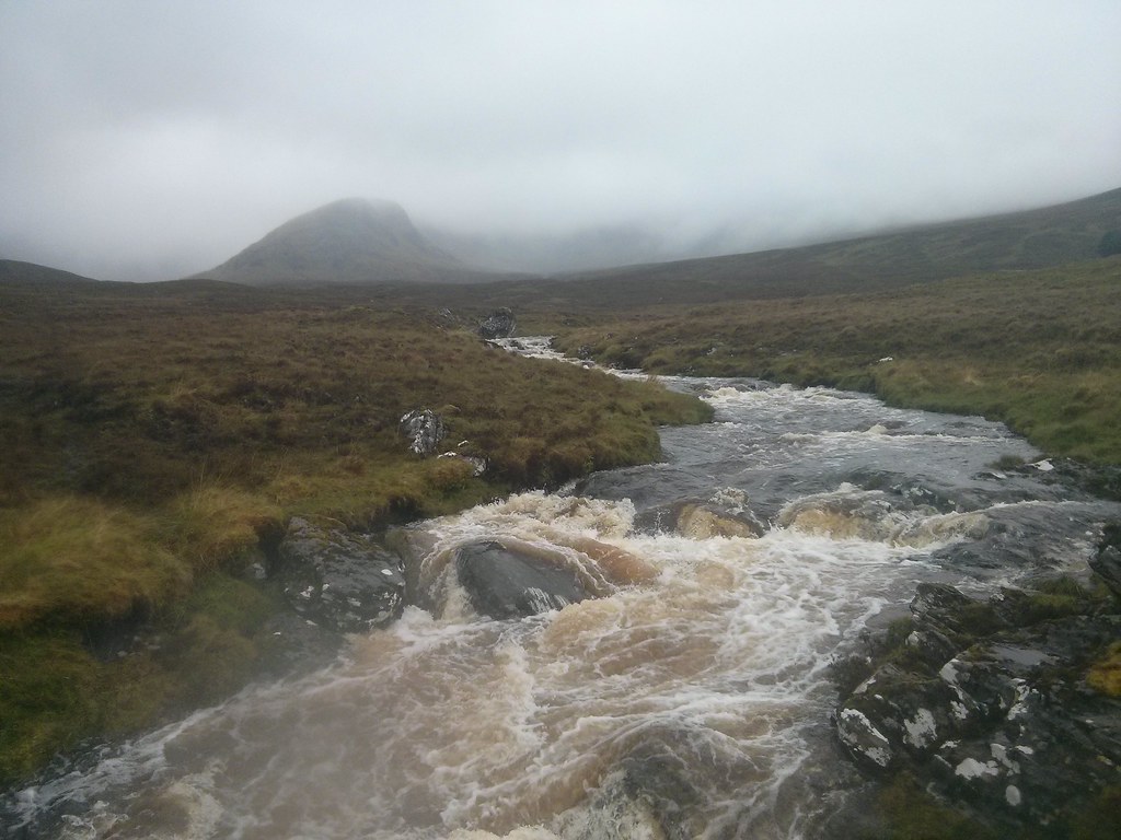
So much for a summer shower… The rain must have continued at that pace for more than an hour. When it did finally let off I zipped open the tent to find a transformed world. Water was pouring off the hills, the slabs were white with water and the Allt I had easily crossed earlier was a raging torrent. Even the fairly lazy inflow next to me had risen to swallow most of the shingle beach besides me. In the river there were fish which would ripple off as soon as I approached.

After a short exploration of my surroundings the rain came on again, heavy and accompanied by rumbles of thunder as another system passed through. Again it took an hour or two to clear in which time I enjoyed dinner and more time with my book.
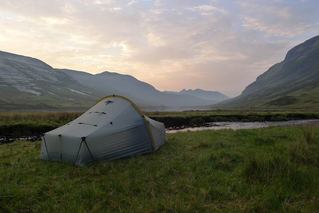
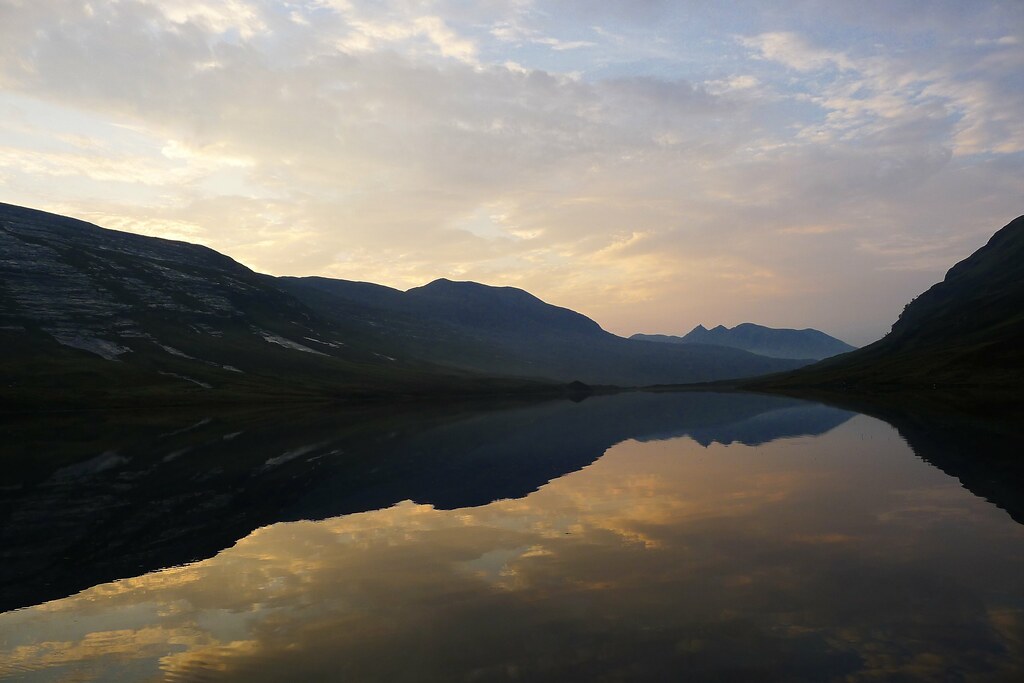
By around 9pm the cloud was dispersing and I got out to enjoy a more extensive wander. The wind had dropped to nothing and the surface of Loch an Nid was a glassy mirror, reflecting the oranges and deep purples of sunset. I enjoyed these last few moments of the day immensely, watching as a thick mist came in from the north. As sunset faded the mist drifted down the loch and within minutes I was in a damp, chilled, grey world. It was time to head back to the tent for a podcast or two before I relaxed into a deep, comfortable sleep.
Wednesday 21st May
Wild Camp by Loch an Nid to Lochluichart Railway Station
Distance: 39.36km (Cumulative: 103.41km)
Elevation: 684m (Cumulative: 4,718m)
Hills: None
It was raining heavily when I woke up. I’d obviously slept comfortably as I slept straight through my alarm - possibly a first for me when camping!
At 9:30am I declared the day to be “fast and light”. Looking at the map I had approximately 40km to cover to get to my chosen exit point at Lochluichart station. The train I intended catching was the 18:38. I’d never caught a train from a request stop before and wasn’t sure of the procedure (in my mind it entailed using a provided phone to call ScotRail central command and letting them know where you were and what train you wanted to stop so that they could relay information to the driver…!) so was giving myself at least 30 minutes spare to figure it all out. That meant I needed to be at the station at 18:10. 8 hours and 40 minutes to cover 40km equated to roughly 4.6kph, a tidy speed given there was also a 600m pass to get up and over.
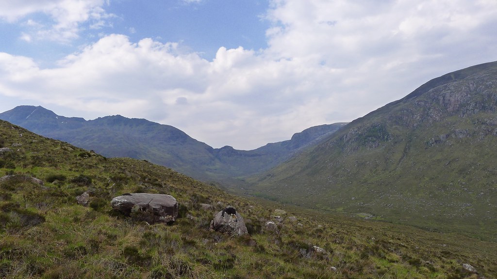
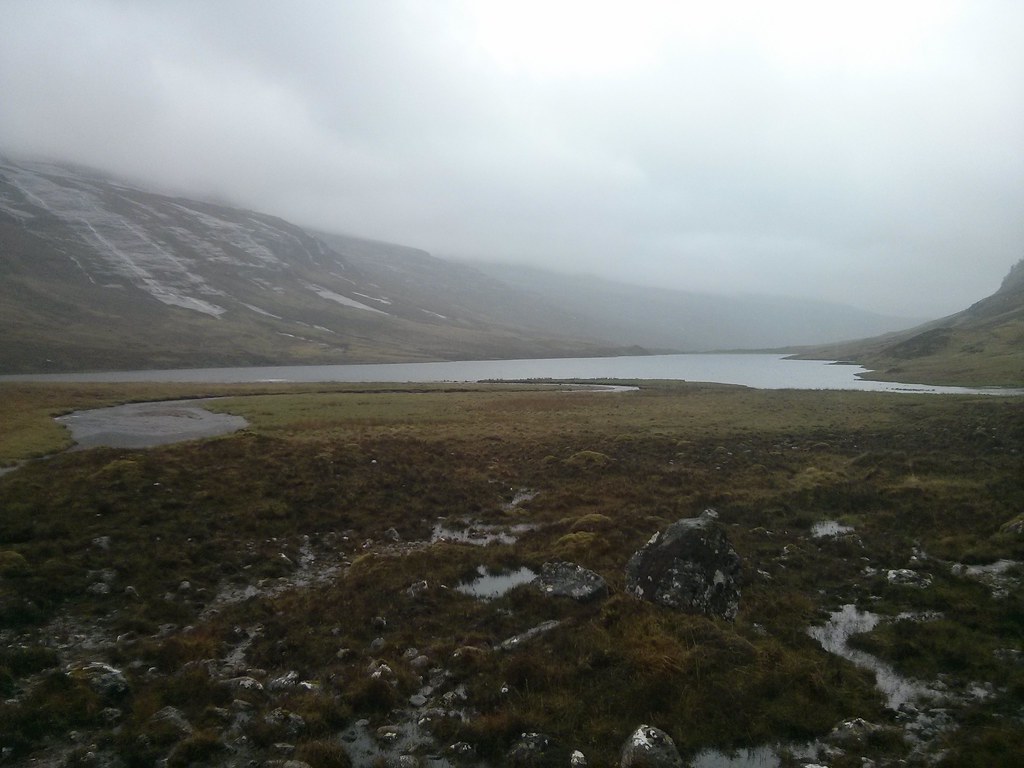
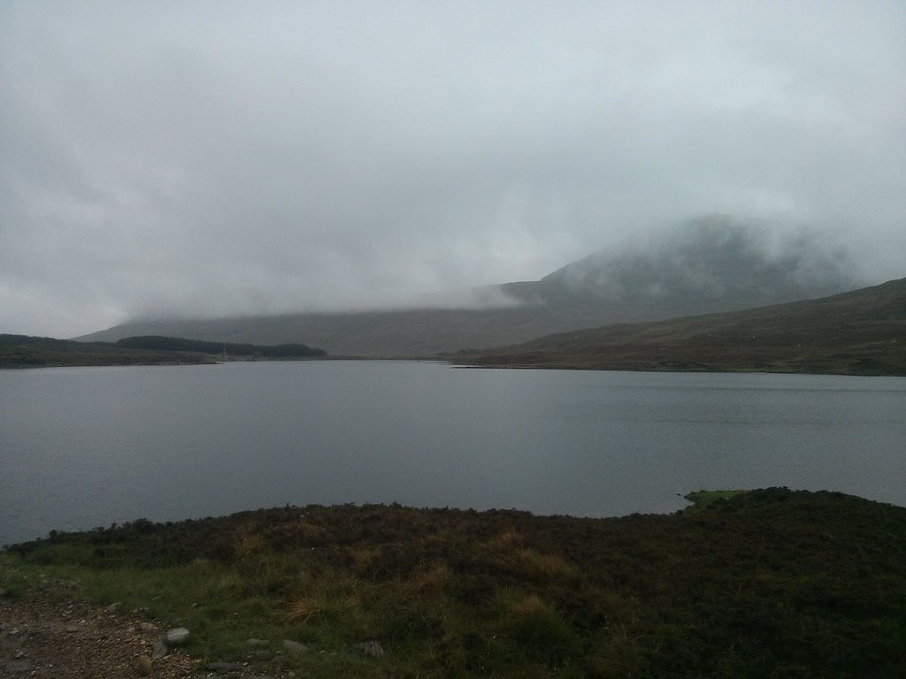
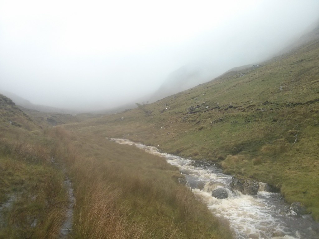
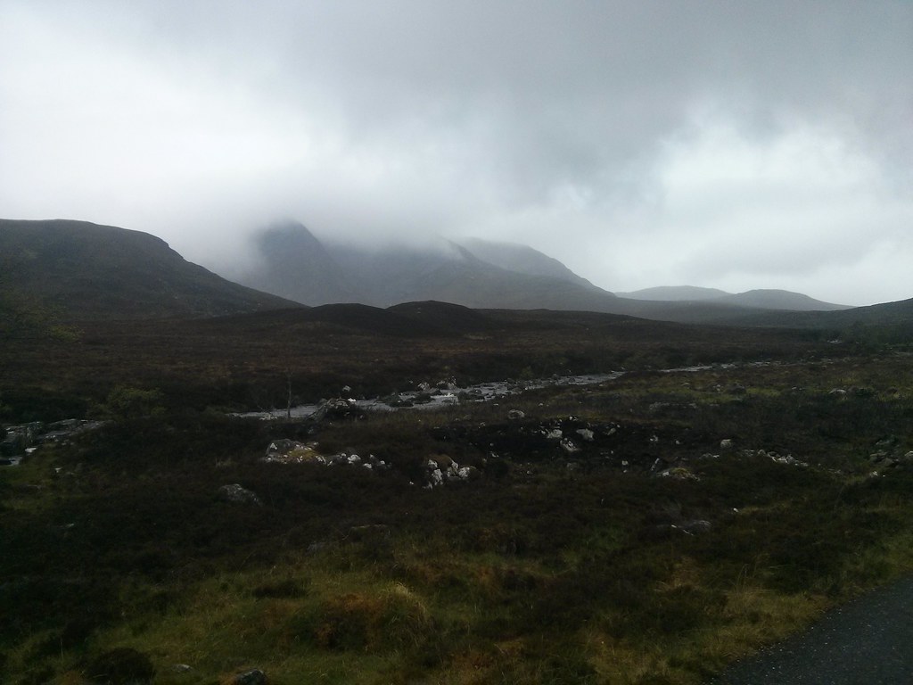
There was little to distract me once I had packed up the tent and picked up the track which comes down from Loch an Nid towards Loch a’ Bhraoin. Water was streaming off the hills and the cloud was low. Views were fairly limited, more so once I had drawn my hood tight around my face.
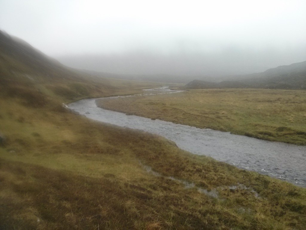
The path is fairly easy going though and well made though the sheer volume of water meant that it was mostly a stream. I sploshed along at a good pace though and was soon around the corner and heading down towards Loch a’ Bhraoin. The crossing of the raging stream coming down from Teanga nan Caiseachan was a cold wade but as I approached the loch the boggy, indistinct track improved until I was crunching along on pebbly gravel.

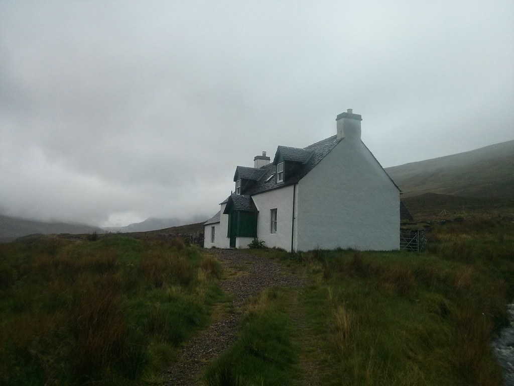
There are new fences around the tidy house at Lochivroan but I passed through without problems. At the end of the loch I paused for a quick Snickers break, noting that I was making good time.
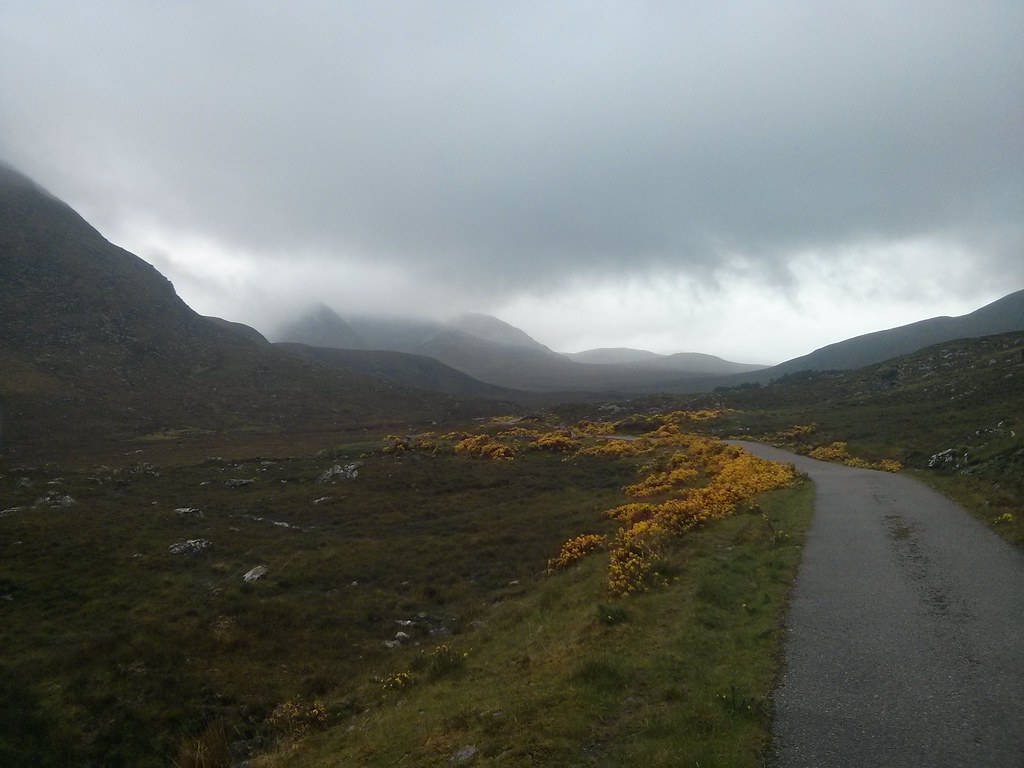
Without much to look at the walk along the loch was a little tedious. The track is easy enough though they were a few wades across side streams. The sky brightened a little but the cloud was still low and the rain relented only slightly.

At the lodge there were signs directing me around a new right of way which ran through a small area of woodland. The damp and dripping trees made a nice change of view. Across the river Cuileig I followed the clear track that heads up towards the pass over to Loch Fannich.

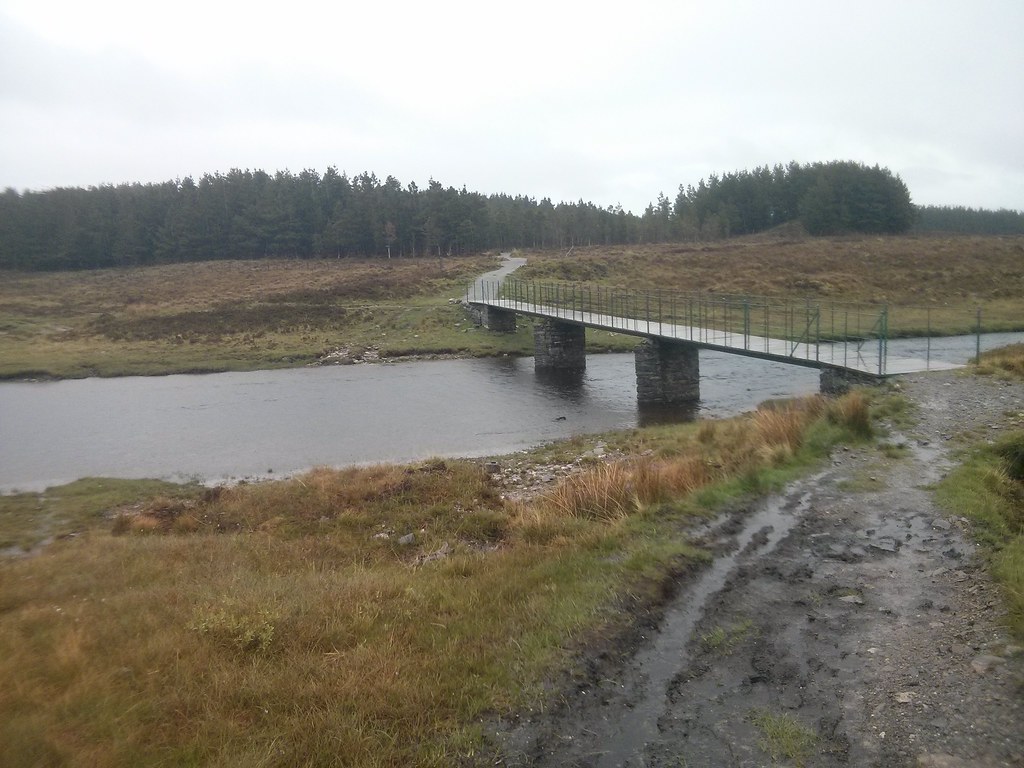
Just as I was round the corner into the glen I met a guy coming back down. He was looking at his map and shaking his head. After wandering up the path I was on he had been stopped by the spate conditions of the Allt Breabaig. On his return he had spotted a bridge slightly further down and realised he could have used this to access his chosen hills. I was very grateful for this and rather than try my own luck upstream, used the bridge which led to a muddy but passable vehicle track wending its way up on the far bank. Eventually this met the continuation of the path and became an excellent footpath which I followed, continuing to make good progress.
Further up the glen I met the school party who were staying at Lochivroan. Resplendent in red waterproofs they were taking a snack break. I chatted with one of the leaders who was cheerful enough despite the conditions.
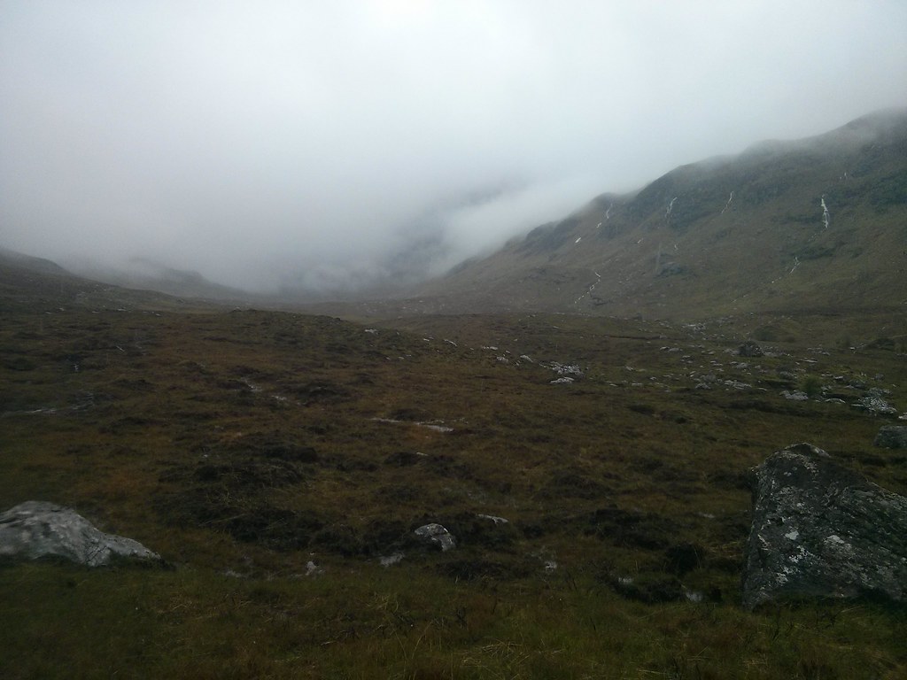
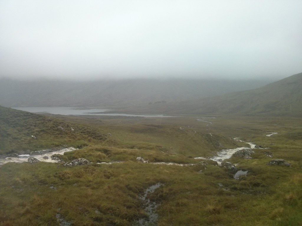
I passed the group and continued up, soon coming to a swollen sidestream coming down from Sgurr nan Clach Geala which was fun to cross as it raged through a boulder strewn torrent. The path now climbed up to the head of the pass, passing between steep slopes of the western end of the Fannaich range. I had one more river crossing to make, passing over the Allt Breabaig much higher up and then I was at the summit, glad of the windbreak that had been constructed.
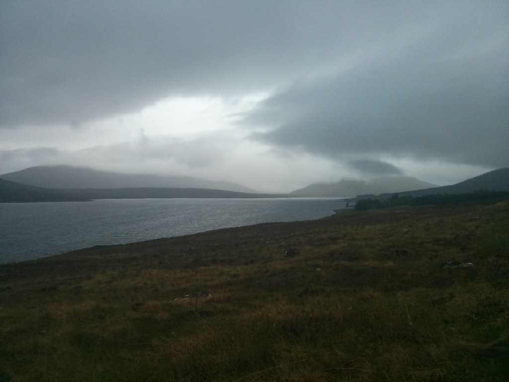
After a short lunch and noting that I had made good pace on the way up I headed down the far side. The descent is much shorter and the path easy and grassy without too many side streams to negotiate. Soon I was approaching the end of the Nest of Fannich with the cool grey waters of Loch Fannich visible beyond the marshy foreshore.
It was early afternoon and this had been my optional point to stop and pitch the tent, leaving myself about 20km to get to Lochluichart for the early afternoon train the next day. There had been no improvement in the weather though and I was still on target to reach Lochluichart in time so I decided to continue on. The Nest of Fannich would be a wonderful place to camp on a pleasant evening but today it was just a touch too gloomy and uninviting.
After a snack I continued on. If I thought Loch a’ Bhroain was long and a little tedious then Loch Fannich was double that and more. At first the track wound up and down, passing by the ruined farmstead at and then plunging into a series of plantations. Beyond this it crossed the flat land below the main Fannichs southern corries but the views were sadly limited. I was very grateful to be crossing the rivers on sturdy bridges. At Loch Fannich lodge the crunchy gravel track turned into asphalt.
My pace increased on the good service and after a final snack break the end of the loch appeared and I wound up and around the final headland to reach the dam. Here the road does a depressingly large loop around the head of the loch and its outflow, a rather grim place though the feet of the eastern end of the Fannichs were impressive with rocky ridges.
The road now gently descended besides the River Grudie and after passing the farm at Aultdearg plunged into the forest. I passed a group of forestry workers looking forlornly at a tree felling machine, its engine bonnet open. Then it was the final stretch down to the power station at Grudie and the main road.
Thankfully late on a Sunday afternoon meant the main road wasn’t too bad though it was a trudge at the end of a long day and I was starting to feel it by the time I reached the turn off for Lochluichart station. I rolled down to the platform at 5:50, 1 hour and 10 minutes before the train, I had covered 40km in 8 hours 20 minutes for an average speed of 4.8kph. Fast and light it had been.

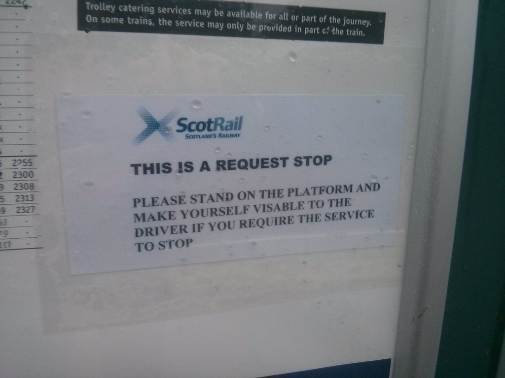
I now read the instructions for request stops, noting that it was a simple case of making yourself visible to the driver when the train appeared around the bend. No calling ahead, nothing. So I had a good long time to wait for the train. There are no faciilities at Lochluichart so I settled down with the remainder of my snacks, using the station bin to dispose of five days of rubbish and reading my book. Rain was still falling so it was good to be in the waiting shelter though the drizzle didn’t seem to be deterring a few of the more hardy midgies.
The train appeared about five minutes later than timetabled but I was able to successfully flag it down and stepped aboard, passing from the solitary world of the long distance backpacker, to the bright comfortable world of those heading through to Inverness on a Sunday evening. The train was a bubble of chatter and the trolley person very kindly offered my a cup of tea despite aleady finishing his round. I watched out the window as the rain continued and gradually the West Highlands slipped away behind.
At Inverness I had time to get fish and chips and a couple of beers before hopping onto the Aberdeen train. It was midnight by the time I was walking back through the streets to home. A happy, tired backpacker who had finally ventured into the heart of Fisherfield.