An overnight backpacking trip taking in a Corbett and three Munros to the east of Glen Roy in the West Highlands. An overnight camp below the summit of Creag Meagaidh was followed by a return along the Burn of Agie.

Date: 29-30th August 2020
Distance: 36.72km
Ascent: 2084m
Time: 26.8hrs
Hills: Carn Dearg (Corbett), Beinn Teallach (Munro), Beinn a' Chaorainn North Top (Munro Top), Beinn a' Chaorainn (Munro), Beinn a' Chaorainn South Top (Munro Top), Creag Meagaidh (Munro)
Weather: Sunshine and showers with a persistent and cold northerly wind
Route: View on OS Maps
Saturday 29th August
In these strange Covid times seemingly the most important part of planning a hill walk is identifying a starting point where you won't be fighting for the last parking spot. Given that Glen Roy is typically used to access a handful of Corbetts, I decided it would be a good place to park up and then walk over to a couple of nearby Munros that were still on my target list, Beinn Teallach and Beinn a' Chaorainn, that are usually accessed from near Roughburn on the A85.
Back in October 2010 I did the Creag Megaidh three via the standard route from Aberader on the shore of Loch Laggan, but I was keen to get back and figured a summit camp would extend the route nicely into a worthwhile overnight trip.
Coming from this direction did mean some extra driving was required, but the opportunity to see Glen Roy and the famous "Parallel Roads" was enough to see me driving past Laggan and down to Roybridge where a single track road climbs up through wooded hills and then winds through this stunning, remote glen.
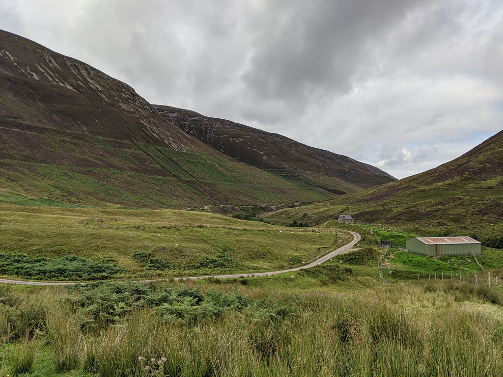
It was a mostly pleasant journey despite roadworks on the A9 upgrade near Perth and the first time I had come this particular way since moving to the central belt. My plan had worked out and I found a very empty parking area to pull up in just downstream of Braeroy Lodge. There was work ongoing closer to the lodge to install a mobile phone mast.
As a side note: Glen Roy is famous for the "parallel roads, a series of terraces carved into the sides of the glen which formed as a vast lake drained away to different levels as the glaciers retreated at the end of the last ice age. They are very obvious all the way along the glen and there is a car park much closer to Roybridge from where you can admire this strange post-glacial landscape.

After a short gear faff I was away, leaving the car in the care of a few sheep that were munching amongst the bracken by the river. I crossed the Roy River via the sturdy footbridge just short of Braeroy Lodge and started working my way uphill. I was aiming to pick up a slanting ridge that rose towards the summit of Carn Bhrunachain.
The ground was steep but presented no technical difficulties. I crossed the two major parallel roads and soon the views were opening up down the glen below me. The slanted ridge was also steep but gave me a rapid gain in height. I came across smatterings of blaeberries that the deer had missed and munched on these as I climbed. Down in the glen I watched a couple of pairs of cyclists head along the road towards Braeroy Lodge.

As I got towards the top of the slope the views to the south opened up with the Grey Corries rising up beyond the hills of lower Glen Roy. In the distance further west the bulk of the Aonachs was hidden by dark clouds.


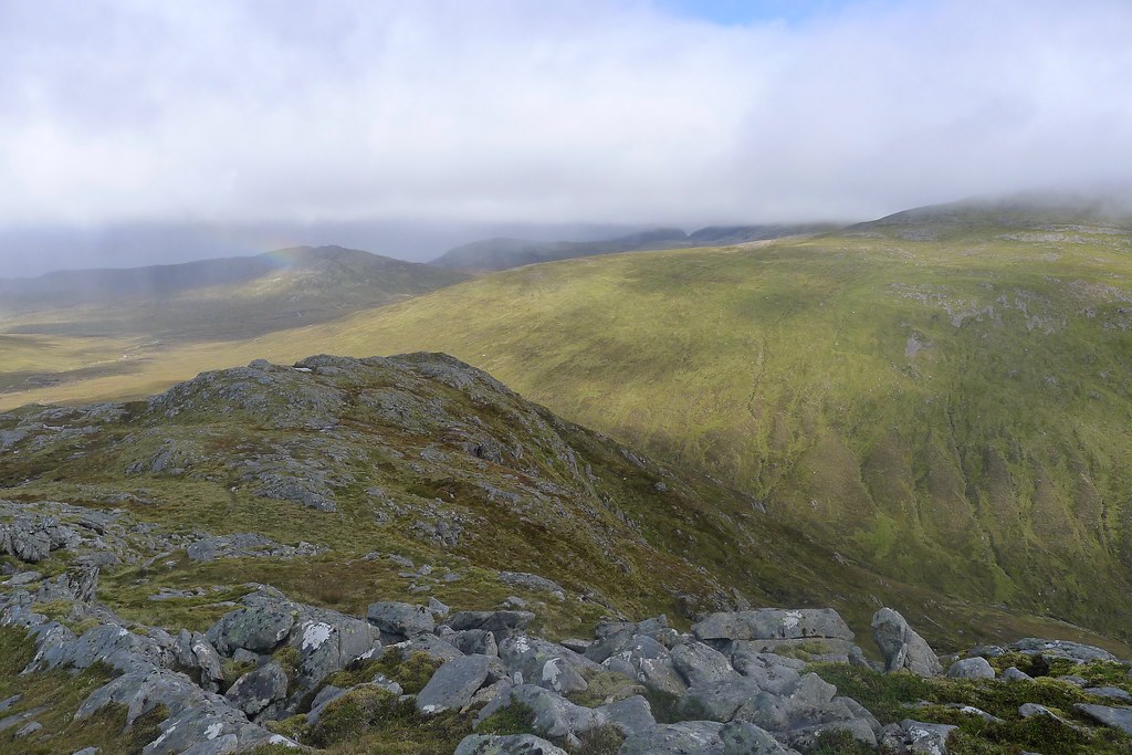
Finally the slope relented and I picked my way up to the summit of Carn Bhrunachain. Strangely, anticipating being alone until I reached the Munros, I could see a couple of figures silhouetted on the summit of the nearby Corbett of Carn Dearg, which was my next target. Though the weather had been very pleasant up until now, the views north revealed that there were a few showers moving through on the cool northerly wind. Up on the tops it certainly didn't feel like the end of August.


I crossed the open ground and then worked my way up the final slopes of Carn Dearg, emerging onto the ridge just south of the summit and making my way up to the cairn. The two people had taken a more direct line off the summit so I could now see them heading to the hill I had just left. At this point the weather was pretty good with decent views south to the Grey Corries. The Aonachs were under a blanket of cloud, as was Creag Meagaidh off to my east, the Window a distinctive notch in the hills. Beinn Teallach, the neighbouring Munro looked very diminutive.
I also had my first view of the two Munros, Beinn Teallach and Beinn a' Chaorainn, that were my primary objectives for this trip. They stood above Loch Sguadaig and a wide area of boggy, wild ground that didn't look like it saw many people.

As I watched, the previously pleasant day quickly worsened with a squally shower blowing in. Thankfully it was quickly followed by sunshine and I watched as the light rapidly changed.
After a short snack break I made my way off Carn Dearg, angling northeast and dropping down easy slopes towards the ground near Loch Sgurdaig. There was one short steep section down a greasy bank, but otherwise it was easy going on grass and tussock. The sun by now was shining again and down in the glen it was much warmer. I shed a layer or two before continuing on.

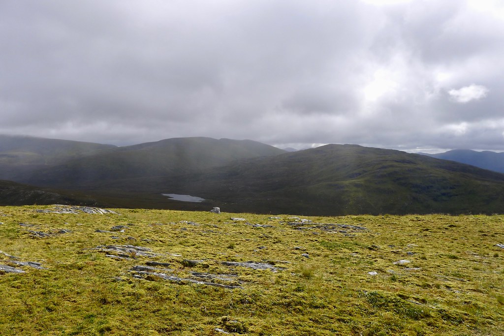
The ground around the loch was boggy and there was a certain amount of bog hopping and peat wading as I made my way towards the green banks of a stream coming down from the western end of Beinn Teallach.


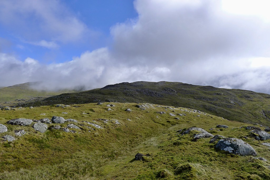
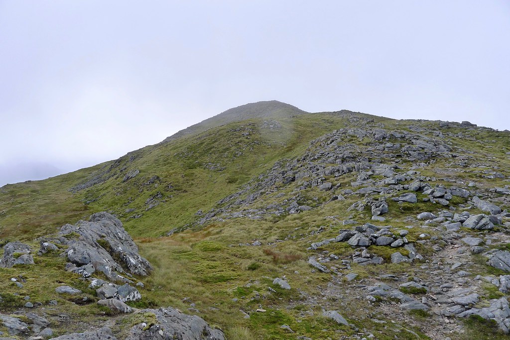
Following the stream led me up onto a loosely defined ridge that climbed steeply up this northwestern shoulder of Beinn Teallach. It was steep but grassy with sheep dotted about further above the slope and a few more blaeberries to snack on. The clouds rolled back in as I reached the top.


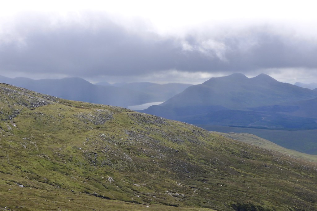
From here I had my first view down Loch Treig and saw that more showers were rolling through, both to my north and south. The weather forecast had said these should all have died out by now but it seemed they were around to stay. I now followed the higher ground as it swung in a big arc around towards the summit of Beinn Teallach at the eastern end of the mountain.

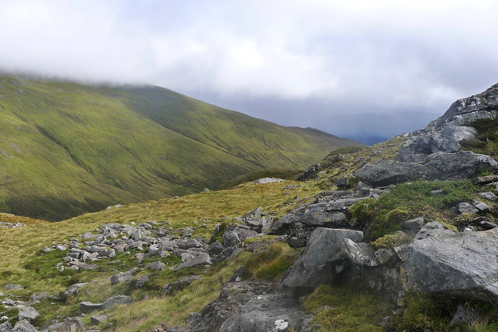
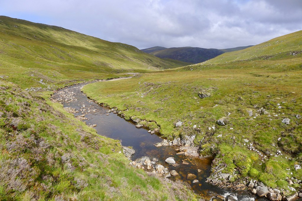
It was quite rocky and there was no particularly direct route, but I made steady progress towards the summit, looping around high above Loch Sgaudaig and the distant hills marking the Burn of Agie that I would follow back the next day.

Just before the final climb I found a good spot out of the wind and stopped for a lunch break with views towards Loch Treig. The clouds continued to build and it felt much cooler when I finally headed up to the cairn.


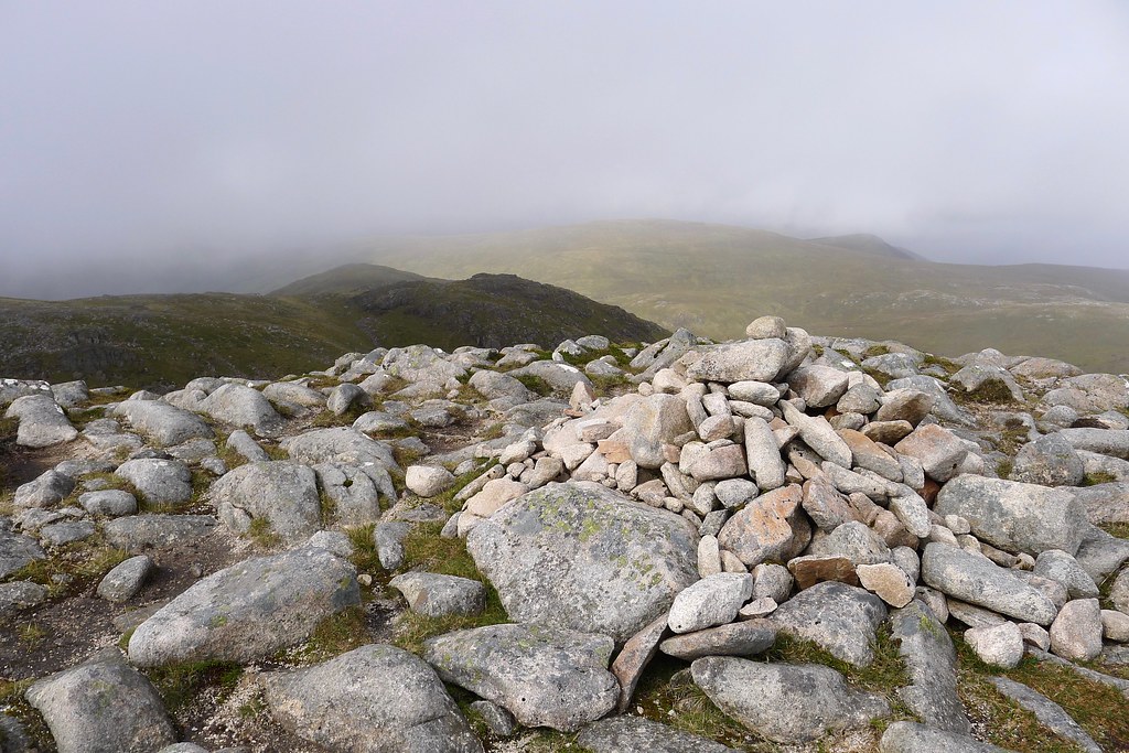
There are two cairns on two separate summits separate by a narrow gully. I visited both, although unfortunately now the weather had closed in around me and I was in an unpleasant cloud. Despite hanging around, getting colder and colder, it never really brightened again and eventually I decided it was time to be moving on.

Now being on the bagger's route there was a clear path heading down the northeast ridge of Beinn Teallach. Beinn a' Chaorainn could be glimpsed across the narrow glen separating the two hills, its upper slopes disappearing into the clag.

As I descended there was a brief clearing in the weather and I had a sweeping view northward where a rainbow was tracking along the line of the Roy River.

Eventually though this shower made its way to where I was and resulted in the longest and most drenching downpour of the afternoon. I lost the path on the lower, wet slopes and cut directly down the final slopes of Tom Mor and then across the boggy bealach to reach the slopes of Beinn a' Chaorainn.

With the rain driving into me from the north, I put on my waterproof and plodded upwards, hoping the shower wouldn't last for too long.

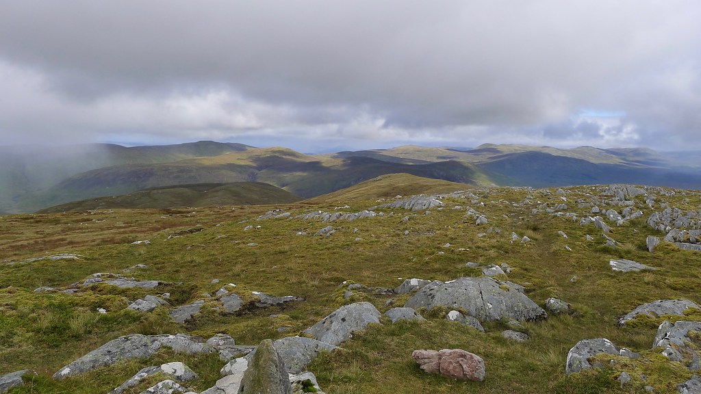
The steep section of climbing to gain the broad ridge was soon over and with it came an improvement in the weather. The surrounding hills were once again revealed and I was able to peel the waterproofs back off. The plateau was grassy and easy underfoot as I turned south towards the first top on the Beinn a' Chaorainn plateau. There were more showers in the north but it looked like I would enjoy at least twenty or so minutes of sunshine before the next band arrived!


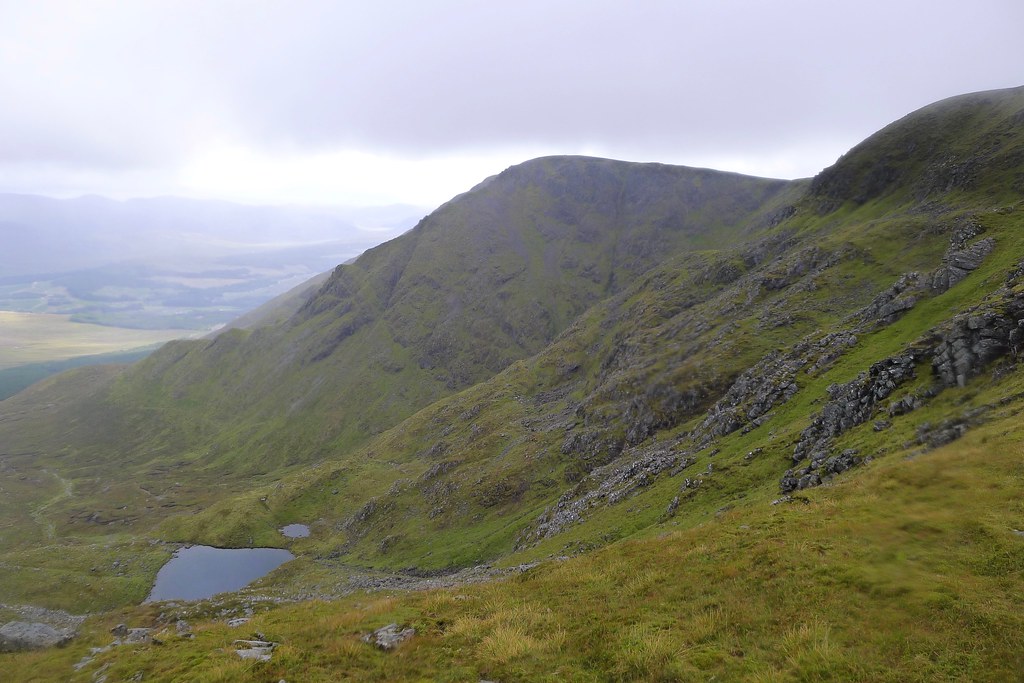
With Creag Meagaidh now looking much closer to hand I finally got up to the North Top of Beinn a' Chaorainn just as the next band of weather arrived. Visibility plummeted to just a short distance in front of me as I arrived at the cairn. The gloomy crags marking the actual Munro summit could just be seen through the clag.

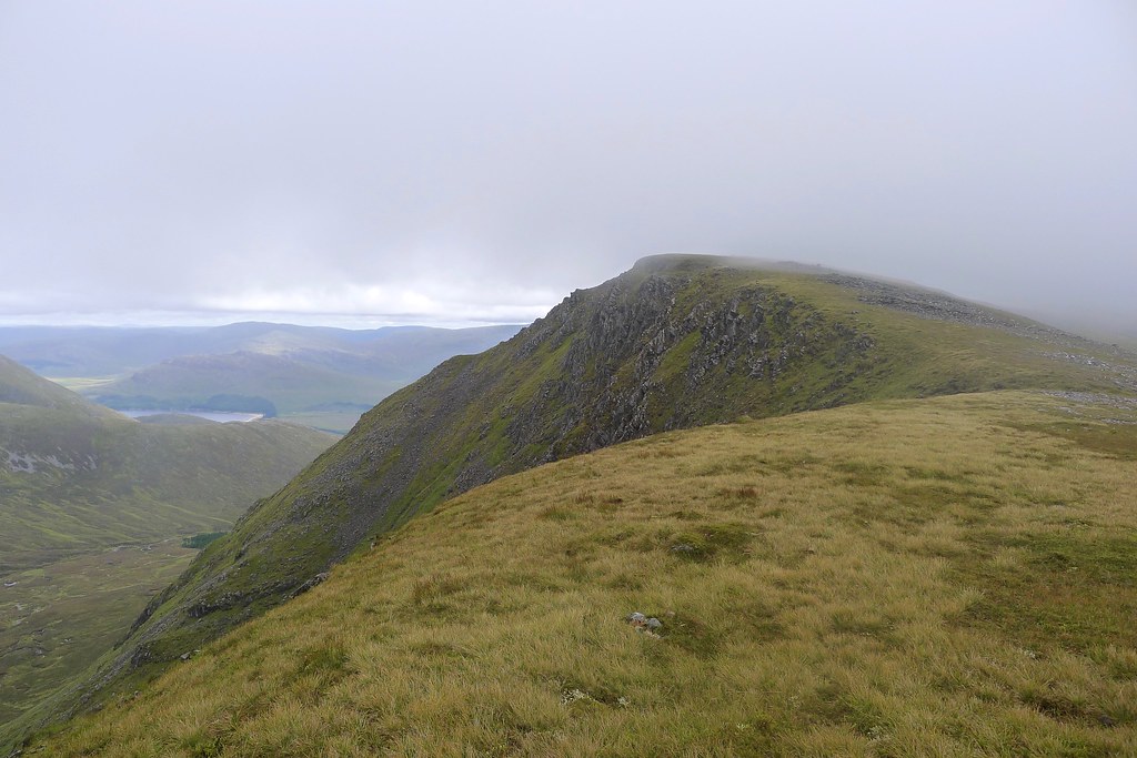
It is a fine ridge which curves around part of the eastern lip of the massive Coire na h-Uamha. This would be a spectacular section of walking on a better day. I was soon climbing up to the summit cairn marking the 1,052m Munro. It was cold and damp and I found a sheltered spot to have a sit and see if conditions would improve at all.


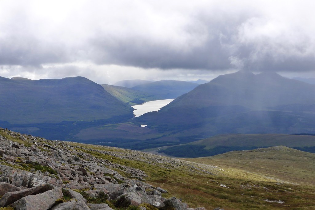
I left my bag at the summit and briefly headed over to the south top. Again, there were glimpses of views over Fersit towards Loch Treig, with some heavy showers coming down towards Laggan.


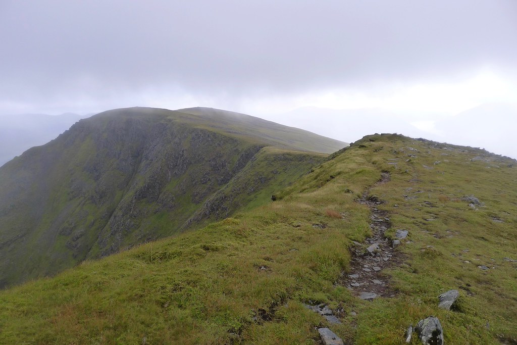
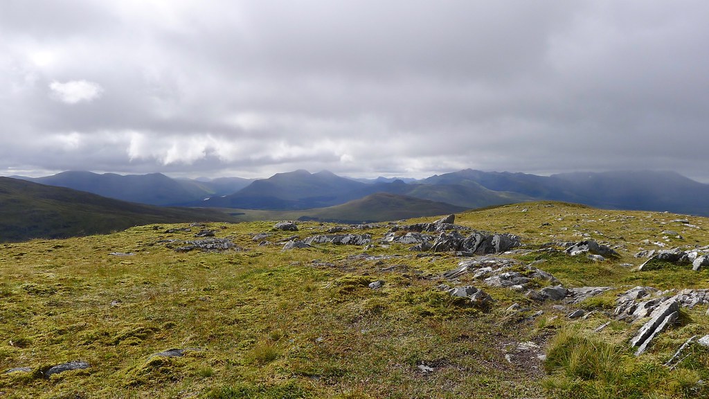
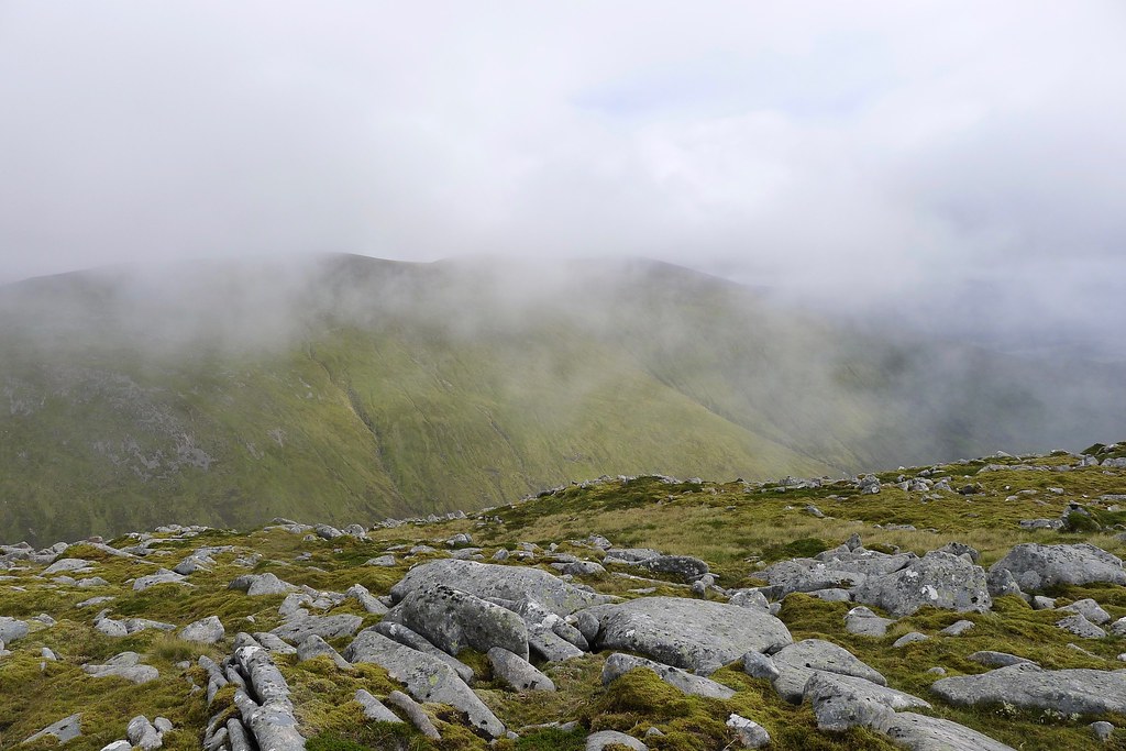
After it became clear that the views weren't going to improve any time soon I returned to the main summit for a quick snack break and then headed back to the north top, this time continuing onto the east ridge and heading towards Creag Meagaidh. There was something of a path and the ridge was gently angled making for some good walking despite the weather conditions. There were good views back across Coire na h-Uamha to the craggy heights of Beinn a' Chaorainn, impressive even through the murk.
After crossing the Bealach a' Bharnish I started up the long western shoulder of Creag Meagaidh. There was a line of fence posts paralleled by a clear track. As I climbed the clouds parted a little and it was brighter for a while as I gained height. Behind me I had a good view of Beinn a' Chaorainn and to the northwest I could see distant peaks arrayed under a band of clouds. There were still a number of showers around and it didn't look promising for a clear summit camp.
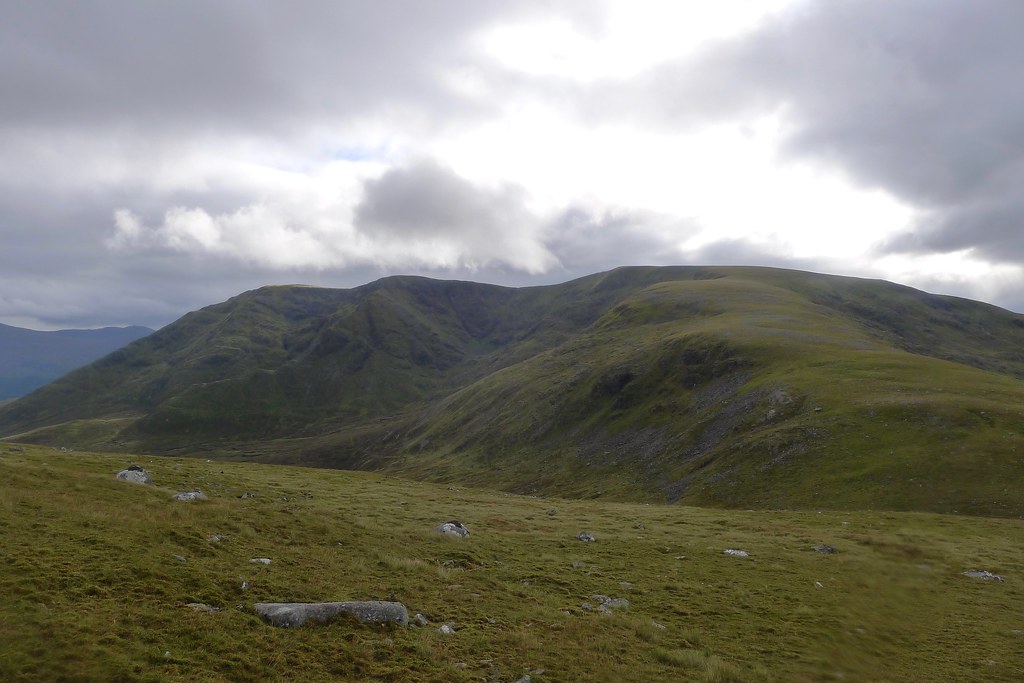

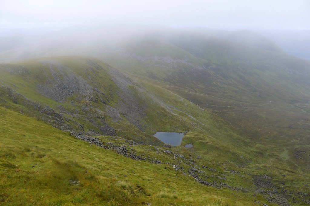
Following the fence I gained height steadily until I was looking over the yawning Coire nan Laogh towards the ripples on the Creag Meagaidh plateau. I was hopefully of getting some views from the top but as I joined the final slope the cloud once again started moving in.


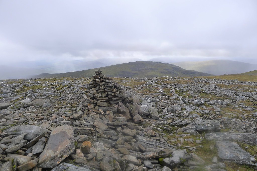
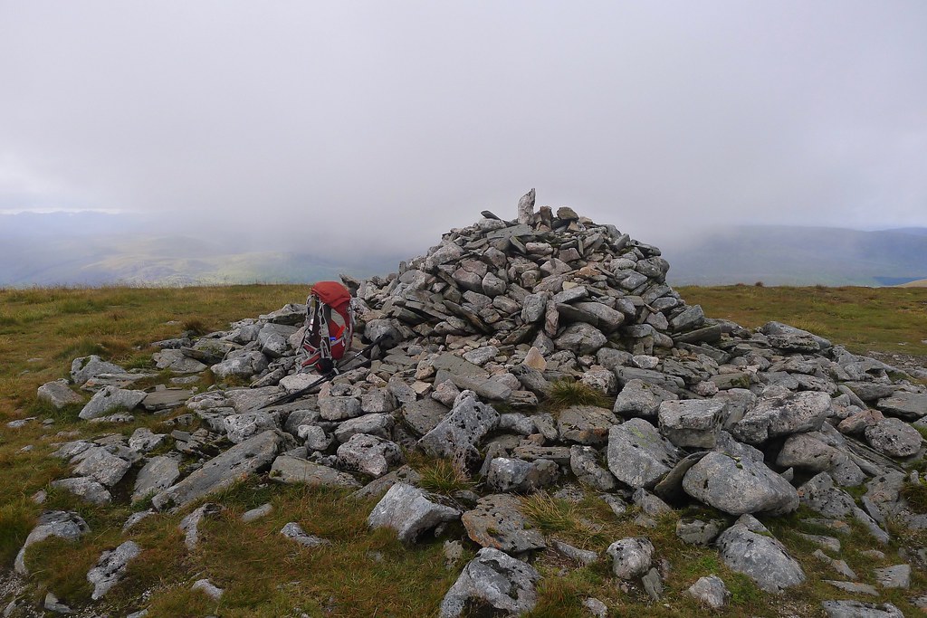
I arrived at the summit just before 6pm. The hills were quiet with just the sound of the wind whistling up and over the crags.There was a promise of some nice light in the northwest so I found a bit of shelter to see whether it would turn into anything.


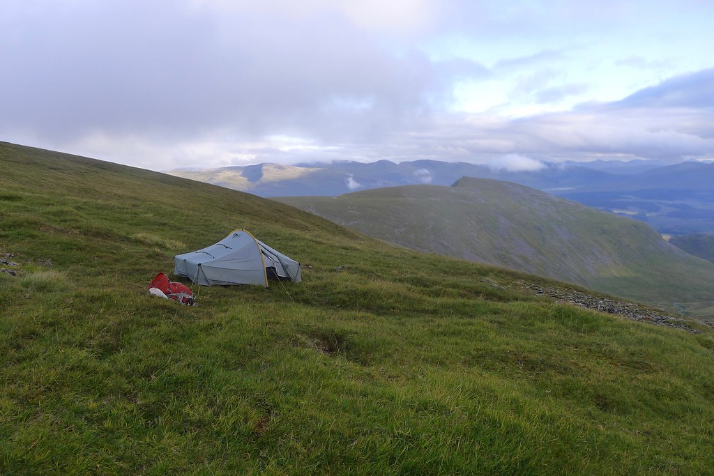
There was some nice light at times but gradually more cloud swept in and the distant views were lost. Keen now to get the tent up I did a quick perusal of the map and the terrain below me. I wanted to drop down off the summit to get some shelter from the wind and though my initial plan had been to camp above one of the great eastern coires, I now decided to try an area just below the summit which had the advantage of being much closer and sheltered.
I dropped down off the summit and soon came to a promising looking area. There was a small area of flattish land just before it dropped down into a rocky bowl below the summit. Here I found a good spot for the tent - it wasn't perfectly level but I thought it would do the job. Despite not having wild camped for more than four years I got the tent up without much trouble and soon had everything unpacked. It seemed like there might be some nice light in the evening so I filled up my water bottle from a nearby trickle and settled in to get some hot food. It really didn't feel like August in the hills as I pulled on hat and glove and every layer of insulation I had brought with me.


As dusk approached there was some nice light over the Beinn Eibhinn range towards Ben Alder, but it was relatively fleeting and as night fell a light rain started falling. I retired to my sleeping bag to enjoy a podcast episode or two before drifting off to sleep.

Sunday 30th August
I awoke to cloying mist shrouding the world around me. There were no views and so I had a lazy breakfast, staying in my warm sleeping bag for as long as possible.

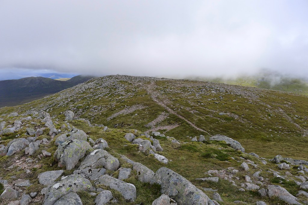
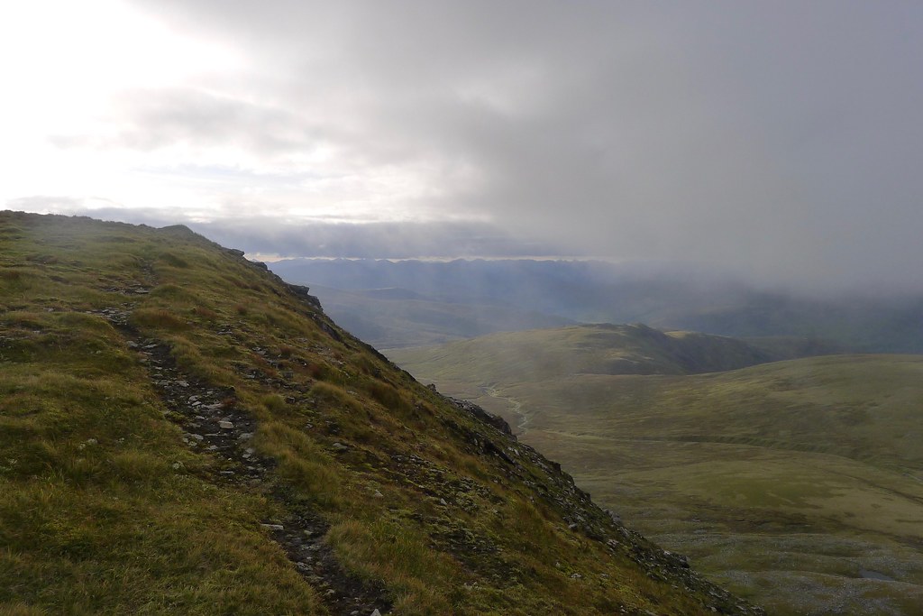
After packing everything up and making sure I left nothing except a patch of flattened grass, I headed briefly back up to the summit which remained firmly in the clag. From here I headed east along the plateau, pausing briefly at Mad Meg's cairn and then dropping down to the bealach above the Window.


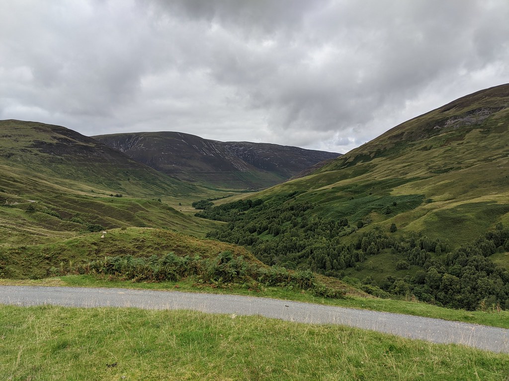
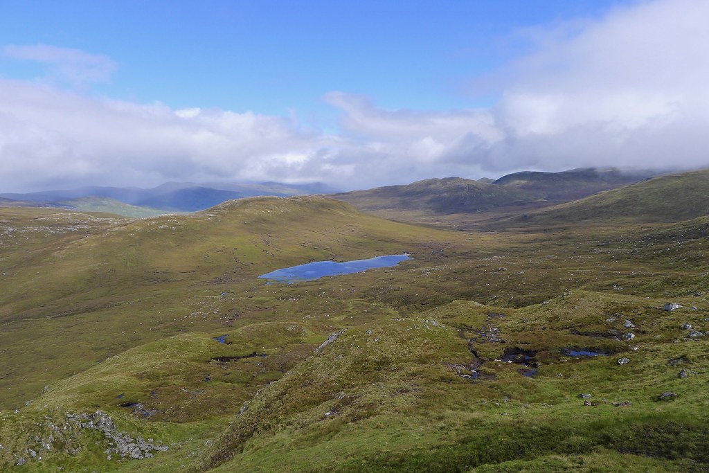
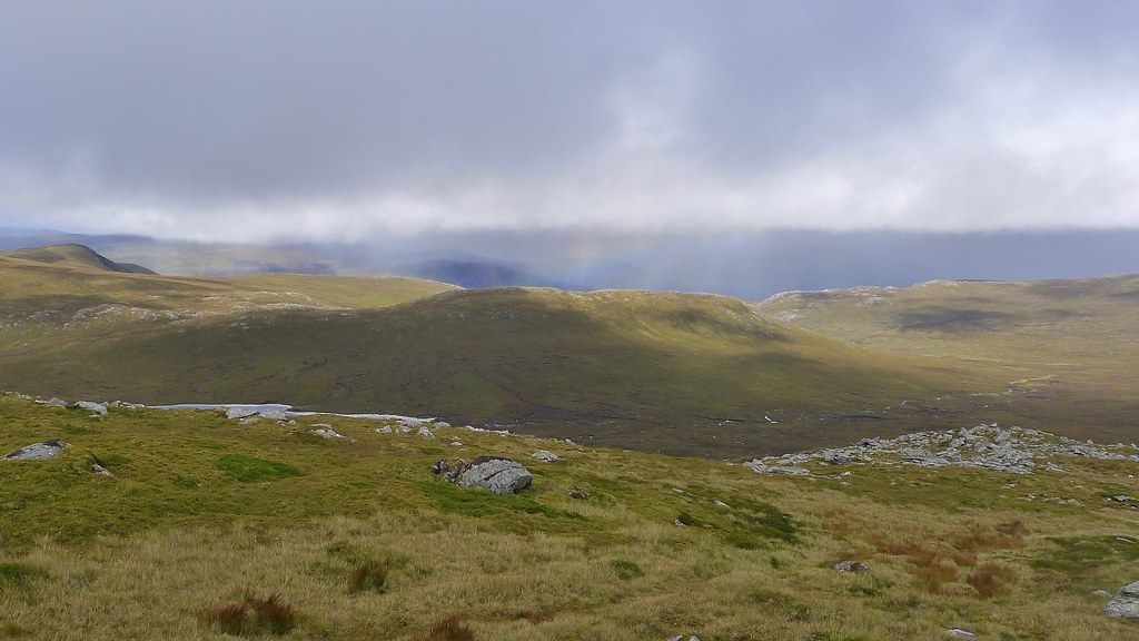
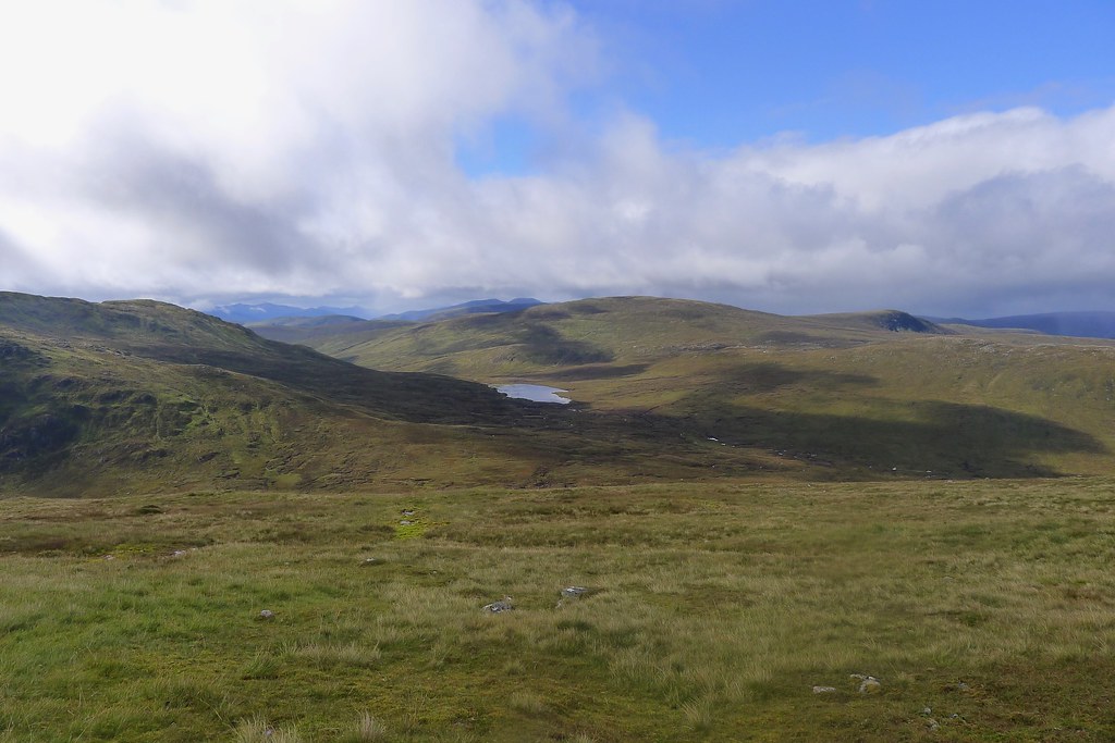
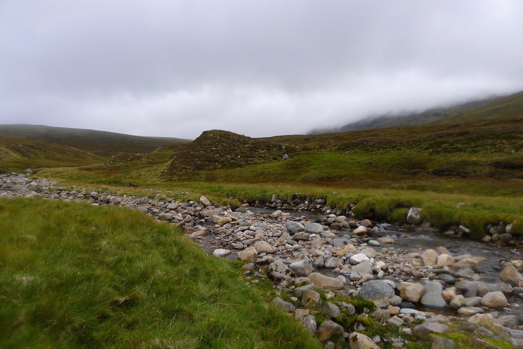
A group of people were just packing up their tent as I passed them by and struck out over the pathless terrain leading away west from the Window. I skirted along the shore of Lochan Uaine and the series of small tributary lochans that eventually flow out as the Uishe nam Fichead. This would serve me as a handrail all the way back to Glen Roy, though it was a fair distance away, 7 or 8km, with some twists and turns along the way.
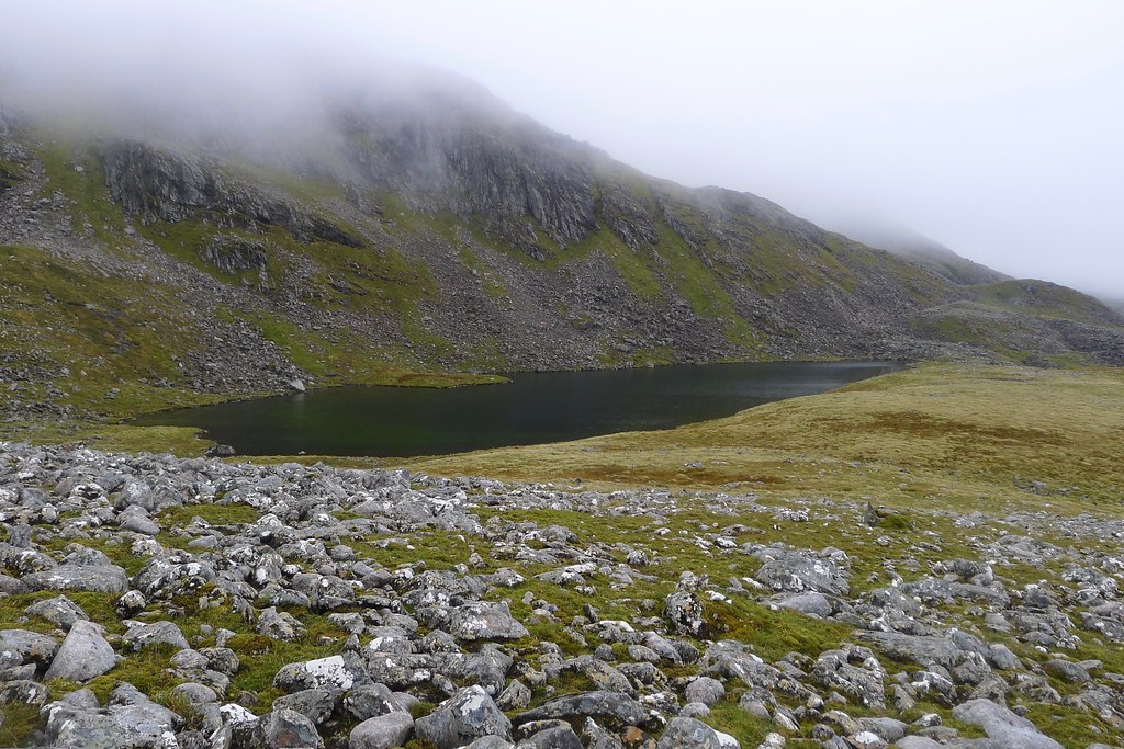
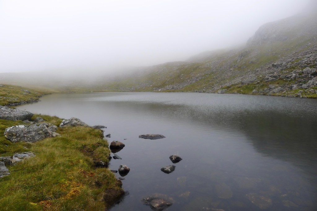
The lochans were very atmospheric with the northern cliffs of Creag Meagaidh rising up into the mist beyond them. As I wandered along a steady rain started to fall.

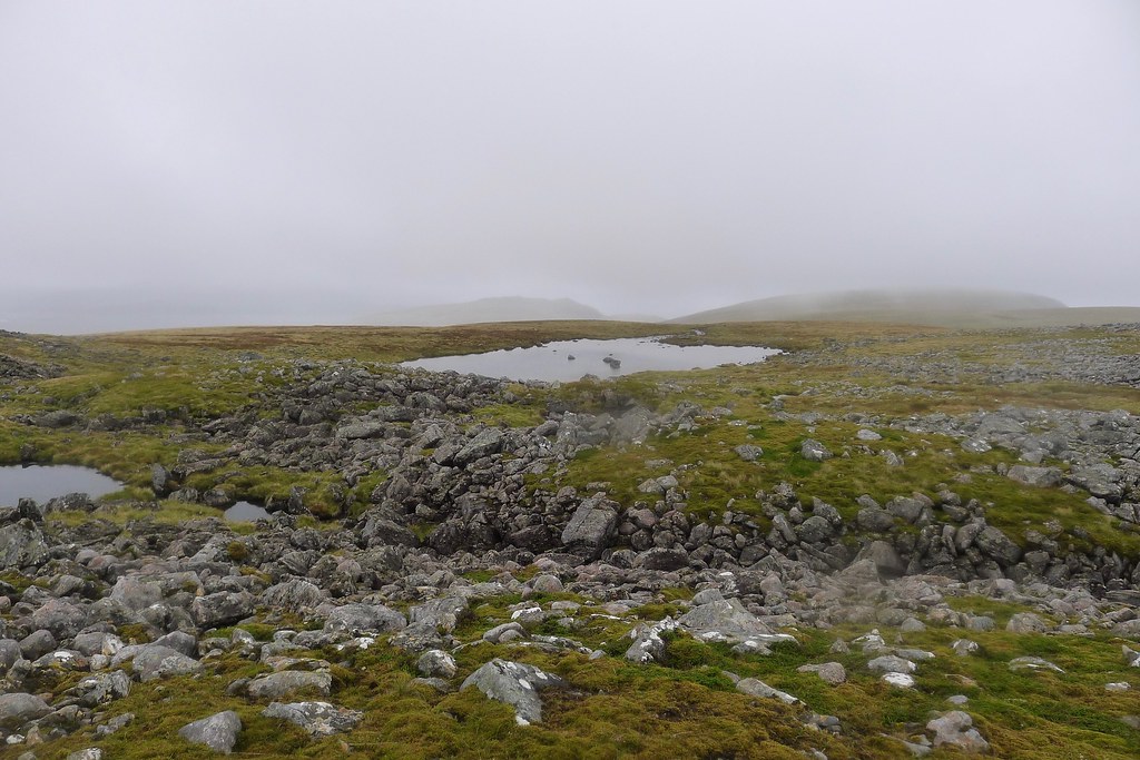
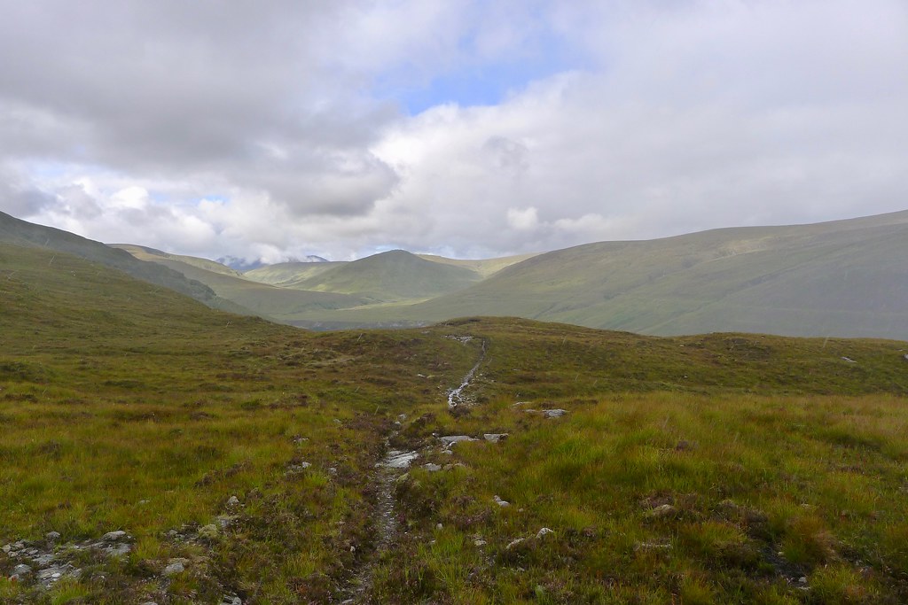
For the first 3km there is no path marked on the OS map. On the ground there were occasional faint hints of a path but it was probably more deer than human made. Thankfully though the terrain on the north bank of the river proved fairly firm and a mixture of heather and tussock. Occasionally there was a side stream to negotiate but none of these proved much hassle.

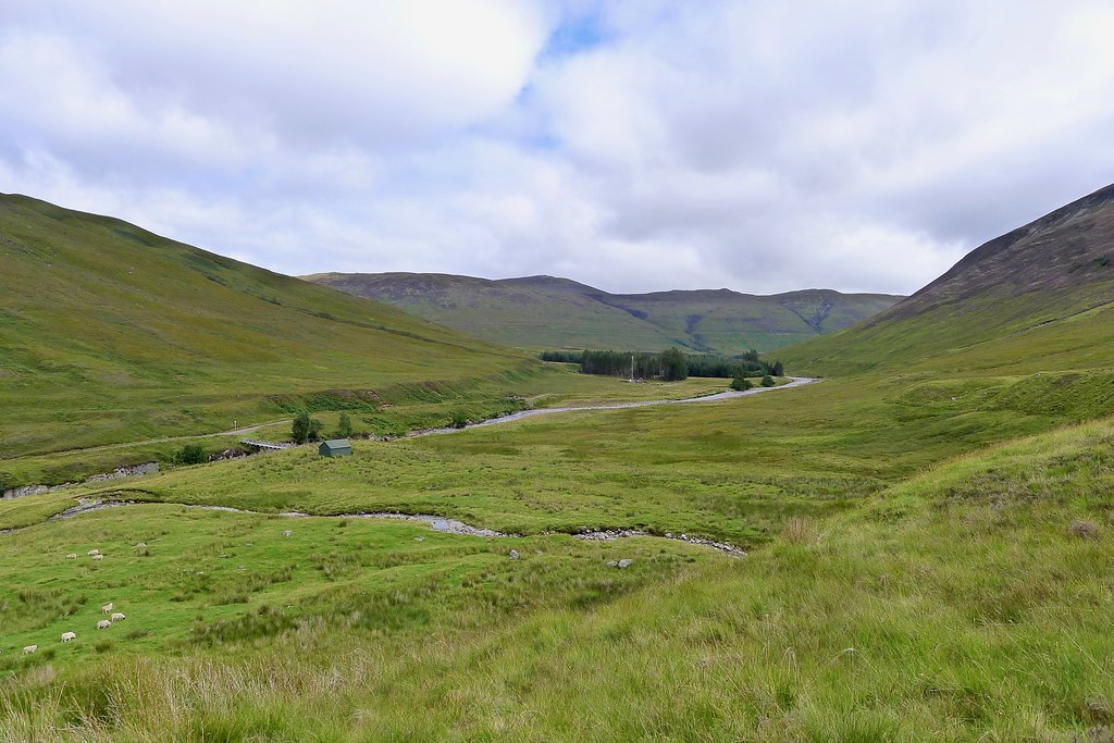
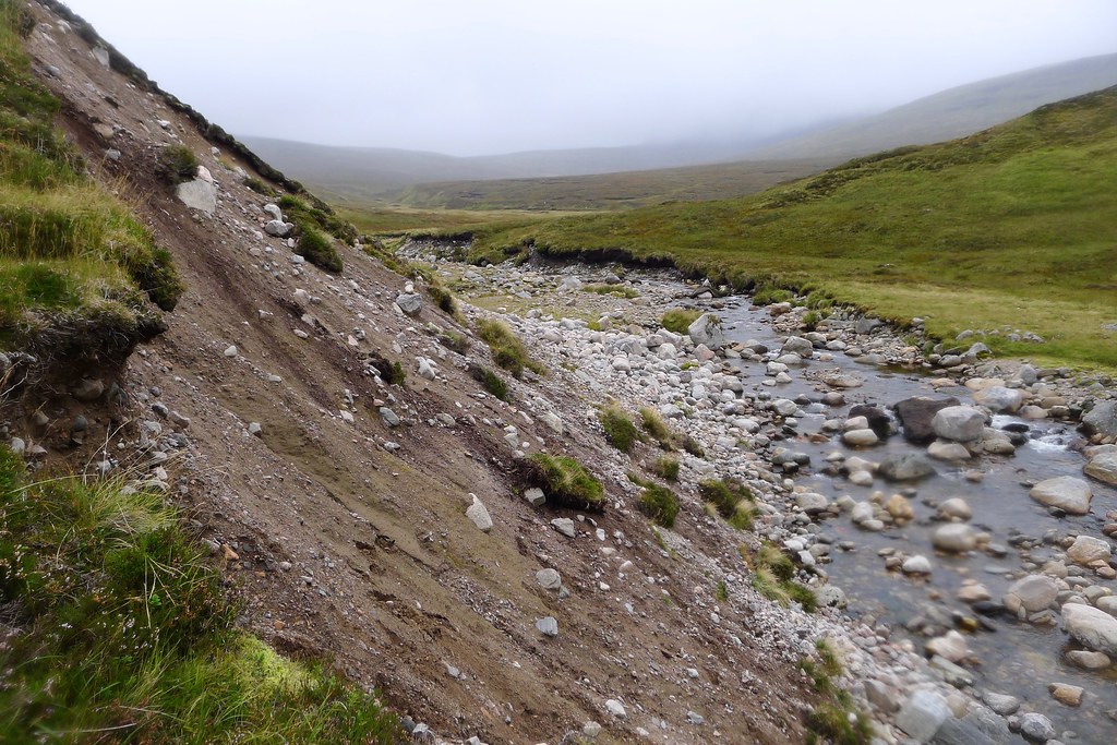
In the low cloud and rain the views weren't particularly special but it was a privilege to walk through this quiet landscape, not a sign of humans in any direction. Eventually I got down to where the burn that drains out of the Coire Buidhe on the north side of Beinn a' Chaorainn joins the Uisge nam Fichead. Here there were some swarths of grass beside the river which would make for a pleasant campsite. Beyond this, at least according to the map, a path should begin. Unfortunately there was a reasonably sizeable landslip at the far end of this area which I got around by following the bank immediately above the water. Beyond this I finally picked up the path,
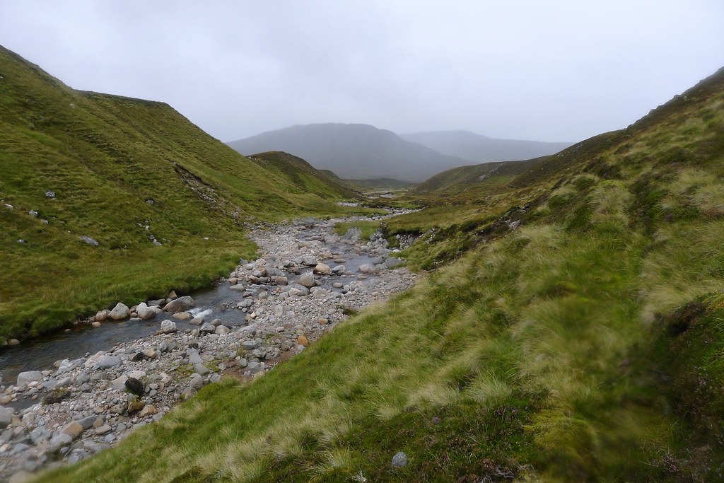
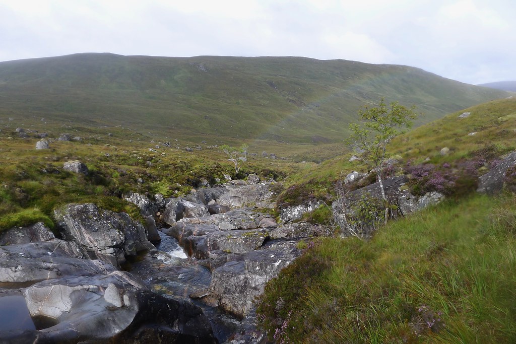
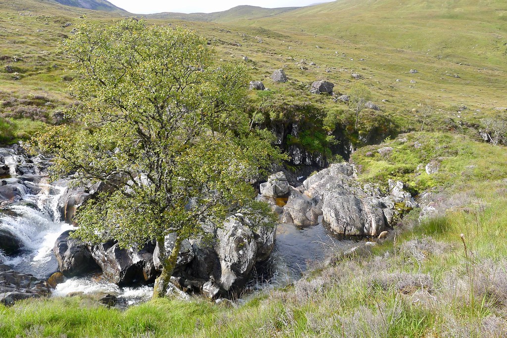
The path wasn't always the clearest and occasionally got lost in the bog but mostly helped me to follow the Uisge nam Fichead. The rain had petered out and it was a little brighter as I approached Crag Tharsuinn and the drop down towards the Burn of Agie which promised an interesting series of cascades. Behind me only the feet of Creag Meagaidh could be seen, receding into the distance.

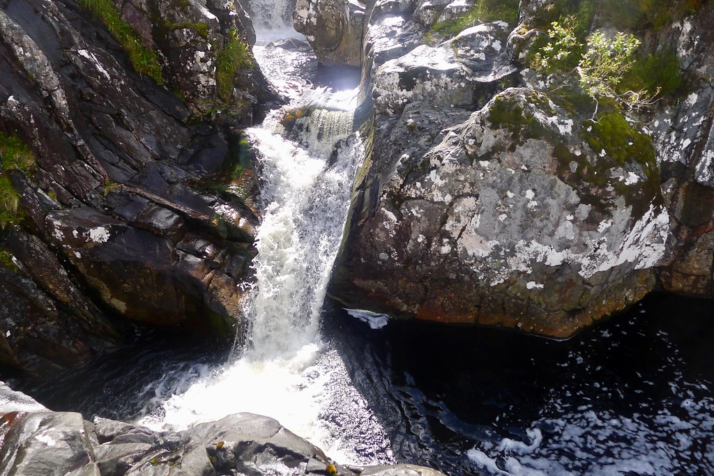
I soon came to the first of these falls as the river dropped through a series of rocky bands. The path wound its way along the north bank and I kept leaving it to see the waterfalls. There was quite a range, with pools and rapids leading one into the next as I lost height. I was also cheered to see a few breaks in the cloud and the sun finally making an appearance.


Further down, after seeing a rainbow, the sun truly came out and the day warmed up rapidly. I took a couple of layers off by the falls before continuing down, soon finding a narrow footbridge that would take me over to the south bank just as the gorge ended and the river widened once again.


The path was very boggy beyond the bridge and so it was good to get back down to the river side as it curved around towards Glen Roy. As it was almost lunchtime I decided to stop here in the sunshine for lunch. It was exceedingly pleasant, to the point where the midges eventually found me.
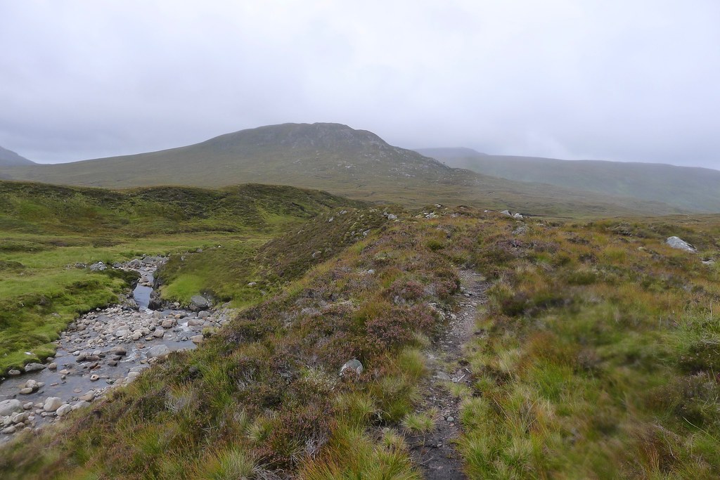
After lunch it was clear that the good weather was only going to be brief. I picked up the path which now started to climb up to the final shoulder separating me from Glen Roy. Behind me a shower was rushing down from the high ground and caught me as I crested the path. I stopped to put on waterproofs and then continued, now dropping down on an excellent path into Glen Roy.


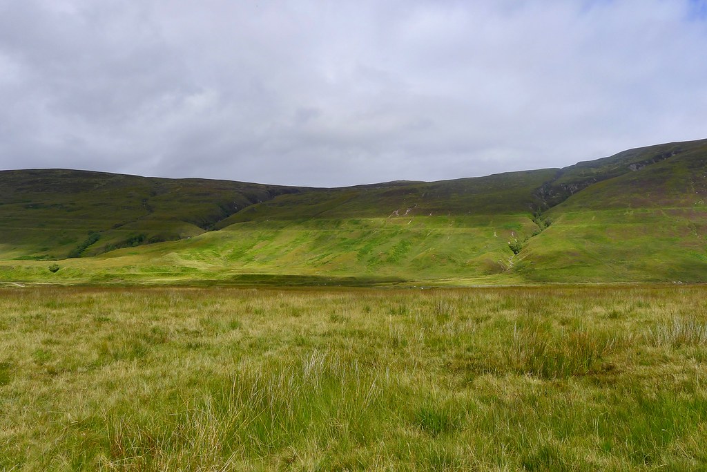
There were a couple of zig-zags and then I was crossing boggy ground to reach the small cottage at Annat. Here a vehicle track was picked up which took me down to the Roy River. The parallel roads were immediately obvious on the surrounding hillsides which were now bright in the returning sunshine.

There wasn't much further to go now and it was a simple case of following the track through Glen Roy. I crossed the river on a sturdy bridge just before Braeroy Lodge where a couple were enjoying a snack break. I made my way along to the Turret Bridge which was framed nicely by purple heather.
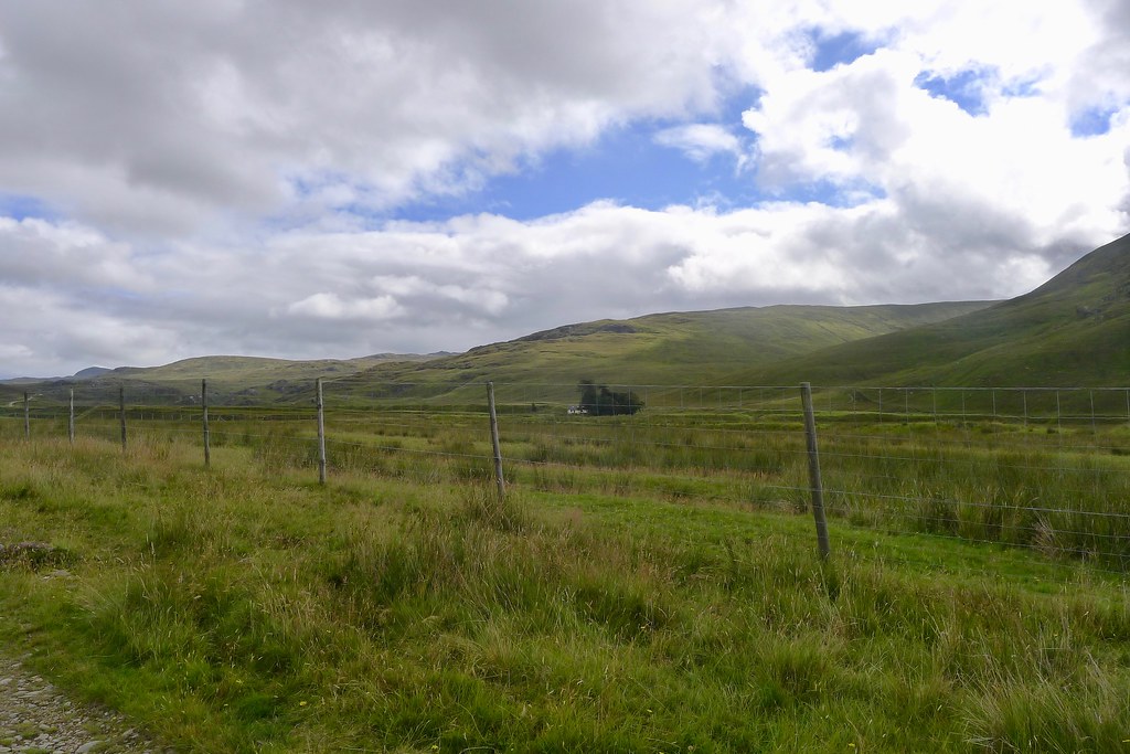


I followed the track past Braeroy Lodge which was simultaneously both very quiet and seemed a hive of activity with some generators droning away in outbuildings and a couple of vehicles moving around. Once past the trees I came out at the mast construction site where people were camped by the river and eventually reached the car to finish a very satisfying loop, despite the vagaries of the late August weather.
I had a break at the car before starting the long drive back. On the way out of the glen I stopped at the viewpoint to take in the scenic views of the parallel roads. Then it was just a case of the long drive road which passed quickly as I listened to almost the entire second series of 13 Minutes to the Moon, a highly recommended podcast from the BBC World Service concerning the dramatic story of Apollo 13.