
A short but pleasant circuit around the North Third Reservoir in the Touch Hills close to Stirling
Date: 29th May 2022
Distance: 5.39km
Ascent: 157m
Time: 2hrs
Hills: Lewis Hill
Weather: A beautiful spring day with warm sunshine
Route: View on OS Maps
After a pleasant Saturday night spent catching up with family in Stirling, we headed out on the Sunday morning to stretch the legs and get some fresh air. It was a beautiful late spring day with blue skies and fluffy white clouds.
We parked up on the side of the minor road that runs along the west side of the North Third Reservoir. We followed the road northwest for a few hundred meters before turning off onto a pleasant path that paralleled one of the main burns that runs into the reservoir.
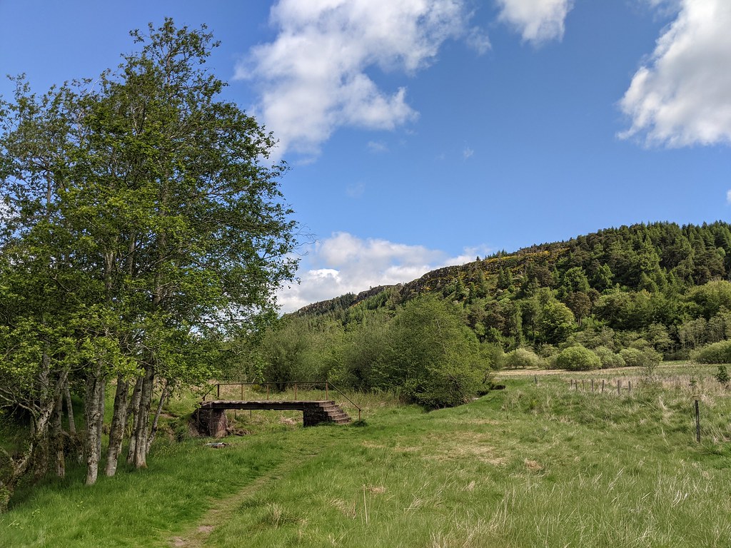
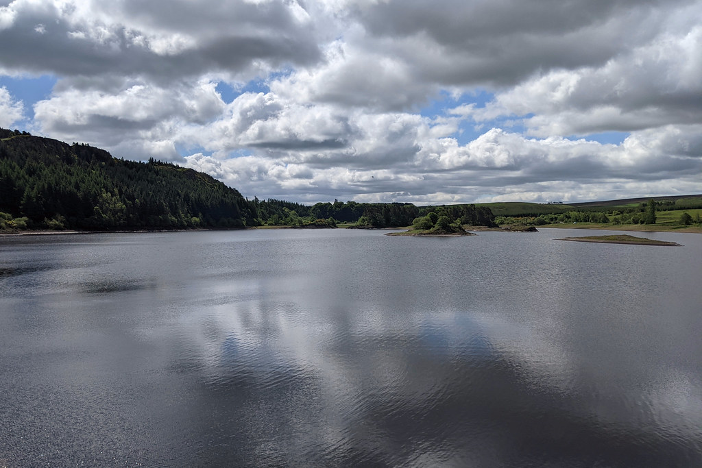
A slightly crumbling footbridge took us across the burn and then down to the end of the reservoir. After a dry spring the water level was very low. The path continues besides the reservoir, slightly above the boggy ground along the water's edge. A few people were camping along here.

The path winds its way through short stretches of beautiful woodland and along a couple of sections of boardwalk that keep feet dry above some boggy bits. As the end of the reservoir approached the path returned to the water's edge to then cut across the dam itself. The spillway was bone dry with grass growing up between the cobbles. From here there were views northward across ranks of forestry.


Across the dam the path now heads up the small Windy Yet Glen that runs east away from the reservoir. A path rises up through the woods via a series of switchbacks and there is a steep mountain biking run that drops down through the trees. Height is gained quickly and we were soon looking out across the trees towards the mountains of the Trossachs.
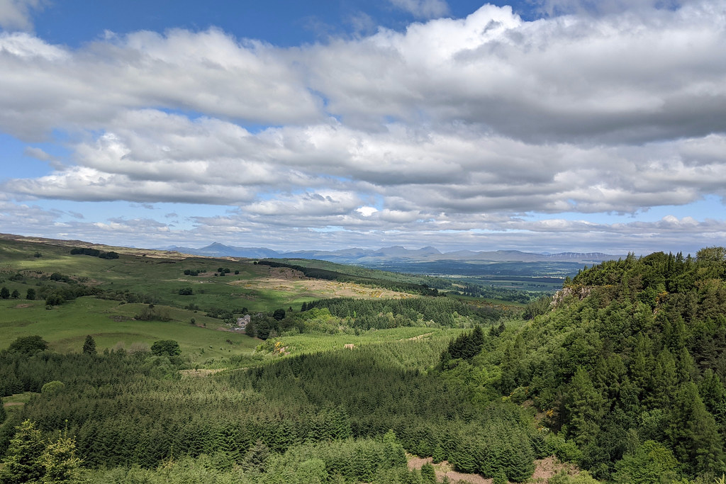
At the top of the hill we diverted briefly to visit the site of an ancient hill fort before picking the path back up which now runs back towards the reservoir. The trees are more sparse up here and there were still patches of bluebells. We caught glimpses of the views southeast where the Firth of Forth was a glimmering patch of silver.
The path now follows the crest of the escarpment of Sauchie Craig with views down the steep cliffs to the reservoir. We found a good spot with a few well placed boulders to sit and enjoy a cuppa and some cake.


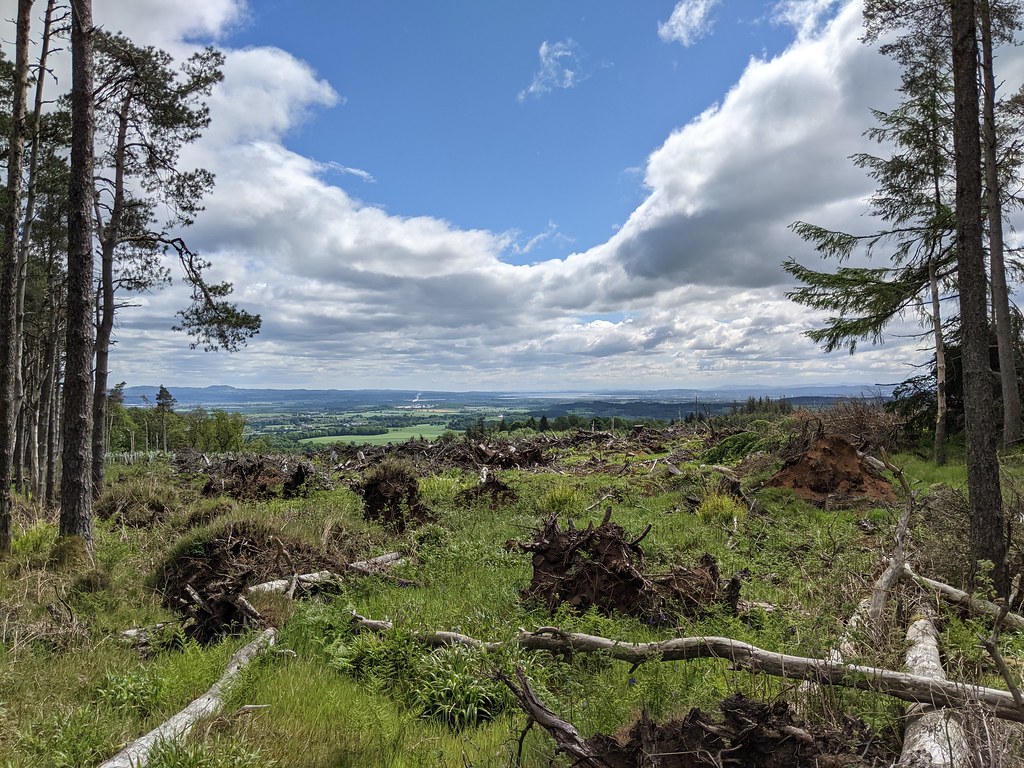
From here the path continues along the heights, passing the trig point which marks the 266m summit of Lewis Hill before then starting to drop back down towards the road. The views across the rolling green and heathery hills, dotted with wind turbines, are splendid.

At the end of the plateau the path drops gently down through the woods with the views dwindling as we headed back into the trees.

The path brought us back out right at the car marking the end of a very pleasant 5km circuit that we had ambled around in a couple of hours.
