As befits a three day wander across the Grampian Mountains this is going to be a long report, so I have decided to split it up a little. This first post will serve as a summary and may really be all you want to read (if you also take a look at the slideshows over on Flickr). The in-depth accounts for each day are linked towards the bottom and follow this post in chronological order, one for each day. It was a fantastic trip, definitely my favourite yet, helped by great weather, a pleasingly ambitious route and brilliant scenery. I really hope you enjoy the photos and report.
The plan
After my last few circular walks, the plan this time was to do a through route making use of public transport. A classic route, reported on by several people, is Blair Atholl to the Aviemore (or vice-versa) by way of Glen Tilt, Glen Dee and the Lairig Ghru. This is a great route in its own right, with spectacular mountain scenery and a great feeling of wilderness. However, it misses out the tops and I was keen to add to my tally of Munros and Corbetts. I have only a handful of remaining Munros east of the A9, and conveniently six of them sat between Blair Atholl and Aviemore, so I devised a plan to bag them all in one long, somewhat winding, through route. To make the traverse work I briefly considered leaving a car at one end and using the train to get back to it, but the more I looked at the train times the more it made sense just to use the train for the full round. Thus I ended up travelling from Aberdeen to Blair Atholl via Perth on Friday, walking across the hills to Aviemore, and then caught the train back to Aberdeen via Inverness on Sunday evening. It did mean that I got home just before midnight on Sunday but luckily the buzz from the trip got me through an early start at work on the Monday morning!
The route
My route can be viewed here.
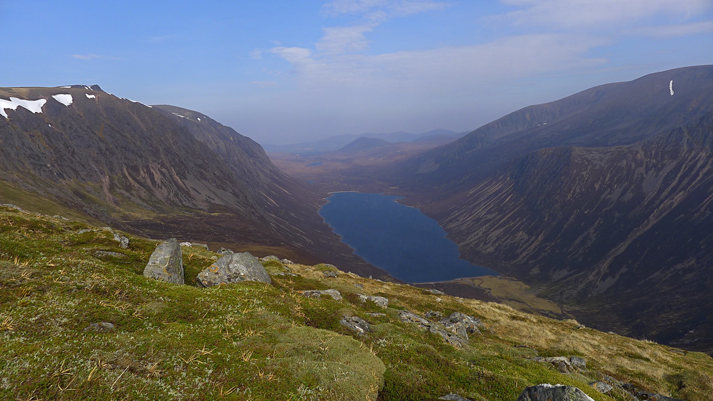
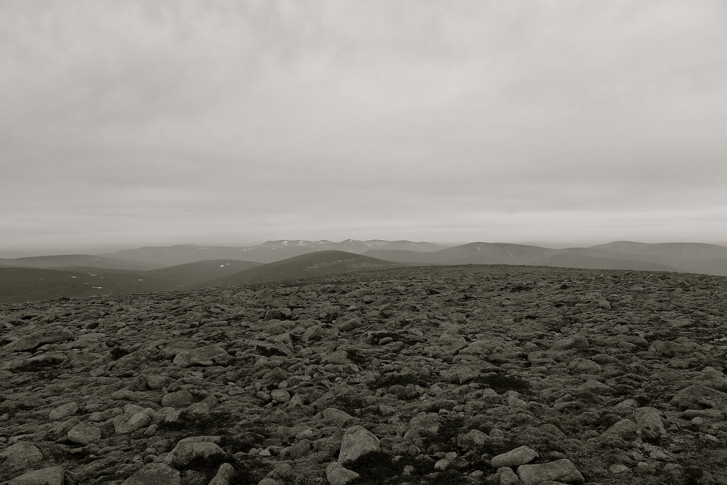
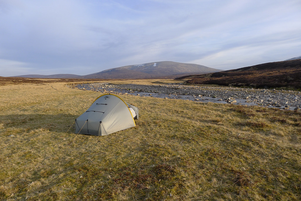
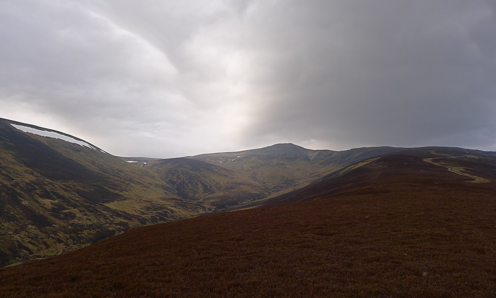
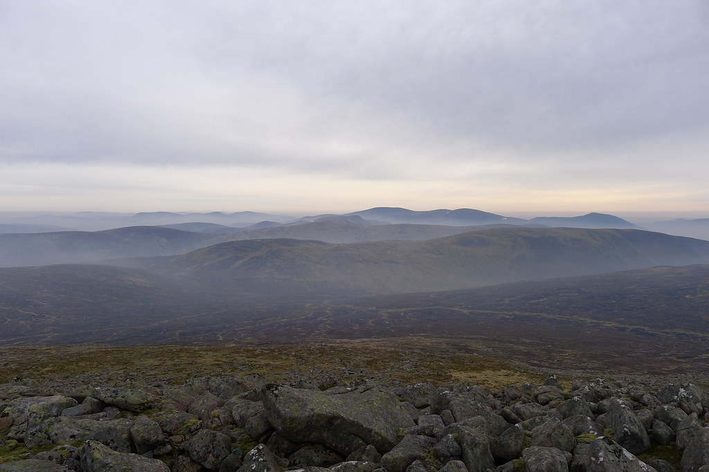
From Blair Atholl I went up Glen Tilt to the Munro of Carn a’ Chlamain. I then went west and camped near the summit of the Corbett Beinn Mheadhonach. The next day I continued west to the second Munro of Beinn Dearg and then turned north to the Corbett Beinn Bhreac. From here I followed the boundary line along a series of rounded hills to the Tarf Munros, Carn an Fhidleir and An Sgarsach, before dropping down to camp by the river Feshie on Saturday evening. On the Sunday I followed the river Eidart up onto the western Cairngorm plateau, went over the Munro Mullach Clach a’ Bhlair and then headed north across the Great Moss to the sixth and final Munro of Sgor Gaoith. I then followed the hills on the west side of Glen Einich before dropping down into the Rothiemurchas Forest, following various tracks past Loch an Eilein, and finally making it to Aviemore and the station there. The total distance was just over 52 miles and my GPS recorded around 11,000 feet of vertical ascent. I was on the move for a total of a little under 24 hours.
The report
DayRouteDistance
Day 1 – Friday 23rd March 2012 From Blair Atholl Station to a camp on Beinn Mheadhonach at 850m 19.49km
Day 2 – Saturday 24th March 2012 From camp on Beinn Mheadhonach to camp besides the River Feshie 25.05km
Day 3 – Sunday 25th March 2012 From camp besides the Feshie to Aviemore Station 35.51km
The photo highlights
The gear
It was all the usual stuff this time around, with perhaps one notable exception. After my POE Peak Elite AC deflated continually during the night on my last trip in February, I contacted customer services to see about that lifetime guarantee of theirs. Unfortunately, despite a few follow up e-mails I haven’t heard anything from them yet. Not wanting to take my bulky Prolite, I ended up ordering an Exped Synmat UL 7 from Ultralight Outdoor Gear which was delivered very speedily and in time to take on the trip. I used this both nights and it was a revelation. I actually found the POE very comfy, and my only complaint really was the mummy outline which meant it was easy for my sleeping-bag-entombed legs to slide sideways off the mat in the night. The rectangular outline of the Synmat largely overcomes this problem and overall I found the mat extremely comfortable (for both back and side sleeping) and warm (though the conditions weren’t anything particularly testing). The advertised weight of 460g was spot on so it is a little heavier and takes up slightly more room in the pack than the POE. To be honest though, the benefits of comfort and additional width actually make up for this. I just hope it turns out to be more durable than the short-lived POE.
After suffering from slow, inefficient boil times with my meths stove last time (due to snowmelt and low river temperatures) I went back to gas for this trip and happily got back into having boiling hot water for drinks and meals within a couple of minutes rather than twenty. This is really a convenience thing more than anything but I’ll definitely be using meths again in the future as I love the quiet simplicity of the Caldera Cone.
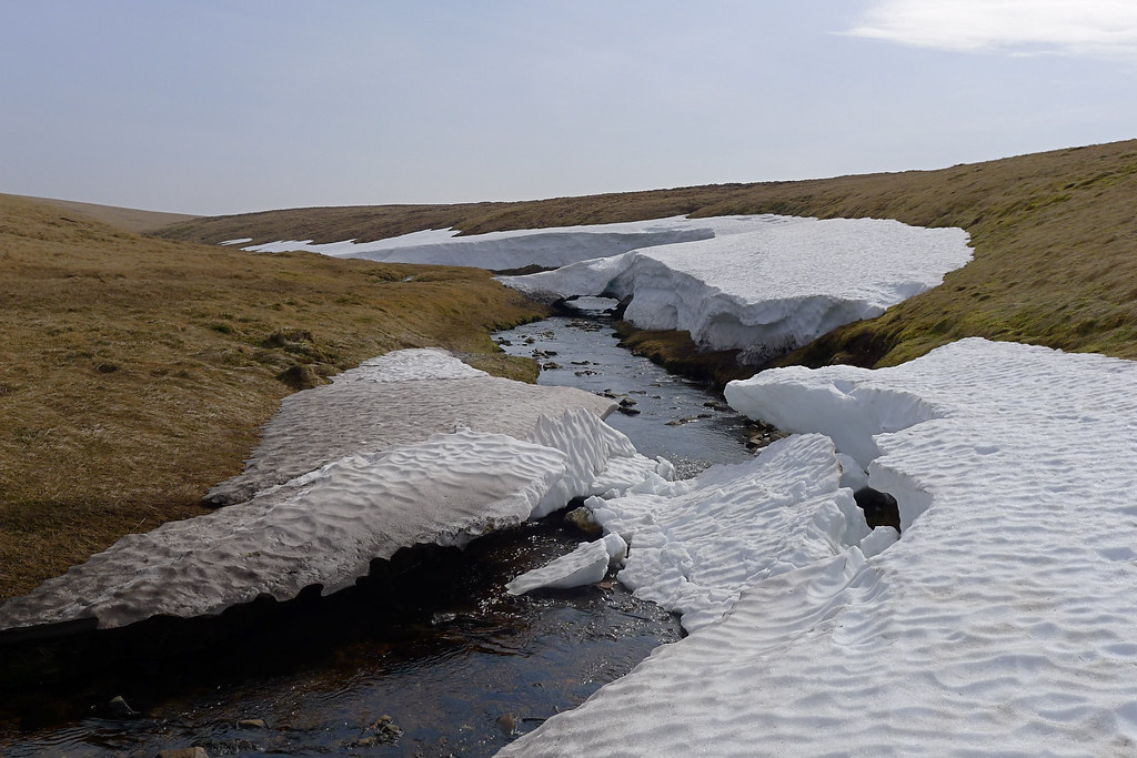
It should be noted that I was lucky in that for late March, at Munro height, I didn’t need any winter kit and in fact came across very little residual snow. This same weekend a year ago my girlfriend and I almost got snowed in whilst spending a weekend in Killin!
In terms of weight for the trip, my base weight came in at around 6.6kg. I took a lot of food which brought up the total pack weight (also including fuel (60g) and water (500g) to 8.7kg. Once my worn clothes and poles were added in I ended up with a total skin-out weight of 10.9kg. You can view my kit list by viewing or downloading this PDF file.
Now, head on to the Part 1 of the trip!