The Mountain's Silhouette

Hiking and backpacking in the mountains of Scotland

A Hint of Winter on Ben Challuim

Date: 15th April 2012
Distance: 19.5km
Ascent: 1,438m
Time: 6hrs 54min
Hills: Ben Chaorach (Corbett, 818m), Cam Chreag (Corbett, 884m), Ben Challuim (Munro, 1,025m)
Weather: Early sunshine giving way to cloud. Very cold wind and low temperatures.
Route: View on OS Maps

River Fillan

Sunday morning, 6:45am. Most sensible, well-adjusted people were still in their beds, grumbling at the noise of ice being noisily chipped off a windscreen and the idling engine bringing some much needed warmth to a frozen car. I was off by 7, the streets of Aberdeen quiet but brightly lit by sunshine. It remained that way for the whole of the journey. The petrol station outside of Dundee still seemed to be catching up with deliveries but I did eventually find a working unleaded pump (are the retailers trying to force us into buying their “premium” stuff with all these continuing shenanigans?) and then it was a fun blast along the road past Loch Earn and over Glen Ogle to Crianlarich and my parking spot besides the A82 just short of Tyndrum.

Atholl Forest and Western Cairngorms Traverse (Day 3)

Date: 25th March 2012
Distance: 35.51km
Ascent: 1,210m
Time: 9hrs 00min
Hills: Mullach Clach a' Bhlair (Munro, 1,017m), Sgor Gaoith (Munro, 1,118m)
Weather: Very warm, sunshine and hazy skies
Route: From camp besides the Feshie to Aviemore Station

If you came straight here then you might like to take a look at Part 1 and Part 2 of this report.

Dawn on the third day

The next time I awoke it was that still, cold hour before dawn. The skies were much hazier, the stars mostly veiled and some patchy cloud was drifting around the glen. I dozed off again, waking some time later when the quality of light had changed and the sun was almost up. Outside it was a beautiful dawn. A crisp, deep blue sky, dewy grass, and the mountains all around me. I made a cup of coffee and sat around, watching the colours change and the sun suddenly crest the eastern hills. It was a stunning sight.

Atholl Forest and Western Cairngorms Traverse (Day 2)

Date: 24th March 2012
Distance: 25.05km
Ascent: 1,192m
Time: 8hrs 39min
Hills: Beinn Dearg (Munro, 1,008m), Beinn Bhreach (Corbett, 912m), Carn an Fhidhleir (Munro, 994m), An Sgarsoch (Munro, 1,006m)
Weather: Very mild, cool wind on the tops, earlier low cloud rising to form a general haze beneath sunshine and blue skies
Route: From camp on Beinn Mheadhonach to camp besides the River Feshie

If you came straight here then you might like to start with Part 1 of this report.

Camped above the clouds

The earlier starry skies had disappeared by dawn and I awoke to find a thick fog swirling around the tent. Visiblitiy was almost zero which was a little worrying as these hills aren’t the sort to really enjoy in thick mist. I dozed for another half an hour or so and then got up to make coffee and porridge. Amazingly as I sat eating breakfast the conditions dramatically changed; the thick cloud was swept away to reveal all the surrounding mountain peaks standing clear of cloud-covered glens.

Atholl Forest and Western Cairngorms Traverse (Day 1)

Date: 23rd March 2012
Distance: 19.49km
Ascent: 1,174m
Time: 4hrs 55min
Hills: Carn a' Chlamain (Munro, 963m)
Weather: Mild, light breeze, some high cloud and haze
Route: Click to view on OS Map

After a week of glorious sunshine in Aberdeen I pulled back the curtains to find it was a grey Friday morning. I guess this is what happens when you book a day off work in order to head to the hills! Thankfully by the time I was heading down to the station, the heavier camping pack on my back, the sun was out and it was a glorious morning; an auspicious start. Train ticket purchased I was soon sitting on the relatively quiet 09:34 service to Glasgow Queen Street. Initially the weather and views were glorious, the sun shimmering off the North Sea, and the fields freshly ploughed and ready to show spring shoots. However, from around Arbroath the cloud built up and it was grey and a little gloomy by the time I got off the train at Perth.

A Wild Camp in Glen Gairn (Part 1)

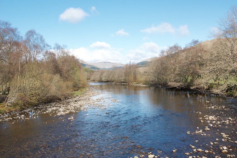
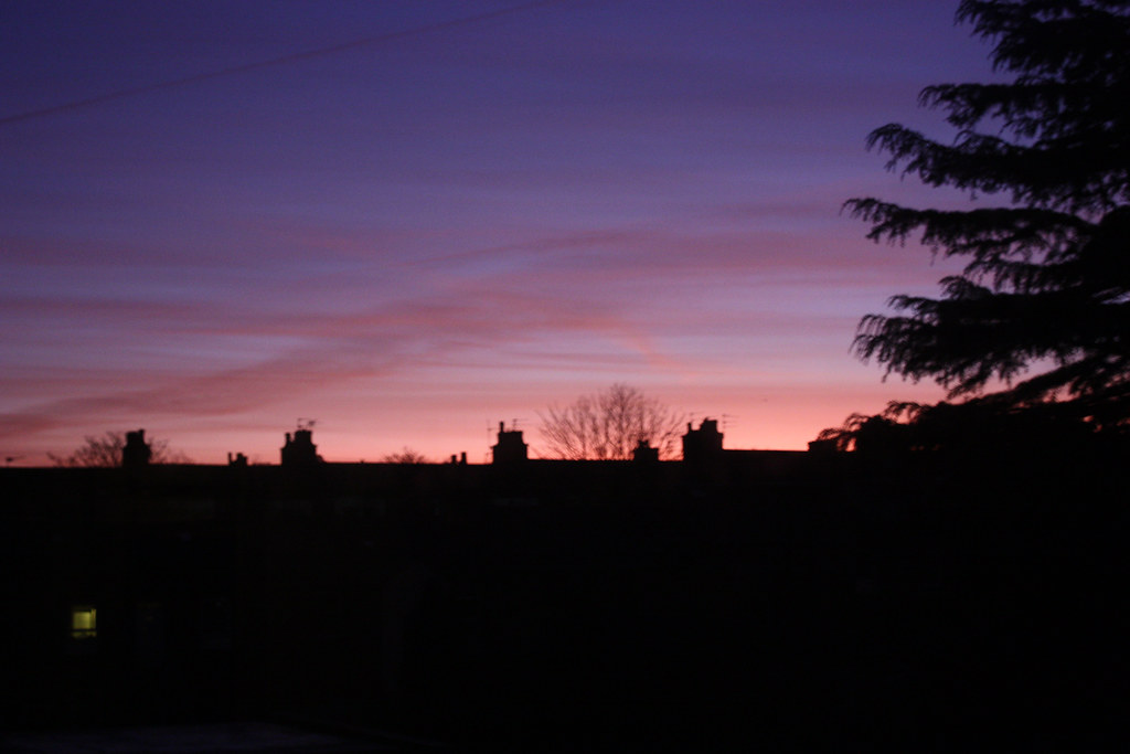
Having now been walking in the Cairngorms and surrounding hills for a few years I’m starting to better put together my internal map of how the glens and hills of the region fit together. There is however one area that still isn’t fixed properly in my mind yet. It is a blank space in my mind’s map; and that is the hills around Glen Gairn. The River Gairn rises on the southern slopes of Ben Avon and eventually meets the River Dee at Ballater making it the longest tributary of that river. With the direct link to Deeside it was once a well populated glen with pastures and homesteads scattered along its length. Nowadays the shielings are ruins, the glen is silent and I was fascinated by this wild area so close to the populace villages of Deeside. Although the trip I ended up doing didn’t take me all the way along the Gairn (something I still plan to do) I visited its central section and enjoyed my night spent there gazing at the distant stars.

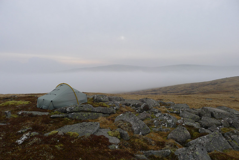
Saturday 25th February – Corgarff castle to River Gairn wild camp
Distance: 23km
Time: 6 hours
Ascent: 800m
Hills: Brown Cow Hill (Corbett, 829m), Meikle Gael Charn (Corbett Top, 802m)
Route: View on OS Maps

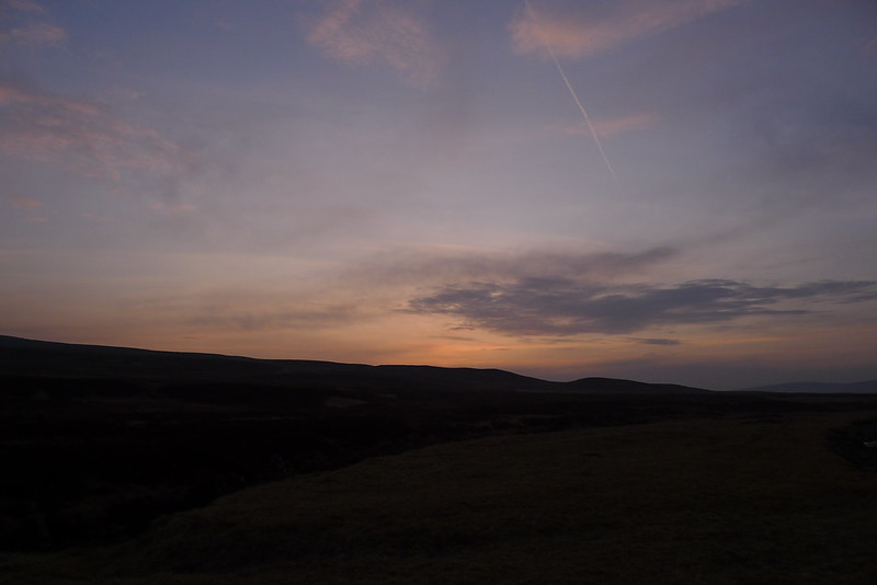
Saturday dawned bright and chilly in Aberdeen. Though the preceding few days had been mild to the point where I had dropped down to just a windshirt for the walk to work, the weekend forecast was a little less promising. In particular MWIS was predicting very strong winds (gusts to 80mph) for Sunday afternoon. With this in mind I came up with a plan that gave me an opportunity to head up onto the plateau of Ben Avon, most eastern of the big Cairngorm hills, on Sunday morning in the hope of catching a break in the weather. To get there I would camp in Glen Gairn, to the south of a winding route that takes you up onto the plateau. Another consideration was the sky show promised for Saturday evening with the Moon, Venus and Jupiter all in close proximity in the west after sunset.

A Wild Camp in Glen Gairn (Part 2)

Sunday 26th February – River Gairn wild camp to Corgarff castle
Distance: 20.8km
Time: 6 hours
Ascent: 700m
Hills: Carn Ealasaid (Corbett, 792m)
Route: Click to view

Part one of this trip can be read here.

The clear skies continued into the morning which unfortunately somewhat muted the sunrise. By the time I got up at around 8am the sky was blue but a dense fog was clinging to all the surrounding summits. In particular I could see that Ben Avon was shrouded in it above about 800m. There was a chill to the air and it would be a bit longer before the sun broke through to my camping spot so I warmed up by getting all my gear sorted and packed up. The tent fly was drenched with dew but there was no sign of ice or even frost: a very mild night for February in the Highlands.

'The Lost Coast: Lossiemouth to Burghead by sand, sea and cliffs'

Date: 11th February 2012
Distance: 16.45km
Ascent: 126m
Time: 5hrs 14mins
Hills: None whatsoever
Weather: Mild, light breeze, later drizzle turning to light rain
Route: View on OS Maps

Moray Coastal Trail

Lossiemouth harbour on a steely grey Saturday morning in February is a quiet, empty sort of place. There were only a handful of dog walkers on beach, an old gentleman wandering down the street with his newspaper, and twenty-seven eager Stockets ready to face the perils of the Moray Coastal Trail.

Hill of Wirren (The Fast Train to Edzell)

Date: 15th January 2012
Distance: 22.12km
Ascent: 708m
Time: 5hrs 59mins
Hills: West Wirren, Hill of Wirren (Graham, 678m), West Wirren
Weather: Very cold, light winds, clear skies, haze developing at low levels
Route: View on OS Maps

Sunrise

I’m not sure whether the driver was slightly masochistic or just trying to acclimatise us to the cold we would face once we jumped off at Tarfside in Glen Esk, but it was absolutely freezing on the coach that took the Stocket Hillwalking Club away from Aberdeen for a day out. Actually, looking back, “jumped off” sounds a bit too active…. I’d met up with some work-related friends at eight on Saturday evening and finally got to bed at four the next morning. I was feeling particularly bleary eyed as I stumbled off the coach into the bright winter sunshine just a few short hours later. Water would have been good at this stage but already my hydration pipe had frozen solid so it was a cup of sweet black tea that did the job of slightly reviving me.

'Book Review: Lowdown on the upland of Mar by Joe Dorward (Kindle Edition)'

Joe Dorward is passionate about that corner of the Cairngorm Mountains, largely west and north of the village of Braemar in Aberdeenshire, which is known as the upland of Mar. Beginning with camping holidays to the area as a young boy, he has spent many enjoyable days exploring the rivers and glens of this rambling area of rough moorland and heathery hills, and is gradually constructing his guide to them, a fabulous website called the the upland of Mar.